Section : Geography Basics
- Geography as a discipline
- Introduction to geography as a subject
- Prior study and transition
- You have studied geography within Social Science up to the secondary stage, gaining awareness of geographical phenomena across the world and its regions
- Now, as an independent subject, geography explores the earth’s physical environment, human activities, and their interrelationships
- Purpose of studying geography
- A key question arises: Why study geography?
- We live on the earth’s surface, and our lives are shaped by our surroundings in numerous ways
- We rely on resources from our environment for survival
- Primitive societies depended on natural means of subsistence like edible plants and animals
- Over time, humans developed technologies to produce food using resources such as land, soil, and water, adapting food habits and clothing to weather conditions
- Defining geography
- Core concept
- What is geography?
- Earth is our home, shared with many creatures, big and small, who live and sustain themselves on it
- The term "geography" was coined by Eratosthenes (father of geography), a Greek scholar (276-194 BC), from Greek roots "geo" (earth) and "graphos" (description), meaning "description of the earth"
- Scholars define it as "the description of the earth as the abode [place of residence] of human beings"
- Focus of study
- Geography studies variations across the earth’s surface:
- Physical features include mountains, hills, valleys, plains, plateaus, oceans, lakes, deserts, and wilderness
- Social and cultural features include villages, cities, roads, railways, ports, markets, and other human creations developed over time
- These variations reveal the relationship between the physical environment and social/cultural features
- The physical environment sets the stage for human societies to display their creative skills using tools and techniques developed through cultural evolution
-
- Scope and approach of geography
- Interdisciplinary nature
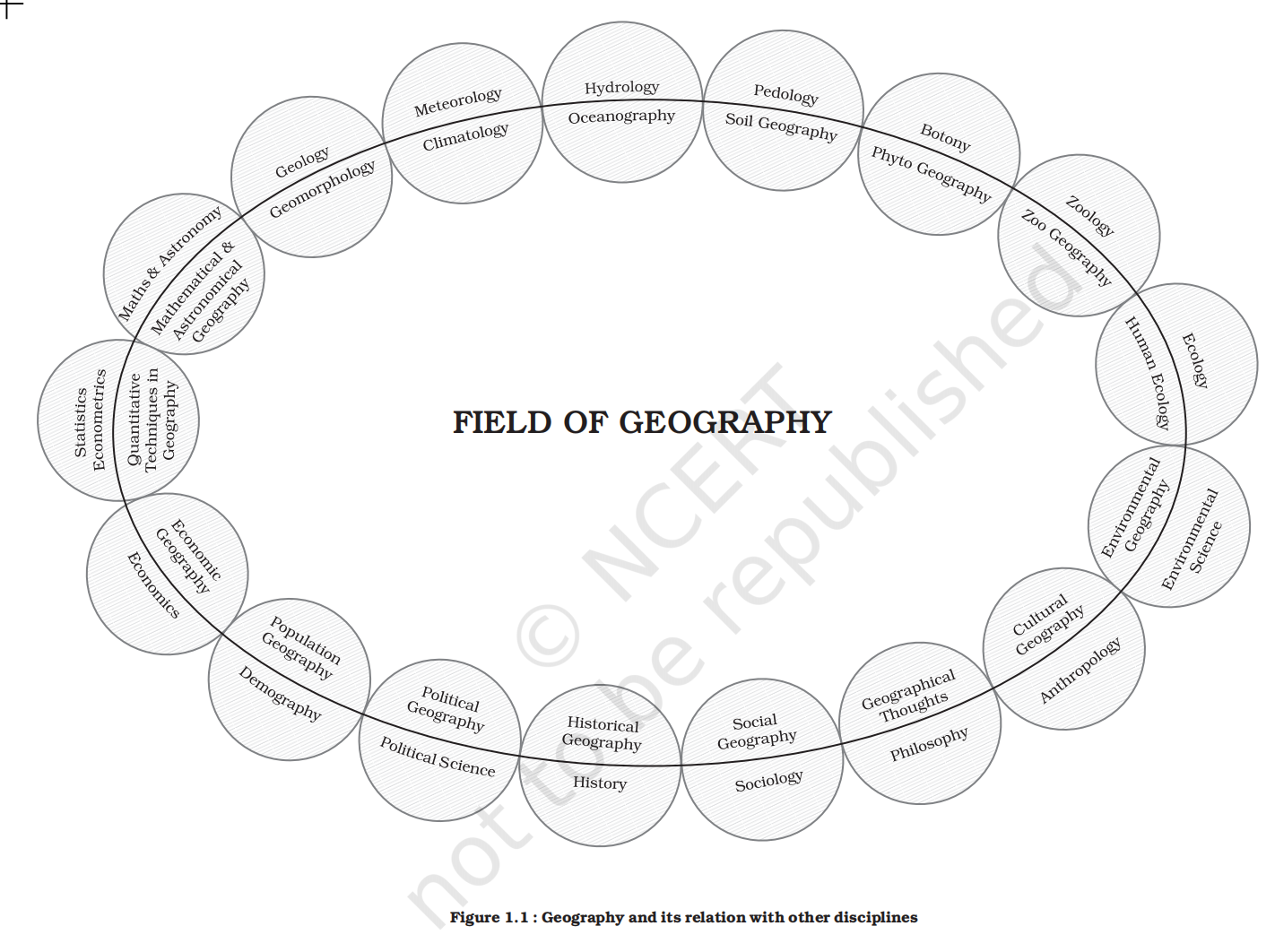
- Geography integrates data from natural sciences (e.g., geology, pedology, oceanography, botany, zoology, meteorology) and social sciences (e.g., economics, history, sociology, political science, anthropology)
- It differs from other sciences in its subject matter and methodology but is closely related to them, synthesizing their insights
- Analytical focus
- Geography examines:
- Variations in phenomena over space (areal differentiation)
- Associations between phenomena and factors causing these variations (e.g., cropping patterns varying due to soils, climates, market demands, farmer investment, and technology)
- Causal relationships between phenomena, aiding interpretation and prediction
- Geographical phenomena, both physical and human, are dynamic, changing over time due to interactions between the evolving earth and active humans
- Nature and human interactions
- Integrated relationship
- Geography studies the interplay between nature and humans as an integrated whole
- Humans are part of nature, leaving imprints on it, while nature influences human life (e.g., food, clothing, shelter, occupation)
- Historical and modern dynamics
- Primitive societies directly depended on their immediate environment
- Modern societies use technology to modify the environment, expanding their scope by utilizing natural resources
- Impact of technology
- Technology has:
- Reduced the harshness of labor and increased efficiency
- Provided leisure for higher pursuits
- Boosted production scale and labor mobility
- Poetic representation
- A poetic dialogue captures this interaction:
- Nature (God): "You created the soil, I created the cup; you created night, I created the lamp; you created wilderness, hilly terrains, and deserts; I created flower beds and gardens"
- Humans have moved from necessity to freedom, humanizing nature while nature naturalizes humans
- Spatial [relating to or occupying space] organization and integration
- Spatial framework
- Geography organizes space through transportation and communication networks, linking routes and settlements (nodes) of varying types and hierarchies
- As a social science, geography focuses on spatial [relating to or occupying space] organization and integration
- Key questions
- It addresses three key questions:
- What?
- Identifying patterns of natural and cultural features on the earth’s surface
- Where?
- Examining the distribution of these features
- Why?
- Explaining causal relationships, processes, and phenomena behind these patterns
- The "what" and "where" questions provide inventory data, popular during colonial times, but the "why" question elevates geography to a scientific discipline
- Skills and tools in geography
- Capabilities developed
- Geography equips you to:
- Appreciate diversity and investigate causes of spatial and temporal [secular / non-spiritual] variations
- Convert the globe into maps, developing a visual sense of the earth’s surface
- Use modern techniques like GIS and computer cartography to contribute to national development
- Geography as an integrating discipline
- Holistic nature of geography
- Spatial and temporal synthesis [the combination of components or elements to form a connected whole]
- Geography synthesizes spatially, while history synthesizes temporally, recognizing [identifying] the world as a system of interdependencies
- Today’s world is a "global village" due to improved transportation, accessibility, and technology (e.g., audio-visual media, IT)
- Technology enhances monitoring of natural, economic, and social phenomena
- Interdisciplinary connections
- Integration with sciences
- Geography interfaces with numerous natural and social sciences, all aiming to understand reality
- It comprehends phenomena associations holistically [individual parts can't be considered, instead whole system is considered] in a spatial context [circumstances], differing across places
- Historical examples
- Examples of integration:
- Spatial distance and depth (e.g., oceans, large land areas) have historically influenced events, providing defense or altering outcomes
- In India, the Himalayas acted as barriers and routes for migrants/invaders, while the sea coast facilitated (make easy) contacts with East/Southeast Asia, Europe, and Africa
- European navigation technology enabled colonization of Asia and Africa, including India
- Time as a dimension
- Temporal dynamics
- Geographical phenomena change over time (e.g., landforms, climate, vegetation, economic activities, cultural developments)
- Time and space are interchangeable (e.g., 1,500 km = 2 hours by plane or 17 hours by train)
- Time is the fourth dimension in geography, alongside three spatial dimensions (please specify the other three: length, width, height)
- Physical geography and natural sciences
- Connections and tools
- Branches like geomorphology, climatology, oceanography, and soil geography link to geology, meteorology, hydrology, and pedology, deriving [obtain / acquire] data from them
- Biogeography connects to botany, zoology, and ecology, studying human niches
- Tools:
- Maps require proficiency [skillful] in mathematics (projections, statistics, econometrics) and art (drawing, sketches)
- Geography uses astronomical locations (latitudes, longitudes) and converts the geoid earth into two-dimensional maps
- Geography and social sciences
- Links to social disciplines
- History links to geography through spatial influences on events
- Geographical thought, as a philosophical root, traces the discipline’s evolution
- Social sciences (sociology, political science, economics, demography) study social reality with spatial aspects, aligning with branches like social, political, economic, and population geography
- Political geography examines territory, people, sovereignty, and political behavior
- Economic geography studies spatial aspects of production, distribution, exchange, and consumption
- Population geography aligns with demography (growth, distribution, migration, etc.)
- Branches of geography
- Approaches to study
- Study methods
- Geography is interdisciplinary [relating to more than one branch of knowledge], studied via:
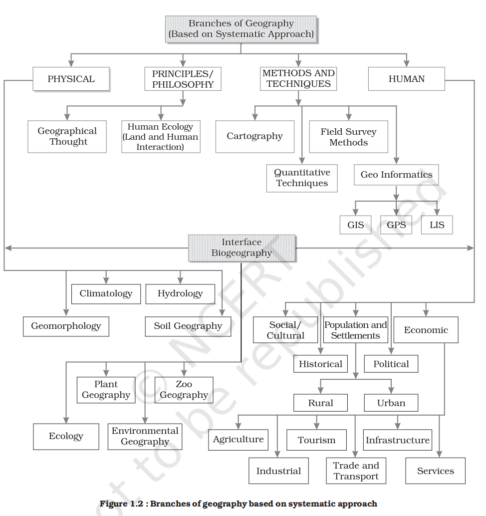
- Systematic approach (by Alexander von Humboldt, 1769-1859): Examines phenomena globally, identifying typologies (e.g., studying vegetation worldwide, then classifying equatorial or monsoon forests)
-
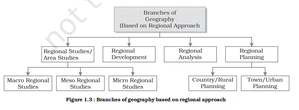
- Regional approach (by Karl Ritter, 1779-1859): Divides the world into regions (natural, political, designated) for holistic study
-
- Dualism exists: Early focus was on physical geography, but human geography emerged due to humans’ integral role in nature
- Branches based on systematic approach
- Physical geography
- Sub-branches
- Geomorphology:
- Studies landforms, their evolution, and processes
- Climatology:
- Examines atmosphere structure, weather, climates, and types
- Hydrology:
- Investigates water (oceans, lakes, rivers) and its effects on life
- Soil geography:
- Analyzes soil formation, types, fertility, distribution, and use
- Importance
- Covers lithosphere (landforms, relief), atmosphere (weather, climate), hydrosphere (oceans, lakes), and biosphere (life forms, food chains, ecological balance)
- Landforms support agriculture (plains), resources (plateaus), and water (mountains)
- Climate affects housing, clothing, farming, and industries; humans modify it with technology (e.g., air conditioners)
- Precipitation drives agriculture and groundwater recharge
- Oceans provide fish, minerals (e.g., manganese nodules [small rounded lumps] in India)
- Soils, renewable yet influenced by nature and culture, support agriculture and the biosphere
- Additional insight
- Geography describes and explains areal differentiation (Richard Hartshorne, Hettner)
- It manages natural resources, balancing human use and ecological sustainability
- Human geography
- Sub-branches
- Social/cultural geography:
- Studies society, spatial dynamics, and cultural contributions
- Population and settlement geography:
- Analyzes population (growth, density, migration) and settlements (rural, urban)
- Economic geography:
- Examines economic activities (agriculture, industry, trade, transport)
- Historical geography:
- Studies historical processes shaping spatial organization
- Political geography:
- Focuses on political events, boundaries, constituencies, and behavior
- Biogeography
- Sub-branches
- Plant geography:
- Studies vegetation patterns in habitats
- Zoo geography:
- Examines animal distributions and habitats
- Ecology/ecosystem:
- Analyzes species habitats scientifically
- Environmental geography:
- Addresses land degradation, pollution, and conservation
- Branches based on regional approach
- Regional branches
- Regional studies/area studies
- Includes macro, meso, and micro levels
- Regional analysis
- Regional planning
- Covers rural/country and urban/town planning
- Regional development
- Common aspects across disciplines
- Philosophy and methods
- Philosophy:
- Geographical thought
- Land and human interaction/human ecology
- Methods and techniques:
- Cartography, including computer cartography (science of drawing maps)
- Quantitative/statistical techniques
- Field survey methods
- Geo-informatics (remote sensing, GIS, GPS)
- Geography evolves with technology (e.g., manual to computer cartography, GIS, GPS), enhancing data handling and analysis (see *Practical Work in Geography – Part I*, NCERT, 2006)
- The origin and evolution of the universe
- Introduction to the chapter
- Motivation and purpose
- Starry nights have always attracted us since childhood
- You may also have thought of these stars and had numerous questions in your mind
- Questions such as how many stars are there in the sky? How did they come into existence? Can one reach the end of the sky?
- May be many more such questions are still there in your mind
- In this chapter, you will learn how these “twinkling little stars” were formed
- With that you will eventually also read the story of origin and evolution of the earth
- Light year
- A light year is a measure of distance and not of time
- Light travels at a speed of 300,000 km/second
- Considering this, the distances the light will travel in one year is taken to be one light year
- This equals to 9.461×10 12 km
- The mean distance between the sun and the earth is 149,598,000 km
- In terms of light years, it is 8.311 minutes
- Universe and it's origin
- The universe is vast expanse of space that contains all matter and energy in existence. It's exact size is still unknown and recent researches showing it's expansion.
- Early views before on universe
- Geocentric view (Geocentrism)
- According to this view, earth is at the centre of the universe and other bodies revolve around it.
- Most religions believed in this view.
- Heliocentric view (Heliocentrism)
- In this view, sun is at the centre and all bodies including earth revolved around it.
- Aristarchus, a Greek philosopher was the first to put forward helio centric view.
- Modern theories on the origin of the universe
- Big Bang theory (expanding universe hypothesis)
-
- Overview
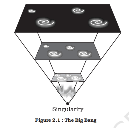
- The most popular argument regarding the origin of the universe is the Big Bang Theory
- It is also called expanding universe hypothesis
- Edwin Hubble, in 1920, provided evidence that the universe is expanding
- As time passes, galaxies move further and further apart
- Balloon analogy
- You can experiment and find what does the expanding universe mean
- Take a balloon and mark some points on it to represent the galaxies
- Now, if you start inflating the balloon, the points marked on the balloon will appear to be moving away from each other as the balloon expands
- Similarly, the distance between the galaxies is also found to be increasing and thereby, the universe is considered to be expanding
- However, you will find that besides the increase in the distances between the points on the balloon, the points themselves are expanding
- This is not in accordance with the fact
- Scientists believe that though the space between the galaxies is increasing, observations do not support the expansion of galaxies
- So, the balloon example is only partially correct
- Stages of development in accordance with big bang
- In the beginning, all matter forming the universe existed in one place in the form of a “tiny ball” (singular atom) with an unimaginably small volume, infinite temperature and infinite density
- At the Big Bang the “tiny ball” exploded violently
- This led to a huge expansion
- It is now generally accepted that the event of big bang took place 13.7 billion years before the present
- The expansion continues even to the present day
- As it grew, some energy was converted into matter
- There was particularly rapid expansion within fractions of a second after the bang
- Thereafter, the expansion has slowed down
- Within first three minutes from the Big Bang event, the first atom began to form
- Within 300,000 years from the Big Bang, temperature dropped to 4,500 K (Kelvin) and gave rise to atomic matter
- The universe became transparent
- Steady state theory (Hoyle's concept of steady state)
-
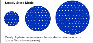
- The expansion of universe means increase in space between the galaxies
- An alternative to this was Hoyle’s concept of steady (stable / balance) state
- It considered the universe to be roughly the same at any point of time
- However, with greater evidence becoming available about the expanding universe, scientific community at present favours argument of expanding universe
- Celestial bodies
- Galaxies
- A galaxy is a huge collection of gas, dust, and billions of stars and their solar systems.
- A galaxy contains a large number of stars
- Galaxies spread over vast distances that are measured in thousands of light-years
- The diameters of individual galaxies range from 80,000-150,000 light years
- Types of galaxies
-
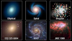
- Spiral galaxies
- Spiral galaxies have active star formation in their arms and in their nuclei.
- Best example is our own Milky Way galaxy, nearby Andromeda galaxy.
- Elliptical galaxies
- Elliptical galaxies generally contain older stars and have less active star formation compared to spiral galaxies.
- Example include Virgo A and IC 1101 (one of the largest known galaxies).
- Irregular galaxies
- Some irregular galaxies exhibit high rates of star formation, while others are more quiescent [inactive / inert].
- Examples include Large Magellanic Cloud (LMC) and Small Magellanic Cloud (SMC).
- Milky way
-
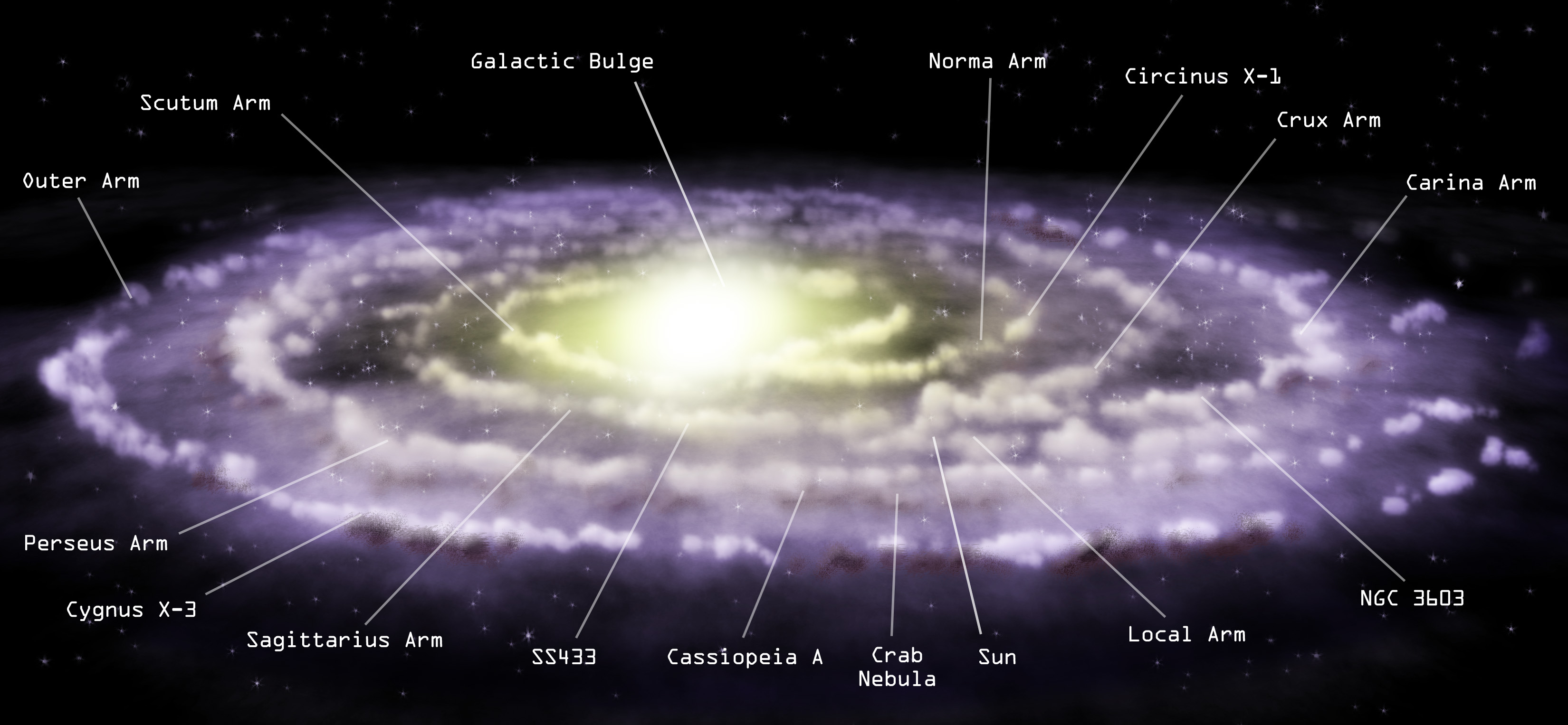
- It is a spiral galaxy in which our solar system is located.
- It's about 100,000 light years across or about 30 kpc
- The Sun does not lie near the center of our Galaxy. It lies about 8 kpc (kiloparsec) from the center on what is known as the Orion Arm of the Milky Way.
- KPC (kiloparsec) is Astronomical unit of distance used to measure large-scale cosmic distances.
- 1 kpc = 1,000 parsecs
- 1 parsec ≈ 3.26 light-years
- 1 kpc ≈ 3,260 light-years
- It contains super massive black hole "Sagittarius A*" at it's centre.
- Andromeda galaxy is the closest neighboring galaxy to milky way. It is also a spiral galaxy and expected to collide with milky way in far future.
- In ancient India, our galaxy was imagined to be a river of light flowing in the sky. Thus, it was named Akash Ganga.
- The galaxy formation
- Initial conditions
- The distribution of matter and energy was not even in the early universe
- These initial density differences gave rise to differences in gravitational forces and it caused the matter to get drawn together
- These formed the bases for development of galaxies
- Formation process
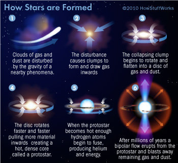
- A galaxy starts to form by accumulation of hydrogen gas in the form of a very large cloud called nebula
- Eventually, growing nebula develops localised clumps of gas
- These clumps continue to grow into even denser gaseous bodies, giving rise to formation of stars
- The formation of stars is believed to have taken place some 5-6 billion years ago
- Stars
- A star is a massive, luminous sphere of plasma held together by its own gravity, generating light and heat through nuclear fusion.
- Star formation
-
- Star life cycle
-
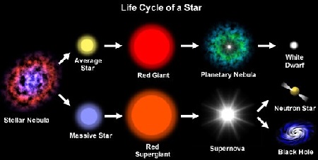
- Sun is also a star.
- It is estimated to be 5 billion years old and has a diameter of 1.4 million kilometers.
- It is approximately 150 million km away from the earth.
- Temperature varies from layers.
-
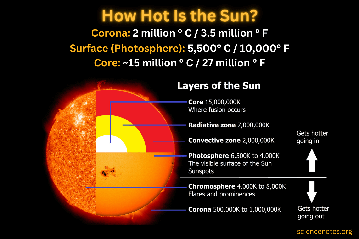
- The solar corona is hotter than the photosphere because of non-thermal heating mechanisms, specifically magnetic fields and waves.
- These mechanisms transport energy from the Sun's interior to the upper atmosphere, where it's released as heat, creating the corona's high temperatures.
- In essence, the corona is hotter than the photosphere because the energy that fuels the Sun is being transported and dissipated in the outer atmosphere, rather than being released at the surface.
- The Sun's mass is approximately 333,000 times greater than Earth's mass. It accounts for 99.83% of the mass of the solar system.
- Its diameter is about 109 times that of Earth's.
- It is 150.92 million km away from earth and this distance is also called 1 astronomical unit.
- The sun is powered by nuclear fusion, where hydrogen atoms fuse into helium, releasing tremendous energy in the process.
- This energy is then radiated outward, ultimately reaching Earth as light and heat. Additionally, the sun's magnetic field plays a role in phenomena like solar flares and the solar wind.
- Sun spots
- Sunspots are dark spots on the Sun's surface that appear darker than the surrounding areas due to being cooler, but still very hot.
- They are caused by strong magnetic fields that inhibit convection, preventing heat from reaching the surface. Sunspots are also visible manifestations of the Sun's active regions, which are sources of solar eruptions.
- Sunspots are located on the outermost layer of the Sun called 'Photosphere'.
- Solar winds
- Solar wind is a stream of charged particles (mainly protons and electrons) emitted from the Sun's corona.
- The interaction of the solar wind with Earth's upper atmosphere can create the beautiful aurora borealis (northern lights) and aurora australis (southern lights).
- Solar wind variations, particularly during solar storms, can impact satellites, communication networks, and even power grids by releasing bursts of charged particles that interact with Earth's atmosphere and magnetic field.
- How can solar flares affect power grids?
- The sun releases a Solar Flare (light/radiation) followed by a Coronal Mass Ejection (CME)—a massive cloud of magnetized plasma. When the CME hits Earth’s magnetosphere, it vibrates and "stretches" our planet's magnetic field. According to Faraday’s Law of Induction, a changing magnetic field creates an electric current in any conductor it passes over.
- The currents created in the Earth's crust are called Geomagnetically Induced Currents (GICs). These currents look for the path of least resistance to travel, and our high-voltage power lines are perfect "superhighways" for them. Power grids run on Alternating Current (AC). GICs act like Direct Current (DC). When this "ghost" DC enters a massive high-voltage transformer, it causes the magnetic core to "saturate." This saturation causes the transformer to vibrate violently and heat up rapidly. In extreme cases, the internal copper wiring can literally melt in minutes.
- The grid is interconnected. If one major transformer in a state like Bihar or West Bengal (to use your previous examples) fails or trips its safety breakers to prevent melting, the electricity must find another route. This creates a cascage failure, where neighboring transformers become overloaded and shut down.
- History provides the proof. In 1989, a solar storm took down the entire Quebec (Canada) power grid in just 90 seconds, leaving 6 million people in the dark for 9 hours.
- Pole star (North star)
- The Pole Star, also known as Polaris, is a prominent star in the night sky located nearly directly above Earth's North Pole.
- It is part of the constellation Ursa Minor (the Little Bear) and is famous for being used as a navigational aid because it remains almost stationary in the sky, with all other stars appearing to rotate around it.
- Constellations
-
-
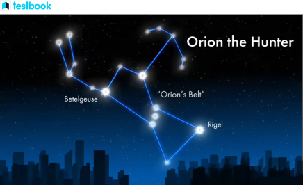
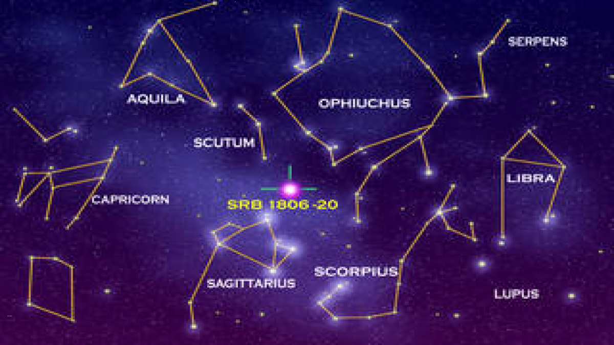
- Constellations are groupings of stars that form patterns or shapes in the sky. These patterns are typically named after mythological figures, animals, or objects.
- Types of Constellations:
- Zodiac Constellations:
- These constellations lie along the ecliptic, the apparent path that the Sun traces through the sky. There are 12 traditional zodiac signs, each associated with a constellation. The Sun, Moon, and planets appear to pass through these constellations in the course of the year.
- The 12 zodiac constellations are:
- Aries (The Ram)
- Taurus (The Bull)
- Gemini (The Twins)
- Cancer (The Crab)
- Leo (The Lion)
- Virgo (The Virgin)
- Libra (The Scales)
- Scorpius (The Scorpion)
- Sagittarius (The Archer)
- Capricornus (The Goat)
- Aquarius (The Water Bearer)
- Pisces (The Fishes)
- Non-Zodiac Constellations:
- These constellations do not lie along the ecliptic and are spread across the sky.
- Some famous non-zodiac constellations include:
- Orion (The Hunter)
- Ursa Major (The Great Bear)
- Ursa Minor (The Little Bear)
- Cassiopeia (The Queen)
- Cygnus (The Swan)
- Lyra (The Lyre)
- Andromeda (The Princess)
- Leo (The Lion)
- Scorpius (The Scorpion)
- Importance of Constellations:
- Navigation:
- Historically, constellations have been used for navigation, particularly by sailors and explorers, to help them find their way across vast oceans and unfamiliar lands.
- Astronomical Observation:
- Constellations serve as a reference point for locating celestial objects like stars, planets, and galaxies in the night sky.
- Cultural Significance:
- Many cultures around the world have different myths and stories associated with constellations, and these stories have been passed down through generations.
- Planets
- The word ‘planet’ comes from the Greek word “Planetai” which means ‘wanderers’.
- A planet is a celestial body that orbits a star (like the Sun), is large enough for its own gravity to make it spherical, and has cleared its orbital path of other objects
- Pluto was re-categorized as dwarf planet because it has not cleared its orbital path of other objects
- Stages of development
-
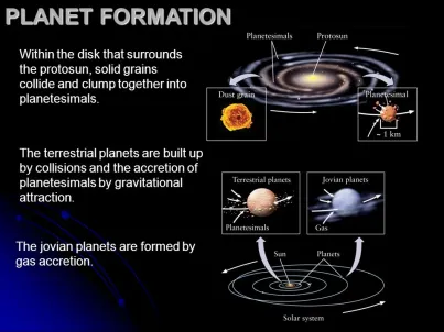
- The stars are localised lumps of gas within a nebula
- The gravitational force within the lumps leads to the formation of a core to the gas cloud and a huge rotating disc of gas and dust develops around the gas core
- In the next stage, the gas cloud starts getting condensed and the matter around the core develops into small-rounded objects
- These small-rounded objects by the process of cohesion [togetherness] develop into what is called planetesimals (minute planet)
- Larger bodies start forming by collision, and gravitational attraction causes the material to stick together
- Planetesimals are a large number of smaller bodies
- In the final stage, these large number of small planetesimals accrete [grow by accumulation] to form a fewer large bodies in the form of planets
- Orbit
- All planets revolve around a star (like the Sun) in fixed paths called orbits, which are generally elliptical (elongated) in shape.
- Earth is also a planet
- Early theories on the origin of the earth
- Overview
- A large number of hypotheses [theory / speculation / supposition] were put forth by different philosophers and scientists regarding the origin of the earth
- Nebular hypothesis
- One of the earlier and popular arguments was by German philosopher Immanuel Kant
- Mathematician Laplace revised it in 1796
- It is known as Nebular Hypothesis
- The hypothesis considered that the planets were formed out of a cloud of material associated with a youthful sun, which was slowly rotating
- Chamberlain and Moulton hypothesis
-
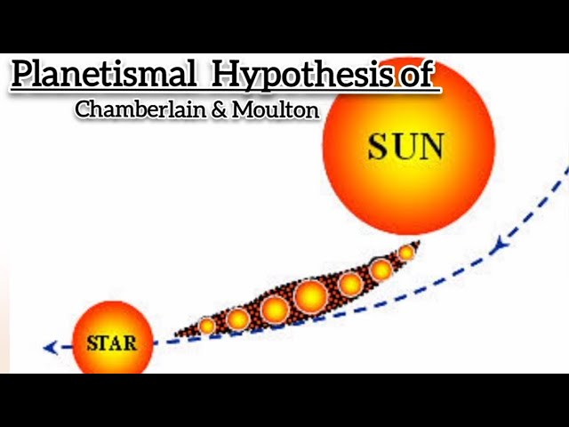
- Later in 1900, Chamberlain and Moulton considered that a wandering star approached the sun
- As a result, a cigar-shaped extension of material was separated from the solar surface
- As the passing star moved away, the material separated from the solar surface continued to revolve around the sun and it slowly condensed into planets
- Sir James Jeans and later Sir Harold Jeffrey supported this argument
- Binary theories
- At a later date, the arguments considered of a companion to the sun to have been coexisting
- These arguments are called binary theories
- Revised nebular hypothesis
- In 1950, Otto Schmidt in Russia and Carl Weizascar in Germany somewhat revised the ‘nebular hypothesis’, though differing in details
- They considered that the sun was surrounded by solar nebula containing mostly the hydrogen and helium along with what may be termed as dust
- The friction and collision of particles led to formation of a disk-shaped cloud and the planets were formed through the process of accretion [accumulation / gathering / amassing]
- Shift in focus
- However, scientists in later period took up the problems of origin of universe rather than that of just the earth or the planets
- The formation of moon (once part of earth)
- The moon is the only natural satellite of the earth, its diametre is only one-quarter that of the earth.
- A satellite is any object that orbits around a larger body in space due to gravitational attraction.
- Types of satellites:
- Natural Satellites:
- These are celestial bodies like moons that orbit planets.
- Example:
- The Moon is Earth's natural satellite.
- Biggest satellite in the Solar System is Ganymede (of Jupiter). It’s bigger than Mercury and Pluto.
- Artificial Satellites:
- Man-made objects launched into orbit for various purposes.
- Used for communication, weather forecasting, navigation, Earth observation, and scientific research.
- Example: INSAT, GPS, Hubble Space Telescope.
- It is about 3,84,400 km away from the earth.
- It has mountains plains and depressions on its surface. These cast shadows on the moon’s surface.
- Neil Armstrong was the first man to step on the surface of the moon on 21 July 1969.
- The Moon takes approximately 27.3 days to complete one full rotation on its axis, and it also takes approximately 27.3 days to complete one orbit around the Earth.
- As a result, only one side of the moon is visible to us on the earth.
- Theories of formation
- Early theory
- Like the origin of the earth, there have been attempts to explain how the moon was formed
- In 1838, Sir George Darwin suggested that initially, the earth and the moon formed a single rapidly rotating body
- The whole mass became a dumb-bell-shaped body and eventually it broke
- It was also suggested that the material forming the moon was separated from what we have at present the depression occupied by the Pacific Ocean
- Current theory
-
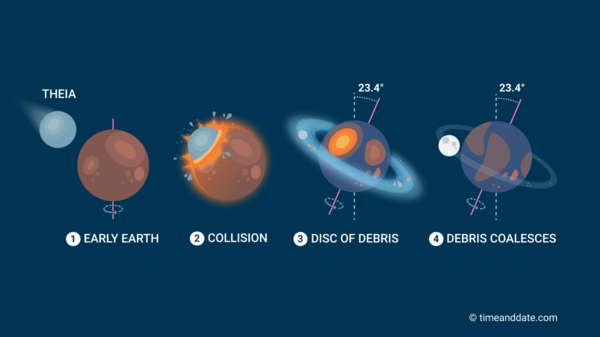
- However, the present scientists do not accept either of the explanations
- It is now generally believed that the formation of moon, as a satellite of the earth, is an outcome of ‘giant impact’ or what is described as “the big splat”
- A body of the size of one to three times that of mars (callded "Theia") collided into the earth sometime shortly after the earth was formed
- It blasted a large part of the earth into space
- This portion of blasted material then continued to orbit the earth and eventually formed into the present moon about 4.44 billion years ago
- Dwarf planets
- Dwarf planets are celestial bodies that orbit the Sun, are massive enough to be nearly round due to their gravity, but have not cleared their orbital path of other objects.
- Asteroid and comets
- Asteroid
- Asteroids are small, rocky objects that orbit the sun, often found in the main asteroid belt between Mars and Jupiter. They are remnants of the solar system's formation and can range in size from boulders to objects hundreds of miles in diameter.
- Asteroids are generally made of rock, dust, and frozen ices.
- The vast majority of asteroids in solar system reside in the main asteroid belt, located between Mars and Jupiter.
- Example: Ceres (largest asteroid), Vesta, Eros, Bennu
- Comets
- Comets are icy, small solar system bodies that orbit the Sun. They are composed of frozen gases, dust, and rocks and are often described as "dirty snowballs".
- Comets in solar system are believed to originate from two primary regions: the Kuiper Belt and the Oort Cloud.
-
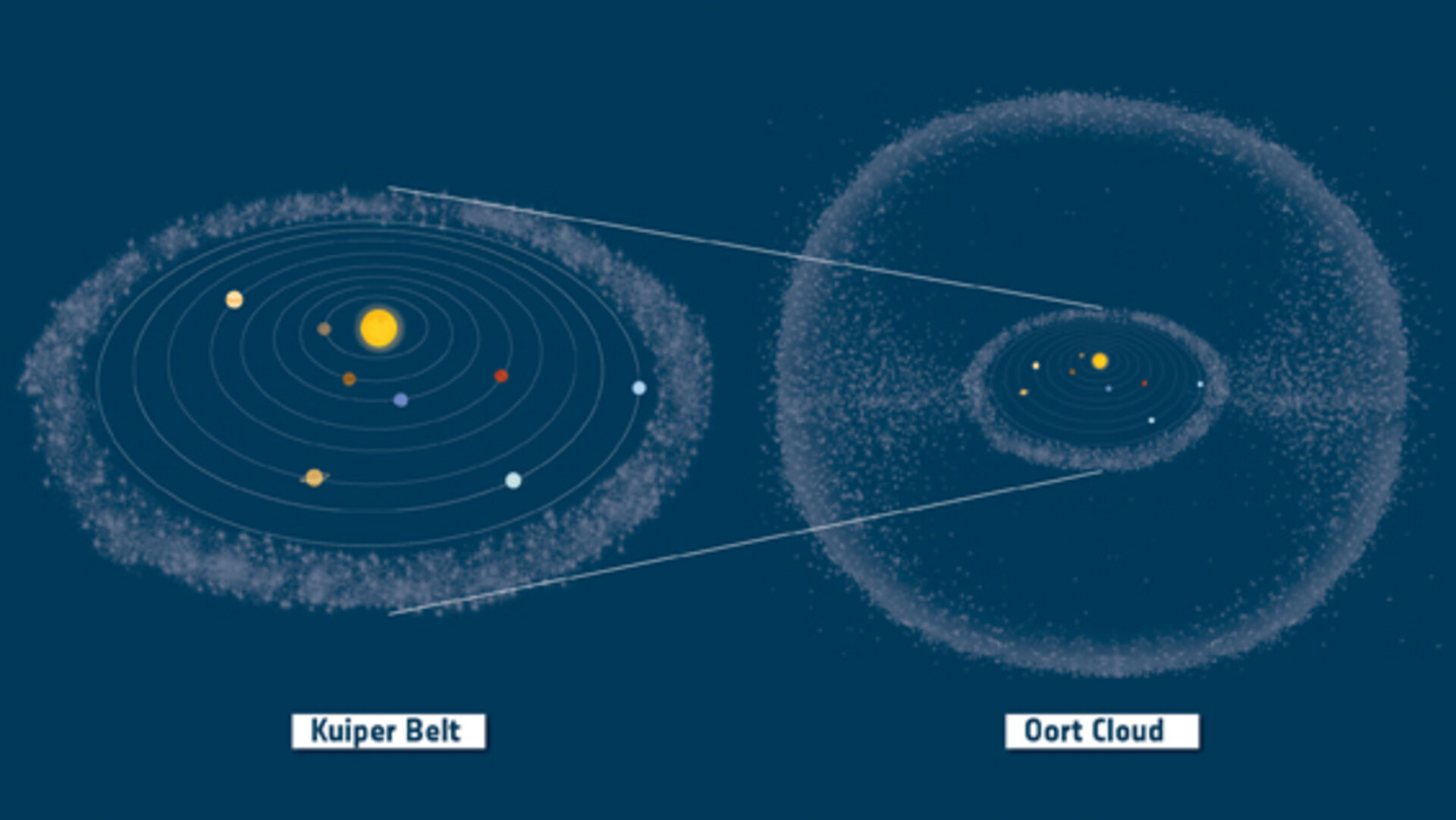
- Asteroids are primarily made of rock and metal, while comets are composed of ice, dust, and rocky material
- Examples : Halley's Comet, Hale-Bopp, and Hyakutake.
- Meteors, meteoroids and meteorites
- Meteoroids are small pieces of rock or metal orbiting the star. When a meteoroid enters a planet's atmosphere, it becomes a meteor, creating a streak of light as it burns up. If a meteoroid survives the atmospheric entry, it becomes a meteorite and lands on the planet.
- The term is not only specific to Earth, but is valid for any planet.
- The primary difference between a meteoroid and an asteroid lies in their size.
- Asteroids are generally larger than meteoroids, with a minimum size of 1 meter (3.28 feet) in diameter. Meteoroids, on the other hand, are smaller, ranging from dust particles to objects up to 1 meter across.
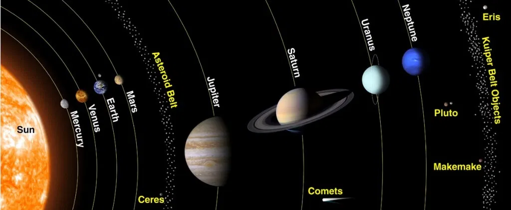
- Our solar system
-
- Overview
- Composition
- Our solar system consists of the sun (the star), 8 planets, 63 moons, millions of smaller bodies like asteroids and comets and huge quantity of dust-grains and gases
- Formation timeline
- The nebula from which our Solar system is supposed to have been formed, started its collapse and core formation some time 5-5.6 billion years ago and the planets were formed about 4.6 billion years ago
- All the planets were formed in the same period sometime about 4.6 billion years ago
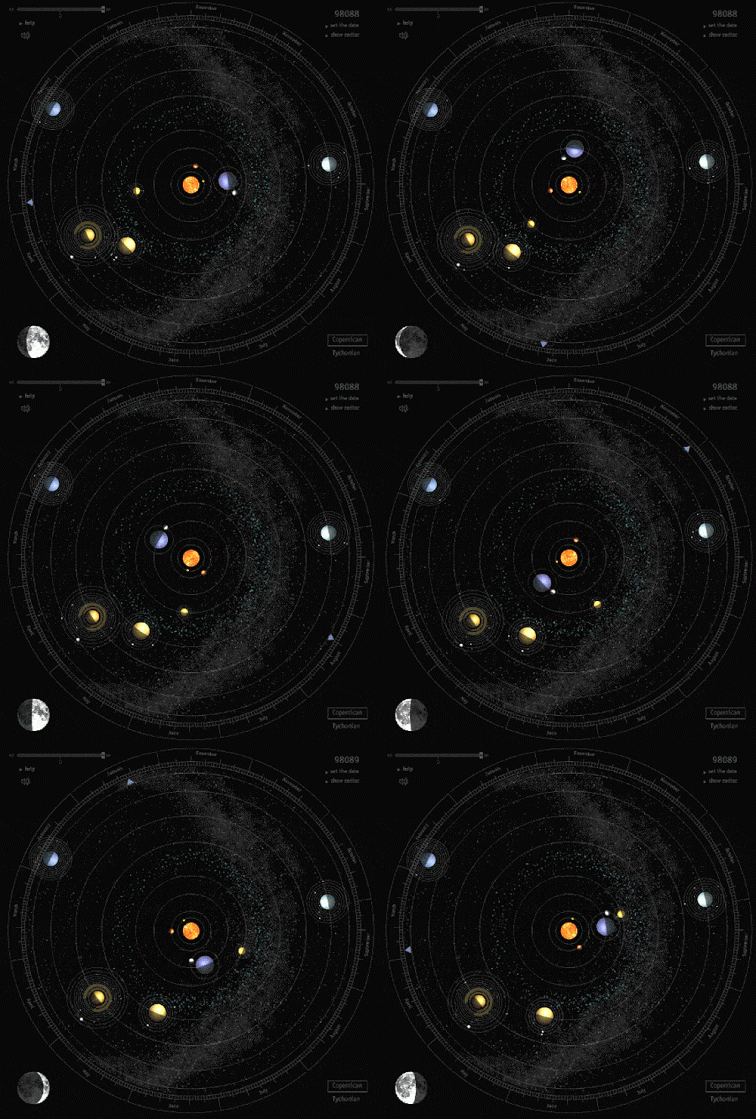
- Everything formed from the same rotating cloud of gas and dust, so, all the planets in our Solar System revolve counterclockwise.
-
- Planet classification in solar system
-
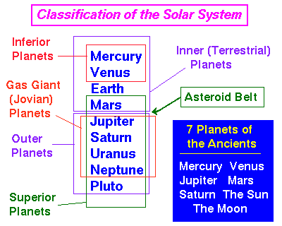
- Inner planets (Terrestrial planets / Earth like planets)
- Out of the eight planets
- Mercury
- It is the smallest, nearest (to sun), and fastest
- Venus (also referred as Earth's twin or sister)
- Most planets rotate in counterclockwise direction, the same direction they orbit the sun.
- But it rotates in clockwise direction as an exception, one theory for this unusual rotation is that it was knocked off its upright position earlier in its history
- The other exception is Uranus which spins in clockwise direction.
- It is also the hottest planet
- Venus is hotter than Mercury despite being further from sun primarily due to its dense, carbon dioxide-rich atmosphere, which creates a strong greenhouse effect.
- Earth
- The earth is the third nearest planet to the sun.
- In size, it is the fifth largest planet.
- It is slightly flattened at the poles. That is why, its shape is described as a Geoid.
- Geoid means an earth-like shape.
- The earth is neither too hot nor too cold. It has water and air, which are very essential for our survival.
- Mars (also called red planet due to iron presence)
- These are called as the inner planets as they lie between the sun and the belt of asteroids
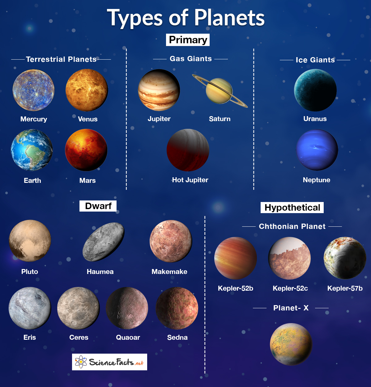
- Alternatively, the first four are called Terrestrial, meaning earth-like as they are made up of rock and metals, and have relatively high densities
- Outer planets (Jovian planets / Jupiter like planets / gas giants)
- The other four planets are called the outer planets, these include:
- Jupiter
- Largest planet
- Saturn
- Second largest planet
- Uranus
- Neptune
- These four are called Jovian or Gas Giant planets
- Jovian means jupiter-like
- Most of them are much larger than the terrestrial planets and have thick atmosphere, mostly of helium and hydrogen
- Exoplanets
- These are planets that orbit stars other than our Sun, making them "extrasolar" or "outside our solar system". They can be gas giants, rocky planets, or even icy planets.
- Differences in composition
- The difference between terrestrial and jovian planets can be attributed to the following conditions:
- The terrestrial planets have composition of rocks, metals, and other heavy elements which solidify while jovian planets are mainly formed of gaseous elements like hydrogen, helium, etc which don't solidify
- The max pressure at jupiter's core forms metal hydrogen, in which hydrogen atoms are so close that electrons flow freely for one to another, a unique state
- Why are the inner planets rocky while others are mostly in gaseous form?
- The terrestrial planets were formed in the close vicinity [surrounding area] of the parent star where it was too warm for gases to condense [become dense] to solid particles
- Which means that only rocky and metallic materials (with higher melting points) could condense and form solid bodies in close vicinity.
- Jovian planets were formed at quite a distant [far away] location
- The solar wind was most intense nearer the sun; so, it blew off lots of gas and dust from the terrestrial planets
- The solar winds were not all that intense to cause similar removal of gases from the Jovian planets
- The terrestrial planets are smaller and their lower gravity could not hold the escaping gases
- Case of pluto
- Till recently (August 2006), Pluto was also considered a planet
- However, in a meeting of the International Astronomical Union, a decision was taken that Pluto like other celestial objects (2003 UB313) discovered in recent past may be called ‘dwarf planet’
- IAU’s 3 Criteria for a Full Planet:
1. Orbits the Sun
- Pluto does this.
2. Has enough mass to assume a nearly round shape (hydrostatic equilibrium)
- Pluto is spherical.
3. Has cleared its orbit of other debris
- Pluto fails here.
- It has only approx. 7% times the mass of the rest of the material in its orbit (Earth has over 1000×).
- Pluto is about 0.2% the mass of Earth and about 18% the mass of the Moon.
- It’s not gravitationally dominant in its zone — it doesn’t "clear out" other objects like planets do.
- Types of planets
-
- Some metrics for planets in solar system
-
| Planet |
Distance (AU)* |
Density (g/cm³)@ |
Radius# (Earth = 1) |
Rotation Period |
Revolution Period |
Mean Orbital Speed (km/s) |
Mean Surface / Cloud-top Temperature (°C) |
Satellites |
| Mercury |
0.387 |
5.44 |
0.383 |
58.6 days |
88 days |
47.4 |
~167 (−173 to 427) |
0 |
| Venus |
0.723 |
5.245 |
0.949 |
243 days (retrograde) |
225 days |
35.0 |
~464 |
0 |
| Earth |
1.000 |
5.517 |
1.000 |
23 h 56 m |
365.25 days |
29.8 |
~15 |
1 |
| Mars |
1.524 |
3.945 |
0.533 |
24 h 37 m |
687 days |
24.1 |
~−65 |
2 |
| Jupiter |
5.203 |
1.33 |
11.19 |
9 h 56 m |
11.86 years |
13.1 |
~−110 |
about 53 |
| Saturn |
9.539 |
0.70 |
9.460 |
10 h 33 m |
29.46 years |
9.7 |
~−140 |
about 53 |
| Uranus |
19.182 |
1.17 |
4.11 |
17 h 14 m (retrograde) |
84 years |
6.8 |
~−195 |
about 27 |
| Neptune |
30.058 |
1.66 |
3.88 |
16 h 6 m |
164.8 years |
5.4 |
~−200 |
13 |
* Distance from the sun in astronomical unit i.e. average mean distance of the earth is 149,598,000 km = 1 @ Density in gm/cm3 # Radius: Equatorial radius 6378.137 km = 1
- Asteroid belt
- The asteroid belt is a region in the Solar System, located between the orbits of Mars and Jupiter, where millions of asteroids orbit the Sun.
- NEA (Near-Earth Asteroid)
- NEA, short for Near-Earth Asteroid, refers to asteroids whose orbits bring them close to Earth's orbit.
- Trojan asteroids are asteroids that share the orbit of a planet, but stay either ahead or behind it, typically at Lagrange points L4 or L5.
-
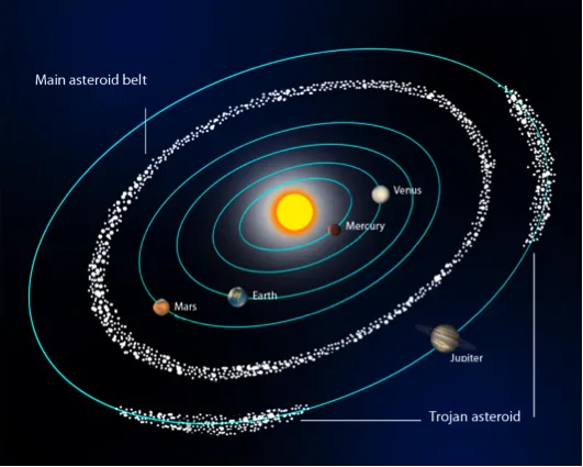
- They are gravitationally stable in these positions and are thought to be remnants of the primordial material that formed the outer planets.
- The best-known examples are the Jupiter Trojans, which orbit alongside Jupiter.
- Kuiper belt
- A region of the solar system beyond the orbit of Neptune, believed to contain many comets, asteroids, and other small bodies made largely of ice.
- There are four known dwarf planets in the Kuiper belt viz. [namely / in other words] Pluto, Makemake, Haumea, and Eris
- Earth and it's evolution
- Initial state
- Overview
- Do you know that the planet earth initially was a barren, rocky and hot object with a thin atmosphere of hydrogen and helium
- This is far from the present day picture of the earth
- Hence, there must have been some events– processes, which may have caused this change from rocky, barren and hot earth to a beautiful planet with ample amount of water and conducive atmosphere favouring the existence of life
- In the following section, you will find out how the period, between the 4,600 million years and the present, led to the evolution of life on the surface of the planet
- Layered structure
- The earth has a layered structure
- From the outermost end of the atmosphere to the centre of the earth, the material that exists is not uniform
- The atmospheric matter has the least density
- From the surface to deeper depths, the earth’s interior has different zones and each of these contains materials with different characteristics
- Evolution of lithosphere
- Process of formation
- How was the layered structure of the earth developed?
- The earth was mostly in a volatile state during its primordial [existing at or from beginning of time] stage
- Due to gradual increase in density the temperature inside has increased
- As a result the material inside started getting separated depending on their densities
- This allowed heavier materials (like iron) to sink towards the centre of the earth and the lighter ones to move towards the surface
- With passage of time it cooled further and solidified and condensed into a smaller size
- This later led to the development of the outer surface in the form of a crust
- During the formation of the moon, due to the giant impact, the earth was further heated up
- It is through the process of differentiation that the earth forming material got separated into different layers
- Starting from the surface to the central parts, we have layers like the crust, mantle, outer core and inner core
- From the crust to the core, the density of the material increases
- We shall discuss in detail the properties of each of this layer in the next chapter
- Evolution of atmosphere and hydrosphere
- Current composition
- The present composition of earth’s atmosphere is chiefly contributed by nitrogen and oxygen
- You will be dealing with the composition and structure of the earth’s atmosphere in Chapter 8
- Stages of evolution
- There are three stages in the evolution of the present atmosphere
- The first stage is marked by the loss of primordial atmosphere
- In the second stage, the hot interior of the earth contributed to the evolution of the atmosphere
- Finally, the composition of the atmosphere was modified by the living world through the process of photosynthesis
- Detailed process
- The early atmosphere, with hydrogen and helium, is supposed to have been stripped off as a result of the solar winds
- This happened not only in case of the earth, but also in all the terrestrial planets, which were supposed to have lost their primordial atmosphere through the impact of solar winds
- During the cooling of the earth, gases and water vapour were released from the interior solid earth
- This started the evolution of the present atmosphere
- The early atmosphere largely contained water vapour, nitrogen, carbon dioxide, methane, ammonia and very little of free oxygen
- The process through which the gases were outpoured from the interior is called degassing
- Continuous volcanic eruptions contributed water vapour and gases to the atmosphere
- As the earth cooled, the water vapour released started getting condensed
- The carbon dioxide in the atmosphere got dissolved in rainwater and the temperature further decreased causing more condensation and more rains
- The rainwater falling onto the surface got collected in the depressions to give rise to oceans
- The earth’s oceans were formed within 500 million years from the formation of the earth
- This tells us that the oceans are as old as 4,000 million years
- Sometime around 3,800 million years ago, life began to evolve
- However, around 2,500-3,000 million years before the present, the process of photosynthesis got evolved
- Life was confined to the oceans for a long time
- Oceans began to have the contribution of oxygen through the process of photosynthesis
- Eventually, oceans were saturated [thoroughly soaked] with oxygen, and 2,000 million years ago, oxygen began to flood the atmosphere
- Origin of life
- Initial conditions and process
- The last phase in the evolution of the earth relates to the origin and evolution of life
- It is undoubtedly clear that initially the earth or even the atmosphere of the earth was not conducive [good for] for the development of life
- Modern scientists refer to the origin of life as a kind of chemical reaction, which first generated complex organic molecules and assembled them
- This assemblage was such that they could duplicate themselves converting inanimate matter into living substance
- Evidence and timeline
- The record of life that existed on this planet in different periods is found in rocks in the form of fossils
- The microscopic structures closely related to the present form of blue algae have been found in geological formations much older than some 3,000 million years
- It can be assumed that life began to evolve sometime 3,800 million years ago
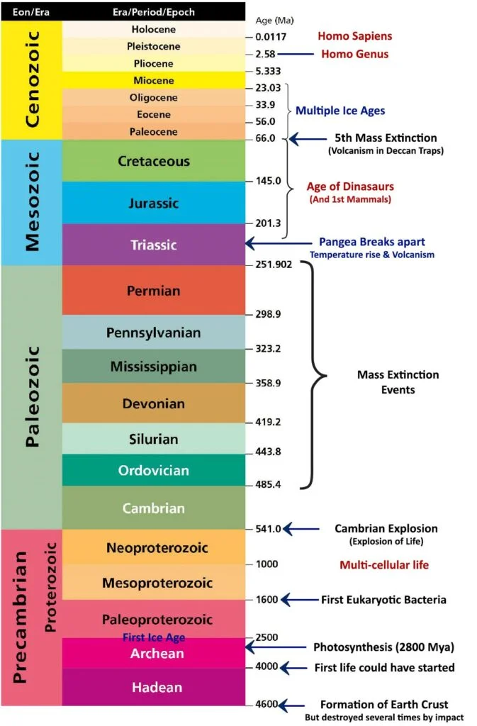
- The summary of evolution of life from unicellular bacteria to the modern man is given in the Geological Time Scale on page 18
-
- Basics of geography
- Latitudes and Longitudes
-
- Latitude (Horizontal Lines)
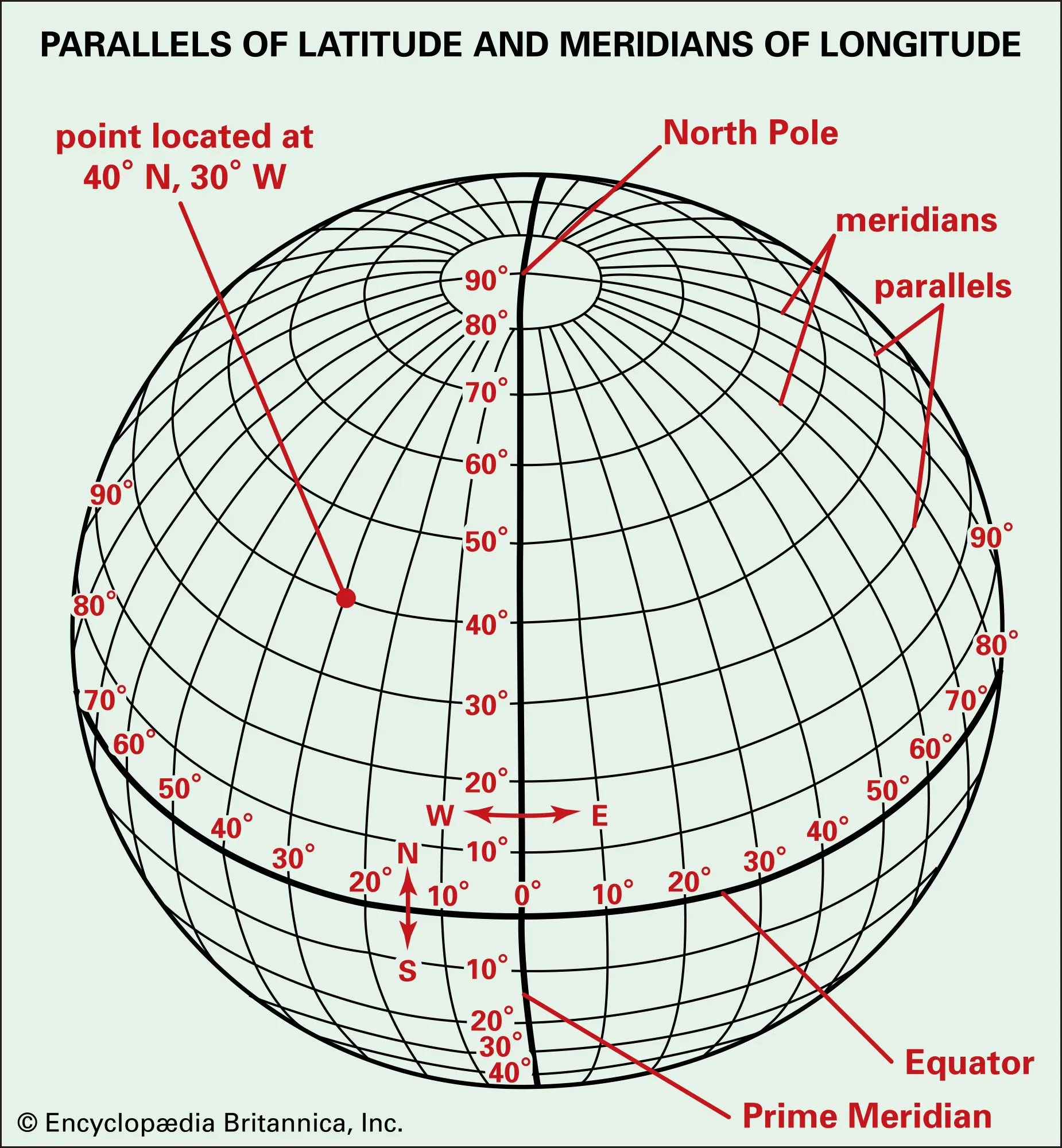
- Latitude is a geographic coordinate that measures the distance of a location on Earth from the Equator.
- An imaginary line notionally drawn on the earth equidistant from the poles, dividing the earth into northern and southern hemispheres and constituting the parallel of latitude 0°
- It is measured with 180 imaginary lines known as parallels.
- All parallels north of the equator are called ‘north latitudes.’ Similarly all parallels south of the equator are called ‘south latitudes.’
- Each parallel measures one degree north or south of the Equator and 90 degrees north of the Equator and 90 degrees south of the Equator.
- One degree degree of latitude covers about 111 kilometers.
- Run east–west, but measure positions north or south of the Equator.
- By measuring the angle of the Pole Star from your place, you can know the latitude of your place.
- The Equator is 0° latitude.
- The upper hemisphere is called Northern Hemisphere.
- The lower hemisphere is called Souther Hemisphere.
- Values range from 0° to 90°:
- North of Equator: 0° to 90°N (e.g., New Delhi is ~28.6°N)
- South of Equator: 0° to 90°S (e.g., Sydney is ~33.9°S)
- Key Latitudes:
- Equator (0°)
- Tropic of Cancer (23.5°N)
- Tropic of Capricorn (23.5°S)
- Arctic Circle (66.5°N)
- Antarctic Circle (66.5°S)
- Heat zones according to greeks
- Torrid zone (Hottest areas)
- Area between tropic of cancer and tropic of capricorn.
- Temperate zone (misnomer for Moderate areas)
- North temperate zone
- Area between tropic of cancer and arctic circle.
- South temperate zone
- Area between tropic of capricorn and antarctic circle.
- Frigid zone (coldest areas)
- Areas at north and south pole.
- Longitude (Vertical Lines)
- Longitude is the measurement east or west of the prime meridian. Run north–south, but measure positions east or west of the Prime Meridian.
- Longitude is measured by imaginary lines that run around Earth vertically and meet at the North and South Poles. These lines are known as meridians.
- Unlike parallels of latitude, all meridians are of equal length but they are not parallel like latitudes
- There are 360 longitudes (also called meridians) on Earth.
- Why 360 longitudes and only 180 latitudes?
- Latitude = distance from Equator (no full circle) → limited (90° each side)
- Longitude = rotation around Earth → full circle (360°)
- A degree of longitude is about 111 kilometers at its widest.
- The widest areas of longitude are near the Equator, where Earth bulges out.
- All meridians meet and north and south poles.
- Prime meridian
- The Prime Meridian (0° longitude) passes through Greenwich, England.
- Its value is 0° longitude and from it we count 180° eastward as well as 180° westward
- Values range from 0° to 180°:
- East of Greenwich:
- 0° to 180°E (e.g., India is ~77°E)
- West of Greenwich:
- 0° to 180°W (e.g., New York is ~74°W)
- Longitude and time
-
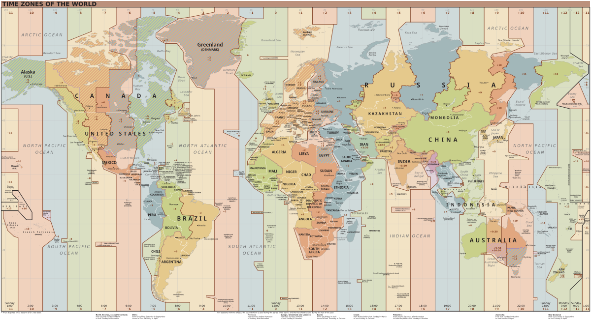
- The world has been divided into 24 major time zones of one hour each. Each zone thus covers 15° of longitude.
- The Prime meridian is taken as the point of reference for calculating time. The time measured at the Prime Medidian is called the Greenwich Mean Time (GMT).
- As the earth rotates from west to east, those places east of Greenwich are ahead of the GMT and those to the west are behind it.
- Earth rotates from west to east as a point on Earth moves toward the east as time passes.
- The earth rotates 360 degree in about 24 hours, it takes 4 minutes to cover 1 degree longitude.
- Thus, when it is 12 noon at Greenwich, the time at 15° east of Greenwich will be 15 × 4 = 60 minutes, i.e., 1 hour ahead of Greenwich time, which means 1 p.m.
- But at 15° west of Greenwich, the time will be behind Greenwich time by one hour,
- Why do we have standard time?
- The local time of places which are on different meridians are bound to differ and create chaos related to time bound tasks and management.
- It is, therefore, necessary to adopt the local time of some central meridian of a country as the standard time for the country.
- In India, the longitude of 82½° E (82° 30'E) is treated as the standard meridian. It passes near Mirzapur district, Uttar Pradesh.
- The local time at this meridian is taken as the standard time for the whole country.
- It is known as the Indian Standard Time (IST).
- Large countries like Russia Canada and the United States have vast longitudinal extent. They do not have a single Standard Time for the whole Country
- Daylight Saving Time
- Daylight Saving Time, system for uniformly advancing clocks, so as to extend daylight hours during conventional waking time in the summer months
- It is practices in countries which are at extreme north and south.
- Reason
- Better use of daytime
- Saves energy as use of artifical lighting is lessened.
- International Date Line
-
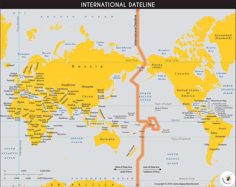
- The International Date Line is an imaginary line on the Earth’s surface, roughly along the 180° longitude, where the date changes by one day when crossed.
- Deviates (zig-zags) to avoid cutting through countries and island groups. Passes through the Pacific, keeping island nations on the same calendar day.
- Motion of the Earth
- Rotation
-
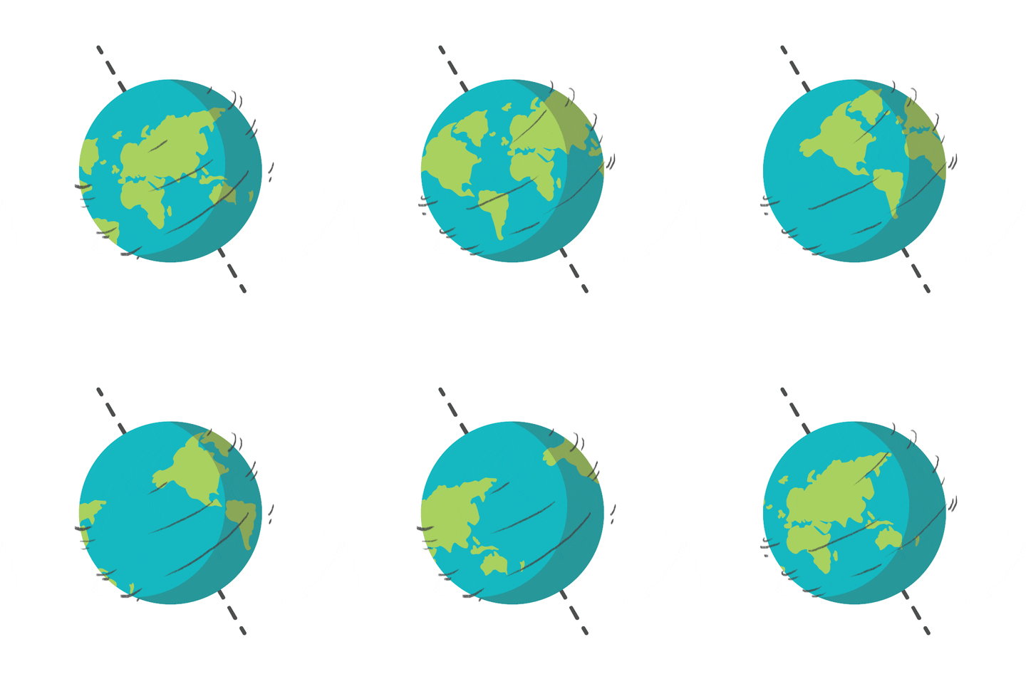
- Earth's rotation, also known as Earth's spin, is the planet's circular movement around its own axis.
- This rotation takes approximately 23 hours, 56 minutes and 4 seconds to complete and is responsible for the cycle of day and night. Earth rotates eastward, counterclockwise when viewed from above the North Pole.
- Solar day vs sidereal day
-
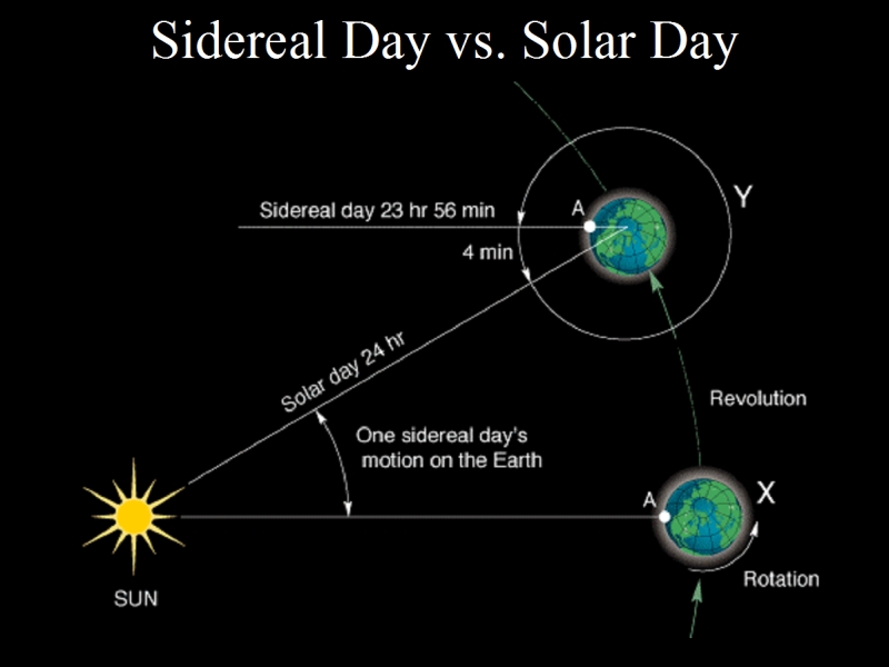
- Solar Day (24 hours) – What We Use Daily
- The time the Earth takes to face the Sun again at the same position (e.g., noon to noon).
- It includes the Earth’s rotation plus a little extra to catch up with the Sun, because the Earth is also moving around the Sun.
- This is the 24-hour day on your clock.
- The period of rotation is known as the earth day
- Sidereal Day (23 hours 56 minutes 4 seconds) – Actual Rotation Time
- The time Earth takes to complete one full 360° spin relative to distant stars.
- It’s shorter because while the Earth spins, it also moves forward in its orbit, so it needs to rotate a bit more to face the Sun again.
- This is used in astronomy and satellite tracking.
- Significance of earth's rotation
-
- Day and Night Cycle (Diurnal cycle)
- The most direct effect of Earth's rotation is the alternation of day and night.
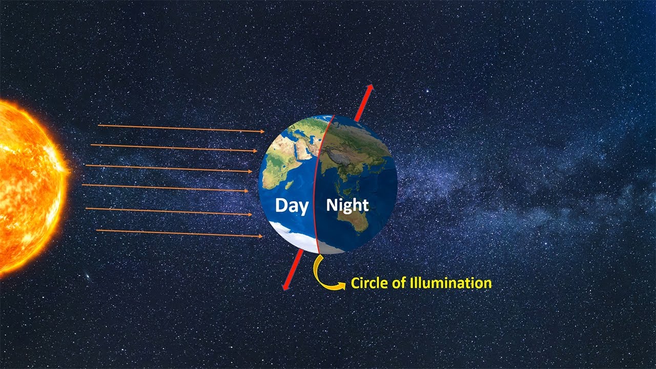
- As Earth rotates from west to east, different parts face the Sun (day) while others are in shadow (night), enabling a 24-hour time cycle that regulates biological rhythms (circadian rhythms) in plants, animals, and humans.
- Circle of illumination
- The circle which divides day area vs night area of earth is called circle of illumination.
-
- Coriolis Effect
- The rotation causes the Coriolis force, which deflects the path of moving air and water:
- To the right in the Northern Hemisphere (near earth's surface)
- To the left in the Southern Hemisphere (near earth's surface)
- How it works:
- The Earth rotates from west to east.
- Because of this rotation, different parts of the Earth move at different speeds:
- At the equator, the surface is moving fastest (~1670 km/h).
- At the poles, it's almost not moving at all.
- This is essential for the formation of weather patterns, ocean currents, and cyclones.
- Effect and deviations at higher altitudes
- The air rising near the equator moves poleward at high altitudes (around the tropopause).
- This poleward moving air at high altitude is moving into regions of faster rotation (because the Earth’s surface velocity is higher at the equator).
- Due to conservation of angular momentum, as air moves poleward it gains an eastward velocity relative to the surface.
- This results in strong westerly winds aloft (blowing from west to east).
- These are called westerly jet streams — such as the subtropical jet and polar jet.
- Why do equatorward-moving surface winds get deflected westward?
- Air begins to move from high pressure at higher latitudes (poles) toward low pressure at lower latitudes (equator).
- Near the poles, air has low eastward velocity because Earth’s rotational speed is low at high latitudes.
- As the air moves equatorward, it enters regions where Earth’s surface rotates progressively faster.
- Surface friction acts on the air and does provide real eastward acceleration.
- However, this frictional acceleration is too weak to allow the air to match the rapidly increasing eastward speed of the Earth’s surface.
- As a result, the air always remains slightly slower than the ground below it and continues to lag behind Earth’s rotation.
- In Earth’s rotating frame, this persistent lag appears as a westward deflection.
- This apparent deflection is explained by the Coriolis force, acting to the right in the Northern Hemisphere and to the left in the Southern Hemisphere.
- Role in Earth’s Magnetic Field (Indirect)
- Earth’s magnetic field is generated by the geodynamo mechanism operating in the liquid outer core.
- The outer core consists of molten iron and nickel, which are electrically conducting.
- Heat-driven convection causes this molten metal to move.
- Earth’s rotation introduces the Coriolis force, which:
- Organizes the convective motions into spiral (helical) flows.
- Prevents random turbulence in the liquid outer core.
- These organized flows sustain electric currents, which in turn generate the geomagnetic field.
- Important clarification
- Earth’s rotation alone does not create the magnetic field.
- Rotation is essential for maintaining and stabilizing the geodynamo.
- Consequences
- Helps in shielding Earth from solar wind and cosmic radiation.
- Enables compass-based navigation.
- Explains phenomena like magnetic reversals over geological time.
- Time Zones
- Because of rotation, different longitudes experience sunrise and sunset at different times.
- The Earth is divided into 24 time zones, roughly 15° of longitude apart, with each zone representing one hour.
- Flattening at the Poles
- Earth's rotation causes a centrifugal force, making it slightly bulge at the equator and flatten at the poles.
- This makes Earth an oblate spheroid, not a perfect sphere.
- Tidal Effects (Minor)
- While tides are mainly due to the Moon and Sun's gravity, Earth's rotation influences the timing and frequency of tides.
- Influence on Satellites and Navigation
- Earth’s rotation is crucial for launching and tracking satellites.
- Navigation systems (like GPS) must account for Earth's rotation to provide accurate positioning.
- Revolution
-
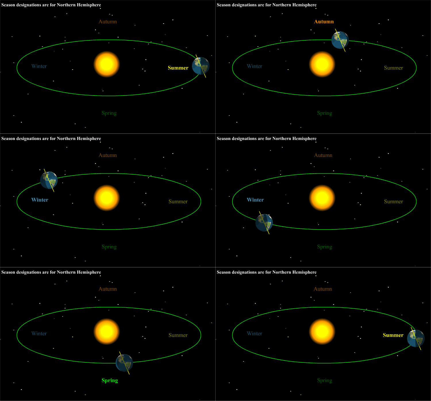
- The revolution of Earth refers to its yearly journey around the Sun in a fixed, elliptical path.
- This movement takes approximately 365.25 days to complete, which is why we have leap years every four years to account for the extra quarter of a day.
- The day is added to only February because of some old Roman thing and people just continued with that in modern times.
- The Earth revolves at varying speeds, reaching its fastest point when closest to the Sun (perihelion) and its slowest when farthest away (aphelion).
- Farthest and nearest points in earth's object
- Aphelion
- It is the point in a celestial body's orbit where it is farthest from the Sun. Earth's aphelion occurs in early July, around July 3rd or 4th, at which time it's about 152.1 million kilometers from the Sun.
- This is about 4.8 million kilometers farther than Earth's perihelion.
- Perihelion
- The point in the orbit of a planet, asteroid, or comet at which it is closest to the sun. Earth's perihelion occurs around January 3rd.
- Earth is closest to the Sun, but ironically, this period has some of the coldest days in India.
- Significance of earth's revolution
- Formation of Seasons
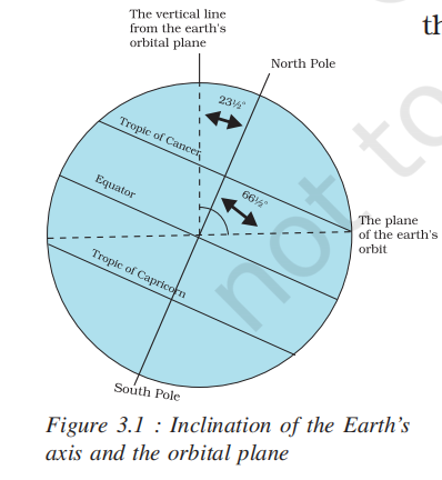
- Earth's axis is tilted at 23.5° relative to its orbital plane.
- The plane formed by the orbit is known as the orbital plane
- As it revolves around the Sun, different parts of Earth receive varying amounts of sunlight throughout the year.
- Summer occurs when a hemisphere is tilted toward the Sun.
- Winter occurs when it is tilted away.
- This variation causes spring, summer, autumn, and winter, each with distinct climate and ecological impacts.
- Variation in Day Length
- Due to revolution and axial tilt, day length changes over the year:
- Longer days in summer
- Shorter days in winter
- This affects plant growth, animal behavior, and human activities.
- Temperature Changes
- Revolution leads to solar energy distribution changes across the globe over the year.
- Areas receive more direct sunlight in summer, increasing temperatures, and less in winter, lowering them.
- Annual Cycle of Life
- Many biological processes (like flowering, migration, hibernation) are tied to seasonal changes caused by Earth’s revolution.
- Agriculture relies heavily on these cycles — sowing, growing, and harvesting are season-dependent.
- Determination of a Year
- One complete revolution takes about 365.25 days, which defines a calendar year.
- The extra 0.25 day leads to a leap year every four years.
- Geographic and magnetic poles
-
- Geographic Poles
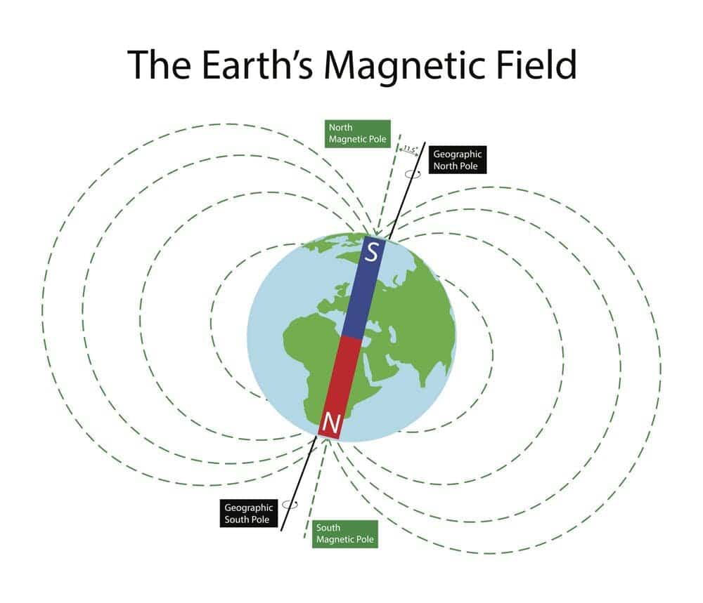
- The Geographic poles refer to the two fixed points where the Earth's axis of rotation intersects its surface.
- These are the North Pole and South Pole:
- North Pole:
- Located at 90°N latitude, at the northernmost point of Earth's axis.
- South Pole:
- Located at 90°S latitude, at the southernmost point of Earth's axis.
- The Geographic poles are fixed in position, meaning they do not move over time.
- Magnetic Poles
- The Magnetic poles are the points where the Earth's magnetic field is vertical.
- There are two magnetic poles:
- North Magnetic Pole:
- Located in the northern hemisphere (currently shifting toward Russia).
- South Magnetic Pole:
- Located near Antarctica.
- Unlike the Geographic poles, Magnetic poles are not fixed and move over time due to changes in the Earth's magnetic field (due to fluid motions in the outer core).
- Key Differences:
- Geographic poles:
- Fixed, determined by Earth's rotation axis.
- Magnetic poles:
- Move, determined by Earth's magnetic field.
- Various terms
- Declination angle
- The angle between true North and magnetic North at any particular position.
- Pole reversal
- Complete reversal of the magnetic poles of the earth over several thousands of years.
- Earth’s magnetic field does not flip suddenly at a single moment. This occurs over thousands of years due to changes in the convection patterns within Earth's outer core, where the magnetic field is generated.
- Magnetosphere
-
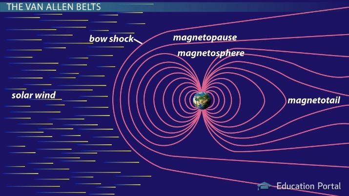
- The magnetosphere is the region of space around Earth that is controlled by Earth's magnetic field.
- It extends several thousand kilometers into space, protecting Earth from harmful solar wind and cosmic radiation.
- It is shaped by the interaction of the solar wind with Earth's magnetic field.
- Magnetopause
-
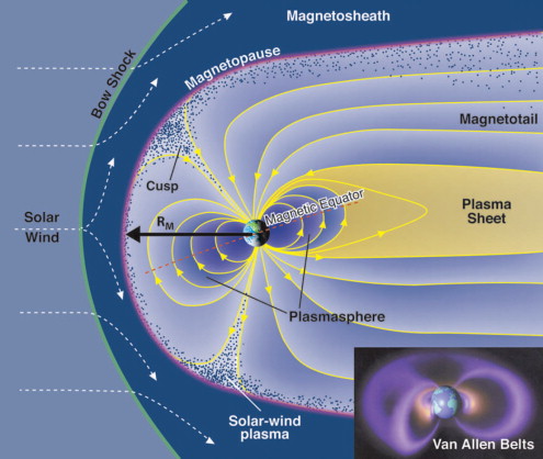
- The magnetopause is the boundary between Earth's magnetosphere and the solar wind.
- It represents the point of pressure balance between the Earth's magnetic field and the incoming solar wind.
- It is an abrupt boundary where the solar wind’s force is countered by the magnetic field’s pressure.
- The distance from Earth varies depending on solar wind strength, but typically lies about 10 Earth radii from Earth.
- Magnetosheath
- The magnetosheath is the turbulent region of space just outside the magnetopause.
- It is where the solar wind is slowed down and compressed as it encounters Earth's magnetic field.
- The particles in the magnetosheath are deflected and can create phenomena such as auroras and geomagnetic storms.
- Significance of Magnetosphere
- The magnetosphere plays a crucial role in protecting life on Earth from solar radiation and cosmic rays. It deflects harmful charged particles away from the planet’s surface.
- It also helps preserve the atmosphere by preventing the stripping away of atmospheric particles by solar winds, which could otherwise lead to atmospheric loss.
- The magnetosphere’s interaction with solar winds leads to auroras (Northern and Southern Lights), which are both beautiful and a result of the magnetic field’s protection.
- Seasons of earth
-
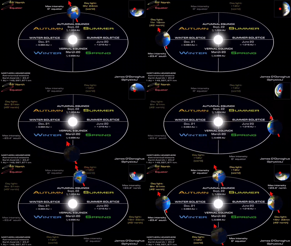
- The Earth’s tilt (23.5°) and revolution around the Sun cause seasonal changes, marked by two solstices and two equinoxes each year.
- Doubt between Autumn and Spring
- Autumn is the transitional season between summer and winter while spring is the transitional season between winter and summer.
- In English, Autumn also called "Fall" because leaves fall during this season.
- Spring refers to plants springing up from the ground.
- Summer Solstice
- Date:
- Around June 21
- Position:
- The Northern Hemisphere is tilted toward the Sun.
- Sun’s vertical rays fall on Tropic of Cancer (23.5°N)
- Significance:
- Longest day and shortest night in the Northern Hemisphere.
- Marks the start of summer in the Northern Hemisphere.
- Opposite in the Southern Hemisphere (they experience winter).
- Winter Solstice
- Date:
- Around December 21
- Position:
- The Northern Hemisphere is tilted away from the Sun.
- Sun’s vertical rays fall on Tropic of Capricorn (23.5°S)
- Significance:
- Shortest day and longest night in the Northern Hemisphere.
- Marks the start of winter in the Northern Hemisphere.
- Opposite in the Southern Hemisphere (they experience summer).
- Vernal Equinox (Spring Equinox)
- Date:
- Around March 21
- Sun’s vertical rays fall on: Equator (0°)
- Position:
- Neither hemisphere is tilted toward or away from the Sun.
- Significance:
- Day and night are equal (12 hours each) everywhere on Earth.
- Marks the start of spring in the Northern Hemisphere.
- Start of autumn in the Southern Hemisphere.
- Autumnal Equinox (Fall Equinox)
- Date:
- Around September 23
- Sun’s vertical rays fall on Equator (0°)
- Position:
- Again, no tilt toward or away.
- Significance:
- Equal day and night worldwide.
- Marks the start of autumn in the Northern Hemisphere.
- Start of spring in the Southern Hemisphere.
- Important note
- Occurrence of seasons are dependent on the hemisphere. Spring equinox is only spring in northern, it becomes autumn for southern hemisphere.
- Maps, sketch and plan
- Map
- A map is a representation or drawing of the Earth's surface or a part of it on a flat surface, drawn according to a scale. It provides detailed information about various features and locations.
- Types of Maps
- Physical Maps:
- Show natural features like mountains, plateaus, plains, rivers, and oceans.
- Political Maps:
- Depict cities, towns, villages, countries, and states with their boundaries.
- Thematic Maps:
- Focus on specific information such as road networks, rainfall distribution, forests, industries, etc.
- Components of Maps
- Distance:
- Maps use a scale to represent the ratio between actual distances on the ground and distances on the map.
- Scale of Maps:
- Large Scale Maps:
- Maps drawn with a larger representative fraction (RF). Show a small area with high level of detail.
- Example:
- Village map, city map, cadastral map.
- Small Scale Maps:
- Maps drawn with a smaller representative fraction (RF). Show a large area with low level of detail.
- Example:
- World map, continent map, country map.
- Direction:
- Maps indicate directions with a compass rose or an arrow pointing north.
- Cardinal Directions (Cardinal points):
- North, South, East, West.
- Intermediate Directions:
- North-East (NE), South-East (SE), South-West (SW), North-West (NW).
- Symbols:
- Standard symbols:
- Standard symbols represent features like buildings, roads, bridges, etc.
- Conventional Symbols:
- Universally accepted symbols used for easy understanding.
- Colour Conventions:
- Blue -> Water bodies.
- Brown -> Mountains.
- Yellow -> Plateaus.
- Green -> Plains.
- Sketch:
- A rough drawing based on memory and observation, not to scale.
- Used to show directions or locations informally.
- Plan:
- A detailed drawing of a small area on a large scale.
- Provides exact measurements and is used for specific purposes like building layouts.
- Major Domains of the Earth
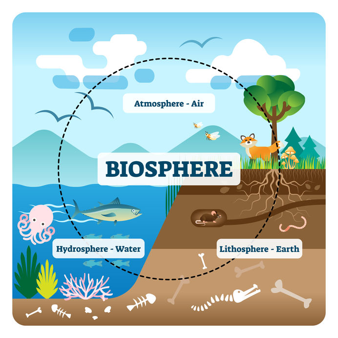
- The earth is made up of four major domains — Lithosphere, Hydrosphere, Atmosphere, and Biosphere — that are closely interconnected and support life.
-
- Domains in detail
- Lithosphere (Land)
- Definition:
- The solid, outermost layer of the Earth, made up of rocks and soil.
- Continents:
- Asia
- Largest continent by both area and population.
- Covers ~30% of the Earth’s total land area and houses ~60% of the world population.
- Bounded by the Arctic Ocean (north), Pacific Ocean (east), Indian Ocean (south), and Europe (west).
- Features the world’s highest point — Mount Everest (8,848 m).
- Origin of major ancient civilizations — Indus Valley, Mesopotamia, Chinese.
- Extremely diverse in culture, languages, climates, and geography.
- Home to vast deserts (Gobi, Thar), massive rivers (Yangtze, Ganga), and dense rainforests (Southeast Asia).
- Africa
- Second-largest continent.
- Only continent to be crossed by the Equator, Tropic of Cancer, and Tropic of Capricorn — lies in all four hemispheres.
- Rich in mineral resources and biodiversity (e.g., Congo Rainforest, Sahara Desert).
- Bounded by the Mediterranean Sea (north), Indian Ocean (east), Atlantic Ocean (west).
- Birthplace of humanity — earliest human fossils found in the Great Rift Valley.
- Major rivers: Nile (longest), Congo, Niger.
- Contains vast deserts (Sahara) and savannas.
- North America
- Third-largest continent.
- Bounded by Arctic Ocean (north), Atlantic Ocean (east), Pacific Ocean (west), and South America (south).
- Dominated by varied geography — Rocky Mountains, Great Plains, Great Lakes.
- Includes high-income nations like the USA and Canada and developing nations in Central America.
- Features important river systems like Mississippi and Missouri.
- Home to the Grand Canyon and diverse climates — tundra in the north, tropical in the south.
- South America
- Lies mostly in the Southern Hemisphere.
- Home to the Amazon Rainforest and Amazon River (largest by volume).
- Bounded by the Atlantic (east) and Pacific (west) Oceans.
- Dominated by the Andes Mountains (longest continental mountain range).
- Rich in biodiversity and natural resources — forests, minerals, oil.
- Inhabited by ancient civilizations like the Inca.
- Contains deserts (Atacama), grasslands (Pampas), and wetlands (Pantanal).
- Antarctica
- Lies entirely in the Southern Hemisphere, encircling the South Pole.
- Covered almost entirely by ice — about 70% of Earth’s freshwater and nearly 90% of the world’s ice are locked in Antarctic ice sheets.
- Coldest, driest, and windiest continent.
- No permanent human residents, only scientific research stations.
- Rich in marine biodiversity — krill, seals, penguins.
- Plays a key role in regulating Earth’s climate and ocean currents.
- Europe
- Is Europe really a continent?
- Geographically, Europe is not really a separate continent. It’s part of the same landmass as Asia. The only reason it exists as a “continent” is history, culture, and politics, not solid physical geography.
- Europe and Asia together form one continuous landmass called Eurasia
- Lies entirely in the Northern Hemisphere and mostly in the Eastern Hemisphere, with small parts in the Western Hemisphere (e.g., Iceland, parts of Portugal).
- Shares landmass with Asia — the two form Eurasia (divided by Ural Mountains).
- Bounded by Arctic Ocean (north), Atlantic Ocean (west), and Mediterranean Sea (south).
- Cradle of Western civilization — Greek, Roman, Renaissance periods.
- Highly developed and urbanized — dense rail and road networks.
- Important rivers: Danube, Rhine, Volga.
- Australia (Oceania)
- Smallest continent. Australia is classified as a continent, not an island.
- Lies entirely in the Southern Hemisphere.
- Geographically isolated — unique flora and fauna (kangaroo, koala, eucalyptus).
- Surrounded by the Indian and Pacific Oceans.
- Flat and arid — most of the population lives along the coasts.
- Home to the Great Barrier Reef, world’s largest coral reef system.
- Includes nearby Pacific islands (Fiji, Papua New Guinea, New Zealand) in the Oceania region.
- Landforms:
- Mountains, plateaus, plains, valleys, deserts, etc.
- Hydrosphere (Water)
- Definition:
- All the water on Earth — oceans, seas, rivers, lakes, glaciers, and underground water.
- Water covers about 71% of the Earth’s surface.
- Oceans:
- Pacific Ocean
- Largest and deepest ocean.
- Covers ~63 million square miles OR ~165 million sq km
- Contains the Mariana Trench (deepest point on Earth).
- Bounded by Asia, Australia, North and South America.
- High tectonic activity (Ring of Fire).
- Atlantic Ocean
- Second-largest ocean.
- Has the Mid-Atlantic Ridge (submarine mountain range).
- Key for transatlantic trade and colonization history.
- Separated by the Americas on the west and Europe-Africa on the east.
- Indian Ocean
- Third-largest ocean.
- Warmest ocean among all.
- Bounded by Asia (north), Africa (west), and Australia (east).
- Plays a crucial role in the Indian Monsoon.
- Important shipping lanes and strategic chokepoints (e.g., Strait of Hormuz, Malacca).
- Southern (Antarctic) Ocean
- Encircles Antarctica.
- Recognized by the International Hydrographic Organization (IHO) in 2000; recognition is not universal.
- Connects Atlantic, Pacific, and Indian Oceans.
- Drives global thermohaline circulation due to cold, dense water masses.
- Arctic Ocean
- Smallest and shallowest.
- Mostly ice-covered throughout the year.
- Bordered by North America, Europe, and Asia.
- Strategic importance increasing due to melting ice and new shipping routes.
- Atmosphere (Air)
- Definition:
- The blanket of gases surrounding the Earth.
- Provides oxygen, protects from harmful solar radiation, and maintains temperature.
- Main Gases:
- Nitrogen (78%)
- Oxygen (21%)
- Others:
- Carbon dioxide, Argon, Ozone, etc.
- Layers of Atmosphere (mentioned briefly):
- Troposphere, Stratosphere, Mesosphere, Thermosphere, Exosphere.
- Biosphere (Life)
- Definition:
- The narrow zone where land, water, and air interact to support life.
- Includes all living organisms — plants, animals, humans, and microorganisms.
- The biosphere depends on balance among lithosphere, atmosphere, and hydrosphere.
- Interdependence of Domains
- Life (biosphere) exists because of the interaction of the other three domains.
- Example: Plants (biosphere) need sunlight (atmosphere), water (hydrosphere), and soil (lithosphere).
- Human activities affect all domains — e.g., deforestation, pollution, global warming.
- Additional topics
- Homosphere
- The homosphere is the region of the atmosphere extending from the Earth’s surface up to about 80–90 km, within which atmospheric gases are well mixed and maintain a nearly constant proportion.
- Includes - Troposphere, Stratosphere, Mesosphere
- The upper limit of the homosphere is called the turbopause (or homopause).
Section: Geomorphology
- Interior of the earth
- Introduction to the earth's interior
- Questions and imagery
- What do you imagine about the nature of the earth?
- Do you imagine it to be a solid ball like cricket ball or a hollow ball with a thick cover of rocks i.e. lithosphere?
- Have you ever seen photographs or images of a volcanic eruption on the television screen?
- Can you recollect [remember] the emergence [appearance / arrival] of hot molten lava, dust, smoke, fire and magma flowing out of the volcanic crater?
- Importance and limitations
- The interior of the earth can be understood only by indirect evidences as neither any one has nor any one can reach the interior of the earth
- The configuration [arrangement of parts or elements in a particular form] of the surface of the earth is largely a product of the processes operating in the interior of the earth
- Exogenic [formed or occurring on the surface of the earth] as well as endogenic [formed or occurring beneath the surface of the earth] processes are constantly shaping the landscape
- A proper understanding of the physiographic character of a region remains incomplete if the effects of endogenic processes are ignored
- Human life is largely influenced by the physiography (physical geography) of the region
- Therefore, it is necessary that one gets acquainted [familiar] with the forces that influence landscape development
- To understand why the earth shakes or how a tsunami wave is generated, it is necessary that we know certain details of the interior of the earth
- Context and focus
- In the previous chapter, you have noted that the earth-forming materials have been distributed in the form of layers from the crust to the core
- It is interesting to know how scientists have gathered information about these layers and what are the characteristics of each of these layers
- This is exactly what this chapter deals with
- Sources of information about the interior
- Overview
- General constraints
- The earth’s radius is 6,370 km
- No one can reach the centre of the earth and make observations or collect samples of the material
- Under such conditions, you may wonder how scientists tell us about the earth’s interior and the type of materials that exist at such depths
- Most of our knowledge about the interior of the earth is largely based on estimates and inferences [deduction / conclusion / reasoning]
- Yet, a part of the information is obtained through direct observations and analysis of materials
- Direct sources
- Surface rocks
- The most easily available solid earth material is surface rocks.
- Mining and drilling projects
- Mining
- These include the rocks and materials from mining areas.
- Gold mines in South Africa are as deep as 3 - 4 km.
- Going beyond [on further side of] this depth is not possible as it is very hot at this depth.
- Drilling
- Besides mining, scientists have taken up a number of projects to penetrate deeper depths to explore the conditions in the crustal [relating to or originating in the earth's crust] portions.
- Scientists world over are working on two major projects such as “Deep Ocean Drilling Project” and “Integrated Ocean Drilling Project”.
- The deepest drill at Kola, in Arctic Ocean, has so far reached a depth of 12 km.
- This and many deep drilling projects have provided large volume of information through the analysis of materials collected at different depths.
- Volcanism
- Volcanic eruption forms another source of obtaining direct information
- As and when the molten material (magma) is thrown onto the surface of the earth, during volcanic eruption it becomes available for laboratory analysis
- However, it is difficult to ascertain [make sure / find out] the depth of the source of such magma
- Indirect sources
- Physical properties
- Analysis of properties of matter indirectly provides information about the interior
- We know through the mining activity that temperature and pressure increase with the increasing distance from the surface towards the interior in deeper depths
- Pressure increases with depth because of the weight of all the material above pressing down due to gravity.
- Temperature increases as a lot of heat is trapped inside, slowly escaping over billions of years.
- Heat sources of earth
- Primordial Heat (leftover from Earth's formation):
- 30% to 50% of Earth's current heat.
- Gradually decreasing over time.
- Radioactive Decay (from elements like uranium, thorium, and potassium):
- 50% to 70% of Earth's current heat.
- This source is constant and continues to generate heat.
- Other Sources (like tidal heating from the Moon and friction within Earth's layers):
- A very small percentage (less than 5%).
- Moreover, it is also known that the density of the material also increases with depth
- It is possible to find the rate of change of these characteristics
- Knowing the total thickness of the earth, scientists have estimated the values of temperature, pressure and the density of materials at different depths
- The details of these characteristics with reference to each layer of the interior are discussed later in this chapter
- Meteors
- Another source of information are the meteors that at times reach the earth
- Most meteorites formed at the same time as Earth (~4.6 billion years ago). They are considered undifferentiated or partially differentiated planetary material.
- However, it may be noted that the material that becomes available for analysis from meteors, is not from the interior of the earth
- The material and the structure observed in the meteors are similar to that of the earth
- They are solid bodies developed out of materials same as, or similar to, our planet
- Hence, this becomes yet another source of information about the interior of the earth
- Geophysical methods
- The other indirect sources include gravitation, magnetic field, and seismic activity
- Gravitation
- The gravitation force (g) is not the same at different latitudes on the surface
- It is greater near the poles and less at the equator
- This is because of the distance from the centre at the equator being greater than that at the poles
- The gravity values also differ according to the mass of material
- The uneven distribution of mass of material within the earth influences this value
- The reading of the gravity at different places is influenced by many other factors
- These readings differ from the expected values
- Such a difference is called gravity anomaly [abnormality / irregularity / inconsistency]
- Gravity anomalies give us information about the distribution of mass of the material in the crust of the earth
- Magnetic field
- Magnetic surveys also provide information about the distribution of magnetic materials in the crustal portion, and thus, provide information about the distribution of materials in this part
- Seismic activity
- Seismic activity is one of the most important sources of information about the interior of the earth
- Hence, we shall discuss it in some detail
- Structure of the Earth
-
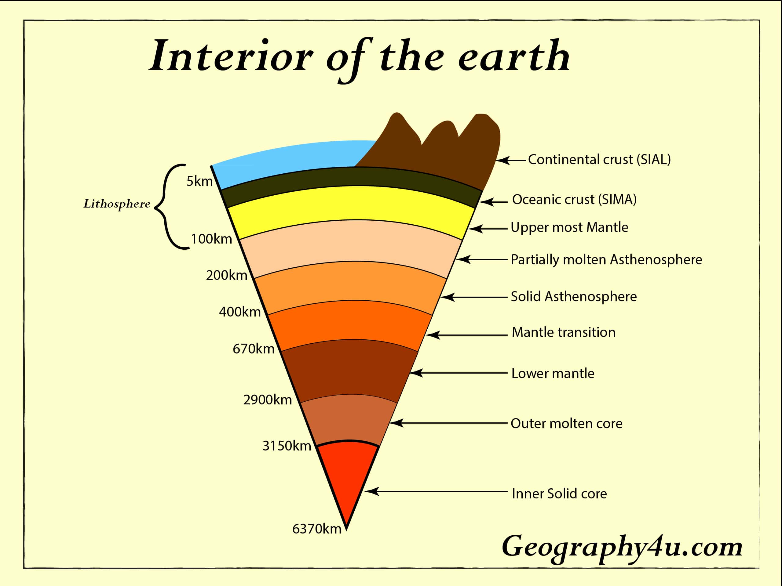
- A. Compositional (Chemical) Structure
- Chemical composition of whole Earth (by mass)
1. Iron (Fe) ≈ 32%
2. Oxygen (O) ≈ 30%
3. Silicon (Si) ≈ 15%
4. Magnesium (Mg) ≈ 14%
5. Nickel (Ni) ≈ 2%
6. Sulphur (S) ≈ 2%
7. Calcium (Ca) ≈ 1.5%
8. Aluminium (Al) ≈ 1.4%
- Chemical composition of Earth's crust
1. Oxygen (O) ≈ 46%
2. Silicon (Si) ≈ 28%
3. Aluminium (Al) ≈ 8%
4. Iron (Fe) ≈ 5%
5. Calcium (Ca) ≈ 3.6%
6. Sodium (Na) ≈ 2.8%
7. Potassium (K) ≈ 2.6%
8. Magnesium (Mg) ≈ 2.1%
- This classification is based on the chemical composition of Earth’s interior and is divided into crust, mantle, and core.
-
| Layer |
Upper Depth (km) |
Lower Depth (km) |
Approx. Thickness (km) |
| Crust |
0 |
5–70 |
5–70 |
| Mantle |
5–70 |
2,900 |
~2,830 |
| Core |
2,900 |
6,371 |
~3,470 |
- The Crust
- The crust is the outermost solid and brittle layer of the Earth.
- Its thickness varies significantly between continental and oceanic regions.
- Continental crust is much thicker than oceanic crust.
- Overall, the crust constitutes less than 1% of Earth’s total mass and volume.
- Composition of the crust
-
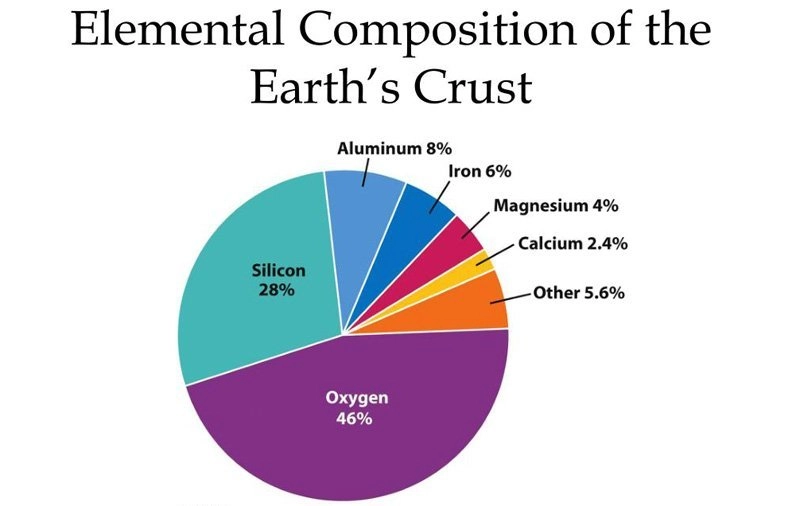
- Types of crust
- Continental Crust (SIAL -> Silica + Aluminium)
- Thicker crust, especially beneath major mountain systems.
- Thickness reaches up to ~70 km in the Himalayan region.
- Mean thickness is around 30 km.
- Composed mainly of granitic rocks.
- Rich in lighter elements such as silicon, aluminium, potassium, and sodium.
- Lower average density of about 2.7 g/cm³.
- Chemically dominated by SIAL (Silica + Aluminium).
- Oceanic Crust (SIMA -> Silica and Magnesium)
- Thinner crust forming the ocean floor.
- Mean thickness is about 5 km.
- Composed mainly of basaltic rocks.
- Rich in heavier elements such as magnesium and iron.
- Higher average density of about 3.0 g/cm³.
- Chemically dominated by SIMA (Silica + Magnesium).
- The Mantle
- The mantle lies beneath the crust and extends from the Mohorovičić Discontinuity (Moho) to a depth of about 2,900 km.
- It forms the thickest layer of the Earth.
- The mantle accounts for about 67% of Earth’s total mass and nearly 83% of its total volume.
- It is composed mainly of silicate minerals rich in iron and magnesium.
- The Core
- The existence of the core is inferred from seismic wave studies, which show sharp changes in wave velocity.
- The core–mantle boundary lies at a depth of approximately 2,900 km.
- The core is composed mainly of heavy metals, primarily iron and nickel, and is therefore referred to as the NiFe layer.
- It accounts for about 33% of Earth’s mass and around 16% of its volume.
- B. Mechanical (Physical) Structure
-
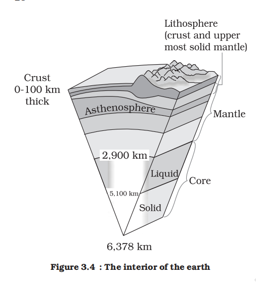
- This classification is based on the physical state and mechanical behavior of Earth’s interior materials.
-
| Layer |
Upper Depth (km) |
Lower Depth (km) |
Approx. Thickness (km) |
| Lithosphere |
0 |
100–200 |
100–200 |
| Asthenosphere |
100–200 |
400 |
~200–300 |
| Mesosphere (Lower Mantle) |
400 |
2,900 |
~2,500 |
| Outer Core |
2,900 |
5,150 |
~2,250 |
| Inner Core |
5,150 |
6,371 |
~1,220 |
- Lithosphere
- The lithosphere is the rigid outermost mechanical layer of the Earth.
- It includes the entire crust and the uppermost solid portion of the mantle.
- It is broken into tectonic plates that move over the underlying weaker layer.
- Its thickness varies from about 10 km beneath oceans to nearly 200 km beneath continents.
- Asthenosphere (Upper Mantle – Weak Zone)
- The asthenosphere lies below the lithosphere within the upper mantle.
- It extends to a depth of about 400 km.
- The term “astheno” means weak.
- It is partially molten and behaves as a plastic solid.
- This layer allows the movement of lithospheric plates and is the principal source of magma for volcanic activity.
- Mesosphere (Lower Mantle)
- The mesosphere lies below the asthenosphere and extends up to the core–mantle boundary.
- Despite being solid, it can flow very slowly due to extreme pressure and temperature over geological time scales.
- Upper boundary is ~400km, lower boundary is ~2,900km, having thickness of ~2,500km.
- Outer Core
- The outer core extends from about 2,900 km to 5,150 km depth, having thickness of ~2,250km.
- It is in a liquid state due to extremely high temperatures.
- Composed mainly of molten iron and nickel.
- The movement of liquid metals in this layer, combined with Earth’s rotation, generates convection currents.
- These convection currents produce electric currents, giving rise to Earth’s magnetic field through the geodynamo mechanism.
-
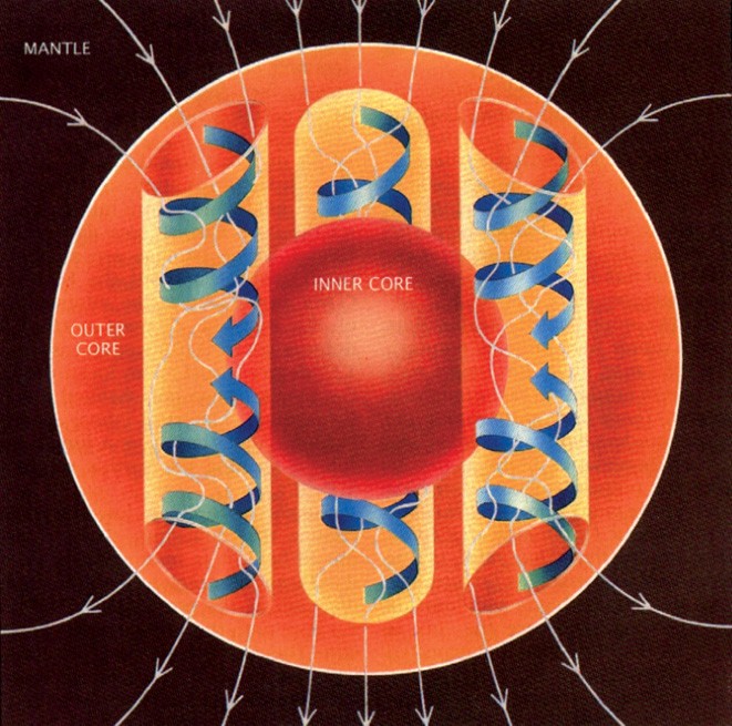
- Inner Core
- The inner core extends from about 5,150 km to Earth’s center at 6,371 km, having thickness of approximately ~1,220km.
- It is solid despite extremely high temperatures because of immense pressure.
- Composed mainly of iron and nickel and is extremely dense.
- The inner core rotates slightly faster than the Earth’s surface.
- It does not directly generate the magnetic field; the outer core is primarily responsible.
- Seismic Discontinuity
- A seismic discontinuity is a boundary within the Earth where seismic wave velocity changes abruptly due to a change in material composition or state. These boundaries help scientists understand Earth’s internal layering.
-
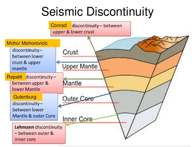
- Major Seismic Discontinuities
- Conrad Discontinuity
- The Conrad Discontinuity is a boundary within the Earth's continental crust.
- It separates the upper crust (less dense, granitic) from the lower crust (denser, basaltic).
- Found at a depth of about 15–20 km beneath continents.
- Not present under oceanic crust.
- Mohorovičić Discontinuity (Moho)
- Boundary between the crust and the mantle.
- Discovered by Andrija Mohorovičić in 1909.
- Seismic wave velocity increases sharply here.
- Depth: ~35 km under continents, ~5–10 km under oceans.
- Repetti Discontinuity
- The Repetti Discontinuity lies within the mantle.
- It separates the upper mantle from the lower mantle.
- Located at a depth of around 1,000 km (though estimates vary between 800–1,200 km).
- It is marked by a change in seismic wave velocities, indicating a change in mineral structure or composition.
- Less distinct than the Moho, Gutenberg, or Lehmann discontinuities, but important in understanding mantle dynamics.
- Gutenberg Discontinuity
- Boundary between the mantle and the outer core.
- Discovered by Beno Gutenberg.
- Located at a depth of ~2,900 km.
- S-waves disappear here, indicating the liquid nature of the outer core.
- Lehmann Discontinuity
- Boundary between the outer core and the inner core.
- Discovered by Inge Lehmann.
- Located at ~5,150 km depth.
- Marks the transition from liquid outer core to solid inner core.
- Mnemonic to remember
- C.M. Rahul Gandhi is Lehmann
- C -> Conrad
- M -> Mohorovicic
- Rahul -> Repetti
- Gandhi -> Gutenberg
- is -> -x
- Lehmann -> Lehmann
- Earthquakes and volcanism
- Earthquake
- Definition and overview
- The study of seismic waves provides a complete picture of the layered interior
- An earthquake in simple words is shaking of the earth
- It is a natural event
- It is caused due to release of energy, which generates waves that travel in all directions
- Why does the earth shake?
- Mechanism
- The release of energy occurs along a fault
- A fault is a sharp break in the crustal rocks
- Rocks along a fault tend to move in opposite directions
- As the overlying rock strata [layer of rocks] press them, the friction locks them together
- However, their tendency to move apart at some point of time overcomes the friction
- As a result, the blocks get deformed and eventually, they slide past one another abruptly [suddenly and unexpectedly]
- This causes a release of energy, and the energy waves travel in all directions
- Key locations
-
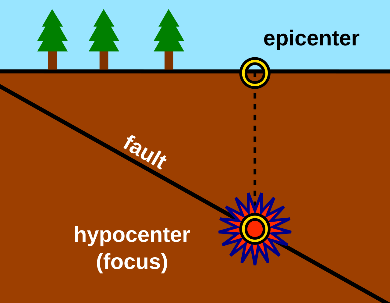
- Focus / hypocenter
- The point where the energy is released is called the focus of an earthquake, alternatively, it is called the hypocenter
- The hypocenter can be divided into three types on the basis of depth
1. Shallow focus
- Depth ranging from 0 km to - 70 km
2. Intermediate focus
- Depth ranging from 70 km to - 300 km
3. Deep focus
- Depth ranging from 300 km to - 700 km
- Epicenter
- The energy waves traveling in different directions reach the surface
- The point on the surface, nearest to the focus, is called epicenter
- It is the first one to experience the waves
- It is a point directly above the focus
- Types of earthquakes
- On the basis of depth of the focus/hypocenter
- Shallow earthquake
- Shallow hypocenter (0-70 km)
- Intermediate earthquake
- Intermediate hypocenter (70-300 km)
- Deep earthquake
- Deep hypocenter (300-700 km)
- On the basis of causality
-
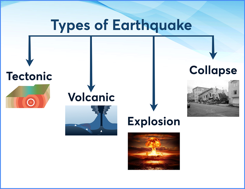
- Tectonic earthquakes
- These are generated due to sliding of rocks along a fault plane
- Volcanic earthquake
- These are caused by slip on a fault near a volcano
- Collapse causing minor tremors
- In the areas of intense mining activity, sometimes the roofs of underground mines collapse
- These are called collapse earthquakes
- Explosion earthquake
- Ground shaking may also occur due to the explosion of chemical or nuclear devices
- Such tremors are called explosion earthquakes
- Reservoir Induced earthquakes
- The earthquakes that occur in the areas of large reservoirs [large water body] are referred to as reservoir induced earthquakes
- Earthquake waves and their characteristics
-
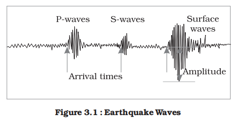
- General characteristics
- All natural earthquakes take place in the lithosphere
- It is sufficient [enough] to note here that the lithosphere refers to the portion of depth up to 200 km from the surface of the earth
- Seismograph / seismometer
- An instrument called ‘seismograph’ records the waves reaching the surface
- A curve of earthquake waves recorded on the seismograph is given in Figure 3.1
- Note that the curve shows three distinct sections each representing different types of wave patterns
- The velocity and direction of waves changes as they travel through materials with different densities
- The denser the material, the higher is the velocity
- Their direction changes as they reflect [send back] or refract [changing direction] when coming across materials with different densities
- Reflection and refraction
- Reflection causes waves to rebound whereas refraction makes waves move in different directions
- The variations in the direction of waves are inferred with the help of their record on seismograph
- Types of waves
- Body waves
- Body waves are generated due to the release of energy at the focus and move in all directions traveling through the body of the earth
- Hence, the name body waves
- Waves are compressional when the medium resists volume change, and transverse when the medium resists shape change.
- That's what distinguishes p-waves from s-waves
- There are two types of body waves
- P-waves
- P-waves move faster and are the first to arrive at the surface
- These are also called ‘primary waves’
- The P-waves are similar to sound waves
- Longitudinal (parallel motion).
- They travel through gaseous, liquid and solid materials
- Since these are compressional waves, all three mediums can be undergo compression, hence they can travel through all.
- P-waves slow down and refract in the outer core, confirming material change.
- S-waves
- S-waves arrive at the surface with some time lag
- These are called secondary waves
- Transverse (perpendicular motion).
- Shearing (change in shape without change in volume).
- An important fact about S-waves is that they can travel only through solid materials
- In solids, shear deformation is resisted by internal rigidity, allowing the disturbance to be restored and transmitted as a wave, but in liquids and gases shear deformation is dissipated because they cannot resist shape change.
- Liquids cannot support shear internally, but at a surface, restoring forces act differently. That's why on a lake surface waves can have transversal characteristics.
- The fact that S-waves do not travel through the outer core directly led to the conclusion that it is liquid.
- This characteristic of the S-waves is quite important
- It has helped scientists to understand the structure of the interior of the earth
- Surface waves
- The body waves interact with the surface rocks and generate new set of waves called surface waves
- These waves move along the surface
- The surface waves are the last to report on seismograph
- These waves are more destructive
- There are two types of surface waves
- Rayleigh waves (elliptical motion)
- Named after Lord Rayleigh, who mathematically predicted their existence.
- Type: Surface seismic wave that moves the ground in an elliptical, rolling motion (like ocean waves), both vertically and horizontally.
- Slower than Love waves but generally more destructive due to their larger amplitude and widespread motion.
- Can travel through solid and liquid surfaces.
- Responsible for the noticeable rolling motion felt during strong earthquakes.
- Most of the ground shaking in an earthquake that causes structural damage is often due to Rayleigh waves.
- Love waves (horizontal shear)
- Named after A.E.H. Love, a British mathematician who first described them.
- Type: Surface seismic wave that moves the ground in a horizontal, side-to-side (transverse) motion, perpendicular to the direction of wave propagation.
- Travel only through solid materials; do not propagate through water or air.
- Typically the fastest surface wave.
- Cause significant damage to the foundations of structures due to intense lateral ground motion.
- Do not have a vertical component, unlike Rayleigh waves.
- They cause displacement of rocks, and hence, the collapse of structures occurs
- Propagation of earthquake waves
-
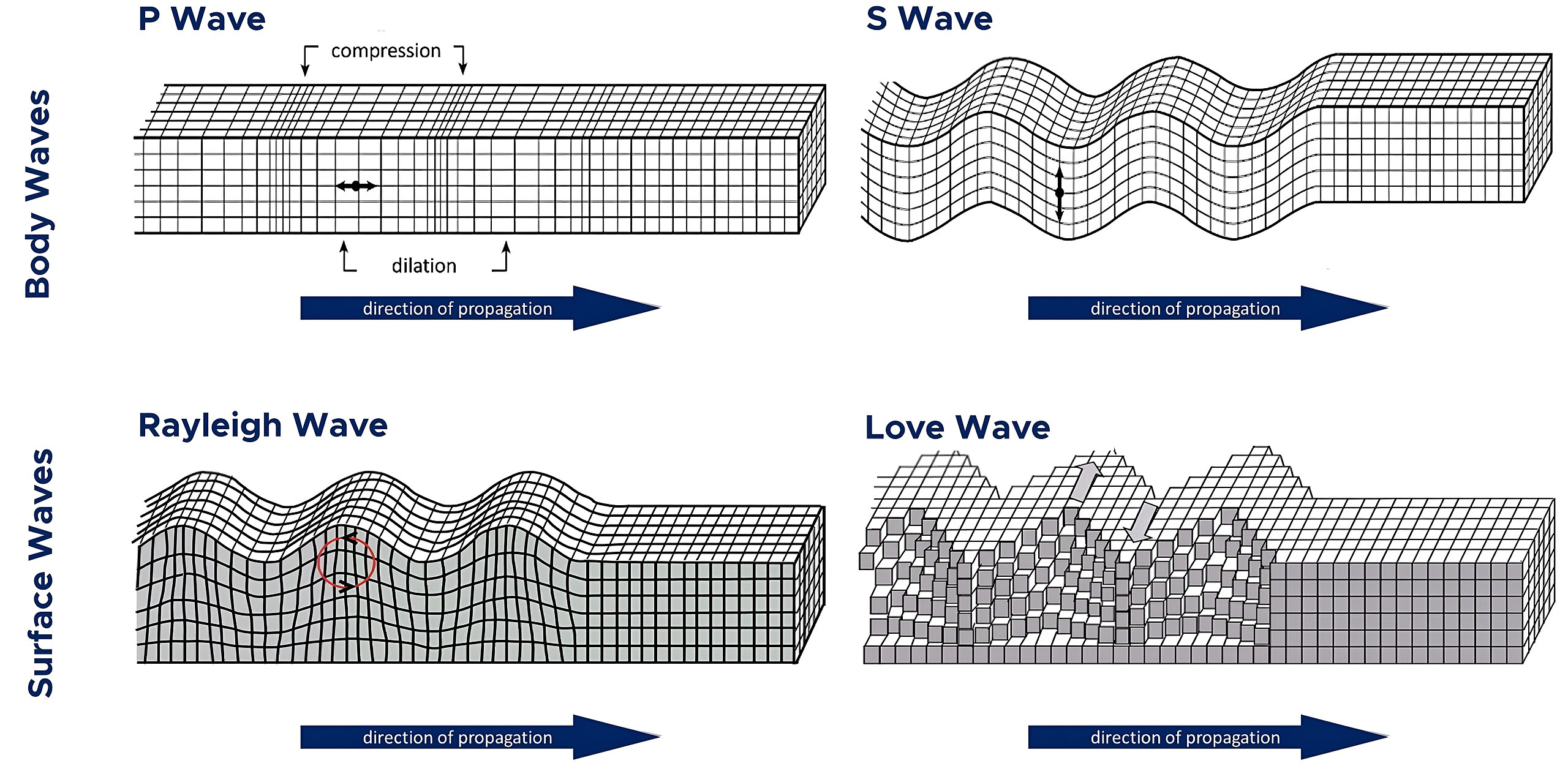
- Wave behavior
- Different types of earthquake waves travel in different manners
- As they move or propagate, they cause vibration in the body of the rocks through which they pass
- Direction of vibration
- Vibration in direction of propagation
- P-waves vibrate parallel to the direction of the wave
- This exerts pressure on the material in the direction of the propagation
- As a result, it creates density differences in the material leading to stretching and squeezing of the material
- Vibration perpendicular to the direction of propagation
- Other three waves vibrate perpendicular to the direction of propagation
- The direction of vibrations of S-waves is perpendicular to the wave direction in the vertical plane
- Hence, they create troughs [elongated region] and crests [top of mountain, wave, etc] in the material through which they pass
- Surface waves are considered to be the most damaging waves
- Emergence of shadow zone
-
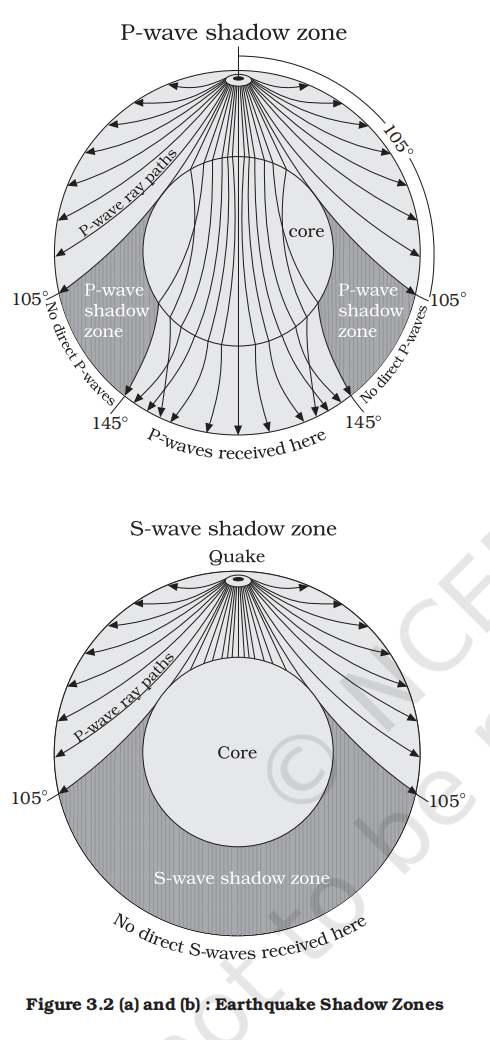
- Observations and zones
- Earthquake waves get recorded in seismographs located at far off locations
- However, there exist some specific areas where the waves are not reported
- Such a zone is called the ‘shadow zone’
- The study of different events reveals that for each earthquake, there exists an altogether different shadow zone
- It was observed that seismographs located at any distance within 105° from the epicentre, recorded the arrival of both P and S-waves
- However, the seismographs located beyond 145° from epicentre, record the arrival of P-waves, but not that of S-waves
- Thus, a zone between 105° and 145° from epicentre was identified as the shadow zone for both the types of waves
- The entire zone beyond 105° does not receive S-waves
- The shadow zone of S-wave is much larger than that of the P-waves
- The shadow zone of P-waves appears as a band around the earth between 105° and 145° away from the epicentre
- The shadow zone of S-waves is not only larger in extent but it is also a little over 40 per cent of the earth surface
- You can draw the shadow zone for any earthquake provided you know the location of the epicentre
- Earthquake shadow zones arise due to the Earth's internal structure, specifically the presence of the liquid outer core.
- Why P-waves
- As P-waves travel from the mantle into the outer core, they pass from a solid to a liquid layer.
- This sudden change in material causes a significant drop in velocity and a strong refraction (bending) of the waves
- Why S-waves
- As S-waves travel from mantle into outer core, they are completely stopped by it, creating a zone on the opposite side of the Earth where these waves are not detected.
- Measuring earthquakes
- Scales
- The earthquake events are scaled either according to the magnitude or intensity of the shock
- Richter scale / Magnitude scale
-
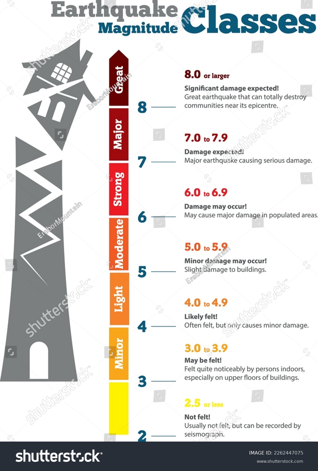
- The magnitude scale is known as the Richter scale
- The magnitude relates to the energy released during the quake
- The magnitude is expressed in numbers, 0-10 (10 is not the upper limit, but almost all earthquakes fall this range)
- Richter scale is open-ended, meaning theoretically, it does not have any upper limit on the scale
- Mercalli scale / Intensity scale
- The intensity scale is named after Mercalli, an Italian seismologist
- The intensity scale takes into account the visible damage caused by the event
- The range of intensity scale is from 1-12
- Effects of earthquake
-
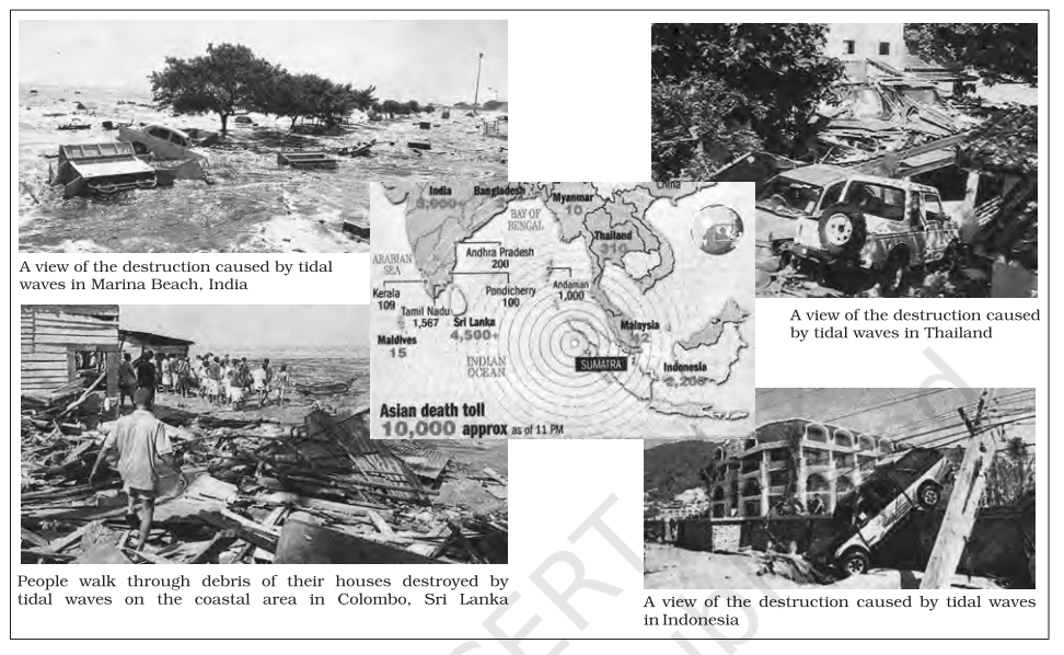
- Hazards
- Earthquake is a natural hazard
- The following are the immediate hazardous effects of earthquake:
- Ground Shaking
- Differential [dissimilar / distinct] ground settlement
- Land and mud slides
- Soil liquefaction
- Ground lurching [abrupt, unsteady and uncontrolled movement]
- Avalanches
- Ground displacement
- Floods from dam and levee [embankment build on river to prevent overflow] failures
- Fires
- Structural collapse
- Falling objects
- Tsunami
- Earthquakes that trigger tsunamis are called tsunami earthquakes.
- The effect of tsunami would occur only if the epicentre of the tremor is below oceanic waters and the magnitude is sufficiently high
- Tsunamis are waves generated by the tremors [an involuntary quivering movement] and not an earthquake in itself
- The first six listed above have some bearings [relation / relevance] upon landforms, while others may be considered the effects causing immediate concern to the life and properties of people in the region
- Though the actual quake activity lasts for a few seconds, its effects are devastating provided the magnitude of the quake is more than 5 on the Richter scale
- Distribution of earthquakes
-
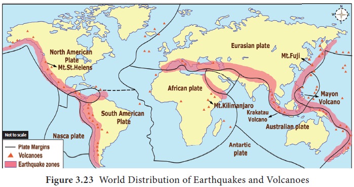
-
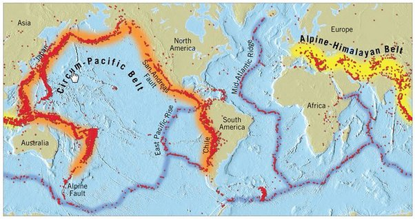
- Main locations
1. Circum-Pacific Belt (Ring of Fire)
-
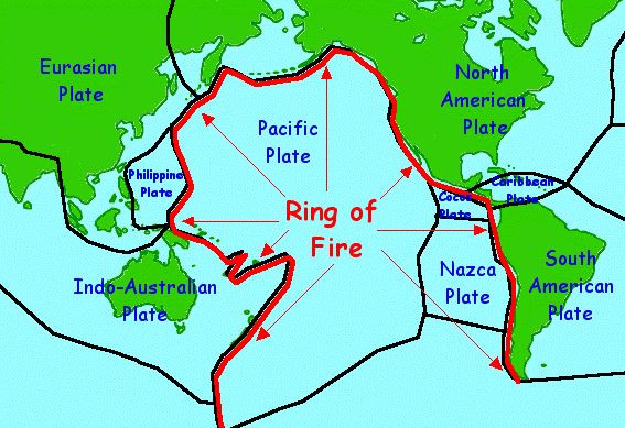
- Accounts for nearly 80% of the world’s earthquakes.
- Includes regions like Japan, the Philippines, Indonesia, New Zealand, western coasts of North and South America.
- Associated with convergent plate boundaries (subduction zones).
- Characterized by deep-focus earthquakes and frequent volcanic activity.
2. Mid-Atlantic Ridge (Oceanic Ridges)
- A global belt of shallow-focus earthquakes along divergent plate boundaries.
- Includes the Mid-Atlantic Ridge, East Pacific Rise, and Indian Ocean ridges.
- Associated with sea-floor spreading and normal faulting.
3. Alpine-Himalayan Belt
- Extends from the Mediterranean region through the Middle East to the Himalayas and into Southeast Asia.
- Formed due to the collision between the African, Indian, and Eurasian plates.
- Characterized by shallow to intermediate focus earthquakes.
- Includes earthquake-prone countries like Turkey, Iran, Pakistan, India, and Nepal.
4. Intraplate Earthquakes
- Occur within tectonic plates, away from plate boundaries.
- Less frequent but can be devastating (e.g., New Madrid earthquakes in the USA, Bhuj earthquake in India).
- Often associated with old fault lines, rift valleys, or isostatic adjustments.
5. Other Notable Zones
- East African Rift Valley: Associated with rifting and shallow earthquakes.
- Carpathians and Caucasus Mountains: Moderate seismic activity.
- Submarine Earthquakes: Often generate tsunamis (e.g., 2004 Indian Ocean tsunami).
- Conclusion:
- Earthquakes are predominantly distributed along tectonic plate boundaries.
- Convergent boundaries (subduction zones) are the most seismically active, followed by divergent and transform boundaries.
- However, intraplate earthquakes, though less common, also pose significant risks.
- Volcanoes and volcanism
- Volcano
- A volcano is a vent or a fissure in the crust from which lava (molten rock), ash, gases, rock fragments erupt from the magma chamber to the surface.
- Magma and it's sources
- The material in the upper mantle portion is called magma
- Magma is molten or semi-molten rock, along with dissolved gases and suspended crystals, found beneath the Earth's surface
- From asthenosphere the molten rock materials find their way from magma chamber to the surface
- Lava
- Once magma starts moving towards the crust or it reaches the surface, it is referred to as lava
- There are two types of lava:
- Acidic lava
- Rich in silica content (over 65%)
- Highly viscous (thick and sticky), flows slowly
- But surprisingly it's density is lower compared to basic lava
- Solidifies quickly upon reaching the surface
- Leads to steep-sided volcanic cones
- Often associated with explosive eruptions
- Common in continental volcanic regions
- Example: Lava from Mount St. Helens (USA)
- Basic lava
- Low silica content (around 50%)
- Low viscosity, flows easily and quickly
- It's density is higher compared to acidic lava
- It has more iron (Fe) and magnesium (Mg) and less silica (SiO₂).
- Spreads over large areas forming gentle slopes
- Leads to broad shield volcanoes
- Associated with quiet, non-explosive eruptions
- Common in oceanic volcanic regions
- Example: Lava from Mauna Loa (Hawaii)
- Volcanism
- Volcanism is the process where molten rock (magma), pyroclastics (solid rock fragments), and volcanic gases erupt from within a solid-surface astronomical body, like Earth, onto its surface.
- The material that reaches the ground includes lava flows, pyroclastic debris, volcanic bombs, ash and dust and gases such as nitrogen compounds, sulphur compounds and minor amounts of chlorene, hydrogen and argon
- Classification of volcanoes
- On the basis of frequency of eruption:
- Active Volcano:
- A volcano that is currently erupting or has erupted in the recent past and is likely to erupt again.
- Shows signs of activity such as earthquakes, gas emissions, and heat.
- Example: Mount Etna (Italy), Mount Stromboli (Italy), Barren island (India) which is only active volcano in India
- Dormant Volcano:
- A volcano that is not currently active but has erupted during historical times.
- It has the potential to erupt again in the future.
- Example: Mount Fuji (Japan), Mount Kilimanjaro (Tanzania).
- Extinct Volcano:
- A volcano that has not erupted in historical times and shows no signs of future activity.
- Its magma chamber is believed to be inactive or completely cooled.
- Example: Mount Thielsen (USA), Edinburgh's Arthur's Seat (Scotland).
- On the basis of nature of eruption and the form developed at the surface:
- Shield volcanoes
- Composite volcanoes (Stratovolcanoes)
- Cinder cone volcanoes
- Lava domes (Volcanic domes)
- Caldera volcanoes
- Flood basalt provinces (also called Plateau Basalts)
- Mid-ocean ridge volcanoes
- They are discussed in detail in later section
- Distribution of volcanoes
-
- Volcanoes are not randomly distributed over the Earth’s surface. Their occurrence is closely related to plate boundaries and tectonic activity.
- Distribution:
1. Circum-Pacific Belt (Pacific Ring of Fire):
- The most seismically and volcanically active zone in the world.
- Hosts about 75% of the world's active and dormant volcanoes.
- Includes countries like Japan, Indonesia, Philippines, New Zealand, USA (west coast), Mexico, Chile, and others.
2. Mid-Atlantic Ridge:
- A divergent plate boundary running down the center of the Atlantic Ocean.
- Features submarine volcanic activity and the formation of new oceanic crust.
- Includes volcanic islands like Iceland and the Azores.
3. Indo-Mediterranean Belt:
- Extends from Indonesia through the Himalayas and into the Mediterranean.
- Formed due to the collision and subduction of the African plate and the Eurasian plate.
- Includes volcanic zones in Italy (Mt. Vesuvius, Mt. Etna), Greece, and Turkey.
4. Intra-plate or Hotspot Volcanoes:
- Form away from plate boundaries due to mantle plumes.
- Found in oceanic and continental regions.
- Example: Hawaiian Islands (oceanic hotspot), Yellowstone (continental hotspot).
5. Rift Zones and Continental Rifts:
- Volcanism associated with continental divergence.
- Example: East African Rift Valley (Mt. Kilimanjaro, Mt. Kenya).
- Summary:
- Most volcanoes are located along convergent and divergent plate boundaries.
- A smaller number are due to hotspots within tectonic plates.
- Their global distribution highlights the role of plate tectonics in volcanic activity.
- Effects of volcanoes and volcanism
- Positive Effects:
- Fertile Soil:
- Volcanic ash and lava break down to form mineral-rich soils ideal for agriculture.
- Example: Coffee cultivation in the volcanic soils of Java, Indonesia.
- Mineral Resources:
- Volcanic regions are rich in valuable minerals like copper, gold, silver, and pumice.
- Example: Copper deposits in Chile (Andes).
- Geothermal Energy:
- Volcanic areas provide sources of clean, renewable geothermal energy.
- Example: Iceland generates a major portion (25–30%) of its electricity from geothermal sources.
- Landform Creation:
- Formation of islands (e.g., Hawaii), mountains (e.g., Mt. Fuji), and plateaus (e.g., Deccan Traps).
- Tourism:
- Volcanoes and their landscapes attract global tourists, boosting local economies.
- Example: Mount Etna (Italy), Mount Vesuvius (Italy).
- Scientific Study:
- Volcanism helps in understanding Earth’s internal structure, plate tectonics, and geologic history.
- Negative Effects:
- Loss of Life and Property:
- Sudden eruptions can be deadly and destructive.
- Example: Mount Vesuvius (79 AD), Mount Merapi (2010).
- Air Pollution:
- Emission of gases like sulfur dioxide, carbon dioxide, and ash can harm air quality.
- May affect climate temporarily (e.g., global cooling).
- Disruption of Climate:
- Volcanic aerosols can block sunlight and cause temporary global cooling.
- Example: Mt. Pinatubo (1991) eruption led to a 0.5°C drop in global temperature.
- Earthquakes and Tsunamis:
- Volcanic activity often triggers earthquakes and underwater eruptions can cause tsunamis.
- Displacement and Economic Loss:
- Eruptions force evacuation, destroy infrastructure, and disrupt agriculture and livelihoods.
- Geomorphic processes
- Introduction to the earth’s surface
- Why is the surface of the earth uneven?
- Dynamic nature
- The earth’s crust is dynamic
- You are well aware that it has moved and moves vertically and horizontally
- Of course, it moved a bit faster in the past than the rate at which it is moving now
- The differences in the internal forces operating from within the earth which built up the crust have been responsible for the variations in the outer surface of the crust
- External and internal forces
- The earth’s surface is being continuously subjected [person or thing that is discussed or dealth with] to external forces induced [persuade / convince] basically by energy (sunlight)
- Of course, the internal forces are still active though with different intensities [strength / power]
- That means, the earth’s surface is being continuously subjected [person or thing that is discussed or dealth with] to by external forces originating within the earth’s atmosphere and by internal forces from within the earth
- The external forces are known as exogenic forces and the internal forces are known as endogenic forces
- Processes and effects
- The actions of exogenic forces result in wearing down (degradation) of relief/elevations and filling up (aggradation) of basins/depressions, on the earth’s surface
- The phenomenon [occurrence / event / situation] of wearing down of relief variations of the surface of the earth through erosion is known as gradation
- The endogenic forces continuously elevate or build up parts of the earth’s surface and hence the exogenic processes fail to even out the relief variations of the surface of the earth
- So, variations remain as long as the opposing actions of exogenic and endogenic forces continue
- In general terms, the endogenic forces are mainly land building forces and the exogenic processes are mainly land wearing forces
- Human interaction
- The surface of the earth is sensitive
- Humans depend on it for their sustenance [maintaining someone or somthing in life or existance] and have been using it extensively and intensively
- So, it is essential to understand its nature in order to use it effectively without disturbing its balance and diminishing [made smaller or less] its potential for the future
- Almost all organisms contribute to sustain the earth’s environment
- However, humans have caused extensive damage to the environment through over use of resources
- Use we must, but must also leave it potential enough to sustain life through the future
- Most of the surface of the earth had and has been shaped over very long periods of time (hundreds and thousands of years) and because of its use and misuse by humans its potential is being diminished at a fast rate
- If the processes which shaped and are shaping the surface of the earth into varieties of forms (shapes) and the nature of materials of which it is composed of, are understood, precautions can be taken to minimise the detrimental effects of human use and to preserve it for posterity
- Geomorphic processes and forces responsible
-
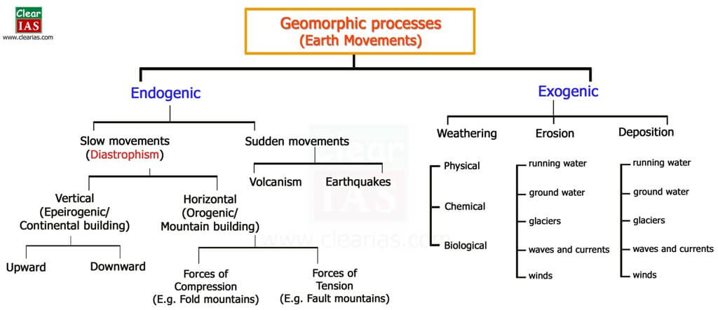
- Geomorphic processes refer to the natural forces and processes that shape the Earth's surface over time. These processes are responsible for the creation, modification, and destruction of various landforms.
- They are mainly driven by internal (tectonic) and external (weathering, erosion) forces.
- These forces include
- The endogenic forces (Internal forces)
- Diastrophism [process of deformation of earth's crust] and volcanism are endogenic geomorphic processes
- These are constructive forces and are also called land building forces.
- The Exogenic forces (External forces)
- Weathering, mass wasting, erosion and deposition are exogenic geomorphic processes
- These are destructive forces and are also called land wearing forces.
- Geomorphic agents
- Any exogenic element of nature (like water, ice, wind, etc.,) capable of acquiring and transporting earth materials can be called a geomorphic agent
- When these elements of nature become mobile due to gradients, they remove the materials and transport them over slopes and deposit them at lower level
- Geomorphic processes and geomorphic agents especially exogenic, unless stated separately, are one and the same
- A process is a force applied on earth materials affecting the same
- An agent is a mobile medium (like running water, moving ice masses, wind, waves and currents etc.) which removes, transports and deposits earth materials
- Running water, groundwater, glaciers, wind, waves and currents, etc., can be called geomorphic agents
- Do you think it is essential to distinguish geomorphic agents and geomorphic processes?
- Role of gravity
- Gravity besides being a directional force activating all downslope movements of matter also causes stresses on the earth’s materials
- Indirect gravitational stresses activate wave and tide induced [persuade / convince] currents and winds
- Without gravity and gradients there would be no mobility and hence no erosion, transportation and deposition are possible
- So, gravitational stresses are as important as the other geomorphic processes
- Gravity is the force that is keeping us in contact with the surface and it is the force that switches on the movement of all surface material on earth
- All the movements either within the earth or on the surface of the earth occur due to gradients — from higher levels to lower levels, from high pressure to low pressure areas etc.
- Endogenic processes
- Overview
- The energy emanating [emerging / coming out] from within the earth is the main force behind endogenic geomorphic processes
- This energy arises from:
- Radioactive decay
- Primordial heat from Earth's formation
- Rotational and tidal friction
- These processes induces [persuade / convince]:
- Diastrophism (crustal deformation)
- Volcanism in lithosphere [movement of molten material]
- Earthquakes
- Metamorphism due to pressure, volume, and temperature changes
- Due to variations in geothermal gradients [an increase or decrease in the magnitude / a slope] and heat flow from within, crustal thickness and strength, the action of endogenic forces are not uniform and hence the tectonically controlled original crustal surface is uneven
- Diastrophism (slow movement)
- Definition
- All processes that move, elevate, or build up portions of the earth’s crust are termed diastrophism
- These are large-scale deformational processes acting on the earth's lithosphere
- Plate Tectonics is the driver for diastrophic processes
- Refers to horizontal movements of crustal plates over the asthenosphere
- Governs processes like seafloor spreading, subduction, and continental drift
- Types of Diastrophic Movements
- Orogenic Movements (mountain building)
- Involve mountain building through intense folding, faulting, and thrusting
- Forces involved in orogenic movement
- Compressional Forces:
- Definition: Forces that push the Earth's crust together, leading to the folding or faulting of rock layers.
- Effect: These forces cause the folding of rock strata, resulting in the formation of fold mountains.
- Example: Himalayas, Andes.
- Tensional Forces:
- Definition: Forces that stretch or pull apart the Earth's crust.
- Effect: Tensional forces create faulting, leading to the formation of fault-block mountains.
- Example: Sierra Nevada (USA), Vosges (Europe).
- Shearing Forces:
- Definition: Forces that cause the Earth's crust to slide past each other horizontally, leading to the formation of strike-slip faults.
- Effect: These forces result in lateral displacement of rock layers, causing the creation of transform fault zones.
- Example: San Andreas Fault (USA).
- Thrusting Forces:
- Definition: A type of compressional force that causes one block of the crust to be pushed up and over another block.
- Effect: Thrusting causes the formation of overthrust faults and can create folded mountain ranges as the rocks are pushed upward.
- Example: The Alps, parts of the Himalayas.
- Typically affect long and narrow belts of the earth’s crust
- Types of movement
- Folding (Compressional Movement)
-
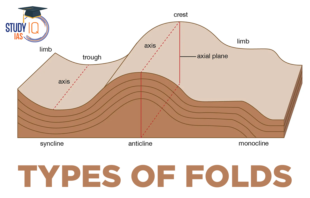
-
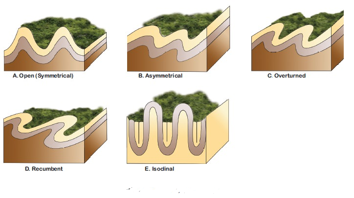
- Definition: Folding occurs when layers of rock are compressed and bent due to compressional forces, creating folds in the Earth's crust.
- Characteristics: Folding results in the formation of fold mountains.
- Example: Himalayas, Andes (young fold mountains), Aravallis, Urals (old fold mountains).
- Faulting (Tensional or Compressional Movement)
-
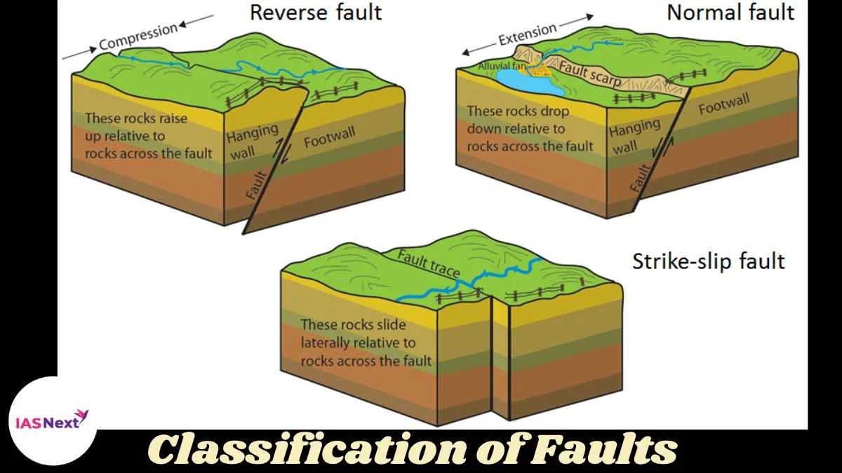
- Definition: Faulting occurs when the Earth's crust fractures and blocks of rock are displaced due to tensional or compressional forces.
- Characteristics: Faulting results in the formation of fault-block mountains, where large blocks of the crust are uplifted or dropped along faults.
- Example: Sierra Nevada (USA), Vosges and Black Forest (Europe).
- Thrusting (Compressional Movement)
- Definition: Thrusting occurs when one block of the Earth's crust is pushed over another due to compressional forces. This often involves the formation of overthrust faults, where one block moves upward over a lower block.
- Characteristics: Thrusting can lead to the formation of fold mountains and overthrusts, creating complex mountain ranges.
- Example: Himalayas, Alps.
- Upwarping (Vertical Movement)
- Definition: Upwarping is a process where the Earth's crust is pushed upward due to internal pressure, often from magma beneath the surface. This leads to the formation of dome mountains without significant folding or faulting.
- Characteristics: Involves vertical displacement of rock layers due to magma intrusion or pressure.
- Example: Black Hills (USA).
- Epeirogenic Movements (continental building)
- Involve broad, gentle uplift or warping of large parts of the earth’s crust (continents)
- Not associated with folding
- Typically vertical and caused by internal forces
- Types of movements:
- Uplift (Positive Epeirogeny):
- Vertical rise of continental areas
- Forms plateaus, domes, or raised landmasses
- Example: Deccan Plateau, Colorado Plateau
- Subsidence (Negative Epeirogeny):
- Sinking or downward warping of crust
- Leads to formation of basins or inland seas
- Example: North Sea Basin, Great Basin (USA)
- Effects
- Orogeny leads to the formation of fold mountains and intense crustal deformation
- Epeirogeny causes broad vertical movements leading to formation of plateaus, basins, or uplifted blocks
- Both processes may cause faulting and fracturing of the crust
- These movements alter pressure, volume, and temperature (PVT), thereby inducing metamorphism in rocks
- Comparison: Epeirogeny vs Orogeny
- Epeirogeny:
- Broad, gentle, vertical movements
- No folding involved
- Leads to formation of continental features like plateaus or domes
- Orogeny:
- Intense, compressional movements
- Leads to folding, faulting, and formation of mountains
- Rapid movement
- Volcanism
- Definition
- Volcanism includes the movement of molten rock (magma) onto or toward the earth’s surface and also formation of many intrusive and extrusive volcanic forms
- Many aspects of volcanism have already been dealt in detail under volcanoes in the Unit II and under igneous rocks in the preceding chapter in this unit
- Earthquakes
- Definition
- Sudden release of energy in the Earth's crust resulting in seismic waves.
- Caused by tectonic movements, volcanic activity, or other internal processes.
- Characteristics
- Measured by instruments like the Richter Scale.
- Can lead to ground shaking, tsunamis, and structural damage.
- Example: 2004 Indian Ocean Tsunami.
- Exogenic processes
- Introduction
- The exogenic processes derive their energy from atmosphere determined by the ultimate energy from the sun and also the gradients [change in magnitude of a property / a slope] created by tectonic factors
- Controlling factors for exogenic processes
- Purpose
- Energy and environmental factors drive and regulate exogenic processes
- Determine the intensity, rate, and type of surface modification
- Energy sources involved in exogenic processes
- Solar Energy
- Powers atmospheric processes like wind, precipitation, and temperature changes
- Drives weathering, erosion, and vegetation growth
- Gravitational Energy
- Facilitates downslope movement of materials
- Enhanced by tectonic uplift creating steep slopes
- Tectonic Influence
- Creates elevation gradients through folding and faulting
- Indirectly supports exogenic activity by forming slopes
- Forces and Stresses involved
- Forces apply energy to earth materials, causing movement or breakdown
- Gravitational Force
- Primary exogenic driving force acting on all materials on a slope
- Facilitates downslope movement, essential to denudational activity
- Stresses
- Stresses induce strain, leading to rock deformation or failure
- Different types of stresses
- Defined as force per unit area acting on a material body
- Responsible for strain, deformation, and eventual failure of rocks
- Types of stresses that act in exogenic processes (based on nature and direction of force)
- Shear stresses
- Acts tangentially to rock surfaces
- Causes slippage or angular displacement
- Crucial in initiating mass movements and landslides
- Molecular stresses (based on micro-mechanical processes)
- Results from:
- Thermal expansion and contraction (diurnal/seasonal)
- Crystallisation of salts and minerals within rock pores
- Freezing and thawing cycles (frost wedging)
- These micro-level changes cause internal stress buildup
- Chemical stresses (due to chemical reactions)
- Caused by:
- Dissolution of minerals
- Oxidation, hydration, carbonation
- Weakens molecular bonds and grain cohesion
- Prepares rock for mechanical breakdown
- Outcome of these forces and stresses
- Mechanical Weathering
- Chemical Weathering
- Rock disintegration
- Initiation of mass wasting
- Climatic influence
- Climate controls the type and rate of exogenic processes
- Influences vegetation, which stabilizes or destabilizes surfaces
- Temperature and precipitation are the two important climatic elements that control various processes
- Temperature
- Drives freeze-thaw cycles and thermal expansion
- Affects chemical reaction rates in weathering
- Precipitation
- Enhances erosion and mass movement through water flow
- Supports chemical weathering in humid regions
- As there are different climatic regions owing to variations in thermal gradients [an increase or decrease in magnitude or a property] created by latitudinal, seasonal, and land and water spread on the surface of the earth, the exogenic geomorphic processes vary from region to region
- Climatic Zones
- Tropical:
- High rainfall accelerates chemical weathering
- Arid:
- Wind erosion dominates; physical weathering prevalent
- Polar:
- Freeze-thaw cycles drive physical weathering
-
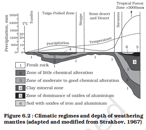
- The density, type and distribution of vegetation which largely depend upon precipitation and temperature also exert [apply / bring to bear] influence [impact / effect] indirectly on exogenic geomorphic processes
- Vegetation Influence
- Dense vegetation stabilizes soil, reducing erosion
- Sparse vegetation in arid zones increases erosion risk
- Within different climatic regions there may be local variations of the effects of different climatic elements due to altitudinal differences, aspect variations and the variation in the amount of insolation received by north and south facing slopes as compared to east and west facing slopes
- Further, due to differences in wind velocities and directions, amount and kind of precipitation, its intensity, the relation between precipitation and evaporation, daily range of temperature, freezing and thawing [unfreezing / melting] frequency, depth of frost penetration, the geomorphic processes vary within any climatic region
- Rock structure influence
- Climatic factors being equal, the intensity of action of exogenic geomorphic processes depends upon type and structure of rocks
- The term structure includes such aspects of rocks as folds, faults, orientation [positioning / familiarization with something / a person's basic belief towards something] and inclination [degree of sloping] of beds, presence or absence of joints, bedding planes, hardness or softness of constituent minerals, chemical susceptibility [vulnerability / sensitivity] of mineral constituents; the permeability [ability to let liquid and gases pass through] or impermeability etc.
- Different types of rocks with differences in their structure offer varying resistances to various geomorphic processes
- A particular rock may be resistant to one process and nonresistant to another
- Soft rocks (e.g., shale) erode quickly
- Hard rocks (e.g., granite) resist weathering
- And, under varying climatic conditions, particular rocks may exhibit different degrees of resistance to geomorphic processes and hence they operate at differential rates and give rise to differences in topography
- Varying resistance creates uneven topography
- Example: Differential erosion in Deccan Traps
- The effects of most of the exogenic geomorphic processes are small and slow and may be imperceptible [unnoticeable] in a short time span, but will in the long run affect the rocks severely due to continued fatigue
- Structural Features
- Folds, faults, joints, and bedding planes weaken rocks
- Permeable rocks allow water infiltration, enhancing weathering
- Denudation
- All the exogenic geomorphic processes are covered under a general term, denudation [process in which moving water, ice, wind, etc eroding the earth's surface]
-
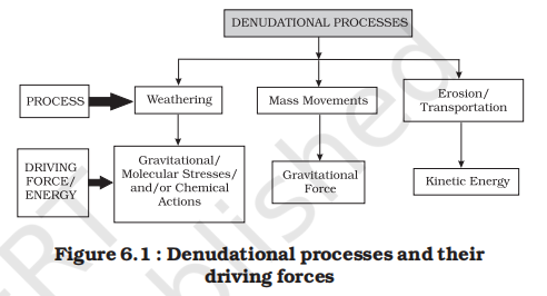
- The word ‘denude’ means to strip off or to uncover
- Weathering, mass wasting/movements, erosion and transportation are included in denudation [process in which moving water, ice, wind, etc eroding the earth's surface]
- The flow chart (Figure 6.1) gives the denudation [process in which moving water, ice, wind, etc eroding the earth's surface] processes and their respective driving forces
- It should become clear from this chart that for each process there exists a distinct driving force or energy
- Major denudational processes
- Weathering
-
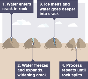
- Definition
- Weathering is action of elements of weather and climate over earth materials
- There are a number of processes within weathering which act either individually or together to affect the earth materials in order to reduce them to fragmental state
- Weathering is defined as mechanical disintegration and chemical decomposition of rocks through the actions of various elements of weather and climate
- As very little or no motion of materials takes place in weathering, it is an in-situ or on-site process
- Is this little motion which can occur sometimes due to weathering synonymous with transportation? If not, why?
- Factors
- Weathering processes are conditioned by many complex geological, climatic, topographic and vegetative factors
- Climate is of particular importance
- Not only weathering processes differ from climate to climate, but also the depth of the weathering mantle (Figure 6.2)
- Types of weathering
- Chemical weathering processes
- A group of weathering processes act on the rocks to decompose, dissolve or reduce them to a fine clastic state through chemical reactions by oxygen, surface and/or soil water and other acids
- These chemical weathering processes include viz.:
- Solution:
- The process in which minerals dissolve in water and are carried away in solution.
- Example: Halite dissolving in rainwater.
- Carbonation:
- Carbon dioxide in rainwater forms a weak carbonic acid which reacts with minerals like calcium carbonate.
- Example: Weathering of limestone.
- Hydration:
- Water molecules combine with minerals to form a new compound, often leading to expansion and breakdown of rocks.
- Example: Anhydrite turning into gypsum.
- Oxidation:
- Oxygen reacts with minerals, especially those containing iron, forming oxides.
- Example: Formation of rust from iron minerals.
- Reduction:
- Occurs in anaerobic (oxygen-poor) conditions where oxygen is removed from the mineral structure.
- Example: Conversion of ferric to ferrous iron in swampy environments.
- Water and air (oxygen and carbon dioxide) along with heat must be present to speed up all chemical reactions
- Over and above the carbon dioxide present in the air, decomposition of plants and animals increases the quantity of carbon dioxide underground
- These chemical reactions on various minerals are very much similar to the chemical reactions in a laboratory
- Physical (Mechanical) weathering processes
- Physical or mechanical weathering processes depend on some applied forces
- The applied forces could be:
- Gravitational forces such as overburden pressure, load and shearing stress
- Expansion forces due to temperature changes, crystal growth or animal activity
- Water pressures controlled by wetting and drying cycles
- Many of these forces are applied both at the surface and within different earth materials leading to rock fracture
- Most of the physical weathering processes are caused by thermal expansion and pressure release
- These processes are small and slow but can cause great damage to the rocks because of continued fatigue the rocks suffer due to repetition of contraction and expansion
- Biological activity and weathering
- Biological weathering is contribution to or removal of minerals and ions from the weathering environment and physical changes due to growth or movement of organisms
- Burrowing and wedging by organisms like earthworms, termites, rodents etc., help in exposing the new surfaces to chemical attack and assists in the penetration of moisture and air
- Human beings by disturbing vegetation, ploughing and cultivating soils, also help in mixing and creating new contacts between air, water and minerals in the earth materials
- Decaying plant and animal matter help in the production of humic, carbonic and other acids which enhance decay and solubility of some elements
- Plant roots exert a tremendous pressure on the earth materials mechanically breaking them apart
- Special effects of weathering
- Exfoliation
-
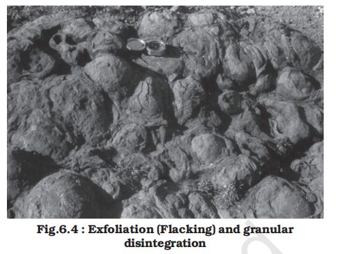
- This has already been explained under physical weathering processes of unloading, thermal contraction and expansion and salt weathering
- Exfoliation is a result but not a process
- Flaking off of more or less curved sheets of shells from over rocks or bedrock results in smooth and rounded surfaces (Figures 6.3; 6.4)
- Exfoliation can occur due to expansion and contraction induced by temperature changes
- Exfoliation domes and tors result due to unloading and thermal expansion respectively
- Significance of weathering
- Weathering processes are responsible for breaking down the rocks into smaller fragments and preparing the way for formation of not only regolith and soils, but also erosion and mass movements
- Biomes and bio-diversity is basically a result of forests (vegetation) and forests depend upon the depth of weathering mantles
- Erosion cannot be significant if the rocks are not weathered
- That means, weathering aids mass wasting, erosion and reduction of relief and changes in landforms are a consequence of erosion
- Weathering of rocks and deposits helps in the enrichment and concentrations of certain valuable ores of iron, manganese, aluminium, copper etc., which are of great importance for the national economy
- Weathering is an important process in the formation of soils
- When rocks undergo weathering, some materials are removed through chemical or physical leaching by groundwater and thereby the concentration of remaining (valuable) materials increases
- Without such a weathering taking place, the concentration of the same valuable material may not be sufficient and economically viable to exploit, process and refine
- This is what is called enrichment
- Mass movements (mass wasting)
-
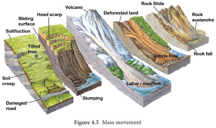
- Definition
- These movements transfer the mass of rock debris down the slopes under the direct influence of gravity
- That means, air, water or ice do not carry debris with them from place to place but on the other hand the debris may carry with it air, water or ice
- The movements of mass may range from slow to rapid, affecting shallow to deep columns of materials and include creep, flow, slide and fall
- Gravity exerts its force on all matter, both bedrock and the products of weathering
- So, weathering is not a pre-requisite for mass movement though it aids mass movements
- Mass movements are very active over weathered slopes rather than over unweathered materials
- Characteristics
- Mass movements are aided by gravity and no geomorphic agent like running water, glaciers, wind, waves and currents participate in the process of mass movements
- That means mass movements do not come under erosion though there is a shift (aided by gravity) of materials from one place to another
- Materials over the slopes have their own resistance to disturbing forces and will yield only when force is greater than the shearing resistance of the materials
- Weak unconsolidated [consisting of particles that do not stick together] materials, thinly bedded rocks, faults, steeply dipping beds, vertical cliffs or steep slopes, abundant precipitation and torrential rains and scarcity of vegetation etc., favour mass movements
- Causes
- Several activating causes precede mass movements
- They are:
- Removal of support from below to materials above through natural or artificial means
- Increase in gradient and height of slopes
- Overloading through addition of materials naturally or by artificial filling
- Overloading due to heavy rainfall, saturation and lubrication of slope materials
- Removal of material or load from over the original slope surfaces
- Occurrence of earthquakes, explosions or machinery
- Excessive natural seepage
- Heavy drawdown of water from lakes, reservoirs and rivers leading to slow outflow of water from under the slopes or river banks
- Indiscriminate removal of natural vegetation
- Three forms of movements:
- Heave (heaving up of soils due to frost growth and other causes)
- Flow
- Slide
- Mass wasting vs erosion
-
| Feature |
Mass Movement |
Erosion |
| Driving Force |
Gravity |
External agents (water, wind, ice) |
| Medium of Transport |
None (materials move as a mass) |
Requires a moving medium like water or wind |
| Movement Type |
Sudden or slow downslope movement |
Gradual removal and transport of surface material |
| Process Involves |
Only displacement under gravity |
Detachment, transportation, and deposition |
| Types |
Creep, slump, debris flow, landslide, rockfall |
Fluvial, aeolian, glacial, coastal |
| Typical Locations |
Hilly or mountainous regions |
Deserts, coasts, riverbanks, glaciers, etc. |
| Example |
Landslide in Western Ghats |
Riverbank erosion by Ganga, dune migration in Thar Desert |
- Important mass movement
- Slow Movements:
- Soil Creep:
- Extremely slow, continuous downslope movement of soil and regolith.
- Often imperceptible but causes bending of trees, tilted poles, cracked roads.
- Solifluction:
- Slow movement of water-saturated soil, typically in periglacial areas.
- Common where permafrost exists and thaws seasonally.
- Rapid Movements (Landslide):
- "Landslide" is an umbrella term for several types of rapid mass movements
-
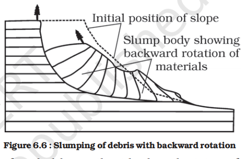
-
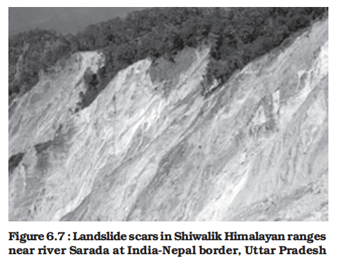
- Overview
- These are relatively rapid and perceptible movements
- The materials involved are relatively dry
- The size and shape of the detached mass depends on the nature of discontinuities in the rock, the degree of weathering and the steepness of the slope
- Depending upon the type of movement of materials several types are identified in this category
- Types of rapid movement (Landslides) based on type of movement:
-
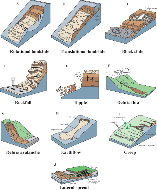
- Falls
- Sudden, vertical or near-vertical movement of rock or debris from steep slopes or cliffs
- Triggered by mechanical weathering, earthquakes, or gravity
- Material detaches without significant shear displacement
- Topples
- Forward rotation and movement of rock or debris blocks about a pivot point, often near the base
- Caused by geological structures like inclined bedding, joints, or fractures
- Common on steep slopes with overhanging rock
- Slides
- Downslope movement along a distinct shear surface
- Includes:
- Rockslide:
- Movement of large rock masses along bedding planes or joints
- Debris Slide:
- Rapid sliding of unconsolidated material without rotational motion
- Slump (Rotational Slide):
- Curved slip surface with backward rotation of material
- Flows
- Movement resembles viscous fluid behavior; material is saturated and deformed internally
- Sub-types:
- Earthflow:
- Slow to moderate movement of fine-grained, water-saturated material
- Debris Flow:
- Rapid movement of mixed debris and water
- Mudflow:
- Very rapid, fluid movement of fine materials and water
- Debris Avalanche:
- Extremely fast flow of fragmented material, often from volcanic slopes
- Questions
- Between mass wasting and mass movements, which term do you feel is most appropriate? Why?
- The term "mass wasting" is often used synonymously with mass movements, but "mass movements" is broader as it includes a variety of processes such as landslides, rockfalls, mudflows, and more, whereas "mass wasting" is more typically associated with the overall process of material being transported downslope under the influence of gravity.
- Therefore, mass movements provides a more accurate description of the entire spectrum of events.
- Can solifluction [the gradual movement of wet soil or other material down the slope] be included under rapid flow movements? Why it can be and can’t be?
- Why it can’t be: The key factor is the rate of movement. Rapid flow movements typically involve much faster material movement (like mudflows or debris flows), where the material can travel at significant speeds in a short amount of time.
- Solifluction, on the other hand, is a slow, gradual process, making it distinct from rapid movements like mudflows or landslides.
- Regional examples
- In our country, debris avalanches and landslides occur very frequently in the Himalayas
- There are many reasons for this:
- The Himalayas are tectonically active
- They are mostly made up of sedimentary rocks and unconsolidated and semi-consolidated deposits
- The slopes are very steep
- Compared to the Himalayas, the Nilgiris bordering Tamilnadu, Karnataka, Kerala and the Western Ghats along the west coast are relatively tectonically stable and are mostly made up of very hard rocks; but, still, debris avalanches and landslides occur though not as frequently as in the Himalayas, in these hills
- Then why landslides (even if less compared to Himalayas)?
- Many slopes are steeper with almost vertical cliffs and escarpments in the Western Ghats and Nilgiris
- Mechanical weathering due to temperature changes and ranges is pronounced
- They receive heavy amounts of rainfall over short periods
- So, there is almost direct rock fall quite frequently in these places along with landslides and debris avalanches
- Erosion and deposition
- Erosion
- Erosion involves acquisition [obtaining / buying / purchase] and transportation of rock debris
- When massive rocks break into smaller fragments through weathering and any other process, erosional geomorphic agents like running water, groundwater, glaciers, wind and waves remove and transport it to other places depending upon the dynamics of each of these agents
- Abrasion by rock debris carried by these geomorphic agents also aids greatly in erosion
- By erosion, relief degrades, i.e., the landscape is worn down
- That means, though weathering aids erosion it is not a pre-condition for erosion to take place
- Weathering, mass-wasting and erosion are degradational processes
- It is erosion that is largely responsible for continuous changes that the earth’s surface is undergoing
- As indicated in Figure 6.1, denudational [process in which moving water, ice, wind, etc eroding the earth's surface] processes like erosion and transportation are controlled by kinetic energy
- The erosion and transportation of earth materials is brought about by wind, running water, glaciers, waves and ground water
- Of these the first three agents are controlled by climatic conditions
- They represent three states of matter — gaseous (wind), liquid (running water) and solid (glacier) respectively
- Can you compare the three climatically controlled agents?
- The work of the other two agents of erosion-waves and ground water is not controlled by climate
- In case of waves it is the location along the interface of litho and hydro sphere — coastal region — that will determine the work of waves, whereas the work of ground water is determined more by the lithological character of the region
- If the rocks are permeable and soluble and water is available only then karst topography develops
- Mainly erosions are due to
- Running water
- Ground water
- Glaciers
- Waves and currents
- Winds
- Deposition
- Deposition is a consequence of erosion
- The erosional agents lose their velocity and hence energy on gentler slopes and the materials carried by them start to settle themselves
- In other words, deposition is not actually the work of any agent
- The coarser [larger grain size] materials get deposited first and finer ones later
- By deposition depressions get filled up
- The same erosional agents viz. [as follows / that is to say / which is], running water, glaciers, wind, waves and groundwater act as aggradational or depositional agents also
- What happens to the surface of the earth due to erosion and deposition is elaborated in the next chapter on landforms and their evolution
- Erosion vs mass movement
- Table is provided under mass movmement section
- Soil formation
-
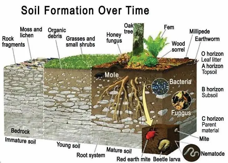
- Overview
- You see plants growing in soils
- You play in the ground and come into contact with soil
- You touch and feel soil and soil your clothes while playing
- Can you describe it?
- Soil is a dynamic medium in which many chemical, physical and biological activities go on constantly
- Soil is a result of decay, it is also the medium for growth
- It is a philosophical statement and can be used in ethics
- It is a changing and developing body
- It has many characteristics that fluctuate with the seasons
- It may be alternatively cold and warm or dry and moist
- Biological activity is slowed or stopped if the soil becomes too cold or too dry
- Organic matter increases when leaves fall or grasses die
- Process of soil formation
- Soil formation or pedogenesis depends first on weathering
- It is this weathering mantle [a garment like shawl worn by women] (depth of the weathered material) which is the basic input for soil to form
- First, the weathered material or transported deposits are colonised by bacteria and other inferior plant bodies like mosses and lichens
- Also, several minor organisms may take shelter within the mantle [a garment like shawl worn by women] and deposits
- The dead remains of organisms and plants help in humus accumulation
- Minor grasses and ferns may grow; later, bushes and trees will start growing through seeds brought in by birds and wind
- Plant roots penetrate down, burrowing animals bring up particles, mass of material becomes porous [permeable] and sponge-like with a capacity to retain [keep] water and to permit the passage of air and finally a mature soil, a complex mixture of mineral and organic products forms
- Is weathering solely responsible for soil formation? If not, why?
- Pedology is soil science
- A pedologist is a soil-scientist
- Various soil forming processes:
- Weathering
- Physical
- Chemical
- Biological
- Erosion
- Deposition
- Leaching
- Eluviation
- Illuviation
- Humification
- Laterization
- Laterization is the soil-forming process in which intense leaching removes silica and bases, leaving behind iron and aluminium oxides.
- That's why leached soils are called laterite soils.
- Podzolization
- Podzolizaton is the soil-forming process in which organic acids leach iron, aluminium, and humus from upper horizons and deposit them in lower horizons.
- Soil layers
- O Horizon (Organic):
- Composition:
- Primarily organic matter like fresh leaves, twigs, and decomposing plant/animal remains (humus).
- Detail:
- Most prominent in forest soils; often thin or absent in grasslands and deserts.
- A Horizon (Topsoil):
- Composition:
- A mix of minerals and decomposed organic matter (humus).
- Detail:
- This is the most fertile layer where seeds germinate and most biological activity (earthworms, bacteria) occurs.
- E Horizon (Eluviated/Leached):
- Composition:
- Lighter in color; mainly sand and silt.
- Detail:
- Eluviation means "washing out." Water moving down strips this layer of clay, minerals, and nutrients, leaving it pale.
- B Horizon (Subsoil):
- Composition:
- High concentration of minerals (iron, aluminum) and clay leached from the layers above.
- Detail:
- Known as the zone of Illuviation (accumulation). It is denser and more compact than the topsoil.
- C Horizon (Parent Material/Saprolite):
- Composition:
- Partially weathered rock fragments.
- Detail:
- Very little organic matter. This is the first stage in soil formation from the bedrock below.
- R Horizon (Bedrock):
- Composition:
- Solid, unweathered rock (granite, limestone, etc.).
- Detail:
- The foundation of the entire profile.
- Mnemomic to remember
- Only Americans Eat Bacon Covered with Raisins
- Only -> O Horizon
- Americans -> A Horizon
- Eat -> E Horizon
- Bacon -> B Horizon
- Covered -> C Horizon
- with -> -x
- Raisins -> R Horizon
- Soil-forming factors
- Parent material
- Parent material is a passive control factor in soil formation
- Parent materials can be any in-situ or on-site weathered rock debris (residual soils) or transported deposits (transported soils)
- Soil formation depends upon the texture (sizes of debris) and structure (disposition of individual grains/particles of debris) as well as the mineral and chemical composition of the rock debris/deposits
- Nature and rate of weathering and depth of weathering mantle are important considerations under parent materials
- There may be differences in soil over similar bedrock and dissimilar bedrocks may have similar soils above them
- But when soils are very young and have not matured these show strong links with the type of parent rock
- Also, in case of some limestone areas, where the weathering processes are specific and peculiar [strange / unusual], soils will show clear relation with the parent rock
- Topography (Relief)
- Topography like parent materials is another passive control factor
- The influence of topography is felt through the amount of exposure of a surface covered by parent materials to sunlight and the amount of surface and sub-surface drainage over and through the parent materials
- Soils will be thin on steep slopes and thick over flat upland areas
- Over gentle slopes where erosion is slow and percolation [filter gradually through a porous surface] of water is good, soil formation is very favourable
- Soils over flat areas may develop a thick layer of clay with good accumulation of organic matter giving the soil dark colour
- Climate
- Climate is an important active factor in soil formation
- The climatic elements involved in soil development are:
- Moisture in terms of its intensity, frequency and duration of precipitation - evaporation and humidity;
- Temperature in terms of seasonal and diurnal [daily / everyday / during the day] variations
- Precipitation gives soil its moisture content which makes the chemical and biological activities possible
- Excess of water helps in the downward transportation of soil components through the soil (eluviation) and deposits the same down below (illuviation)
- Eluviation
- Removal (washing out) of fine particles by percolating water in downward direction from top to bottom.
- Upper layer becomes lighter in colour and poorer in nutrients.
- Illuviation
- Accumulation (washing in) of materials removed by eluviation in the lower levels of the soil.
- Lower layer becomes darker, denser, and richer in minerals.
-
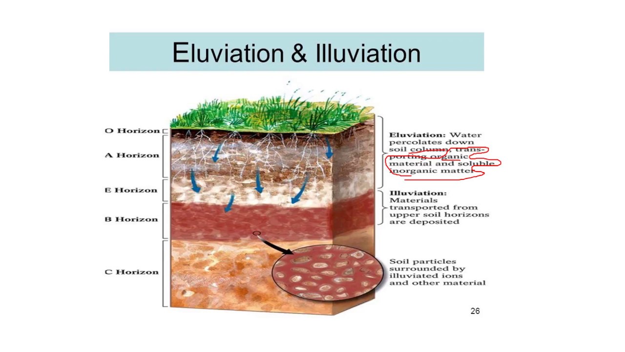
- In climates like wet equatorial rainy areas with high rainfall, not only calcium, sodium, magnesium, potassium etc. but also a major part of silica is removed from the soil
- Removal of silica from the soil is known as desilication
- In dry climates, because of high temperature, evaporation exceeds precipitation and hence ground water is brought up to the surface by capillary action and in the process the water evaporates leaving behind salts in the soil, such salts form into a crust in the soil known as hardpans
-
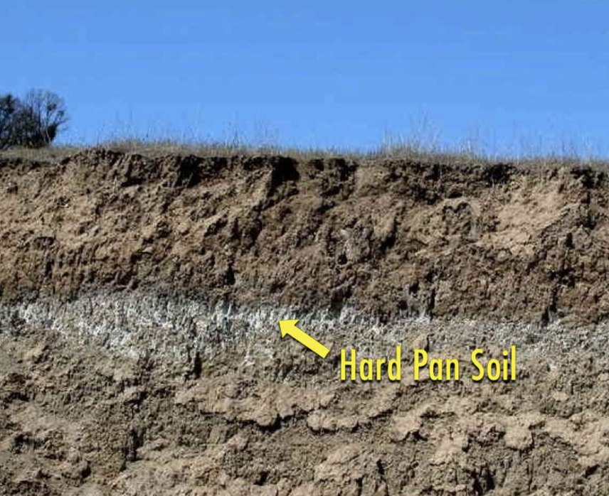
- In tropical climates and in areas with intermediate precipitation conditions, calcium carbonate nodules (kanker) are formed
- Temperature acts in two ways — increasing or reducing chemical and biological activity
- Chemical activity is increased in higher temperatures, reduced in cooler temperatures (with an exception of carbonation) and stops in freezing conditions
- That is why, tropical soils with higher temperatures show deeper profiles and in the frozen tundra regions soils contain largely mechanically broken materials
- Biological activity
- The vegetative cover and organisms that occupy the parent materials from the beginning and also at later stages help in adding organic matter, moisture retention, nitrogen etc.
- Dead plants provide humus, the finely divided organic matter of the soil
- Some organic acids which form during humification aid in decomposing the minerals of the soil parent materials
- Intensity of bacterial activity shows up differences between soils of cold and warm climates
- Humus accumulates in cold climates as bacterial growth is slow
- With undecomposed organic matter because of low bacterial activity, layers of peat develop in subarctic and tundra climates
- In humid tropical and equatorial climates, bacterial growth and action is intense and dead vegetation is rapidly oxidised leaving very low humus content in the soil
- Further, bacteria and other soil organisms take gaseous nitrogen from the air and convert it into a chemical form that can be used by plants, this process is known as nitrogen fixation
- Rhizobium, a type of bacteria, lives in the root nodules of leguminous plants and fixes nitrogen beneficial to the host plant
- The influence of large animals like ants, termites, earthworms, rodents etc., is mechanical, but, it is nevertheless important in soil formation as they rework the soil up and down
- In case of earthworms, as they feed on soil, the texture and chemistry of the soil that comes out of their body changes
- Vermicomposting is the process of using earthworms to decompose organic waste into a fine, nutrient-rich compost.
- Time
- Time is the third important controlling factor in soil formation
- The length of time the soil forming processes operate, determines maturation of soils and profile development
- A soil becomes mature when all soil-forming processes act for a sufficiently long time developing a profile
- Soils developing from recently deposited alluvium or glacial till are considered young and they exhibit no horizons or only poorly developed horizons
- No specific length of time in absolute terms can be fixed for soils to develop and mature
- Is it necessary to separate the process of soil formation and the soil forming control factors?
- Why are time, topography and parent material considered as passive control factors in soil formation?
- Distribution of oceans and continents
- Introduction to the chapter
- Context and background
- In the previous chapter, you have studied the interior of the earth
- You are already familiar with the world map
- You know that continents cover 29 per cent of the surface of the earth and the remainder is under oceanic waters
- The positions of the continents and the ocean bodies, as we see them in the map, have not been the same in the past
- Moreover, it is now a well-accepted fact that oceans and continents will not continue to enjoy their present positions in times to come
- Key questions
- If this is so, the question arises what were their positions in the past?
- Why and how do they change their positions?
- Even if it is true that the continents and oceans have changed and are changing their positions, you may wonder as to how scientists know this
- How have they determined their earlier positions?
- You will find the answers to some of these and related questions in this chapter
- Ocean floor configuration
-
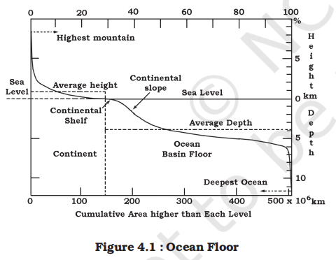
-
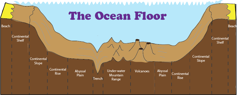
- The ocean floor may be segmented into three major divisions based on the depth as well as the forms of relief
- Continental margins
- These form the transition between continental shores and deep-sea basins
- They include continental shelf, continental slope, continental rise and deep-oceanic trenches [ditch]
- Of these, the deep-oceanic trenches are the areas which are of considerable interest in so far as the distribution of oceans and continents is concerned
- Deep-sea basins
- These are broad, deep regions of the ocean floor that lie between the continental margins and mid-ocean ridges.
- They include:
- Abyssal plains
- These are extensive plains that lie between the continental margins and mid-oceanic ridges
- The abyssal plains are the areas where the continental sediments that move beyond the margins get deposited
- Abyssal hills
- Small, gently sloping elevations found on abyssal plains.
- Seamounts
- Isolated underwater volcanic mountains, they rise at least 1,000 m above the surrounding ocean floor and do not reach the ocean surface.
- Guyots
- These are flat-topped seamounts, also called tablemounts.
- Oceanic trenches (in some cases)
- These are long, narrow, and very deep depressions on the ocean floor.
- Mid-oceanic ridges [long narrow hilltop, mountain range]
- This forms an interconnected chain of mountain system within the ocean
- It is the longest mountain-chain on the surface of the earth though submerged under the oceanic waters
- It is characterised by a central rift [crack] system at the crest [top of mountain or hill], a fractionated plateau and flank [on sides] zone all along its length
- The rift system at the crest is the zone of intense volcanic activity
- In the previous chapter, you have been introduced to this type of volcanoes as mid-oceanic volcanoes
- Continental drift theory
-
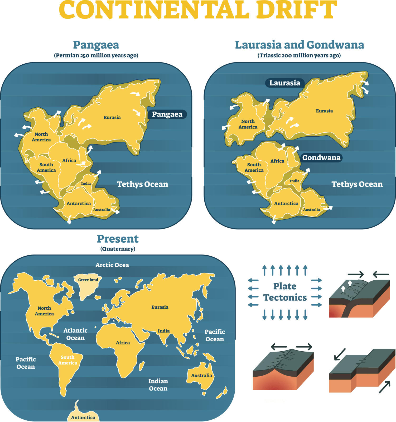
- Initial observations
- Observe the shape of the coastline of the Atlantic Ocean
- You will be surprised by the symmetry of the coastlines on either side of the ocean
- No wonder, many scientists thought of this similarity and considered the possibility of the two Americas, Europe and Africa, to be once joined together
- Historical development
- From the known records of the history of science, it was Abraham Ortelius, a Dutch map maker, who first proposed such a possibility as early as 1596
- Antonio Pellegrini drew a map showing the three continents together
- However, it was Alfred Wegener—a German meteorologist who put forth a comprehensive argument in the form of “the continental drift theory” in 1912
- This was regarding the distribution of the oceans and the continents
- Wegener’s theory
- According to Wegener, all the continents formed a single continental mass and mega ocean surrounded the same
- The super continent was named PANGAEA, which meant all earth
- The mega-ocean was called PANTHALASSA, meaning all water
- He argued that, around 200 million years ago, the super continent, Pangaea, began to split
- Pangaea first broke into two large continental masses as Laurasia and Gondwanaland forming the northern and southern components respectively
- Subsequently, Laurasia and Gondwanaland continued to break into various smaller continents that exist today
- Laurasia included present day:
- North America
- Greenland
- All of Eurasia
- Gondwanaland included present day:
- South America
- Africa
- Madagascar
- India
- Arabia
- Malaysia
- Australia
- Antarctica
- A variety of evidence was offered in support of the continental drift
- Some of these are given below
- Evidence in support of the continental drift
- The matching of continents (jig-saw-fit)
- The shorelines of Africa and South America facing each other have a remarkable and unmistakable match
- It may be noted that a map produced using a computer programme to find the best fit of the Atlantic margin was presented by Bullard in 1964
- It proved to be quite perfect
- The match was tried at 1,000-fathom [unit of length equal to six feet, used in reference] line instead of the present shoreline
- Rocks of same age across the oceans
- The radiometric dating methods developed in the recent period have facilitated correlating the rock formation from different continents across the vast ocean
- The belt of ancient rocks of 2,000 million years from Brazil coast matches with those from western Africa
- The earliest marine deposits along the coastline of South America and Africa are of the Jurassic age
- This suggests that the ocean did not exist prior to that time
- Tillite
- It is the sedimentary rock formed out of deposits of glaciers
- The Gondawana system of sediments from India is known to have its counterparts in six different landmasses of the Southern Hemisphere
- At the base, the system has thick tillite indicating extensive and prolonged glaciation
- Counterparts of this succession [following one after another] are found in Africa, Falkland Island, Madagascar, Antarctica and Australia
- Overall resemblance of the Gondawana-type sediments clearly demonstrates that these landmasses had remarkably similar histories
- The glacial tillite provides unambiguous [not open to more than one interpretation] evidence of palaeoclimates and also of drifting of continents
- Placer deposits
- The occurrence of rich placer deposits of gold in the Ghana coast and the absolute absence of source rock in the region is an amazing fact
- The gold bearing veins are in Brazil and it is obvious that the gold deposits of the Ghana are derived from the Brazil plateau when the two continents lay side by side
- Distribution of fossils
- When identical species of plants and animals adapted to living on land or in fresh water are found on either side of the marine barriers, a problem arises regarding accounting for such distribution
- The observations that Lemurs occur in India, Madagascar and Africa led some to consider a contiguous [sharing common border] landmass ‘Lemuria’ linking these three landmasses
- Mesosaurus was a small reptile adapted to shallow brackish water
- The skeletons of these are found only in two localities: the Southern Cape province of South Africa and Iraver formations of Brazil
- The two localities are presently 4,800 km apart with an ocean in between them
- Botanical evidence
- Presence of glossopteris vegetation in carboniferous rocks of India, Australia, South Africa, Falkland Island (overseas territory of UK), Antarctica, etc can be explained form the fact that parts were linked in the past.
- Glossopteris is the largest and best-known genus of the extinct Permian order of seed plants known as Glossopteridales
- The name Glossopteris refers only to leaves, within the framework of form genera used in paleobotany, used for leaves of plants belonging to the glossopterid family Dictyopteridiaceae.
- Force for drifting
- Wegener suggested that the movement responsible for the drifting of the continents was caused by pole-fleeing force and tidal force
- The polar-fleeing force relates to the rotation of the earth
- You are aware of the fact that the earth is not a perfect sphere; it has a bulge at the equator
- This bulge is due to the rotation of the earth
- The second force that was suggested by Wegener — the tidal force — is due to the attraction of the moon and the sun that develops tides in oceanic waters
- Wegener believed that these forces would become effective when applied over many million years
- However, most of scholars considered these forces to be totally inadequate [insufficient / not enough]
- Drawbacks of continental drift theory
- Timing contradiction
- Wegener failed to explain why the drift began only in Mesozoic era and not before.
- Lack of Mechanism
- Wegener could not explain the force or process that caused the continents to move.
- He proposed that tidal forces and centrifugal force caused drift — both were considered too weak by physicists.
- Misunderstanding of Oceanic Crust
- Wegener believed continents "plowed through" oceanic crust, like ships through water.
- Modern geology shows that oceanic crust is not weak or passive; it's part of dynamic tectonic plates.
- Neglect of Mantle Dynamics
- He did not consider convection currents in the mantle, which are now seen as the primary driver of plate movements.
- Limited Support from Fossil and Climatic Evidence
- While he used fossils and paleoclimate data effectively, critics argued these could be explained by land bridges or local climatic changes, not necessarily by drift.
- Post-drift studies and evidences
- Studies
- Overview
- It is interesting to note that for continental drift, most of the evidence was collected from the continental areas in the form of distribution of flora and fauna or deposits, like tillite
- A number of discoveries during the post–World War II period added new information to geological literature
- Particularly, the information collected from the ocean floor mapping provided new dimensions for the study of distribution of oceans and continents
- Convectional current theory
- Arthur Holmes in 1930s discussed the possibility of convection currents operating in the mantle portion
- These currents are generated due to radioactive elements causing thermal differences in the mantle portion
- Holmes argued that there exists a system of such currents in the entire mantle portion
- This was an attempt to provide an explanation to the issue of force, on the basis of which contemporary scientists discarded the continental drift theory
- Mapping of the ocean floor
- Detailed research of the ocean configuration revealed that the ocean floor is not just a vast plain but it is full of relief
- Expeditions to map the oceanic floor in the post–World War II period provided a detailed picture of the ocean relief and indicated the existence of submerged mountain ranges as well as deep trenches, mostly located closer to the continent margins
- The mid-oceanic ridges were found to be most active in terms of volcanic eruptions
- The dating of the rocks from the oceanic crust revealed the fact that they are much younger than the continental areas
- Rocks on either side of the crest of oceanic ridges and having equi-distant locations from the crest were found to have remarkable similarities both in terms of their constituents and their age
- Evidence
- As mentioned above, the post-drift studies provided considerable information that was not available at the time Wegener put forth his concept of continental drift
- Particularly, the mapping of the ocean floor and palaeomagnetic studies of rocks from oceanic regions revealed the following facts:
- It was realised that all along the mid-oceanic ridges, volcanic eruptions are common and they bring huge amounts of lava to the surface in this area
- The rocks equidistant on either sides of the crest of mid-oceanic ridges show remarkable similarities in terms of period of formation, chemical compositions and magnetic properties
- Rocks closer to the mid-oceanic ridges have normal polarity and are the youngest
- The age of the rocks increases as one moves away from the crest
- The ocean crust rocks are much younger than the continental rocks
- The age of rocks in the oceanic crust is nowhere more than 200 million years old
- Some of the continental rock formations are as old as 3,200 million years
- The sediments on the ocean floor are unexpectedly very thin
- Scientists were expecting, if the ocean floors were as old as the continent, to have a complete sequence of sediments for a period of much longer duration
- However, nowhere was the sediment column found to be older than 200 million years
- The deep trenches have deep-seated earthquake occurrences while in the mid-oceanic ridge areas, the quake foci [the centre of interest or activity] have shallow depths
- Sea floor spreading theory (Hess’s hypothesis)
-
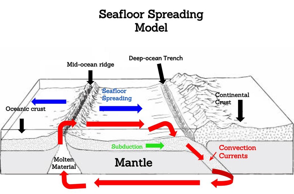
-
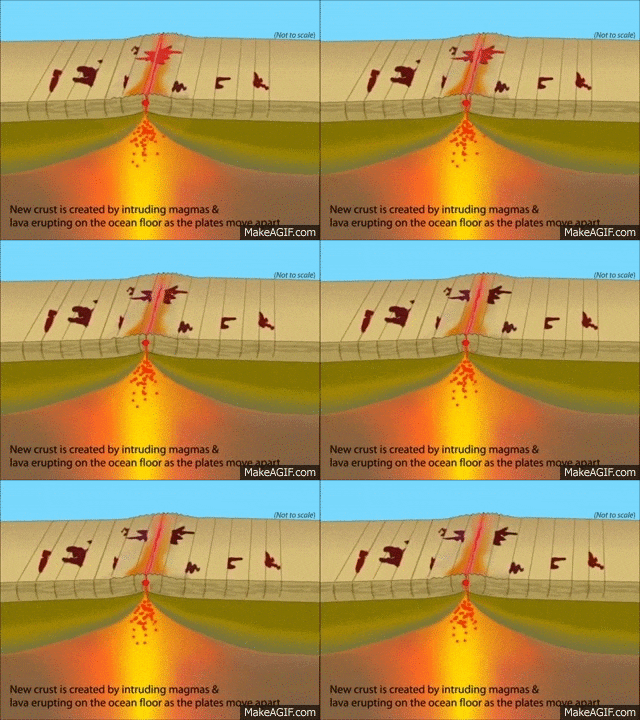
-
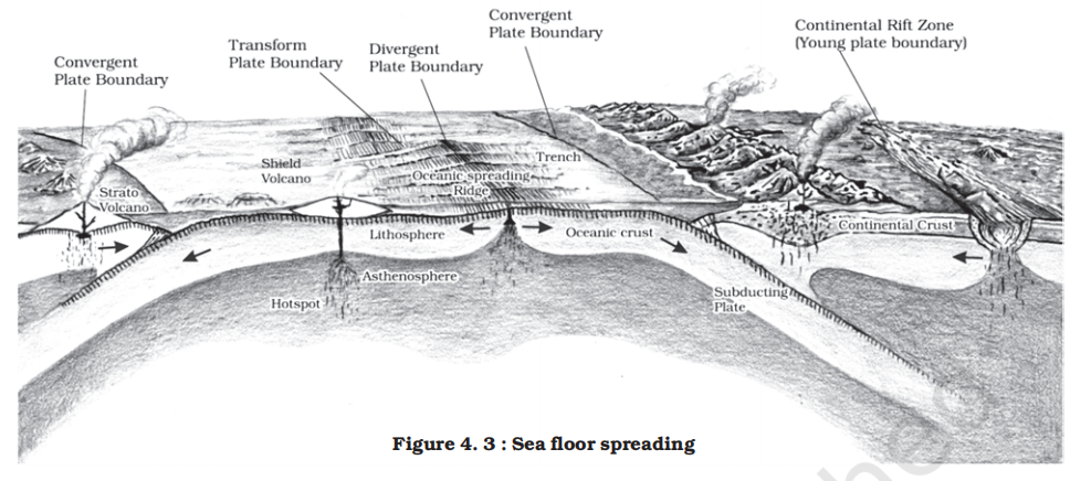
-
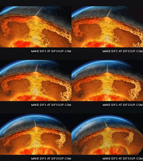
- Hypothesis
- Based on analysis of oceanic magnetic anomalies and rock dating, Harry H. Hess proposed the concept of sea floor spreading.
- He suggested that the continuous volcanic eruptions along the mid-oceanic ridges cause the oceanic crust to rupture.
- Basaltic magma from the mantle rises through the rift at the ridge crest, cools, and solidifies to form new oceanic crust.
- This process forces the existing crust on either side of the ridge to move outward, leading to the widening or "spreading" of the ocean floor.
- With time, older rocks are spread farther away from the spreading zone while younger rocks will be found neared to the spreading zone
- Hess proposed that older oceanic crust eventually descends into the mantle at deep-sea trenches (subduction zones), where it is recycled.
- This explained why Earth does not expand in size despite the continuous formation of new crust — old crust is destroyed at the same rate it is created.
- Evidence supporting the theory:
- The oceanic crust near the ridge is significantly younger than that farther away.
- Magnetic stripes on the ocean floor display symmetrical patterns of normal and reversed polarity on both sides of the ridge, matching Earth's magnetic reversals.
- Example
- The East Pacific Rise is a site of major seafloor spreading in the Ring of Fire
- Outcomes
- It resolved the conflict between the discovery of younger crust at mid-oceanic ridges and the discovery of older rocks as we moved out from the centre of the ridges.
- It clarified why sediments in the oceanic ridges' cores are so thin.
- Limitations of theory
- Lack of Mechanism for Driving Force
- The theory describes how new oceanic crust forms and spreads but does not explain what drives this movement.
- It lacks a clear explanation of the forces responsible for plate motion, such as mantle convection, which was introduced later under plate tectonics.
- Limited Scope to Oceanic Crust
- The theory focuses mainly on the ocean floor and does not explain continental plate movements or how continents interact with oceanic crust.
- Does Not Address Transform Faults
- It fails to explain lateral movements of plates along transform boundaries, such as the San Andreas Fault.
- No Integrated Global Framework
- Sea floor spreading treats mid-ocean ridges and trenches individually rather than as part of a global system of plate interactions.
- Inability to Explain Mountain Formation
- The theory does not account for major geological features like fold mountains, which form due to continental collisions.
- Incomplete Understanding of Magnetic Stripes
- Although later used as strong evidence, the theory initially lacked a clear interpretation of the symmetrical magnetic striping on both sides of mid-oceanic ridges.
- Asymmetry in Some Oceanic Ridges
- In several cases, the age and magnetic patterns on either side of the ridge are not symmetrical, challenging the universal application of the model.
- Plate tectonics theory
-
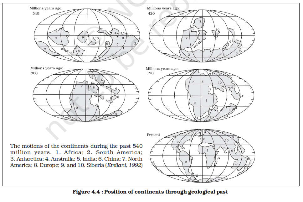
- Development of the theory
- Since the advent of the concept of sea floor spreading, the interest in the problem of distribution of oceans and continents was revived
- It was in 1967, McKenzie and Parker and also Morgan, independently collected the available ideas and came out with another concept termed Plate Tectonics
- Definition and structure
- A tectonic plate (also called lithospheric plate) is a massive, irregularly-shaped slab of solid rock, generally composed of both continental and oceanic lithosphere
- The lithosphere includes the crust and top mantle with its thickness range varying between 5 and 100 km in oceanic parts and about 200 km in the continental areas
- Plates move horizontally over the asthenosphere as rigid units
- A plate may be referred to as the continental plate or oceanic plate depending on which of the two occupy a larger portion of the plate
- Pacific plate is largely an oceanic plate whereas the Eurasian plate may be called a continental plate
- Force for the plate movement
- At the time that Wegener proposed his theory of continental drift, most scientists believed that the earth was a solid, motionless body
- However, concepts of sea floor spreading and the unified theory of plate tectonics have emphasised that both the surface of the earth and the interior are not static and motionless but are dynamic
- The fact that the plates move is now a well-accepted fact
- The mobile rock beneath the rigid plates is believed to be moving in a circular manner
- The heated material rises to the surface, spreads and begins to cool, and then sinks back into deeper depths
- This cycle is repeated over and over to generate what scientists call a convection [movement in liquid where hotter and less dense part rise while cold and heavy part sink] cell or convective flow
- Heat within the earth comes from two main sources: radioactive decay and residual heat
- Arthur Holmes first considered this idea in the 1930s, which later influenced Harry Hess’ thinking about seafloor spreading
- The slow movement of hot, softened mantle that lies below the rigid plates is the driving force behind the plate movement
- Major and minor plates
-
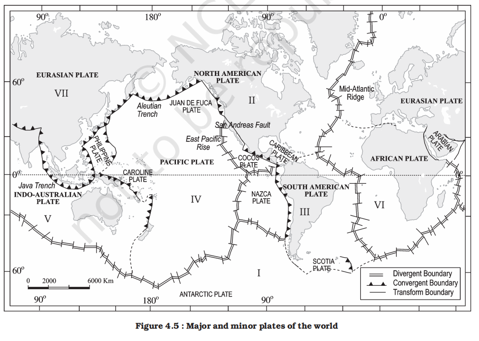
- The theory of plate tectonics proposes that the earth’s lithosphere is divided into seven major and some minor plates
- Young Fold Mountain ridges, trenches, and/or faults surround these major plates (Figure 4.5)
- The major plates are as follows:
- Antarctica and the surrounding oceanic plate
- North American (with western Atlantic floor separated from the South American plate along the Caribbean islands) plate
- South American (with western Atlantic floor separated from the North American plate along the Caribbean islands) plate
- Pacific plate
- India-Australia-New Zealand plate
- Africa with the eastern Atlantic floor plate
- Eurasia and the adjacent oceanic plate
- Some important minor plates are listed below:
- Cocos plate - Between Central America and Pacific plate
- Nazca plate - Between South America and Pacific plate
- Arabian plate - Mostly the Saudi Arabian landmass
- Philippine plate - Between the Asiatic and Pacific plate
- Caroline plate - Between the Philippine and Indian plate (North of New Guinea)
- Fuji plate - North-east of Australia
- Types of plate boundaries
-
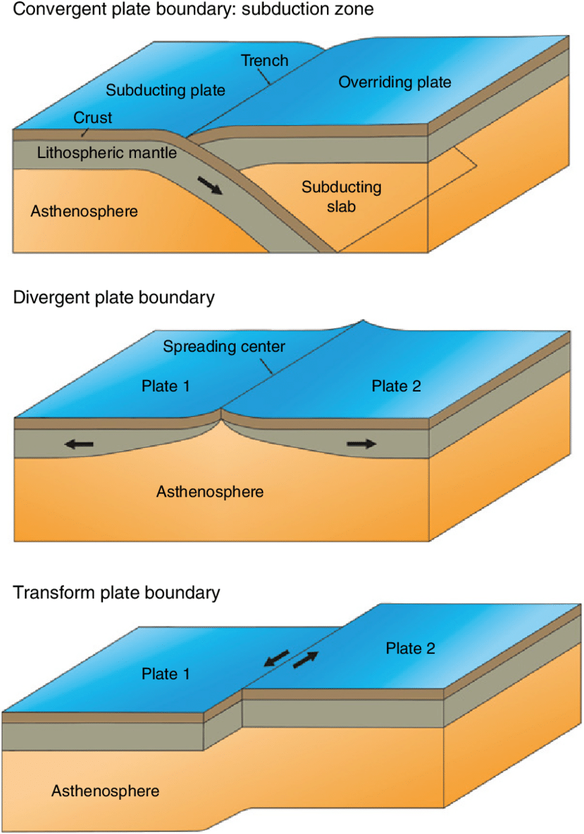
- Divergent boundaries
- Where new crust is generated as the plates pull away from each other
- The sites where the plates move away from each other are called spreading sites
- The best-known example of divergent boundaries is the Mid-Atlantic Ridge
- At this, the American Plate(s) is/are separated from the Eurasian and African Plates
- Convergent boundaries
- Where the crust is destroyed as one plate dived under another
- The location where sinking of a plate occurs is called a subduction [the sideways and downwards movement of the edge of a plate into mantle] zone
- There are three ways in which convergence can occur
- These are:
1. Between an oceanic and continental plate;
2. Between two oceanic plates; and
3. Between two continental plates
- Transform boundaries
- Where the crust is neither produced nor destroyed as the plates slide horizontally past each other
- Transform faults are the planes of separation generally perpendicular to the mid-oceanic ridges
- As the eruptions do not take all along the entire crest at the same time, there is a differential movement of a portion of the plate away from the axis of the earth
- Also, the rotation of the earth has its effect on the separated blocks of the plate portions
- Plate movement and historical context
- These plates have been constantly moving over the globe throughout the history of the earth
- It is not the continent that moves as believed by Wegener
- Continents are part of a plate and what moves is the plate
- Moreover, it may be noted that all the plates, without exception, have moved in the geological past, and shall continue to move in the future as well
- Wegener had thought of all the continents to have initially existed as a super continent in the form of Pangaea
- However, later discoveries reveal that the continental masses, resting on the plates, have been wandering all through the geological period, and Pangaea was a result of converging of different continental masses that were parts of one or the other plates
- Scientists using the palaeomagnetic data have determined the positions held by each of the present continental landmass in different geological periods (Fig 4.4)
- Position of the Indian subcontinent (mostly Peninsular India) is traced with the help of the rocks analysed from the Nagpur area
- Rates of plate movement
- How do you think the rate of plate movement is determined?
- The strips of normal and reverse magnetic field that parallel the mid-oceanic ridges help scientists determine the rates of plate movement
- These rates vary considerably
- The Arctic Ridge has the slowest rate (less than 2.5 cm/yr), and the East Pacific Rise near Easter Island, in the South Pacific about 3,400 km west of Chile, has the fastest rate (more than 15 cm/yr)
- Movement of the Indian plate
-
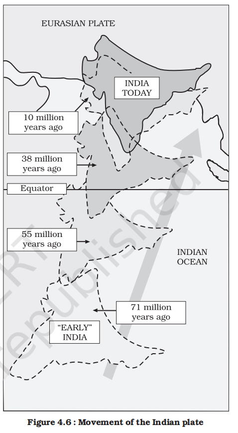
- Plate boundaries
- The Indian plate includes Peninsular India and the Australian continental portions
- The subduction zone along the Himalayas forms the northern plate boundary in the form of continent—continent convergence
- In the east, it extends through Rakinyoma Mountains of Myanmar towards the island arc along the Java Trench
- The eastern margin is a spreading site lying to the east of Australia in the form of an oceanic ridge in SW Pacific
- The Western margin follows Kirthar Mountain of Pakistan
- It further extends along the Makrana coast and joins the spreading site from the Red Sea rift southeastward along the Chagos Archipelago
- Archipelago
- An archipelago is a group or chain of islands clustered together in a sea or ocean. These islands can be volcanic in origin, formed by tectonic activity, or created through erosion and sedimentation.
- The word comes from Greek "arkhi" (chief) + "pelagos" (sea) = "chief sea" (originally referred to the Aegean Sea).
- Examples:
- Andaman and Nicobar Islands – India
- Lakshadweep Islands – India
- Indonesia
- Philippines
- Japan
- The boundary between India and the Antarctic plate is also marked by oceanic ridge [divergent boundary] running in roughly W-E direction and merging into the spreading site, a little south of New Zealand
- Historical movement
- India was a large island situated off the Australian coast, in a vast ocean
- The Tethys Sea separated it from the Asian continent till about 225 million years ago
- India is supposed to have started her northward journey about 200 million years ago at the time when Pangaea broke
- India collided with Asia about 40-50 million years ago causing rapid uplift of the Himalayas
- The positions of India since about 71 million years till the present are shown in the Figure 4.6
- It also shows the position of the Indian subcontinent and the Eurasian plate
- About 140 million years before the present, the subcontinent was located as south as 50°S latitude
- The two major plates were separated by the Tethys Sea and the Tibetan block was closer to the Asiatic landmass
- During the movement of the Indian plate towards the Eurasian plate, a major event that occurred was the outpouring of lava and formation of the Deccan Traps
- This started somewhere around 60 million years ago and continued for a long period of time
- Note that the subcontinent was still close to the equator
- From 40 million years ago and thereafter, the event of formation of the Himalayas took place
- Scientists believe that the process is still continuing and the height of the Himalayas is rising even to this date
- Minerals and rocks
- Introduction to minerals
- Composition of the earth
- The earth is composed of various kinds of elements
- These elements are in solid form in the outer layer of the earth and in hot and molten form in the interior
- About 98 per cent of the total crust of the earth is composed of eight elements like oxygen, silicon, aluminium, iron, calcium, sodium, potassium and magnesium, and the rest is constituted by titanium, hydrogen, phosphorous, manganese, sulphur, carbon, nickel and other elements
- Definition of minerals
- The elements in the earth’s crust are rarely found exclusively but are usually combined with other elements to make various substances
- These substances are recognised as minerals
- Thus, a mineral is a naturally occurring organic and inorganic substance, having an orderly atomic structure and a definite chemical composition and physical properties
- A mineral is composed of two or more elements
- But, sometimes single element minerals like sulphur, copper, silver, gold, graphite etc. are found
- Variety and formation
- Though the number of elements making up the lithosphere are limited they are combined in many different ways to make up many varieties of minerals
- There are at least 2,000 minerals that have been named and identified in the earth crust; but almost all the commonly occurring ones are related to six major mineral groups that are known as major rock forming minerals
- The basic source of all minerals is the hot magma in the interior of the earth
- When magma cools, crystals of minerals appear and a systematic series of minerals are formed in sequence to solidify so as to form rocks
- Minerals such as coal, petroleum and natural gas are organic substances found in solid, liquid and gaseous forms respectively
- Physical characteristics
- Overview
- A brief information about some important minerals in terms of their nature and physical characteristics is given below
- Characteristics
- External crystal form
- Determined by internal arrangement of the molecules — cubes, octahedrons, hexagonal prisms, etc.
- Cleavage
- Tendency to break in given directions producing relatively plane surfaces — result of internal arrangement of the molecules — may cleave in one or more directions and at any angle to each other
- Fracture
- Internal molecular arrangement so complex there are no planes of molecules; the crystal will break in an irregular manner, not along planes of cleavage
- Lustre
- Appearance of a material without regard to colour; each mineral has a distinctive lustre like metallic, silky, glossy etc.
- Color
- Some minerals have characteristic colour determined by their molecular structure — malachite, azurite, chalcopyrite etc., and some minerals are coloured by impurities
- For example, because of impurities quartz may be white, green, red, yellow etc.
- Streak
- Colour of the ground powder of any mineral
- It may be of the same colour as the mineral or may differ — malachite is green and gives green streak, fluorite is purple or green but gives a white streak
- Transparency
- Transparent:
- Light rays pass through so that objects can be seen plainly;
- Translucent
- Light rays pass through but will get diffused so that objects cannot be seen;
- Opaque
- Light will not pass at all
- Structure
- Particular arrangement of the individual crystals; fine, medium or coarse grained; fibrous — separable, divergent, radiating
- Hardness
- Relative resistance being scratched; ten minerals are selected to measure the degree of hardness from 1-10
- They are:
1. Talc (softest)
2. Gypsum
3. Calcite
4. Fluorite
5. Apatite
6. Feldspar
7. Quartz
8. Topaz
9. Corundum
10. Diamond (hardest)
- Compared to this for example, a fingernail is 2.5 and glass or knife blade is 5.5
- Specific gravity
- The ratio between the weight of a given object and the weight of an equal volume of water; object weighed in air and then weighed in water and divide weight in air by the difference of the two weights
- Types of minerals
- Metallic minerals
- These minerals contain metal content and can be sub-divided into three types:
1. Precious metals: gold, silver, platinum etc.
2. Ferrous metals: iron and other metals often mixed with iron to form various kinds of steel
3. Non-ferrous metals: include metals like copper, lead, zinc, tin, aluminium etc.
- Non-metallic minerals
- These minerals do not contain metal content
- Sulphur, phosphates and nitrates are examples of non-metallic minerals
- Cement is a mixture of non-metallic minerals
- Rocks
- Definition and overview
- The earth’s crust is composed of rocks
- A rock is an aggregate [collection / cluster] of one or more minerals
- Rock may be hard or soft and in varied colours
- For example, granite is hard, soapstone is soft
- Gabbro is black and quartzite can be milky white
- Rocks do not have definite composition of mineral constituents
- Feldspar and quartz are the most common minerals found in rocks
- Petrology
- Petrology is science of rocks
- A petrologist studies rocks in all their aspects viz., mineral composition, texture, structure, origin, occurrence, alteration and relationship with other rocks
- Importance for geographers
- As there is a close relation between rocks and landforms, rocks and soils, a geographer requires basic knowledge of rocks
- Classification of rocks
- Overview
- There are many different kinds of rocks which are grouped under three families on the basis of their mode of formation
- They are:
- Igneous Rocks — solidified from magma and lava;
- Sedimentary Rocks — the result of deposition [action of depositing] of fragments of rocks by exogenous [external cause or origin] processes
- Metamorphic Rocks — formed out of existing rocks undergoing recrystallization
-
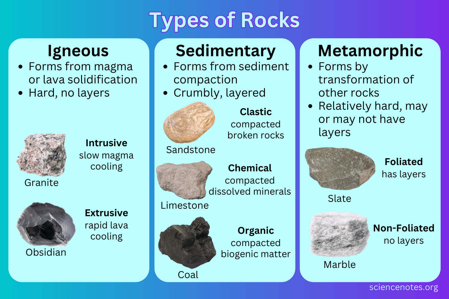
- Igneous Rocks (Primary rocks)
- Formation
- Igneous rocks are known as primary rocks because they form directly from magma or lava
- The word ‘igneous’ comes from the Latin word ignis, meaning ‘fire’
- These rocks are formed when molten magma cools and solidifies
- The process of solidification can take place either beneath the earth’s surface (intrusive) or on the surface (extrusive)
- When magma cools slowly beneath the surface, it forms intrusive igneous rocks
- When lava erupts on the surface and cools rapidly, it forms extrusive igneous rocks
- Classification of Igneous Rocks:
- Based on Mode of Formation:
- Intrusive (Plutonic) Rocks:
- Formed from magma that cools and solidifies beneath the Earth's surface.
- Slow cooling allows the formation of large, visible crystals (coarse-grained texture).
- Examples:
- Granite:
- Rich in quartz and feldspar, light-colored, coarse-grained.
- Gabbro:
- Dark-colored, mafic composition, coarse-grained.
- Pegmatite:
- Extremely coarse-grained, often with large crystals of quartz, feldspar, and mica.
- Extrusive (Volcanic) Rocks:
- Formed when magma (lava) erupts on the surface and cools rapidly.
- Rapid cooling results in fine-grained or glassy texture with small or no visible crystals.
- Examples:
- Basalt:
- Dark-colored, fine-grained, rich in iron and magnesium.
- Volcanic
- Breccia: Composed of angular rock fragments fused together during explosive eruptions.
- Tuff:
- Formed from volcanic ash and dust compacted and cemented together.
- Based on Texture (determined by cooling rate):
- Coarse-Grained (Phaneritic):
- Slow cooling deep inside the Earth.
- When magma cools deep inside the Earth it is surrounded by hot rocks, heat escapes very slowly, temperature drops gradually
- Slow cooling = more time for atoms to arrange themselves = bigger crystals
- Large, visible crystals.
- Example: Granite, Gabbro.
- Fine-Grained (Aphanitic):
- Rapid cooling on or near the surface.
- When lava reaches the surface or just below it is suddenly exposed to air, water, much cooler rocks, heat escapes very fast
- Now atoms don’t get time to wander around, find proper crystal positions, grow large faces. They get locked in place almost immediately.
- Cooling is rapid, crystal growth is cut short, crystals remain microscopic, texture becomes fine-grained (aphanitic).
- That’s why basalt looks smooth and dull while granite looks chunky and speckled.
- Small or no visible crystals.
- Example: Basalt.
- Very Coarse-Grained (Pegmatitic):
- Extremely slow cooling or fluid-rich environments.
- Exceptionally large crystals.
- Example: Pegmatite.
- Glassy:
- Instant cooling with no time for crystal formation.
- Atoms were frozen before they could organise themselves.
- Glass is an amorphous solid formed when a molten material is cooled so rapidly that its atoms do not get time to arrange into a regular crystalline structure.
- Man-made glass is made by melting silica (SiO₂) and cooling it rapidly so it solidifies without forming crystals.
- Rapid cooling makes rocks more brittle.
- Example: Obsidian
- Porphyritic:
- Two-stage cooling – large crystals (phenocrysts) embedded in a fine-grained matrix.
- Indicates a complex cooling history.
- Sedimentary Rocks
- Formation
- The word ‘sedimentary’ is derived from the Latin word sedimentum, meaning ‘settling’
- Rocks (igneous, sedimentary, and metamorphic) at the earth’s surface undergo weathering and erosion due to denudational agents such as wind, water, and ice
- The resulting fragments are transported and deposited by these agents
- Over time, the accumulated deposits undergo compaction and cementation, turning into sedimentary rocks — a process called lithification
- Sedimentary rocks often exhibit distinct layering or bedding, which can remain visible even after lithification
- Common examples showing such layers include sandstone, shale, and limestone
- Sand is a sediment formed by weathering of rocks and it does not come under igneous, sedamentary and metamorphic rocks, because sand is not a rock.
- Classification
- Based on mode of formation, sedimentary rocks are classified into:
1. Mechanically formed
- Formed by physical accumulation of rock fragments
- Examples: sandstone, conglomerate, shale, loess
2. Organically formed
- Formed from the accumulation of plant or animal remains
- Examples:
- From animals: chalk, coral limestone, some types of limestone
- From plants: peat, lignite, bituminous coal
3. Chemically formed
- Formed from mineral substances precipitated from solution
- Examples: chert, gypsum, halite, potash, some types of limestone
- Metamorphic rocks
- Formation
- The word metamorphic means ‘change of form’
- These rocks form under the action of pressure, volume and temperature (PVT) changes
- Metamorphism occurs when rocks are forced down to lower levels by tectonic processes or when molten magma rising through the crust comes in contact with the crustal rocks or the underlying rocks are subjected to great amounts of pressure by overlying rocks
- Metamorphism
- Metamorphism is a process by which already consolidated rocks undergo recrystallisation and reorganisation of materials within original rocks
- Types of Metamorphism
- Dynamic Metamorphism
- Caused primarily by mechanical forces such as crushing, grinding, and shearing
- Occurs along fault zones where intense pressure leads to reorganization of minerals
- No significant chemical changes take place
- Example: Mylonites formed along fault zones
- Thermal Metamorphism (also called Contact Metamorphism)
- Occurs due to high temperatures from nearby intruding magma or lava
- Recrystallisation of original rock minerals without much deformation
- New minerals may also form due to the introduction of materials from magma/lava
- Common near igneous intrusions
- Regional Metamorphism
- Caused by a combination of high pressure and temperature over large areas
- Associated with tectonic plate collisions and mountain building
- Rocks undergo deformation, chemical alteration, and recrystallisation
- Produces foliated rocks like schist, gneiss
- Structural Features of Metamorphic Rocks
- Foliation
- Refers to the alignment of mineral grains or structural features within a rock
- Caused by pressure during metamorphism, leading to a layered or banded appearance
- Lineation
- Linear arrangement of minerals due to directed pressure
- Common in rocks that have undergone significant deformation
- Banding
- Occurs when minerals segregate into alternating layers of light and dark shades
- Rocks showing this structure are known as banded metamorphic rocks
- Classification of Metamorphic Rocks
- Based on Structure
-
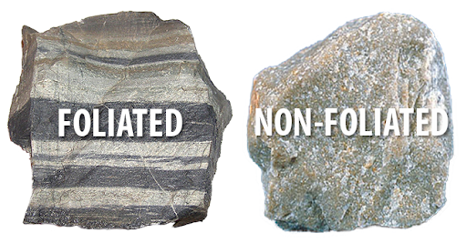
- Foliated Rocks
- Exhibit parallel arrangement of minerals
- Common examples: Slate, Schist, Gneiss
- Non-Foliated Rocks
- Do not show layered or banded texture
- Usually composed of minerals that recrystallize without orientation [positioning / familiarization with something / a person's basic belief towards something]
- Common examples: Marble (from limestone), Quartzite (from sandstone)
- Based on Parent Rock (Protolith)
- Slate:
- From shale (foliated)
- Schist:
- From shale or basalt (foliated)
- Gneiss:
- From granite or sedimentary rocks (foliated)
- Marble:
- From limestone (non-foliated)
- Quartzite:
- From sandstone (non-foliated)
- Rock cycle
-
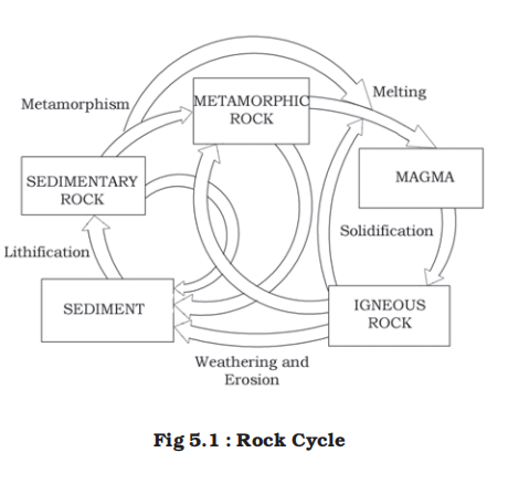
- Overview
- Rocks do not remain in their original form for long but may undergo transformation
- Rock cycle is a continuous process through which old rocks are transformed into new ones
- Process
- Igneous rocks are primary rocks and other rocks (sedimentary and metamorphic) form from these primary rocks
- Igneous rocks can be changed into metamorphic rocks
- The fragments derived out of igneous and metamorphic rocks form into sedimentary rocks
- Sedimentary rocks themselves can turn into fragments and the fragments can be a source for formation of sedimentary rocks
- The crustal rocks (igneous, metamorphic and sedimentary) once formed may be carried down into the mantle (interior of the earth) through subduction [sideways and downward movement of the edge of the plate beneath another plate] process (parts or whole of crustal plates going down under another plate in zones of plate convergence) and the same melt down due to increase in temperature in the interior and turn into molten magma, the original source for igneous rocks (Figure 5.1)
- Landforms and their evolution
- Introduction to landforms
- Overview
- After weathering processes have had their actions on the earth materials making up the surface of the earth, the geomorphic agents like running water, ground water, wind, glaciers, waves perform erosion
- It is already known to you that erosion causes changes on the surface of the earth
- Deposition follows erosion and because of deposition too, changes occur on the surface of the earth
- Definition of landforms
- A landform is a natural feature on the Earth's surface, like a mountain or a valley, that is shaped by geological processes like erosion, deposition, and tectonic activity
- If landform is a small to medium sized part of the surface of the earth, what is a landscape [scenery]?
- While a landform is a specific geomorphic feature like a hill, valley, or plateau, a landscape is the visible integration of multiple landforms and natural or man-made elements in a region, forming the overall appearance of that part of the Earth's surface.
- Several related landforms together make up landscapes, (large tracts of earth’s surface)
- Each landform has its own physical shape, size, materials and is a result of the action of certain geomorphic processes and agent(s)
- Evolution of landforms
- Actions of most of the geomorphic processes and agents are slow, and hence the results take a long time to take shape
- Every landform has a beginning
- Landforms once formed may change in their shape, size and nature slowly or fast due to continued action of geomorphic processes and agents
- Due to changes in climatic conditions and vertical or horizontal movements of landmasses, either the intensity of processes or the processes themselves might change leading to new modifications in the landforms
- Evolution here implies stages of transformation of either a part of the earth’s surface from one landform into another or transformation of individual landforms after they are once formed
- That means, each and every landform has a history of development and changes through time
- A landmass passes through stages of development somewhat comparable to the stages of life — youth, mature and old age
- Mount everest is the highest landform and Mariana trench is the lowest
- What are the two important aspects of the evolution of landforms?
- Major Landforms of the Earth
-
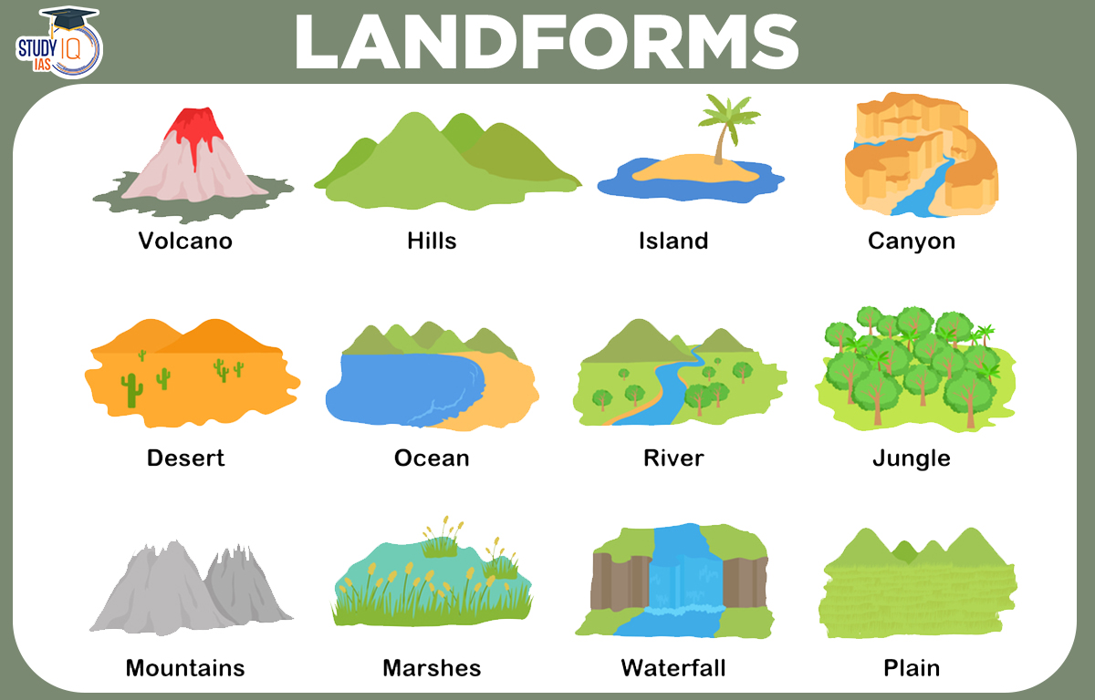
- Mountains
- A mountain is a natural elevation of the Earth's surface rising more prominently than a hill, usually with steep sides and significant exposed rock.
- They are formed primarily due to endogenic forces such as tectonic activity and volcanism.
- Characteristics:
- Elevation is generally above 600 meters from the surrounding area
- Exhibit prominent relief features
- Often form major physical barriers and influence climate and biodiversity
- Types of Mountains:
-
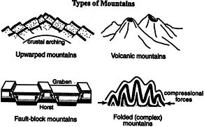
- Fold Mountains
- Formed due to compressional forces resulting in the folding of rock strata
- Most common and highest mountain ranges in the world
- Young Fold Mountains: steep, rugged, seismically active
- Examples: Himalayas, Andes, Rockies
- Old Fold Mountains: worn down by erosion, lower in height
- Examples: Aravallis, Urals, Appalachians
- Block Mountains (Horst Mountains)
- Formed due to tensional forces causing faulting in the Earth’s crust
- A block is either uplifted (horst) or the surrounding land subsides (graben)
- Typically have steep sides and flat tops
- Examples: Sierra Nevada (USA), Vosges and Black Forest (Europe)
- Volcanic Mountains
- Formed by the accumulation of volcanic materials like lava, ash, and cinders
- Built over time by repeated eruptions
- Can be active, dormant, or extinct
- Examples: Mount Fuji (Japan), Mount Kilimanjaro (Tanzania), Mount Mayon (Philippines)
- Residual Mountains
- Remnants of old mountains worn down by erosion
- Also called erosional or denudational mountains
- Usually isolated, rounded hills of hard rock
- Examples: Aravallis (India), Highlands of Scotland
- Plateaus
- A plateau is an extensive area of flat or gently undulating land that is significantly elevated above the surrounding terrain.
- Plateaus are formed due to various geological processes such as uplift of land due to tectonic activity, volcanic eruptions, or erosion of surrounding areas.
- Characteristics:
- Elevated flat-topped landform with steep edges
- May have rivers cutting deep gorges or canyons
- Can be of volcanic, tectonic, or erosional origin
- Often support human settlements, agriculture, and mineral extraction
- Types of Plateaus:
-
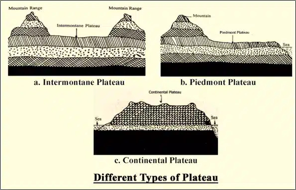
- Intermontane Plateaus (Tectonic Plateus)
- Located between mountain ranges
- Formed due to uplift during mountain building or by deposition of volcanic materials between ranges
- Surrounded by mountains on all sides
- Examples: Tibetan Plateau (between the Himalayas and Kunlun), Bolivian Plateau
- Continental Plateaus (Uplifted Plateaus)
- Located away from mountain ranges, often in the interior parts of continents
- Formed due to broad tectonic uplift of large areas
- Often bounded by steep escarpments on one or more sides
- Examples: Deccan Plateau (India), Colorado Plateau (USA), Brazilian Highlands
- Piedmont Plateaus
- Located at the foot of mountain ranges
- Formed by erosion or deposition at the base of mountains or through tectonic uplift
- Transition zones between mountain regions and plains
- Examples: Malwa Plateau (India)
- Volcanic Plateaus
- Formed from successive lava flows spreading over large areas
- Typically found in regions with prolonged volcanic activity
- Examples: Antrim Plateau (Northern Ireland), Columbia Plateau (USA)
- Dissected Plateaus
- Originally flat plateaus that have been heavily eroded by rivers and streams
- Rugged appearance due to deep valleys and gorges
- Examples: Chotanagpur Plateau (India), Ozark Plateau (USA)
- Plains
- Plains are extensive, relatively flat or gently rolling areas of land with minimal elevation variation.
- They are among the most fertile and densely populated landforms, suitable for agriculture, transport, and settlements.
- Types of Plains:
- Structural Plains
- Formed by the uplift of horizontal or gently tilted sedimentary rock layers
- Surfaces remain relatively undisturbed by folding or faulting
- Typically found in continental interiors
- Examples: Russian Plain (East European Plain), Great Plains (USA)
- Depositional Plains
- Formed by the deposition of sediments carried by rivers, glaciers, wind, or seas over time
- Generally very fertile and flat
- Subtypes:
- Alluvial Plains:
- Formed by rivers depositing alluvium
- Example: Indo-Gangetic Plain (India)
- Glacial Plains:
- Formed by glacial deposits during and after ice ages
- Example: Northern plains of Canada and northern USA
- Coastal Plains:
- Formed by marine sedimentation or emergence of sea floors
- Example: Eastern Coastal Plains of India
- Lacustrine Plains:
- Formed by the drying up of lakes
- Example: Kashmir Valley (India)
- Erosional Plains
- Formed by the gradual wearing down of elevated land by agents like rivers, glaciers, and wind
- Features reduced relief and old, mature landscapes
- Subtypes:
- Peneplains:
- Nearly level surfaces formed by prolonged erosion
- Represent the final stage of fluvial erosion
- Pediplains:
- Formed in arid and semi-arid regions by wind and water erosion
- Examples: West Central Australian Plain
- Hills
- Hills are natural elevations of the Earth's surface that are lower in height and more rounded than mountains.
- They usually have gentle slopes and are found in a variety of landscapes, including near mountains or in isolated regions.
- Hills are typically less than 600 meters (2,000 feet) above sea level.
- Characteristics:
- Smaller and lower than mountains
- Rounded summit and gentle slopes
- May form due to tectonic uplift, erosion, or volcanic activity
- Types of Hills:
- Residual Hills
- Formed by the erosion of surrounding softer rocks, leaving behind more resistant rock
- Example: Monadnocks in the USA, Inselbergs in Africa
- Volcanic Hills
- Formed by solidified lava or volcanic debris
- Example: Hills in the Deccan Trap region (India)
- Tectonic Hills
- Result from minor folding, faulting, or uplift of the Earth’s crust
- Example: Shillong Hills (Meghalaya, India)
- Erosional Hills
- Created through the long-term erosion of larger landforms
- Example: Hills in the Eastern Ghats region
- Valleys
- A valley is a low area of land between hills or mountains, typically with a river or stream running through it. Valleys are often formed through the process of erosion by water or glaciers.
- Characteristics:
- Lower elevation compared to the surrounding terrain
- Often formed by river erosion or tectonic forces
- Can be U-shaped (glacial valleys) or V-shaped (river valleys)
- Typically contain rivers or streams, although some can be dry
- Types of Valleys:
- River Valleys
- Formed by the erosional action of rivers or streams over long periods.
- These valleys are typically V-shaped and are found in regions where rivers are active in erosion.
- Example: River valleys in the Himalayas
- Rift Valleys
- Formed due to tectonic forces, where the Earth's crust is pulled apart along faults, creating a deep, long, and often steep-sided valley.
- Rift valleys can occur due to both continental and oceanic tectonic movements.
- Example: Narmada Valley (India), East African Rift Valley (Ethiopia, Kenya, Tanzania)
- Glacial Valleys
- Formed by the movement of glaciers, which carve deep U-shaped valleys in mountainous regions.
- These valleys typically have steep sides and flat floors.
- Example: Yosemite Valley (USA), Alpine valleys in the Himalayas
- Structural Valleys
- Formed by the differential erosion of rock layers, often due to folding or faulting.
- These valleys have a structural origin and can exhibit unique geological features.
- Example: The Rhone Valley (France), Son Valley (India)
- Deserts
- A desert is a barren area of land where little precipitation occurs, resulting in a landscape of limited vegetation and often extreme temperature fluctuations. Deserts can be hot or cold and are typically characterized by arid conditions.
- Characteristics:
- Low annual rainfall (less than 250 mm per year)
- Can be hot (e.g., Sahara, Thar) or cold (e.g., Gobi)
- Can feature sand dunes, gravel plains (regs), rocky surfaces (hamadas), or barren landscapes with little or no vegetation
- Temperature extremes, with hot days and cold nights (or cold days and freezing nights in cold deserts)
- Types of deserts based on climate & location:
- Hot deserts
- Example: Sahara, Thar
- Cold deserts
- Example: Gobi
- Mountain deserts
- Example: Ladakh, Tibetan Plateau
- Types of deserts based on surface features:
-
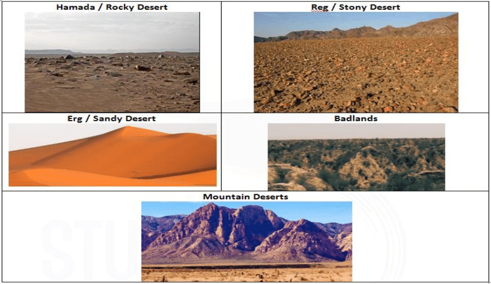
- (Badland and mountain deserts are not desert landforms)
- Erg (Sand Desert)
- Dominated by sand dunes; extensive wind-blown sand deposits
- Found mainly in hot deserts
- Example: Sahara Desert (Africa), Rub' al Khali (Arabian Peninsula)
- Reg (Stony Desert)
- Surface covered with gravel or pebbles; flat and wind-polished
- Sparse vegetation; lacks sand dunes
- Example: Gobi Desert (China/Mongolia), Mojave Desert (USA)
- Hamada (Barren, Hard Rock Desert)
- Consists of exposed bedrock or hard rocky surfaces
- Formed due to deflation and erosion removing finer materials
- Example: Central Sahara (Africa), Negev Desert (Israel)
- Coastal Landforms
-
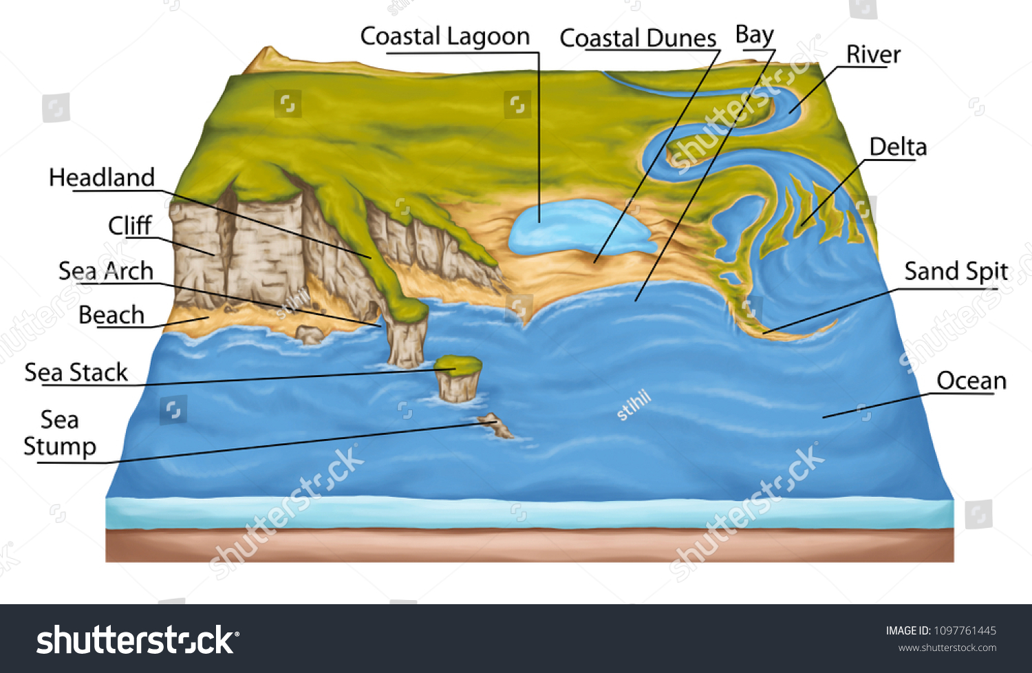
- Coastal landforms are shaped by the interaction between the land and the sea, influenced by waves, tides, and currents. These landforms are constantly evolving due to coastal erosion, deposition, and the dynamic nature of the ocean.
- Types of Coastal Landforms:
- Cliffs
- Coastal cliffs are steep rock faces found along coasts, formed through the erosion of softer rocks and the weathering of harder rocks.
- They are typically seen where the land meets the sea, particularly along active coasts.
- Example: White Cliffs of Dover (England), Cliffs of Moher (Ireland)
- Beaches
- Beaches are formed by the deposition of sand, pebbles, or cobbles along the shoreline.
- They are shaped by the action of waves and tides, which transport and deposit material from the sea.
- Example: Waikiki Beach (Hawaii), Copacabana Beach (Brazil)
- Sea Arches
- Sea arches are formed when waves erode the base of a coastal headland, creating a natural arch-like structure.
- The erosion happens along cracks or joints in the rock, often producing spectacular formations.
- Example: Arch Rock (USA), London Arch (Australia)
- Sea Stacks
- Sea stacks are vertical columns of rock that remain standing after the erosion of a sea arch.
- These formations are typically isolated and stand out in the water after the arch has collapsed.
- Example: Old Man of Hoy (Scotland), Twelve Apostles (Australia)
- Spits and Bars
- Spits are narrow, elongated sand or gravel formations that project from the shoreline into the water, often formed by longshore drift.
- Bars are sand ridges formed by wave action that may partially or completely block bays or river mouths.
- Example: Spurn Head (England), Sandy Hook (USA)
- Lagoons
- Lagoons are shallow bodies of water separated from the sea by a barrier, such as a sandbar, reef, or barrier island.
- They are typically calm, sheltered areas where sediments accumulate, forming a unique ecosystem.
- Example: Chilika Lake (India), Venice Lagoon (Italy)
- Headlands and Bays
- Headlands are resistant rock projections extending into the sea, while bays are indented coastal areas formed where softer rocks are eroded more rapidly.
- Formed due to differential erosion along coastlines.
- Example: Headlands and bays along the south coast of England
- Sea Caves
- Sea caves are hollowed-out cavities formed at the base of coastal cliffs due to continuous wave erosion along joints and cracks.
- Represent the initial stage in the cave–arch–stack sequence.
- Example: Sea caves along the Konkan Coast (India)
- Tombolos
- A tombolo is a sand or shingle ridge that connects an island to the mainland or to another island.
- Formed due to wave refraction and deposition.
- Example: St. Ninian’s Isle (Scotland)
- Barrier Islands
- Long, narrow offshore sand islands running parallel to the mainland coast.
- Formed by deposition due to wave action and longshore drift.
- Act as natural barriers protecting the mainland coast.
- Example: Barrier islands along the Atlantic coast of the USA
- Offshore Bars
- Sand ridges formed parallel to the coastline due to wave action.
- May later emerge above sea level to form barrier islands.
- Example: Offshore bars along the eastern coast of India
- Mudflats
- Flat, low-lying coastal surfaces composed of fine sediments deposited in sheltered tidal environments.
- Common in estuaries and deltaic regions.
- Example: Sundarbans (India–Bangladesh)
- Fluvial Landforms (River-based)
-
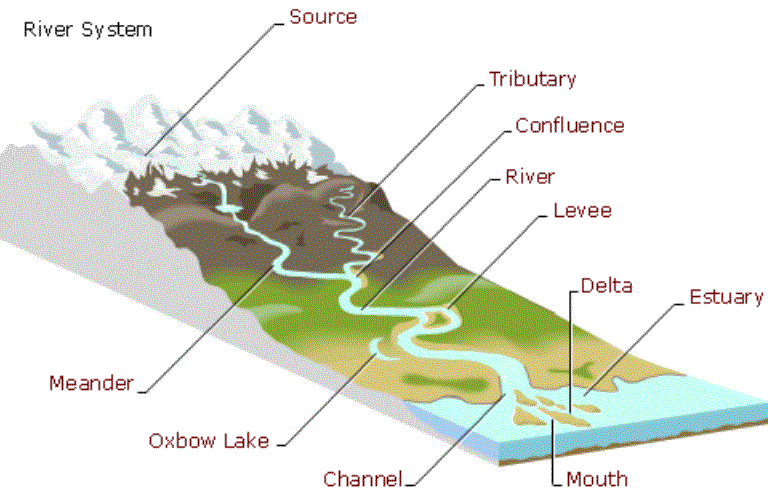
- Fluvial landforms are formed by the erosional, transportational, and depositional activities of running water (rivers and streams).
- These landforms evolve continuously due to variations in river velocity, discharge, gradient, and sediment load.
- Types of Fluvial Landforms (based on dominant process):
- Erosional Fluvial Landforms
- V-shaped Valleys
- Formed due to dominant vertical erosion in the youthful stage of a river.
- Characterized by steep sides and narrow valley floor.
- Example: River valleys in the Himalayas
- Gorges and Canyons
- Deep, narrow valleys formed by prolonged vertical erosion.
- Canyons are wider and step-sided compared to gorges.
- Example: Grand Canyon (USA)
- Waterfalls
- Formed due to differential erosion of hard and soft rock layers or faulting.
- Retreat upstream due to headward erosion.
- Example: Niagara Falls (Canada/USA), Victoria Falls (Zambia/Zimbabwe)
- Potholes
- Circular depressions formed in riverbeds due to abrasion by swirling rock fragments.
- Common in rocky river courses.
- Depositional Fluvial Landforms
- Floodplains
- Flat, low-lying depositional surfaces formed by periodic flooding.
- Composed of fertile alluvium.
- Example: Indo-Gangetic Plain (India), Nile Floodplain (Egypt)
- Natural Levees
- Raised river banks formed by deposition of coarser sediments during floods.
- Help confine river flow within the channel.
- Alluvial Fans
- Fan-shaped deposits formed where a river emerges from a mountainous region onto a plain.
- Result from sudden loss of velocity and deposition of sediments.
- Example: Himalayan foothills, Mojave Desert (USA)
- Deltas
- Depositional landforms formed at river mouths where sediment deposition exceeds marine removal.
- Example: Ganga–Brahmaputra Delta (India/Bangladesh), Nile Delta (Egypt)
- Erosional and Depositional Fluvial Landforms
- Meanders
- Sinuous bends formed due to erosion on the outer bank and deposition on the inner bank.
- Common in the mature stage of a river.
- Example: Mississippi River (USA), Ganga River (India)
- Oxbow Lakes
- Crescent-shaped lakes formed when a meander loop is cut off during floods.
- Example: Oxbow lakes in the Ganga plains, Mississippi basin
- River Terraces
- Step-like surfaces along valley sides representing former floodplain levels.
- Indicate river rejuvenation.
- Braided Channels
- Network of interlacing channels formed due to high sediment load and variable discharge.
- Example: Brahmaputra River
- Aeolian Landforms (Wind-based)
- Aeolian landforms are created by the action of wind through erosion, transportation, and deposition.
- These landforms are most prominent in arid and semi-arid regions where sparse vegetation allows wind to act effectively.
- Types of Aeolian Landforms:
- Loess Deposits
- Loess is a fine, silty sediment deposited by wind over large areas.
- Forms fertile plains due to its porous nature and good moisture retention.
- Example: Loess Plateau (China), Loess deposits in the Midwest (USA)
- Sand Dunes
- Sand dunes are mounds or ridges of sand accumulated by wind action.
- Their form depends on wind direction, velocity, and sand supply.
- Types of Sand Dunes:
- Barchans
- Crescent-shaped dunes with horns pointing downwind.
- Form in areas with limited sand supply and unidirectional winds.
- Seifs (Longitudinal dunes)
- Long, narrow dunes aligned parallel to prevailing wind direction.
- Form where wind direction varies slightly.
- Example: Barchans in the Sahara Desert, Seifs in the Kalahari Desert
- Yardangs
- Streamlined ridges carved by wind abrasion and deflation.
- Aligned parallel to the prevailing wind direction.
- Example: Yardangs in the Gobi Desert, Atacama Desert
- Mushroom Rocks (Pedestal Rocks)
- Rock formations with narrow bases and wider tops due to greater erosion near the ground.
- Formed by sand-laden winds eroding the lower portion more intensely.
- Example: Mushroom rocks in the Wadi Rum Desert (Jordan)
- Deflation Hollows
- Depressions formed by removal of loose particles through wind action.
- May expose groundwater or lead to oasis formation.
- Sand Sheets
- Extensive, flat or gently undulating sand-covered surfaces.
- Occur where sand supply is abundant but wind strength is insufficient to form dunes.
- Glacial Landforms
-
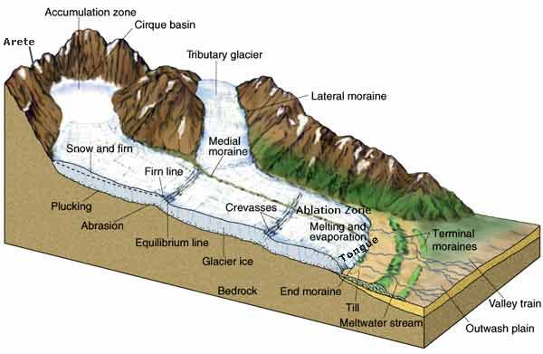
- Glacial landforms are formed by the erosional and depositional activities of glaciers.
- Glaciers erode land through plucking and abrasion and deposit materials when they melt.
- Erosional Landforms:
- Cirques (Corries)
- Bowl-shaped depressions on mountain sides formed due to plucking, abrasion, and freeze–thaw action.
- Often contain tarn lakes after glacier retreat.
- U-shaped Valleys (Glacial Troughs)
- Broad, flat-floored valleys with steep sides formed when glaciers deepen and widen former V-shaped river valleys.
- Aretes
- Sharp, knife-edged ridges formed between two adjacent cirques or glacial valleys.
- Horns
- Pyramidal peaks formed when several cirques erode a mountain from different sides.
- Example: Matterhorn (Alps)
- Roche Moutonnée
- Asymmetrical rock hummocks formed by differential glacial erosion.
- Gentle stoss side and steep, plucked lee side.
- Depositional Landforms:
- Moraines
- Accumulations of unsorted debris (till) deposited by glaciers.
- Types:
- Lateral moraine
- Medial moraine
- Terminal moraine
- Ground moraine
- Drumlins
- Smooth, elongated hills composed mainly of glacial till.
- Indicate direction of glacier movement.
- Eskers
- Long, sinuous ridges of sand and gravel deposited by meltwater streams flowing within or beneath glaciers.
- Kettles (Kettle Lakes)
- Depressions formed by melting of buried ice blocks in glacial deposits.
- Often filled with water.
- Outwash Plains
- Broad plains formed by meltwater streams depositing sorted sediments beyond the glacier front.
- Karst Landforms (Limestone Regions)
-
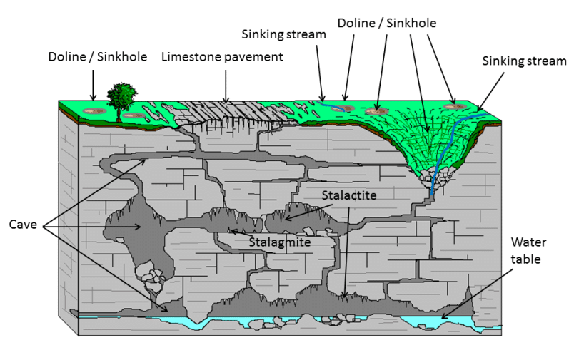
- Karst topography develops in regions underlain by soluble rocks, especially limestone, due to chemical weathering and solution by slightly acidic water (carbonic acid).
- These landforms are produced mainly by dissolution rather than mechanical erosion or deposition.
- Surface Karst Landforms:
- Dolines (Sinkholes)
- Circular or oval depressions formed due to solution, collapse, or subsidence of limestone.
- Sinkholes is a commonly used term for dolines, especially in American literature.
- Uvalas
- Large depressions formed by the coalescence of several dolines.
- Irregular in shape and larger than dolines.
- Poljes
- Very large, flat-floored depressions with steep sides.
- Often drained by swallow holes (ponors).
- Common in the Dinaric Alps region.
- Limestone Pavement
- Flat, exposed limestone surface marked by clints (blocks) and grikes (deep fissures).
- Formed due to prolonged chemical weathering.
- Lapies
- Grooved, fluted, or furrowed limestone surfaces formed by solution along joints.
- Common on exposed limestone surfaces.
- Subsurface Karst Landforms:
- Caves (Caverns)
- Underground voids formed by dissolution of limestone by acidic groundwater.
- Often interconnected through passages and chambers.
- Stalactites and Stalagmites
- Stalactites hang from cave ceilings, formed by deposition of calcium carbonate from dripping water.
- Stalagmites rise from the cave floor due to accumulation of mineral deposits.
- When they meet, they form pillars or columns.
- Volcanic Landforms
- Volcanic landforms are geological features formed by volcanic activity, ranging from small cones and lava flows to vast plateaus and submarine ridges.
- They are closely associated with plate boundaries, hot spots, and rift zones.
- Some volcanic features (e.g., calderas, flood basalts, mid-ocean ridges) do not form classic cones but are geologically significant.
- Based on formation location:
- Extrusive Landforms (Surface Volcanism)
- Formed when magma erupts onto the Earth’s surface and cools rapidly.
- Volcanoes (classified by morphology and eruption style)
-
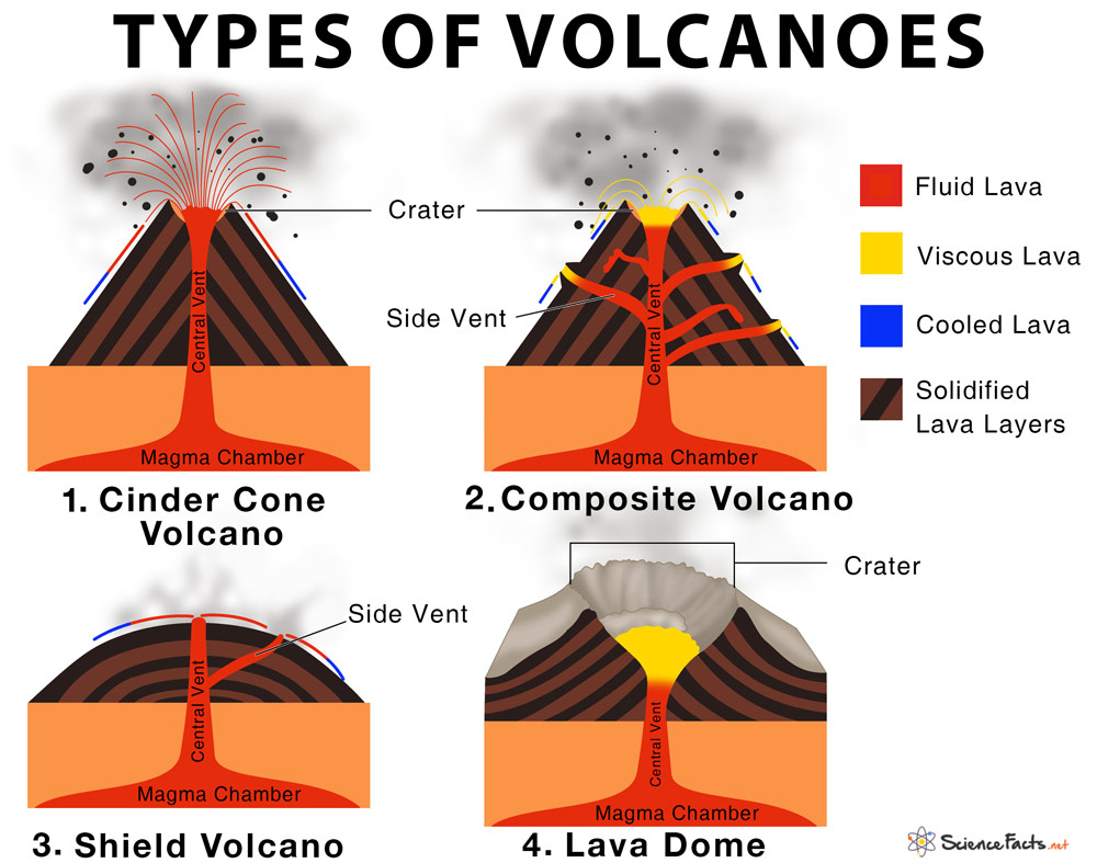
-
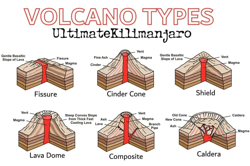
- Shield Volcanoes
- Broad, gently sloping structures composed mainly of basaltic lava.
- Lava is low-viscosity and spreads over large areas.
- Eruptions are non-explosive to mildly explosive.
- Example: Mauna Loa, Kilauea (Hawaii)
- Composite Volcanoes (Stratovolcanoes)
- Tall, conical volcanoes with alternating layers of lava and pyroclastic material.
- Lava is mainly andesitic, leading to explosive eruptions.
- Common at subduction zones.
- Example: Mount Fuji (Japan), Mount St. Helens (USA)
- Cinder Cone Volcanoes
- Small, steep-sided cones built from pyroclastic fragments.
- Short-lived and localized.
- Often occur near larger volcanoes.
- Example: Parícutin (Mexico)
- Lava Domes (Volcanic Domes)
- Formed by slow extrusion of highly viscous, silica-rich lava (rhyolitic).
- Dome-shaped and prone to collapse, causing pyroclastic flows.
- Example: Novarupta Dome (Alaska), Mount Unzen (Japan)
- Caldera Volcanoes
-
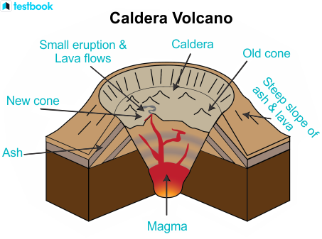
- Large circular depressions formed after collapse of an emptied magma chamber.
- Among the most explosive volcanic features.
- Example: Yellowstone Caldera (USA), Toba Caldera (Indonesia)
- Flood Basalt Provinces (Plateau Basalts)
-
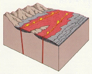
- Massive outpourings of basaltic lava through fissures.
- Form extensive, flat-topped plateaus.
- Example: Deccan Traps (India), Columbia River Basalt Group (USA)
- Mid-Ocean Ridge Volcanoes
-
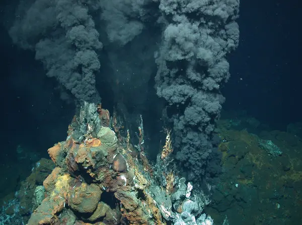
- Occur at divergent plate boundaries.
- Basaltic eruptions due to decompression melting.
- Create new oceanic crust.
- Example: Mid-Atlantic Ridge
- Intrusive Landforms (Subsurface Volcanism)
-
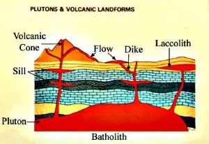
-
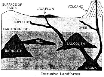
- Formed when magma cools and solidifies beneath the Earth’s surface.
- Exposed later by erosion of overlying rocks.
- Batholiths
- Very large, irregular intrusive bodies, usually granitic.
- Represent cooled magma chambers.
- Exposed after prolonged denudation.
- Laccoliths
- Dome-shaped intrusions with flat bases.
- Magma uplifts overlying strata without reaching the surface.
- Example: Henry Mountains (USA)
- Lopoliths
- Saucer-shaped intrusions, concave upward.
- Thicker at the center due to subsidence.
- Phacoliths
- Lens-shaped intrusions formed along crests or troughs of folds.
- Associated with anticlines and synclines.
- Sills
- Horizontal, sheet-like intrusions parallel to bedding planes.
- Dykes
- Vertical or steeply inclined intrusions cutting across rock layers.
- Often act as feeders for surface eruptions.
- Common in the Deccan region of India
- Oceanic Landforms (Submarine)
-
- Oceanic landforms lie beneath the ocean surface and are formed by tectonic, volcanic, and sedimentary processes.
- They represent distinct morphological divisions of the ocean floor.
- These include:
- Continental Shelf
- The submerged, gently sloping extension of the continental landmass under shallow seas.
- Rich in marine life and mineral resources such as oil and natural gas.
- Width varies greatly:
- Very wide along Atlantic-type margins
- Narrow along Pacific-type margins
- Example: Siberian Shelf (widest), eastern coast of India
- Continental Slope
- Steep slope extending from the outer edge of the continental shelf to deeper oceanic regions.
- Marks the true edge of the continental crust.
- Prone to submarine landslides and turbidity currents.
- Continental Rise
- Gentle slope at the base of the continental slope.
- Formed by accumulation of sediments brought down by turbidity currents.
- Transitional zone between continental slope and abyssal plain.
- Abyssal Plain
- Vast, deep, and extremely flat regions of the ocean floor, generally between 3,000 and 5,000 meters depth.
- Formed by deposition of fine sediments over basaltic oceanic crust.
- Among the flattest surfaces on Earth.
- Example: Sohm Plain (Atlantic Ocean)
- Abyssal hills
- Small, gently sloping elevations found on abyssal plains.
- Mid-Ocean Ridge
- Extensive underwater mountain chains formed at divergent plate boundaries.
- Sites of continuous volcanic activity and sea-floor spreading.
- Associated with hydrothermal vents.
- Example: Mid-Atlantic Ridge, East Pacific Rise
- Ocean Trenches
- Long, narrow, and deepest depressions on the ocean floor.
- Formed at subduction zones where one plate descends beneath another.
- Associated with earthquakes and tsunamis.
- Example: Mariana Trench (deepest), Java Trench
- Seamounts and Guyots
- Seamounts
- Isolated underwater volcanic mountains that do not reach sea level.
- Example: Davidson Seamount (Pacific Ocean)
- Guyots
- Flat-topped seamounts formed when volcanic islands are eroded at sea level and later submerged due to crustal subsidence.
- Example: Horizon Guyot
- Classification of landforms
- Based on Origin (Genetic Classification)
1. Endogenic Landforms (formed by internal forces)
- Result from tectonic and volcanic activity
- Examples:
- Mountains (Fold, Block, Volcanic)
- Plateaus
- Rift Valleys
- Domes
2. Exogenic Landforms (formed by external forces)
- Result from weathering, erosion, transportation, and deposition by agents like rivers, wind, glaciers, and waves
- Examples:
- Riverine features: valleys, meanders, oxbow lakes, floodplains, deltas
- Aeolian features: sand dunes, loess
- Glacial features: cirques, moraines, U-shaped valleys
- Coastal features: cliffs, stacks, arches, beaches
- Karst features: sinkholes, stalactites, stalagmites
- Based on Size (Morphological or Scale Classification)
1. Major Landforms
- Large-scale features formed primarily by endogenic processes
- Examples:
- Mountains
- Plateaus
- Plains
2. Minor Landforms
- Medium-scale surface features formed by erosion and deposition
- Examples:
- Hills
- Escarpments
- Terraces
- Cliffs
- Valleys
3. Micro Landforms
- Small-scale features, often local in extent, formed by both endogenic and exogenic processes
- Examples:
- Ripple marks
- Potholes
- Sand dunes
- Yardangs
- Sinkholes
- Geomorphic agents and resulting landforms
- Some endogenic agents
- Tectonic forces (folding, faulting, uplift)
- Folding
- Folding occurs when horizontal forces compress the earth’s crust, causing it to bend.
- This results in the formation of fold mountains like the Himalayas and the Alps. Folds can also create anticlines (upward arches) and synclines (downward troughs), which influence drainage patterns and valley formation.
- Faulting
- Faulting is the fracturing of the earth’s crust due to tensional or compressional forces.
- It leads to features like rift valleys (e.g., the East African Rift), block mountains (e.g., the Vosges and Black Forest), and fault scarps, which dramatically shape the landscape.
- Uplift
- Uplift raises large portions of the earth’s crust vertically, forming plateaus (e.g., the Deccan Plateau). Uplifted regions can later be dissected by rivers, forming canyons and gorges.
- Volcanic activity
- Volcanic eruptions build up landforms through the accumulation of lava, ash, and volcanic debris. Over time, this leads to the formation of volcanic cones, domes, and shield volcanoes (e.g., Mauna Loa in Hawaii).
- Extensive lava flows can create volcanic plateaus such as the Columbia Plateau or Deccan Traps. Volcanic activity also results in features like calderas, lava plains, and volcanic islands (e.g., Iceland, the Galápagos).
- Earthquakes
- While earthquakes themselves are sudden movements, their long-term geomorphic impact comes through uplift, subsidence, and faulting.
- Major earthquakes can create new fault lines, uplifted blocks, or cause coastal submergence, thereby reshaping coastlines and river courses. For instance, the 2004 Indian Ocean earthquake led to significant changes in coastal topography.
- Some exogenic agents
- Running water
- Importance and components
- In humid regions, which receive heavy rainfall running water is considered the most important of the geomorphic agents in bringing about the degradation of the land surface
- There are two components of running water
- One is overland flow on general land surface as a sheet
- Another is linear flow as streams and rivers in valleys
- Erosional processes
- Most of the erosional landforms made by running water are associated with vigorous [strong / healthy] and youthful rivers flowing over steep [rising or falling sharply] gradients [a slope]
- With time, stream [small, narrow river] channels [waterway] over steep gradients turn gentler [lenient] due to continued erosion, and as a consequence [result], lose their velocity, facilitating [make easier] active deposition
- There may be depositional forms associated with streams flowing over steep slopes
- But these phenomena will be on a small scale compared to those associated with rivers flowing over medium to gentle slopes
- The gentler the river channels in gradient or slope, the greater is the deposition
- When the stream beds turn gentler due to continued erosion, downward cutting becomes less dominant and lateral [sideways] erosion of banks increases and as a consequence the hills and valleys are reduced to plains
- Is complete reduction of relief of a high land mass possible?
- Overland flow causes sheet erosion
- Depending upon irregularities of the land surface, the overland flow may concentrate into narrow to wide paths
- Because of the sheer friction of the column of flowing water, minor or major quantities of materials from the surface of the land are removed in the direction of flow and gradually small and narrow rills will form
- These rills will gradually develop into long and wide gullies; the gullies [pass] will further deepen, widen, lengthen and unite to give rise to a network of valleys
- In the early stages, down-cutting dominates during which irregularities such as waterfalls and cascades [small waterfalls in stages] will be removed
- In the middle stages, streams cut their beds slower, and lateral erosion of valley sides becomes severe
- Gradually, the valley sides are reduced to lower and lower slopes
- The divides between drainage basins are likewise lowered until they are almost completely flattened leaving finally, a lowland of faint relief with some low resistant remnants [remains] called monadnocks standing out here and there
- This type of plain forming as a result of stream erosion is called a peneplain (an almost plain)
- Stages of landscape development
- Overview
- The characteristics of each of the stages of landscapes developing in running water regimes may be summarised as follows:
- Youth
- Streams are few during this stage with poor integration and flow over original slopes showing shallow V-shaped valleys with no floodplains or with very narrow floodplains along trunk streams
- Streams divides are broad and flat with marshes, swamp and lakes
- Meanders [a winding curve or bend of river or road / zig-zag] if present develop over these broad upland surfaces
- These meanders may eventually entrench themselves into the uplands
- Waterfalls and rapids may exist where local hard rock bodies are exposed
- Mature
- During this stage streams are plenty with good integration
- The valleys are still V-shaped but deep; trunk [major] streams are broad enough to have wider floodplains within which streams may flow in meanders confined within the valley
- The flat and broad inter stream areas and swamps and marshes of youth disappear and the stream divides turn sharp
- Waterfalls and rapids disappear
- Old
- Smaller tributaries during old age are few with gentle gradients
- Streams meander freely over vast floodplains showing natural levees, oxbow lakes, etc.
- Divides are broad and flat with lakes, swamps and marshes
- Most of the landscape is at or slightly above sea level
- Erosional landforms
- Valleys
-
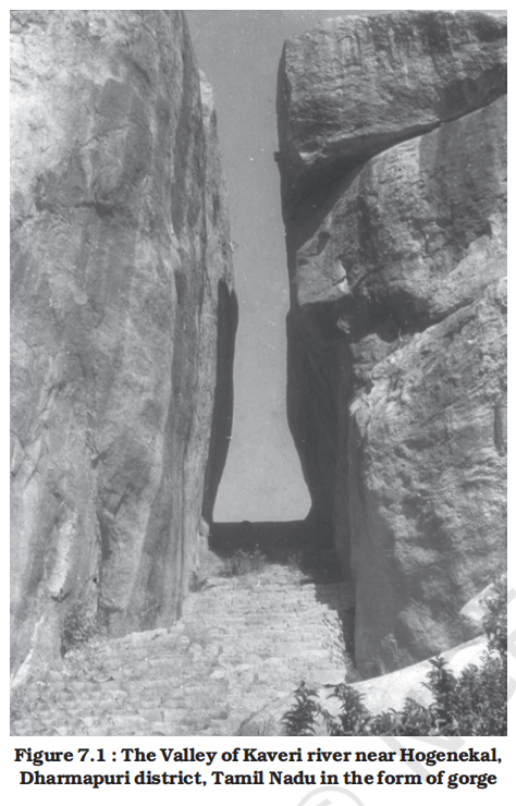
- Valleys start as small and narrow rills; the rills will gradually develop into long and wide gullies; the gullies will further deepen, widen and lengthen to give rise to valleys
- Depending upon dimensions and shape, many types of valleys:
-
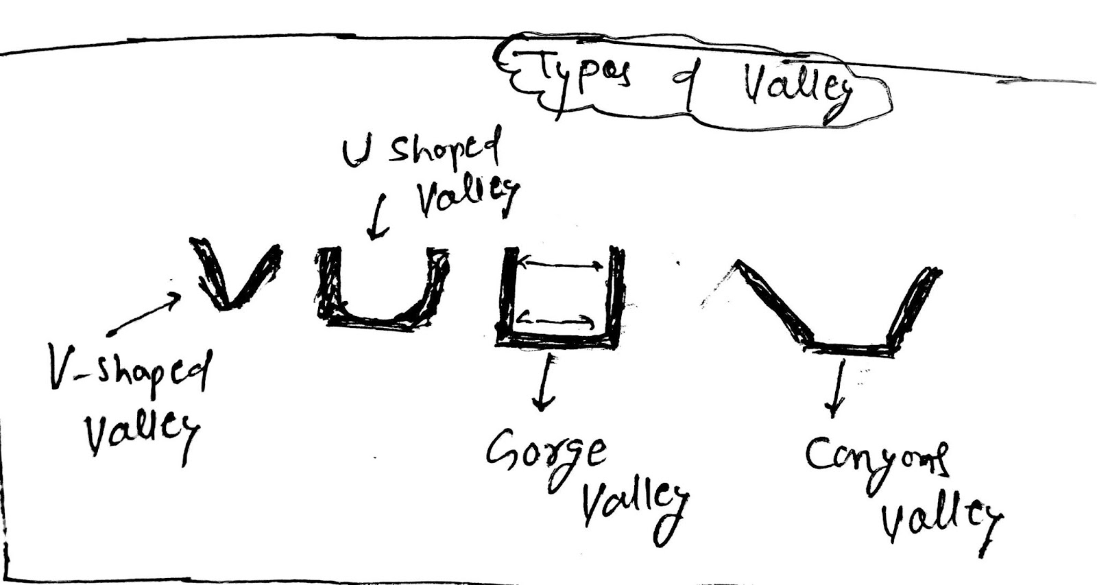
- V-shaped valley
- U-shaped valley
- A gorge is a deep valley with very steep to straight sides (Figure 7.1). A gorge is almost equal in width at its top as well as its bottom
- A canyon is characterised by steep steplike side slopes (Figure 7.2) and may be as deep as a gorge. A canyon is wider at its top than at its bottom.
- In fact, a canyon is a variant of gorge
- Valley types depend upon the type and structure of rocks in which they form
- For example, canyons commonly form in horizontal bedded sedimentary rocks and gorges form in hard rocks
-
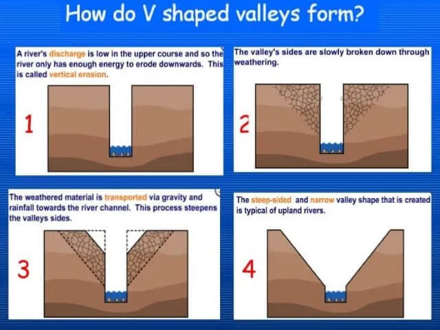
- Potholes and plunge pools
-
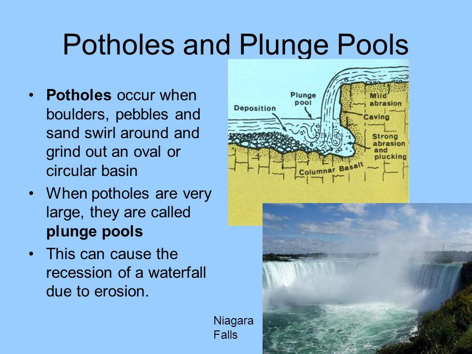
- Over the rocky beds of hill-streams more or less circular depressions called potholes form because of stream erosion aided by the abrasion of rock fragments
- Once a small and shallow depression forms, pebbles and boulders get collected in those depressions and get rotated by flowing water and consequently the depressions grow in dimensions
- A series of such depressions eventually join and the stream valley gets deepened
- At the foot of waterfalls also, large potholes, quite deep and wide, form because of the sheer impact of water and rotation of boulders
- Such large and deep holes at the base of waterfalls are called plunge pools
- Incised or entrenched meanders
-
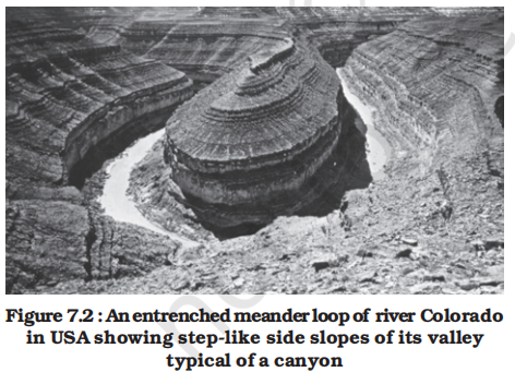
-
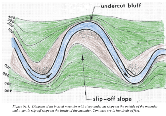
- In streams that flow rapidly over steep gradients, normally erosion is concentrated on the bottom of the stream channel
- Also, in the case of steep gradient streams, lateral erosion on the sides of the valleys is not much when compared to the streams flowing on low and gentle slopes
- Because of active lateral erosion, streams flowing over gentle slopes, develop sinuous [having many curves and turns] or meandering courses
- It is common to find meandering courses over floodplains and delta plains where stream gradients are very gentle
- But very deep and wide meanders can also be found cut in hard rocks, such meanders are called incised or entrenched meanders (Figure 7.2)
- River terraces
-
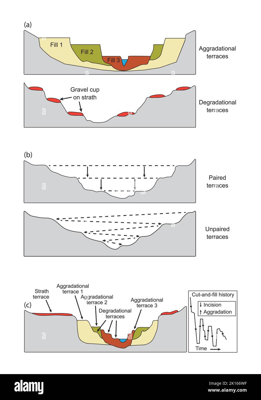
- River terraces are surfaces marking old valley floor or floodplain levels
- They may be bedrock surfaces without any alluvial cover or alluvial terraces consisting of stream deposits
- River terraces are basically products of erosion as they result due to vertical erosion by the stream into its own depositional floodplain
- There can be a number of such terraces at different heights indicating former river bed levels
- The river terraces may occur at the same elevation on either side of the rivers in which case they are called paired terraces
- Depositional landforms
- Alluvial fans
-
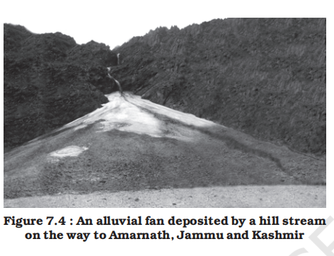
-
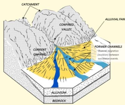
- Alluvial fans (Figure 7.4) are formed when streams flowing from higher levels break into foot slope plains of low gradient
- Normally very coarse load is carried by streams flowing over mountain slopes
- This load becomes too heavy for the streams to be carried over gentler gradients and gets dumped and spread as a broad low to high cone shaped deposit called alluvial fan
- Usually, the streams which flow over fans are not confined to their original channels for long and shift their position across the fan forming many channels called distributaries
- Alluvial fans in humid areas show normally low cones with gentle slope from head to toe and they appear as high cones with steep slope in arid and semi-arid climates
- Deltas
-
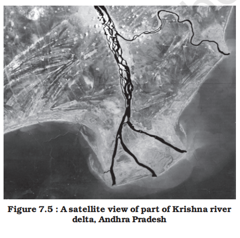
-
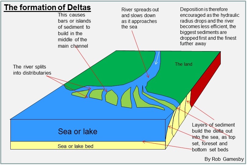
- Deltas are like alluvial fans but develop at a different location
- The load carried by the rivers is dumped and spread into the sea
- If this load is not carried away far into the sea or distributed along the coast, it spreads and accumulates as a low cone
- Unlike in alluvial fans, the deposits making up deltas are very well sorted with clear stratification [the arrangement or classification of something into different groups]
- The coarsest materials settle out first and the finer fractions like silts and clays are carried out into the sea
- As the delta grows, the river distributaries continue to increase in length (Figure 7.5) and delta continues to build up into the sea
- Types of delta
-
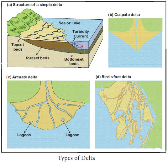
- Floodplains, natural levees and point bars
-
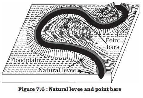
-
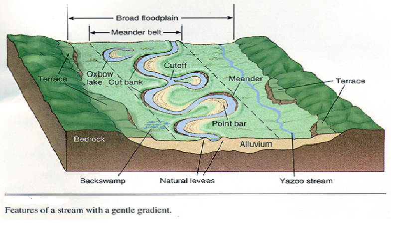
- Floodplains
- Deposition develops a floodplain just as erosion makes valleys
- Floodplain is a major landform of river deposition
- Large sized materials are deposited first when stream channel breaks into a gentle slope
- Thus, normally, fine sized materials like sand, silt and clay are carried by relatively slow moving waters in gentler channels usually found in the plains and deposited over the bed and when the waters spill over the banks during flooding above the bed
- A river bed made of river deposits is the active floodplain
- The floodplain above the bank is inactive floodplain
- Inactive floodplain above the banks basically contain two types of deposits
- Flood deposits
- Channel deposits
- In plains, channels shift laterally and change their courses occasionally leaving cut-off courses which get filled up gradually [slowly]
- Such areas over flood plains built up by abandoned or cut-off channels contain coarse deposits
- The flood deposits of spilled waters carry relatively finer materials like silt and clay
- The flood plains in a delta are called delta plains
- Natural levees and point bars (Figure 7.6) are some of the important landforms found associated with floodplains
- Natural levees
- Natural levees are found along the banks of large rivers
- They are low, linear and parallel ridges of coarse deposits along the banks of rivers, quite often cut into individual mounds
- Point bars
- Point bars are also known as meander bars
- They are found on the concave side of meanders of large rivers and are sediments deposited in a linear fashion by flowing waters along the bank
- They are almost uniform in profile and in width and contain mixed sizes of sediments
- In what way do natural levees differ from point bars?
-
| Feature |
Natural Levees |
Point Bars |
| Location |
Along the riverbanks on the floodplain |
On the inner side of meander bends |
| Formation Process |
Formed by deposition during floods when river overflows and deposits coarser sediments near banks |
Formed by slow-flowing water depositing sediments on the inside curve of a river bend |
| Composition |
Mainly silt and sand |
Sand, gravel, and fine sediments |
| Function |
Act as natural embankments, reducing minor flooding |
Temporary depositional features that change with river flow |
| Shape |
Broad and gently sloping away from the river |
Crescent-shaped or scroll-like |
- Meanders
-
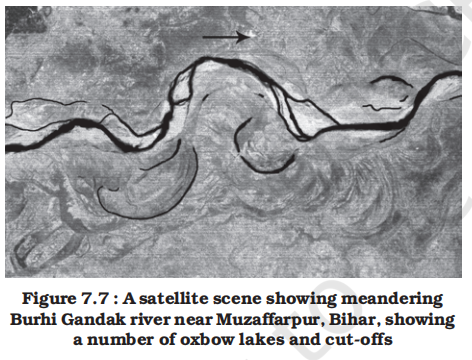
-
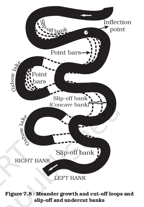
- In large flood and delta plains, rivers rarely flow in straight courses
- Loop-like channel patterns called meanders develop over flood and delta plains (Figure 7.7)
- Meander is not a landform but is only a type of channel pattern, this is because of:
- Propensity [tendency] of water flowing over very gentle gradients to work laterally on the banks
- Unconsolidated nature of alluvial deposits making up the banks with many irregularities which can be used by water exerting pressure laterally
- Coriolis force acting on the fluid water deflecting it like it deflects the wind
- When the gradient of the channel becomes extremely low, water flows leisurely [relaxed] and starts working laterally
- Slight irregularities along the banks slowly get transformed into a small curvature in the banks; the curvature deepens due to deposition on the inside of the curve and erosion along the bank on the outside
- If there is no deposition and no erosion or undercutting, the tendency to meander is reduced
- Normally, in meanders of large rivers, there is active deposition along the concave bank and undercutting along the convex bank
- The concave bank is known as cut-off bank which shows up as a steep scarp and the convex bank presents a long, gentle profile (Figure 7.8)
- As meanders grow into deep loops, the same may get cut-off due to erosion at the inflection points and are left as ox-bow lakes
- Groundwater
-
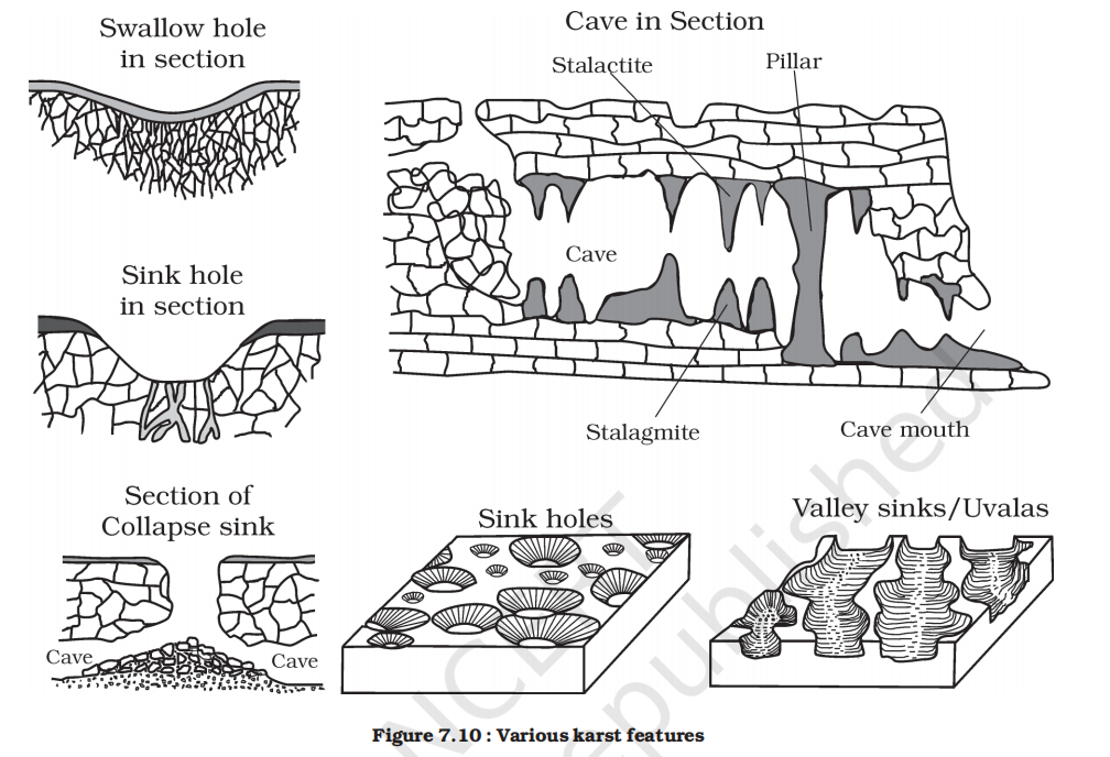
-
- Overview
- Here the interest is not on groundwater as a resource
- Our focus is on the work of groundwater in the erosion of landmasses and evolution of landforms
- The surface water percolates [filter gradually through a porous surface] well when the rocks are permeable, thinly bedded and highly jointed and cracked
- After vertically going down to some depth, the water under the ground flows horizontally through the bedding planes, joints or through the materials themselves
- It is this downward and horizontal movement of water which causes the rocks to erode
- Physical or mechanical removal of materials by moving groundwater is insignificant in developing landforms
- That is why, the results of the work of groundwater cannot be seen in all types of rocks
- But in rocks like limestones or dolomites rich in calcium carbonate, the surface water as well as groundwater through the chemical process of solution and precipitation deposition develop varieties of landforms
- These two processes of solution and precipitation are active in limestones or dolomites occurring either exclusively or interbedded with other rocks
- Any limestone or dolomitic region showing typical landforms produced by the action of groundwater through the processes of solution and deposition is called Karst topography after the typical topography developed in limestone rocks of Karst region in the Balkans adjacent to Adriatic sea
- The karst topography is also characterised by erosional and depositional landforms
- Erosional landforms
- Pools, sinkholes, lapies and limestone pavements
- Small to medium sized round to sub-rounded shallow depressions called swallow holes form on the surface of limestones through solution
- Sinkholes are very common in limestone/karst areas
- A sinkhole is an opening more or less circular at the top and funnel-shaped towards the bottom with sizes varying in area from a few sq. m to a hectare and with depth from a less than half a metre to thirty metres or more
- Some of these form solely through solution action (solution sinks) and others might start as solution forms first and if the bottom of a sinkhole forms the roof of a void or cave underground, it might collapse leaving a large hole opening into a cave or a void below (collapse sinks)
- Quite often, sinkholes are covered up with soil mantle and appear as shallow water pools
- Anybody stepping over such pools would go down like it happens in quicksands in deserts
- The term doline is sometimes used to refer the collapse sinks
- Solution sinks are more common than collapse sinks
- Quite often the surface runoff simply goes down swallow and sink holes and flow as underground streams and re-emerge at a distance downstream through a cave opening
- When sink holes and dolines join together because of slumping of materials along their margins or due to roof collapse of caves, long, narrow to wide trenches called valley sinks or Uvalas form
- Gradually, most of the surface of the limestone is eaten away by these pits and trenches, leaving it extremely irregular with a maze of points, grooves and ridges or lapies
- Especially, these ridges or lapies form due to differential solution activity along parallel to sub-parallel joints
- The lapie field may eventually turn into somewhat smooth limestone pavements
- Caves
- In areas where there are alternating beds of rocks (shales, sandstones, quartzites) with limestones or dolomites in between or in areas where limestones are dense, massive and occurring as thick beds, cave formation is prominent
- Water percolates [filter gradually through a porous surface] down either through the materials or through cracks and joints and moves horizontally along bedding planes
- It is along these bedding planes that the limestone dissolves and long and narrow to wide gaps called caves result
- There can be a maze of caves at different elevations depending upon the limestone beds and intervening rocks
- Caves normally have an opening through which cave streams are discharged
- Caves having openings at both the ends are called tunnels
- Depositional landforms
- Overview
- Many depositional forms develop within the limestone caves
- The chief chemical in limestone is calcium carbonate which is easily soluble in carbonated water (carbon dioxide absorbed rainwater)
- This calcium carbonate is deposited when the water carrying it in solution evaporates or loses its carbon dioxide as it trickles over rough rock surfaces
- Stalactites, stalagmites and pillars
-
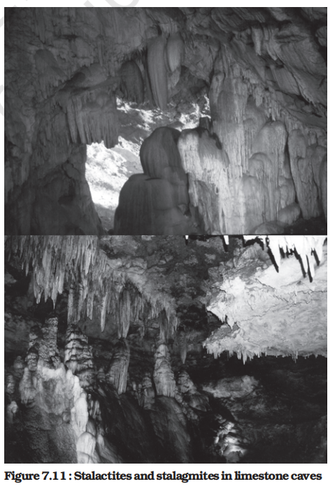
- Stalactites hang as icicles of different diameters
- Normally they are broad at their bases and taper towards the free ends showing up in a variety of forms
- Stalagmites rise up from the floor of the caves
- In fact, stalagmites form due to dripping water from the surface or through the thin pipe, of the stalactite, immediately below it (Figure 7.11)
- Stalagmites may take the shape of a column, a disc, with either a smooth, rounded bulging end or a miniature crater like depression
- The stalagmite and stalactites eventually fuse to give rise to columns and pillars of different diameters
- Glaciers
-
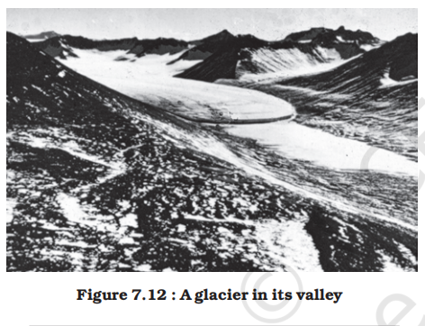
- Overview
- Masses of ice moving as sheets over the land (continental glacier or piedmont glacier if a vast sheet of ice is spread over the plains at the foot of mountains) or as linear flows down the slopes of mountains in broad trough-like valleys (mountain and valley glaciers) are called glaciers (Figure 7.12)
- The movement of glaciers is slow unlike water flow
- The movement could be a few centimetres to a few metres a day or even less or more
- Glaciers move basically because of the force of gravity
- We have many glaciers in our country moving down the slopes and valleys in Himalayas
- Higher reaches of Uttaranchal, Himachal Pradesh and Jammu and Kashmir, are places to see some of them
- Do you know where one can see river Bhagirathi is basically fed by meltwaters from under the snout [the projecting nose or mouth of an animal] (Gaumukh) of the Gangotri glacier
- In fact, Alkapuri glacier feeds waters to Alakananda river
- Rivers Alkananda and Bhagirathi join to make river Ganga near Deoprayag
- Erosion by glaciers is tremendous [enormous / colossal / very great] because of friction caused by sheer weight of the ice
- The material plucked from the land by glaciers (usually large-sized angular blocks and fragments) get dragged along the floors or sides of the valleys and cause great damage through abrasion and plucking
- Glaciers can cause significant damage to even unweathered rocks and can reduce high mountains into low hills and plains
- As glaciers continue to move, debris gets removed, divides get lowered and eventually the slope is reduced to such an extent that glaciers will stop moving leaving only a mass of low hills and vast outwash plains along with other depositional features
- Figures 7.13 and 7.14 show various glacial erosional and depositional forms described in the text
- Erosional landforms
-
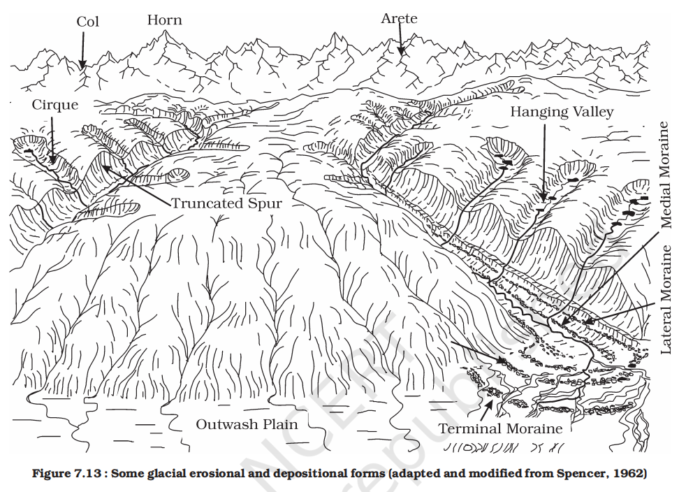
-
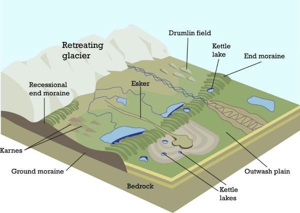
- Cirque
- Cirques are the most common of landforms in glaciated mountains
- The cirques quite often are found at the heads of glacial valleys
- The accumulated ice cuts these cirques while moving down the mountain tops
- They are deep, long and wide troughs or basins with very steep concave to vertically dropping high walls at its head as well as sides
- A lake of water can be seen quite often within the cirques after the glacier disappears, such lakes are called cirque or tarn lakes
- There can be two or more cirques one leading into another down below in a stepped sequence
- Horns and serrated ridges
- Horns form through head ward erosion of the cirque walls
- If three or more radiating glaciers cut headward until their cirques meet, high, sharp pointed and steep sided peaks called horns form
- The divides between cirque side walls or head walls get narrow because of progressive erosion and turn into serrated or saw-toothed ridges sometimes referred to as arêtes with very sharp crest and a zig-zag outline
- The highest peak in the Alps, Matterhorn and the highest peak in the Himalayas, Everest are in fact horns formed through headward erosion of radiating cirques
- Glacial valleys/troughs
- Glaciated valleys are trough-like and U shaped with broad floors and relatively smooth, and steep sides
- The valleys may contain littered debris or debris shaped as moraines with swampy appearance
- There may be lakes gouged [scoop out / excavate] out of rocky floor or formed by debris within the valleys
- There can be hanging valleys at an elevation on one or both sides of the main glacial valley
- A hanging valley is a tributary valley whose floor is located at a higher elevation than the floor of the main, larger valley
- The faces of divides or spurs of such hanging valleys opening into main glacial valleys are quite often truncated [shorten in duration or extend] to give them an appearance like triangular facets [one side of many sided]
- Very deep glacial troughs [long, narrow, open body or container for animals to drink] filled with sea water and making up shorelines (in high latitudes) are called fjords/fiords
- What are the basic differences between glacial valleys and river valleys?
-
| Feature |
Glacial Valley |
River Valley |
| Shape |
U-shaped |
V-shaped |
| Formation Agent |
Glaciers (moving ice) |
Rivers (flowing water) |
| Erosion Type |
Plucking and abrasion by ice |
Downcutting by water flow |
| Valley Sides |
Steep and straight |
Steep but more angular |
| Location |
Typically in high mountains and polar areas |
Found in most terrains |
| Examples |
Valleys in the Alps, Himalayas (e.g., Pindari Glacier) |
Ganga Valley, Indus Valley |
- Depositional landforms
-
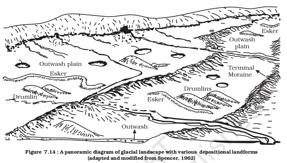
-
- Overview
- The unassorted [not having been grouped or categorized] coarse [rough or harsh in texture / consisting of large grains] and fine [thin / small/ good quality] debris [waste / scattered pieces of rubbish or remains] dropped by the melting glaciers is called glacial till
- Most of the rock fragments in till are angular to sub-angular in form
- Streams form by melting ice at the bottom, sides or lower ends of glaciers
- Some amount of rock debris small enough to be carried by such melt-water streams is washed down and deposited
- Such glacio-fluvial deposits are called outwash deposits
- Unlike till deposits, the outwash deposits are roughly stratified [formed or arranged into strata or layers] and assorted [of various sorts put together]
- The rock fragments in outwash deposits are somewhat rounded at their edges
- Figure 7.14 shows a few depositional landforms commonly found in glaciated areas
- Moraines
-
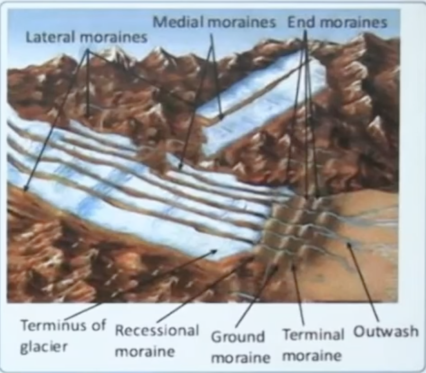
- They are long ridges of deposits of glacial till. Deposition occurs due to melting of ice, not velocity loss like in the case of a river.
- Terminal moraines are long ridges of debris deposited at the end (toe) of the glaciers
- Lateral moraines form along the sides parallel to the glacial valleys
- The lateral moraines may join a terminal moraine forming a horse-shoe shaped ridge (Fig. 7.13)
- There can be many lateral moraines on either side in a glacial valley
- These moraines partly or fully owe their origin to glacio-fluvial waters pushing up materials to the sides of glaciers
- Many valley glaciers retreating rapidly leave an irregular sheet of till over their valley floors
- Such deposits varying greatly in thickness and in surface topography are called ground moraines
- The moraine in the centre of the glacial valley flanked by lateral moraines is called medial moraine
- They are imperfectly formed as compared to lateral moraines
- Sometimes medial moraines are indistinguishable from ground moraines
- Eskers
- When glaciers melt in summer, the water flows on the surface of the ice or seeps down along the margins or even moves through holes in the ice
- These waters accumulate beneath the glacier and flow like streams in a channel beneath the ice
- Such streams flow over the ground (not in a valley cut in the ground) with ice forming its banks
- Very coarse materials like boulders and blocks along with some minor fractions of rock debris carried into this stream settle in the valley of ice beneath the glacier and after the ice melts can be found as a sinuous [having many curves and turns] ridge called esker
- Outwash plains
- The plains at the foot of the glacial mountains or beyond the limits of continental ice sheets are covered with glacio-fluvial deposits in the form of broad flat alluvial fans which may join to form outwash plains of gravel, silt, sand and clay
- Distinguish between river alluvial plains and glacial outwash plains
| Basis |
River Alluvial Plains |
Glacial Outwash Plains |
| Agent of formation |
Rivers |
Glaciers (meltwater) |
| Mode of deposition |
Overbank flooding and river deposition |
Deposition by meltwater streams beyond glacier front |
| Nature of sediments |
Fine sediments (silt, clay, fine sand) |
Coarse sediments (sand and gravel) |
| Sorting of material |
Moderately to well sorted |
Well sorted |
| Fertility |
Highly fertile |
Less fertile |
| Relief |
Very flat and low-lying |
Gently sloping, uneven |
| Typical location |
Along river floodplains |
In front of retreating glaciers |
| Associated landforms |
Meanders, oxbow lakes, natural levees |
Eskers, kettles, braided channels |
| Example |
Indo-Gangetic Plain |
Outwash plains of Canada |
- Drumlins
- Drumlins are smooth oval shaped ridge-like features composed mainly of glacial till with some masses of gravel and sand
- The long axes of drumlins are parallel to the direction of ice movement
- They may measure up to 1 km in length and 30 m or so in height
- One end of the drumlins facing the glacier called the stoss end is blunter and steeper than the other end called tail
- The drumlins form due to dumping of rock debris beneath heavily loaded ice through fissures in the glacier
- The stoss end gets blunted due to pushing by moving ice
- Drumlins give an indication of direction of glacier movement
- What is the difference between till and alluvium?
-
| Feature |
Till |
Alluvium |
| Origin |
Deposited directly by glaciers |
Deposited by rivers or running water |
| Sorting |
Unsorted and unstratified (contains mixed sizes of particles) |
Well-sorted and stratified (layered by particle size) |
| Material Composition |
Clay, sand, gravel, boulders mixed randomly |
Sand, silt, clay, and fine sediments |
| Depositional Environment |
Glacial (continental or alpine glaciers) |
Fluvial (rivers, floodplains, deltas) |
| Appearance |
Heterogeneous and rough |
Homogeneous and layered |
- Waves and currents
- Overview
- Coastal processes are the most dynamic and hence most destructive
- So, don’t you think it is important to know about the coastal processes and forms?
- Some of the changes along the coasts take place very fast
- At one place, there can be erosion in one season and deposition in another
- Most of the changes along the coasts are accomplished by waves
- When waves break, the water is thrown with great force onto the shore, and simultaneously, there is a great churning [move or cause to move about vigorously] of sediments on the sea bottom
- Constant impact of breaking waves drastically affects the coasts
- Storm waves and tsunami waves can cause far-reaching changes in a short period of time than normal breaking waves
- As wave environment changes, the intensity of the force of breaking waves changes
- Do you know about the generating forces behind waves and currents? If not, refer to the chapter on movements in ocean waters
- Other than the action of waves, the coastal landforms depend upon:
- The configuration of land and sea floor
- Whether the coast is advancing (emerging) seaward or retreating (submerging) landward
- Assuming sea level to be constant, two types of coasts are considered to explain the concept of evolution of coastal landforms:
- High, rocky coasts (submerged coasts)
- Low, smooth and gently sloping sedimentary coasts
-
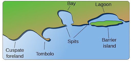
- High rocky coasts
- Along the high rocky coasts, the rivers appear to have been drowned with highly irregular coastline
- The coastline appears highly indented [move further from margin] with extension of water into the land where glacial valleys (fjords) are present
- The hill sides drop off sharply into the water
- Shores do not show any depositional landforms initially
- Erosion features dominate
- Along high rocky coasts, waves break with great force against the land shaping the hill sides into cliffs
- With constant pounding by waves, the cliffs recede leaving a wave-cut platform in front of the sea cliff
- Waves gradually minimise the irregularities along the shore
- The materials which fall off, and removed from the sea cliffs, gradually break into smaller fragments and roll to roundness, will get deposited in the offshore
- After a considerable period of cliff development and retreat when coastline turns somewhat smooth, with the addition of some more material to this deposit in the offshore, a wave-built terrace would develop in front of wave-cut terrace
- As the erosion along the coast takes place a good supply material becomes available to longshore currents and waves to deposit them as beaches along the shore and as bars (long ridges of sand and/or shingle parallel to the coast) in the nearshore zone
- Bars are submerged features and when bars show up above water, they are called barrier bars
- Barrier bar which get keyed up to the headland of a bay is called a spit
- When barrier bars and spits form at the mouth of a bay and block it, a lagoon forms
- The lagoons would gradually get filled up by sediments from the land giving rise to a coastal plain
- Low sedimentary coasts
- Along low sedimentary coasts the rivers appear to extend their length by building coastal plains and deltas
- The coastline appears smooth with occasional incursions of water in the form of lagoons and tidal creeks
- The land slopes gently into the water
- Marshes and swamps may abound along the coasts
- Depositional features dominate
- When waves break over a gently sloping sedimentary coast, the bottom sediments get churned and move readily building bars, barrier bars, spits and lagoons
- Lagoons would eventually turn into a swamp which would subsequently turn into a coastal plain
- The maintenance of these depositional features depends upon the steady supply of materials
- Storm and tsunami waves cause drastic changes irrespective of supply of sediments
- Large rivers which bring lots of sediments build deltas along low sedimentary coasts
- The west coast of our country is a high rocky retreating coast
- Erosional forms dominate in the west coast
- The east coast of India is a low sedimentary coast
- Depositional forms dominate in the east coast
- What are the various differences between a high rocky coast and a low sedimentary coast in terms of processes and landforms?
-
| Feature |
High Rocky Coast |
Low Sedimentary Coast |
| Elevation |
Steep, elevated cliffs and headlands |
Low-lying, flat terrain near sea level |
| Material Composition |
Hard rocks like granite, basalt |
Loose sediments like sand, silt, clay |
| Dominant Process |
Marine erosion (abrasion, hydraulic action) |
Marine deposition (along with minor erosion) |
| Landforms |
Cliffs, wave-cut platforms, sea caves, arches, stacks |
Beaches, spits, bars, lagoons, dunes |
| Stability |
More stable and resistant to rapid change |
Highly dynamic, changes quickly due to deposition and erosion |
| Examples |
Western coasts of India (Konkan coast), British Isles |
Eastern coasts of India (Coromandel coast), Nile Delta |
- Erosional landforms
-
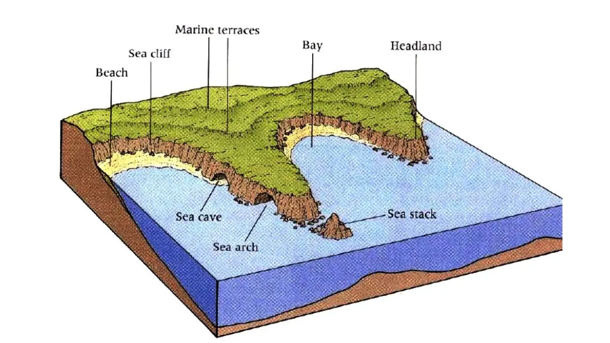
- Cliffs, terraces, caves and stacks
- Wave-cut cliffs and terraces are two forms usually found where erosion is the dominant shore process
- Almost all sea cliffs are steep and may range from a few m to 30 m or even more
- At the foot of such cliffs there may be a flat or gently sloping platform covered by rock debris derived from the sea cliff behind, such platforms occurring at elevations above the average height of waves is called a wave-cut terrace
- The lashing of waves against the base of the cliff and the rock debris that gets smashed against the cliff along with lashing waves create hollows and these hollows get widened and deepened to form sea caves
- The roofs of caves collapse and the sea cliffs recede further inland, retreat of the cliff may leave some remnants of rock standing isolated as small islands just off the shore, such resistant masses of rock, originally parts of a cliff or hill are called sea stacks
- Like all other features, sea stacks are also temporary and eventually coastal hills and cliffs will disappear because of wave erosion giving rise to narrow coastal plains, and with onrush of deposits from over the land behind may get covered up by alluvium or may get covered up by shingle or sand to form a wide beach
- Depositional landforms
-
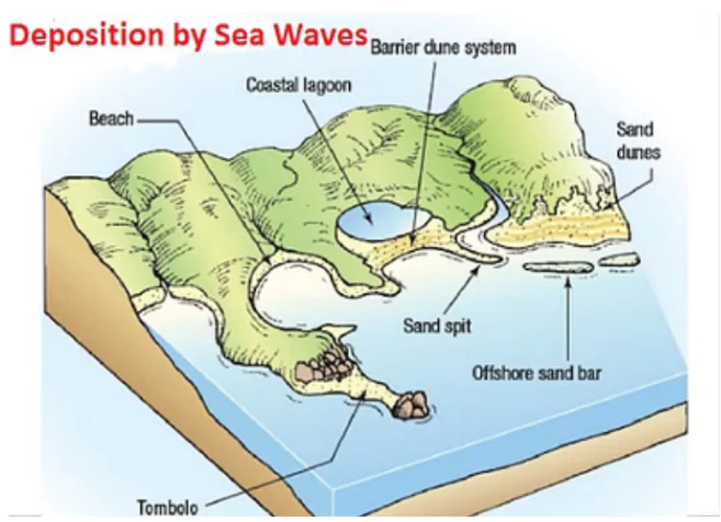
- Beaches and dunes
- Beaches are characteristic of shorelines that are dominated by deposition, but may occur as patches along even the rugged [having broken, rocky or uneven surface] shores [the land along the edge of a water body]
- Most of the sediment making up the beaches comes from land carried by the streams and rivers or from wave erosion
- Beaches are temporary features
- The sandy beach which appears so permanent may be reduced to a very narrow strip of coarse pebbles in some other season
- Most of the beaches are made up of sand sized materials
- Beaches called shingle beaches contain excessively small pebbles and even cobbles
- Just behind the beach, the sands lifted and winnowed [blow] from over the beach surfaces will be deposited as sand dunes
- Sand dunes forming long ridges parallel to the coastline are very common along low sedimentary coasts
- Bars, barriers and spits
-
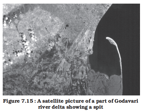
- A ridge of sand and shingle formed in the sea in the off-shore zone (from the position of low tide waterline to seaward) lying approximately parallel to the coast is called an off-shore bar
- An off-shore bar which is exposed due to further addition of sand is termed a barrier bar
- The off-shore bars and barriers commonly form across the mouth of a river or at the entrance of a bay
- Sometimes such barrier bars get keyed up to one end of the bay when they are called spits (Figure 7.15)
- Spits may also develop attached to headlands/hills
- The barriers, bars and spits at the mouth of the bay gradually extend leaving only a small opening of the bay into the sea and the bay will eventually develop into a lagoon
- The lagoons get filled up gradually by sediment coming from the land or from the beach itself (aided by wind) and a broad and wide coastal plain may develop replacing a lagoon
- Do you know, the coastal off-shore bars offer the first buffer or defence against storm or tsunami by absorbing most of their destructive force
- Then come the barriers, beaches, beach dunes and mangroves, if any, to absorb the destructive force of storm and tsunami waves
- So, if we do anything which disturbs the ‘sediment budget’ and the mangroves along the coast, these coastal forms will get eroded away leaving human habitations to bear first strike of storm and tsunami waves
- Winds
- Overview
- Wind is one of the two dominant agents in hot deserts
- The desert floors get heated up too much and too quickly because of being dry and barren
- The heated floors heat up the air directly above them and result in upward movements in the hot lighter air with turbulence [violent or unsteady movement of air, water or other liquid], and any obstructions in its path sets up eddies, whirlwinds, updrafts and downdrafts
- Winds also move along the desert floors with great speed and the obstructions in their path create turbulence
- Of course, there are storm winds which are very destructive
- Winds cause deflation, abrasion and impact
- Deflation includes lifting and removal of dust and smaller particles from the surface of rocks
- In the transportation process sand and silt act as effective tools to abrade the land surface
- The impact is simply sheer force of momentum which occurs when sand is blown into or against a rock surface
- It is similar to sandblasting operation
- The wind action creates a number of interesting erosional and depositional features in the deserts
- In fact, many features of deserts owe their formation to mass wasting and running water as sheet floods
- Though rain is scarce in deserts, it comes down torrentially in a short period of time
- The desert rocks devoid [lacking] of vegetation, exposed to mechanical and chemical weathering processes due to drastic [extreme / serious / far-reaching] diurnal [of or during the day / daily / everyday] temperature changes, decay faster and the torrential [heavy / relentless / violent] rains help in removing the weathered materials easily
- That means, the weathered debris in deserts is moved by not only wind but also by rain/sheet wash
- The wind moves fine materials and general mass erosion is accomplished mainly through sheet floods or sheet wash
- Stream channels in desert areas are broad, smooth and indefinite and flow for a brief time after rains
- Erosional landforms
-
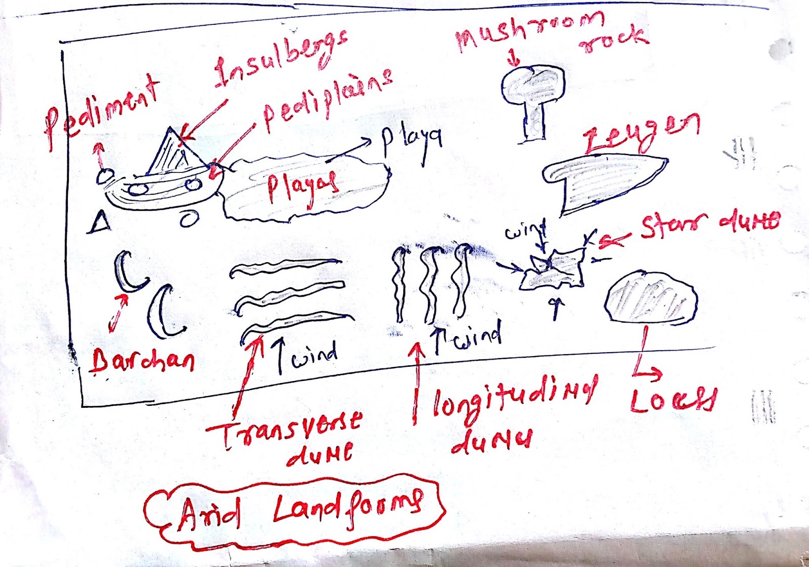
- Pediments and pediplains
- Landscape evolution in deserts is primarily concerned with the formation and extension of pediments
- Gently inclined rocky floors close to the mountains at their foot with or without a thin cover of debris, are called pediments
- Such rocky floors form through the erosion of mountain front through a combination of lateral erosion by streams and sheet flooding
- Erosion starts along the steep margins of the landmass or the steep sides of the tectonically controlled steep incision features over the landmass
- Once, pediments are formed with a steep wash slope followed by cliff or free face above it, the steep wash slope and free face retreat backwards
- This method of erosion is termed as parallel retreat of slopes through backwasting
- So, through parallel retreat of slopes, the pediments extend backwards at the expense of mountain front, and gradually, the mountain gets reduced leaving an inselberg [an isolated hill or mountain rising abruptly from a plain] which is a remnant of the mountain
- That’s how the high relief in desert areas is reduced to low featureless plains called pediplains
- Playas
- Plains are by far the most prominent landforms in the deserts
- In basins with mountains and hills around and along, the drainage is towards the centre of the basin and due to gradual deposition of sediment from basin margins, a nearly level plain forms at the centre of the basin, in times of sufficient water, this plain is covered up by a shallow water body
- Such types of shallow lakes are called as playas where water is retained only for short duration due to evaporation and quite often the playas contain good deposition of salts
- The playa plain covered up by salts is called alkali flats
- Deflation hollows and caves
- Weathered mantle from over the rocks or bare soil, gets blown out by persistent movement of wind currents in one direction. This process may create shallow depressions called deflation hollows
- Deflation also creates numerous small pits or cavities over rock surfaces
- The rock faces suffer impact and abrasion of wind-borne sand and first shallow depressions called blow outs are created, and some of the blow outs become deeper and wider fit to be called caves
- Mushroom, table and pedestal rocks
- Many rock-outcrops in the deserts easily susceptible to wind deflation and abrasion are worn out quickly leaving some remnants of resistant rocks polished beautifully in the shape of mushroom with a slender [gracefully thin] stalk [the main stem of herbacious plant] and a broad and rounded pear shaped cap above
- Sometimes, the top surface is broad like a table top and quite often, the remnants stand out like pedestals
- List the erosional features carved out by wind action and action of sheet floods
- Depositional landforms
- Overview
- Wind is a good sorting agent
- Depending upon the velocity of wind, different sizes of grains are moved along the floors by rolling or saltation and carried in suspension and in this process of transportation itself, the materials get sorted
- When the wind slows or begins to die down, depending upon sizes of grains and their critical velocities, the grains will begin to settle
- So, in depositional landforms made by wind, good sorting of grains can be found
- Since wind is there everywhere and wherever there is good source of sand and with constant wind directions, depositional features in arid regions can develop anywhere
- Sand dunes
-

- Dry hot deserts are good places for sand dune formation
- Obstacles to initiate dune formation are equally important
- There can be a great variety of dune forms (Figure 7.16)
- Crescent shaped dunes called barchans with the points or wings directed away from wind direction i.e., downwind, form where the wind direction is constant and moderate and where the original surface over which sand is moving is almost uniform
- Parabolic dunes form when sandy surfaces are partially covered with vegetation
- That means parabolic dunes are reversed barchans with wind direction being the same
- Seif is similar to barchan with a small difference, seif has only one wing or point. This happens when there is shift in wind conditions
- The lone wings of seifs can grow very long and high
- Longitudinal dunes form when supply of sand is poor and wind direction is constant. They appear as long ridges of considerable length but low in height
- Transverse dunes are aligned perpendicular to wind direction. These dunes form when the wind direction is constant and the source of sand is an elongated feature at right angles to the wind direction. They may be very long and low in height
- When sand is plenty, quite often, the regular shaped dunes coalesce and lose their individual characteristics
- Most of the dunes in the deserts shift and a few of them will get stabilised especially near human habitations
Section: Climatology
- Composition and structure of atmosphere
- Introduction to the atmosphere
- Importance of air
- Can a person live without air?
- We eat food two - three times a day and drink water more frequently but breathe every few seconds
- Air is essential to the survival of all organisms
- Some organisms like humans may survive for some time without food and water but can’t survive even a few minutes without breathing air
- That shows the reason why we should understand the atmosphere in greater detail
- Characteristics of the atmosphere
- Atmosphere is a mixture of different gases and it envelopes [wrap] the earth all round
- It contains life-giving gases like oxygen for humans and animals and carbon dioxide for plants
- The air is an integral part of the earth’s mass and 99 per cent of the total mass of the atmosphere is confined [restricted / cramped] to the height of 32 km from the earth’s surface
- The air is colourless and odourless and can be felt only when it blows as wind
- Can you imagine what will happen to us in the absence of ozone in the atmosphere?
- The ozone layer absorbs about 97–99% of harmful ultraviolet (UV-B and UV-C) radiation from the Sun. Without it, this radiation would directly reach the Earth's surface in full intensity.
- Severe Health Impacts:
- Humans and animals would face increased risks of:
- Skin cancer (especially melanoma)
- Cataracts and other eye damage
- Weakened immune systems
- Ecological Disruption:
- Phytoplankton, the base of aquatic food chains, are highly sensitive to UV radiation. Their decline would disrupt entire marine ecosystems.
- Crops like wheat, rice, and soybeans would suffer lower yields due to DNA damage and reduced photosynthesis.
- Forests and natural vegetation could be damaged, affecting biodiversity.
- Climatic Effects:
- While ozone itself is a greenhouse gas in the troposphere, its absence in the stratosphere would alter temperature balance, affecting atmospheric circulation and weather patterns.
- Composition of the atmosphere
-
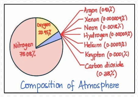
- Overview
- The atmosphere is composed of gases, water vapour and dust particles
- The proportion of gases changes in the higher layers of the atmosphere in such a way that oxygen will be almost in negligible quantity at the height of 120 km
- Similarly, carbon dioxide and water vapour are found only up to 90 km from the surface of the earth
- Composition
- The Earth's atmosphere is composed of a mixture of gases, primarily concentrated in the troposphere.
- These gases regulate Earth’s temperature, protect life from harmful solar radiation, and enable biological and chemical processes.
- These gases can be broadly divided into permanent and variable gases.
- Permanent Gases (remain constant in proportion):
- Nitrogen (N₂): ~78.08%
- Inert, non-reactive, crucial for plant growth through nitrogen cycle.
- Oxygen (O₂): ~20.95%
- Essential for respiration and combustion.
- Ozone is found between 10 and 50 km above the earth’s surface and acts as a filter and absorbs the ultra-violet rays radiating from the sun and prevents them from reaching the surface of the earth
- Argon (Ar): ~0.93%
- Inert noble gas, no known biological role.
- Others (Neon, Helium, Krypton, Hydrogen): ~0.01%
- Present in trace amounts with limited atmospheric roles.
- Variable Gases (vary in concentration and influence weather/climate):
- Carbon Dioxide (CO₂)
- ~0.041% (increasing due to human activity)
- Key greenhouse gas; essential for photosynthesis.
- Carbon dioxide is meteorologically a very important gas as it is transparent to the incoming solar radiation but opaque to the outgoing terrestrial radiation
- [Meteorologically : relating to the branch of science concerned with the processes and phenomena of the atmosphere, especially as a means of forecasting the weather]
- It absorbs a part of terrestrial radiation and reflects back some part of it towards the earth’s surface
- This has also increased the temperature of the air
- Water Vapor (H₂O):
- 0.1% to 4% (highly variable)
- Water vapour decreases with altitude
- In the warm and wet tropics, it may account for 4% of the air by volume, while in the dry and cold areas of desert and polar regions, it may be less than 1% of the air
- Water vapour also decreases from the equator towards the poles
- Influences weather patterns, clouds, and precipitation.
- It also absorbs parts of the insolation [the amount of solar radiation reaching a given area] from the sun and preserves the earth’s radiated heat
- It thus, acts like a blanket allowing the earth neither to become too cold nor too hot
- Ozone (O₃):
- Mostly in stratosphere; crucial for UV protection.
- It is between 20 km to 25 km altitude, where highest concentration of ozone is found
- Methane (CH₄):
- Trace amount (~1.9 ppm) but powerful greenhouse gas.
- Nitrous Oxide (N₂O):
- Greenhouse gas with agricultural sources.
- Particulates/Aerosols:
- Include dust, pollen, soot; impact weather and radiation.
- Atmosphere has a sufficient capacity to keep small solid particles, which may originate from different sources and include sea salts, fine soil, smoke-soot, ash, pollen, dust and disintegrated particles of meteors
- Dust particles are generally concentrated in the lower layers of the atmosphere; yet, convectional air currents may transport them to great heights
- The higher concentration of dust particles is found in subtropical and temperate [mild / pleasant] regions due to dry winds in comparison to equatorial and polar regions
- Dust and salt particles act as hygroscopic [tending to absord moisture from air] nuclei around which water vapour condenses to produce clouds
- Structure of the atmosphere
-
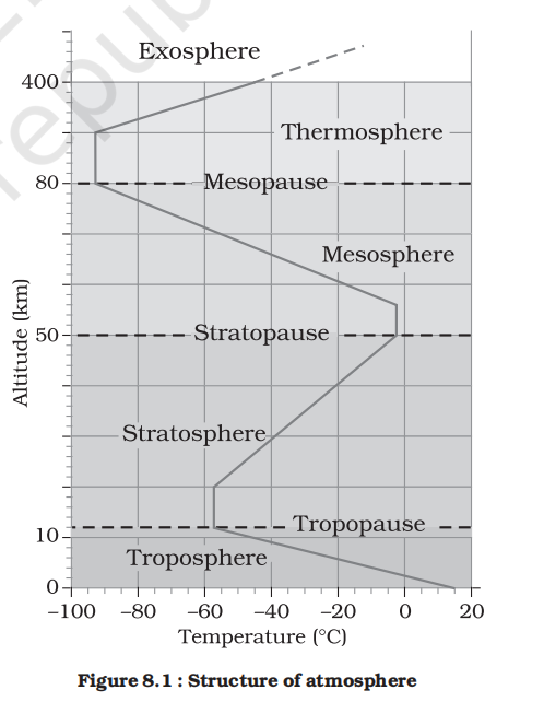
-
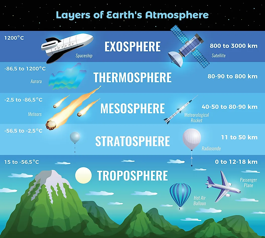
- Overview
- The atmosphere consists of different layers with varying density and temperature
- Density is highest near the surface of the earth and decreases with increasing altitude
- The column of atmosphere is divided into five different layers depending upon the temperature condition
1. Troposphere
- The troposphere is the lowermost layer of the atmosphere
- Its average height is 13 km and extends roughly to a height of 8 km near the poles and about 18 km at the equator
- Thickness of the troposphere is greatest at the equator because heat is transported to great heights by strong convectional currents
- As warm air rises, it carries heat and moisture upward into the atmosphere.
- The rising air pushes the tropopause (the upper boundary of the troposphere) higher, thereby increasing the vertical extent (thickness) of the troposphere.
- This layer contains dust particles and water vapour
- All changes in climate and weather take place in this layer
- The temperature in this layer decreases at the rate of 1°C for every 165m of height
- This is the most important layer for all biological activity
- Tropopause:
- The zone separating the troposphere from stratosphere is known as the tropopause
- The air temperature at the tropopause is about -80°C over the equator and about -45°C over the poles
- Why tropopause is colder at equator then at poles?
- The troposphere is much thicker over the equator, higher altitude -> thinner air -> colder than poles.
- The temperature here is nearly constant, and hence, it is called the tropopause
2. Stratosphere
- The stratosphere is found above the tropopause and extends up to a height of 50 km
- One important feature of the stratosphere is that it contains the ozone layer
- This layer absorbs ultra-violet radiation and shields life on the earth from intense, harmful form of energy
- Stratopause:
- The boundary between the stratosphere and mesosphere.
- The temperature stops increasing and begins to decrease as you move into the mesosphere.
- Marks the highest point of the stratosphere, and temperature begins to drop rapidly in the mesosphere.
3. Mesosphere
- The mesosphere lies above the stratosphere, which extends up to a height of 80 km
- In this layer, once again, temperature starts decreasing with the increase in altitude and reaches up to -100°C at the height of 80 km
- The upper limit of mesosphere is known as the mesopause
- Mesopause:
- The boundary between the mesosphere and thermosphere.
- The coldest part of the atmosphere.
- Marks the transition to the thermosphere, where temperatures start increasing with altitude.
4. Thermosphere
- Extends roughly from about 80 km to 400–600 km above the Earth.
- Temperature increases rapidly with height due to absorption of solar radiation.
- The ionosphere lies mainly within the thermosphere and partly overlaps the upper mesosphere.
- It contains ions and free electrons produced by solar ultraviolet and X-ray radiation.
- Certain radio waves transmitted from the Earth are reflected back by this region.
- Thermopause
- The boundary between the thermosphere and the exosphere.
- Atmospheric particles become extremely sparse and may escape into space.
- Temperature remains very high beyond this level, though heat content is negligible.
5. Exosphere
- The uppermost layer of the atmosphere above the thermosphere is known as the exosphere
- This is the highest layer but very little is known about it
- Whatever contents are there, these are extremely rarefied in this layer, and it gradually merges with the outer space
- Although all layers of the atmosphere must be exercising influence on us, geographers are concerned with the first two layers of the atmosphere
- The exosphere’s very high temperature (around 1,200°C) is a theoretical value derived from kinetic-energy formulas for individual gas molecules, but in physical reality the extremely low particle density means negligible heat content, and even direct exposure to solar radiation does not raise objects anywhere near such temperatures.
- This is same for thermosphere
- Ionization Zones:
- The ionosphere is an ionized region of the upper atmosphere, primarily located in the thermosphere, produced by solar ultraviolet and X-ray radiation.
- Elements of weather and climate
- The main elements of atmosphere which are subject to change and which influence human life on earth are temperature, pressure, winds, humidity, clouds and precipitation
- These elements have been dealt in detail in Chapters 9, 10 and 11
- Solar radiation, heat balance and temperature
- Introduction to the atmosphere and energy
- Overview
- We inhale and exhale but we feel the air when it is in motion
- It means air in motion is wind
- You have already learnt about the fact that earth is surrounded by air all around
- This envelop of air is atmosphere which is composed of numerous gases
- These gases support life over the earth’s surface
- The earth receives almost all of its energy from the sun
- The earth in turn radiates back to space the energy received from the sun
- As a result, the earth neither warms up nor does it get cooled over a period of time
- Thus, the amount of heat received by different parts of the earth is not the same
- This variation causes pressure differences in the atmosphere
- This leads to transfer of heat from one region to the other by winds
- This chapter explains the process of heating and cooling of the atmosphere and the resultant temperature distribution over the earth’s surface
- Solar radiation
- Overview
- The earth’s surface receives most of its energy in short wavelengths
- The energy received by the earth is known as incoming solar radiation which in short is termed as insolation
- The term do not refer for whole earch but an area
- As the earth is a geoid resembling a sphere, the sun’s rays fall obliquely [indirectly / at an angle] at the top of the atmosphere and the earth intercepts [obstruct in between from reaching destination] a very small portion of the sun’s energy
- Earth is called a geoid because its shape is best described as an irregular, undulating surface that represents the Earth's gravitational field at sea level.
- This shape is not a perfect sphere or ellipsoid, but rather a slightly flattened sphere with bumps and dips. This irregular shape arises from variations in the Earth's mass distribution and gravitational pull.
- On an average the earth receives 1.94 calories per sq. cm per minute at the top of its atmosphere
- Insolation
- Insolation is the amount of solar radiation received by a given area of the Earth's surface per unit time.
- Key Points:
- It stands for incoming solar radiation.
- Measured in watts per square meter (W/m²).
- Influences temperature, weather, and climate patterns.
- Affected by factors like latitude, time of day, season, and atmospheric conditions.
- Selective Absorption by Gases
- Gases in the atmosphere selectively absorb radiation.
- They are not efficient at absorbing shortwave solar radiation, but they efficiently absorb and re-emit longwave infrared radiation emitted by Earth.
- Wavelength Difference
- Incoming solar radiation (shortwave):
- Mostly visible light and UV rays (wavelength ~0.1 to 4 microns).
- These shortwaves pass through the atmosphere relatively easily because atmospheric gases are largely transparent to them.
- Outgoing terrestrial radiation (longwave):
- Earth emits energy as infrared radiation (wavelength ~4 to 100 microns).
- Atmospheric gases like carbon dioxide, water vapor, methane, and ozone are good absorbers of longwave radiation, so they trap and re-radiate this heat — this is the greenhouse effect.
- Why Earth emits longwave (infrared) radiation instead of shortwave?
- This is governed by Planck’s Law and Stefan-Boltzmann Law, which relate temperature to radiation wavelength.
- Hotter bodies emit shorter wavelengths while Cooler bodies emit longer wavelengths
- When an object gets hotter, the kinetic energy of its particles increases.
- These faster-moving particles cause electromagnetic oscillations with higher frequencies.
- Higher frequency = shorter wavelength
- Variations in solar output
- The solar output received at the top of the atmosphere varies slightly [to a small degree] in a year due to the variations in the distance between the earth and the sun
- During its revolution around the sun, the earth is farthest from the sun (152 million km) on 4th July
- This position of the earth is called aphelion
- On 3rd January, the earth is the nearest to the sun (147 million km)
- This position is called perihelion
- Therefore, the annual insolation [the amount of solar radiation reaching a given area] received by the earth on 3rd January is slightly more than the amount received on 4th July
- However, the effect of this variation in the solar output is masked by other factors like the distribution of land and sea and the atmospheric circulation
- Hence, this variation in the solar output does not have great effect on daily weather changes on the surface of the earth
- Common misconception about proximity to sun
- It’s a common misconception that the Earth’s closest approach to the Sun (perihelion) coincides with the coldest part of the year (winter) and the farthest point (aphelion) coincides with the hottest part of the year (summer), but the seasons are not caused by the Earth’s distance from the Sun.
- They are due to the tilt of the Earth’s axis relative to its orbit around the Sun.
- Despite being closer to the Sun at Perihelion, it is winter in the northern hemisphere. This happens because the Earth is tilted on its axis, and during this time, the northern hemisphere is tilted away from the Sun.
- Even though the Earth is farther from the Sun during Aphelion, it is summer in the northern hemisphere because the northern hemisphere is tilted toward the Sun.
- Seasons are caused by the tilt of Earth's axis (about 23.5 degrees) relative to the plane of its orbit, not the Earth’s distance from the Sun.
-
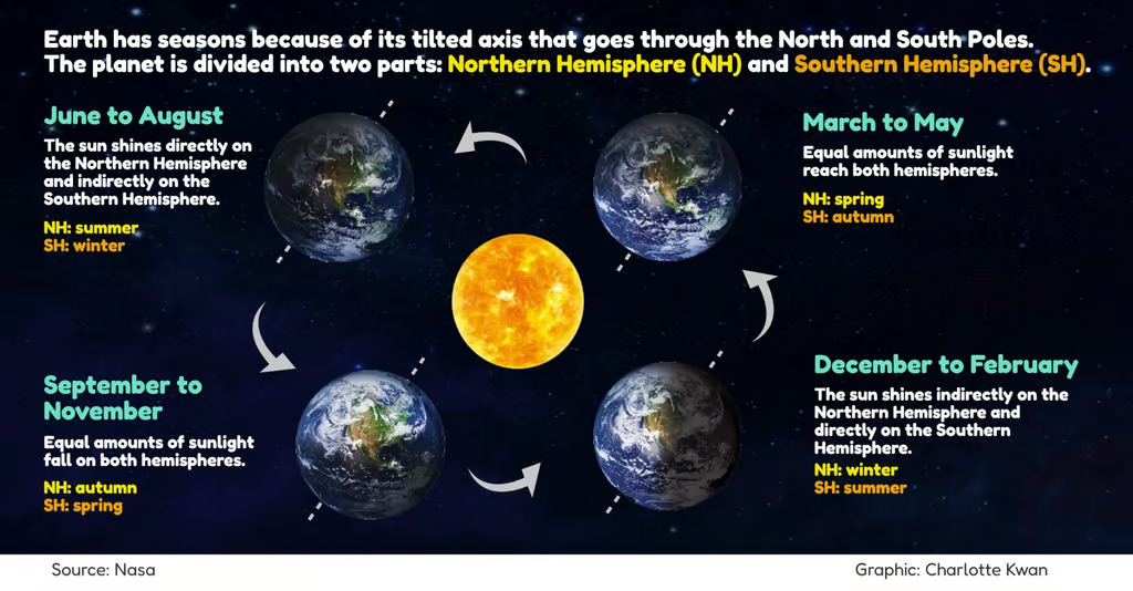
- Variability of insolation [the amount of solar radiation reaching a given area] at the surface of the earth
-
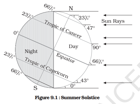
- Overview
- The amount and the intensity of insolation vary during a day, in a season and in a year
- Some factors that cause these variations in insolation are:
- The distance from the sun
- The rotation of earth on its axis
- The fact that the earth’s axis makes an angle of 66½ with the plane of its orbit round the sun has a greater influence on the amount of insolation received at different latitudes
- Angle of inclination of the Sun’s rays
- Depends on the latitude of a place due to the spherical shape of the Earth. As latitude increases, the Sun’s rays become more slanting.
- Vertical rays fall nearly perpendicular to the surface and cover a smaller area. Slant rays spread the same amount of energy over a larger area.
- Hence, energy received per unit area decreases due to slant rays.
- Additionally, slant rays pass through a greater thickness of the atmosphere.
- This leads to greater absorption, scattering, and diffusion of solar energy.
- As a result, higher latitudes receive less heat than lower latitudes.
- The length of the day
- Altitude
- At higher altitudes, the thinner atmosphere causes less absorption and scattering of solar radiation, slightly increasing direct insolation.
- The transparency of the atmosphere
- The configuration of land in terms of its aspect
- The last two however, have less influence
- The passage of solar radiation through the atmosphere
- The atmosphere is largely transparent to short wave solar radiation
- The incoming solar radiation passes through the atmosphere before striking the earth’s surface
- Within the troposphere water vapour, ozone and other gases absorb much of the near infrared radiation
- Very small-suspended particles in the troposphere scatter visible spectrum both to the space and towards the earth surface
- This process adds colour to the sky
-
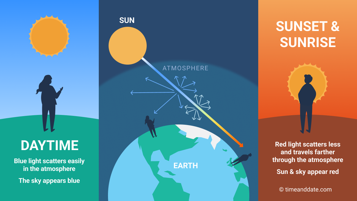
- Sunlight is white, made up of all colors of the visible spectrum.
- Blue color
- Blue light has a shorter wavelength, so it is scattered much more efficiently (about 10 times more) than red.
- Thus, when you look in any direction away from the Sun, the sky appears blue because blue light is scattered in all directions.
- Red or orange color
- At sunrise and sunset, sunlight has to travel a longer path through the atmosphere.
- Shorter wavelengths (blue and violet) are scattered out before the light reaches your eyes.
- The remaining light is red, orange, or yellow, which has longer wavelengths and is scattered less.
- White color of clouds
- Mie scattering occurs when the particles (like water droplets in clouds) are larger than the wavelength of light.
- This type of scattering does not favor any particular wavelength, so all colors scatter equally.
- When all colors mix, the result is white.
- Spatial [relating to or occupying space] distribution of insolation at the earth’s surface
- The insolation received at the surface varies from about 320 Watt/m2 in the tropics to about 70 Watt/m2 in the poles
- Maximum insolation is received over the subtropical deserts, where the cloudiness is the least
- Equator receives comparatively less insolation than the tropics
- Despite being centrally located between the tropics, the equator receives slightly less annual insolation than the tropics mainly due to
- Cloud Cover
- The equator is part of the Intertropical Convergence Zone (ITCZ), where warm, moist air rises rapidly.
- This rising air cools and condenses, forming thick cloud cover and frequent rainfall.
- These dense clouds reflect or absorb solar radiation, reducing the net insolation reaching the surface.
- High Atmospheric Moisture
- High humidity in equatorial regions leads to more scattering and absorption of solar radiation in the atmosphere.
- This further lowers the direct insolation reaching the ground.
- Solar Declination
- The Sun is directly overhead twice a year at the equator, but once a year at the tropics.
- Around the time of the solstices, the Sun is directly overhead at the Tropic of Cancer (June) and Tropic of Capricorn (December) — leading to maximum insolation there during those periods.
- Generally, at the same latitude the insolation is more over the continent than over the oceans
- In winter, the middle and higher latitudes receive less radiation than in summer
- Heating and cooling of atmosphere
- Sources of atmospheric heating
- Primary source of energy for atmospheric heating is the sun, but the atmosphere is not heated directly by the insolation but rather by different ways given below.
- There are different ways of heating and cooling of the atmosphere
-
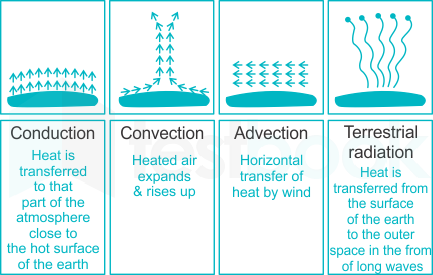
- Conduction
- The earth after being heated by insolation transmits the heat to the atmospheric layers near to the earth in long wave form
- The air in contact with the land gets heated slowly and the upper layers in contact with the lower layers also get heated
- This process is called conduction
- Conduction takes place when two bodies of unequal temperature are in contact with one another, there is a flow of energy from the warmer to cooler body
- The transfer of heat continues until both the bodies attain the same temperature or the contact is broken
- Conduction is important in heating the lower layers of the atmosphere
- The Earth's surface is the primary receiver of solar energy, not the air directly.
- This surface (land or water) absorbs solar radiation and becomes warm.
- The air molecules in direct contact with the warm surface gain heat through conduction—a process where heat is transferred through direct molecular contact.
- Since air is a poor conductor of heat, conduction occurs only in the very thin layer of atmosphere close to the ground (just a few centimeters thick), but it's crucial because it initiates the heating process of the atmosphere.
- This warmed air then rises and sets convection in motion, helping to distribute heat further upward.
- Convection
- The air in contact with the earth rises vertically on heating in the form of currents and further transmits the heat of the atmosphere
- This process of vertical heating of the atmosphere is known as convection
- The convective transfer of energy is confined only to the troposphere
- Advection
- The transfer of heat through horizontal movement of air is called advection
- Horizontal movement of the air is relatively more important than the vertical movement
- In middle latitudes, most of diurnal (day and night) variation in daily weather are caused by advection alone
- In tropical regions particularly in northern India during summer season local winds called ‘loo’ is the outcome of advection process
- Terrestrial radiation
- Terrestrial radiation, also known as outgoing longwave radiation or thermal infrared radiation, is the electromagnetic radiation emitted by the Earth's surface and atmosphere.
- Earth's atmosphere is mostly heated by terrestrial radiation due to it's inability to absorb short wavelength radiation from insolation.
- The insolation received by the earth is in short waves forms and heats up its surface
- The earth after being heated itself becomes a radiating body and it radiates energy to the atmosphere in long wave form
- This energy heats up the atmosphere from below
- The long wave radiation is absorbed by the atmospheric gases particularly by carbon dioxide and the other greenhouse gases
- Thus, the atmosphere is indirectly heated by the earth’s radiation
- The atmosphere in turn radiates and transmits heat to the space
- Finally the amount of heat received from the sun is returned to space, thereby maintaining constant temperature at the earth’s surface and in the atmosphere
- Land emits radiation more quickly and in larger amounts at night because it heats up and cools down faster than oceans while ocean heats slowly and emits slowly and steadily
- Heat budget of the planet earth (radiation budget)
-
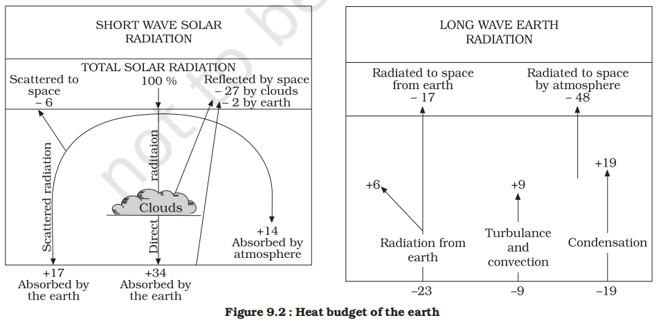
-
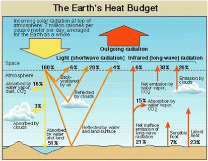
- Figure 9.2 depicts the heat budget of the planet earth
- The earth as a whole does not accumulate or lose heat, it maintains its temperature
- This can happen only if the amount of heat received in the form of insolation equals the amount lost by the earth through terrestrial radiation
- Consider that the insolation received at the top of the atmosphere is 100 per cent
- While passing through the atmosphere some amount of energy is reflected, scattered and absorbed
- Only the remaining part reaches the earth surface
- Budget analysis
- This information is primarily based on the NASA CERES State of the Climate Report (2024) and the 2025 NASA Earth Science Technology Office (ESTO) Annual Report.
- Distribution of Incoming Solar Radiation (100 units)
- Reflected back to space (Total Albedo) -> 30 units
- 6 units:
- Scattered by atmospheric gases and aerosols
- 20 units:
- Reflected by Cloud tops
- 4 units:
- Reflected by Earth’s surface (Ice, Snow, Desert)
- Absorbed (Net Solar Radiation) -> 70 units
- 23 units:
- Absorbed within the Atmosphere (Ozone, Water Vapor, Dust)
- NASA confirms that the atmosphere is absorbing significantly more energy (23 units) than the 14 units typically taught in older 2000s-era textbooks.
- 47 units:
- Absorbed at Earth’s Surface (Oceans and Landmasses)
- Outgoing Terrestrial Radiation and Energy Transfers
- Earth’s Surface (Energy Loss of 47 units):
- 12 units:
- Terrestrial radiation directly to space (Atmospheric Window)
- 5 units:
- Sensible Heat (Thermals/Conduction/Convection)
- 24 units:
- Latent Heat (Evapotranspiration/Condensation)
- 6 units:
- Net Longwave radiation absorbed by the Greenhouse gases
- Atmosphere (Energy Loss of 58 units):
- 58 units
- Emitted as longwave radiation to space
- Atmosphere at total have:
- 23 units from direct solar absorption + 35 units from surface trasfers (5 Sensible, 24 Latent, 6 Longwave)
- Balance Summary (Global Heat Balance)
- Incoming = 100 units
- Outgoing = 100 units
- This is termed the heat budget or heat balance of the earth
- This explains, why the earth neither warms up nor cools down despite the huge transfer of heat that takes place
- Variation in the net heat budget at the earth’s surface
-
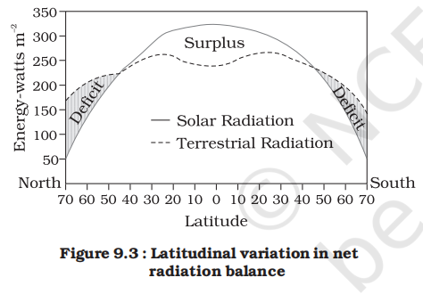
- As explained earlier, there are variations in the amount of radiation received at the earth’s surface
- Some part of the earth has surplus radiation balance while the other part has deficit
- Figure 9.3 depicts the latitudinal variation in the net radiation balance of the earth — the atmosphere system
- The figure shows that there is a surplus of net radiation balance between 40 degrees north and south and the regions near the poles have a deficit [shortage / undersupply / deficiency]
- The surplus heat energy from the tropics is redistributed pole wards and as a result the tropics do not get progressively heated up due to the accumulation of excess heat or the high latitudes get permanently frozen due to excess deficit
- Temperature
- Overview
- The interaction of insolation with the atmosphere and the earth’s surface creates heat which is measured in terms of temperature
- While heat represents the molecular movement of particles comprising a substance, the temperature is the measurement in degrees of how hot (or cold) a thing (or a place) is
- Meaning of basic terms
- Latitude
- Definition:
- Latitude is the angular distance of a place north or south of the Equator, measured in degrees.
- Range:
- 0° (Equator) to 90° North (North Pole) and 90° South (South Pole).
- Lines:
- Lines of latitude (parallels) run horizontally around the globe.
- Longitude
- Definition:
- Longitude is the angular distance of a place east or west of the Prime Meridian, measured in degrees.
- Range:
- 0° (Prime Meridian) to 180° East or West.
- Lines:
- Lines of longitude (meridians) run vertically from pole to pole.
- Altitude
- Altitude is the vertical height of an object or location above sea level.
- Factors controlling temperature distribution
- Latitude
- The temperature of a place depends on the insolation received
- It has been explained earlier that the insolation varies according to the latitude hence the temperature also varies accordingly
- Altitude
- The atmosphere is indirectly heated by terrestrial radiation from below
- Therefore, the places near the sea-level record higher temperature than the places situated at higher elevations
- In other words, the temperature generally decreases with increasing height
- Lapse rate
- The rate of decrease of temperature with height is termed as the normal lapse rate
- It is 6.5°C per 1,000 m
- Distance from the sea
- Another factor that influences the temperature is the location of a place with respect to the sea
- Compared to land, the sea gets heated slowly and loses heat slowly
- Ocean water has a high specific heat capacity
- Specific heat is the energy needed to raise the temperature of one gram of substance by one Celsius
- Land heats up and cools down quickly
- Therefore, the variation in temperature over the sea is less compared to land
- The places situated near the sea come under the moderating influence of the sea and land breezes which moderate the temperature
- Air-mass and ocean currents
- Like the land and sea breezes, the passage of air masses also affects the temperature
- The places, which come under the influence of warm air-masses experience higher temperature and the places that come under the influence of cold air-masses experience low temperature
- Similarly, the places located on the coast where the warm ocean currents flow record higher temperature than the places located on the coast where the cold currents flow
- Distribution of Temperature
-
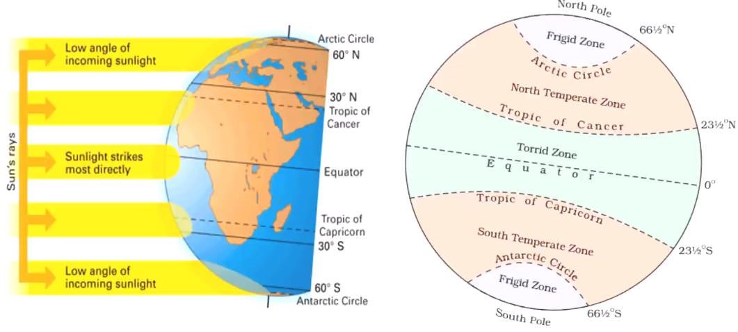
- Temperature distribution on the Earth’s surface is not uniform.
- It is influenced by:
- Latitude
- Altitude
- Land–water contrast
- Ocean currents
- Cloud cover and winds
- Aspect of slope (local factor)
- Representation of temperature distribution
- Isopleth
- An isopleth is a line drawn on a map joining points that have the same value of a particular variable.
- Isotherms
- Temperature distribution is represented on maps using isotherms.
- Isotherms are imaginary lines joining places having the same temperature at a given time or during a specific period.
- Strictly avoid thinking isotherms as a patch of area, I was confused for nearly an hour, before I figured out that it is just a line, it is very critical to understand it's bending nature.
- In general, isotherms tend to run parallel to latitudes, reflecting the dominant control of latitude.
- Isothermal zone
- An isothermal zone refers to a region in the atmosphere or ocean where temperature remains nearly constant with increasing height or depth.
- Thermal equator
- The thermal equator is an imaginary line connecting regions of highest average temperature, usually located north of the geographic equator due to land–sea distribution and seasonal solar shift.
- Seasonal distribution of temperature
- The global distribution of temperature is best understood by studying January and July temperature patterns.
- Temperature anomaly
- A temperature anomaly is the difference between the actual recorded temperature and the climatological normal (long-term average) temperature of a region.
- Why isotherms bend (pure, simple logic)
- Imagine a 25°C isotherm moving from the ocean onto a hot landmass in summer.
- As the 25°C line moves from the ocean onto the hot land, it suddenly finds itself in a place that is 35°C.
- To find 25°C again, the line has to move away from the heat.
- Since temperatures get cooler toward the poles, the line must bend poleward to find that 25°C value again.
- It will not move towards the equator as it won't find temperature close to 25°C there because landmass is heating to more than 25°C.
- Example
- In January, how an isotherm over Australia will bend?
- January is summer in the Southern Hemisphere.
- Imagine the 25°C isotherm line coming from the ocean. When it hits the Australian coast, the land temperature is much higher (e.g., 35°C).
- The line suddenly finds itself in a place that is too hot. To find 25°C again, it must move toward a colder region.
- In the Southern Hemisphere, the "cold" direction is South (towards Antarctica/the South Pole).
- It cannot move "just above" (North) Australia to find its temperature because of getting near to equator.
- January Temperature Distribution
-
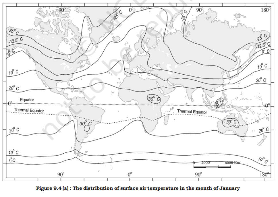
- Deviation from latitudinal pattern is more pronounced in January, especially in the Northern Hemisphere.
- Northern Hemisphere:
- Dominated by large landmasses, leading to strong continentality.
- Isotherms bend equatorward over continents due to intense cooling.
- Isotherms bend poleward over oceans due to moderating effect of warm ocean currents.
- North Atlantic:
- Isotherms bend northward due to the influence of the Gulf Stream and North Atlantic Drift.
- Eurasian continent:
- Severe winter cooling causes southward bending of isotherms.
- Mean January temperature along 60°E longitude is about −20°C at both 80°N and 50°N latitudes.
- Mean January temperatures:
- Over 27°C in equatorial oceans
- Over 24°C in the tropics
- 2°C to 0°C in middle latitudes
- −18°C to −48°C in the interior of Eurasia
- Southern Hemisphere:
- Dominated by oceans, resulting in more uniform temperature distribution.
- Isotherms run nearly parallel to latitudes.
- The isotherms of:
- 20°C near 35°S
- 10°C near 45°S
- 0°C near 60°S
- July Temperature Distribution
-
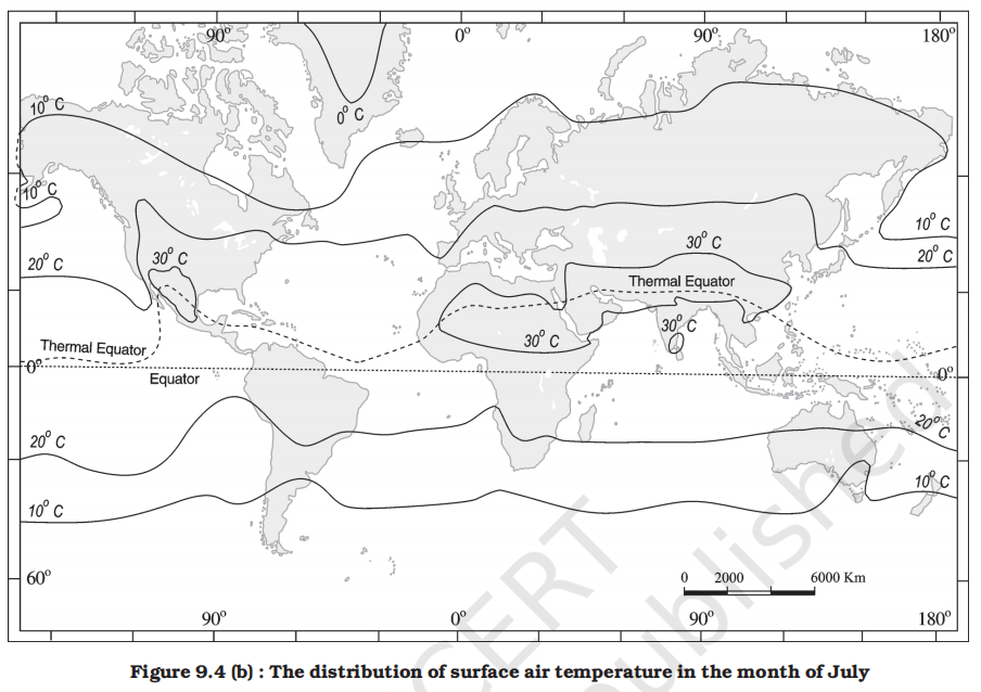
- Seasonal reversal of January patterns.
- Northern Hemisphere:
- Landmasses heat up rapidly.
- Subtropical Asia records temperatures exceeding 30°C along the 30°N latitude.
- Isotherms bend poleward over oceans due to their moderating influence.
- Southern Hemisphere:
- Oceans dominate and heat up slowly.
- Temperature variation remains limited.
- Isotherms largely follow latitudinal pattern.
- In July:
- Equatorial oceans record temperatures above 27°C.
- The 10°C isotherm runs along:
- About 40°N latitude
- About 40°S latitude
- Annual Range of Temperature (January–July)
-
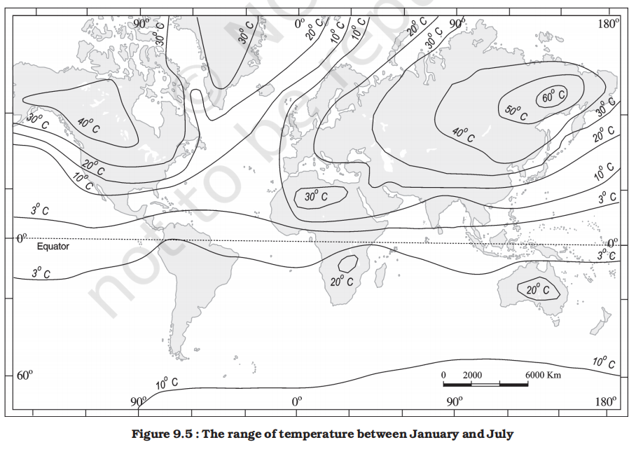
- Refers to the difference between mean temperatures of January and July.
- Highest annual range:
- Northeastern Eurasia
- Exceeds 60°C due to extreme continentality
- Lowest annual range:
- Equatorial belt between 20°S and 15°N
- Around 3°C due to constant solar input and oceanic moderation
- Conclusion
- Temperature distribution is the result of complex interactions among latitude, land–water contrast, ocean currents, and atmospheric circulation.
- Study of isotherms helps in understanding global climate patterns and their influence on vegetation and human activities.
- Inversion of temperature
- Overview
- Normally, temperature decreases with increase in elevation, it is called normal lapse rate
- At times, the situations is reversed and the normal lapse rate is inverted, it is called inversion of temperature
- Inversion is usually of short duration but quite common nonetheless
- Winter nights and early mornings
- A long winter night with clear skies and still air is ideal situation for inversion
- The heat of the day is radiated off during the night, and by early morning hours, the earth is cooler than the air above
- Over polar areas, temperature inversion is normal throughout the year
- Surface inversion promotes stability in the lower layers of the atmosphere
- Smoke and dust particles get collected beneath the inversion layer and spread horizontally to fill the lower strata of the atmosphere
- Dense fogs in mornings are common occurrences especially during winter season
- This inversion commonly lasts for few hours until the sun comes up and begins to warm the earth
- Air drainage in hills and mountains
- The inversion takes place in hills and mountains due to air drainage
- Cold air at the hills and mountains, produced during night, flows under the influence of gravity
- Being heavy and dense, the cold air acts almost like water and moves down the slope to pile up deeply in pockets and valley bottoms with warm air above, this is called air drainage
- To protect plants from frost, farmers and orchardists (like those growing grapes or citrus) usually plant them on the mid-slopes (the "thermal belt"), where the air is warmer.
- Atmospheric circulation and weather systems
- Introduction to atmospheric circulation
- Air expands when heated and gets compressed when cooled
- This results in variations in the atmospheric pressure
- The result is that it causes the movement of air from high pressure to low pressure, setting the air in motion
- You already know that air in horizontal motion is wind
- Atmospheric pressure also determines when the air will rise or sink
- The wind redistributes the heat and moisture across the planet, thereby, maintaining a constant temperature for the planet as a whole
- The vertical rising of moist air cools it down to form the clouds and bring precipitation
- This chapter has been devoted [very loving / faithful / loyal] to explain the causes of pressure differences, the forces that control the atmospheric circulation, the turbulent pattern of wind, the formation of air masses, the disturbed weather when air masses interact with each other and the phenomenon of violent tropical storms
- Atmospheric pressure
- Introduction
- The weight of a column of air contained in a unit area from the mean sea level to the top of the atmosphere is called the atmospheric pressure
- Atmospheric pressure is the force exerted by the air per unit area on the surfce of the earth.
- The atmospheric pressure is expressed in units such as atmospheres, bars, milibars or pascals
- Meteorologists often use millibars or pascals to measure atmospheric pressure
- At sea level the average atmospheric pressure is 1,013.2 milibar and it is called 1 atmosphere or 1 bar
- Due to gravity the air at the surface is denser and hence has higher pressure
- Air pressure is measured with the help of a mercury barometer or the aneroid barometer
- The pressure decreases with height
- At any elevation it varies from place to place and its variation is the primary cause of air motion, i.e. wind which moves from high pressure areas to low pressure areas
- Vertical variation of pressure
-
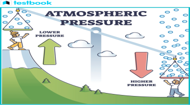
- In the lower atmosphere the pressure decreases rapidly with height
- As one moves up the air gets varified [becoming different, vary, or variegate] and one feels breathless
- The decrease amounts to about 1 mb for each 10 m increase in elevation
- It does not always decrease at the same rate
- The vertical pressure gradient force is much larger than that of the horizontal pressure gradient
- But, it is generally balanced by a nearly equal but opposite gravitational force
- Hence, we do not experience strong upward winds
-
| Level |
Pressure (mb) |
Temperature (°C) |
| Sea Level |
1,013.25 |
15.2 |
| 1 km |
898.76 |
8.7 |
| 5 km |
540.48 |
–17.3 |
| 10 km |
265.00 |
–49.7 |
- Horizontal distribution of pressure
-
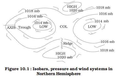
- Small differences in pressure are highly significant in terms of the wind direction and velocity
- Horizontal distribution of pressure is studied by drawing isobars at constant levels
- Isobars
- Isobars are lines drawn on weather maps that connect points of equal atmospheric pressure, measured in millibars (mb) or hectopascals (hPa).
- In order to eliminate the effect of altitude on pressure, it is measured at any station after being reduced to sea level for purposes of comparison
- The sea level pressure distribution is shown on weather maps
- Figure 10.1 shows the patterns of isobars corresponding to pressure systems
- Low-pressure system is enclosed by one or more isobars with the lowest pressure in the centre
- High-pressure system is also enclosed by one or more isobars with the highest pressure in the centre
- Why isobars bend (pure, simple logic)
- Isobars join places having the same atmospheric pressure (weight of air).
- Imagine a 1010 mb isobar moving from the ocean onto a hot landmass in summer.
- As the 1010 mb line moves from the ocean onto the hot land, it suddenly finds itself in a place that is 1000 mb (Low Pressure).
- This happens because hot air expands and becomes lighter, so the "weight" of the air at that spot has dropped.
- To find 1010 mb again, the line has to move away from the "light" air and find "heavier" air.
- Since cold air is denser and heavier, the isobar must bend toward the colder region (the pole) to find that extra 10 mb of weight.
- Conversely, in winter, the land is cold and the air is heavy (High Pressure). A 1010 mb line hitting cold land would find 1020 mb of weight. To get back down to 1010 mb, it would bend toward the warmer region (the equator).
- Why isobars form loops and circles (NCERT diagrams)
- Unlike temperature, which usually changes steadily from North to South, air pressure often piles up in specific spots.
- High Pressure Loop:
- Think of a "mountain of air" sitting over a cold continent. To show this mountain, the isobar must wrap all the way around it to connect all the points with the same weight, forming a circle.
- Low Pressure Loop:
- Think of a "valley of air" sitting over a hot region. The isobar circles the depression to separate the light air inside from the heavier air outside.
- These closed loops are called "cells" or "systems" (Cyclones and Anticyclones).
- World distribution of sea level pressure
-
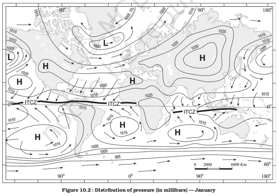
-
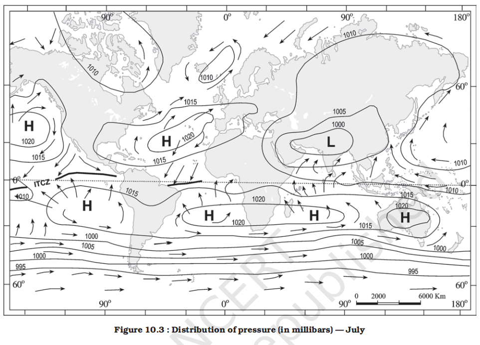
- The world distribution of sea level pressure in January and July has been shown in Figures 10.2 and 10.3
- Near the equator the sea level pressure is low and the area is known as equatorial low
- Along 30° N and 30° S are found the high-pressure areas known as the subtropical highs
- Further pole wards along 60° N and 60° S, the low-pressure belts are termed as the sub polar lows
- Near the poles the pressure is high and it is known as the polar high
- These pressure belts are not permanent in nature. They oscillate with the apparent movement of the sun
- In the northern hemisphere in winter they move southwards and in the summer northwards
- Pressure Belts
- The Earth has a pattern of alternating high and low pressure zones called pressure belts, formed primarily due to the uneven heating of the Earth’s surface and the rotation of the planet.
- High pressure is a zone of divergence while low pressure is a zone of convergence
- These belts are arranged more or less symmetrically on both sides of the equator and play a crucial role in global wind and weather patterns.
- Major Pressure Belts:
-
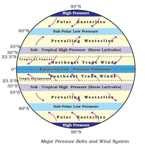
- Equatorial Low Pressure Belt (around 0° latitude)
- Also known as the doldrums.
- Caused by intense solar heating at the equator leading to strong convectional uplift.
- Characterized by low pressure, calm winds, and frequent rainfall.
- Subtropical High Pressure Belts (around 30° N and 30° S)
- Also known as horse latitudes.
- The term "horse latitudes" originated from the days of sailing ships. It is believed that when ships became becalmed in these areas and ran out of provisions, sailors would throw horses overboard to conserve water and lighten the load.
- Descending air from the Hadley cell creates zones of high pressure.
- Characterized by clear skies, dry air, and little precipitation.
- Associated with major deserts (e.g., Sahara, Kalahari, Australian Desert).
- Subpolar Low Pressure Belts (around 60° N and 60° S)
- Formed by the meeting of warm westerlies and cold polar easterlies (polar front).
- Characterized by ascending air, stormy weather, and cyclonic activity.
- Polar High Pressure Belts (around 90° N and 90° S)
- Cold, dense air descends at the poles, creating areas of high pressure.
- Characterized by stable, cold, and dry conditions.
- These pressure belts shift slightly northward or southward with the apparent movement of the sun during the year.
- The shifting of the pressure belts is driven by the axial tilt of the Earth, which causes seasonal changes in the sun’s position and energy distribution across the planet.
- This shift of pressure systems has a significant influence on seasonal weather patterns, such as monsoons in South Asia, seasonal rains in the Tropics, and changes in the intensity of trade winds and westerlies.
- Winds
- Introduction:
- Wind is the horizontal movement of air from high-pressure areas to low-pressure areas.
- It is caused by the uneven heating of the Earth's surface, which creates pressure differences.
- Wind speed is measured using anemometers, and direction is indicated by wind vanes.
- Why land heats faster and cools faster than ocean?
- Specific Heat Capacity:
- Water has a higher specific heat capacity than land.
- It takes more energy to raise the temperature of water compared to land.
- Land heats up and cools down faster because it requires less energy for temperature change.
- Transparency:
- Water is transparent, allowing solar radiation to penetrate deeper layers.
- Heat is distributed through a greater volume, slowing temperature change.
- Land is opaque, so all solar radiation is absorbed at the surface.
- Mobility:
- Water is fluid and circulates through convection currents, distributing heat.
- Land is rigid and cannot circulate, so heat remains at the surface and causes rapid warming or cooling.
- Evaporation:
- Water surfaces lose significant heat through evaporation.
- This latent heat loss slows down the temperature rise in oceans.
- Land has less moisture to evaporate, so less energy is used up that way.
- Albedo and Heat Retention:
- Ocean water generally has a lower albedo (darker), but the other factors dominate.
- Soil and rock types may vary in color and heat retention, but overall land responds faster to solar radiation changes.
- Classification of Winds:
- Based on Duration:
- While it's not explicitly stated, this traditional classification (Permanent, Seasonal, Local) is implicitly referring to winds at or near the Earth's surface.
- That's why it do not include jet stream under classification, because it flows in above troposphere at around 9-14 km above the earth's surface
- Permanent Winds (Planetary winds)
- Blow throughout the year in a particular direction.
- Major permanent winds
- Trade Winds
- Blow from the subtropical high-pressure belts to the equatorial low-pressure belt.
- Trade winds are strongest between 5°–30°, not strictly “confined” (ITCZ shifts seasonally).
- In the Northern Hemisphere: from northeast to southwest.
- In the Southern Hemisphere: from southeast to northwest.
- These winds are deflected by the Coriolis force.
- Westerlies
- Blow from the subtropical high-pressure belts to the subpolar low-pressure belts.
- Westerlies generally exist between ~30°–60°.
- The westerlies are best developed between the latitudes in both hemispheres:
- 40° North - 65° North
- 40° South - 65° South
- Not present at equator
- Hemispheric Difference:
- The westerlies are much stronger and more persistent in southern hemisphere because there are very few landmasses to create friction or break the wind flow (the "Great Southern Ocean").
- Due to this high velocity, they are known by specific sailors' terms:
- Roaring Forties (at 40°S)
- Furious Fifties (at 50°S)
- Shrieking/Screaming Sixties (at 60°S)
- Polar Easterlies
- Blow from the polar high to the subpolar low-pressure belt.
- These are cold and dry winds blowing from east to west near the poles.
- Seasonal Winds (Secondary winds)
- Change direction with seasons.
- Major seasonal winds
- Monsoon Winds:
- Caused by seasonal reversal of wind direction due to differential heating of land and water.
- Summer Monsoon: Moist air from ocean to land, brings rainfall.
- Winter Monsoon: Dry air from land to sea, mostly dry.
- Local Winds (Tertiary winds)
- Affect small areas for short durations and are influenced by local geography and temperature differences.
- Classification
- Based on local topographical features:
- Breezes [gentle winds]:
- Sea Breeze:
-
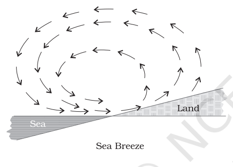
- During daytime, land heats up faster than the sea.
- Warm air rises over land and cooler air from the sea moves in to replace it.
- Land Breeze:
-
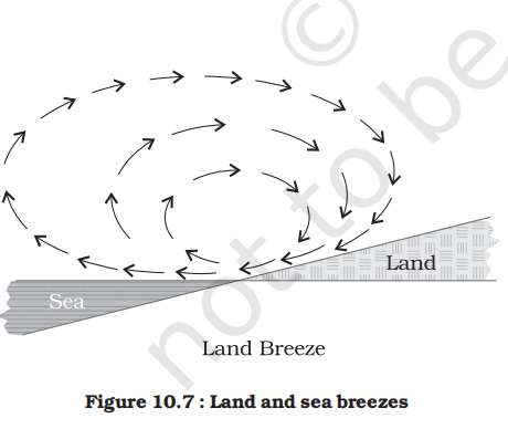
- At night, land cools faster than the sea.
- Warm air rises over the sea and cool air from the land moves toward the sea.
- Mountain Breeze:
-
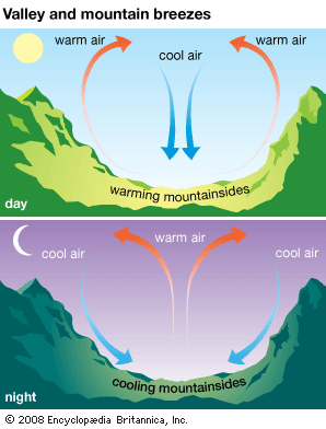
- At night, cooler, denser air flows down the mountain slopes into the valleys.
- During the night the slopes get cooled and the dense air descends into the valley as the mountain wind
- The cool air, of the high plateaus and ice fields draining into the valley is called katabatic wind
- Another type of warm wind occurs on the leeward side of the mountain ranges
- The moisture in these winds, while crossing the mountain ranges condense and precipitate
- When it descends down the leeward [sheltered towards or away from the wind] side of the slope the dry air gets warmed up by adiabatic process [process in which heat does not enter or leave the system]
- This dry air may melt the snow in a short time
- Valley Breeze (Anabatic winds / upslope winds):
- During the day, warm air rises from the valleys and flows up the mountain slopes.
- The slopes get heated up and air moves upslope and to fill the resulting gap the air from the valley blows up the valley
- This wind is known as the valley breeze
- Katabatic Breeze:
- Katabatic winds are gravity-driven cold downslope winds, often strong and regional (e.g., Antarctica).
- Mountain breeze is a local nocturnal katabatic-type flow, but not all katabatic winds are mountain breezes.
- Based on specific regional occurrence:
- Hot winds
- Loo:
- Hot, dry wind in northwestern India during summer.
- Common in May and June; can cause heatstrokes.
- Accelerates ripening of crops, especially mangoes
- Chinook:
- Warm, dry wind on the eastern slopes of the Rockies in North America.
- Also known as "snow eater" because it melts snow rapidly.
- Föhn:
- Warm, dry wind in the Alps, similar to Chinook.
- Helps ripen grapes and other crops early.
- Sirocco:
- Hot, dry wind blowing from the Sahara over the Mediterranean into southern Europe.
- After crossing the Mediterranean, Sirocco often becomes warm and humid
- Often carries dust and affects weather in Italy, Greece, and Spain.
- Santa Ana:
- Hot, dry wind in southern California, USA.
- Intensifies wildfires and lowers humidity.
- Harmattan (Doctor winds):
- Hot, dry and dusty wind from the Sahara blowing towards the Gulf of Guinea in West Africa.
- Reduces humidity and visibility, often creating hazy conditions.
- Cold winds
- Mistral:
- Cold, dry wind blowing from the Alps to the Mediterranean in southern France.
- Known for its high speed and chilling effect.
- Bora:
- Cold wind in the Balkans, especially along the Adriatic coast.
- Strong and gusty, often bringing sudden drops in temperature.
- Etesian (Meltemi):
- Cool, dry northerly wind blowing over the Aegean Sea in summer.
- Helps moderate the intense summer heat in Greece and western Turkey.
- Local convective storms
- Nor'wester (Kalbaisakhi / Bardoli cheera):
- Thunderstorm-laden wind in eastern India and Bangladesh during pre-monsoon season.
- Brings sudden showers and relief from heat in April-May.
- Mango showers
- Mango showers are the pre-monsoon rains in South India, mainly in Kerala, Karnataka and Tamil Nadu, that arrive in March–April and help mango trees.
- Based on Origin:
- Planetary Winds
- Result from global pressure belts and Earth's rotation.
- Include Trade Winds, Westerlies, and Polar Easterlies.
- Local Winds
- Influenced by local topography or temperature variations.
- Include sea breeze, land breeze, mountain breeze, and valley breeze.
- The above classification do not cover:
- Jet Streams
- Jet streams are narrow, fast-moving bands of wind located near the tropopause in the upper troposphere at about 9–14 km altitude.
- They play a significant role in global and regional weather patterns, including the Indian monsoon.
- Types of Jet Streams
- Tropical Easterly Jet (TEJ)
- Appears in summer around 15°N
- Develops due to intense heating over the Tibetan Plateau
- Supports and strengthens monsoon circulation
- Does not directly cause rainfall
- Subtropical Westerly Jet (STJ)
- Occurs around 30° latitude
- Active over India during winter
- Influences western disturbances
- Its southward shift suppresses the summer monsoon
- Polar Jet
- Occurs around 60° latitude
- Associated with temperate cyclones and frontal activity
- Geostrophic Winds
- Theoretical upper-air winds resulting from a balance between pressure gradient force and Coriolis force.
- Gradient Winds
- Winds that flow along curved isobars due to balance between pressure gradient force, Coriolis force, and centrifugal force.
- Upper Air Winds
- Winds blowing above the surface, including jet streams and large-scale atmospheric circulation in the upper troposphere.
- Forces affecting the velocity and direction of wind
- Overview
- The wind blows from high pressure to low pressure
- The wind at the surface experiences friction
- In addition, rotation of the earth also affects the wind movement
- The force exerted by the rotation of the earth is known as the Coriolis force
- Thus, the horizontal winds near the earth surface respond to the combined effect of three forces – the pressure gradient force, the frictional force and the Coriolis force
- In addition, the gravitational force acts downward
- Factors
- Pressure gradient force
- It is the force that results when there is a difference in atmospheric pressure across a surface.
- PGF causes air to move from high-pressure areas to low-pressure areas.
- It is the primary driving force of wind.
- The pressure gradient is strong where the isobars are close to each other and is weak where the isobars are apart
- Frictional force
- It affects the speed of the wind
- It is greatest at the surface and its influence generally extends up to an elevation of 1 - 3 km
- Over the sea surface the friction is minimal
- Coriolis Force
- Images:
-
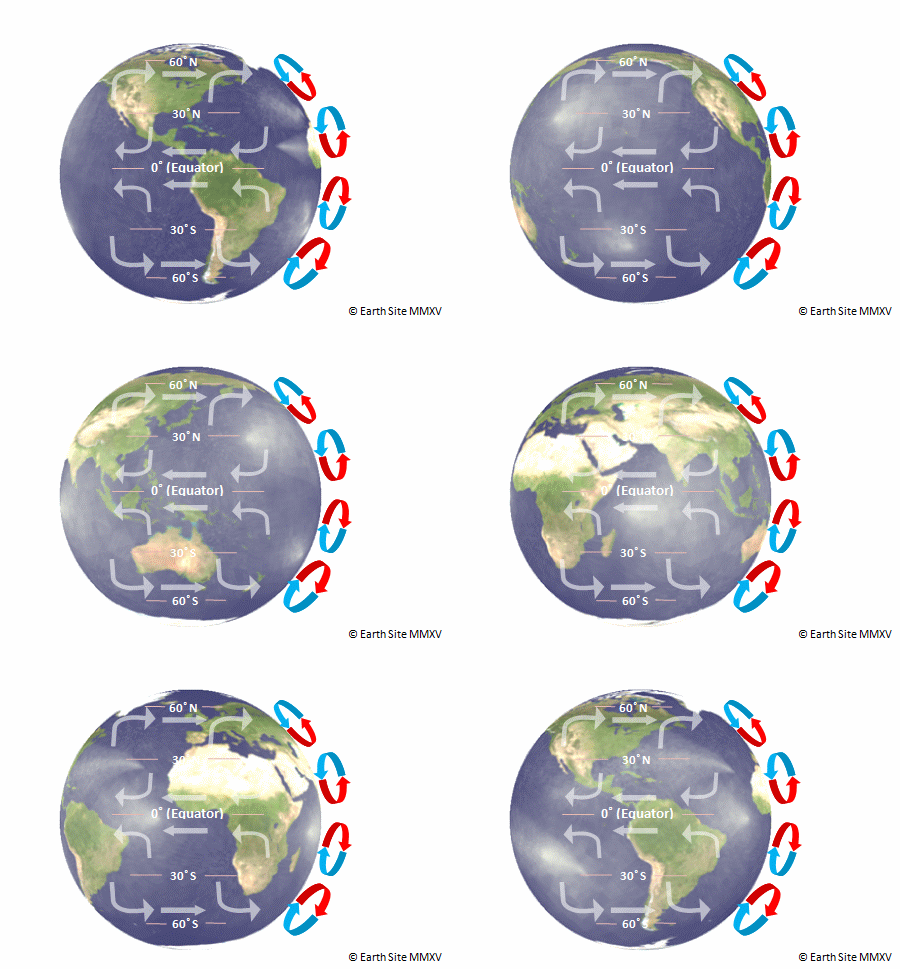
-
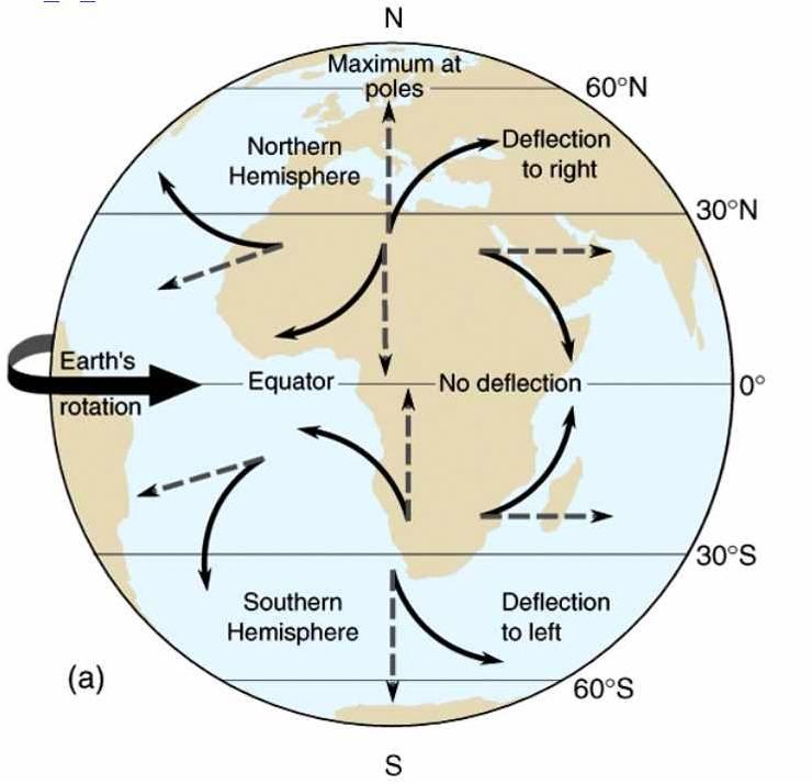
- Description:
- The rotation of the Earth about its axis affects the direction of the wind.
- This apparent force is called the Coriolis force, named after the French physicist Gaspard-Gustave de Coriolis who described it in 1844.
- It deflects the wind:
- To the right in the northern hemisphere.
- To the left in the southern hemisphere.
- Characteristics:
- The deflection increases with increasing wind velocity.
- It is directly proportional to the latitude:
- Maximum at the poles.
- Zero at the equator.
- The Coriolis force acts perpendicular to the direction of the Pressure Gradient Force (PGF).
- PGF itself is perpendicular to isobars (lines of equal pressure).
- As wind speed increases (due to a stronger PGF), the Coriolis deflection also increases.
- Implications:
- Due to the interaction between the Coriolis force and PGF, winds tend to blow parallel to isobars, especially in upper atmosphere.
- In low-pressure areas, this interaction causes wind to spiral around the center rather than directly inward.
- At the equator, where Coriolis force is absent, wind flows straight into low-pressure zones.
-
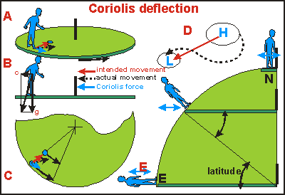
-
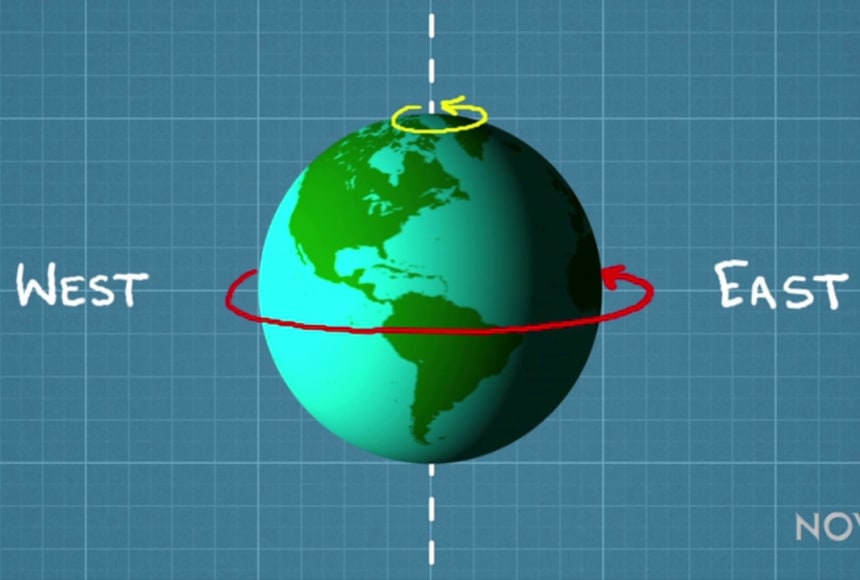
- The Coriolis force is zero at the equator because the Earth’s rotation does not produce any horizontal deflection there.
- Image standing at the end of a rotating disk, at the very end (equator), you keep on moving as it is, at the center (poles), you will be rotating and see continuous change in direction.
- As a result, there is no deflection of wind direction due to Earth’s rotation. Therefore, winds flow directly from high-pressure to low-pressure zones, perpendicular to isobars.
- This lack of deflection prevents the rotational organization of air masses needed for cyclone formation.
- Therefore, tropical cyclones do not form within 5° latitude of the equator.
- Pressure and wind
-
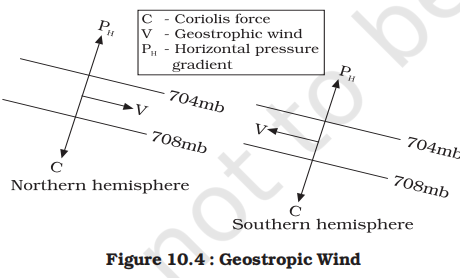
-
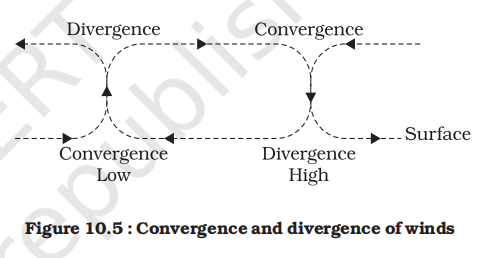
- Overview
- The velocity and direction of the wind are the net result of the wind generating forces
- The winds in the upper atmosphere, 2 - 3 km above the surface, are free from frictional effect of the surface and are controlled mainly by the pressure gradient and the Coriolis force
- When isobars are straight and when there is no friction, the pressure gradient force is balanced by the Coriolis force and the resultant wind blows parallel to the isobar, this wind is known as the geostrophic wind (Figure 10.4)
- The wind circulation around a low is called cyclonic circulation
- Around a high it is called anti cyclonic circulation
- The direction of winds around such systems changes according to their location in different hemispheres (Table 10.2)
- The wind circulation at the earth’s surface around low and high on many occasions is closely related to the wind circulation at higher level
- Generally, over low pressure area the air will converge and rise
- Over high pressure area the air will subside from above and diverge at the surface (Figure 10.5)
- Apart from convergence, some eddies, convection currents, orographic uplift and uplift along fronts cause the rising of air, which is essential for the formation of clouds and precipitation
- General circulation of the atmosphere
-
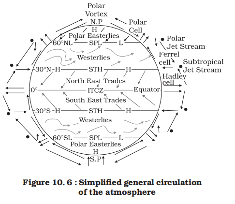
- Introduction
- The pattern of the movement of the planetary winds is called the general circulation of the atmosphere
- The general circulation of the atmosphere also sets in motion the ocean water circulation which influences the earth’s climate
- The pattern of planetary winds largely depends on:
- Latitudinal variation of atmospheric heating
- Emergence of pressure belts
- The migration of belts following apparent path of the sun
- The distribution of continents and oceans
- The rotation of earth
- Circulation cells
-
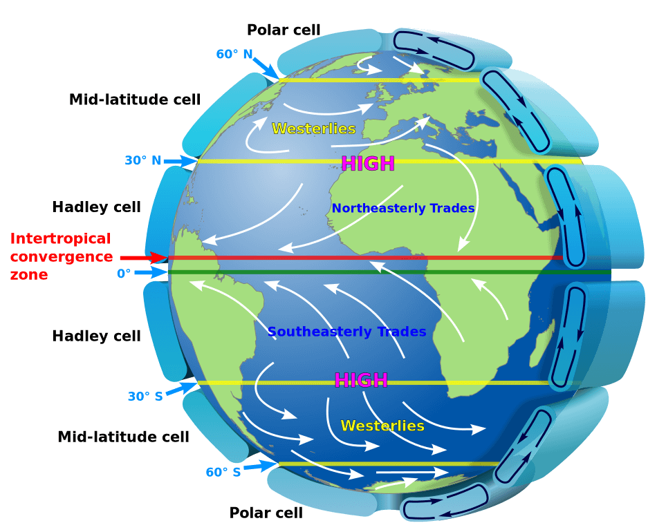
- These are large-scale wind systems that distribute heat and moisture around the Earth. They are driven by the Earth's rotation, the distribution of land and water, and solar heating.
- The air at the Inter Tropical Convergence Zone (ITCZ) rises because of convection caused by high insolation and a low pressure is created
- The winds from the tropics converge at this low pressure zone
- The converged air rises along with the convective cell
- It reaches the top of the troposphere up to an altitude of 14 km and moves towards the poles
- This causes accumulation of air at about 30° N and S
- Part of the accumulated air sinks to the ground and forms a subtropical high
- Another reason for sinking is the cooling of air when it reaches 30° N and S latitudes
- Down below near the land surface the air flows towards the equator as the easterlies
- Such circulations from the surface upwards and vice-versa are called cells
- Key models of general circulation
- Single-Cell Model (Hadley’s Model)
-
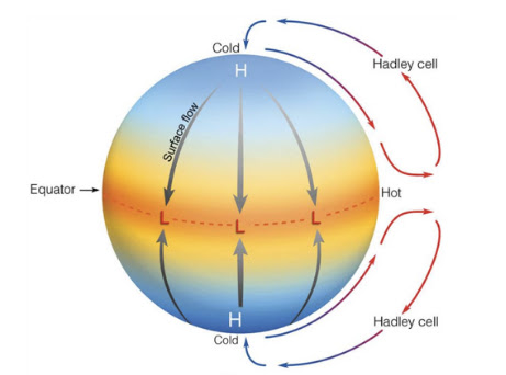
- Proposed by George Hadley in 1735.
- Assumptions:
- Earth is uniformly covered by water.
- Sun’s heating is most intense at the equator.
- Earth does not rotate (Coriolis force ignored).
- Mechanism:
- Warm air rises at the equator due to strong solar heating.
- Moves poleward at upper levels.
- Cools and sinks at the poles.
- Returns toward the equator at surface level.
- Result: One large convection cell per hemisphere.
- Limitation:
- Fails to account for Earth's rotation.
- Cannot explain the observed pattern of trade winds and westerlies.
- Three-Cell Model (More Realistic)
-
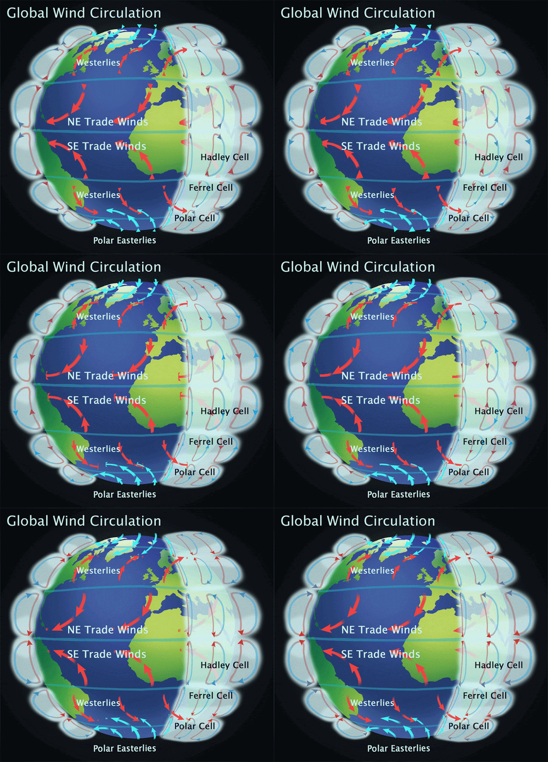
- Earth’s atmosphere is divided into three cells per hemisphere:
- Hadley Cell
- Located between the equator and about 30° N and 30° S latitudes.
- Warm air rises at the equator due to intense solar heating, creating low-pressure zones.
- As the warm air rises, it moves poleward at high altitudes, cooling and sinking at around 30° N and 30° S, forming a high-pressure zone.
- The surface air moves back towards the equator as the trade winds, completing the circulation loop.
- Responsible for tropical rainforests and deserts (due to dry descending air at the subtropical high-pressure belts).
- Ferrel Cell
- Located between 30° and 60° latitudes in both hemispheres.
- Unlike the Hadley and Polar cells, the Ferrel cell is NOT thermally driven.
- Hadley cell is driven by intense heating at the equator.
- Polar cell is driven by intense cooling at the poles.
- The Ferrel cell is an indirect or mechanically driven circulation created by the interaction of the Hadley and Polar cells.
- At the surface, air flows poleward from the subtropical high-pressure belt near 30° latitude.
- Due to the Coriolis force, this poleward-moving air is deflected, forming the westerlies (west to east winds).
- Near 60° latitude, warm westerlies meet cold polar easterlies, producing uplift and a subpolar low-pressure belt.
- Aloft, air flows equatorward and sinks again near 30°, completing the Ferrel circulation.
- Polar Cell
- Located at the poles, between 60° and 90° latitudes.
- Cold air sinks at the poles, creating high-pressure areas.
- This cold air moves towards lower latitudes, where it meets the warmer air from the Ferrel cell, causing the formation of low-pressure areas around 60° N and S.
- This creates the polar easterlies, which blow from east to west.
- Polar cells are responsible for cold, dry conditions at the poles.
- General Circulation
- The three cells (Hadley, Ferrel, and Polar) combined drive the global circulation of air and play a significant role in weather patterns and climate.
- These cells help distribute heat from the equator to the poles and maintain balance in the Earth's temperature.
- The interaction between these cells also influences the jet streams and the occurrence of storm systems.
- Limitations include:
- Assumes ideal conditions like uniform surface (no land-ocean contrast), which do not exist in reality.
- Ignores topography, seasonal variations, and differential heating of land and water.
- Over-simplifies wind systems by treating the Ferrel cell as a real thermally driven cell, when it is largely a zone of mixing and eddies.
- Cannot accurately explain jet streams and subtropical highs formed due to dynamic factors.
- Assumes fixed latitude boundaries for cells, but these shift seasonally in the real atmosphere.
- Does not account for transient weather systems like cyclones, anticyclones, and monsoons.
- Neglects the influence of Earth's axial tilt and orbital changes on atmospheric circulation.
- Thermal Wind Model
- Based on actual temperature and pressure gradients.
- Takes into account:
- Geostrophic winds
- Jet streams (polar and subtropical)
- Coriolis force and pressure gradient force
- Used in modern meteorology and climate modeling.
- Model's limitations include:
- Assumes geostrophic balance (balance between Coriolis and pressure gradient forces), which is often violated in the tropics and near the surface due to friction.
- Cannot represent winds near the equator where the Coriolis force approaches zero.
- Does not account for ageostrophic winds (e.g., caused by friction, convection, or weather systems).
- Ignores vertical air motions and assumes a purely horizontal wind field.
- Over-simplifies the complex vertical and horizontal interactions in jet streams and upper-level winds.
- Based on idealized baroclinic conditions, whereas the real atmosphere often behaves in a barotropic or hybrid manner.
- Does not include effects of latent heat release during condensation or surface temperature discontinuities (e.g., fronts).
- General atmospheric circulation and its effects on oceans
- The general circulation of the atmosphere also affects the oceans.
- Large-scale atmospheric winds generate large, slow-moving ocean currents.
- Oceans, in turn, supply heat and water vapour to the atmosphere.
- These interactions occur slowly over vast oceanic areas.
- Importance of the Pacific Ocean
- Warming and cooling of the Pacific Ocean play the most important role in influencing global atmospheric circulation.
- Normal Pacific conditions
- Trade winds blow from east to west.
- Warm water accumulates in the western Pacific.
- Cold water upwells along the South American coast due to the Peruvian (Humboldt) Current.
- El Niño (Oceanic phenomenon)
- The warm water of the central Pacific slowly drifts eastward towards the South American coast.
- It replaces the cold Peruvian Current.
- The appearance of warm water off the coast of Peru is known as El Niño.
- El Niño does not occur at fixed intervals because it is governed by complex ocean–atmosphere interactions rather than a regular cycle.
-
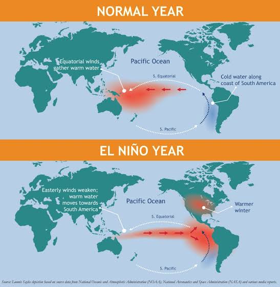
-
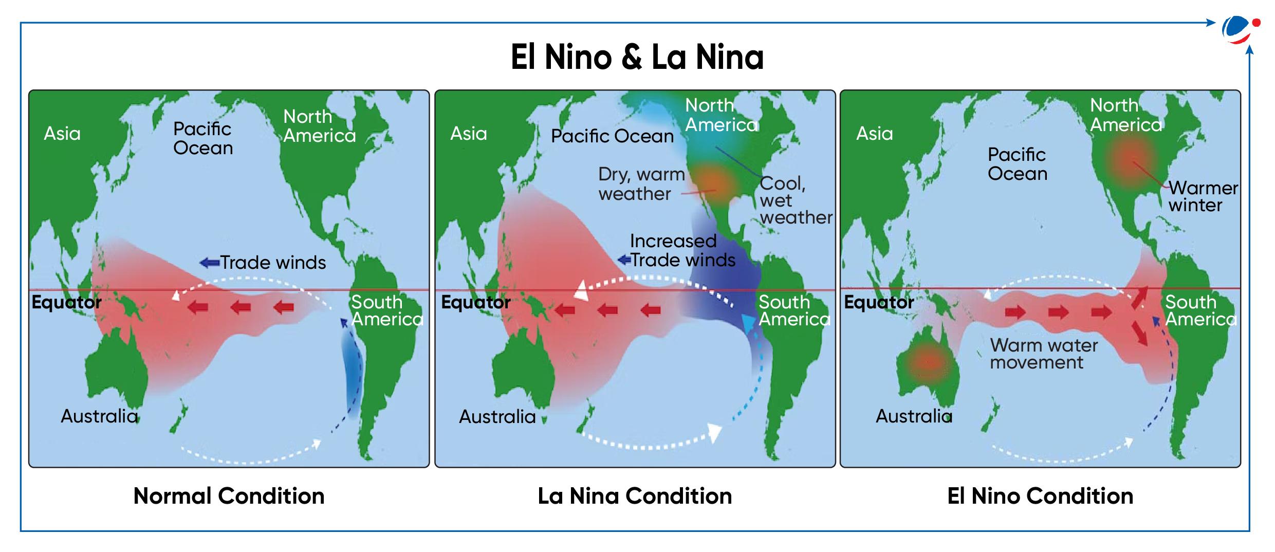
- Southern Oscillation (Atmospheric phenomenon)
- El Niño is closely associated with pressure changes over the Pacific Ocean and Australia.
- This large-scale reversal of pressure between the eastern and western Pacific is known as the Southern Oscillation.
- El Niño is an oceanic phenomenon, while the Southern Oscillation is an atmospheric phenomenon.
- Both are interdependent:
- Changes in pressure influence ocean temperatures.
- Changes in ocean temperatures further alter pressure patterns.
- ENSO
- The combined phenomenon of El Niño and Southern Oscillation is known as ENSO (El Niño–Southern Oscillation).
- Global impacts of ENSO
- Strong ENSO events cause large-scale weather anomalies.
- Heavy rainfall occurs along the arid west coast of South America.
- Drought occurs in Australia and sometimes in India.
- El Niño dries Australia and India by shifting warm water and rising air away from the western Pacific, weakening convection and monsoon circulation.
- Generally, the Indian monsoon becomes weaker during El Niño, though not invariably
- Floods may occur in parts of China.
- Why this shifting changes rainfall pattern?
- Because warm ocean water is the engine that drives rising air and rainfall. When that engine shifts location, the entire atmospheric circulation shifts with it.
- Significance
- ENSO is closely monitored worldwide.
- It is widely used for long-range weather forecasting.
- Air masses
- Definition
- When the air remains over a homogenous [uniform] area for a sufficiently longer time, it acquires the characteristics of the area
- The homogenous regions can be the vast ocean surface or vast plains
- Air mass is defined as a large body of air having:
- Large area coverage
- Uniform properties like temperature and moisture in the horizontal dimension
- Must travel as a unit
- The air with distinctive [differentiating] characteristics in terms of temperature and humidity is called an airmass
- The homogenous surfaces, over which air masses form, are called the source regions
- Classification
- The air masses are classified according to the source regions:
1. Warm tropical and subtropical oceans
2. The subtropical hot deserts
3. The relatively cold high latitude oceans
4. The very cold snow covered continents in high latitudes
5. Permanently ice covered continents in the Arctic and Antarctica
- Accordingly to the source regions, following types of airmasses are recognised:
-
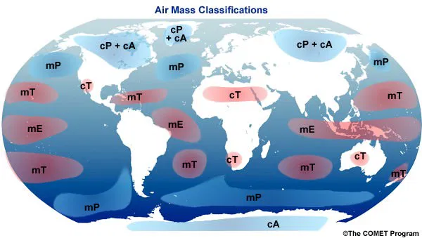
- Maritime tropical (mT)
- Maritime polar (mP)
- Marine equatorial (mE)
- Continental tropical (cT)
- Continental polar (cP)
- Continental arctic (cA)
- Fronts
-
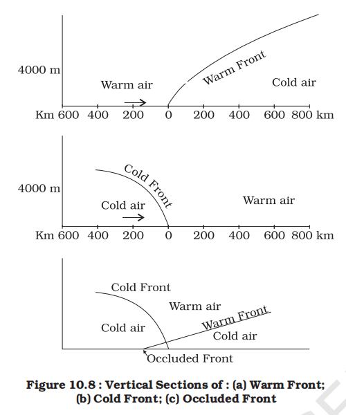
- When two different air masses meet, the boundary zone between them is called a front
- Frontogenesis
- The process of formation of the fronts is known as frontogenesis (genesis means formation or origin of something)
- Frontolysis
- The process of dissipation of a front is known as frontolysis (lysis means process of disintegration)
- The fronts occur in middle latitudes and are characterised by steep gradient in temperature and pressure
- They bring abrupt changes in temperature and cause the air to rise to form clouds and cause precipitation
- These fronts play a significant role in weather patterns, especially in terms of precipitation and temperature changes.
- There are four main types of weather fronts, each characterized by the interaction between different air masses.
-
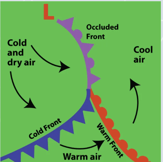
- Cold Front:
- Occurs when a colder air mass moves towards a warmer air mass. The boundary formed between these two air masses is called a cold front.
- Typically, cold fronts bring abrupt weather changes, including thunderstorms and a sharp drop in temperature.
- Warm Front:
- Occurs when a warmer air mass moves towards a colder air mass. The boundary where the warm air replaces the cold air is called a warm front.
- Warm fronts generally bring gradual changes in weather, with light rain or drizzle followed by warmer temperatures.
- Stationary Front:
- A stationary front occurs when two air masses, one cold and one warm, meet but neither is strong enough to move the other. This results in a front that remains in place for an extended period.
- Stationary fronts often bring prolonged periods of cloudiness and precipitation.
- Occluded Front:
- An occluded front forms when a cold front overtakes a warm front, lifting the warm air mass completely off the ground. This results in the boundary where two cold air masses meet.
- Occluded fronts typically bring complex weather patterns, including precipitation and a mix of air masses.
- Weather and Climate
- Weather:
- Refers to the atmospheric conditions of a specific place over a short period (hours to days).
- Includes elements like temperature, humidity, precipitation, cloud cover, wind, and atmospheric pressure.
- It changes frequently and can be predicted only for short durations.
- Example:
- A rainy day in Delhi or a snowstorm in New York.
- Climate:
- Refers to the average weather conditions of a region over a long period (30 years or more).
- It represents general patterns like hot summers, cold winters, or monsoon rains.
- Climate is more stable and helps classify regions (e.g., tropical, temperate, polar).
- Example:
- The Mediterranean climate has dry summers and wet winters.
- Key Differences:
- Duration:
- Weather is short-term; climate is long-term.
- Variability:
- Weather changes daily; climate is relatively stable.
- Scope:
- Weather describes day-to-day conditions; climate describes trends over decades.
- Severe weather phenomenas
- Rational
- These violent events are the manifestation of the atmosphere’s adjustments to varying energy distribution
- The potential and heat energies are converted into kinetic energy in these events and the restless atmosphere again returns to its stable state
- Cyclones
- A cyclone is a large air mass that rotates around a strong center of low atmospheric pressure, counterclockwise in the Northern Hemisphere and clockwise in the Southern Hemisphere as viewed from above (opposite to an anticyclone).
- Fujiwara effect
-
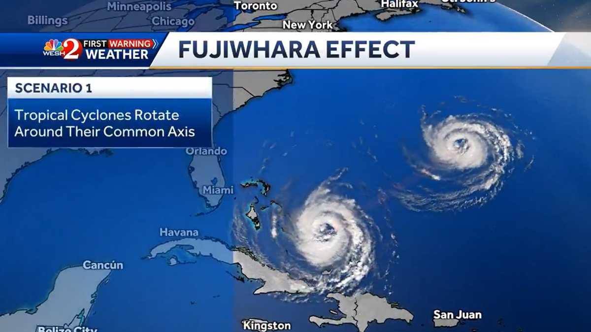
- In certain instances, two cyclones move toward each other and revolve around one another, with the smaller and less intense one moving more quickly.
- This phenomenon is called the Fujiwara effect
- Naming of cylones
- They are named by the Regional Specialised Meteorological Centres (RSMCs)
- There are six RSMCs in the world
- As an RSMC, the Indian Meteorological Department (IMD) names the cyclones developing over the north Indian Ocean, including the Bay of Bengal and the Arabian sea
- The IMD is also mandated to issue advisories to 12 other countries in the region on the development of cyclones and storms
- They include:
- Tropical cyclones
-
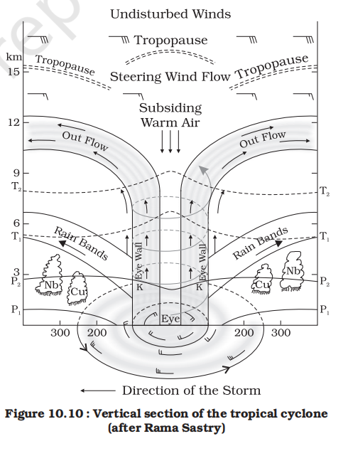
- Definition
- Tropical cyclones are violent storms that originate over oceans in tropical areas and move over to the coastal areas bringing about large scale destruction caused by violent winds, very heavy rainfall and storm surges
- This is one of the most devastating natural calamities
- They are known with different names around different parts of the world
- Cyclones in the Indian Ocean
- Hurricanes in the Atlantic
- Typhoons in the Western Pacific and South China Sea
- Willy-willies in the Western Australia
- Formation and conditions
-
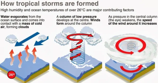
- Tropical cyclones originate and intensify over warm tropical oceans, between about 5° and 20° latitudes.
- The conditions favourable for the formation and intensification of tropical storms are:
- Large sea surface with temperature higher than 27° C
- Presence of the Coriolis force
- This is the reason Tropical cyclones are not formed very close to the equater and they never cross the equator because coriolis force is zero at the equator.
- Small variations in the vertical wind speed
- A pre-existing weak low-pressure area or low-level-cyclonic circulation
- Upper divergence above the sea level system
- The energy that intensifies the storm, comes from the condensation process in the towering cumulonimbus clouds, surrounding the centre of the storm
- This is because when water evaporates, it absorbs energy, when water condenses, it releases the same energy back.
- When condensation occurs in cumulonimbus clouds:
1. Latent heat is released by condensation of cumulonimbus clouds
2. The air column becomes warmer than its surroundings
3. Warm air has lower density, tt rises faster and higher. This creates a strong vertical updraft
4. As air rises, surface air is continuously removed, this causes a drop in surface pressure
5. Air moves from high pressure to low pressure, steeper pressure gradient = faster inflow
6. Due to Coriolis force, inflowing air curves and forms strong rotating winds
7. This sets a positive feedback loop in motion, which won't break unless the cycle is broken either by reaching on land or different pressure area
- With continuous supply of moisture from the sea, the storm is further strengthened
- On reaching the land the moisture supply is cut off and the storm dissipates
- The place where a tropical cyclone crosses the coast is called the landfall of the cyclone
- The cyclones, which cross 20° N latitude generally, recurve and they are more destructive
-
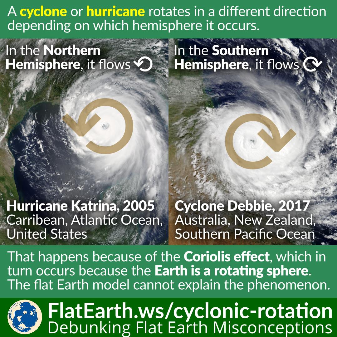
- Structure
-
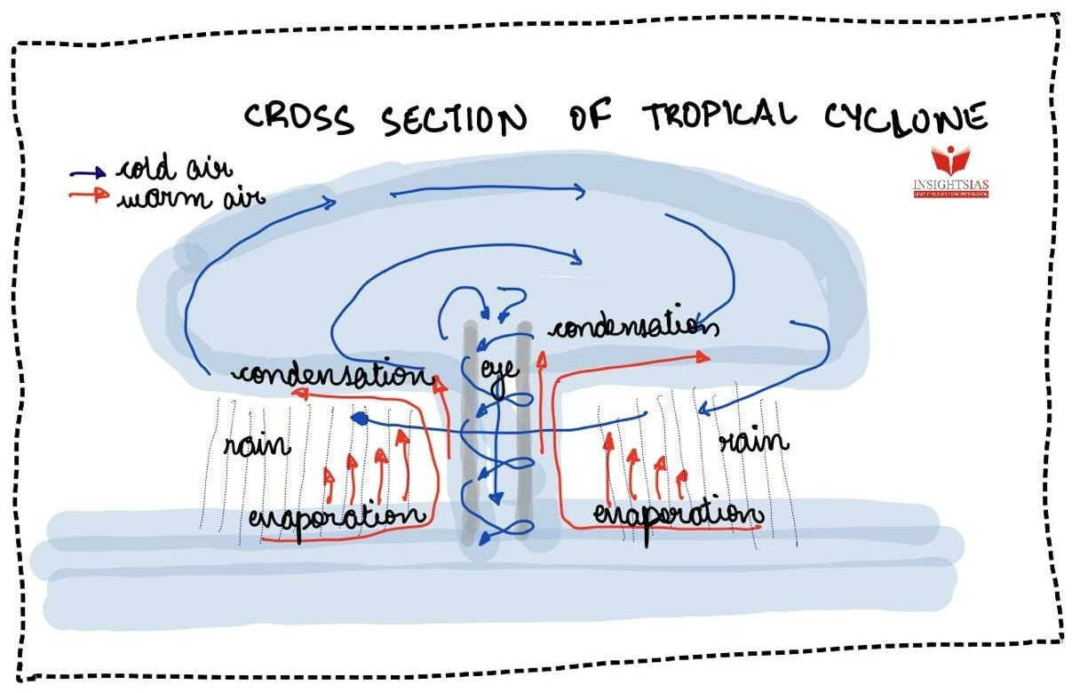
- A schematic representation of the vertical structure of a mature tropical cyclonic storm is shown in Figure 10.10
- A mature tropical cyclone is characterised by the strong spirally circulating wind around the centre, called the eye
- The diameter of the circulating system can vary between 150 and 250 km
- The eye is a region of calm with subsiding air
- Around the eye is the eye wall, where there is a strong spiralling ascent of air to greater height reaching the tropopause
- The wind reaches maximum velocity in this region, reaching as high as 250 km per hour
- Torrential rain occurs here
- From the eye wall rain bands may radiate and trains of cumulus and cumulonimbus clouds may drift into the outer region
- The diameter of the storm over the Bay of Bengal, Arabian Sea and Indian Ocean is between 600 - 1200 km
- The system moves slowly about 300 - 500 km per day
- The cyclone creates storm surges and they inundate [overflow / submerge] the coastal low lands
- The storm peters [decrease or fade gradually before coming to an end] out on the land
- Recurvature towards the pole and later stage
- As cyclones move to higher latitudes:
- The subtropical high (~30° latitude) acts as a steering barrier, cyclones usually cannot pass straight through its strong core. Instead, they move along its outer edge.
- After crossing 30 degree latitude
- Influence of trade winds weakens.
- Influence of westerlies increases.
- Westerlies push the cyclone:
- Poleward
- Eastward
- This turning of the cyclone towards the pole is called recurvature.
- Later stage
- On reaching higher latitudes:
- Sea surface temperature decreases.
- Moisture supply weakens.
- The cyclone weakens or transforms into an extra-tropical cyclone.
- Extra tropical cyclones (Temperate cyclones)
-
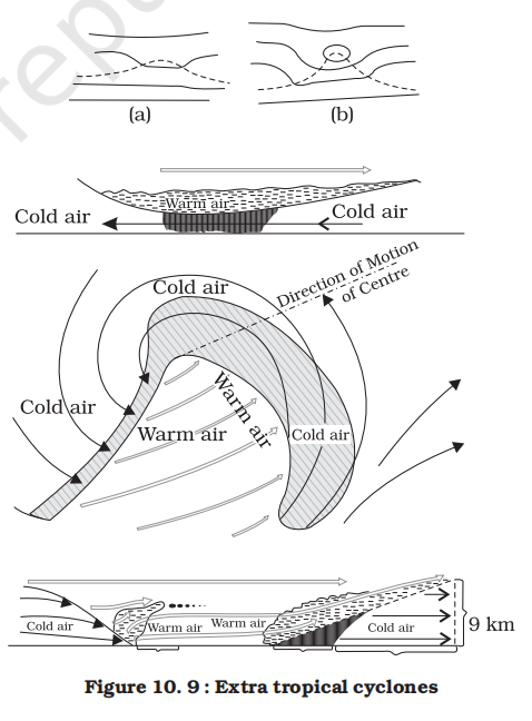
- Definition
- The systems developing in the mid and high latitude, beyond the tropics are called the middle latitude or extra tropical cyclones
- The passage of front causes abrupt changes in the weather conditions over the area in the middle and high latitudes
- Formation and structure
-
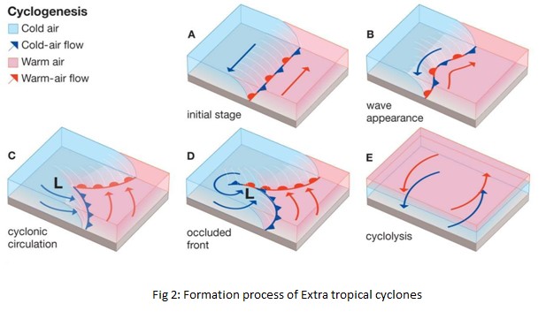
-
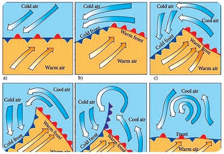
1. Extra-tropical cyclones form along the polar front, which separates warm tropical air from cold polar air.
2. Initially, the polar front remains stationary with warm air to the south and cold air to the north (in the Northern Hemisphere).
3. A small pressure drop develops along the polar front, creating an initial disturbance.
4. Due to this pressure fall:
- Warm air begins to move poleward.
- Cold air begins to move equatorward.
5. The movement of air, combined with the Coriolis force, initiates an anticlockwise cyclonic circulation around the low-pressure centre.
6. As circulation intensifies, a well-defined extra-tropical cyclone develops.
7. Two distinct fronts are formed:
- A warm front ahead of the cyclone.
- A cold front behind the cyclone.
8. A wedge of warm air becomes trapped between the advancing cold air masses, forming the warm sector.
9. Along the warm front:
- Warm air gently rises over cold air.
- Stratiform clouds develop.
- Widespread and continuous precipitation occurs.
10. Along the cold front:
- Cold air advances more rapidly.
- It forces warm air to rise steeply.
- Cumulus and cumulonimbus clouds develop, causing heavy rainfall and thunderstorms.
- Dissipation
1. The cold front moves faster than the warm front and gradually overtakes it.
2. When the cold front catches up with the warm front, the warm air is completely lifted off the surface.
3. This stage is known as occlusion.
4. With the removal of warm air at the surface, the temperature contrast between air masses weakens.
5. The cyclone loses its primary energy source.
6. Surface pressure rises, wind strength decreases, and the cyclone gradually dissipates.
- Comparison with tropical cyclones
-
| Basis |
Tropical Cyclone |
Extra-Tropical Cyclone |
| Region of formation |
Form over warm tropical oceans only |
Form in mid-latitudes over land and sea |
| Source of energy |
Latent heat released from condensation |
Temperature contrast between warm and cold air masses |
| Frontal system |
No fronts present |
Well-developed warm and cold fronts present |
| Structure |
Symmetrical, circular structure with a clear eye |
Asymmetrical structure, no eye |
| Area covered |
Smaller area |
Much larger area |
| Wind velocity |
Very high wind speeds; highly destructive |
Moderate wind speeds |
| Movement direction |
Generally move from east to west initially |
Generally move from west to east |
| Effect of land |
Weakens rapidly after landfall |
Can sustain over land |
| Latitude range |
5°–20° (tropical latitudes) |
30°–60° (temperate latitudes) |
- Anticyclones
-
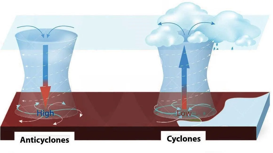
- An anticyclone is a large-scale circulation of air that rotates around a high-pressure center. The air moves in a clockwise direction in the Northern Hemisphere and counterclockwise in the Southern Hemisphere.
- Characteristics:
- High-Pressure Systems:
- Anticyclones are associated with areas of high atmospheric pressure.
- Clear Skies:
- Typically, anticyclones bring clear skies and calm weather because the air is descending, which prevents clouds from forming.
- Calm Winds:
- The winds within an anticyclone tend to be light and variable.
- Subsidence:
- Air in an anticyclone moves downward, which inhibits cloud formation and precipitation.
- Temperature Extremes:
- Anticyclones can lead to extreme temperature conditions. In the summer, they can cause heatwaves due to the lack of cloud cover, whereas, in winter, they can lead to cold, frosty conditions due to the clear skies and radiational cooling at night.
- Dry Weather:
- Since the air is descending, moisture is prevented from rising and cooling to form clouds, leading to dry conditions.
- Formation:
1. Primary cause is sinking (subsiding) air
- Anticyclones form where air descends from higher levels of the atmosphere.
- Descending air increases surface air pressure.
- This creates a high-pressure centre.
2. Thermal origin of sinking air
- In subtropical regions (~30° latitude):
- Air descends as part of the Hadley circulation.
- This produces permanent subtropical highs (e.g., Azores High, Hawaiian High).
- In polar regions:
- Extremely cold, dense air sinks.
- This creates polar high-pressure areas.
3. Dynamic origin (upper-level divergence)
- Anticyclones can also develop when air diverges at upper levels.
- Removal of air aloft causes air from below to rise slightly and then sink.
- This subsidence increases surface pressure.
4. Surface air movement
- At the surface, air flows outward from the high-pressure centre toward surrounding lower-pressure areas.
5. Role of Coriolis force
- Due to Earth’s rotation:
- In the Northern Hemisphere, outward-flowing air is deflected to the right, producing clockwise circulation.
- In the Southern Hemisphere, outward-flowing air is deflected to the left, producing anticlockwise circulation.
6. Weather associated with anticyclones
- Sinking air warms adiabatically.
- Cloud formation is suppressed.
- Anticyclones are associated with clear skies, dry weather, and stable atmospheric conditions.
- Effects:
- Weather Patterns:
- In an anticyclone, weather is generally settled and calm, with clear skies and low winds. Precipitation is rare, except for the occasional light showers from weak or fragmented systems.
- Air Quality:
- Because of the calm winds and clear skies, pollutants can accumulate under an anticyclone, leading to poor air quality, especially in urban areas.
- Temperature Inversion:
- In some cases, anticyclones can trap cooler air near the surface, leading to temperature inversions where the temperature increases with height, causing pollutants to be trapped near the ground.
- Comparison with Cyclones:
- Opposite Direction of Rotation:
- In contrast to cyclones, anticyclones involve clockwise rotation in the Northern Hemisphere and counterclockwise rotation in the Southern Hemisphere.
- Clear Weather:
- Cyclones bring cloud cover and precipitation, while anticyclones bring clear skies and dry weather.
- Pressure Systems:
- Cyclones are low-pressure systems, while anticyclones are high-pressure systems.
- Examples:
- Azores High:
- A persistent high-pressure system in the North Atlantic that influences weather patterns in Europe.
- Siberian High:
- A large, cold high-pressure system that affects the weather in Eastern Europe and Asia, particularly during winter.
- Comparison between different cyclones and anti-cylones:
-
| Type |
Formation |
Location |
Rotation |
Characteristics |
Duration |
| Temperate Cyclone |
Forms along the polar front |
Mid and high latitudes |
Counterclockwise in the Northern Hemisphere |
Associated with cold and warm fronts, causes abrupt weather changes |
Several days to weeks |
| Tropical Cyclone |
Forms over warm tropical oceans |
Near the equator, over oceans |
Counterclockwise in the Northern Hemisphere |
Intense, causes heavy rainfall, storm surges, and high winds |
Several days to a week |
| Anticyclone |
Forms in high-pressure areas |
All latitudes (especially subtropical regions) |
Clockwise in the Northern Hemisphere |
Associated with clear, dry weather, light winds |
Can persist for weeks |
- Localized short duration events
- They are of short duration, occurring over a small area but are violent
- They include:
- Thunderstorms
-
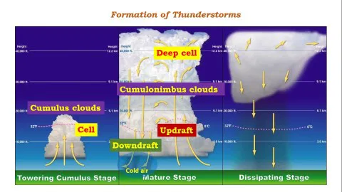
- Thunderstorms are caused by intense convection on moist hot days
- A thunderstorm is a well-grown cumulonimbus cloud producing thunder and lightning
- When the clouds extend to heights where sub-zero temperature prevails, hails are formed and they come down as hailstorm
- If there is insufficient moisture, a thunderstorm can generate duststorms
- A thunderstorm is characterised by intense updraft [an upword current of air] of rising warm air, which causes the clouds to grow bigger and rise to greater height
- This causes precipitation
- Later, downdraft brings down to earth the cool air and the rain
- Tornadoes
- A tornado is a violently rotating column of air extending from a cumulonimbus cloud to the ground.
- It is associated with severe thunderstorms, particularly supercell thunderstorms.
- Formation
-
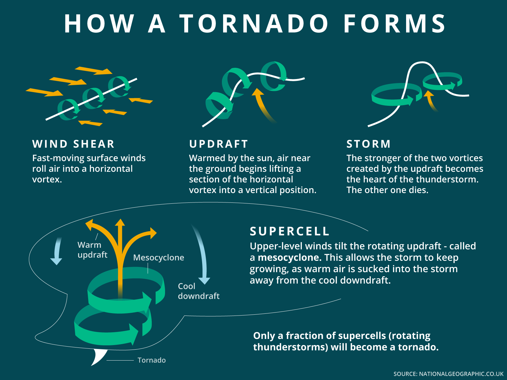
1. Warm, moist air near the surface comes into contact with cold, dry air aloft.
2. This vertical temperature contrast creates strong atmospheric instability.
3. Powerful updrafts develop within a severe thunderstorm (cumulonimbus cloud).
4. Wind shear (change in wind speed and direction with height) causes the rising air to begin rotating horizontally.
5. Strong updrafts tilt this horizontal rotation into a vertical axis.
6. The rotating air column is stretched vertically, increasing its rotational speed.
7. A funnel-shaped rotating column of air forms and descends from the cloud base.
8. When the rotating funnel reaches the ground, it becomes a tornado.
- Structure
- Tornadoes appear as a funnel-shaped cloud, often described as resembling the trunk of an elephant.
- They have:
- Extremely low pressure at the centre.
- Very high wind speeds.
- The visible funnel consists of condensed water droplets and debris.
- Intensity and impact
- Tornadoes are among the most destructive atmospheric phenomena.
- Wind speeds can exceed 300 km/h.
- They cause severe damage through:
- Strong winds
- Flying debris
- Sudden pressure drop
- Duration and size
- Tornadoes are short-lived phenomena, usually lasting a few minutes.
- They affect a relatively small area compared to cyclones.
- Distribution
- Tornadoes occur mainly in the middle latitudes.
- They are most frequent in the central United States (Tornado Alley), where warm air from the Gulf of Mexico meets cold air from Canada.
- They are rare in tropical regions.
- Tornadoes over water
- Tornadoes occurring over seas or large water bodies are called waterspouts.
- Waterspouts are generally weaker than land tornadoes.
- Twisters
- Twister is a colloquial (informal) term used to describe a tornado because of its violently twisting motion.
- Distinction from cyclones
- Tornadoes:
- Are very small in size
- Are short-lived
- Originate from thunderstorms
- Tropical cyclones:
- Cover vast areas
- Last for several days
- Originate over warm oceans
- Water in the atmosphere
- Introduction to water in the atmosphere
- You have already learnt that the air contains water vapour
- It varies from zero to four per cent by volume of the atmosphere and plays an important role in the weather phenomena
- Water is present in the atmosphere in three forms namely
- Gaseous
- Liquid
- Solid
- The moisture in the atmosphere is derived from water bodies through evaporation and from plants through transpiration
- Thus, there is a continuous exchange of water between the atmosphere, the oceans and the continents through the processes of evaporation, transpiration, condensation and precipitation
- Humidity
- Water vapour present in the air is known as humidity
- It is expressed quantitatively in different ways
- Absolute humidity
- The actual amount of the water vapour present in the atmosphere is known as the absolute humidity
- It is the weight of water vapour per unit volume of air and is expressed in terms of grams per cubic metre
- Temperature is the most important factor determining the moisture-holding capacity of air.
- The absolute humidity differs from place to place on the surface of the earth
- Relative humidity
- The percentage of moisture present in the atmosphere as compared to its full capacity at a given temperature is known as the relative humidity
- It is greater over the oceans and least over the continents
- Effect of temperature
- With the change of air temperature, the capacity to retain moisture increases or decreases and the relative humidity is also affected
- Saturation point
- The air containing moisture to its full capacity at a given temperature is said to be saturated
- It means that the air at the given temperature is incapable of holding any additional amount of moisture at that stage
- The temperature at which saturation occurs in a given sample of air is known as dew point
- Evaporation
- The amount of water vapour in the atmosphere is added or withdrawn due to evaporation and condensation respectively
- Evaporation is a process by which water is transformed from liquid to gaseous state
- Heat is the main cause for evaporation
- Latent heat of vaporization refers to the amount of heat energy required to convert a unit mass of a liquid (like water) into a gas (vapor) without changing its temperature.
- Increase in temperature increases water absorption and retention capacity of the given parcel of air
- Higher temperatures increases the rate of evaporation because the liquid water molecules gain enough energy to break free from the surface and enter the atmosphere as water vapor.
- As the temperature of the air rises, the water molecules in the air gain energy and become more spread out. This allows the air to hold a greater amount of water vapor.
- When the air temperature increases, the saturation point also increases, meaning air can hold more moisture before it becomes saturated and condensation occurs.
- Similarly, if the moisture content is low, air has a potentiality of absorbing and retaining moisture
- Impact of movement of air
- Movement of air replaces the saturated layer with the unsaturated layer
- Hence, the greater the movement of air, the greater is the evaporation
- Condensation
- The transformation of water vapour into water is called condensation
- Condensation is caused by the loss of heat
- When moist air is cooled, it may reach a level when its capacity to hold water vapour ceases, then, the excess water vapour condenses into liquid form
- If it directly condenses into solid form, it is known as sublimation
- Conditions for condensation include:
- Moisture in the air:
- The air must contain sufficient water vapor
- A surface with a temperature below the dew point:
- This occurs when warm, moist air comes into contact with a cooler surface, causing the water vapor to condense.
- Impact of dust particles
- In free air, condensation results from cooling around very small particles termed as hygroscopic condensation nuclei
- Particles of dust, smoke and salt from the ocean are particularly good nuclei because they absorb water
- Impact of various factors
- Condensation also takes place when the moist air comes in contact with some colder object and it may also take place when the temperature is close to the dew point
- Condensation, therefore, depends upon the amount of cooling and the relative humidity of the air
- Condensation is influenced by the volume of air, temperature, pressure and humidity
- Unconventinal ways in which condensation can occur:
- When the temperature of the air is reduced to dew point with its volume remaining constant
- When both the volume and the temperature are reduced
- Forms of condensation
- Condensation can take place when the dew point is lower than the freezing point or even if it is higher than the freezing point
- This leads to different forms of condensations like frost, liquid, etc
- Different forms include:
- Dew
- When the moisture is deposited in the form of water droplets on cooler surfaces of solid objects (rather than nuclei in air above the surface) such as stones, grass blades and plant leaves, it is known as dew
- The ideal conditions for its formation are clear sky, calm air, high relative humidity, and cold and long nights
- For the formation of dew, it is necessary that the dew point is above the freezing point
- Frost
- Frost forms on cold surfaces when condensation takes place below freezing point (0°C), i.e. the dew point is at or below the freezing point
- The excess moisture is deposited in the form of minute ice crystals instead of water droplets
- The ideal conditions for the formation of white frost are the same as those for the formation of dew, except that the air temperature must be at or below the freezing point
- Fog and mist
- When the temperature of an air mass containing a large quantity of water vapour falls all of a sudden, condensation takes place within itself on fine dust particles
- Fogs are mini clouds in which condensation takes place around nuclei provided by the dust, smoke, and the salt particles
- So, the fog is a cloud with its base at or very near to the ground
- Because of the fog and mist, the visibility becomes poor to zero
- Difference between fog and mist
- The only difference between the mist and fog is that mist contains more moisture than the fog
- In mist each nuclei contains a thicker layer of moisture
- Mists are frequent over mountains as the rising warm air up the slopes meets a cold surface
- Fogs are drier than mist and they are prevalent where warm currents of air come in contact with cold currents
- Smog
- In urban and industrial centres smoke provides plenty of nuclei which help the formation of fog and mist
- Such a condition when fog is mixed with smoke, is described as smog
- Clouds
-
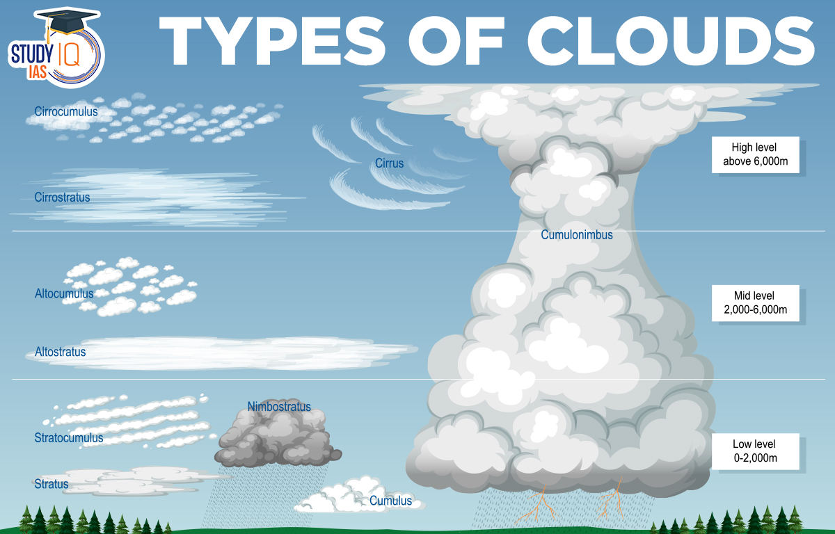
- Cloud is a mass of minute water droplets or tiny crystals of ice formed by the condensation of the water vapour in free air at considerable elevations
- As the clouds are formed at some height over the surface of the earth, they take various shapes
- According to their height, expanse, density and transparency or opaqueness clouds are grouped under four types:
- Cirrus
- Cirrus clouds are formed at high altitudes (8,000 - 12,000m)
- They are thin and detached clouds having a feathery appearance
- They are always white in colour
- Cumulus
- Cumulus clouds look like cotton wool
- They are generally formed at a height of 4,000 - 7,000 m
- They exist in patches and can be seen scattered here and there
- They have a flat base
- Stratus
- As their name implies, these are layered clouds covering large portions of the sky
- These clouds are generally formed either due to loss of heat or the mixing of air masses with different temperatures
- Nimbus
- Nimbus clouds are black or dark gray
- They form at middle levels or very near to the surface of the earth
- These are extremely dense and opaque to the rays of the sun
- Sometimes, the clouds are so low that they seem to touch the ground
- Nimbus clouds are shapeless masses of thick vapour
- Combinations
- High clouds
- Cirrostratus
- Cirrocumulus
- Middle clouds
- Altostratus
- Altocumulus
- Low clouds
- Stratocumulus
- Nimbostratus
- Clouds with extensive vertical development
- Cumulonimbus
- Precipitation
- In meteorology, precipitation is any product of the condensation of atmospheric water vapor that falls from clouds due to gravitational pull.
- This may take place in liquid or solid form
- The process of continuous condensation in free air helps the condensed particles to grow in size
- When the resistance of the air fails to hold them against the force of gravity, they fall on to the earth’s surface
- So after the condensation of water vapour, the release of moisture is known as precipitation
- The main forms of precipitation include drizzle, rain, Rain and snow mixed, snow, ice pellets, graupel and hail.
- The precipitation in the form of water is called rainfall, when the temperature is lower than the 0°C, precipitation takes place in the form of fine flakes of snow and is called snowfall
- Moisture is released in the form of hexagonal crystals, these crystals form flakes of snow
- Besides rain and snow, other forms of precipitation are sleet and hail, though the latter are limited in occurrence and are sporadic [infrequent / irregular] in both time and space
- Types of precipitation processes
- Convectional
-
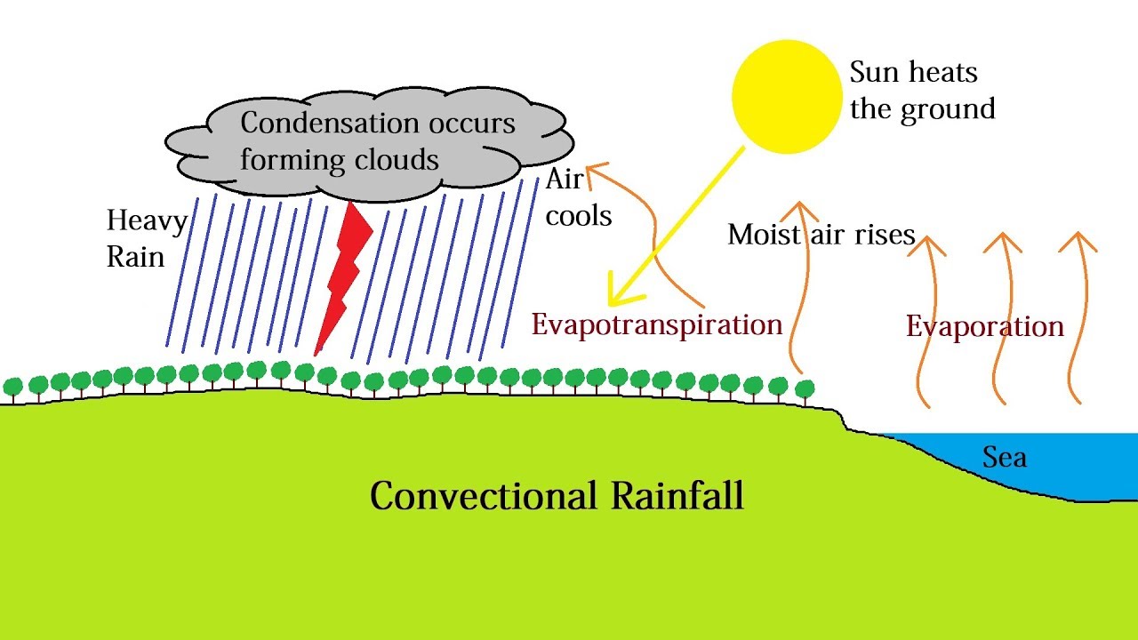
- The, air on being heated, becomes light and rises up in convection currents
- As it rises, it expands and loses heat and consequently, condensation takes place and cumulous clouds are formed
- With thunder and lightning, heavy rainfall takes place but this does not last long
- Such rain is common in the summer or in the hotter part of the day
- It is very common in the equatorial regions and interior parts of the continents, particularly in the northern hemisphere
- Orographic (Relief rain)
-
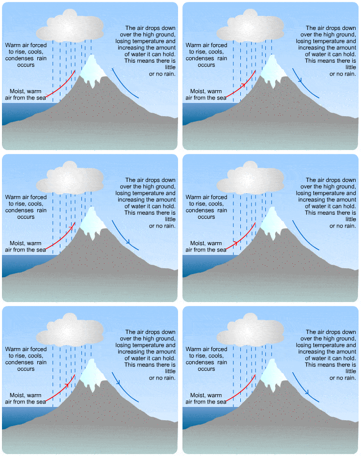
-
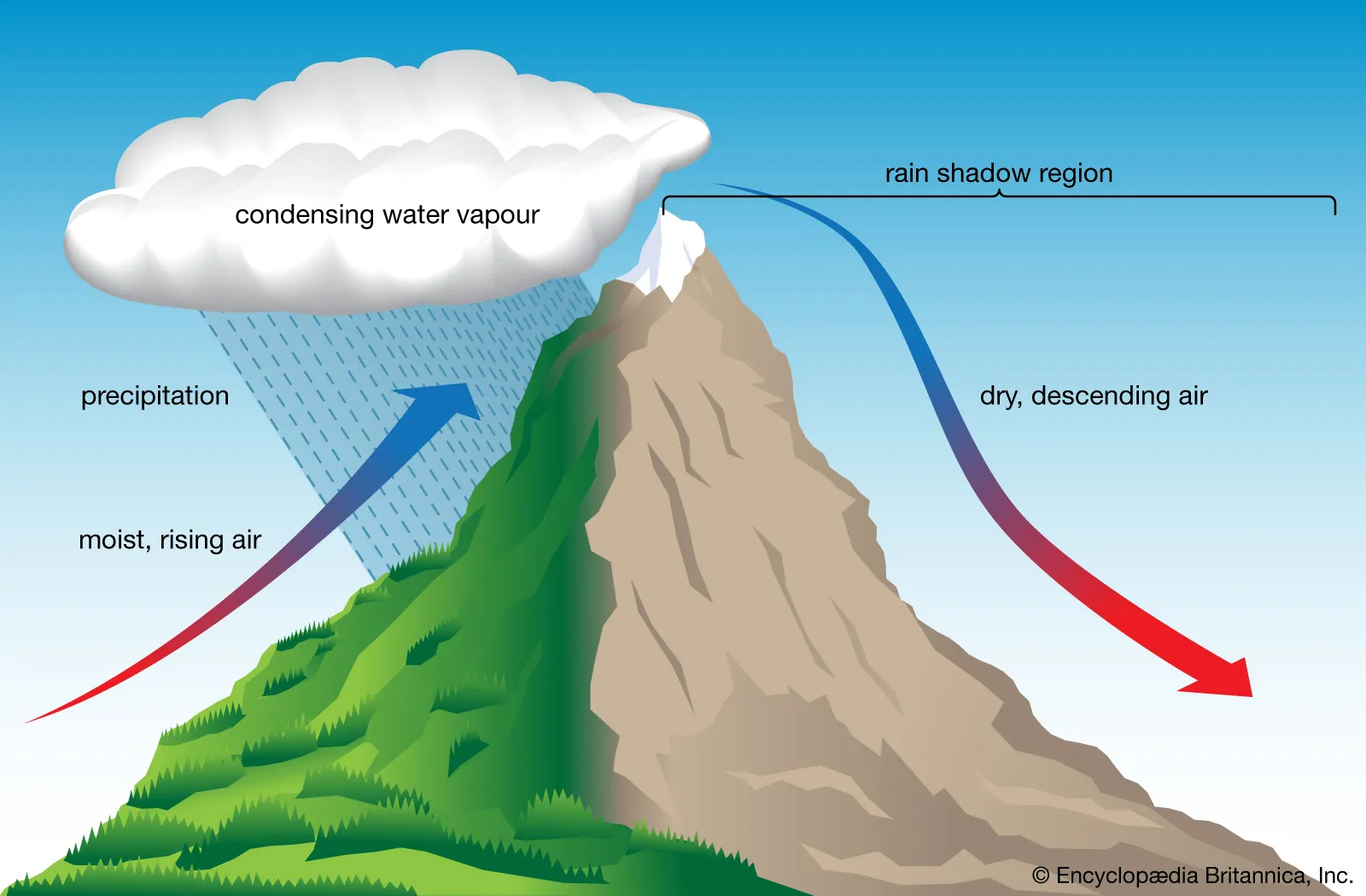
- When the saturated air mass comes across a mountain, it is forced to ascend and as it rises, it expands; the temperature falls, and the moisture is condensed
- The chief characteristic of this sort of rain is that the windward slopes receive greater rainfall
- After giving rain on the windward side, when these winds reach the other slope, they descend, and their temperature rises
- Then their capacity to take in moisture increases and hence, these leeward slopes remain rainless and dry
- The area situated on the leeward side, which gets less rainfall is known as the rain-shadow area
- It is also known as the relief rain
- There is no different term used for mountains blocking the clouds, it comes under the orographic only
- Cyclonic (Frontal rainfall)
-
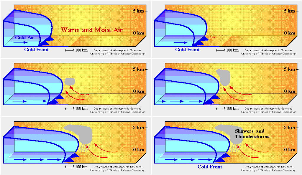
-
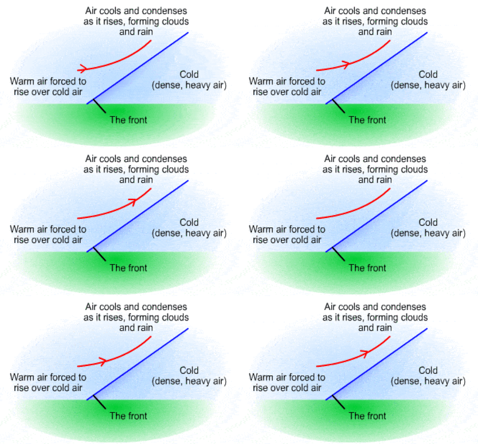
- Cyclonic rainfall, also known as frontal rainfall, occurs when two distinct air masses (warm and cold) converge, causing the warm air to rise and cool, leading to condensation and precipitation.
- This type of rainfall is associated with cyclones, which are large air masses with rotating winds and a low-pressure center.
- Type of precipitation
-
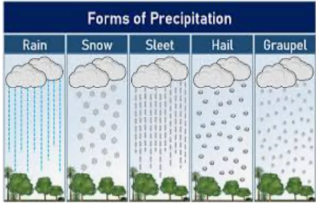
- Rain
- In meteorology, rain refers to liquid water falling from the sky in the form of drops, typically larger than drizzle (0.5 mm or more).
- Drizzle
- In meteorology, drizzle refers to light precipitation consisting of numerous, very small water droplets.
- These droplets are typically less than 0.5 mm in diameter and fall at a rate of less than 1 mm per hour.
- Drizzle is generally produced by low stratiform clouds and is often associated with overcast or cloudy weather.
- Snow
- In meteorology, snow refers to precipitation in the form of ice crystals that fall from clouds.
- Snow is formed when water vapour in clouds freezes directly into ice without first becoming liquid.
- These ice crystals join together to form snowflakes.
- Snowflakes grow in size as they collide and stick together while falling through cold air.
- Snow occurs when the temperature of the cloud and the air between the cloud and the ground is below 0°C.
- Unlike sleet, snow does not melt into rain before reaching the ground.
- Snow is generally associated with cold regions, winter seasons, and high-altitude areas.
- Sleet
- Sleet is frozen raindrops and refrozen melted snow-water (a mix of rain and snow)
- Sleet is different from snow as, snow is made of flakes made in clouds, while it is rain which got frozen mid way.
- When a layer of air with the temperature above freezing point overlies a subfreezing layer near the ground, precipitation takes place in the form of sleet
- Raindrops, which leave the warmer air, encounter the colder air below
- As a result, they solidify and reach the ground as small pellets of ice not bigger than the raindrops from which they are formed
- Hail
- Sometimes, drops of rain after being released by the clouds become solidified into small rounded solid pieces of ice and which reach the surface of the earth are called hailstones
- These are formed by the rainwater passing through the colder layers
- Hailstones have several concentric layers of ice one over the other
- World Distribution of Rainfall
-
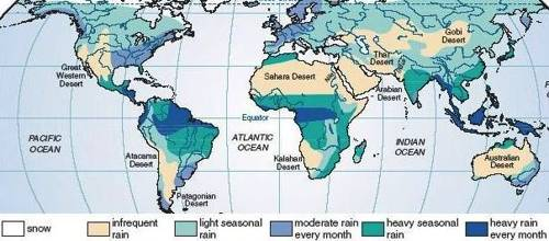
- Distribution variation
- Different places on Earth receive varying amounts of rainfall throughout the year and across different seasons.
- Rainfall generally decreases as we move from the equator towards the poles.
- Coastal areas receive more rainfall compared to the interior regions of continents.
- Oceans receive more rainfall than landmasses due to their vast water sources.
- Between latitudes 35° and 40° N and S of the equator, rainfall is heavier on the eastern coasts, decreasing towards the west.
- Between latitudes 45° and 65° N and S, the westerlies cause more rainfall on the western margins of continents, decreasing towards the east.
- In regions where mountains run parallel to the coast, rainfall is greater on the windward side of the mountains, decreasing towards the leeward side.
- Seasonal distribution
- Some regions experience evenly distributed rainfall throughout the year, such as:
- The equatorial belt
- Western parts of cool temperate regions
- Precipitation Regimes
- Based on annual precipitation, the major precipitation regimes of the world are categorized as follows:
- Heavy Rainfall (>200 cm per annum):
- Equatorial belt
- Windward slopes of mountains along the western coasts in the cool temperate zone
- Coastal areas of monsoon lands
- Moderate Rainfall (100 - 200 cm per annum):
- Interior continental areas
- Coastal regions of continents
- Light Rainfall (50 - 100 cm per annum):
- Central parts of tropical lands
- Eastern and interior parts of temperate lands
- Very Low Rainfall (<50 cm per annum):
- Rain shadow zones of interior continents
- High latitudes
- Subcontinent
-
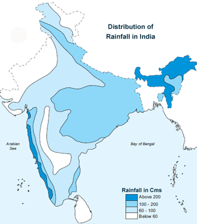
- World climate and climate change
- Introduction to world climate
- Overview
- The world climate can be studied by organising information and data on climate and synthesising [the combination of components or elements to form a connected whole] them in smaller units for easy understanding, description and analysis
- Three broad approaches have been adopted for classifying climate
- They are empirical, genetic and applied
- Empirical classification is based on observed data, particularly on temperature and precipitation
- Genetic classification attempts to organise climates according to their causes
- Applied classification is for specific purpose
- Koeppen’s scheme of classification of climate
- Overview
- The most widely used classification of climate is the empirical climate classification scheme developed by V. Koeppen
- Koeppen identified a close relationship between the distribution of vegetation and climate
- He selected certain values of temperature and precipitation and related them to the distribution of vegetation and used these values for classifying the climates
- It is an empirical classification based on mean annual and mean monthly temperature and precipitation data
- He introduced the use of capital and small letters to designate climatic groups and types
- Although developed in 1918 and modified over a period of time, Koeppen’s scheme is still popular and in use
- Koeppen recognised five major climatic groups, four of them are based on temperature and one on precipitation
- Table 12.1 lists the climatic groups and their characteristics according to Koeppen
- The capital letters: A, C, D and E delineate humid climates and B dry climates
- The climatic groups are subdivided into types, designated by small letters, based on seasonality of precipitation and temperature characteristics
- The seasons of dryness are indicated by the small letters: f, m, w and s, where f corresponds to no dry season, m - monsoon climate, w - winter dry season and s - summer dry season
- The small letters a, b, c and d refer to the degree of severity of temperature
- The Dry Climates are subdivided using the capital letters:
- S for steppe or semi-arid
- W for deserts
- The climatic types are listed in Table 12.2
- The distribution of climatic groups and types is shown in Table 12.1
| Season Basis |
Letter |
Meaning |
Defining Criterion |
Indicates |
Examples |
| Rainfall distribution |
f |
No dry season |
Rainfall in all months |
Uniform rainfall |
Af, Cfa, Cfb |
| m |
Monsoon |
Short dry season, very high rainfall |
Seasonal rainfall concentration |
Am |
| w |
Winter dry season |
Driest period in winter |
Dry winters, wet summers |
Aw, Cwa |
| s |
Summer dry season |
Driest period in summer |
Dry summers, wet winters |
Csa, Csb |
| Summer temperature severity |
a |
Hot summer |
Warmest month 22 C or more |
Very hot summers |
Cfa, Dfa |
| b |
Warm summer |
Warmest month below 22 C, at least 4 months above 10 C |
Moderate summers |
Cfb, Dfb |
| c |
Cool short summer |
Only 1 to 3 months above 10 C |
Short cool summers |
Cfc, Dfc |
| Winter temperature severity |
d |
Very severe winter |
Coldest month minus 38 C or below |
Extremely cold winters |
Dfd |
| Dry climate temperature |
h |
Hot dry climate |
Mean annual temperature 18 C or more |
Hot deserts and steppes |
BWh, BSh |
| k |
Cold dry climate |
Mean annual temperature below 18 C |
Cold deserts and steppes |
BWk, BSk |
| Group |
Characteristics and Classification Logic |
| A - Tropical |
- Primary group based on temperature
- Coldest month temperature ≥ 18 C
- No true winter
- Classification uses modifiers:
- f – no dry season
- m – monsoon type
- w – winter dry
- Letters indicate rainfall seasonality, not subdivision
|
| B - Dry Climates |
- Primary group based on aridity
- Potential evaporation exceeds precipitation
- True subdivision based on degree of aridity:
- S – steppe (semi-arid)
- W – desert (arid)
- Temperature modifiers used after subdivision:
- h – hot (mean annual temperature ≥ 18 C)
- k – cold (mean annual temperature < 18 C)
|
| C - Warm Temperate (Mid-latitude) |
- Primary group based on temperature
- Coldest month temperature:
- No true subdivision within group
- Classification uses modifiers:
- f, s, w – rainfall seasonality
- a, b, c – summer temperature severity
|
| D - Cold Snow Forest |
- Primary group based on temperature
- Coldest month temperature ≤ -3 C
- Warmest month > 10 C
- No true subdivision within group
- Classification uses modifiers:
- f, s, w – rainfall seasonality
- a, b, c – summer temperature severity
- d – very severe winter
|
| E - Polar |
- Primary group based on temperature
- Average temperature of all months < 10 C
- True subdivision based on temperature:
|
| Group |
Climate Type |
Letter Code |
Annual Rainfall |
Temperature (UPSC-grade) |
Vegetation |
Geographical Location |
Features |
Reason |
| A - Tropical Humid |
Tropical Rainforest |
Af |
>2000 mm; year-round rain; no dry month (<60 mm) |
All months >18°C; mean 25–27°C; low annual range |
Dense evergreen forests |
Amazon, Congo, SE Asia |
No dry season, daily convectional rain |
Permanent ITCZ + convection |
| Tropical Monsoon |
Am |
1800–3000 mm; strong summer peak; short dry season |
All months >18°C; summer ~28–32°C |
Monsoon deciduous forests |
India, Myanmar, Guinea coast |
Very heavy summer rain |
Seasonal ITCZ + monsoon winds |
| Savanna (Wet & Dry) |
Aw |
750–1600 mm; seasonal; long dry winter |
Summer >25°C; winter ~18–22°C |
Tall grass, scattered trees |
Sudan, Brazil, Deccan |
Wet–dry contrast |
ITCZ seasonal shift |
| B - Dry |
Hot Steppe |
BSh |
250–500 mm; short irregular wet season |
Mean >18°C; summer ~30–40°C |
Short grass, thorn scrub |
Sahel, Rajasthan |
Semi-arid belt |
Edge of subtropical highs |
| Hot Desert |
BWh |
<250 mm; rainfall rare and erratic |
Mean >18°C; summer often >45°C |
Xerophytes |
Sahara, Arabia |
Extreme aridity |
Descending dry air |
| Cold Steppe |
BSk |
250–500 mm; seasonal; summer peak |
Summer ~20–30°C; winter <0°C |
Temperate grass |
Central Asia, Great Plains |
Large temp range |
Continental interior |
| Cold Desert |
BWk |
<250 mm; low and erratic; often snow |
Summer warm; winter often <0°C |
Desert scrub |
Gobi, Patagonia |
Cold arid |
Rain shadow + interiority |
| C - Warm Temperate |
Humid Subtropical (China type) |
Cfa |
750–1500 mm; year-round; summer maximum |
Summer >22°C; winter ~0–10°C |
Mixed forest |
SE USA, Japan |
Humid summers |
Westerlies + convection |
| Humid Subtropical (Monsoon) |
Cwa |
800–1500 mm; summer maximum; dry winter |
Summer >22°C; cool winter ~5–12°C |
Monsoon forest |
N India, N China |
Monsoon pattern |
Seasonal wind reversal |
| Mediterranean |
Csa/Csb |
400–900 mm; winter rain; summer drought |
Summer ~25–30°C; winter ~5–12°C |
Scrub, olive |
Mediterranean, California |
Dry summer |
Subtropical high in summer |
| Marine West Coast |
Cfb |
1000–2000 mm; year-round; winter maximum |
Summer ~15–20°C; winter ~5–10°C |
Deciduous + conifer |
W Europe, NZ |
Cloudy, moist |
Westerlies + ocean currents |
| D - Cold (Microthermal) |
Humid Continental |
Dfa/Dfb |
500–1000 mm; year-round; summer peak; winter snow |
Summer >20°C; winter often <−5°C |
Mixed forest |
NE USA, E Europe |
Four seasons |
Mid-latitude interior |
| Subarctic |
Dfc |
300–600 mm; low total; summer peak |
Summer ~10–15°C; winter −20°C or lower |
Taiga |
Siberia, Canada |
Very long winters |
High-latitude continental |
| E - Polar |
Tundra |
ET |
<300 mm; very low; mostly snow |
Warmest month 0–10°C |
Moss, lichens |
Arctic coasts |
No trees |
Permafrost + weak sun |
| Ice Cap |
EF |
<100 mm; polar desert; snowfall only |
All months below 0°C |
None |
Antarctica, Greenland |
Permanent ice |
Extreme polar cold |
-
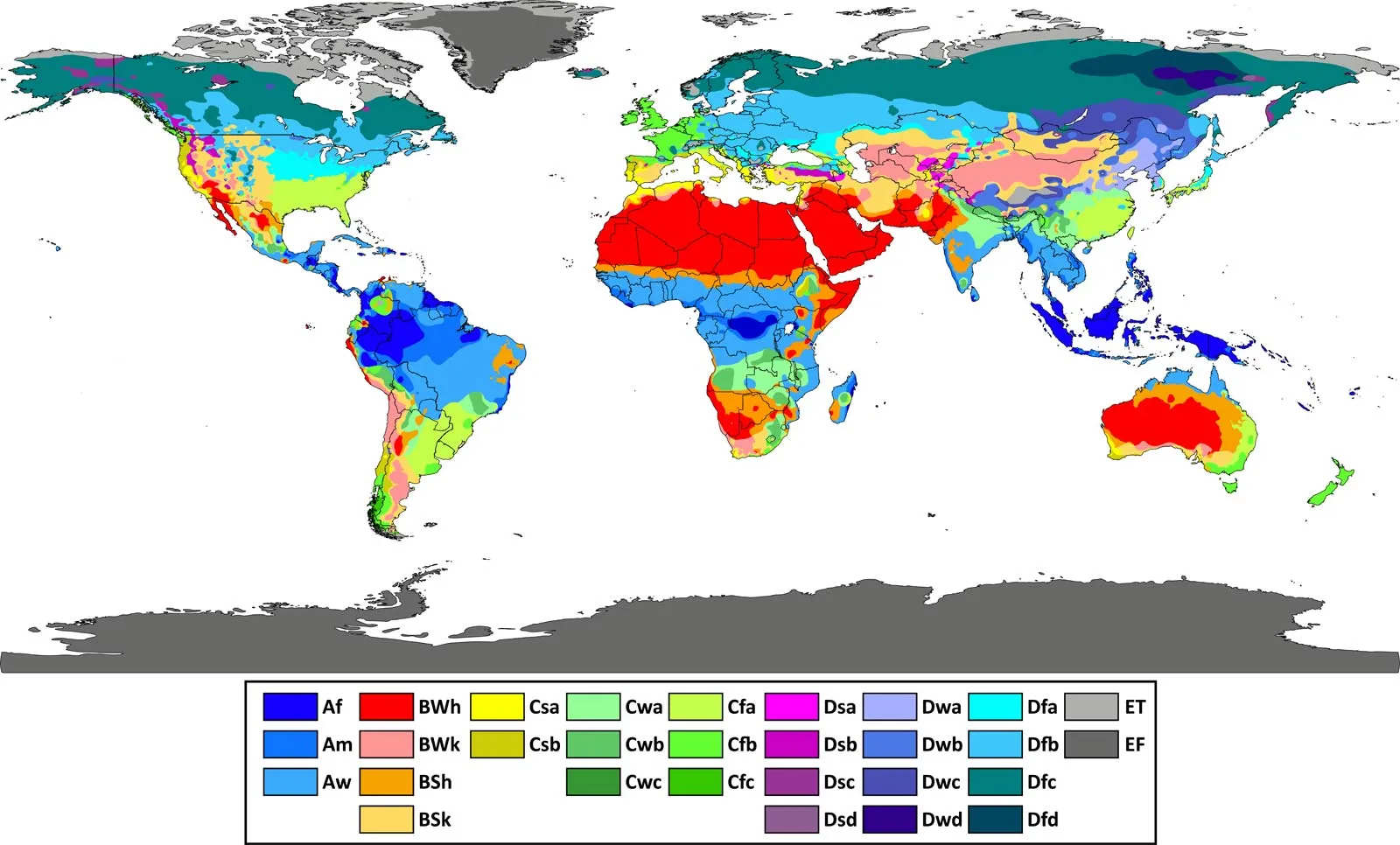
- Group A: Tropical humid climates
- Overview
- Tropical humid climates exist between Tropic of Cancer and Tropic of Capricorn
- The sun being overhead throughout the year and the presence of Inter Tropical Convergence Zone (ITCZ) make the climate hot and humid
- Annual range of temperature is very low and annual rainfall is high
- The tropical group is divided into three types, namely
1. Af - Tropical wet climate
2. Am - Tropical monsoon climate
3. Aw - Tropical wet and dry climate
- Tropical wet climate (Af)
- Tropical wet climate is found near the equator
- The major areas are the Amazon Basin in South America, western equatorial Africa and the islands of East Indies
- Significant amount of rainfall occurs in every month of the year as thunder showers in the afternoon
- The temperature is uniformly high and the annual range of temperature is negligible
- The maximum temperature on any day is around 30°C while the minimum temperature is around 20°C
- Tropical evergreen forests with dense canopy cover and large biodiversity are found in this climate
- Tropical monsoon climate (Am)
- Tropical monsoon climate (Am) is found over the Indian sub-continent, North Eastern part of South America and Northern Australia
- Heavy rainfall occurs mostly in summer
- Winter is dry
- The detailed climatic account of this climatic type is given in the book on India: Physical Environment
- Tropical wet and dry climate (Aw)
- Tropical wet and dry climate occurs north and south of Af type climate regions
- It borders with dry climate on the western part of the continent and Cf or Cw on the eastern part
- Extensive Aw climate is found to the north and south of the Amazon forest in Brazil and adjoining parts of Bolivia and Paraguay in South America, Sudan and south of Central Africa
- The annual rainfall in this climate is considerably less than that in Af and Am climate types and is variable also
- The wet season is shorter and the dry season is longer with the drought being more severe
- Temperature is high throughout the year and diurnal ranges of temperature are the greatest in the dry season
- Deciduous forest and tree-shredded grasslands occur in this climate
- Dry climates: B
- Overview
- Dry climates are characterised by very low rainfall that is not adequate for the growth of plants
- These climates cover a very large area of the planet extending over large latitudes from 15° - 60° north and south of the equator
- At low latitudes, from 15° - 30°, they occur in the area of subtropical high where subsidence and inversion of temperature do not produce rainfall
- On the western margin of the continents, adjoining the cold current, particularly over the west coast of South America, they extend more equatorwards and occur on the coast land
- In middle latitudes, from 35° - 60° north and south of equator, they are confined to the interior of continents where maritime-humid winds do not reach and to areas often surrounded by mountains
- Dry climates are divided into steppe or semi-arid climate (BS) and desert climate (BW)
- They are further subdivided as subtropical steppe (BSh) and subtropical desert (BWh) at latitudes from 15° - 35° and mid-latitude steppe (BSk) and mid-latitude desert (BWk) at latitudes between 35° - 60°
- Subtropical steppe (BSh) and subtropical desert (BWh) climates
- Subtropical steppe (BSh) and subtropical desert (BWh) have common precipitation and temperature characteristics
- Located in the transition zone between humid and dry climates, subtropical steppe receives slightly more rainfall than the desert, adequate enough for the growth of sparse grasslands
- The rainfall in both the climates is highly variable
- The variability in the rainfall affects the life in the steppe much more than in the desert, more often causing famine
- Rain occurs in short intense thundershowers in deserts and is ineffective in building soil moisture
- Fog is common in coastal deserts bordering cold currents
- Maximum temperature in the summer is very high
- The highest shade temperature of 58° C was recorded at Al Aziziyah, Libya on 13 September 1922
- The annual and diurnal ranges of temperature are also high
- Warm temperate (mid-latitude) climates - C
- Overview
- Warm temperate (mid-latitude) climates extend from 30° - 50° of latitude mainly on the eastern and western margins of continents
- These climates generally have warm summers with mild winters
- They are grouped into four types:
1. Humid subtropical, i.e. dry in winter and hot in summer (Cwa)
2. Mediterranean (Cs)
3. Humid subtropical, i.e. no dry season and mild winter (Cfa)
4. Marine west coast climate (Cfb)
- Humid subtropical climate (Cwa)
- Humid subtropical climate occurs poleward of Tropic of Cancer and Capricorn, mainly in North Indian plains and South China interior plains
- The climate is similar to Aw climate except that the temperature in winter is warm
- Mediterranean climate (Cs)
- As the name suggests, Mediterranean climate occurs around Mediterranean sea, along the west coast of continents in subtropical latitudes between 30° - 40° latitudes e.g. — Central California, Central Chile, along the coast in south eastern and south western Australia
- These areas come under the influence of sub tropical high in summer and westerly wind in winter
- Hence, the climate is characterised by hot, dry summer and mild, rainy winter
- Monthly average temperature in summer is around 25° C and in winter below 10°C
- The annual precipitation ranges between 35 - 90 cm
- Humid subtropical (Cfa) climate
- Humid subtropical climate lies on the eastern parts of the continent in subtropical latitudes
- In this region the air masses are generally unstable and cause rainfall throughout the year
- They occur in eastern United States of America, southern and eastern China, southern Japan, northeastern Argentina, coastal south Africa and eastern coast of Australia
- The annual averages of precipitation vary from 75-150 cm
- Thunderstorms in summer and frontal precipitation in winter are common
- Mean monthly temperature in summer is around 27°C, and in winter it varies from 5°-12° C
- The daily range of temperature is small
- Marine west coast climate (Cfb)
- Marine west coast climate is located poleward from the Mediterranean climate on the west coast of the continents
- The main areas are: Northwestern Europe, west coast of North America, north of California, southern Chile, southeastern Australia and New Zealand
- Due to marine influence, the temperature is moderate and in winter, it is warmer than for its latitude
- The mean temperature in summer months ranges from 15°-20°C and in winter 4°-10°C
- The annual and daily ranges of temperature are small
- Precipitation occurs throughout the year
- Precipitation varies greatly from 50-250cm
- Cold snow forest climates (D)
- Overview
- Cold snow forest climates occur in the large continental area in the northern hemisphere between 40°-70° north latitudes in Europe, Asia and North America
- Cold snow forest climates are divided into two types:
1. Df - cold climate with humid winter
2. Dw - cold climate with dry winter
- The severity of winter is more pronounced in higher latitudes
- Cold climate with humid winters (Df)
- Cold climate with humid winter occurs poleward of marine west coast climate and mid latitude steppe
- The winters are cold and snowy
- The frost free season is short
- The annual ranges of temperature are large
- The weather changes are abrupt and short
- Poleward, the winters are more severe
- Cold climate with dry winters (Dw)
- Cold climate with dry winter occurs mainly over Northeastern Asia
- The development of pronounced winter anti cyclone and its weakening in summer sets in monsoon like reversal of wind in this region
- Poleward summer temperatures are lower and winter temperatures are extremely low with many locations experiencing below freezing point temperatures for up to seven months in a year
- Precipitation occurs in summer
- The annual precipitation is low from 12-15 cm
- Polar climates (E)
- Overview
- Polar climates exist poleward beyond 70° latitude
- Polar climates consist of two types:
1. Tundra (ET)
2. Ice Cap (EF)
- Tundra climate (ET)
- The tundra climate (ET) is so called after the types of vegetation, like low growing mosses, lichens and flowering plants
- This is the region of permafrost where the sub soil is permanently frozen
- The short growing season and water logging support only low growing plants
- During summer, the tundra regions have very long duration of day light
- Ice cap climate (EF)
- The ice cap climate (EF) occurs over interior Greenland and Antarctica
- Even in summer, the temperature is below freezing point
- This area receives very little precipitation
- The snow and ice get accumulated and the mounting pressure causes the deformation of the ice sheets and they break
- They move as icebergs that float in the Arctic and Antarctic waters
- Plateau Station, Antarctica, 79°S, portray this climate
- Highland climates (H)
- Highland climates are governed by topography
- In high mountains, large changes in mean temperature occur over short distances
- Precipitation types and intensity also vary spatially across high lands
- There is vertical zonation of layering of climatic types with elevation in the mountain environment
- Soil types based on climate
- International classification
-
| Soil Order |
Main Characteristics |
Typical Locations |
Vegetation |
| Gelisols |
Soils with permafrost; found in very cold climates |
Arctic, Antarctica, Siberia |
Cold tundra vegetation; mosses, lichens, small shrubs |
| Histosols |
Organic-rich soils; formed in wetlands |
Peat bogs, marshes (e.g., Finland, Canada) |
Wetland vegetation; sedges, grasses, mosses |
| Spodosols |
Acidic soils with subsurface accumulation of organic matter and metals |
Cool, moist forests (e.g., Russia, Canada) |
Coniferous forests; pines, spruces |
| Andisols |
Formed from volcanic ash; fertile |
Japan, Pacific Ring of Fire |
Tropical and subtropical forests; mixed vegetation |
| Oxisols |
Highly weathered, nutrient-poor tropical soils |
Amazon, Congo Basin |
Tropical rainforests; dense, evergreen trees |
| Vertisols |
Clay-rich soils that shrink and swell |
Deccan Plateau (India), Australia |
Grasslands, savannas |
| Aridisols |
Soils of dry regions; low organic matter |
Deserts (Thar, Sahara) |
Desert vegetation; cacti, drought-resistant plants |
| Ultisols |
Highly leached, acidic soils; less fertile |
Southeast USA, parts of India |
Tropical and subtropical forests |
| Mollisols |
Fertile soils with thick organic-rich surface; grassland soils |
Prairies (USA), Steppes |
Grasslands; tall grasses, herbs |
| Alfisols |
Moderately leached, fertile soils; common in deciduous forest areas |
Europe, Northern India |
Deciduous forests; oak, maple, beech trees |
| Inceptisols |
Young soils with minimal horizon development |
Mountain slopes, foothills |
Varied vegetation depending on the location; shrubs, grasses, forests |
| Entisols |
Very young soils; minimal profile |
River deltas, sand dunes, glacial areas |
Grasslands, sparse vegetation in sandy areas |
- India classification
-
| Soil Type |
Characteristics |
Locations |
Vegetation |
| Alluvial Soil |
Fertile, rich in minerals, fine-grained |
River basins of the Himalayas, Ganges, Brahmaputra, Indus, Narmada |
Wheat, rice, sugarcane, cotton |
| Black Soil |
Rich in lime, iron, magnesium, and alumina; moisture-retaining |
Deccan Plateau, Maharashtra, Madhya Pradesh, Gujarat, Andhra Pradesh |
Cotton, groundnut, soybeans, pulses |
| Red Soil |
High in iron oxide, well-drained, low in fertility |
Tamil Nadu, Karnataka, parts of Andhra Pradesh, Odisha |
Cashew, millet, groundnut |
| Yellow Soil |
Slightly acidic, rich in potash and clay, low in nitrogen |
Chhattisgarh, Odisha, Deccan Plateau |
Rice, groundnut, cotton |
| Laterite Soil |
Rich in iron and aluminum, well-drained, acidic |
Western Ghats, Kerala, Karnataka, Goa, Eastern Ghats |
Teak, sal, coffee, tea plantations |
| Saline Soil |
High salt content, poor fertility |
Rajasthan, Gujarat, coastal Andhra Pradesh |
Cacti, salt-tolerant plants |
| Peaty and Marshy Soil |
Rich in organic matter, waterlogged, high in acidity |
West Bengal, Assam, Uttar Pradesh |
Rice, reeds, marsh plants |
| Arid Soil |
Dry, sandy, low in nitrogen and organic matter, prone to erosion |
Rajasthan, Gujarat, Haryana |
Drought-resistant plants, cactus, shrubs |
| Forest Soil |
Rich in humus, slightly acidic, found in tropical and subtropical regions |
Himalayan region, temperate zone |
Coniferous and deciduous forests |
- Climate change
- Overview
- The earlier chapters on climate summarised our understanding of climate as it prevails now
- The type of climate we experience now might be prevailing over the last 10,000 years with minor and occasionally wide fluctuations [variation]
- The planet earth has witnessed many variations in climate since the beginning
- Geological records show alteration [change / modification] of glacial and inter-glacial periods
- The geomorphological features, especially in high altitudes and high latitudes, exhibit traces of advances and retreats of glaciers
- The sediment deposits in glacial lakes also reveal the occurrence of warm and cold periods
- The rings in the trees provide clues about wet and dry periods
- Historical records describe the vagaries in climate
- All these evidences indicate that change in climate is a natural and continuous process
- Historical climate variations
- India also witnessed alternate wet and dry periods
- Archaeological findings show that the Rajasthan desert experienced wet and cool climate around 8,000 B.C.
- The period 3,000-1,700 B.C. had higher rainfall
- From about 2,000-1,700 B.C., this region was the centre of the Harappan civilisation
- Dry conditions accentuated [make more noticeable or prominent] since then
- In the geological past, the earth was warm some 500-300 million years ago, through the Cambrian, Ordovician and Silurian periods
- During the Pleistocene epoch, glacial and inter-glacial periods occurred, the last major peak glacial period was about 18,000 years ago
- The present inter-glacial period started 10,000 years ago
- Climate in the recent past
- Variability in climate occurs all the time
- The nineties decade of the last century witnessed extreme weather events
- The 1990s recorded the warmest temperature of the century and some of the worst floods around the world
- The worst devastating drought in the Sahel region, south of the Sahara desert, from 1967-1977 is one such variability
- During the 1930s, severe drought occurred in southwestern Great Plains of the United States, described as the dust bowl
- Historical records of crop yield or crop failures, of floods and migration of people tell about the effects of changing climate
- A number of times Europe witnessed warm, wet, cold and dry periods, the significant episodes were the warm and dry conditions in the tenth and eleventh centuries, when the Vikings settled in Greenland
- Europe witnessed “Little Ice Age” from 1550 to about 1850
- From about 1885-1940 world temperature showed an upward trend
- After 1940, the rate of increase in temperature slowed down
- Causes of climate change
-
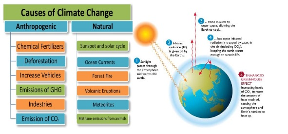
- Overview
- The causes for climate change are many
- They can be grouped into astronomical and terrestrial causes
- Astronomical causes
- The astronomical causes are the changes in solar output associated with sunspot activities
- Sunspots are dark and cooler patches on the sun which increase and decrease in a cyclical manner
- According to some meteorologists, when the number of sunspots increase, cooler and wetter weather and greater storminess occur
- A decrease in sunspot numbers is associated with warm and drier conditions
- Yet, these findings are not statistically significant
- An another astronomical theory is Millankovitch oscillations, which infer cycles in the variations in the earth’s orbital characteristics around the sun, the wobbling [move unsteadily side to side] of the earth and the changes in the earth’s axial tilt
- All these alter the amount of insolation received from the sun, which in turn, might have a bearing on the climate
- Terrestrial causes
- Volcanism is considered as another cause for climate change
- Volcanic eruption throws up lots of aerosols [particles held under pressure and released] into the atmosphere
- These aerosols remain in the atmosphere for a considerable period of time reducing the sun’s radiation reaching the Earth’s surface
- After the recent Pinatoba and El Cion volcanic eruptions, the average temperature of the earth fell to some extent for some years
- The most important anthropogenic [resulting from the influence of human beings] effect on the climate is the increasing trend in the concentration of greenhouse gases in the atmosphere which is likely to cause global warming
- Global warming
- Overview
- Due to the presence of greenhouse gases, the atmosphere is behaving like a greenhouse
- The atmosphere also transmits the incoming solar radiation but absorbs the vast majority of long wave radiation emitted upwards by the earth’s surface
- The gases that absorb long wave radiation are called greenhouse gases
- The processes that warm the atmosphere are often collectively referred to as the greenhouse effect
- The term greenhouse is derived from the analogy [parallelism / similarity] to a greenhouse used in cold areas for preserving heat
- A greenhouse is made up of glass
- The glass which is transparent to incoming short wave solar radiation is opaque [not able to be seen through] to outgoing long wave radiation
- The glass, therefore, allows in more radiation and prevents the long wave radiation going outside the glass house, causing the temperature inside the glasshouse structure warmer than outside
- When you enter a car or a bus, during summers, where windows are closed, you feel more heat than outside
- Likewise during winter the vehicles with closed doors and windows remain warmer than the temperature outside
- This is another example of the greenhouse effect
- Greenhouse gases (GHGs)
- The primary GHGs of concern today are carbon dioxide (CO2), Chlorofluorocarbons (CFCs), methane (CH4), nitrous oxide (N2O) and ozone (O3)
- While ozone is protective in the stratosphere (absorbing UV rays), in the troposphere (closer to Earth’s surface), it behaves as a greenhouse gas
- Some other gases such as nitric oxide (NO) and carbon monoxide (CO) easily react with GHGs and affect their concentration in the atmosphere
- The effectiveness of any given GHG molecule will depend on the magnitude of the increase in its concentration, its life time in the atmosphere and the wavelength of radiation that it absorbs
- The chlorofluorocarbons (CFCs) are highly effective
- Ozone which absorbs ultra violet radiation in the stratosphere is very effective in absorbing terrestrial radiation when it is present in the lower troposphere
- Another important point to be noted is that the more time the GHG molecule remains in the atmosphere, the longer it will take for earth’s atmospheric system to recover from any change brought about by the latter [nearer to end]
- The largest concentration of GHGs in the atmosphere is carbon dioxide
- The emission of CO2 comes mainly from fossil fuel combustion (oil, gas and coal)
- Forests and oceans are the sinks for the carbon dioxide
- Forests use CO2 in their growth
- So, deforestation due to changes in land use, also increases the concentration of CO2
- The time taken for atmospheric CO2 to adjust to changes in sources to sinks is 20-50 years
- It is rising at about 0.5 per cent annually
- Doubling of concentration of CO2 over pre-industrial level is used as an index for estimating the changes in climate in climatic models
- Chlorofluorocarbons (CFCs) are products of human activity
- Ozone occurs in the stratosphere where ultra-violet rays convert oxygen into ozone
- Thus, ultra violet rays do not reach the earth’s surface
- The CFCs which drift into the stratosphere destroy the ozone
- Over time, they rise into the stratosphere, where UV radiation breaks them down, releasing chlorine and bromine atoms.
- These chlorine and bromine atoms react with ozone (O₃) molecules, breaking them apart and causing a significant depletion of the ozone layer
- Large depletion of ozone occurs over Antarctica
- The depletion of ozone concentration in the stratosphere is called the ozone hole
- This allows the ultra violet rays to pass through the troposphere
- International efforts have been initiated for reducing the emission of GHGs into the atmosphere
- The most important one is the Kyoto protocol proclaimed in 1997
- This protocol went into effect in 2005, ratified by 141 nations
- Kyoto protocol bounds the 35 industrialised countries to reduce their emissions by the year 2012 to 5 per cent less than the levels prevalent in the year 1990
- The increasing trend in the concentration of GHGs in the atmosphere may, in the long run, warm up the earth
- Once the global warming sets in, it will be difficult to reverse it
- The effect of global warming may not be uniform everywhere
- Nevertheless, the adverse [harmful / unfavourable] effect due to global warming will adversely affect the life supporting system
- Rise in the sea level due to melting of glaciers and ice-caps and thermal expansion of the sea may inundate [submerge / overwhelm with something] large parts of the coastal area and islands, leading to social problems
- This is another cause for serious concern for the world community
- Efforts have already been initiated to control the emission of GHGs and to arrest the trend towards global warming
- Let us hope the world community responds to this challenge and adopts a lifestyle that leaves behind a livable world for the generations to come
- One of the major concerns of the world today is global warming
- Let us look at how much the planet has warmed up from the temperature records
- Temperature records
- Temperature data are available from the middle of the 19th century mostly for western Europe
- The reference period for this study is 1961-90
- The temperature anomalies for the earlier and later periods are estimated from the average temperature for the period 1961-90
- The annual average near-surface air temperature of the world is approximately 14°C
- The time series show anomalies of annual near surface temperature over land from 1856-2000, relative to the period 1961-90 as normal for the globe
- An increasing trend in temperature was discernible in the 20th century
- The greatest warming of the 20th century was during the two periods, 1901-44 and 1977-99
- Over each of these two periods, global temperatures rose by about 0.4°C
- In between, there was a slight cooling, which was more marked in the Northern Hemisphere
- The globally averaged annual mean temperature at the end of the 20th century was about 0.6°C above that recorded at the end of the 19th century
- The seven warmest years during the 1856-2000 were recorded in the last decade
- The year 1998 was the warmest year, probably not only for the 20th century but also for the whole millennium [period of 1000 years]
-
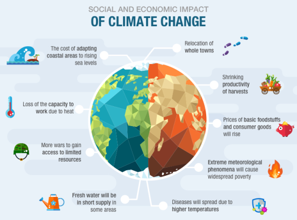
Section : Oceanography
- Water (oceans)
- Introduction to water
- It is said that the water is life
- Water is an essential component of all life forms that exist over the surface of the earth
- The creatures on the earth are lucky that it is a water planet, otherwise we all would have no existence
- Water is a rare commodity in our solar system
- There is no water on the sun or anywhere else in the solar system
- The earth, fortunately has an abundant supply of water on its surface
- 71% of earth's surface is covered with water
- Hence, our planet is called the ‘Blue Planet’
- Water distribution and challenges
- Approximately 97% of Earth's water is found in the oceans. The remaining 3% is primarily in glaciers, ice caps, and freshwater sources.
- Distribution in hemispheres and it's impact
- Southern Hemisphere
- Often called the "Water Hemisphere".
- About 81% of its surface is covered by water.
- Due to higher water content, the Southern Hemisphere experiences more moderate temperatures and less extreme seasonal variations.
- Northern Hemisphere
- Called the "Land Hemisphere".
- About 61% land and 39% water.
- Greater landmass leads to more continental climate: higher temperature extremes between summer and winter.
- Distribution of water in various bodies (validated)
-
| Water Body |
% of Total Water |
Nature |
| Oceans & Seas |
~97.5% |
Saline |
| Glaciers & Ice Caps |
~1.74% |
Fresh (frozen) |
| Groundwater |
~1.7% |
Fresh/Saline |
| Lakes (freshwater) |
~0.013% |
Fresh |
| Soil Moisture |
~0.001% |
Fresh |
| Atmosphere (water vapor) |
~0.001% |
Fresh |
| Rivers |
~0.0002% |
Fresh |
| Biological Water (in organisms) |
~0.0001% |
Fresh |
- Nearly 59 per cent of the water that falls on land returns to the atmosphere through evaporation from over the oceans as well as from other places
- The remainder runs-off on the surface, infiltrates into the ground or a part of it becomes glacier
- It is to be noted that the renewable water on the earth is constant while the demand is increasing tremendously [to a very great extend]
- This leads to water crisis in different parts of the world — spatially [with regard to space or location] and temporally [with regard to time]
- The pollution of river waters has further aggravated [make worse] the crisis
- Hydrological cycle
-
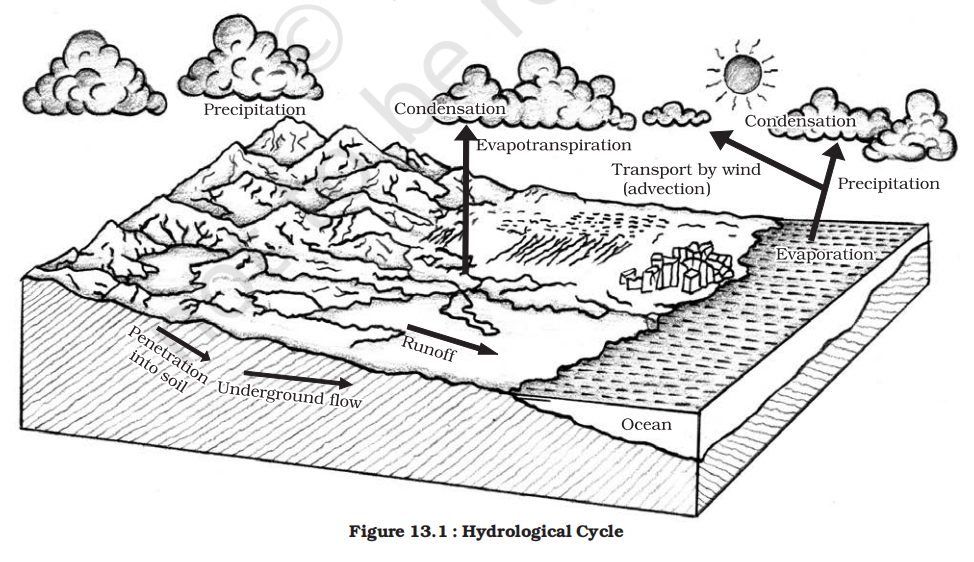
-
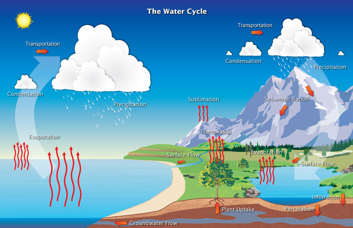
-
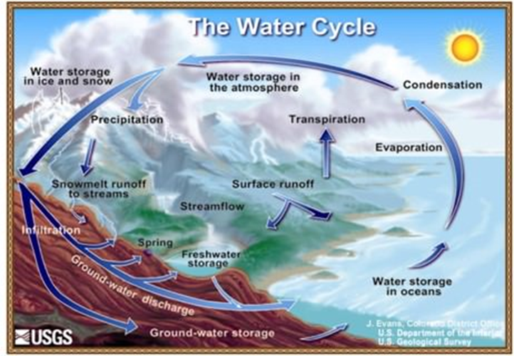
- Overview
- Water is a cyclic resource
- It can be used and re-used
- Water also undergoes a cycle from the ocean to land and land to ocean
- The hydrological cycle describes the movement of water on, in, and above the earth
- The water cycle has been working for billions of years and all the life on earth depends on it
- The distribution of water on earth is quite uneven
- Many locations have plenty of water while others have very limited quantity
- The hydrological cycle, is the circulation of water within the earth’s hydrosphere in different forms i.e. the liquid, solid and the gaseous phases
- It also refers to the continuous exchange of water between the oceans, atmosphere, landsurface and subsurface and the organisms
- Components and Processes of the Water Cycle.
-
| Components |
Processes |
| Water storage in oceans |
Evaporation, Evapotranspiration, Sublimation |
| Water in the atmosphere |
Condensation, Precipitation |
| Water storage in ice and snow |
Snowmelt runoff to streams |
| Surface runoff |
Streamflow, Freshwater storage, Infiltration |
| Groundwater storage |
Groundwater discharge, Springs |
- Relief of the ocean floor
-
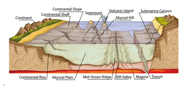
- Overview
- The oceans are confined to the great depressions of the earth’s outer layer
- In this section, we shall see the nature of the ocean basins of the earth and their topography
- The oceans, unlike the continents, merge so naturally into one another that it is hard to demarcate [set the boundaries or limits to] them
- The geographers have divided the oceanic part of the earth into five oceans, namely the Pacific, the Atlantic, the Indian, Southern ocean and the Arctic
- The various seas, bays, gulfs and other inlets are parts of these four large oceans
- A major portion of the ocean floor is found between 3-6 km below the sea level
- The ‘land’ under the waters of the oceans, that is, the ocean floor exhibits complex and varied features as those observed over the land (Figure 13.2)
- The floors of the oceans are rugged [rough / uneven] with the world’s largest mountain ranges, deepest trenches [ditch] and the largest plains
- These features are formed, like those of the continents, by the factors of tectonic, volcanic and depositional processes
- Divisions of the ocean floors
-
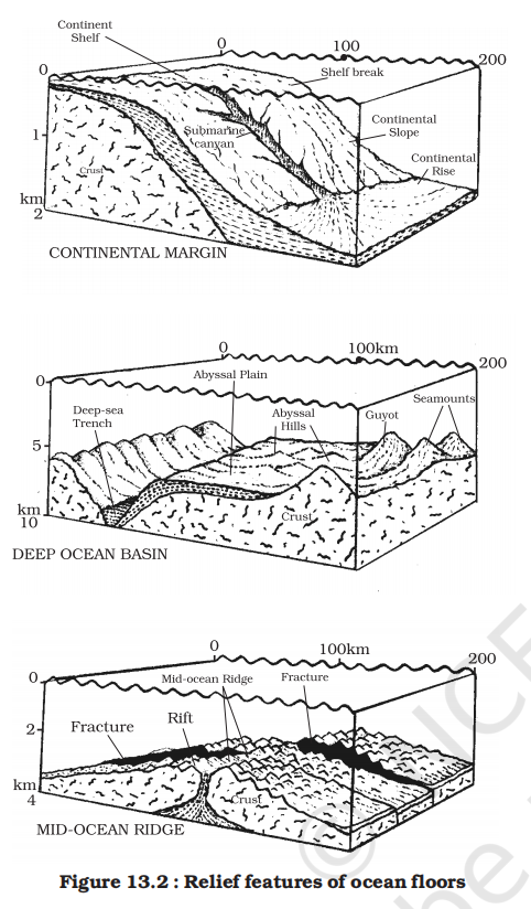
- Major and minor relief features
- Continental shelf
- The continental shelf is the extended margin of each continent occupied by relatively shallow seas and gulfs
- It is the shallowest part of the ocean showing an average gradient of 1° or even less
- The shelf typically ends at a very steep slope, called the shelf break
- The width of the continental shelves vary from one ocean to another
- The average width of continental shelves is about 80 km
- The shelves are almost absent or very narrow along some of the margins like the coasts of Chile, the west coast of Sumatra, etc
- On the contrary, the Siberian shelf in the Arctic Ocean, the largest in the world, stretches to 1,500 km in width
- The depth of the shelves also varies
- It may be as shallow as 30 m in some areas while in some areas it is as deep as 600 m
- The continental shelves are covered with variable thicknesses of sediments brought down by rivers, glaciers, wind, from the land and distributed by waves and currents
- Massive sedimentary deposits received over a long time by the continental shelves, become the source of fossil fuels
- Continental slope
- The continental slope connects the continental shelf and the ocean basins
- It begins where the bottom of the continental shelf sharply drops off into a steep slope
- The gradient of the slope region varies between 2-5°
- The depth of the slope region varies between 200 and 3,000 m
- The slope boundary indicates the end of the continents
- Canyons and trenches are observed in this region
- Deep sea plain (Abyssal plain)
- Deep sea plains are gently sloping areas of the ocean basins
- These are the flattest and smoothest regions of the world
- The depths vary between 3,000 and 6,000m
- These plains are covered with fine-grained sediments like clay and silt
- Oceanic deeps or trenches
- These areas are the deepest parts of the oceans
- The trenches are relatively steep sided, narrow basins
- They are some 3-5 km deeper than the surrounding ocean floor
- They occur at the bases of continental slopes and along island arcs [curves] and are associated with active volcanoes and strong earthquakes
- That is why they are very significant in the study of plate movements
- As many as 57 deeps have been explored so far; of which 32 are in the Pacific Ocean; 19 in the Atlantic Ocean and 6 in the Indian Ocean
- Minor relief features
- Mid-oceanic ridges
- A mid-oceanic ridge is composed of two chains of mountains separated by a large depression
- The mountain ranges can have peaks as high as 2,500 m and some even reach above the ocean’s surface
- Iceland, a part of the mid-Atlantic Ridge, is an example
- Seamount
- It is a mountain with pointed summits [top / peak], rising from the seafloor that does not reach the surface of the ocean
- Seamounts are volcanic in origin
- These can be 3,000-4,500 m tall
- The Emperor seamount, an extension of the Hawaiian Islands in the Pacific Ocean, is a good example
- Submarine canyons
- These are deep valleys, some comparable to the Grand Canyon of the Colorado river
- They are sometimes found cutting across the continental shelves and slopes, often extending from the mouths of large rivers
- The Hudson Canyon is the best known submarine canyon in the world
- Guyots
- It is a flat topped seamount
- They show evidences of gradual subsidence [collapse / falling in / settling] through stages to become flat topped submerged mountains
- It is estimated that more than 10,000 seamounts and guyots exist in the Pacific Ocean alone
- Atoll
- These are low islands found in the tropical oceans consisting of coral reefs surrounding a central depression
- It may be a part of the sea (lagoon), or sometimes form enclosing a body of fresh, brackish, or highly saline water
- Deposits at ocean floor
- Terrigenous Deposits
- Derived from land (continental rocks).
- Transported by rivers, wind, glaciers, and turbidity currents.
- Includes sand, silt, clay, and gravel.
- Found mostly near continental margins (continental shelf and slope).
- Biogenous Deposits (Organic)
- From the remains of marine organisms.
- Calcareous ooze:
- Formed from shells of foraminifera, coccolithophores (CaCO₃).
- Siliceous ooze:
- Formed from skeletons of diatoms and radiolarians (SiO₂).
- Abundant in open ocean areas (pelagic zones), especially where biological productivity is high.
- Hydrogenous Deposits (Chemical precipitates)
- Formed by the precipitation of minerals directly from seawater.
- Includes manganese nodules, phosphorites, glauconite, and metal sulfides.
- Found in deep ocean basins and mid-ocean ridges.
- Cosmogenous Deposits
- Extraterrestrial (from space).
- Includes micrometeorites, cosmic dust, and tektites.
- Extremely rare and scattered across the ocean floor.
- Volcanogenic Deposits
- Underwater volcanic activity.
- Includes ash, lava fragments, and hydrothermal sediments.
- Common near mid-ocean ridges and island arcs.
- Temperature of ocean waters
- Overview
- This section deals with the spatial and vertical variations of temperature in various oceans
- Ocean waters get heated up by the solar energy just as land
- The process of heating and cooling of the oceanic water is slower than land
- Factors affecting temperature distribution
- Factors
- Insolation variation with latitude
- The temperature of surface water decreases from the equator towards the poles because the amount of insolation decreases poleward
- Varies with latitude, time of year, and time of day.
- Equatorial regions receive more insolation compared to polar regions.
- Volcanic activities
- Increase local temperatures due to geothermal heat release near eruption zones.
- Unequal distribution of land and water:
- The oceans in the northern hemisphere receive more heat due to their contact with larger extent of land than the oceans in the southern hemisphere
- Atmospheric circulation:
- The winds blowing from the land towards the oceans drive warm surface water away form the coast resulting in the upwelling of cold water from below.
- It results into the longitudinal variation in the temperature. Contrary to this, the onshore winds pile up warm water near the coast and this raises the temperature
- Ocean currents:
- Warm ocean currents raise the temperature in cold areas while the cold currents decrease the temperature in warm ocean areas.
- Gulf stream (warm current) raises the temperature near the eastern coast of North America and the West Coast of Europe while the Labrador current (cold current) lowers the temperature near the north-east coast of North America
- All these factors influence the temperature of the ocean currents locally
- The enclosed seas in the low latitudes record relatively higher temperature than the open seas; whereas the enclosed seas in the high latitudes have lower temperature than the open seas
- Horizontal and vertical distribution of temperature
-
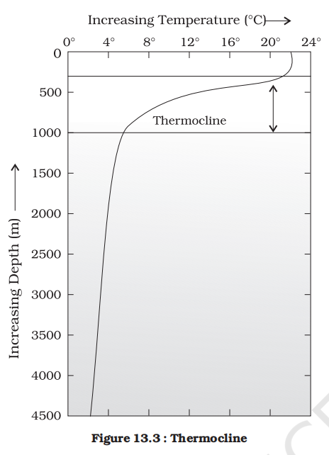
- Overview
- The temperature-depth profile for the ocean water shows how the temperature decreases with the increasing depth
- The profile shows a boundary region between the surface waters of the ocean and the deeper layers
- The boundary usually begins around 100 - 400 m below the sea surface and extends several hundred of metres downward (Figure 13.3)
- This boundary region, from where there is a rapid decrease of temperature, is called the thermocline
- About 90 per cent of the total volume of water is found below the thermocline in the deep ocean. In this zone, temperatures approach 0° C
- Less biomass exists below the thermocline compared to surface waters, because:
- Sunlight doesn’t penetrate well below the thermocline, limiting photosynthesis.
- Phytoplankton, the base of the ocean food web, thrive in the sunlit upper layers, mostly above the thermocline (in the epipelagic zone, ~0–200 m).
- Most commercial fisheries (e.g., sardines, tuna, anchovies, mackerel) operate above or near the thermocline.
- Mesopelagic fish, such as lanternfish, form an enormous biomass below the thermocline. They are:
- Possibly the largest biomass of fish on Earth.
- Three-layer system
- The temperature structure of oceans over middle and low latitudes can be described as a three-layer system from surface to the bottom
- First layer (Surface mixed layer / warm water layer)
- Represents the upper layer of warm oceanic water
- Temperature is nearly uniform due to wind-driven mixing
- Generally ranges between 20°C and 25°C
- Thickness is variable
- Well-mixed layer usually extends up to about 100–200 m
- In tropical regions, warm water influence may extend deeper, sometimes approaching 500 m
- Present throughout the year in tropical regions
- In mid-latitudes, it develops mainly during summer
- Second layer (Thermocline layer)
- Lies below the surface mixed layer
- Characterised by rapid decrease in temperature with increasing depth
- Temperature may drop from around 20°C to about 5°C
- Rate of decrease is steep in the upper part and gradually slows with depth
- Extends over several hundred metres
- Commonly from about 200 m to nearly 1,000 m
- Thickness varies with latitude, season, and ocean basin
- Third layer (Deep ocean layer)
- Extends from the base of the thermocline to the deep ocean floor
- Very cold and nearly uniform temperature
- Typically ranges between 0°C and 3°C
- Very little vertical temperature change
- In lakes and freshwater bodies
- Bottom layers are usually at 4°C due to maximum density of water at 4°C
- But this is not the case for ocean water due to presence of dissolved salts
- Case with atlantic
- In the Arctic and Antarctic circles, the surface water temperatures are close to 0° C and so the temperature change with the depth is very slight
- Here, only one layer of cold water exists, which extends from surface to deep ocean floor
- Surface temperature patterns
- The average temperature of surface water of the oceans is about 27°C and it gradually decreases from the equator towards the poles
- The rate of decrease of temperature with increasing latitude is generally 0.5°C per latitude
- The average temperature is around 22°C at 20° latitudes, 14° C at 40° latitudes and 0° C near poles
- The oceans in the northern hemisphere record relatively higher temperature than in the southern hemisphere
- The highest temperature is not recorded at the equator but slightly towards north of it
- The average annual temperatures for the northern and southern hemisphere are around 19° C and 16° C respectively
- This variation is due to the unequal distribution of land and water in the northern and southern hemispheres
- Figure 13.4 shows the spatial pattern of surface temperature of the oceans
- Vertical temperature trends
- It is a well known fact that the maximum temperature of the oceans is always at their surfaces because they directly receive the heat from the sun and the heat is transmitted to the lower sections of the oceans through the process of convection
- It results into decrease of temperature with the increasing depth, but the rate of decrease is not uniform throughout
- Surface Temperature (0–200 meters)
- Tropical oceans:
- 25°C to 30°C
- Mid-latitudes:
- 10°C to 25°C (seasonal variation)
- Polar regions:
- Close to 0°C
- Thermocline Layer (200–1000 meters)
- Rapid decrease in temperature with depth
- Temperature may drop from ~20°C to ~5°C
- Deep Ocean (Below 1000 meters)
- Very cold and stable
- Typically ranges between 0°C to 3°C worldwide, regardless of surface temperature
- Salinity of ocean waters
-
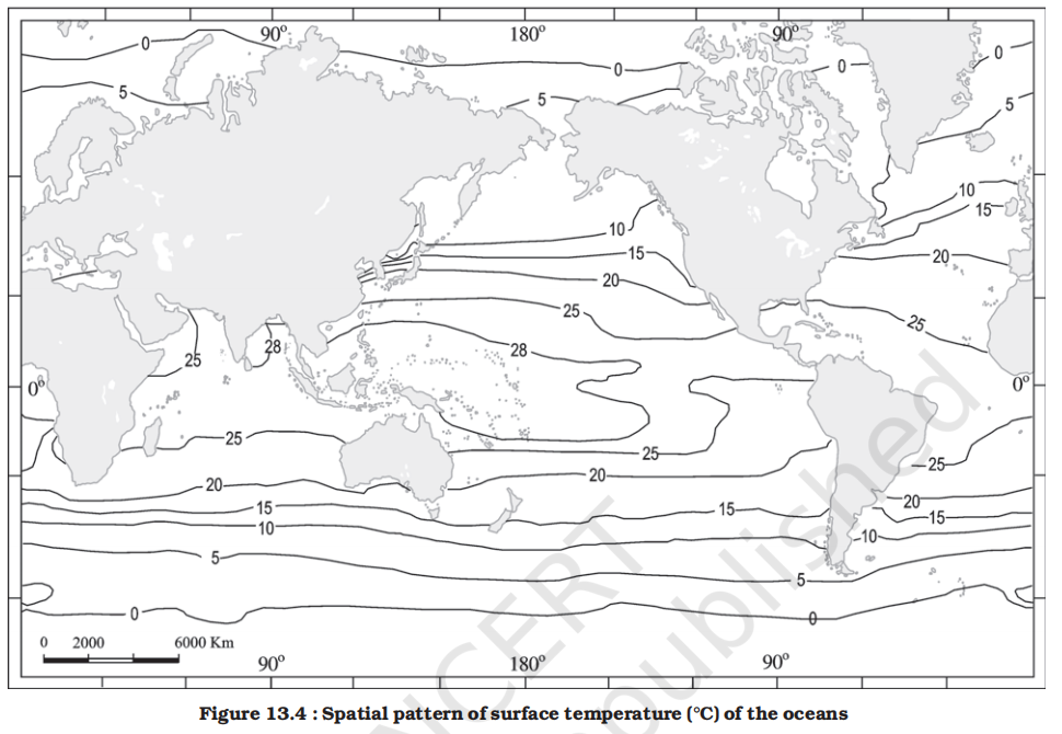
-
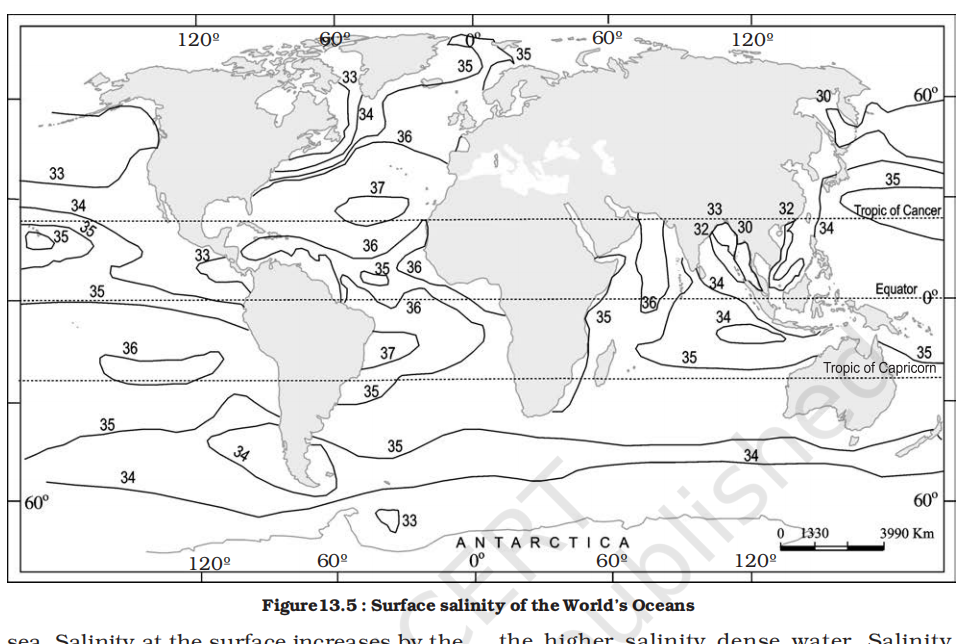
- Overview
- All waters in nature, whether rain water or ocean water, contain dissolved mineral salts
- Dissolved salts in per kg of sea water
- Chlorine : 18.97%
- Sodium : 10.47%
- Sulphate : 1.65%
- Magnesium : 1.28%
- Calcium : 0.41%
- Potassium : 0.38%
- Bicarbonate : 0.14%
- Bromine : 0.06%
- Borate : 0.02%
- Salinity is the term used to define the total content of dissolved salts in sea water (Table 13.4)
- It is calculated as the amount of salt (in gm) dissolved in 1,000 gm (1 kg) of seawater
- It is usually expressed as parts per thousand (o/oo) or ppt
- Salinity is an important property of sea water
- Salinity of 24.7 o/oo has been considered as the upper limit to demarcate ‘brackish water’
- Factors affecting ocean salinity
- Evaporation
- The salinity of water in the surface layer of oceans depend mainly on evaporation and precipitation
- High evaporation increases salinity (e.g., subtropical regions).
- High rainfall decreases salinity (e.g., equatorial zones).
- Influx of rivers
- Surface salinity is greatly influenced in coastal regions by the fresh water flow from rivers, and in polar regions by the processes of freezing and thawing of ice
- Freshwater from rivers dilutes ocean water, reducing salinity.
- Precipitation
- Freshwater from precipitation dilutes ocean water, reducing salinity
- Wind
- Wind, also influences salinity of an area by transferring water to other areas
- Moves surface water around, causing redistribution of saline and less saline waters.
- Ocean currents
- The ocean currents contribute to the salinity variations
- Transport water masses with different salinity, affecting regional levels.
- Salinity, temperature and density of water are interrelated
- Hence, any change in the temperature or density influences the salinity of water in an area
- Examples of high salinity
- Highest salinity in water bodies Lake Van in Turkey (330 o/oo), Dead Sea (238 o/oo), Great Salt Lake (220 o/oo)
- Horizontal distribution of salinity
- Overview
- The salinity for normal open ocean ranges between 33 o/oo and 37 o/oo
- In the land locked Red Sea, it is as high as 41o/oo, while in the estuaries and the Arctic, the salinity fluctuates from 0 - 35 o/oo, seasonally
- In hot and dry regions, where evaporation is high, the salinity sometimes reaches to 70 o/oo
- Salinity decreases toward the poles because evaporation is very low in cold conditions, and although freezing of seawater locally increases salinity by rejecting salt, this effect is temporary and is outweighed by freshwater input from snowfall and melting sea ice and glaciers, resulting in overall dilution of seawater.
- Salinity is lowest near the poles
- Pacific Ocean
- The salinity variation in the Pacific Ocean is mainly due to its shape and larger areal extent
- Salinity decreases from 35 o/oo - 31 o/oo on the western parts of the northern hemisphere because of the influx of melted water from the Arctic region
- In the same way, after 15° - 20° south, it decreases to 33 o/oo
- Atlantic Ocean
- The average salinity of the Atlantic Ocean is around 36 o/oo
- The highest salinity is recorded between 15° and 20° latitudes
- Maximum salinity (37 o/oo) is observed between 20° N and 30° N and 20° W - 60° W
- It gradually decreases towards the north
- Regional variations
- The North Sea, in spite of its location in higher latitudes, records higher salinity due to more saline water brought by the North Atlantic Drift
- Baltic Sea records low salinity due to influx of river waters in large quantity
- The Mediterranean Sea records higher salinity due to high evaporation
- Salinity is, however, very low in Black Sea due to enormous fresh water influx by rivers
- See the atlas to find out the rivers joining Black Sea
- The average salinity of the Indian Ocean is 35 o/oo
- The low salinity trend is observed in the Bay of Bengal due to influx [arrival or entry in large number or amount] of river water
- On the contrary, the Arabian Sea shows higher salinity due to high evaporation and low influx of fresh water
- Figure 13.5 shows the salinity of the World’s oceans
- Relation between salinity and biological life
- Salinity influences aquatic life by controlling osmotic balance, metabolism, growth, and reproduction of organisms
- Most marine organisms are adapted to stable salinity and are stenohaline, tolerating only a narrow salinity range
- Osmosis and osmotic stress
- Water always moves from low solute concentration to high solute concentration, this movement is called osmosis.
- Osmotic stress is the stress experienced by cells when the salinity (or solute concentration) outside the cell differs significantly from inside, causing uncontrolled movement of water across the cell membrane.
- Moderate salinity (~30–40‰)
- Represents normal open-ocean conditions (~35‰)
- Supports maximum marine biodiversity
- Most fish, plankton, corals, and marine ecosystems thrive under this range
- Low salinity conditions (<30‰)
- Found near river mouths, estuaries, and polar regions
- Species diversity decreases
- Dominated by euryhaline organisms that tolerate salinity fluctuations
- Energy is diverted towards osmoregulation rather than growth
- High salinity conditions (>40–50‰)
- Found in enclosed seas and lagoons with high evaporation
- Biodiversity sharply declines
- Only highly salt-tolerant organisms can survive
- Extremely high salinity (>100‰)
- Example: Dead Sea (~340‰)
- Normal marine life cannot survive due to extreme osmotic stress
- Only specialized microorganisms like halophilic bacteria and archaea exist
- Cells lose water rapidly, proteins denature, and normal metabolism becomes impossible
- Vertical distribution of salinity
-
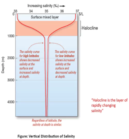
- Salinity changes with depth, but the way it changes depends upon the location of the sea
- Salinity at the surface increases by the loss of water to ice or evaporation, or decreased by the input of fresh waters, such as from the rivers
- Salinity at depth is very much fixed, because there is no way that water is ‘lost’, or the salt is ‘added’
- Salinity, generally, increases with depth and there is a distinct zone called the halocline, where salinity increases sharply
- The lower salinity water rests above the higher salinity dense water
- Other factors being constant, increasing salinity of seawater causes its density to increase
- High salinity seawater, generally, sinks below the lower salinity water
- This leads to stratification by salinity
-
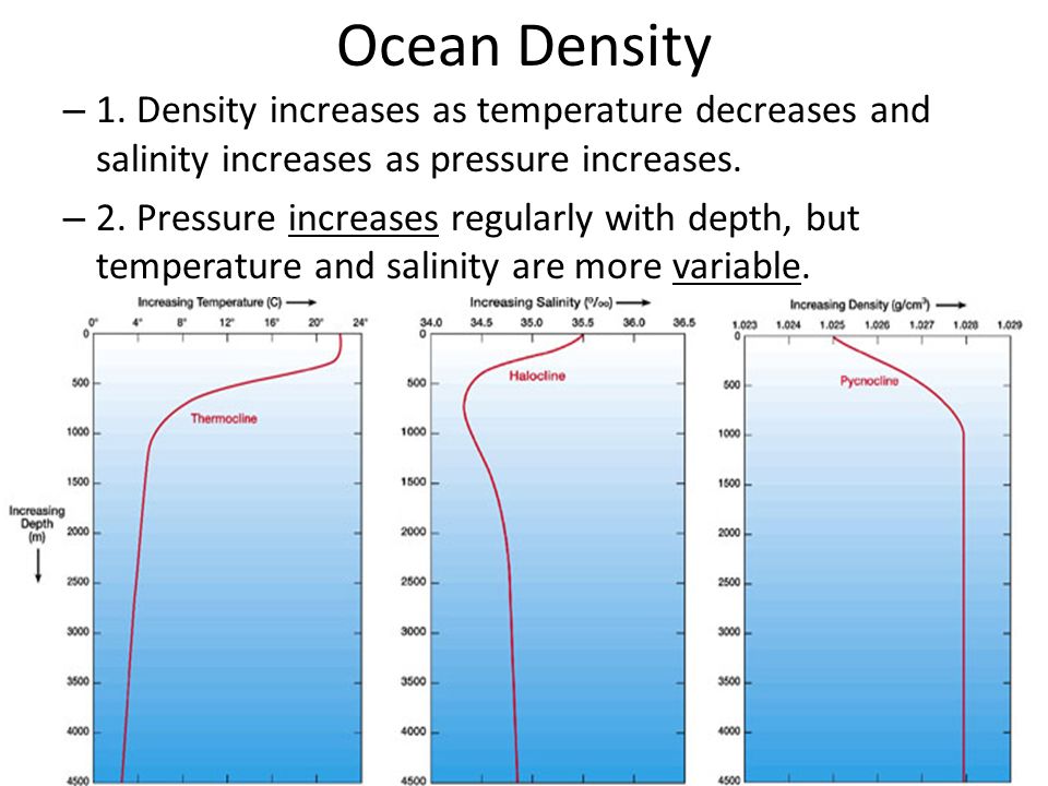
- Different water bodies
- Salt water
- Ocean
- Definition:
- Vast, continuous body of saltwater covering major portions of the Earth’s surface
- Examples:
- Pacific Ocean, Atlantic Ocean, Indian Ocean, Arctic Ocean, Southern Ocean
-
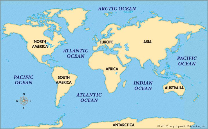
- Sea
- Definition:
- Large body of saltwater partly enclosed by land and connected to an ocean
- Examples:
- Arabian Sea, South China Sea, Baltic Sea
- Subtypes:
- Marginal Sea
- Definition:
- Located on the margins of oceans and partly enclosed by peninsulas, islands, or archipelagos
- Examples:
- Sea of Japan, Bering Sea, Andaman Sea
-
- Inland Sea
- Definition:
- Large sea almost completely surrounded by land and connected to the ocean through narrow straits
- Examples:
- Black Sea
-
- Gulf
- Definition:
- Large coastal indentation of the sea or ocean, usually deeper and more enclosed than a bay
- It means the coastline curves inward, so the sea extends into the land in a curved shape.
- Examples:
- Gulf of Mexico, Persian Gulf, Gulf of Aden
-
- Bay
- Definition:
- A bay is a broad, curved inlet of the sea or ocean where the land indents inward, usually partially enclosed by land, providing relatively calm waters compared to the open sea.
- Examples:
- Bay of Bengal, Hudson Bay, Chesapeake Bay
-
- Strait
- Definition:
- Narrow natural passage of water connecting two larger water bodies
- Examples:
- Strait of Gibraltar, Strait of Malacca, Palk Strait, Bering Strait
-
- Related term:
- Channel
- Definition:
- Broad navigable water passage connecting seas or oceans
- Focus is navigation route
- Example:
- English Channel
-
- Isthmus
- Definition:
- Narrow strip of land connecting two larger landmasses and separating two water bodies
- Example:
- Isthmus of Panama
-
- Lagoon
- Definition:
- Shallow body of water separated from a larger sea by barrier islands, sandbars, or coral reefs
- Examples:
- Chilika Lake (brackish), Venice Lagoon
-
- Fjord
- Definition:
- Long, deep, narrow sea inlet with steep sides formed by glacial erosion
- Examples:
- Fjords of Norway, Milford Sound (New Zealand)
-
- Sound
- Definition:
- A sound is a coastal water body whose meaning varies by region; it may refer either to a broad inlet of the sea or ocean or to a narrow channel between two landmasses. The term is descriptive and historical, not a strict geomorphological category, and therefore should not be forced into bay or strait logic.
- Examples:
- Puget Sound, Long Island Sound
-
- Estuary
- Definition:
- Tidal mouth of a river where freshwater mixes with seawater
- Examples:
- Hooghly Estuary, Thames Estuary
-
- Harbour
- Definition:
- Sheltered coastal water body where ships can anchor safely
- Examples:
- Mumbai Harbour, Sydney Harbour
-
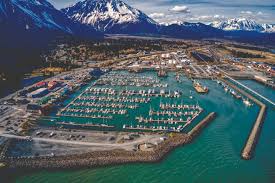
- Fresh water
- River
- Definition:
- Natural flowing watercourse, usually freshwater, flowing towards a sea, lake, or another river
- Examples:
- Ganga, Amazon, Nile
-
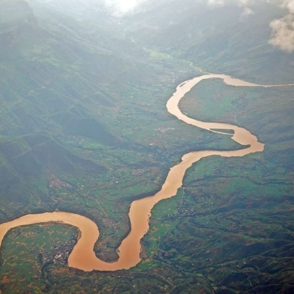
- Types:
- Perennial rivers:
- Flow throughout the year
- Examples: Ganga, Brahmaputra, Godavari, Kaveri
- Seasonal rivers:
- Flow mainly during the rainy season
- Examples: Luni, Ghaggar, Sabarmati
- Important parts:
- River basin
- Area of land drained by a river and its tributaries
- Includes smaller sub-basins and watersheds
- Lake
- Definition:
- Large inland body of standing water, either freshwater or saline
- Examples:
- Lake Victoria, Wular Lake, Caspian Sea (geographically a lake despite the name)
-
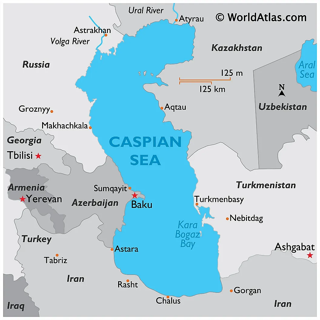
-
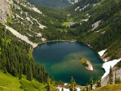
- Types:
- Freshwater lakes:
- Lake Superior, Dal Lake
- Saltwater lakes:
- Sambhar Lake, Great Salt Lake
- Oxbow lakes:
- Kanwar Lake
- Crater / Tectonic lakes:
- Lonar Lake, Lake Toba
- Glacial lakes:
- Pangong Tso
- Pond
- Definition:
- Small, shallow, still water body, often artificial
- Characteristics:
- Sunlight usually reaches the bottom
- Supports aquatic plants throughout
-
- Wetland
- Definition:
- Areas where land is permanently or seasonally saturated with water
- Examples:
- Sundarbans, Keoladeo National Park
-
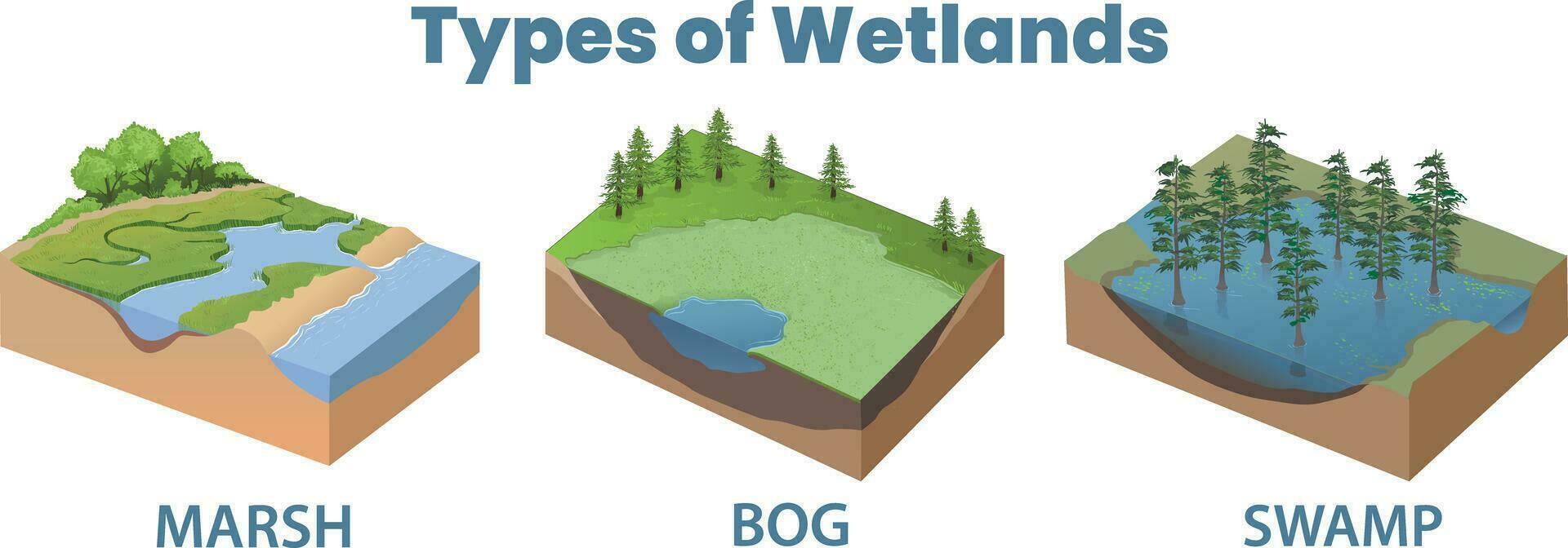
- Types:
- Marsh:
- Dominated by grasses
- Swamp:
- Dominated by trees
- Bog:
- Acidic, peat-rich wetlands
- Fen:
- Less acidic, nutrient-rich wetlands
- Reservoir
- Definition:
- Artificial lake formed by constructing a dam across a river
- Examples:
- Bhakra Reservoir, Hirakud Reservoir
-
- Stream
- Definition:
- Small, narrow flowing water body that feeds rivers
-
- Canal
- Definition:
- Artificial waterway used for irrigation, drainage, or navigation
- Examples:
- Indira Gandhi Canal, Panama Canal (not freshwater throughout)
-
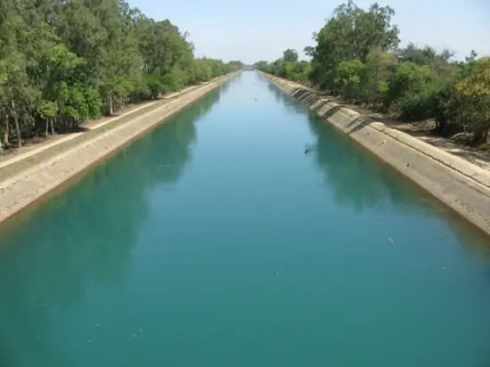
- Spring
- Definition:
- Natural outflow of groundwater at the Earth’s surface
- Types:
- Hot spring:
- Geothermally heated (Manikaran)
- Cold spring:
- Normal groundwater discharge
-
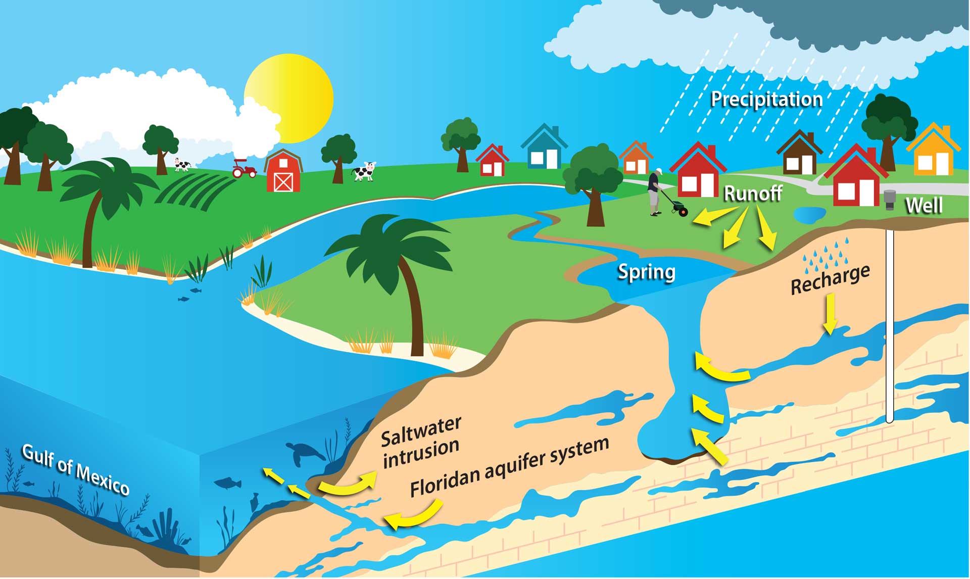
- Glacier
- Definition:
- Large mass of ice that moves slowly over land and acts as a major freshwater source
- Examples:
- Gangotri Glacier, Siachen Glacier
-
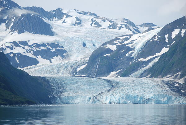
- Movements of ocean water
- Introduction to ocean water movements
- Overview
- The ocean water is dynamic
- Its physical characteristics like temperature, salinity, density and the external forces like of the sun, moon and the winds influence the movement of ocean water
- The horizontal and vertical motions are common in ocean water bodies
- The horizontal motion refers to the ocean currents and waves
- The vertical motion refers to tides
- Ocean currents are the continuous flow of huge amount of water in a definite direction while the waves are the horizontal motion of water
- Water moves ahead from one place to another through ocean currents while the water in the waves does not move, but the wave trains move ahead
- The vertical motion refers to the rise and fall of water in the oceans and seas
- Due to attraction of the sun and the moon, the ocean water is raised up and falls down twice a day
- The upwelling of cold water from subsurface and the sinking of surface water are also forms of vertical motion of ocean water
- Waves
-
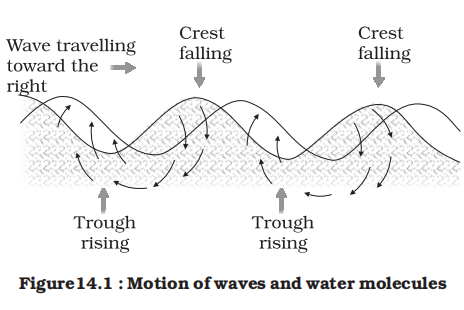
- Overview
- Waves are actually the energy, not the water as such, which moves across the ocean surface
- Water particles only travel in a small circle as a wave passes
- Wind provides energy to the waves
- Wind causes waves to travel in the ocean and the energy is released on shorelines
- The motion of the surface water seldom [rarely] affects the stagnant [still / motionless] deep bottom water of the oceans
- As a wave approaches the beach, it slows down
- This is due to the friction occurring between the dynamic water and the sea floor
- And, when the depth of water is less than half the wavelength of the wave, the wave breaks
- The largest waves are found in the open oceans
- Waves continue to grow larger as they move and absorb energy from the wind
- Most of the waves are caused by the wind driving against water
- When a breeze of two knots or less blows over calm water, small ripples form and grow as the wind speed increases until white caps appear in the breaking waves
- Waves may travel thousands of km before rolling ashore, breaking and dissolving as surf
- A wave’s size and shape reveal its origin
- Steep [sharp] waves are fairly young ones and are probably formed by local wind
- Slow and steady waves originate from far away places, possibly from another hemisphere
- The maximum wave height is determined by the strength of the wind, i.e. how long it blows and the area over which it blows in a single direction
- Waves travel because wind pushes the water body in its course while gravity pulls the crests of the waves downward
- The falling water pushes the former troughs upward, and the wave moves to a new position (Figure 14.1)
- The actual motion of the water beneath the waves is circular
- It indicates that things are carried up and forward as the wave approaches, and down and back as it passes
- Characteristics of waves
-
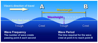
- Wave crest and trough:
- The highest and lowest points of a wave are called the crest and trough respectively
- Wave height:
- It is the vertical distance from the bottom of a trough to the top of a crest of a wave
- Wave amplitude:
- It is one-half of the wave height
- Wave period:
- It is merely the time interval between two successive wave crests or troughs as they pass a fixed point
- Wavelength:
- It is the horizontal distance between two successive crests
- Wave speed:
- It is the rate at which the wave moves through the water, and is measured in knots
- Wave frequency:
- It is the number of waves passing a given point during a one-second time interval
- Tides
-
- Overview
- The periodical rise and fall of the sea level, once or twice a day, mainly due to the attraction of the sun and the moon, is called a tide
- Movement of water caused by meteorological effects (winds and atmospheric pressure changes) are called surges
- Surges are not regular like tides
- The study of tides is very complex, spatially and temporally, as it has great variations in frequency, magnitude and height
- The moon’s gravitational pull to a great extent and to a lesser extent the sun’s gravitational pull, are the major causes for the occurrence of tides
- Another factor is centrifugal force, which is the force that acts to counter balance the gravity
- Together, the gravitational pull and the centrifugal force are responsible for creating the two major tidal bulges on the earth
- On the side of the earth facing the moon, a tidal bulge occurs while on the opposite side though the gravitational attraction of the moon is less as it is farther away, the centrifugal force causes tidal bulge on the other side (Figure 14.2)
- The ‘tide-generating’ force is the difference between these two forces; i.e. the gravitational attraction of the moon and the centrifugal force
- On the surface of the earth, nearest the moon, pull or the attractive force of the moon is greater than the centrifugal force, and so there is a net force causing a bulge towards the moon
- On the opposite side of the earth, the attractive force is less, as it is farther away from the moon, the centrifugal force is dominant
- Hence, there is a net force away from the moon
- It creates the second bulge away from the moon
- On the surface of the earth, the horizontal tide generating forces are more important than the vertical forces in generating the tidal bulges
- The tidal bulges on wide continental shelves, have greater height
- When tidal bulges hit the mid-oceanic islands they become low
- The shape of bays and estuaries [tidal mouth of river] along a coastline can also magnify the intensity of tides
- Funnel-shaped bays greatly change tidal magnitudes
- When the tide is channelled between islands or into bays and estuaries they are called tidal currents
-
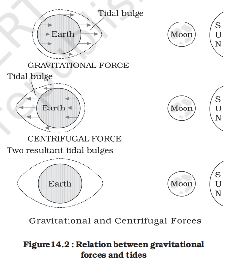
- Tides of Bay of Fundy, Canada
- The highest tides in the world occur in the Bay of Fundy in Nova Scotia, Canada
- The tidal bulge is 15 - 16 m
- Because there are two high tides and two low tides every day (roughly a 24 hour period); then a tide must come in within about a six hour period
- As a rough estimate, the tide rises about 240 cm an hour (1,440 cm divided by 6 hours)
- If you have walked down a beach with a steep cliff alongside (which is common there), make sure you watch the tides
- If you walk for about an hour and then notice that the tide is coming in, the water will be over your head before you get back to where you started!
- Types of tides
- Overview
- Tides vary in their frequency, direction and movement from place to place and also from time to time
- Tides may be grouped into various types based on their frequency of occurrence in one day or 24 hours or based on their height
- Tides based on frequency
- Semi-diurnal tide:
- The most common tidal pattern, featuring two high tides and two low tides each day
- The successive high or low tides are approximately of the same height
- Diurnal tide:
- There is only one high tide and one low tide during each day
- The successive high and low tides are approximately of the same height
- Mixed tide:
- Tides having variations in height are known as mixed tides
- These tides generally occur along the west coast of North America and on many islands of the Pacific Ocean
- Tides based on the sun, moon and the earth positions
-
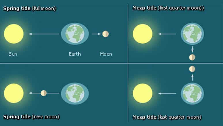
- The height of rising water (high tide) varies appreciably depending upon the position of sun and moon with respect to the earth
- Spring Tides
- The position of both the sun and the moon in relation to the earth has direct bearing on tide height
- When the sun, the moon and the earth are in a straight line, the height of the tide will be higher
- These are called spring tides and they occur twice a month:
- Once during full moon period (Poornima)
- Once during new moon period (Amavasya)
- The Moon is not visible during the New Moon phase
- Neap Tides
- Normally, there is a seven day interval between the spring tides and neap tides
- At this time the sun and moon are at right angles to each other
- The forces of the sun and moon tend to counteract one another
- The Moon’s attraction, though more than twice as strong as the sun’s, is diminished by the counteracting force of the sun’s gravitational pull
- Monthly Variations
- Once in a month, when the moon’s orbit is closest to the earth (perigee), unusually high and low tides occur
- During this time the tidal range is greater than normal
- Two weeks later, when the moon is farthest from earth (apogee), the moon’s gravitational force is limited and the tidal ranges are less than their average heights
- Annual Variations
- When the earth is closest to the sun (perihelion), around 3rd January each year:
- Tidal ranges are much greater
- Unusually high and unusually low tides occur
- When the earth is farthest from the sun (aphelion), around 4th July each year:
- Tidal ranges are much less than average
- Tidal Phases
- The time between the high tide and low tide, when the water level is falling, is called the ebb
- The time between the low tide and high tide, when the tide is rising, is called the flow or flood
- Importance of tides
- Since tides are caused by the earth-moon-sun positions which are known accurately, the tides can be predicted well in advance
- This helps the navigators and fishermen plan their activities
- Tidal flows are of great importance in navigation
- Tidal heights are very important, especially harbours near rivers and within estuaries having shallow ‘bars’ at the entrance, which prevent ships and boats from entering into the harbour
- Tides are also helpful in desilting the sediments and in removing polluted water from river estuaries
- Tides are used to generate electrical power (in Canada, France, Russia, and China)
- A 3 MW tidal power project at Durgaduani in Sunderbans of West Bengal is under way
- Update on this project as of 2025:
- The initial project did not proceed to actual implementation and was later reported as shelved due to very high project costs and other challenges. The state government decided not to continue with the project at the time.
- Oceanic currents
-
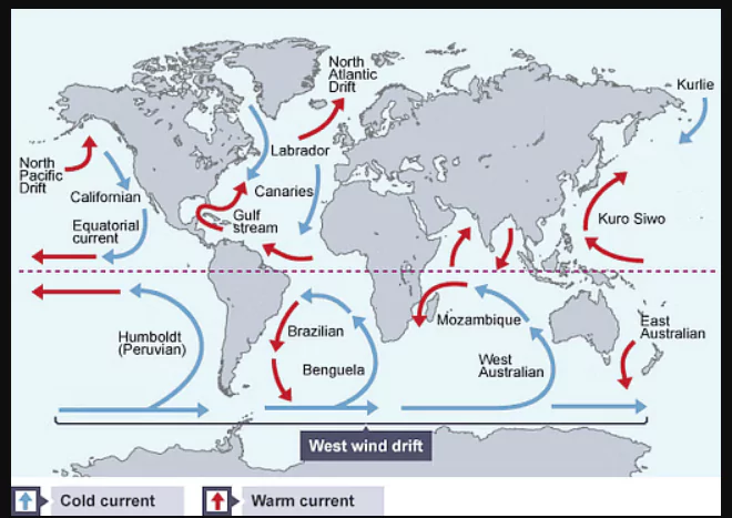
-
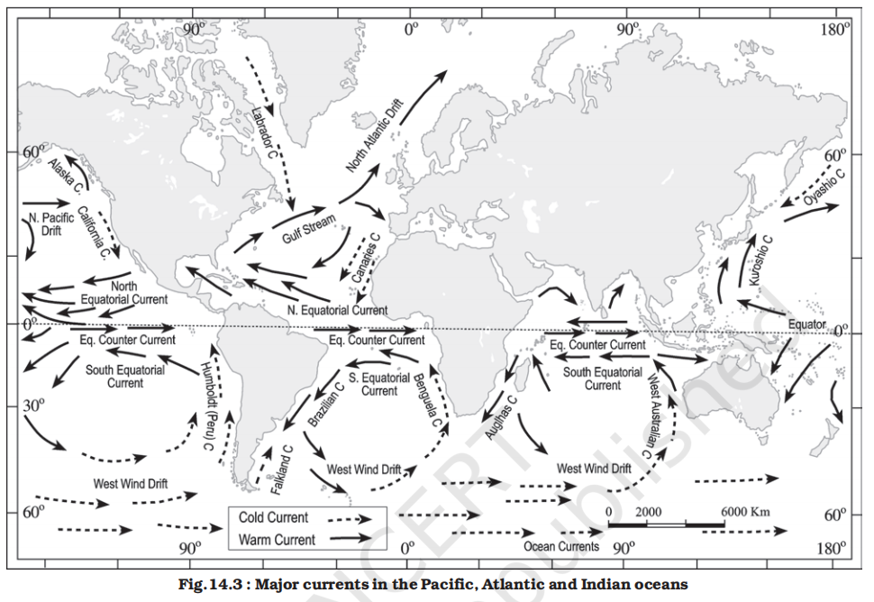
- Definition:
- Large-scale, continuous movement of ocean water driven by various forces such as wind, Earth's rotation, salinity, and temperature differences.
- Formation
- Heating by solar energy causes the water to expand
- That is why, near the equator the ocean water is about 8 cm higher in level than in the middle latitudes
- This causes a very slight gradient and water tends to flow down the slope
- Wind blowing on the surface of the ocean pushes the water to move
- Friction between the wind and the water surface affects the movement of the water body in its course
- Gravity tends to pull the water down the pile and create gradient variation
- The Coriolis force intervenes and causes the water to move to the right in the northern hemisphere and to the left in the southern hemisphere
- These large accumulations of water and the flow around them are called Gyres
- These produce large circular currents in all the ocean basins
- What about convection?
- Convection mainly affects vertical movement and deep circulation, not horizontal surface flow
- Characteristics of ocean currents
- Drift
- Currents are referred to by their “drift”
- Usually, the currents are strongest near the surface and may attain speeds over five knots
- At depths, currents are generally slow with speeds less than 0.5 knots
- We refer to the speed of a current as its “drift”
- Drift is measured in terms of knots
- Strength of current
- The strength of a current refers to the speed of the current
- A fast current is considered strong
- A current is usually strongest at the surface and decreases in strength (speed) with depth
- Most currents have speeds less than or equal to 5 knots
- Effect of density
- Differences in water density affect vertical mobility of ocean currents
- Water with high salinity is denser than water with low salinity and in the same way cold water is denser than warm water
- Denser water tends to sink, while relatively lighter water tends to rise
- Temperature driven
- Cold-water ocean currents occur when the cold water at the poles sinks and slowly moves towards the equator
- Warm-water currents travel out from the equator along the surface, flowing towards the poles to replace the sinking cold water
- Water masses can move from cold to warm regions due to winds and density differences, but heat transfer always occurs from warmer to colder bodies.
- Classification
- On the basis of depth:
- Surface Currents:
- Occur in the upper 10% of the ocean (up to ~400 meters).
- Driven mainly by prevailing winds and the Coriolis effect.
- Form large circular patterns called gyres (e.g., North Atlantic Gyre).
- Deep Water Currents (Thermohaline Circulation):
- Occur below the surface, influenced by differences in water density due to temperature (thermo) and salinity (haline).
- Form the Global Conveyor Belt, crucial for regulating Earth's climate.
- Deep water currents make up the 90% of the ocean current.
- Key Processes Involved:
-
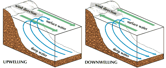
- Upwelling:
- The process where deep, cold, and nutrient-rich water rises to the surface.
- Common along western coasts of continents (e.g., Peru, California) due to offshore surface winds.
- Supports high marine productivity and rich fishing grounds.
- Downwelling:
- The sinking of surface water, usually due to cooling (in polar regions) or increased salinity (from evaporation or ice formation).
- Helps transport oxygen-rich water to deeper parts of the ocean.
- Critical for the formation of deep water masses like North Atlantic Deep Water (NADW).
- On the basis of temperature
-
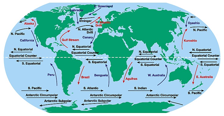
- Warm currents
- Ocean currents that originate near the equator and flow towards the poles, carrying warm water into cooler regions.
- They raise the temperature of the coastal areas they flow past and generally lead to increased evaporation, humid conditions, and greater rainfall.
- Major Warm Currents:
- Gulf Stream (North Atlantic Ocean)
- North Atlantic Drift (North Atlantic Ocean)
- Brazil Current (South Atlantic)
- Alaska Current (North Pacific)
- Kuroshio (North Pacific)
- Eastern Australia (South Pacific)
- Agulhas Current (Indian Ocean)
- Cold currents
- Ocean currents that originate near the polar regions and flow towards the equator, carrying cold water into warmer regions.
- They lower the temperature of the nearby coastal areas and often lead to dry conditions, fog, and less rainfall, but can also bring nutrient-rich water, supporting marine life.
- Major Cold Currents:
- Easter Greenland Current (North Atlantic)
- Labrador Current (North Atlantic)
- Benguela Current (South Atlantic)
- California Current (North Pacific)
- Peru Current (South Pacific)
- Oyashio (North Pacific)
- West Australian Current (Indian Ocean)
- Factors Influencing Ocean Currents:
- Wind patterns (e.g., trade winds, westerlies)
- Surface ocean currents are primarily driven by global wind systems.
- Trade winds push equatorial waters westward, while westerlies drive mid-latitude currents eastward.
- These wind patterns create large circular currents called gyres in ocean basins.
- The oceanic circulation pattern roughly corresponds to the earth’s atmospheric circulation pattern
- The air circulation over the oceans in the middle latitudes is mainly anticyclonic (more pronounced in the southern hemisphere than in the northern hemisphere)
- The oceanic circulation pattern also corresponds with the same
- At higher latitudes, where the wind flow is mostly cyclonic, the oceanic circulation follows this pattern
- In regions of pronounced monsoonal flow, the monsoon winds influence the current movements
- Coriolis force
- Caused by Earth’s rotation, it deflects the direction of moving water.
- In the Northern Hemisphere, it deflects currents to the right; in the Southern Hemisphere, to the left.
- This deflection helps form the circular movement of major ocean gyres.
- Gyres
- A gyre is any large system of ocean surface currents moving in a circular fashion driven by wind movements.
- Gyres are caused by the Coriolis effect; planetary vorticity, horizontal friction and vertical friction determine the circulatory patterns from the wind stress curl.
- Due to the coriolis force, the warm currents from low latitudes tend to move to the right in the northern hemisphere and to their left in the southern hemisphere
- Temperature and salinity gradients
- Differences in temperature and salinity affect water density.
- Cold, salty water is denser and sinks, while warm, less salty water rises.
- This drives deep ocean currents and creates a global "conveyor belt" of water circulation.
- Earth's rotation and shape
- The spherical shape of Earth and its rotation influence the direction and distribution of currents.
- Equatorial bulging and the tilt of the axis also impact how water masses move across latitudes.
- Position of continents and seafloor topography
- Continents block and redirect ocean currents, shaping their flow around landmasses.
- Underwater features like ridges, basins, and trenches guide or obstruct current paths.
- Narrow passages (e.g., Straits of Gibraltar) can concentrate or accelerate currents.
- Effects of Ocean Currents:
- Influence coastal climates (e.g., warm currents raise temperatures)
- Aid navigation and trade
- Affect marine life and nutrient distribution as discussed above
- The mixing of warm and cold currents help to replenish [recharge / refill] the oxygen and favour the growth of planktons, the primary food for fish population
- The best fishing grounds of the world exist mainly in these mixing zones
- Play a role in global heat and moisture transfer
- The oceanic circulation transports heat from one latitude belt to another in a manner similar to the heat transported by the general circulation of the atmosphere
- The cold waters of the Arctic and Antarctic circles move towards warmer water in tropical and equatorial regions, while the warm waters of the lower latitudes move polewards
Section: Environment geography
- Life on the earth
- Introduction to the biosphere
- Overview
- By now you might have realised that all units of this book have acquainted you with the three major realms of the environment, that is, the lithosphere, the atmosphere and the hydrosphere
- You know that living organisms of the earth, constituting the biosphere, interact with other environmental realms
- The biosphere includes all the living components of the earth
- It consists of all plants and animals, including all the micro organisms that live on the planet earth and their interactions with the surrounding environment
- Most of the organisms exist on the lithosphere and/or the hydrosphere as well as in the atmosphere
- There are also many organisms that move freely from one realm to the other
- The biosphere and its components are very significant elements of the environment
- These elements interact with other components of the natural landscape such as land, water and soil
- They are also influenced by the atmospheric elements such as the temperature, rainfall, moisture and sunlight
- The interactions of biosphere with land, air and water are important to the growth, development and evolution of the organism
- Life on the earth is found almost everywhere
- Living organisms are found from the poles to the equator, from the bottom of the sea to several km in the air, from freezing waters to dry valleys, from under the sea to underground water lying below the earth’s surface
- Ecology
- Overview
- You have been reading about ecological and environmental problems in newspapers and magazines
- Have you ever thought what ecology is?
- The environment as you know, is made up of abiotic and biotic components
- It would be interesting to understand how the diversity of life-forms is maintained to bring a kind of balance
- This balance is maintained in a particular proportion so that a healthy interaction between the biotic and the abiotic components goes on
- The interactions of a particular group of organisms with abiotic factors within a particular habitat resulting in clearly defined energy flows and material cycles on land, water and air, are called ecological systems
- The term ecology is derived from the Greek word ‘oikos’ meaning ‘house’, combined with the word ‘logy’ meaning the ‘science of’ or ‘the study of ’
- Ecology is the study of how living things (like plants, animals, and humans) interact with each other and their surroundings (like air, water, and soil), essentially looking at nature's "homes" and the relationships within them
- They all live together as interdependent components
- A German zoologist Ernst Haeckel, who used the term as ‘oekologie’ in 1869, became the first person to use the term ‘ecology’
- The study of interactions between life forms (biotic) and the physical environment (abiotic) is the science of ecology
- Hence, ecology can be defined as a scientific study of the interactions of organisms with their physical environment and with each other
- A habitat in the ecological sense is the totality of the physical and chemical factors that constitute the general environment
- A system consisting of biotic and abiotic components is known as ecosystem
- All these components in ecosystem are inter related and interact with each other
- Different types of ecosystems exist with varying ranges of environmental conditions where various plants and animal species have got adapted through evolution
- This phenomenon is known as ecological adaptation
- Types of ecosystems
-
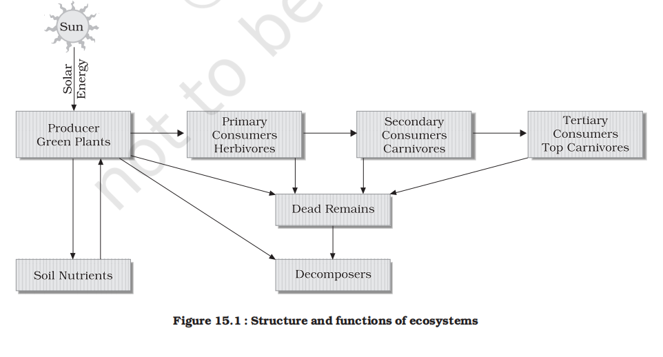
-
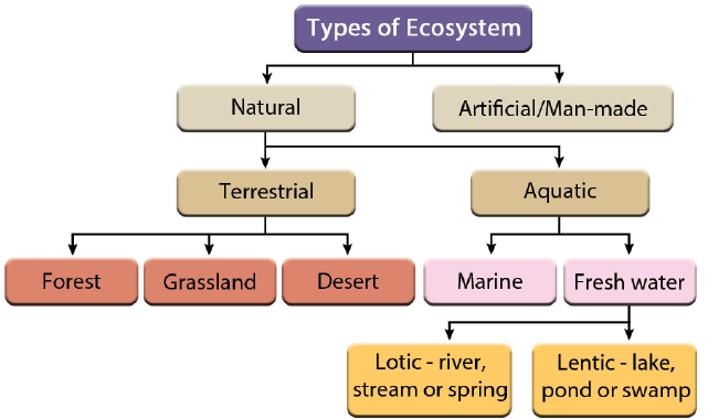
- Ecosystems are of two major types: terrestrial and aquatic
- Terrestrial ecosystem can be further be classified into ‘biomes’
- A biome is a plant and animal community that covers a large geographical area
- The boundaries of different biomes on land are determined mainly by climate
- Therefore, a biome can be defined as the total assemblage of plant and animal species interacting within specific conditions
- These include rainfall, temperature, humidity and soil conditions
- Some of the major biomes of the world are: forest, grassland, desert and tundra biomes
- Aquatic ecosystems can be classed as marine and freshwater ecosystems
- Marine ecosystem includes the oceans, estuaries and coral reefs
- Freshwater ecosystem includes lakes, ponds, streams, marshes and bogs
- Structure and functions of ecosystems
-
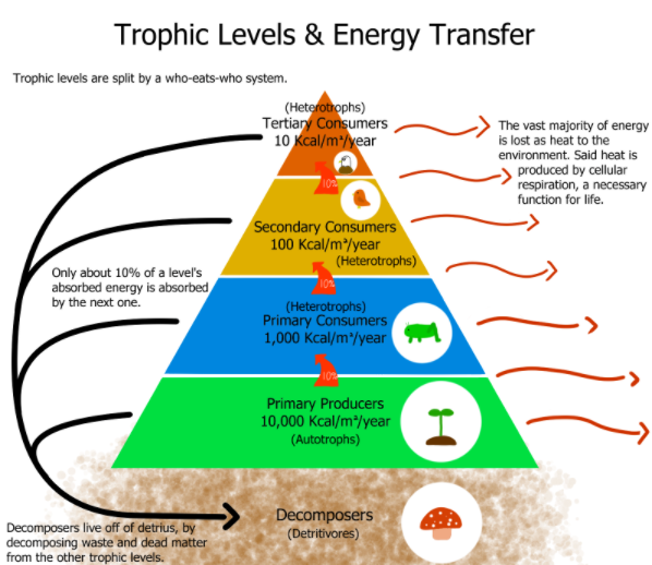
- Overview
- The structure of an ecosystem involves a description of the available plant and animal species
- From a structural point of view, all ecosystems consist of abiotic and biotic factors
- Abiotic factors include rainfall, temperature, sunlight, atmospheric humidity, soil conditions, inorganic substances (carbon dioxide, water, nitrogen, calcium, phosphorus, potassium, etc.)
- Biotic factors include the producers, the consumers (primary, secondary, tertiary) and the decomposers
- Biotic components
- The producers include all the green plants, which manufacture their own food through photosynthesis
- The primary consumers include herbivorous animals like deer, goats, mice and all plant-eating animals
- The carnivores include all the flesh-eating animals like snakes, tigers and lions
- Certain carnivores that feed also on carnivores are known as top carnivores like hawks and mongooses
- Decomposers are those that feed on dead organisms (for example, scavengers like vultures and crows), and further breaking down of the dead matter by other decomposing agents like bacteria and various microorganisms
- Energy flow and food chains
- The producers are consumed by the primary consumers whereas the primary consumers are, in turn, being eaten by the secondary consumers
- Further, the secondary consumers are consumed by the tertiary consumers
- The decomposers feed on the dead at each and every level
- They change them into various substances such as nutrients, organic and inorganic salts essential for soil fertility
- Organisms of an ecosystem are linked together through a foodchain (Figure 15.1)
- For example, a plant eating beetle feeding on a paddy stalk is eaten by a frog, which is, in turn, eaten by a snake, which is then consumed by a hawk
- This sequence of eating and being eaten and the resultant transfer of energy from one level to another is known as the food-chain
- Transfer of energy that occurs during the process of a foodchain from one level to another is known as flow of energy
-
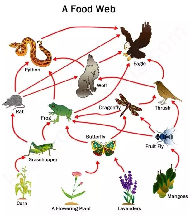
- However, food-chains are not isolated from one another
- For example, a mouse feeding on grain may be eaten by different secondary consumers (carnivores) and these carnivores may be eaten by other different tertiary consumers (top carnivores)
- In such situations, each of the carnivores may consume more than one type of prey
- As a result, the food-chains get interlocked with one another
- This interconnecting network of species is known as food web
- Generally, two types of food-chains are recognised:
- Grazing food-chain
- In a grazing food-chain, the first level starts with plants as producers and ends with carnivores as consumers at the last level, with the herbivores being at the intermediate level
- There is a loss of energy at each level which may be through respiration, excretion or decomposition
- The levels involved in a foodchain range between three to five and energy is lost at each level
- Detritus food-chain
- The detritus food chain (also called the detrital food chain) is a food chain that begins with dead organic matter rather than living producers.
- A detritus food chain starts with detritus—dead plants, animals, and organic waste—which is first consumed by decomposers and detritivores, and then passed on to higher trophic levels.
- Types of biomes
- Overview
- In the earlier paragraphs, you have learnt the meaning of the term ‘biome’
- Let us now try to identify the major biomes of the world
- There are five major biomes — forest, desert, grassland, aquatic and altitudinal biomes
- Some features of these biomes are given in Table 15.1
| Biomes |
Subtypes |
Climatic Characteristics |
Regions |
Soil |
Flora and Fauna |
| Forest |
Tropical Equatorial |
Temperature 20–25°C; high rainfall, evenly distributed |
~10° N–S |
Acidic, lateritic, poor in nutrients |
Dense multi-layered evergreen forests; tall hardwood trees |
| Tropical Deciduous |
Temperature 25–30°C; rainfall 1,000–2,000 mm, seasonal |
10°–25° N–S |
Fertile, nutrient-rich |
Medium-height deciduous trees; insects, birds, mammals |
| Temperate |
Temperature 5–20°C; rainfall 750–1,500 mm; well-defined seasons |
Eastern North America, NE Asia, Western & Central Europe |
Fertile, rich in humus from leaf litter |
Oak, beech, maple; squirrels, rabbits, bears, deer |
| Boreal (Taiga) |
Short warm summers, long cold winters; low temperatures |
Siberia, Alaska, Canada, Scandinavia |
Acidic, thin, nutrient-poor |
Evergreen conifers; wolves, bears, deer, hares |
| Desert |
Hot Desert |
Temperature 20–45°C; rainfall <250 mm |
Sahara, Kalahari, Thar, Rub-al-Khali |
Mineral-rich but poor in organic matter |
Scanty xerophytic vegetation; reptiles, insects, few mammals |
| Semi-arid |
Temperature 21–38°C; rainfall 250–500 mm |
Margins of hot deserts |
Moderately fertile |
Sparse grasses and shrubs |
| Coastal Desert |
Mild temperatures; rainfall <50 mm |
Atacama, Namib |
Mineral-rich, low organic content |
Very sparse vegetation |
| Cold Desert |
Cold winters, cool summers; rainfall <250 mm |
Gobi, Ladakh, Patagonia |
Thin, poorly developed |
Grasses, shrubs; yaks, wild asses, rodents |
| Grassland |
Tropical Savanna |
Warm climate; rainfall 500–1,250 mm |
Africa, Australia, South America, India |
Porous, thin humus layer |
Grasses with scattered trees; giraffes, zebras, elephants |
| Temperate Steppe |
Hot summers, cold winters; rainfall 250–500 mm |
Eurasia, North America |
Deep, fertile chernozem soils |
Grasses; wild horses, antelopes, rodents |
| Aquatic |
Freshwater |
Variable temperatures |
Lakes, rivers, wetlands |
Water-based sediments |
Algae, aquatic plants, freshwater fish, amphibians |
| Marine |
Variable temperatures and salinity |
Oceans, seas, coral reefs |
Marine sediments |
Phytoplankton, seaweeds, fish, marine mammals |
| Altitudinal |
— |
Temperature and precipitation vary with altitude |
Himalayas, Andes, Rockies |
Thin, immature soils on slopes |
Vegetation ranges from forests to alpine tundra |
- Biogeochemical cycles
- Overview
- The sun is the basic source of energy on which all life depends
- This energy initiates life processes in the biosphere through photosynthesis, the main source of food and energy for green plants
- During photosynthesis, carbon dioxide is converted into organic compounds and oxygen
- Out of the total solar insolation that reaches the earth’s surface, only a very small fraction (0.1 per cent) is fixed in photosynthesis
- More than half is used for plant respiration and the remaining part is temporarily stored or is shifted to other portions of the plant
- Life on earth consists of a great variety of living organisms
- These living organisms exist and survive in a diversity of associations
- Such survival involves the presence of systemic flows such as flows of energy, water and nutrients
- These flows show variations in different parts of the world, in different seasons of the year and under varying local circumstances
- Studies have shown that for the last one billion years, the atmosphere and hydrosphere have been composed of approximately the same balance of chemical components
- This balance of the chemical elements is maintained by a cyclic passage through the tissues of plants and animals
- The cycle starts by absorbing the chemical elements by the organism and is returned to the air, water and soil through decomposition
- These cycles are largely energised by solar insolation
- These cyclic movements of chemical elements of the biosphere between the organism and the environment are referred to as biogeochemical cycles
- Bio refers to living organisms and geo to rocks, soil, air and water of the earth
- There are two types of biogeochemical cycles:
- The gaseous cycle
- In the gaseous cycle, the main reservoir of nutrients is the atmosphere and the ocean
- The sedimentary cycle
- In the sedimentary cycle, the main reservoir is the soil and the sedimentary and other rocks of the earth’s crust
- The water cycle
- All living organisms, the atmosphere and the lithosphere maintain between them a circulation of water in solid, liquid or gaseous form referred to as the water or hydrologic cycle (Chapter 13 of this book)
- The carbon cycle
- Carbon is one of the basic elements of all living organisms
- It forms the basic constituent of all the organic compounds
- The biosphere contains over half a million carbon compounds in them
- The carbon cycle is mainly the conversion of carbon dioxide
- This conversion is initiated by the fixation of carbon dioxide from the atmosphere through photosynthesis
- Such conversion results in the production of carbohydrate, glucose that may be converted to other organic compounds such as sucrose, starch, cellulose, etc.
- Here, some of the carbohydrates are utilised directly by the plant itself
- During this process, more carbon dioxide is generated and is released through its leaves or roots during the day
- The remaining carbohydrates not being utilised by the plant become part of the plant tissue
- Plant tissues are either being eaten by the herbivorous animals or get decomposed by the microorganisms
- The herbivores convert some of the consumed carbohydrates into carbon dioxide for release into the air through respiration
- The micro-organisms decompose the remaining carbohydrates after the animal dies
- The carbohydrates that are decomposed by the micro-organisms then get oxidised into carbon dioxide and are returned to the atmosphere
- The oxygen cycle
- Oxygen is the main by-product of photosynthesis
- It is involved in the oxidation of carbohydrates with the release of energy, carbon dioxide and water
- The cycling of oxygen is a highly complex process
- Oxygen occurs in a number of chemical forms and combinations
- It combines with nitrogen to form nitrates and with many other minerals and elements to form various oxides such as the iron oxide, aluminium oxide and others
- Much of oxygen is produced from the decomposition of water molecules by sunlight during photosynthesis and is released in the atmosphere through transpiration and respiration processes of plants
- The nitrogen cycle
-
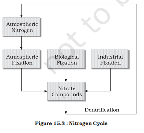
- Nitrogen is a major constituent of the atmosphere comprising about seventy-eight per cent of the atmospheric gases
- It is also an essential constituent of different organic compounds such as the amino acids, nucleic acids, proteins, vitamins and pigments
- Only a few types of organisms like certain species of soil bacteria and blue green algae are capable of utilising it directly in its gaseous form
- Generally, nitrogen is usable only after it is fixed
- Ninety per cent of fixed nitrogen is biological
- The principal source of free nitrogen is the action of soil micro-organisms and associated plant roots on atmospheric nitrogen found in pore spaces of the soil
- Nitrogen can also be fixed in the atmosphere by lightning and cosmic radiation
- In the oceans, some marine animals can fix it
- After atmospheric nitrogen has been fixed into an available form, green plants can assimilate [absorb] it
- Herbivorous animals feeding on plants, in turn, consume some of it
- Dead plants and animals, excretion of nitrogenous wastes are converted into nitrites by the action of bacteria present in the soil
- Some bacteria can even convert nitrites into nitrates that can be used again by green plants
- There are still other types of bacteria capable of converting nitrates into free nitrogen, a process known as denitrification (Figure 15.3)
- Other mineral cycles
- Other than carbon, oxygen, nitrogen and hydrogen being the principal geochemical components of the biosphere, many other minerals also occur as critical nutrients for plant and animal life
- These mineral elements required by living organisms are obtained initially from inorganic sources such as phosphorus, sulphur, calcium and potassium
- They usually occur as salts dissolved in soil water or lakes, streams and seas
- Mineral salts come directly from the earth’s crust by weathering where the soluble salts enter the water cycle, eventually reaching the sea
- Other salts are returned to the earth’s surface through sedimentation, and after weathering, they again enter the cycle
- All living organisms fulfill their mineral requirements from mineral solutions in their environments
- Other animals receive their mineral needs from the plants and animals they consume
- After the death of living organisms, the minerals are returned to the soil and water through decomposition and flow
- Ecological balance
- Overview
- Ecological balance is a state of dynamic equilibrium within a community of organisms in a habitat or ecosystem
- It can happen when the diversity of the living organisms remains relatively stable
- Gradual changes do take place but that happens only through natural succession
- It can also be explained as a stable balance in the numbers of each species in an ecosystem
- This occurs through competition and cooperation between different organisms where population remains stable
- This balance is brought about by the fact that certain species compete with one another determined by the environment in which they grow
- This balance is also attained by the fact that some species depend on others for their food and sustenance
- Such accounts are encountered in vast grasslands where the herbivorous animals (deer, zebras, buffaloes, etc.) are found in plenty
- On the other hand, the carnivorous animals (tigers, lions, etc.) that are not usually in large numbers, hunt and feed on the herbivores, thereby controlling their population
- In the plants, any disturbance in the native forests such as clearing the forest for shifting cultivation usually brings about a change in the species distribution
- This change is due to competition where the secondary forest species such as grasses, bamboos or pines overtakes the native species changing the original forest structure, this is called succession
- Disturbances to ecological balance
- Ecological balance may be disturbed due to the introduction of new species, natural hazards or human causes
- Human interference has affected the balance of plant communities leading to disturbances in the ecosystems
- Such disturbances bring about numerous secondary successions
- Human pressure on the earth’s resources has put a heavy toll on the ecosystem
- This has destroyed its originality and has caused adverse effects to the general environment
- Ecological imbalances have brought many natural calamities like floods, landslides, diseases, erratic climatic occurrences, etc.
- Relationship between plant and animal communities
- There is a very close relationship between the plant and animal communities within particular habitats
- Diversity of life in a particular area can be employed as an indicator of the habitat factor
- Proper knowledge and understanding of such factors provide a strong base for protecting and conserving the ecosystems
- Biodiversity and conservation
- Introduction to biodiversity
- Overview
- You have already learnt about the geomorphic processes particularly weathering and depth of weathering mantle in different climatic zones
- See the Figure 6.2 in Chapter 6 in order to recapitulate
- You should know that this weathering mantle is the basis for the diversity of vegetation and hence, the biodiversity
- The basic cause for such weathering variations and resultant biodiversity is the input of solar energy and water
- No wonder that the areas that are rich in these inputs are the areas of wide spectrum of biodiversity
- Biodiversity as we have today is the result of 2.5-3.5 billion years of evolution
- Before the advent of humans, our earth supported more biodiversity than in any other period
- Since, the emergence of humans, however, biodiversity has begun a rapid decline, with one species after another bearing the brunt of extinction due to overuse
- The number of species globally vary from 2 million to 100 million, with 10 million being the best estimate
- New species are regularly discovered most of which are yet to be classified (an estimate states that about 40 per cent of fresh water fishes from South America are not classified yet)
- Tropical forests are very rich in bio-diversity
- Biodiversity is a system in constant evolution, from a view point of species, as well as from view point of an individual organism
- The average half-life of a species is estimated at between one and four million years, and 99 per cent of the species that have ever lived on the earth are today extinct
- Biodiversity is not found evenly on the earth
- It is consistently richer in the tropics
- As one approaches the polar regions, one finds larger and larger populations of fewer and fewer species
- Definition of biodiversity
- Biodiversity itself is a combination of two words, Bio (life) and diversity (variety)
- In simple terms, biodiversity is the number and variety of organisms found within a specified geographic region
- It refers to the varieties of plants, animals and micro-organisms, the genes they contain and the ecosystems they form
- It relates to the variability among living organisms on the earth, including the variability within and between the species and that within and between the ecosystems
- Biodiversity is our living wealth
- It is a result of hundreds of millions of years of evolutionary history
- Levels of biodiversity
- Biodiversity can be discussed at three levels:
- Genetic diversity
- Genes are the basic building blocks of various life forms
- Genetic biodiversity refers to the variation of genes within species
- Groups of individual organisms having certain similarities in their physical characteristics are called species
- Human beings genetically belong to the homo sapiens group and also differ in their characteristics such as height, colour, physical appearance, etc., considerably
- This is due to genetic diversity
- This genetic diversity is essential for a healthy breeding of population of species
- Species diversity
- This refers to the variety of species
- It relates to the number of species in a defined area
- The diversity of species can be measured through its richness, abundance and types
- Some areas are more rich in species than others
- Areas rich in species diversity are called hotspots of diversity (Figure 16.5)
- Ecosystem diversity
-
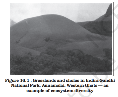
- You have studied about the ecosystem in the earlier chapter
- The broad differences between ecosystem types and the diversity of habitats and ecological processes occurring within each ecosystem type constitute the ecosystem diversity
- The ‘boundaries’ of communities (associations of species) and ecosystems are not very rigidly defined
- Thus, the demarcation of ecosystem boundaries is difficult and complex
- Importance of biodiversity
- Overview
- Biodiversity has contributed in many ways to the development of human culture and, in turn, human communities have played a major role in shaping the diversity of nature at the genetic, species and ecological levels
- Biodiversity plays the following roles: ecological, economic and scientific
- Ecological role of biodiversity
- Species of many kinds perform some function or the other in an ecosystem
- Nothing in an ecosystem evolves and sustains without any reason
- That means, every organism, besides extracting its needs, also contributes something of useful to other organisms
- Can you think of the way we, humans contribute to the sustenance of ecosystems
- Species capture and store energy, produce and decompose organic materials, help to cycle water and nutrients throughout the ecosystem, fix atmospheric gases and help regulate the climate
- These functions are important for ecosystem function and human survival
- The more diverse an ecosystem, better are the chances for the species to survive through adversities and attacks, and consequently, is more productive
- Hence, the loss of species would decrease the ability of the system to maintain itself
- Just like a species with a high genetic diversity, an ecosystem with high biodiversity may have a greater chance of adapting to environmental change
- In other words, the more the variety of species in an ecosystem, the more stable the ecosystem is likely to be
- Economic role of biodiversity
- For all humans, biodiversity is an important resource in their day-to-day life
- One important part of biodiversity is ‘crop diversity’, which is also called agro-biodiversity
- Biodiversity is seen as a reservoir of resources to be drawn upon for the manufacture of food, pharmaceutical, and cosmetic products
- This concept of biological resources is responsible for the deterioration of biodiversity
- At the same time, it is also the origin of new conflicts dealing with rules of division and appropriation of natural resources
- Some of the important economic commodities that biodiversity supplies to humankind are: food crops, livestock, forests, fish, medicinal resources, etc.
- Scientific role of biodiversity
- Biodiversity is important because each species can give us some clue as to how life evolved and will continue to evolve
- Biodiversity also helps in understanding how life functions and the role of each species in sustaining ecosystems of which we are also a species
- This fact must be drawn upon every one of us so that we live and let other species also live their lives
- It is our ethical responsibility to consider that each and every species along with us have an intrinsic right to exist
- Hence, it is morally wrong to voluntarily cause the extinction of any species
- The level of biodiversity is a good indicator of the state of our relationships with other living species
- In fact, the concept of biodiversity is an integral part of many human cultures
- Loss of biodiversity
- Overview
- Since the last few decades, growth in human population has increased the rate of consumption of natural resources
- It has accelerated the loss of species and habitation in different parts of the world
- Tropical regions which occupy only about one-fourth of the total area of the world, contain about three-fourth of the world human population
- Overexploitation of resources and deforestation have become rampant to fulfil the needs of large population
- As these tropical rain forests contain 50 per cent of the species on the earth, destruction of natural habitats have proved disastrous for the entire biosphere
- Causes of biodiversity loss
- Natural calamities such as earthquakes, floods, volcanic eruptions, forest fires, droughts, etc. cause damage to the flora and fauna of the earth, bringing change the biodiversity of respective affected regions
- Pesticides and other pollutants such as hydrocarbons and toxic heavy metals destroy the weak and sensitive species
- Species which are not the natural inhabitants of the local habitat but are introduced into the system, are called exotic species
- There are many examples when a natural biotic community of the ecosystem suffered extensive damage because of the introduction of exotic species
- During the last few decades, some animals like tigers, elephants, rhinoceros, crocodiles, minks and birds were hunted mercilessly by poachers for their horn, tusks, hides, etc.
- It has resulted in the rendering of certain types of organisms as endangered category
- The International Union for Conservation of Nature (IUCN)
-
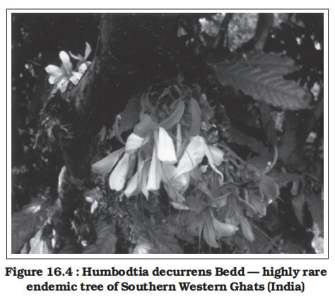
- IUCN assesses the global conservation status of species and publishes the Red List of Threatened Species
- Categories of threatened species (IUCN Red List)
- Extinct (EX)
- No known individuals of the species remain
- Examples:
- Dodo
- Passenger pigeon
- Extinct in the Wild (EW)
- Species survives only in captivity or outside its natural range
- Examples:
- Scimitar-horned oryx
- Critically Endangered (CR)
- Extremely high risk of extinction in the wild
- Examples:
- Great Indian Bustard
- Javan rhinoceros
- Vaquita porpoise
- Endangered (EN)
- Very high risk of extinction in the wild
- Examples:
- Tiger
- Asian elephant
- Blue whale
- Vulnerable (VU)
- High risk of extinction in the medium term
- Examples:
- Snow leopard
- One-horned rhinoceros
- Giant panda
- Near Threatened (NT)
- Close to qualifying for a threatened category
- Examples:
- Jaguar
- Plains zebra
- Least Concern (LC)
- Widespread and abundant species
- Examples:
- House sparrow
- Human beings
- Data Deficient (DD)
- Insufficient information to assess extinction risk
- Examples:
- Many deep-sea fish and invertebrates
- Not Evaluated (NE)
- Species not yet assessed by IUCN
- Examples:
- Newly discovered species
- Conservation of biodiversity
-
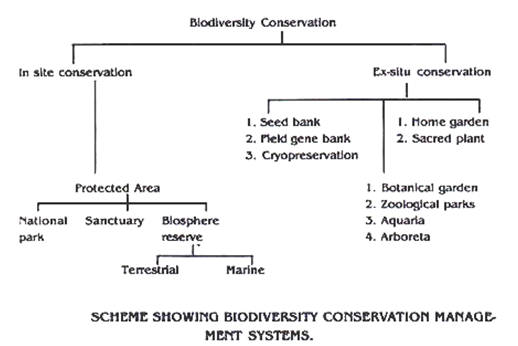
- Overview
- Biodiversity is important for human existence
- All forms of life are so closely interlinked that disturbance in one gives rise to imbalance in the others
- If species of plants and animals become endangered, they cause degradation in the environment, which may threaten human being’s own existence
- There is an urgent need to educate people to adopt environment-friendly practices and reorient their activities in such a way that our development is harmonious with other life forms and is sustainable
- There is an increasing consciousness of the fact that such conservation with sustainable use is possible only with the involvement and cooperation of local communities and individuals
- For this, the development of institutional structures at local levels is necessary
- The critical problem is not merely the conservation of species nor the habitat but the continuation of process of conservation
- International efforts
-
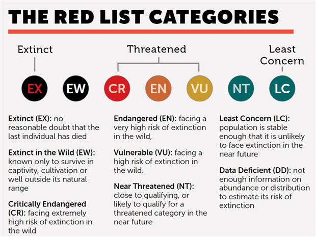
- The Government of India along with 155 other nations have signed the Convention of Biodiversity at the Earth Summit held at Rio de Janeiro, Brazil in June 1992
- The world conservation strategy has suggested the following steps for biodiversity conservation:
- Efforts should be made to preserve the species that are endangered;
- Prevention of extinction requires proper planning and management;
- Varieties of food crops, forage plants, timber trees, livestock, animals and their wild relatives should be preserved;
- Each country should identify habitats of wild relatives and ensure their protection;
- Habitats where species feed, breed, rest and nurse their young should be safeguarded and protected;
- International trade in wild plants and animals be regulated
- National efforts
- To protect, preserve and propagate the variety of species within natural boundaries, the Government of India passed the Wild Life (Protection) Act, 1972, under which national parks and sanctuaries were established and biosphere reserves declared
- Details of these biosphere reserves are given in the book India: Physical Environment (NCERT, 2006)
- Mega diversity centres and hotspots
-
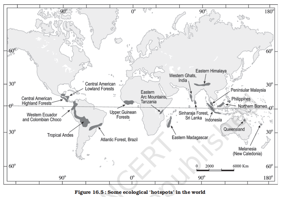
- There are some countries which are situated in the tropical region; they possess a large number of the world’s species diversity, they are called mega diversity centres
- There are 12 such countries, namely Mexico, Columbia, Ecuador, Peru, Brazil, Democratic Republic of Congo, Madagascar, China, India, Malaysia, Indonesia and Australia in which these centres are located
- In order to concentrate resources on those areas that are most vulnerable, the International Union for the Conservation of Nature and Natural Resources (IUCN) has identified certain areas as biodiversity hotspots (Figure 16.5)
- Hotspots are defined according to their vegetation
- Plants are important because these determine the primary productivity of an ecosystem
- Most, but not all, of the hotspots rely on species-rich ecosystems for food, firewood, cropland, and income from timber
- In Madagascar, for example, about 85 per cent of the plants and animals are found nowhere else in the world
- Other hotspots in wealthy countries are facing different types of pressures
- The islands of Hawaii have many unique plants and animals that are threatened by introduced species and land development
- Soil erosion and conservation
- Soil erosion is the process by which the top layer of soil (the most fertile part) is removed or displaced by natural forces such as water, wind, ice, or human activity like deforestation and overgrazing.
- Soil conservation is a methodology to maintain soil fertility, prevent soil erosion and exhaustion, and improve the degraded condition of the soil
- Causes of Soil Erosion:
- Deforestation
- Overgrazing
- Unscientific farming practices
- Urban expansion
- Mining
- Types of soil erosion
-
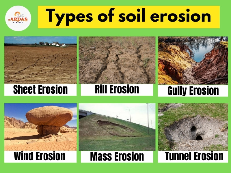
- Sheet Erosion
- Thin layers of topsoil are removed uniformly by rainfall or surface water.
- Often goes unnoticed until productivity declines.
- Rill Erosion
- Small channels form on sloped lands due to surface runoff.
- These rills are easily removed by normal tilling but can deepen into gullies if ignored.
- Gully Erosion
- Advanced stage of rill erosion where deep gullies form.
- Common in badlands like Chambal Valley.
- Splash Erosion
- Impact of raindrops dislodges soil particles, which are then washed away.
- Common on bare soil surfaces.
- Wind Erosion
- In arid and semi-arid areas, strong winds blow away loose topsoil.
- Common in Rajasthan, especially in the Thar Desert.
- Stream Bank Erosion
- Riverbanks eroded due to strong water currents, especially during floods.
- Affects riverine agriculture.
- Coastal Erosion
- Sea waves and currents erode shoreline soils.
- Threatens coastal habitats and infrastructure.
- Impacts of soil erosion
- Loss of Topsoil
- The nutrient-rich uppermost layer of soil is removed, reducing soil fertility and productivity.
- This affects crop yields and leads to food insecurity, especially in agrarian economies.
- Decline in Agricultural Productivity
- Eroded soils have poor water retention and fewer nutrients, resulting in lower agricultural output.
- Farmers may have to rely more on chemical fertilizers, increasing input costs.
- A fairly large area of arable land in the irrigated zones of India is becoming saline because of over-irrigation
- The salt lodged in the lower profiles of the soil comes up to the surface and destroys its fertility
- Silting of Rivers and Reservoirs
- Eroded soil is carried into rivers, lakes, and reservoirs, causing siltation.
- This reduces water-holding capacity, increases the risk of floods, and shortens the lifespan of dams.
- Eroded materials are carried down to rivers and they lower down their carrying capacity, and cause frequent floods and damage to agricultural lands
- Desertification
- Continuous erosion in dry regions can lead to the transformation of fertile land into desert-like conditions.
- Especially seen in parts of Rajasthan and semi-arid Deccan plateau.
- Deforestation and Biodiversity Loss
- Plants keep soils bound in locks of roots, and thus, prevent erosion
- They also add humus to the soil by shedding leaves and twigs
- Forests have been denuded practically in most parts of India but their effect on soil erosion are more in hilly parts of the country
- Erosion often accompanies deforestation, exposing soil to rain and wind.
- Habitats are destroyed, impacting flora and fauna diversity.
- Pollution and Water Quality Deterioration
- Soil particles may carry pesticides and fertilizers into water bodies, polluting them.
- Leads to eutrophication and impacts aquatic life.
- Chemical fertilisers in the absence of organic manures are also harmful to the soil
- Unless the soil gets enough humus, chemicals harden it and reduce its fertility in the long run
- This problem is common in all the command areas of the river valley projects, which were the first beneficiaries of the Green Revolution
- Infrastructure Damage
- Soil erosion can undermine roads, buildings, and pipelines, causing structural damage and economic losses.
- Livelihood Impact
- In rural areas, where livelihoods depend on land, erosion leads to poverty and forced migration.
- Climate Impact
- Eroded soils store less carbon, reducing their ability to act as carbon sinks, thus contributing to climate change.
- Economic Cost
- Costs related to land degradation, loss of productivity, flood control, and dam maintenance rise significantly.
- Soild conservation
- Methods
-
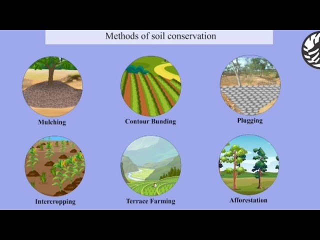
- Contour Ploughing
- Ploughing along the contour lines to reduce water runoff and prevent rill formation.
- Terracing
- Creating flat areas (terraces) on slopes to slow down water flow and reduce erosion.
- Strip Cropping
- Alternating strips of erosion-prone and erosion-resistant crops to break the force of wind or water.
- Afforestation & Reforestation
- Planting trees to bind soil and prevent erosion by wind or water.
- Cover Crops / Mulching
- Using plant residues or grass to cover soil and prevent splash erosion.
- Check Dams and Gully Plugging
- Small barriers across streams or gullies to slow water flow and promote sediment deposition.
- Windbreaks / Shelter Belts
- Rows of trees planted to reduce wind speed and trap moving soil.
- Coastal Protection Measures
- Planting mangroves and building sea walls to prevent coastal erosion.
- Policy and planning in India
- Limitations of Existing Plans
- While a number of plans have been developed, they remain fragmented and often lack integration across sectors such as agriculture, forestry, and water management.
- This piecemeal approach has limited the impact of conservation efforts in certain regions.
- Policies and schemes
- Central Soil Conservation Board Initiatives
- The Government of India established the Central Soil Conservation Board with the primary objective of formulating region-specific soil conservation plans.
- These plans consider diverse climatic conditions, terrain configuration, and the socio-economic behaviour of local communities.
- The board provides technical guidance and frameworks for state-level implementation.
- Policy Measures and Schemes
- Various central and state government schemes support soil conservation, such as:
- Watershed Development Projects (e.g., Integrated Watershed Management Programme)
- National Mission for Sustainable Agriculture (NMSA) under the National Action Plan on Climate Change
- Soil Health Card Scheme to promote balanced fertilization and awareness of soil quality
- Need for Integrated Land Use Planning
- A holistic and integrated land use strategy is increasingly seen as the most effective approach. This includes:
- Classifying land according to capability and erosion risk
- Creating land use maps
- Ensuring land is used according to its best-suited function—whether for agriculture, afforestation, pasture, or watershed development.
- Interdepartmental Coordination
- Achieving meaningful conservation requires coordination between multiple departments—agriculture, environment, rural development, and water resources—along with convergence of funding from various schemes.
- Community Participation and Responsibility
- The success of any soil conservation programme hinges on the active participation of local communities, especially farmers and landowners.
- Since they are both the users and beneficiaries, educating and incentivizing them to adopt soil-friendly practices is vital. This includes promoting:
- Contour ploughing and terracing in hilly regions
- Agroforestry and mixed cropping
- Use of organic manures and mulching
- Technology and Research
- Use of remote sensing, GIS mapping, and real-time monitoring has strengthened soil conservation planning and assessment.
- Research institutions like ICAR and CRIDA play a key role in developing region-specific soil conservation techniques.
- Sustainable and Long-Term Vision
- Soil conservation is not just an environmental necessity but an economic and social imperative. A long-term vision integrating ecological balance, food security, and climate resilience must underpin India’s conservation policies.
- Physical Geography PYQs
- [1995]
- Q1: A meteor is:
- Options:
(a) a rapidly moving star
(b) a piece of matter which has entered the earth's atmosphere from outer space
(c) part of a constellation
(d) a comet without a tail
- Answer:
(b) a piece of matter which has entered the earth's atmosphere from outer space
- Analysis:
- Scientific Context:
- A meteor is a fragment of rock or metal (meteoroid) from space that enters Earth's atmosphere and burns up due to friction, creating a visible streak of light (often called a "shooting star").
- This phenomenon occurs when meteoroids, typically from comets or asteroids, encounter Earth's atmosphere at high speeds (10-70 km/s), distinguishing them from other celestial bodies.
- Why Not Others?:
- (a) A rapidly moving star:
- Incorrect—Stars are massive, luminous bodies fixed in their positions relative to Earth over short timescales. A "rapidly moving star" is a misnomer; the visible motion of meteors is due to their atmospheric entry, not stellar movement.
- (c) Part of a constellation:
- Incorrect—Constellations are patterns of stars as seen from Earth, fixed in the night sky. Meteors are transient phenomena unrelated to these patterns.
- (d) A comet without a tail:
- Incorrect—Comets are icy bodies that develop tails when heated by the Sun, but a meteor is a distinct object (a meteoroid burning up). Even a comet without a visible tail is not a meteor.
- Related Concepts:
- Meteoroid:
- The solid object in space before entering the atmosphere.
- Meteor:
- The visible streak during atmospheric entry.
- Meteorite:
- A meteoroid that survives and lands on Earth’s surface.
- Meteor Showers:
- Events like the Perseids or Leonids, caused by Earth passing through comet debris, producing multiple meteors.
- Broader Connection:
- Links to questions on astronomy (e.g., Q84 [2012-I] on celestial bodies) or atmospheric phenomena, reflecting the interdisciplinary nature of physical geography in UPSC exams.
- Understanding meteors ties into broader topics like planetary science or the study of near-Earth objects (NEOs).
- Key Takeaway:
- A meteor is specifically the visible phenomenon of a meteoroid burning in Earth’s atmosphere, distinct from stars, constellations, or comets, highlighting precise astronomical terminology.
- Q3: The graph given below shows the mean average monthly temperatures (in °C) and mean monthly rainfall (in cm) of a place:
-
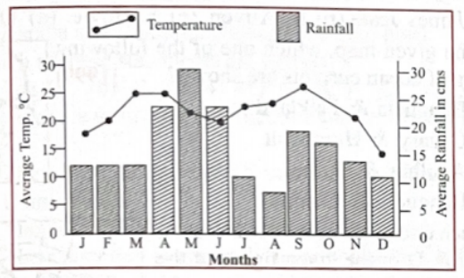
- This graph is indicative of which one of the climatic zones of the world?
- Options:
(a) Wet and dry tropical
(b) Rainy tropical
(c) Semi-arid tropical
(d) Temperate marine
- Answer:
(a) Wet and dry tropical
- Q4: Willy Willy is:
- Options:
(a) a type of tree grown in temperate regions
(b) a wind that blows in a desert
(c) a tropical cyclone of the North-west Australia
(d) a kind of common fish found near Laccadive Islands
- Answer:
(c) a tropical cyclone of the North-west Australia
- Analysis:
- Geographical Context:
- A Willy Willy is a local term for a tropical cyclone in North-west Australia, particularly affecting coastal areas of Western Australia and the Northern Territory.
- These cyclones form over warm ocean waters (above 26.5°C) in the Indian Ocean and Timor Sea, typically between November and April, bringing heavy rain, strong winds, and storm surges.
- Why Not Others?:
- (a) A type of tree grown in temperate regions:
- Incorrect—No evidence links "Willy Willy" to trees; the term is meteorological, not botanical.
- (b) A wind that blows in a desert:
- Incorrect—While Australia has desert winds (e.g., dust storms), Willy Willy specifically refers to tropical cyclones, not arid winds.
- (d) A kind of common fish found near Laccadive Islands:
- Incorrect—Willy Willy is unrelated to marine biology or the Laccadive (Lakshadweep) Islands, which are in the Arabian Sea.
- Related Concepts:
- Tropical Cyclones:
- Known by different names globally: hurricanes (Atlantic), typhoons (Pacific), cyclones (Indian Ocean).
- Other Regional Terms:
- Cyclone (India/Bangladesh), Baguios (Philippines), Taifu (Japan).
- Australian Cyclones:
- Notable examples include Cyclone Tracy (1974), which devastated Darwin.
- Broader Connection:
- Links to questions on meteorological phenomena (e.g., Q29 [2001] on local winds like Fohn) or natural disasters (e.g., Q18 [1998] on Indonesian fires).
- Understanding cyclone terminology is crucial for studying climate impacts and disaster management in geography.
- Key Takeaway:
- Willy Willy is a regional term for tropical cyclones in North-west Australia, distinguishing it from other meteorological or biological phenomena.
- Q5: Which one of the following is the continent with the highest mean elevation in the world?
- Options:
(a) Antarctica
(b) North America
(c) Asia
(d) South America
- Answer:
(a) Antarctica
- Analysis:
- Geographical Context:
- Antarctica has the highest mean elevation of any continent, averaging about 2,300 meters above sea level, due to its massive ice sheet, which is up to 4 km thick in places.
- This elevation is driven by the thick ice covering 98% of the continent, elevating its surface far above sea level, unlike other continents with varied topography.
- Why Not Others?:
- (b) North America:
- Incorrect—North America’s mean elevation is about 720 meters, with high points like the Rockies (e.g., Mt. Elbert, 4,401 m) but lower overall due to vast plains.
- (c) Asia:
- Incorrect—Asia, with the Himalayas (e.g., Everest, 8,848 m), has a mean elevation of about 950 meters, lowered by extensive lowlands like the Ganges Plain.
- (d) South America:
- Incorrect—South America’s mean elevation is around 590 meters, with the Andes (e.g., Aconcagua, 6,960 m) but significant lowlands like the Amazon Basin.
- Elevation Data:
- Antarctica: ~2,300 m (ice-driven, highest due to ice sheet).
- Asia: ~950 m (Himalayas offset by lowlands).
- North America: ~720 m (Rockies, plains balance).
- South America: ~590 m (Andes, Amazon lowlands).
- Related Concepts:
- Ice Sheets:
- Antarctica’s elevation is due to its ice sheet, unlike Greenland’s smaller ice cover.
- Plate Tectonics:
- Other continents’ elevations are influenced by tectonic activity (e.g., Andes, Himalayas), but Antarctica’s is ice-dominated.
- Broader Connection:
- Links to questions on physical geography (e.g., Q52 [2005] on continental land area) or polar environments (e.g., Q88 [2018-I] on shrinking water bodies).
- Understanding elevation impacts climate, glaciation, and global sea level studies.
- Key Takeaway:
- Antarctica’s unparalleled mean elevation, driven by its ice sheet, sets it apart from other continents, a critical fact in physical geography.
- [1996]
- Q6: Which one of the following layers of the atmosphere is responsible for the deflection of radio waves?
- Options:
(a) Troposphere
(b) Stratosphere
(c) Mesosphere
(d) Ionosphere
- Answer:
(d) Ionosphere
- Analysis:
- Scientific Context:
- The ionosphere, located 50-1000 km above Earth’s surface, contains charged particles (ions) due to solar radiation. It deflects radio waves, enabling long-distance communication by reflecting shortwave radio signals back to Earth.
- This is vital for radio broadcasting and early global communication, as signals can bounce over the horizon.
- Why Not Others?:
- (a) Troposphere:
- Incorrect—The troposphere (0-12 km) is where weather occurs, with water vapor and neutral gases, but lacks ionization to deflect radio waves.
- (b) Stratosphere:
- Incorrect—The stratosphere (12-50 km), containing the ozone layer, absorbs UV radiation but has no significant ionization for radio wave reflection.
- (c) Mesosphere:
- Incorrect—The mesosphere (50-85 km) is thin, with minimal ionization, unsuitable for radio wave deflection compared to the ionosphere.
- Related Concepts:
- Ionospheric Layers:
- Includes D, E, and F layers; the F-layer is key for reflecting high-frequency radio waves during the day.
- Solar Activity:
- Solar flares increase ionization, enhancing reflection but potentially disrupting signals (e.g., radio blackouts).
- Broader Connection:
- Links to atmospheric science questions (e.g., Q57 [2006] on geographical phenomena) or communication technology, showing the ionosphere’s role in physical geography.
- Relevant to space weather impacts on GPS and satellite systems.
- Key Takeaway:
- The ionosphere’s ionized particles enable radio wave deflection, a unique function critical for communication, distinct from other atmospheric layers.
- Q7: Given below are two statements, one labelled as Assertion (A) and the other labelled as Reason (R):
- Assertion (A): Areas near the equator receive rainfall throughout the year.
- Reason (R): High temperatures and high humidity cause convectional rain in most afternoons near the equator.
- In the context of the above two statements, which one of the following is correct?
- Options:
(a) Both A and R are true and R is the correct explanation of A
(b) Both A and R are true but R is not a correct explanation of A
(c) A is true but R is false
(d) A is false but R is true
- Answer:
(a) Both A and R are true and R is the correct explanation of A
- Analysis:
- Geographical Context:
- Equatorial regions (e.g., Amazon Basin, Congo Basin, Indonesia) have a rainy tropical climate (Af in Köppen classification), with 200-400 cm of rainfall yearly due to the Intertropical Convergence Zone (ITCZ), where trade winds converge, causing uplift and precipitation.
- High temperatures (25-30°C) and humidity drive convectional rainfall, where warm, moist air rises, cools, and condenses, forming afternoon showers or thunderstorms.
- Assertion (A) Analysis:
- True—Equatorial areas receive near-daily rainfall, with no pronounced dry season, due to consistent ITCZ activity.
- Reason (R) Analysis:
- True—High temperatures and humidity cause convectional rain, as heated air creates low-pressure systems, leading to regular afternoon precipitation.
- Correct Explanation—R explains A, as convectional rain is the primary mechanism for year-round equatorial rainfall.
- Why Not Others?:
- (b) Both A and R are true but R is not a correct explanation of A:
- Incorrect—R directly explains A, as convectional rain drives the consistent rainfall.
- (c) A is true but R is false:
- Incorrect—R is true; convectional rain is a well-documented equatorial phenomenon.
- (d) A is false but R is true:
- Incorrect—A is true; equatorial regions do receive year-round rainfall.
- Related Concepts:
- ITCZ:
- A low-pressure zone driving equatorial rainfall, shifting slightly with seasons.
- Convectional Rainfall:
- Common in tropics, linked to daily heating cycles, unlike frontal or orographic rain.
- Broader Connection:
- Links to climatic zone questions (e.g., Q3 [1995] on tropical climates) or atmospheric processes, relevant for understanding global weather patterns in UPSC geography.
- Key Takeaway:
- Equatorial rainfall is driven by convectional processes due to high temperatures and humidity, making both the assertion and its explanation accurate.
- Q8: Given below are two statements, one labelled as Assertion (A) and the other labelled as Reason (R):
- Assertion (A): Mangroves are very specialised forest ecosystems of tropical and sub-tropical regions bordering certain sea coasts.
- Reason (R): They stabilise the shoreline and act as bulwark against encroachments by the sea.
- In the context of the above two statements, which one of the following is correct?
- Options:
(a) Both A and R are true and R is the correct explanation of A
(b) Both A and R are true but R is not a correct explanation of A
(c) A is true but R is false
(d) A is false but R is true
- Answer:
(a) Both A and R are true and R is the correct explanation of A
- Analysis:
- Geographical Context:
- Mangroves are specialized forest ecosystems found in tropical and subtropical coastal regions (e.g., Sunderbans, Andaman and Nicobar Islands), thriving in saline, tidal zones with waterlogged soils.
- They have specialized adaptations such as aerial roots (pneumatophores) and salt-filtering mechanisms, supporting a rich biodiversity of fish, birds, and crustaceans.
- Assertion (A) Analysis:
- True—Mangroves are unique ecosystems in tropical/subtropical coastal areas, shaped by environmental conditions and biological adaptations.
- Reason (R) Analysis:
- True—Mangroves stabilize shorelines by trapping sediment with their dense root systems, reducing erosion, and acting as natural barriers against sea surges and tsunamis.
- Correct Explanation—Their ability to stabilise shorelines and protect against sea encroachment directly supports their ecological role, explaining why they are so specialised in such coastal environments.
- Why Not Others?:
- (b) Both A and R are true but R is not a correct explanation of A:
- Incorrect—R *does* help explain A, since shoreline protection is a direct result of mangrove adaptations.
- (c) A is true but R is false:
- Incorrect—R is factually correct; mangroves do act as natural coastal bulwarks.
- (d) A is false but R is true:
- Incorrect—A is factually true and widely accepted.
- Related Concepts:
- Mangrove Adaptations:
- Viviparous seeds, salt-excreting leaves, stilt and pneumatophore roots for oxygen intake in anoxic mud.
- Ecological Roles:
- Serve as breeding grounds for marine species, carbon sequestration hubs, and buffers against climate-related disasters.
- Broader Connection:
- Ties into questions on biosphere reserves (e.g., Q2 [1995] – Sunderbans) and coastal ecosystems (e.g., Q31 [2001] – Gulf of Mannar).
- Highly relevant to environmental geography and climate resilience themes.
- Key Takeaway:
- Mangroves are specialized due to both their ecological adaptations and functional role in shoreline protection, making R a correct and relevant explanation of A.
- Q9: Diamond ring is a phenomenon observed:
- Options:
(a) at the start of a total solar eclipse
(b) at the end of a total solar eclipse
(c) only along the peripheral regions of the totality trail
(d) only in the central regions of the totality trail
- Answer:
(c) only along the peripheral regions of the totality trail
- Analysis:
- Scientific Context:
- The diamond ring effect is a brief flash of bright light seen during a total solar eclipse.
- It occurs when a tiny portion of the Sun's photosphere shines through lunar valleys just before or just after totality, creating a brilliant point of light — like a diamond — on the ring of the Sun’s corona.
- This is most clearly visible near the start or end of the total eclipse, which corresponds to the peripheral regions within the totality path.
- Assertion Analysis:
- The effect does not occur outside the path of totality — hence, it’s not visible during partial eclipses.
- It also doesn’t occur during the central part of totality, where the Sun is fully blocked.
- Therefore, the phenomenon is best observed along the inner edges (peripheral areas) of the totality trail — making option (c) accurate.
- Why Not Others?:
- (a) At the start of a total solar eclipse:
- Partially true — it may occur, but the question specifies exclusivity, and it's not limited to the start alone.
- (b) At the end of a total solar eclipse:
- Also partially true, but again not exclusive.
- (d) Only in the central regions of the totality trail:
- Incorrect — the central region has full totality with no visible photosphere, so no diamond ring.
- Related Concepts:
- Baily’s Beads:
- Precede or follow the diamond ring effect due to sunlight passing through lunar valleys.
- Totality Path:
- The narrow area on Earth’s surface where a total solar eclipse is visible. Diamond ring occurs only within this path, near the edges.
- Broader Connection:
- Relevant to astronomy and physical geography.
- Also appears in UPSC questions involving celestial phenomena, optics, or eclipse mechanics.
- Key Takeaway:
- The diamond ring effect occurs specifically along the peripheral regions of the path of totality, just before or after totality — making option (c) the most accurate answer.
- [1997]
- Q10: Which one of the following factors is responsible for the change in the regular direction of the ocean currents in the Indian Ocean?
- Options:
(a) Indian Ocean is half an ocean
(b) Indian Ocean has monsoon drift
(c) Indian Ocean is a land-locked ocean
(d) Indian Ocean has greater variation in salinity
- Answer:
(b) Indian Ocean has monsoon drift
- Analysis:
- Geographical Context:
- The Indian Ocean’s currents reverse seasonally due to the monsoon, a unique phenomenon called monsoon drift. During the southwest monsoon (June-September), winds push surface currents northeastward; during the northeast monsoon (November-February), they reverse southwestward.
- This is driven by monsoon winds, influenced by the differential heating of the Indian subcontinent and surrounding ocean.
- Why Not Others?:
- (a) Indian Ocean is half an ocean:
- Incorrect—No standard geographical definition supports this; the Indian Ocean is a full ocean, smaller than the Pacific or Atlantic but not “half.”
- (c) Indian Ocean is a land-locked ocean:
- Incorrect—The Indian Ocean is not land-locked; it connects to the Pacific and Atlantic via open boundaries, unlike the Mediterranean.
- (d) Indian Ocean has greater variation in salinity:
- Incorrect—Salinity variations exist but are not the primary driver of current reversals, which are wind-driven by monsoons.
- Related Concepts:
- Monsoon Winds:
- Seasonal wind reversals due to land-ocean temperature contrasts, affecting currents and rainfall.
- Other Currents:
- North Equatorial Current and South Equatorial Current are influenced by monsoons, unlike steady currents like the Gulf Stream.
- Broader Connection:
- Links to oceanography questions (e.g., Q43 [2004] on Mekong River) or monsoon impacts (e.g., Q7 [1996] on equatorial rainfall).
- Relevant to climate studies, as monsoon currents affect fishing, navigation, and coastal economies.
- Key Takeaway:
- Monsoon drift, driven by seasonal wind reversals, uniquely alters Indian Ocean currents, distinguishing it from other oceans.
- Q11: Daily weather map showing isobars is an example of:
- Options:
(a) Choropleth map
(b) Isopleth map
(c) Chorochromatic map
(d) Choroschematic map
- Answer:
(b) Isopleth map
- Analysis:
- Geographical Context:
- An isopleth map displays lines (isopleths) connecting points of equal value, such as isobars (equal atmospheric pressure) on a weather map. Daily weather maps use isobars to show pressure systems, aiding in forecasting.
- Isobars indicate high-pressure (anticyclones) and low-pressure (cyclones) areas, critical for meteorology.
- Why Not Others?:
- (a) Choropleth map:
- Incorrect—Choropleth maps show data variations across regions (e.g., population density) using shaded areas, not continuous lines like isobars.
- (c) Chorochromatic map:
- Incorrect—These maps use colors to show categorical data (e.g., soil types), not numerical values like pressure.
- (d) Choroschematic map:
- Incorrect—These use symbols to represent features (e.g., crop types), not lines for equal values.
- Related Concepts:
- Other Isopleths:
- Isotherms (temperature), isohyets (rainfall), contour lines (elevation).
- Weather Maps:
- Include fronts, wind patterns, and precipitation, with isobars as a key feature.
- Broader Connection:
- Links to meteorology questions (e.g., Q4 [1995] on Willy Willy) or cartography, essential for understanding weather patterns in UPSC geography.
- Relevant to climate analysis and disaster preparedness.
- Key Takeaway:
- Isopleth maps, like those with isobars, represent continuous data (pressure) with lines, distinguishing them from other map types.
- Q12: The group of small pieces of rock revolving round the sun between the orbits of Mars and Jupiter are called:
- Options:
(a) meteors
(b) comets
(c) meteorites
(d) asteroids
- Answer:
(d) asteroids
- Analysis:
- Scientific Context:
- Asteroids are rocky bodies orbiting the Sun, primarily in the asteroid belt between Mars and Jupiter (2.1-3.3 AU). They range from small rocks to large bodies like Ceres (a dwarf planet).
- The belt contains millions of asteroids, remnants of the solar system’s formation, distinct from other celestial objects.
- Why Not Others?:
- (a) Meteors:
- Incorrect—Meteors are meteoroids burning up in Earth’s atmosphere, not orbiting bodies (see Q1 [1995]).
- (b) Comets:
- Incorrect—Comets are icy bodies with elliptical orbits, developing tails near the Sun, not confined to the asteroid belt.
- (c) Meteorites:
- Incorrect—Meteorites are meteoroids that land on Earth, not orbiting objects.
- Related Concepts:
- Asteroid Belt:
- Formed from material that failed to coalesce into a planet due to Jupiter’s gravity.
- Notable Asteroids:
- Ceres, Vesta, Pallas; some are studied for mining potential.
- Broader Connection:
- Links to astronomy questions (e.g., Q1 [1995] on meteors) or solar system dynamics, relevant for physical geography and space exploration.
- Ties to near-Earth asteroid tracking for planetary defense.
- Key Takeaway:
- Asteroids, orbiting in the belt between Mars and Jupiter, are distinct rocky bodies, unlike meteors, comets, or meteorites.
- Q13: If the earth's direction of rotation is reversed, what should be the IST when it is noon at the International Date Line?
- Options:
(a) 06.30 hrs
(b) 05.30 hrs
(c) 18.30 hrs
(d) 17.30 hrs
- Answer:
(a) 06.30 hrs
- Analysis:
- Scientific Context:
- Earth normally rotates from west to east, which makes places to the east (like India at 82.5°E) ahead in time compared to places to the west (like the International Date Line at 180°).
- In this natural direction, when it is noon at the IDL, it is 5 hours 30 minutes ahead in IST, i.e., 17:30 hrs.
- If the Earth’s rotation is reversed (i.e., east to west), the time progression also reverses — now, places west of the IDL (like India) would be behind in time instead of ahead.
- Thus, when it is noon at the IDL, India would be 5.5 hours behind, making the IST 06:30 hrs.
- Why Not Others?:
- (b) 05.30 hrs:
- Incorrect—It suggests a 6.5-hour difference, not the correct 5.5 hours.
- (c) 18.30 hrs:
- Incorrect—That would be the time in India if Earth rotated in the usual direction and India was 6.5 hours ahead, not behind.
- (d) 17.30 hrs:
- Incorrect—Matches regular rotation, not reversed rotation.
- Related Concepts:
- Earth’s Rotation and Time Zones:
- Earth rotates 360° in 24 hours, i.e., 15° per hour. Time zones are calculated based on this.
- Reversal of rotation flips the direction of time zone advancement.
- International Date Line:
- Serves as the boundary for calendar dates and lies opposite the Prime Meridian.
- Broader Connection:
- Helpful for UPSC questions dealing with physical geography, time zones, Earth’s rotation, and global navigation.
- Key Takeaway:
- Reversing Earth’s rotation causes a reversal in time zone relationships. Therefore, if it is noon at the IDL, Indian Standard Time (IST) would be 06:30 hrs, as India would now be 5.5 hours behind, not ahead.
- Q14: Which one of the following stars is nearest to the Earth?
- Options:
(a) Polaris
(b) Alpha Centauri
(c) Sun
(d) Sirius
- Answer:
(c) Sun
- Analysis:
- Scientific Context:
- The Sun, at an average distance of 149.6 million km (1 AU), is Earth’s closest star, providing light, heat, and energy essential for life.
- Other stars are much farther, measured in light-years (1 ly ≈ 9.46 trillion km).
- Why Not Others?:
- (a) Polaris:
- Incorrect—Polaris (North Star) is ~433 light-years away, used for navigation but not close.
- (b) Alpha Centauri:
- Incorrect—Alpha Centauri, the closest star system after the Sun, is 4.37 light-years away, including Proxima Centauri (4.24 ly).
- (d) Sirius:
- Incorrect—Sirius, the brightest star in the sky, is 8.6 light-years away.
- Related Concepts:
- Stellar Distances:
- Measured in light-years or parsecs (1 pc = 3.26 ly).
- Closest Stars:
- Proxima Centauri is the nearest after the Sun, part of the Alpha Centauri system.
- Broader Connection:
- Links to astronomy questions (e.g., Q9 [1996] on solar eclipses) or celestial navigation, vital for physical geography.
- Relevant to solar system studies and astrophysics.
- Key Takeaway:
- The Sun, as Earth’s closest star, is uniquely significant, far nearer than other stars like Alpha Centauri or Sirius.
- Q15: Which one of the following conditions is most relevant for the presence of life on Mars?
- Options:
(a) Atmospheric composition
(b) Thermal conditions
(c) Occurrence of ice caps and frozen water
(d) Occurrence of ozone
- Answer:
(c) Occurrence of ice caps and frozen water
- Analysis:
- Scientific Context:
- Life, as understood from Earth, requires liquid water, a key factor for habitability. Mars has polar ice caps and subsurface frozen water, confirmed by missions like Viking and Mars Odyssey, suggesting potential past or present liquid water.
- While atmospheric composition and temperature are important, water availability is the most critical for life, as it supports biochemical processes.
- Why Not Others?:
- (a) Atmospheric composition:
- Incorrect—Mars’ atmosphere is thin (0.6% Earth’s pressure), mostly CO₂ (95%), with little oxygen, less critical than water for life.
- (b) Thermal conditions:
- Incorrect—Mars’ temperatures (-140°C to 20°C) are harsh, but extremophiles could survive; water remains more essential.
- (d) Occurrence of ozone:
- Incorrect—Mars lacks significant ozone, offering little UV protection, but this is less critical than water for life’s existence.
- Related Concepts:
- Martian Water:
- Evidence includes polar caps, subsurface ice, and past riverbeds, suggesting a wetter past.
- Astrobiology:
- Searches for microbial life focus on water-rich areas, like recurring slope lineae (RSL).
- Broader Connection:
- Links to planetary science questions (e.g., Q12 [1997] on asteroids) or exobiology, relevant for UPSC’s focus on space exploration.
- Ties to NASA’s Perseverance mission seeking signs of ancient life.
- Key Takeaway:
- Frozen water on Mars, via ice caps and subsurface ice, is the most relevant condition for potential life, surpassing atmospheric or thermal factors.
- Q16: Consider the map given below:
-
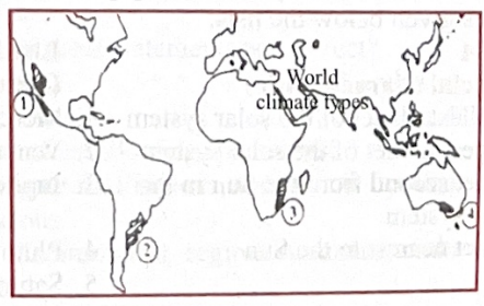
- Of the four shaded areas in the map, which is characterised by hot dry summers, mild and moist winters and seasonal reversal of winds?
- Options:
(a) 1
(b) 2
(c) 3
(d) 4
- Answer:
(a) 1
- [1998]
- Q17: Consider the following statements regarding asteroids:
- Statements:
1. Asteroids are rocky debris of varying size orbiting the sun
2. Most of the asteroids are small but some have diameter as large as 1000 km
3. The orbit of asteroids lies between the orbits of Jupiter and Saturn
- Of these statements:
- Options:
(a) 1, 2 and 3 are correct
(b) 2 and 3 are correct
(c) 1 and 2 are correct
(d) 1 and 3 are correct
- Answer:
(c) 1 and 2 are correct
- Analysis:
- Scientific Context:
- Asteroids are rocky, airless bodies orbiting the Sun, primarily in the asteroid belt between Mars and Jupiter (2.1-3.3 AU), remnants of the solar system’s formation.
- Statement 1: True—Asteroids are rocky debris, ranging from meters to hundreds of kilometers.
- Statement 2: True—Most asteroids are small, but some, like Ceres (~940 km diameter), approach 1000 km.
- Statement 3: False—The asteroid belt is between Mars and Jupiter, not Jupiter and Saturn (5.2-9.5 AU).
- Why Not Others?:
- (a) 1, 2, and 3 are correct:
- Incorrect—Statement 3 is false, as asteroids orbit between Mars and Jupiter.
- (b) 2 and 3 are correct:
- Incorrect—Statement 3 is false.
- (d) 1 and 3 are correct:
- Incorrect—Statement 3 is false.
- Related Concepts:
- Asteroid Belt:
- Contains millions of asteroids, shaped by Jupiter’s gravity (see Q12 [1997]).
- Notable Asteroids:
- Ceres (dwarf planet), Vesta, Pallas; studied for resources.
- Broader Connection:
- Links to astronomy questions (e.g., Q12 [1997] on asteroids) or solar system dynamics, key for UPSC physical geography.
- Relevant to planetary defense against near-Earth asteroids.
- Key Takeaway:
- Asteroids are rocky bodies in the Mars-Jupiter belt, with sizes up to ~1000 km, but not between Jupiter and Saturn.
- Q18: Match the rivers labelled A, B, C and D on the given map with their names given in the list and select the correct answer using the codes given below the lists:
- List-I
-
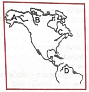
- List-II:
1. St. Lawrence
2. Orinoco
3. Mackenzie
4. Amazon
5. Yukon
- Options:
(a) A-4, B-3, C-2, D-1
(b) A-5, B-3, C-1, D-2
(c) A-5, B-4, C-1, D-3
(d) A-3, B-1, C-4, D-2
- Answer:
(b) A-5, B-3, C-1, D-2
- Q19: The correct sequence of different layers of the atmosphere from the surface of the Earth upwards is:
- Options:
(a) Troposphere, Stratosphere, Ionosphere, Mesosphere
(b) Stratosphere, Troposphere, Ionosphere, Mesosphere
(c) Troposphere, Stratosphere, Mesosphere, Ionosphere
(d) Stratosphere, Troposphere, Mesosphere, Ionosphere
- Answer:
(c) Troposphere, Stratosphere, Mesosphere, Ionosphere
- Analysis:
- Scientific Context:
- Earth’s atmosphere is layered by temperature and composition:
- Troposphere (0-12 km): Weather layer, temperature decreases.
- Stratosphere (12-50 km): Ozone layer, temperature increases.
- Mesosphere (50-85 km): Coldest, meteors burn up.
- Ionosphere (50-1000 km, overlapping mesosphere/thermosphere): Ionized, reflects radio waves (see Q6 [1996]).
- Why Not Others?:
- (a) Troposphere, Stratosphere, Ionosphere, Mesosphere:
- Incorrect—Ionosphere extends beyond mesosphere, not before.
- (b) Stratosphere, Troposphere, Ionosphere, Mesosphere:
- Incorrect—Troposphere is lowest, not stratosphere.
- (d) Stratosphere, Troposphere, Mesosphere, Ionosphere:
- Incorrect—Troposphere is first, not stratosphere.
- Related Concepts:
- Thermosphere:
- Above mesosphere (85-600 km), includes part of ionosphere, hosts auroras.
- Exosphere:
- Outermost layer, transitions to space.
- Broader Connection:
- Links to atmospheric science (e.g., Q6 [1996] on ionosphere) or meteorology, key for UPSC physical geography.
- Relevant to climate and satellite communication.
- Key Takeaway:
- Atmospheric layers, from surface up, are Troposphere, Stratosphere, Mesosphere, Ionosphere, each with distinct roles.
- Q20: Estuaries possess distinct blooms of excessive growth of a pigmented dinoflagellates. These blooms are called:
- Options:
(a) red tides
(b) sea tides
(c) black tides
(d) sea flowers
- Answer:
(a) red tides
- Analysis:
- Scientific Context:
- Red tides are blooms of pigmented dinoflagellates (e.g., Karenia brevis) in estuaries/coastal waters, causing reddish discoloration due to high cell concentrations.
- These can produce toxins, harming marine life and humans (e.g., shellfish poisoning), often triggered by nutrient runoff.
- Why Not Others?:
- (b) Sea tides:
- Incorrect—Sea tides are gravitational, not biological phenomena.
- (c) Black tides:
- Incorrect—Black tides refer to oil spills, not algal blooms.
- (d) Sea flowers:
- Incorrect—No such term for dinoflagellate blooms; a misnomer.
- Related Concepts:
- Harmful Algal Blooms (HABs):
- Red tides are HABs, impacting fisheries and ecosystems.
- Eutrophication:
- Nutrient enrichment (nitrogen, phosphorus) fuels blooms.
- Broader Connection:
- Links to environmental science (e.g., Q2 [1995] on biosphere reserves) or marine ecology, key for UPSC geography.
- Relevant to coastal pollution and ecosystem management.
- Key Takeaway:
- Red tides, caused by dinoflagellate blooms, are significant in estuaries, distinct from tidal or oil-related phenomena.
- Q21: Consider the following climatic conditions (northern hemisphere):
- Temp. °C Rainfall cm.
J 3.9 4.7
F 4.4 5.7
M 8.3 8.2
A 14.4 9.2
M 20.0 9.2
J 23.3 17.7
J 27.8 14.5
A 27.8 14.0
S 22.3 12.7
O 18.3 7.0
N 12.2 5.0
D 6.7 3.5
- These are most likely to be found in the natural regions of:
- Options:
(a) China type
(b) equatorial type
(c) hot desert type
(d) monsoon type
- Answer:
(a) China type
- Analysis:
- Geographical Context:
- China type climate (Cwa/Cwb, Köppen), in eastern China, southeast USA, and parts of Argentina, has warm, humid summers (hottest ~27.8°C) and mild, drier winters (~3.9°C), with summer rainfall peaks (June: 17.7 cm).
- Data shows high summer temperatures/rainfall, cooler/drier winters, matching China type due to monsoon and continental influences.
- Why Not Others?:
- (b) Equatorial type:
- Incorrect—Equatorial (Af) has consistent high temperatures (~25-30°C) and rainfall year-round, not seasonal (see Q7 [1996]).
- (c) Hot desert type:
- Incorrect—Deserts (BWh) have high temperatures but low rainfall (<25 cm/year), unlike ~111.2 cm here.
- (d) Monsoon type:
- Incorrect—Monsoon (Am/As) has stronger wet seasons; data’s milder winters align better with China type.
- Related Concepts:
- Köppen Cwa:
- Cold, dry winter; warmest month under 32°C.
- Similar Regions:
- Southeast USA (Georgia), eastern Australia (Queensland).
- Broader Connection:
- Links to climatic zones (e.g., Q7 [1996] on equatorial rainfall) or agriculture, key for UPSC geography.
- Relevant to monsoon-influenced temperate climates.
- Key Takeaway:
- China type climate, with warm, wet summers and mild, drier winters, matches the data, distinct from equatorial, desert, or monsoon climates.
- Q22: Match List-I with List-II and select the correct answer by using the codes given below the lists:
- List-I (Special characteristic):
A. Smallest planet of the solar system
B. Largest planet of the solar system
C. Planet second from the Sun in the solar system
D. Planet nearest to the Sun
- List-II (Name of planet):
1. Mercury
2. Venus
3. Jupiter
4. Pluto
5. Saturn
- Options:
(a) A-2, B-3, C-5, D-1
(b) A-3, B-5, C-1, D-2
(c) A-4, B-1, C-2, D-3
(d) A-4, B-3, C-2, D-1
- Answer:
(d) A-4, B-3, C-2, D-1
- Analysis:
- Scientific Context:
- In 1998, Pluto was a planet (reclassified as dwarf planet in 2006). Matches:
- A. Smallest: Pluto (~2,377 km diameter).
- B. Largest: Jupiter (~139,820 km).
- C. Second from Sun: Venus (after Mercury).
- D. Nearest to Sun: Mercury.
- Correct: A-4 (Pluto), B-3 (Jupiter), C-2 (Venus), D-1 (Mercury).
- Why Not Others?:
- (a) A-2, B-3, C-5, D-1:
- Incorrect—Venus not smallest; Saturn not second.
- (b) A-3, B-5, C-1, D-2:
- Incorrect—Jupiter not smallest; Mercury not second; Venus not nearest.
- (c) A-4, B-1, C-2, D-3:
- Incorrect—Mercury not largest; Jupiter not nearest.
- Related Concepts:
- Planetary Order:
- Mercury, Venus, Earth, Mars, Jupiter, Saturn, Uranus, Neptune, (Pluto).
- Size:
- Jupiter > Saturn > Uranus > Neptune > Earth > Venus > Mars > Mercury > Pluto.
- Broader Connection:
- Links to solar system questions (e.g., Q12 [1997] on asteroids) or planetary classification, key for UPSC physical geography.
- Relevant to Pluto’s reclassification debate.
- Key Takeaway:
- Matching planetary characteristics (size, position) reflects 1998 understanding, with Pluto as smallest.
- [1999]
- Q23: Physical regions marked as 1, 2, 3, & 4 on the given map are respectively:
-
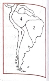
- Options:
(a) Andes, Brazilian Shield, Guyana Highlands & Amazon Basin
(b) Andes, Guyana Highlands, Brazilian Shield & Amazon Basin
(c) Amazon Basin, Guyana Highlands, Brazilian Shield & Andes
(d) Guyana Highlands, Brazilian Shield, Andes & Amazon Basin
- Answer:
(a) Andes, Brazilian Shield, Guyana Highlands & Amazon Basin
- Q25: Which one of the following scholars suggested the earth's origin from gases & dust particles?
- Options:
(a) James Jeans
(b) H. Alfven
(c) F. Hoyle
(d) O. Schmidt
- Answer:
(d) O. Schmidt
- Analysis:
- Scientific Context:
- Otto Schmidt’s accretion theory (1940s) posits Earth formed from a solar nebula of gas and dust, condensing into planetesimals and planets, refining the nebular hypothesis.
- Why Not Others?:
- (a) James Jeans:
- Incorrect—Jeans’ tidal theory (1910s) suggested a star’s gravity pulled material from the Sun, not gas/dust accretion.
- (b) H. Alfven:
- Incorrect—Alfven focused on plasma cosmology, not planetary formation.
- (c) F. Hoyle:
- Incorrect—Hoyle worked on nucleosynthesis and steady-state cosmology, not dust-based origins.
- Related Concepts:
- Nebular Hypothesis:
- Originated with Kant/Laplace, refined by Schmidt.
- Planetesimals:
- Small bodies forming planets.
- Broader Connection:
- Links to astronomy (e.g., Q22 [1998] on planets) or cosmogony, key for UPSC physical geography.
- Relevant to exoplanet formation models.
- Key Takeaway:
- Schmidt’s gas and dust accretion theory is the accepted model for Earth’s origin, distinct from tidal or cosmological theories.
- Q26: In the given map, which one of the following pairs of ocean currents are shown?
-
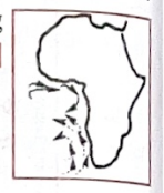
- Options:
(a) Benguela & Falkland
(b) Canary & Humboldt
(c) Agulhas & Guinea
(d) Benguela & Guinea
- Answer:
(d) Benguela & Guinea
- Q27: Which one of the areas marked as A, B, C & D in the given figure of the cyclone, witnesses heavy torrential short duration rainfall accompanied by thunderstorms?
-
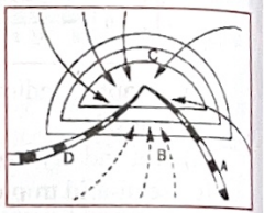
- Options:
(a) A
(b) B
(c) C
(d) D
- Answer:
(b) B
- Q28: Consider the following temperature & rainfall data:
- Month | Temp. (°C) | Rainfall (cm)
January | 6.7 | 14.0
February | 6.7 | 13.2
March | 7.2 | 11.4
April | 8.9 | 9.4
May | 11.1 | 8.1
June | 13.9 | 8.1
July | 15.0 | 9.6
August | 15.0 | 12.2
September | 13.9 | 10.4
October | 11.1 | 14.4
November | 8.9 | 14.0
December | 7.8 | 16.8
- The climate to which this data pertains is:
- Options:
(a) St. Lawrence type
(b) China type
(c) West European type
(d) Mediterranean type
- Answer:
(c) West European type
- Analysis:
- Geographical Context:
- West European type (Cfb, Köppen), in northwest Europe (e.g., UK, Ireland), has mild temperatures (6.7-15°C) and even rainfall (~141.6 cm annually) due to westerly winds and oceanic influence (North Atlantic Drift).
- Data shows cool summers (15°C max) and mild winters, with consistent rainfall, matching West European type.
- Why Not Others?:
- (a) St. Lawrence type:
- Incorrect—St. Lawrence (Dfb) has colder winters (below -3°C), less rainfall, typical of eastern Canada.
- (b) China type:
- Incorrect—China type (Cwa) has warmer summers (~27°C), summer rainfall peak (see Q21 [1998]).
- (d) Mediterranean type:
- Incorrect—Mediterranean (Csa/Csb) has dry summers, wet winters, unlike even rainfall here.
- Related Concepts:
- Oceanic Climate:
- Driven by warm ocean currents.
- Similar Regions:
- Coastal Norway, New Zealand’s west coast.
- Broader Connection:
- Links to climatic zones (e.g., Q21 [1998] on China type) or ocean-atmosphere interactions, key for UPSC geography.
- Relevant to temperate agriculture and urban planning.
- Key Takeaway:
- West European type climate, with mild temperatures and year-round rainfall, matches the data, distinct from colder, seasonal, or dry climates.
- Q29: At which one of the following positions shown in the diagram will the height of the ocean tide be maximum?
-
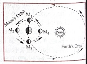
- Options:
(a) M1
(b) M2
(c) M3
(d) M4
- Answer:
(d) M4
- Q30: Match List-I with List-II and select the correct answer using the codes given below the lists:
- List-I (Timber):
A. Cedar
B. Douglas Fir
C. Mahogany
D. Teak
- List-II (Country):
1. Myanmar
2. Canada
3. Mexico
4. Honduras
- Options:
(a) A-3, B-2, C-1, D-4
(b) A-3, B-2, C-4, D-1
(c) A-2, B-3, C-4, D-1
(d) A-2, B-3, C-1, D-4
- Answer:
(b) A-3, B-2, C-4, D-1
- Analysis:
- Geographical Context:
- Timber species and regions:
- A. Cedar: Mexico (e.g., Cedrela odorata), key in Central America.
- B. Douglas Fir: Canada (British Columbia), major construction wood.
- C. Mahogany: Honduras, renowned for Swietenia macrophylla.
- D. Teak: Myanmar, leading exporter of Tectona grandis.
- Correct: A-3 (Mexico), B-2 (Canada), C-4 (Honduras), D-1 (Myanmar).
- Why Not Others?:
- (a) A-3, B-2, C-1, D-4:
- Incorrect—Myanmar not primary for mahogany; Honduras not teak.
- (c) A-2, B-3, C-4, D-1:
- Incorrect—Canada not cedar hub; Mexico not Douglas fir.
- (d) A-2, B-3, C-1, D-4:
- Incorrect—Myanmar not mahogany; Honduras not teak.
- Related Concepts:
- Tropical Hardwoods:
- Mahogany, teak for furniture, from rainforests.
- Softwoods:
- Cedar, Douglas fir for construction, from temperate forests.
- Broader Connection:
- Links to resource geography (e.g., Q24 [1999] on coal) or deforestation, key for UPSC economic geography.
- Relevant to sustainable forestry and CITES regulations.
- Key Takeaway:
- Matching timber to countries highlights their ecological/economic roles, with Mexico, Canada, Honduras, and Myanmar as key sources.
- [2000]
- Q32: Consider the following statements:
- Statements:
1. Tides are of great help in navigation and fishing
2. High tide enables big ships to enter or leave the harbour safely
3. Tide prevents siltation in the harbours
4. Kandla and Diamond Harbour are tidal ports
- Which of these statements are correct?
- Options:
(a) 1 & 4
(b) 2, 3 & 4
(c) 1, 2 & 3
(d) 1, 2, 3 & 4
- Answer:
(d) 1, 2, 3 & 4
- Analysis:
- Geographical Context:
- Tides, driven by Moon/Sun gravity, impact coasts:
- Statement 1: True—Tides aid navigation (ship timing) and fishing (fish concentration).
- Statement 2: True—High tides raise water levels, allowing large ships in shallow harbors.
- Statement 3: True—Tidal currents flush sediment, reducing siltation.
- Statement 4: True—Kandla (Gujarat), Diamond Harbour (West Bengal) rely on tides.
- Why Not Others?:
- (a) 1 & 4:
- Incorrect—Excludes true statements 2, 3.
- (b) 2, 3 & 4:
- Incorrect—Excludes true statement 1.
- (c) 1, 2 & 3:
- Incorrect—Excludes true statement 4.
- Related Concepts:
- Tidal Ports:
- Mumbai, Kolkata also tidal-dependent.
- Tidal Energy:
- Used for power in some regions.
- Broader Connection:
- Links to coastal geography (e.g., Q51 [2002] on lagoons) or ports, key for UPSC economic geography.
- Relevant to maritime trade and harbor management.
- Key Takeaway:
- Tides support navigation, fishing, harbor access, and silt prevention, with Kandla and Diamond Harbour as tidal ports.
- Q33: Consider the following statements about the 'Roaring Forties':
- Statements:
1. They blow uninterrupted in the northern and Southern Hemispheres
2. They blow with great strength and constancy
3. Their direction is generally from north-west to east in the Southern Hemisphere
4. Overcast skies, rain and raw weather are generally associated with them
- Which of these statements are correct?
- Options:
(a) 1, 2 & 3
(b) 2, 3 & 4
(c) 1, 3 & 4
(d) 1, 2 & 4
- Answer:
(b) 2, 3 & 4
- Analysis:
- Geographical Context:
- Roaring Forties are strong westerly winds at 40-50°S in the Southern Hemisphere, driven by minimal landmasses and strong pressure gradients.
- Statement 1: False—Primarily Southern Hemisphere; Northern Hemisphere has landmasses disrupting such winds.
- Statement 2: True—High speed (50-100 km/h) and consistency due to Coriolis effect.
- Statement 3: True—Northwest to east in Southern Hemisphere, per Earth’s rotation.
- Statement 4: True—Overcast skies, rain, storms from cyclonic activity.
- Why Not Others?:
- (a) 1, 2 & 3:
- Incorrect—Statement 1 false.
- (c) 1, 3 & 4:
- Incorrect—Statement 1 false.
- (d) 1, 2 & 4:
- Incorrect—Statement 1 false.
- Related Concepts:
- Other Westerlies:
- Furious Fifties (50-60°S), Screaming Sixties (60-70°S).
- Oceanic Circulation:
- Forties drive Antarctic Circumpolar Current.
- Broader Connection:
- Links to meteorology (e.g., Q4 [1995] on Willy Willy) or ocean currents, key for UPSC physical geography.
- Relevant to maritime navigation and climate.
- Key Takeaway:
- Roaring Forties are strong, rainy westerlies in the Southern Hemisphere, not uninterrupted in the north.
- [2001]
- Q34: Which one of the following weather conditions is indicated by a sudden fall in barometer reading?
- Options:
(a) Stormy
(b) Calm weather
(c) Cold and dry weather
(d) Hot and sunny weather
- Answer:
(a) Stormy
- Analysis:
- Scientific Context:
- A sudden fall in barometer reading indicates a rapid drop in atmospheric pressure, signaling an approaching low-pressure system, typically associated with stormy weather (e.g., cyclones, thunderstorms).
- Low pressure draws in moist air, leading to clouds and precipitation.
- Why Not Others?:
- (b) Calm weather:
- Incorrect—Calm weather corresponds to high or stable pressure.
- (c) Cold and dry weather:
- Incorrect—Cold, dry conditions are linked to high-pressure systems.
- (d) Hot and sunny weather:
- Incorrect—Hot, sunny conditions occur under high pressure.
- Related Concepts:
- Barometric Pressure:
- Measured in millibars; rapid drops indicate cyclonic activity.
- Weather Maps:
- Isobars show pressure systems (see Q11 [1997]).
- Broader Connection:
- Links to meteorology (e.g., Q11 [1997] on isopleth maps) or cyclones (e.g., Q4 [1995]), key for UPSC physical geography.
- Relevant to weather forecasting and disaster preparedness.
- Key Takeaway:
- A sudden barometer fall signals stormy weather due to low-pressure systems, distinct from calm or clear conditions.
- Q35: Who amongst the following was the first to state that the earth was spherical?
- Options:
(a) Aristotle
(b) Copernicus
(c) Ptolemy
(d) Strabo
- Answer:
(a) Aristotle
- Analysis:
- Scientific Context:
- Aristotle (384-322 BCE) was the first to argue Earth is spherical, based on observations: lunar eclipse shadows (circular), changing constellations with latitude, and ships disappearing bottom-first over the horizon.
- His work in “On the Heavens” laid groundwork for later astronomers.
- Why Not Others?:
- (b) Copernicus:
- Incorrect—Copernicus (1473-1543) proposed heliocentrism, not Earth’s shape.
- (c) Ptolemy:
- Incorrect—Ptolemy (100-170 CE) assumed a spherical Earth but followed Aristotle.
- (d) Strabo:
- Incorrect—Strabo (64 BCE-24 CE), a geographer, described Earth’s features, not its shape.
- Related Concepts:
- Greek Astronomy:
- Pythagoras also suggested a spherical Earth; Aristotle provided evidence.
- Later Developments:
- Eratosthenes measured Earth’s circumference (~240 BCE).
- Broader Connection:
- Links to historical geography (e.g., Q25 [1999] on Earth’s origin) or astronomy, key for UPSC physical geography.
- Relevant to the history of science and navigation.
- Key Takeaway:
- Aristotle’s evidence-based claim of a spherical Earth was a foundational step in astronomy, predating later scholars.
- Q36: If the stars are seen to rise perpendicular to the horizon by an observer, he is located on the:
- Options:
(a) Equator
(b) Tropic of Cancer
(c) South Pole
(d) North Pole
- Answer:
(a) Equator
- Analysis:
- Scientific Context:
- At the equator (0° latitude), the celestial sphere’s axis is parallel to the horizon, causing stars to rise vertically (perpendicular to the horizon) as Earth rotates.
- At other latitudes, stars rise at an angle, except at the poles where they circle the zenith or nadir.
- Why Not Others?:
- (b) Tropic of Cancer:
- Incorrect—At 23.5°N, stars rise at an angle, not perpendicular.
- (c) South Pole:
- Incorrect—At 90°S, stars circle horizontally, not rising.
- (d) North Pole:
- Incorrect—At 90°N, stars circle horizontally, not rising.
- Related Concepts:
- Celestial Navigation:
- Equatorial position simplifies star tracking.
- Latitude Effects:
- Star paths vary with observer’s latitude.
- Broader Connection:
- Links to astronomy (e.g., Q14 [1997] on stars) or navigation, key for UPSC physical geography.
- Relevant to understanding Earth’s rotation and sky observation.
- Key Takeaway:
- Only at the equator do stars rise perpendicular to the horizon, due to the celestial axis alignment.
- Q37: Consider the following statements made about sedimentary rocks:
- Statements:
1. Sedimentary rocks are formed at earth's surface by the hydrological system
2. Formation of sedimentary rocks involves the weathering of preexisting rocks
3. Sedimentary rocks contain fossils
4. Sedimentary rocks typically occur in layers
- Which of these statements are correct?
- Options:
(a) 1 & 2
(b) 1 & 4
(c) 2, 3 & 4
(d) 1, 2, 3 & 4
- Answer:
(d) 1, 2, 3 & 4
- Analysis:
- Scientific Context:
- Sedimentary rocks form at Earth’s surface via the hydrological system:
- Statement 1: True—Formed by deposition and compaction of sediments through water, wind, or ice.
- Statement 2: True—Weathering (physical/chemical) of pre-existing rocks produces sediments.
- Statement 3: True—Often contain fossils, as organisms are preserved in sediments (e.g., limestone).
- Statement 4: True—Form in layers (strata) due to sequential deposition (e.g., sandstone, shale).
- Why Not Others?:
- (a) 1 & 2:
- Incorrect—Excludes true statements 3, 4.
- (b) 1 & 4:
- Incorrect—Excludes true statements 2, 3.
- (c) 2, 3 & 4:
- Incorrect—Excludes true statement 1.
- Related Concepts:
- Types:
- Clastic (sandstone), chemical (limestone), organic (coal).
- Geological Record:
- Sedimentary rocks preserve Earth’s history.
- Broader Connection:
- Links to geology (e.g., Q39 [2001] on quartzite) or paleontology, key for UPSC physical geography.
- Relevant to fossil fuels and stratigraphy.
- Key Takeaway:
- Sedimentary rocks, formed by hydrological processes, weathering, fossil preservation, and layering, are key to Earth’s surface geology.
- Q38: Volcanic eruptions do not occur in:
- Options:
(a) Baltic Sea
(b) Black Sea
(c) Caribbean Sea
(d) Caspian Sea
- Answer:
(a) Baltic Sea
- Analysis:
- Scientific Context:
- Volcanic eruptions typically occur along tectonic plate boundaries or geological hotspots, often in geologically active oceanic regions.
- Baltic Sea: Part of the East European Craton, one of the most geologically stable regions with no known volcanic activity.
- Black Sea: Although relatively tectonically stable, it is located near the collision zone of the Eurasian and Anatolian plates, and has some deep-seated geological complexity, including potential ancient volcanism.
- Caribbean Sea: Highly volcanic due to the subduction of the Atlantic plate beneath the Caribbean plate; includes active volcanoes like Soufrière Hills in Montserrat and La Soufrière in St. Vincent.
- Caspian Sea: An inland basin on stable continental crust, but it lies near tectonic fault zones with some seismic activity.
- Among these, the Baltic Sea is the most geologically stable and least associated with any form of volcanism.
- Why Not Others?:
- (b) Black Sea:
- Incorrect—While relatively inactive, it is located near tectonic boundaries and may host some submarine volcanic features or ancient activity.
- (c) Caribbean Sea:
- Incorrect—A volcanically active zone with frequent eruptions and seismic events.
- (d) Caspian Sea:
- Incorrect—Though largely inactive volcanically, the region has some tectonic instability and seismic activity.
- Related Concepts:
- Plate Tectonics:
- Subduction zones, mid-ocean ridges, and hotspots are primary locations for volcanic activity.
- Stable Cratons:
- Regions like the Baltic Shield are ancient, tectonically inactive zones with no volcanism.
- Broader Connection:
- Useful in physical geography, especially topics related to tectonics, volcanism, and geological hazards in UPSC.
- Helps eliminate options in questions related to plate boundaries and geological formations.
- Key Takeaway:
- The Baltic Sea, being part of an ancient and tectonically stable craton, is not associated with any volcanic activity, unlike the other options.
- Q39: Quartzite is metamorphosed from:
- Options:
(a) limestone
(b) obsidian
(c) sandstone
(d) shale
- Answer:
(c) sandstone
- Analysis:
- Scientific Context:
- Quartzite is a metamorphic rock formed from sandstone (primarily quartz grains) under heat and pressure, recrystallizing into a hard, quartz-rich rock.
- Sandstone’s high silica content transforms into quartzite’s interlocking quartz crystals.
- Why Not Others?:
- (a) Limestone:
- Incorrect—Limestone (calcium carbonate) metamorphoses into marble.
- (b) Obsidian:
- Incorrect—Obsidian is volcanic glass (igneous), not metamorphic.
- (c) Shale:
- Incorrect—Shale metamorphoses into slate or schist.
- Related Concepts:
- Metamorphism:
- Heat/pressure alters rock structure (e.g., regional/contact metamorphism).
- Other Metamorphic Rocks:
- Marble (limestone), gneiss (granite).
- Broader Connection:
- Links to geology (e.g., Q37 [2001] on sedimentary rocks) or rock cycle, key for UPSC physical geography.
- Relevant to construction materials and geological mapping.
- Key Takeaway:
- Quartzite forms from sandstone through metamorphism, distinct from limestone, obsidian, or shale transformations.
- Q40: Identify the correct order of the process of soil-erosion from the following:
- Options:
(a) Splash erosion, Sheet erosion, Rill erosion, Gully erosion
(b) Sheet erosion, Splash erosion, Gully erosion, Rill erosion
- (c) Rill erosion, Gully erosion, Sheet erosion, Splash erosion
- (d) Gully erosion, Rill erosion, Sheet erosion, Splash erosion
- Answer:
(a) Splash erosion, Sheet erosion, Rill erosion, Gully erosion
- Analysis:
- Scientific Context:
- Soil erosion progresses in stages:
- Splash erosion: Raindrops dislodge soil particles.
- Sheet erosion: Thin layers of soil removed uniformly.
- Rill erosion: Small channels form from concentrated runoff.
- Gully erosion: Large channels carved by intense water flow.
- Sequence reflects increasing intensity and scale of water impact.
- Why Not Others?:
- (b) Sheet, Splash, Gully, Rill:
- Incorrect—Splash precedes sheet; gully follows rill.
- (c) Rill, Gully, Sheet, Splash:
- Incorrect—Rill/gully are later stages; splash is first.
- (d) Gully, Rill, Sheet, Splash:
- Incorrect—Gully is last, not first; splash is initial.
- Related Concepts:
- Erosion Agents:
- Water, wind, ice; water is primary here.
- Soil Conservation:
- Terracing, contour plowing prevent erosion.
- Broader Connection:
- Links to geomorphology (e.g., Q37 [2001] on rocks) or agriculture, key for UPSC physical geography.
- Relevant to land degradation and watershed management.
- Key Takeaway:
- Soil erosion progresses from splash to sheet, rill, and gully, reflecting increasing water impact and land damage.
- Q41: Temperature and rainfall of a meteorological station are given below:
- Month | Temperature (°C) | Rainfall (cm)
J | 9.4 | 12.2
F | 10.6 | 9.1
M | 11.7 | 7.9
A | 12.2 | 2.5
M | 13.3 | 1.0
J | 13.9 | 0.3
J | 13.9 | -
A | 14.4 | -
S | 15.6 | 0.8
O | 15.0 | 2.5
N | 13.3 | 6.1
D | 10.6 | 11.7
- Average temperature: 12.8°C
- Average rainfall: 54.9 cm per annum
- Identify the region having the above climatic patterns from amongst the following:
- Options:
(a) Mediterranean region
(b) Monsoon region
(c) Steppe region
(d) N.W. European region
- Answer:
(a) Mediterranean region
- Analysis:
- Geographical Context:
- The Mediterranean climate (Csa/Csb, Köppen), found in southern Europe (e.g., Greece, Italy), California, and parts of Australia, features mild, wet winters (e.g., January: 9.4°C, 12.2 cm) and hot, dry summers (e.g., July/August: ~14.4°C, near-zero rainfall). The data shows a clear winter rainfall peak and summer drought, with an average temperature of 12.8°C and 54.9 cm annual rainfall, typical of Mediterranean regions (Csb, cooler variant).
- Why Not Others?:
- (b) Monsoon region:
- Incorrect—Monsoon climates (Am/As) have heavy summer rainfall, not dry summers as shown (see Q10 [1997] on monsoon drift).
- (c) Steppe region:
- Incorrect—Steppe (BSk) has lower rainfall (~20-40 cm/year) and greater temperature extremes, unlike the wet winters here.
- (d) N.W. European region:
- Incorrect—N.W. Europe (Cfb) has even rainfall year-round (~141.6 cm, see Q28 [1999]), not summer drought.
- Related Concepts:
- Köppen Csb:
- Cool, dry summer; wet winter, typical of coastal Mediterranean.
- Vegetation:
- Mediterranean scrub (maquis, chaparral), adapted to dry summers.
- Broader Connection:
- Links to climatic zones (e.g., Q28 [1999] on West European type) or agriculture (e.g., olives, grapes), key for UPSC geography.
- Relevant to water management and tourism in Mediterranean climates.
- Key Takeaway:
- The Mediterranean climate, with wet winters and dry summers, matches the data, distinct from monsoon, steppe, or N.W. European patterns.
- Q42: Assertion (A): During the neap tides, the high tide is lower and the low tide is higher than usual.
- Reason (R): The neap tide, unlike the spring tide, occurs on the new moon instead of on the full moon.
- Options:
(a) Both A and R are true and R is the correct explanation of A
(b) Both A and R are true but R is NOT a correct explanation of A
(c) A is true but R is false
(d) A is false but R is true
- Answer:
(c) A is true but R is false
- Analysis:
- Scientific Context:
- Tides result from gravitational forces of the Moon and Sun. Neap tides occur when Sun, Moon, and Earth form a right angle (first and third quarter moons), reducing tidal range: high tides are lower, low tides higher than average.
- Assertion (A): True—Neap tides have a smaller tidal range, with moderated highs and lows.
- Reason (R): False—Neap tides occur during quarter moons, not new moon. Spring tides occur on new and full moons, when Sun and Moon align.
- Why Not Others?:
- (a) Both A and R are true and R is the correct explanation of A:
- Incorrect—R is false; it misstates neap tide timing.
- (b) Both A and R are true but R is NOT a correct explanation of A:
- Incorrect—R is false.
- (d) A is false but R is true:
- Incorrect—A is true; R is false.
- Related Concepts:
- Spring Tides:
- Maximum tidal range during new/full moons.
- Tidal Forces:
- Gravitational pull varies with lunar phases.
- Broader Connection:
- Links to oceanography (e.g., Q32 [2000] on tides) or coastal geography, key for UPSC physical geography.
- Relevant to navigation and tidal energy.
- Key Takeaway:
- Neap tides reduce tidal range but occur during quarter moons, not new moon, making A true and R false.
- [2002]
- Q43: Sun's halo is produced by the refraction of light in:
- Options:
(a) water vapour in Stratus clouds
(b) ice crystals in Cirro-Cumulus clouds
(c) ice crystals in Cirrus clouds
(d) dust particles in Stratus clouds
- Answer:
(c) ice crystals in Cirrus clouds
- Analysis:
- Scientific Context:
- A Sun’s halo is a 22° ring around the Sun caused by refraction of sunlight through hexagonal ice crystals in high-altitude Cirrus clouds (~5-10 km), acting as prisms.
- Why Not Others?:
- (a) Water vapour in Stratus clouds:
- Incorrect—Stratus (low, 0-2 km) has water droplets, not ice; no refraction for halos.
- (b) Ice crystals in Cirro-Cumulus clouds:
- Incorrect—Cirro-Cumulus are high but puffy, with less consistent ice crystal alignment.
- (d) Dust particles in Stratus clouds:
- Incorrect—Dust scatters light; Stratus lacks ice for refraction.
- Related Concepts:
- Optical Phenomena:
- Sundogs, coronas involve ice crystals.
- Cloud Types:
- Cirrus (icy, wispy), Stratus (low, layered).
- Broader Connection:
- Links to meteorology (e.g., Q34 [2001]) or atmospheric optics, key for UPSC geography.
- Relevant to weather observation.
- Key Takeaway:
- Sun’s halo forms from ice crystal refraction in Cirrus clouds, not water vapour or dust.
- Q44: Consider the following statements:
- Statements:
1. Ocean currents are slow-surface movement of water in the ocean
2. Ocean currents assist in maintaining the Earth's heat balance
3. Ocean currents are set in motion primarily by prevailing winds
4. Ocean currents are affected by the configuration of the ocean
- Which of these statements are correct?
- Options:
(a) 1 and 2
(b) 2, 3 and 4
(c) 1, 3 and 4
(d) 1, 2, 3 and 4
- Answer:
(b) 2, 3 and 4
- Analysis:
- Scientific Context:
- Statement 1: False—Currents vary (e.g., Gulf Stream ~2 m/s is fast); include deep/surface currents.
- Statement 2: True—Currents redistribute heat (e.g., Gulf Stream warms Europe).
- Statement 3: True—Winds (trade winds, westerlies) drive surface currents.
- Statement 4: True—Ocean basin shape, coastlines affect currents (e.g., gyres).
- Why Not Others?:
- (a) 1 and 2:
- Incorrect—Statement 1 false.
- (c) 1, 3 and 4:
- Incorrect—Statement 1 false.
- (d) 1, 2, 3 and 4:
- Incorrect—Statement 1 false.
- Related Concepts:
- Thermohaline Circulation:
- Deep currents driven by density.
- Gyres:
- Circular currents shaped by winds/continents.
- Broader Connection:
- Links to oceanography (e.g., Q10 [1997]) or climate, key for UPSC geography.
- Relevant to global warming.
- Key Takeaway:
- Ocean currents regulate heat, are wind-driven, and shaped by ocean configuration, but not always slow.
- Q45: Consider the following statements:
- Statements:
1. In equatorial regions, the year is divided into four main seasons
2. In Mediterranean region, summer months receive more rain
3. In China type climate, rainfall occurs throughout the year
4. Tropical highlands exhibit vertical zonation of different climates
- Which of these statements are correct:
- Options:
(a) 1, 2, 3 & 4
(b) 1, 2 & 3
(c) 1, 2 & 4
(d) 3 & 4
- Answer:
(d) 3 & 4
- Analysis:
- Scientific Context:
- Statement 1: False—Equatorial regions (Af) have no distinct seasons, only wet/dry periods (see Q7 [1996]).
- Statement 2: False—Mediterranean (Csa/Csb) has dry summers, wet winters (see Q41 [2001]).
- Statement 3: True—China type (Cwa) has rainfall year-round, peaking in summer (see Q21 [1998]).
- Statement 4: True—Tropical highlands (e.g., Andes) show climate zones by altitude (tierra caliente to fría).
- Why Not Others?:
- (a) 1, 2, 3 & 4:
- Incorrect—Statements 1, 2 false.
- (b) 1, 2 & 3:
- Incorrect—Statements 1, 2 false.
- (c) 1, 2 & 4:
- Incorrect—Statements 1, 2 false.
- Related Concepts:
- Köppen Classification:
- Af (equatorial), Csa (Mediterranean), Cwa (China type).
- Altitudinal Zonation:
- Climate varies with elevation in tropics.
- Broader Connection:
- Links to climatic zones (e.g., Q21 [1998]) or biogeography, key for UPSC geography.
- Relevant to agriculture and ecology.
- Key Takeaway:
- China type has year-round rainfall; tropical highlands show vertical climate zonation, unlike equatorial or Mediterranean regions.
- Q46: Consider the following ecosystems:
- Ecosystems:
1. Taiga
2. Tropical Evergreen
3. Tropical Deciduous
4. Tundra
- The correct sequence in decreasing order of the Albedo values of these ecosystems is:
- Options:
(a) 1, 4, 3, 2
(b) 4, 1, 2, 3
(c) 4, 1, 3, 2
(d) 1, 4, 2, 3
- Answer:
(c) 4, 1, 3, 2 (book says option b, but all other online sources are saying option c)
- Analysis:
- Scientific Context:
- Albedo is the reflectivity of a surface (higher = more reflection). Ecosystems’ albedo depends on vegetation/cover:
- Tundra (4): High (~0.6-0.8) due to snow/ice.
- Taiga (1): Moderate (~0.2-0.4) with coniferous forests, snow in winter.
- Tropical Deciduous (3): Lower (~0.15-0.2) due to seasonal leaf loss, less reflective.
- Tropical Evergreen (2): Lowest (~0.1-0.15) with dense, dark canopy.
- Sequence: Tundra > Taiga > Tropical Deciduous > Tropical Evergreen.
- Why Not Others?:
- (a) 1, 4, 3, 2:
- Incorrect—Tundra (4) has higher albedo than Taiga (1).
- (b) 4, 1, 2, 3:
- Incorrect—Tropical Evergreen (2) has lower albedo than Deciduous (3).
- (d) 1, 4, 2, 3:
- Incorrect—Tundra (4) has highest albedo, not Taiga (1).
- Related Concepts:
- Albedo Effect:
- Influences climate (high albedo cools, low warms).
- Biomes:
- Ecosystems defined by climate/vegetation.
- Broader Connection:
- Links to ecology (e.g., Q8 [1996] on mangroves) or climate, key for UPSC geography.
- Relevant to climate change and reflectivity.
- Key Takeaway:
- Tundra has highest albedo, followed by Taiga, Tropical Deciduous, and Tropical Evergreen due to surface cover.
- Q47: Assertion (A): 60° - 65° latitudes in both the hemispheres have a low pressure belt instead of high pressure.
- Reason (R): The low pressure areas are permanent over oceans rather than on land.
- Options:
(a) Both A and R are true and R is the correct explanation of A
(b) Both A and R are true but R is NOT a correct explanation of A
(c) A is true but R is false
(d) A is false but R is true
- Answer:
(b) Both A and R are true but R is NOT a correct explanation of A
- Analysis:
- Scientific Context:
- Assertion (A): True—60°-65° latitudes have a subpolar low-pressure belt due to the meeting of polar and Ferrel cells, causing cyclonic activity.
- Reason (R): True—Low-pressure areas (e.g., Aleutian, Icelandic lows) are more permanent over oceans due to less land interference, but this doesn’t explain why low pressure exists at 60°-65° (driven by atmospheric circulation, not ocean permanence).
- Why Not Others?:
- (a) Both A and R are true and R is the correct explanation of A:
- Incorrect—R doesn’t explain A’s atmospheric dynamics.
- (c) A is true but R is false:
- Incorrect—R is true (oceanic lows are stable).
- (d) A is false but R is true:
- Incorrect—A is true (subpolar lows exist).
- Related Concepts:
- Atmospheric Circulation:
- Hadley, Ferrel, Polar cells drive pressure belts.
- Pressure Systems:
- Subpolar lows contrast with polar highs.
- Broader Connection:
- Links to meteorology (e.g., Q33 [2000] on Roaring Forties) or climate, key for UPSC geography.
- Relevant to weather patterns and ocean-atmosphere interactions.
- Key Takeaway:
- Subpolar low-pressure belts at 60°-65° are due to circulation, not ocean permanence, though oceanic lows are stable.
- Q48: Assertion (A): The surface winds spiral inwards upon the centre of the cyclone.
- Reason (R): Air descends in the centre of the cyclone.
- Options:
(a) Both A and R are true and R is the correct explanation of A
(b) Both A and R are true but R is NOT a correct explanation of A
- (c) A is true but R is false
- (d) A is false but R is true
- Answer:
(c) A is true but R is false (book says option a, but all other sources say option c)
- Analysis:
- Scientific Context:
- Assertion (A): True—Cyclones (low-pressure systems) have surface winds spiraling inward due to pressure gradient force and Coriolis effect (clockwise in Southern Hemisphere, counterclockwise in Northern).
- Reason (R): False—Air rises in the cyclone’s center (eye wall), causing low pressure and cloud formation, not descends (descent occurs in anticyclones).
- Why Not Others?:
- (a) Both A and R are true and R is the correct explanation of A:
- Incorrect—R is false; rising air drives cyclones.
- (b) Both A and R are true but R is NOT a correct explanation of A:
- Incorrect—R is false.
- (d) A is false but R is true:
- Incorrect—A is true; R is false.
- Related Concepts:
- Coriolis Effect:
- Deflects winds, shaping cyclone spirals.
- Anticyclones:
- High pressure, outward winds, descending air.
- Broader Connection:
- Links to meteorology (e.g., Q34 [2001] on barometer) or cyclones, key for UPSC geography.
- Relevant to storm forecasting.
- Key Takeaway:
- Cyclone winds spiral inward, but air rises, not descends, in the center, driving storm dynamics.
- Q49: Consider the following climatic and geographical phenomena:
- Phenomena:
1. Condensation
2. High temperature and humidity
3. Orography
4. Vertical wind
- Thunder cloud development is due to which of these phenomena?
- Options:
(a) 1 & 2
(b) 2, 3 & 4
(c) 1, 3 & 4
(d) 1, 2, 3 & 4
- Answer:
(d) 1, 2, 3 & 4
- Analysis:
- Scientific Context:
- Thunder clouds (cumulonimbus) form via:
- Condensation (1): Water vapor condenses into droplets, forming clouds.
- High temperature and humidity (2): Warm, moist air rises, fueling cloud growth.
- Orography (3): Mountains force air upward, triggering cloud formation.
- Vertical wind (4): Updrafts lift moist air, promoting towering cloud development.
- All contribute to thunderstorm formation.
- Why Not Others?:
- (a) 1 & 2:
- Incorrect—Excludes orography, vertical winds.
- (b) 2, 3 & 4:
- Incorrect—Excludes condensation, essential for clouds.
- (c) 1, 3 & 4:
- Incorrect—Excludes temperature/humidity, key for air rise.
- Related Concepts:
- Convection:
- Driven by heat/humidity, powers thunderstorms.
- Orographic Lift:
- Enhances rainfall on windward slopes.
- Broader Connection:
- Links to meteorology (e.g., Q7 [1996] on convectional rain) or climate, key for UPSC geography.
- Relevant to weather hazards and forecasting.
- Key Takeaway:
- Thunder clouds form from condensation, high temperature/humidity, orography, and vertical winds, all critical processes.
- Q50: For short-term climatic predictions, which one of the following events, detected in the last decade, is associated with occasional weak monsoon rains in the Indian sub-continent?
- Options:
(a) La Nina
(b) Movement of Jet Stream
(c) El Nino and Southern Oscillations
(d) Greenhouse effect at global level
- Answer:
(c) El Nino and Southern Oscillations
- Analysis:
- Scientific Context:
- El Niño and Southern Oscillation (ENSO) involves warming of Pacific Ocean waters (El Niño), disrupting monsoon patterns, often causing weak rains in India due to altered Walker circulation.
- Detected prominently in the 1990s (e.g., 1997-98 El Niño).
- Why Not Others?:
- (a) La Nina:
- Incorrect—La Niña typically strengthens Indian monsoons.
- (b) Movement of Jet Stream:
- Incorrect—Jet stream affects weather but not primary for monsoon predictions.
- (d) Greenhouse effect at global level:
- Incorrect—Long-term climate change, not short-term monsoon variability.
- Related Concepts:
- ENSO Cycle:
- El Niño (warm), La Niña (cool), neutral phases.
- Monsoon Dynamics:
- Linked to sea surface temperatures.
- Broader Connection:
- Links to climatology (e.g., Q10 [1997] on monsoon drift) or agriculture, key for UPSC geography.
- Relevant to monsoon forecasting and drought management.
- Key Takeaway:
- El Niño and Southern Oscillation cause weak Indian monsoons, critical for short-term predictions.
- Q51: Which one of the following is not a lagoon?
- Options:
(a) Ashtamudi lake
(b) Chilka lake
(c) Periyar lake
(d) Pulicat lake
- Answer:
(c) Periyar lake
- Analysis:
- Scientific Context:
- Lagoons are coastal water bodies separated from the sea by barriers (e.g., sandbars), often brackish.
- Ashtamudi lake (Kerala): Lagoon, backwater system.
- Chilka lake (Odisha): Brackish lagoon, India’s largest.
- Pulicat lake (Andhra Pradesh/Tamil Nadu): Coastal lagoon.
- Periyar lake (Kerala): Freshwater lake formed by a dam, not a lagoon.
- Why Not Others?:
- (a) Ashtamudi lake:
- Incorrect—Is a lagoon, connected to sea.
- (b) Chilka lake:
- Incorrect—Is a lagoon, brackish ecosystem.
- (d) Pulicat lake:
- Incorrect—Is a lagoon, coastal barrier.
- Related Concepts:
- Coastal Landforms:
- Lagoons, estuaries, deltas.
- Ecosystems:
- Lagoons support unique biodiversity.
- Broader Connection:
- Links to coastal geography (e.g., Q8 [1996] on mangroves) or ecology, key for UPSC geography.
- Relevant to wetland conservation.
- Key Takeaway:
- Periyar lake, a freshwater dam reservoir, is not a lagoon, unlike Ashtamudi, Chilka, and Pulicat.
- Q52: Which one of the following statements is correct with reference to our solar system?
- Options:
(a) The earth is the densest of all the planets in our solar system
(b) The predominant element in the composition of earth is silicon
(c) The sun contains 75% of the mass of the solar system
(d) The diameter of the sun is 190 times that of the earth
- Answer:
(a) The earth is the densest of all the planets in our solar system
- Analysis:
- Scientific Context:
- Statement (a): True—Earth’s density (~5.51 g/cm³) is highest, due to its iron-nickel core and rocky mantle.
- Statement (b): False—Earth’s predominant element is iron (~32%), then oxygen; silicon is significant but not dominant.
- Statement (c): False—Sun has ~99.86% of solar system mass, not 75%.
- Statement (d): False—Sun’s diameter (~1.39 million km) is ~109 times Earth’s (~12,742 km), not 190.
- Why Not Others?:
- (b) Incorrect—Iron, not silicon, dominates Earth’s composition.
- (c) Incorrect—Sun’s mass is ~99.86%, not 75%.
- (d) Incorrect—Sun’s diameter is ~109 times Earth’s, not 190.
- Related Concepts:
- Planetary Composition:
- Terrestrial (rocky) vs. gas giants.
- Solar System Mass:
- Sun dominates, planets minimal.
- Broader Connection:
- Links to astronomy (e.g., Q22 [1998] on planets) or planetary science, key for UPSC geography.
- Relevant to Earth’s structure studies.
- Key Takeaway:
- Earth’s high density, due to its core, makes it the densest planet, unlike other statements’ inaccuracies.
- [2003]
- Q53: Assertion (A): The amount of moisture in the atmosphere is related to latitude.
- Reason (R): The capacity to hold moisture in the form of water vapour is related to temperature.
- Options:
(a) Both A and R are individually true and R is the correct explanation of A
(b) Both A and R are individually true but R is not the correct explanation of A
(c) A is true but R is false
(d) A is false but R is true
- Answer:
(a) Both A and R are individually true and R is the correct explanation of A
- Analysis:
- Scientific Context:
- Assertion (A): True—Moisture varies with latitude; tropics (low latitude) have high moisture due to high temperatures, while polar regions (high latitude) have low moisture.
- Reason (R): True—Warmer air holds more water vapor (Clausius-Clapeyron relation); temperature decreases with latitude, explaining moisture distribution.
- R explains A, as latitude-driven temperature controls moisture capacity.
- Why Not Others?:
- (b) Both A and R are true but R is not the correct explanation of A:
- Incorrect—R directly explains A via temperature-moisture link.
- (c) A is true but R is false:
- Incorrect—R is true.
- (d) A is false but R is true:
- Incorrect—A is true.
- Related Concepts:
- Humidity:
- Absolute vs. relative humidity tied to temperature.
- Latitudinal Zones:
- Tropics (humid), polar (dry).
- Broader Connection:
- Links to climatology (e.g., Q7 [1996] on equatorial rain) or meteorology, key for UPSC geography.
- Relevant to climate modeling.
- Key Takeaway:
- Moisture’s latitudinal variation is explained by temperature’s effect on vapor capacity, linking A and R.
- Q54: Assertion (A): Unlike temperate forests, the tropical rain forests, if cleared, can yield productive farmland that can support intensive agriculture for several years even without chemical fertilizers.
- Reason (R): The primary productivity of the tropical rain forest is very high when compared to that of temperate forests.
- Options:
(a) Both A and R are individually true and R is the correct explanation of A
(b) Both A and R are individually true but R is not the correct explanation of A
(c) A is true but R is false
(d) A is false but R is true
- Answer:
(d) A is false but R is true
- Analysis:
- Scientific Context:
- Assertion (A): False—Tropical rainforests (e.g., Amazon) have nutrient-poor soils (laterite); clearing leads to rapid nutrient depletion, unsustainable for long-term agriculture without fertilizers.
- Reason (R): True—Tropical rainforests have high primary productivity (~2,200 g/m²/year) due to year-round warmth and rain, compared to temperate forests (~1,200 g/m²/year).
- R is true but doesn’t explain A, as high productivity doesn’t translate to fertile soil post-clearing.
- Why Not Others?:
- (a) Both A and R are true and R is the correct explanation of A:
- Incorrect—A is false.
- (b) Both A and R are true but R is not the correct explanation of A:
- Incorrect—A is false.
- (c) A is true but R is false:
- Incorrect—A is false; R is true.
- Related Concepts:
- Soil Fertility:
- Rainforest nutrients in biomass, not soil.
- Deforestation:
- Leads to soil degradation in tropics.
- Broader Connection:
- Links to ecology (e.g., Q8 [1996] on mangroves) or agriculture, key for UPSC geography.
- Relevant to deforestation and sustainability.
- Key Takeaway:
- Tropical rainforests have high productivity but poor soils, making A false; R is true but unrelated.
- Q55: Assertion (A): Areas lying within five to eight degrees latitude on either side of the equator receive rainfall throughout the year.
- Reason (R): High temperatures and high humidity cause convectional rain to fall mostly in the afternoons near the equator.
- Options:
(a) Both A and R are individually true and R is the correct explanation of A
(b) Both A and R are individually true but R is not the correct explanation of A
(c) A is true but R is false
(d) A is false but R is true
- Answer:
(a) Both A and R are individually true and R is the correct explanation of A
- Analysis:
- Scientific Context:
- Assertion (A): True—Areas within 5°-8° of equator (e.g., Amazon, Congo) receive year-round rainfall due to Intertropical Convergence Zone (ITCZ) and convection (see Q7 [1996]).
- Reason (R): True—High temperatures (~25-30°C) and humidity near equator drive convectional rain, often in afternoons, causing consistent rainfall.
- R explains A, as convectional rain is the mechanism for year-round rainfall.
- Why Not Others?:
- (b) Both A and R are true but R is not the correct explanation of A:
- Incorrect—R directly explains A’s rainfall mechanism.
- (c) A is true but R is false:
- Incorrect—R is true.
- (d) A is false but R is true:
- Incorrect—A is true.
- Related Concepts:
- ITCZ:
- Drives equatorial rainfall.
- Convectional Rainfall:
- Daily cycle in tropics.
- Broader Connection:
- Links to climatology (e.g., Q7 [1996]) or tropical ecosystems, key for UPSC geography.
- Relevant to agriculture and hydrology.
- Key Takeaway:
- Equatorial rainfall (5°-8°) is driven by convectional rain from high temperature/humidity, linking A and R.
- Q56: Which one among the following covers the highest percentage of forest area in the world?
- Options:
(a) Temperate coniferous forests
(b) Temperate deciduous forests
(c) Tropical monsoon forests
(d) Tropical rain forests
- Answer:
(a) Temperate coniferous forests
- Analysis:
- Scientific Context:
- Temperate coniferous forests (e.g., boreal forests in Canada, Russia, Scandinavia) cover the largest area globally. These forests dominate the northern latitudes, especially in the boreal zone (taiga), and are vast, stretching across multiple continents.
- They cover approximately 33% of the world's total forest area.
- Tropical rainforests (e.g., Amazon, Congo, Southeast Asia) cover about 6-7% of Earth's land area (~10 million km²), but they are more concentrated in the tropical regions.
- Temperate deciduous forests are smaller and are mainly found in regions like Eastern North America, parts of Europe, and Asia, covering a smaller fraction of the global forest area (~2-3%).
- Tropical monsoon forests are seasonal and occur in regions like parts of India, Southeast Asia, and northern Australia, but their area is also limited compared to the boreal forests.
- Why Not Others?
- (b) Temperate deciduous forests:
- Incorrect—While significant in some regions, these forests cover a smaller area globally than temperate coniferous forests.
- (c) Tropical monsoon forests:
- Incorrect—These forests, though widespread, cover a relatively smaller area compared to temperate coniferous forests and tropical rainforests.
- (d) Tropical rain forests:
- Incorrect—Despite their biodiversity and global importance, tropical rainforests cover less area than temperate coniferous forests.
- Related Concepts:
- Boreal Forests (Taiga):
- Boreal forests play a significant role in the global carbon cycle and are the largest terrestrial biome.
- Deforestation and Conservation:
- The loss of temperate coniferous forests has significant environmental implications, especially for climate regulation.
- Broader Connection:
- This concept links to climate change studies, forest conservation, and biomes, key for understanding global ecosystems.
- The global distribution of forest types and their role in biodiversity and climate regulation are significant in UPSC Geography.
- Key Takeaway:
- Temperate coniferous forests cover the largest percentage of forest area globally, mainly due to the extensive boreal forests of the northern hemisphere, making them the most widespread forest type globally.
- Q57: Among the following which planet takes maximum time for one revolution around the Sun?
- Options:
(a) Earth
(b) Jupiter
(c) Mars
(d) Venus
- Answer:
(b) Jupiter
- Analysis:
- Scientific Context:
- Orbital period depends on distance from Sun (Kepler’s Third Law):
- Jupiter: ~11.86 years (farthest, 5.2 AU).
- Earth: ~1 year (1 AU).
- Mars: ~1.88 years (1.5 AU).
- Venus: ~0.62 years (0.7 AU).
- Why Not Others?:
- (a) Earth:
- Incorrect—Shorter orbit (1 year).
- (c) Mars:
- Incorrect—Shorter orbit (1.88 years).
- (d) Venus:
- Incorrect—Shortest orbit (0.62 years).
- Related Concepts:
- Kepler’s Laws:
- Orbital period increases with distance.
- Gas Giants:
- Jupiter, Saturn have long orbits.
- Broader Connection:
- Links to astronomy (e.g., Q22 [1998]) or planetary science, key for UPSC geography.
- Relevant to solar system dynamics.
- Key Takeaway:
- Jupiter’s long orbital period (~11.86 years) is due to its distance from the Sun.
- [2004]
- Q58: Assertion (A): Thickness of the atmosphere is maximum over the Equator.
- Reason (R): High insolation and strong convection currents occur over the Equator.
- Options:
(a) Both A and R are individually true and R is the correct explanation of A
(b) Both A and R are individually true but R is not the correct explanation of A
(c) A is true but R is false
(d) A is false but R is true
- Answer:
(a) Both A and R are individually true and R is the correct explanation of A
- Analysis:
- Scientific Context:
- Assertion (A): True—Atmosphere is thicker (extends higher) over the equator due to intense heating and convection, pushing the tropopause higher (~16-18 km vs. ~8-12 km at poles).
- Reason (R): True—High insolation (solar radiation) and convection currents at the equator drive atmospheric expansion.
- R explains A, as heating/convection cause atmospheric thickening.
- Why Not Others?:
- (b) Both A and R are true but R is not the correct explanation of A:
- Incorrect—R directly explains A’s thickening mechanism.
- (c) A is true but R is false:
- Incorrect—R is true.
- (d) A is false but R is true:
- Incorrect—A is true.
- Related Concepts:
- Tropopause:
- Boundary varies by latitude.
- Hadley Cell:
- Equatorial convection drives circulation.
- Broader Connection:
- Links to atmospheric science (e.g., Q19 [1998]) or climate, key for UPSC geography.
- Relevant to weather patterns and aviation.
- Key Takeaway:
- Equatorial atmospheric thickness is due to high insolation and convection, linking A and R.
- [2005]
- Q59: Where is the volcanic mountain, Mount St. Helens located?
- Options:
(a) Chile
(b) Japan
(c) Philippines
(d) United States of America
- Answer:
(d) United States of America
- Analysis:
- Scientific Context:
- Mount St. Helens, an active stratovolcano, is in Washington, USA, part of the Cascade Range, known for its 1980 eruption.
- Why Not Others?:
- (a) Chile:
- Incorrect—Chile has Andes volcanoes (e.g., Villarrica).
- (b) Japan:
- Incorrect—Japan has volcanoes (e.g., Fuji), not St. Helens.
- (c) Philippines:
- Incorrect—Philippines has volcanoes (e.g., Mayon), not St. Helens.
- Related Concepts:
- Plate Tectonics:
- Cascade Range on Pacific Ring of Fire.
- Volcanic Hazards:
- Eruptions impact environment, communities.
- Broader Connection:
- Links to geology (e.g., Q38 [2001]) or tectonics, key for UPSC geography.
- Relevant to disaster management.
- Key Takeaway:
- Mount St. Helens is in the USA, part of the Cascade volcanic chain.
- Q60: Assertion (A): The same face of the moon is always presented to the earth.
- Reason (R): The moon rotates about its own axis in 23 and half days which is about the same time that it takes to orbit the earth.
- Options:
(a) Both A and R are true and R is the correct explanation of A
(b) Both A and R are true but R is NOT a correct explanation of A
(c) A is true but R is false
(d) A is false but R is true
- Answer:
(c) A is true but R is false
- Analysis:
- Scientific Context:
- Assertion (A): True—Moon is tidally locked, showing one face to Earth due to synchronous rotation (rotation period equals orbital period, ~27.3 days).
- Reason (R): False—Moon’s rotation and orbit are ~27.3 days, not 23.5 days (23.5 hours is Earth’s rotation).
- Why Not Others?:
- (a) Both A and R are true and R is the correct explanation of A:
- Incorrect—R is false.
- (b) Both A and R are true but R is NOT a correct explanation of A:
- Incorrect—R is false.
- (d) A is false but R is true:
- Incorrect—A is true; R is false.
- Related Concepts:
- Tidal Locking:
- Common in moons (e.g., Jupiter’s moons).
- Lunar Orbit:
- ~27.3 days sidereal, ~29.5 days synodic.
- Broader Connection:
- Links to astronomy (e.g., Q9 [1996] on eclipses) or celestial mechanics, key for UPSC geography.
- Relevant to lunar studies.
- Key Takeaway:
- Moon’s tidal locking shows one face, but R’s 23.5-day claim is incorrect.
- Q61: Assertion (A): Existence of human life on Venus is highly improbable.
- Reason (R): Venus has extremely high level of carbon dioxide in its atmosphere.
- Options:
(a) Both A and R are true and R is the correct explanation of A
(b) Both A and R are true but R is NOT a correct explanation of A
(c) A is true but R is false
(d) A is false but R is true
- Answer:
(a) Both A and R are true and R is the correct explanation of A
- Analysis:
- Scientific Context:
- Assertion (A): True—Venus’ conditions (surface ~460°C, 92 atm pressure, no liquid water) make human life improbable.
- Reason (R): True—Venus’ atmosphere is ~96% CO₂, causing extreme greenhouse effect, high temperatures.
- R explains A, as CO₂ drives Venus’ hostile environment.
- Why Not Others?:
- (b) Both A and R are true but R is not the correct explanation of A:
- Incorrect—R’s CO₂ explains A’s inhospitability.
- (c) A is true but R is false:
- Incorrect—R is true.
- (d) A is false but R is true:
- Incorrect—A is true.
- Related Concepts:
- Greenhouse Effect:
- CO₂ traps heat, raising temperatures.
- Planetary Habitability:
- Venus contrasts with Earth, Mars.
- Broader Connection:
- Links to planetary science (e.g., Q15 [1997] on Mars) or astrobiology, key for UPSC geography.
- Relevant to exoplanet studies.
- Key Takeaway:
- Venus’ high CO₂ atmosphere makes human life improbable, linking A and R.
- Q62: Assertion (A): Wind patterns are clockwise in the Northern Hemisphere and anti-clockwise in the Southern Hemisphere.
- Reason (R): The directions of wind patterns in the Northern and the Southern Hemisphere are governed by the Coriolis effect.
- Options:
(a) Both A and R are true and R is the correct explanation of A
(b) Both A and R are true but R is NOT a correct explanation of A
(c) A is true but R is false
(d) A is false but R is true
- Answer:
(d) A is false but R is true (book is saying option a, but all other sources are saying option d)
- Analysis:
- Scientific Context:
- Assertion (A): False—Wind patterns are not generally clockwise in the Northern Hemisphere and anti-clockwise in the Southern Hemisphere as suggested in the assertion. Instead, the directions of wind patterns are influenced by pressure systems:
- Around low-pressure systems (cyclones), wind patterns are counterclockwise in the Northern Hemisphere and clockwise in the Southern Hemisphere due to the Coriolis effect.
- Around high-pressure systems (anticyclones), wind patterns are the reverse: clockwise in the Northern Hemisphere and counterclockwise in the Southern Hemisphere.
- Reason (R): True—The Coriolis effect, caused by Earth’s rotation, deflects winds to the right in the Northern Hemisphere and to the left in the Southern Hemisphere, thereby influencing the wind direction around pressure systems and creating these spiraling patterns.
- Why Not Others?
- (a) Both A and R are true and R is the correct explanation of A:
- Incorrect—A is false. The wind direction for low-pressure systems is opposite to what is stated in A.
- (b) Both A and R are true but R is NOT a correct explanation of A:
- Incorrect—R is true, but A is false.
- (c) A is true but R is false:
- Incorrect—A is false, but R is true.
- Related Concepts:
- Coriolis Effect: A result of Earth's rotation that causes moving air (winds) to be deflected to the right in the Northern Hemisphere and to the left in the Southern Hemisphere.
- Cyclones and Anticyclones: Low and high-pressure systems, respectively, with wind patterns shaped by the Coriolis effect.
- Broader Connection:
- This connects to meteorology and atmospheric science (e.g., cyclonic and anticyclonic systems) and is crucial for understanding global weather systems and forecasting, key for UPSC Geography.
- Key Takeaway:
- While the Coriolis effect correctly governs wind patterns, the assertion misstates the specific directions of wind around low and high-pressure systems. In reality, low-pressure systems have counterclockwise winds in the Northern Hemisphere, not clockwise.
- Q63: Where are the Balearic Islands located?
- Options:
(a) Mediterranean Sea
(b) Black Sea
(c) Baltic Sea
(d) North Sea
- Answer:
(a) Mediterranean Sea
- Analysis:
- Scientific Context:
- Balearic Islands (e.g., Mallorca, Ibiza) are in the western Mediterranean Sea, off Spain’s east coast.
- Why Not Others?:
- (b) Black Sea:
- Incorrect—Black Sea is east, near Turkey.
- (c) Baltic Sea:
- Incorrect—Baltic is northern Europe.
- (d) North Sea:
- Incorrect—North Sea is northwest Europe.
- Related Concepts:
- Mediterranean Geography:
- Includes islands like Corsica, Sardinia.
- Tourism:
- Balearics are major tourist destinations.
- Broader Connection:
- Links to regional geography (e.g., Q38 [2001] on seas) or tourism, key for UPSC geography.
- Relevant to Mediterranean ecosystems.
- Key Takeaway:
- Balearic Islands are in the Mediterranean Sea, off Spain.
- Q64: Which one of the following pairs is not correctly matched?
- Options:
(a) Bahamas: Nassau
(b) Costa Rica: San Jose
(c) Nicaragua: Balmopan
(d) Dominican Republic: Santo Domingo
- Answer:
(c) Nicaragua: Balmopan
- Analysis:
- Scientific Context:
- Correct matches:
- Bahamas: Nassau (capital).
- Costa Rica: San Jose (capital).
- Dominican Republic: Santo Domingo (capital).
- Incorrect: Nicaragua’s capital is Managua, not Belmopan (Belize’s capital).
- Why Not Others?:
- (a) Bahamas: Nassau:
- Correct.
- (b) Costa Rica: San Jose:
- Correct.
- (d) Dominican Republic: Santo Domingo:
- Correct.
- Related Concepts:
- Political Geography:
- Capitals reflect national identity.
- Central America:
- Nicaragua, Costa Rica, Belize neighbors.
- Broader Connection:
- Links to human geography or regional studies, key for UPSC geography.
- Relevant to international relations.
- Key Takeaway:
- Nicaragua’s capital is Managua, not Belmopan, making (c) incorrect.
- Q65: Consider the following statements:
- Statements:
1. The Axis of the earth's magnetic field is inclined at 23 and half to the geographic axis of the earth
2. The earth's magnetic pole in the Northern Hemisphere is located on a Peninsula in Northern Canada
3. The earth's magnetic equator passes through Thumba in South India
- Which of the statements given above is/are correct?
- Options:
(a) 1, 2 and 3
(b) 2 and 3
(c) 2 only
(d) 3 only
- Answer:
(b) 2 and 3
- Analysis:
- Scientific Context:
- Statement 1: False—Magnetic axis is inclined ~11° to geographic axis, not 23.5° (Earth’s axial tilt).
- Statement 2: True—North magnetic pole is near Ellesmere Island, Northern Canada (shifts over time).
- Statement 3: True—Magnetic equator, where magnetic inclination is 0°, passes near Thumba, Kerala (used for rocket launches).
- Why Not Others?:
- (a) 1, 2 and 3:
- Incorrect—Statement 1 false.
- (c) 2 only:
- Incorrect—Statement 3 true.
- (d) 3 only:
- Incorrect—Statement 2 true.
- Related Concepts:
- Geomagnetism:
- Earth’s magnetic field protects from solar wind.
- Magnetic Equator:
- Influences auroras, satellite launches.
- Broader Connection:
- Links to geophysics (e.g., Q52 [2002]) or space science, key for UPSC geography.
- Relevant to navigation and satellite technology.
- Key Takeaway:
- North magnetic pole is in Canada, magnetic equator near Thumba; magnetic axis tilt is ~11°, not 23.5°.
- Q66: Consider the following statements:
- Statements:
1. Total land area of Earth is approximately 1475 lakh square kilometers
2. Ratio of land area to water area of Earth is approximately 1:4
3. Maximum percentage of Earth's water is in the Pacific Ocean
- Which of the statements given above is/are correct?
- Options:
(a) 1 & 3
(b) 2 & 3
(c) 1 only
(d) 3 only
- Answer:
(a) 1 & 3
- Analysis:
- Scientific Context:
- Statement 1: True—The total land area of Earth is approximately 1475 lakh square kilometers (~148 million square kilometers), which aligns closely with standard values (about 149 million square kilometers).
- Though some rounding discrepancies may exist, this figure is widely accepted.
- Statement 2: False—The land-to-water ratio of Earth is approximately 1:2.4 (about 29% land, 71% water), not 1:4 as suggested. The ratio of 1:4 is an incorrect approximation.
- Statement 3: True—The Pacific Ocean holds the largest percentage of Earth's water, approximately 50%. It is the largest ocean by both surface area (~155 million square kilometers) and water volume.
- Why Not Others?
- (b) 2 & 3:
- Incorrect—Statement 2 is false because the land-to-water ratio is approximately 1:2.4, not 1:4.
- (c) 1 only:
- Incorrect—Although Statement 1 is true, Statement 3 is also true, so the correct answer includes both.
- (d) 3 only:
- Incorrect—Statement 1 is also correct, making option (d) incorrect.
- Related Concepts:
- Earth’s Surface: The total surface area of Earth is about 510 million square kilometers, with approximately 71% covered by water and 29% by land.
- Ocean Volumes: The Pacific Ocean holds the greatest volume of water, followed by the Atlantic and Indian Oceans.
- Broader Connection:
- This question connects to physical geography, oceanography, and the study of Earth's surface, which is essential for UPSC Geography.
- The distribution of land and water is fundamental in understanding Earth's climate, resources, and ecosystems.
- Key Takeaway:
- The total land area of Earth is close to 1475 lakh square kilometers, and the Pacific Ocean holds the maximum percentage of Earth's water. The ratio of land to water, however, is closer to 1:2.4, not 1:4.
- [2006]
- Q67: In which one of the following oceans Diamantina Trench is situated?
- Options:
(a) Pacific Ocean
(b) Atlantic Ocean
(c) Indian Ocean
(d) Arctic Ocean
- Answer:
(c) Indian Ocean
- Analysis:
- Scientific Context:
- Diamantina Trench, one of the deepest points in the Indian Ocean (~8,047 m), is located in the southeastern Indian Ocean, near the Diamantina Fracture Zone, southwest of Australia.
- Why Not Others?:
- (a) Pacific Ocean:
- Incorrect—Pacific has trenches like Mariana, not Diamantina.
- (b) Atlantic Ocean:
- Incorrect—Atlantic has Puerto Rico Trench, not Diamantina.
- (d) Arctic Ocean:
- Incorrect—Arctic has no major trenches like Diamantina.
- Related Concepts:
- Oceanic Trenches:
- Formed by subduction or fracture zones.
- Indian Ocean Bathymetry:
- Includes Java Trench, Diamantina.
- Broader Connection:
- Links to oceanography (e.g., Q44 [2002] on currents) or tectonics, key for UPSC geography.
- Relevant to deep-sea exploration.
- Key Takeaway:
- Diamantina Trench is in the Indian Ocean, distinct from other ocean trenches.
- Q68: Assertion (A): To orbit around the Sun the planet Mars takes lesser time than the time taken by the earth.
- Reason (R): The diameter of the planet Mars is less than that of earth.
- Options:
(a) Both A and R are individually true and R is the correct explanation of A
(b) Both A and R are individually true but R is not the correct explanation of A
(c) A is true but R is false
(d) A is false but R is true
- Answer:
(d) A is false but R is true
- Analysis:
- Scientific Context:
- Assertion (A): False—Mars’ orbital period is ~687 days, longer than Earth’s ~365 days, due to its greater distance from the Sun (1.5 AU vs. 1 AU), per Kepler’s Third Law.
- Reason (R): True—Mars’ diameter (~6,792 km) is less than Earth’s (~12,742 km).
- R is true but doesn’t explain A, as orbital period depends on distance, not diameter.
- Why Not Others?:
- (a) Both A and R are true and R is the correct explanation of A:
- Incorrect—A is false.
- (b) Both A and R are true but R is not the correct explanation of A:
- Incorrect—A is false.
- (c) A is true but R is false:
- Incorrect—A is false; R is true.
- Related Concepts:
- Kepler’s Laws:
- Orbital period increases with distance.
- Planetary Size:
- Mars is smaller but farther from Sun.
- Broader Connection:
- Links to astronomy (e.g., Q57 [2003] on orbits) or planetary science, key for UPSC geography.
- Relevant to solar system dynamics.
- Key Takeaway:
- Mars’ longer orbit is due to distance, not diameter, making A false, R true.
- [2007]
- Q69: What is the average distance (approximate) between the sun and the earth?
- Options:
(a) 70 x 10^5 km
(b) 100 x 10^5 km
(c) 110 x 10^5 km
(d) 150 x 10^5 km
- Answer:
(d) 150 x 10^5 km
- Analysis:
- Scientific Context:
- The average distance between the Sun and Earth is ~150 million km (1 AU, or 150 x 10^6 km = 150 x 10^5 km), varying slightly due to Earth’s elliptical orbit (perihelion ~147 million km, aphelion ~152 million km).
- Why Not Others?:
- (a) 70 x 10^5 km:
- Incorrect—Too small (~70 million km).
- (b) 100 x 10^5 km:
- Incorrect—Underestimates (~100 million km).
- (c) 110 x 10^5 km:
- Incorrect—Still too low (~110 million km).
- Related Concepts:
- Astronomical Unit (AU):
- Standard measure for solar system distances.
- Elliptical Orbits:
- Earth’s orbit varies slightly.
- Broader Connection:
- Links to astronomy (e.g., Q57 [2003]) or orbital mechanics, key for UPSC geography.
- Relevant to space missions and solar radiation.
- Key Takeaway:
- Earth-Sun distance is ~150 x 10^5 km, defining 1 AU.
- Q70: Consider the following statements:
- Statements:
1. Either of the two belts over the oceans at about 30° to 35° N and S Latitudes is known as Horse latitude
2. Horse latitudes are low pressure belts
- Which of the statements given above is/are correct?
- Options:
(a) 1 only
(b) 2 only
(c) Both 1 & 2
(d) Neither 1 nor 2
- Answer:
(a) 1 only
- Analysis:
- Scientific Context:
- Statement 1: True—Horse latitudes (~30°-35° N/S) are subtropical high-pressure belts over oceans, named for calm winds where ships were becalmed, historically linked to stranded horses.
- Statement 2: False—Horse latitudes are high-pressure belts (subtropical highs), not low-pressure, due to descending air in Hadley cells.
- Why Not Others?:
- (b) 2 only:
- Incorrect—Statement 2 false.
- (c) Both 1 & 2:
- Incorrect—Statement 2 false.
- (d) Neither 1 nor 2:
- Incorrect—Statement 1 true.
- Related Concepts:
- Atmospheric Circulation:
- Hadley cells create subtropical highs.
- Pressure Belts:
- Contrast with low-pressure ITCZ, subpolar lows.
- Broader Connection:
- Links to meteorology (e.g., Q47 [2002] on pressure belts) or climate, key for UPSC geography.
- Relevant to global wind patterns.
- Key Takeaway:
- Horse latitudes (~30°-35° N/S) are high-pressure belts, making only statement 1 correct.
- Q71: Consider the following statements:
- Statements:
1. Annual range of temperature is greater in the Pacific Ocean than that in the Atlantic Ocean
2. Annual range of temperature is greater in the Northern Hemisphere than that in the Southern Hemisphere
- Which of the statements given above is/are correct?
- Options:
(a) 1 only
(b) 2 only
(c) Both 1 & 2
(d) Neither 1 nor 2
- Answer:
(b) 2 only
- Analysis:
- Scientific Context:
- Statement 1: False—Pacific and Atlantic Oceans have similar annual temperature ranges (~5-10°C), as both are moderated by large water masses; Pacific is not notably greater.
- Statement 2: True—Northern Hemisphere has greater temperature range due to more landmass (land heats/cools faster than water), while Southern Hemisphere is ocean-dominated, moderating temperatures.
- Why Not Others?:
- (a) 1 only:
- Incorrect—Statement 1 false.
- (c) Both 1 & 2:
- Incorrect—Statement 1 false.
- (d) Neither 1 nor 2:
- Incorrect—Statement 2 true.
- Related Concepts:
- Specific Heat:
- Water moderates temperature changes.
- Continental vs. Maritime Climates:
- Land-driven variability in North.
- Broader Connection:
- Links to oceanography (e.g., Q44 [2002]) or climatology (e.g., Q100 [2013]), key for UPSC geography.
- Relevant to climate variability studies.
- Key Takeaway:
- Northern Hemisphere’s greater landmass drives higher temperature range, unlike oceans’ similarity.
- [2008]
- Q72: Consider the following statements:
- Statements:
1. Albedo of an object determines its visual brightness when viewed with reflected light
2. Albedo of Mercury is much greater than the albedo of the Earth
- Which of the statements given above is/are correct?
- Options:
(a) 1 only
(b) 2 only
(c) Both 1 & 2
(d) Neither 1 nor 2
- Answer:
(a) 1 only
- Analysis:
- Scientific Context:
- Statement 1: True—Albedo (reflectivity) determines how bright an object appears by reflecting light (e.g., snow: high albedo, forests: low).
- Statement 2: False—Mercury’s albedo (~0.12) is lower than Earth’s (~0.3), due to its dark, rocky surface vs. Earth’s clouds, ice, and oceans.
- Why Not Others?:
- (b) 2 only:
- Incorrect—Statement 2 false.
- (c) Both 1 & 2:
- Incorrect—Statement 2 false.
- (d) Neither 1 nor 2:
- Incorrect—Statement 1 true.
- Related Concepts:
- Albedo:
- Influences planetary temperatures (see Q46 [2002]).
- Planetary Surfaces:
- Mercury (rocky), Earth (mixed).
- Broader Connection:
- Links to planetary science (e.g., Q52 [2002]) or climate, key for UPSC geography.
- Relevant to remote sensing and climate modeling.
- Key Takeaway:
- Albedo drives brightness, but Mercury’s is lower than Earth’s, making only statement 1 correct.
- Q74: In order of their distances from the Sun, which of the following planets lie between Mars and Uranus?
- Options:
(a) Earth and Jupiter
(b) Jupiter and Saturn
(c) Saturn and Earth
(d) Saturn and Neptune
- Answer:
(b) Jupiter and Saturn
- Analysis:
- Scientific Context:
- Planetary order by distance from Sun (AU):
- Mars (1.5), Jupiter (5.2), Saturn (9.5), Uranus (19.2).
- Between Mars and Uranus: Jupiter and Saturn.
- Why Not Others?:
- (a) Earth and Jupiter:
- Incorrect—Earth (1 AU) is before Mars.
- (c) Saturn and Earth:
- Incorrect—Earth is before Mars.
- (d) Saturn and Neptune:
- Incorrect—Neptune (30 AU) is beyond Uranus.
- Related Concepts:
- Solar System Structure:
- Terrestrial vs. gas giants.
- Orbital Distances:
- Measured in AU.
- Broader Connection:
- Links to astronomy (e.g., Q57 [2003]) or planetary science, key for UPSC geography.
- Relevant to space exploration.
- Key Takeaway:
- Jupiter and Saturn lie between Mars and Uranus in solar system order.
- [2009]
- Q75: Which one of the following planets has largest number of natural satellites or moons?
- Options:
(a) Jupiter
(b) Mars
(c) Saturn
(d) Venus
- Answer:
(c) Saturn
- Analysis:
- Scientific Context:
- As of 2009, Saturn had the most known moons (~83, e.g., Titan, Enceladus), surpassing Jupiter (~79, e.g., Ganymede). Mars has 2 (Phobos, Deimos), Venus has 0.
- Why Not Others?:
- (a) Jupiter:
- Incorrect—Fewer moons than Saturn at the time.
- (b) Mars:
- Incorrect—Only 2 moons.
- (d) Venus:
- Incorrect—No moons.
- Related Concepts:
- Planetary Moons:
- Gas giants have many due to strong gravity.
- Satellite Discovery:
- Ongoing, numbers evolve.
- Broader Connection:
- Links to astronomy (e.g., Q52 [2002]) or planetary science, key for UPSC geography.
- Relevant to space missions (e.g., Cassini).
- Key Takeaway:
- Saturn had the most moons in 2009, outnumbering Jupiter’s.
- Q76: In the structure of planet Earth, below the mantle, the core is mainly made up of which one of the following?
- Options:
(a) Aluminium
(b) Chromium
(c) Iron
(d) Silicon
- Answer:
(c) Iron
- Analysis:
- Scientific Context:
- Earth’s core (inner and outer) is primarily iron (~85%) and nickel (~10%), with minor elements, due to high density (~10-13 g/cm³) inferred from seismic data.
- Why Not Others?:
- (a) Aluminium:
- Incorrect—Abundant in crust, not core.
- (b) Chromium:
- Incorrect—Minor element, not dominant.
- (d) Silicon:
- Incorrect—Dominant in mantle, crust.
- Related Concepts:
- Earth’s Layers:
- Crust (silicate), mantle (silicate), core (iron-nickel).
- Geomagnetism:
- Core generates magnetic field (see Q65 [2005]).
- Broader Connection:
- Links to geophysics (e.g., Q52 [2002]) or Earth structure, key for UPSC geography.
- Relevant to planetary differentiation.
- Key Takeaway:
- Earth’s core is mainly iron, driving its density and magnetic field.
- [2010]
- Q77: Consider the following statements:
- Statements:
1. On the planet Earth, the fresh water available for use amounts to about less than 1% of the total water found
2. Of the total fresh water found on the planet Earth 95% is bound up in polar ice caps and glaciers
- Which of the statements given above is/are correct?
- Options:
(a) 1 only
(b) 2 only
(c) Both 1 & 2
(d) Neither 1 nor 2
- Answer:
(a) 1 only
- Analysis:
- Scientific Context:
- Statement 1: True—Total water is ~71% of Earth’s surface; freshwater is ~2.5% of total water, but usable freshwater (lakes, rivers) is <1% (~0.3%) due to ice and groundwater.
- Statement 2: False—Of freshwater, ~68-70% is in ice caps/glaciers, ~30% groundwater, ~1% surface water, not 95%.
- Why Not Others?:
- (b) 2 only:
- Incorrect—Statement 2 false.
- (c) Both 1 & 2:
- Incorrect—Statement 2 false.
- (d) Neither 1 nor 2:
- Incorrect—Statement 1 true.
- Related Concepts:
- Hydrologic Cycle:
- Distributes water across forms.
- Freshwater Scarcity:
- Limited usable water (see Q96 [2013]).
- Broader Connection:
- Links to hydrology or resource management, key for UPSC geography.
- Relevant to water conservation.
- Key Takeaway:
- Usable freshwater is <1% of total water; ice holds ~70%, not 95%, of freshwater.
- Q78: A geographic area with an altitude of 400 metres has the following characteristics:
- Month | J | F | M | A | M | J | J | A | S | O | N | D
- Average maximum temp °C | 31 | 31 | 31 | 31 | 30 | 30 | 29 | 28 | 29 | 29 | 30 | 31
- Average minimum temp °C | 21 | 21 | 21 | 21 | 21 | 21 | 20 | 20 | 20 | 20 | 20 | 20
- Rainfall (mm) | 51 | 85 | 188 | 158 | 139 | 121 | 134 | 168 | 185 | 221 | 198 | 86
- If this geographic area were to have a natural forest, which one of the following would it most likely be?
- Options:
(a) Moist temperate coniferous forest
(b) Montane subtropical forest
(c) Temperate forest
(d) Tropical rain forest
- Answer:
(d) Tropical rain forest
- Analysis:
- Scientific Context:
- Climate: High temperatures (~28-31°C max, ~20-21°C min), high rainfall (~2000 mm/year, no dry season) at 400 m altitude suggest a tropical rainforest (Af, Köppen).
- Tropical rainforests (e.g., Amazon, Congo) have dense, evergreen forests, high biodiversity.
- Why Not Others?:
- (a) Moist temperate coniferous forest:
- Incorrect—Requires cooler climates (~0-15°C), higher latitudes/altitudes.
- (b) Montane subtropical forest:
- Incorrect—Found at higher altitudes (~1000-2000 m), less rainfall.
- (c) Temperate forest:
- Incorrect—Needs distinct seasons, cooler temperatures (~0-20°C).
- Related Concepts:
- Köppen Af:
- Hot, wet, no dry season.
- Biome:
- Rainforests support unique ecosystems (see Q99 [2013]).
- Broader Connection:
- Links to biogeography (e.g., Q56 [2003]) or ecology, key for UPSC geography.
- Relevant to biodiversity conservation.
- Key Takeaway:
- High temperature, year-round rainfall at 400 m supports tropical rainforest, not temperate or montane forests.
- Q79: A new type of El Nino called El Nino Modoki appeared in the news. In this context, consider the following statements:
- Statements:
1. Normal El Nino forms in the Central Pacific Ocean whereas El Nino Modoki forms in Eastern Pacific Ocean
2. Normal El Nino results in diminished hurricanes in the Atlantic Ocean but El Nino Modoki results in a greater number of hurricanes with greater frequency
- Which of the statements given above is/are correct?
- Options:
(a) 1 only
(b) 2 only
(c) Both 1 & 2
(d) Neither 1 nor 2
- Answer:
(b) 2 only
- Analysis:
- Scientific Context:
- Statement 1: False—Normal El Niño forms in Eastern Pacific (warmer waters off South America); El Niño Modoki forms in Central Pacific (warmer central equatorial waters).
- Statement 2: True—Normal El Niño reduces Atlantic hurricanes (stronger upper-level winds); Modoki increases hurricanes due to weaker wind shear, enhancing storm formation.
- Why Not Others?:
- (a) 1 only:
- Incorrect—Statement 1 false.
- (c) Both 1 & 2:
- Incorrect—Statement 1 false.
- (d) Neither 1 nor 2:
- Incorrect—Statement 2 true.
- Related Concepts:
- ENSO Variants:
- Modoki alters global weather differently (see Q50 [2002]).
- Hurricane Dynamics:
- Influenced by Pacific sea surface temperatures.
- Broader Connection:
- Links to climatology (e.g., Q50 [2002]) or meteorology, key for UPSC geography.
- Relevant to climate forecasting and disaster preparedness.
- Key Takeaway:
- El Niño Modoki, forming in Central Pacific, increases Atlantic hurricanes, unlike normal El Niño.
- Q80: Which one of the following reflects back more sunlight as compared to other three?
- Options:
(a) Sand desert
(b) Paddy crop
(c) Land covered with fresh snow
(d) Prairie land
- Answer:
(c) Land covered with fresh snow
- Analysis:
- Scientific Context:
- Albedo (reflectivity):
- Fresh snow: ~0.8-0.9 (highest, bright white).
- Sand desert: ~0.3-0.4 (moderate, light-colored).
- Prairie land: ~0.2 (grass, moderate).
- Paddy crop: ~0.1-0.15 (dark, green, low).
- Fresh snow reflects most sunlight.
- Why Not Others?:
- (a) Sand desert:
- Incorrect—Lower albedo than snow.
- (b) Paddy crop:
- Incorrect—Lowest albedo, absorbs more light.
- (d) Prairie land:
- Incorrect—Lower albedo than snow.
- Related Concepts:
- Albedo Effect:
- High albedo cools surfaces (see Q46 [2002]).
- Surface Types:
- Snow, sand, vegetation differ in reflectivity.
- Broader Connection:
- Links to climatology (e.g., Q72 [2008]) or remote sensing, key for UPSC geography.
- Relevant to climate change (snow loss reduces albedo).
- Key Takeaway:
- Fresh snow has the highest albedo, reflecting most sunlight compared to sand, crops, or prairie.
- Q81: A geographic region has the following distinct characteristics:
- Characteristics:
1. Warm and dry climate
2. Mild and wet winter
3. Evergreen Oak trees
- The above features are distinct characteristics of which one of the following regions?
- Options:
(a) Mediterranean
(b) Eastern China
(c) Central Asia
(d) Atlantic coast of North America
- Answer:
(a) Mediterranean
- Analysis:
- Scientific Context:
- Characteristics match Mediterranean climate (Csa/Csb):
- Warm, dry summers, mild, wet winters (see Q41 [2001]).
- Evergreen oaks (e.g., Quercus ilex) are typical in Mediterranean scrub (maquis).
- Found in southern Europe, California, Chile, etc.
- Why Not Others?:
- (b) Eastern China:
- Incorrect—Humid subtropical (Cwa), wet summers, no evergreen oaks.
- (c) Central Asia:
- Incorrect—Arid steppe (BSk), cold winters, no oaks.
- (d) Atlantic coast of North America:
- Incorrect—Temperate (Cfb), wet year-round, deciduous forests.
- Related Concepts:
- Mediterranean Biome:
- Supports unique vegetation (see Q45 [2002]).
- Köppen Csa/Csb:
- Dry summer, wet winter.
- Broader Connection:
- Links to biogeography (e.g., Q41 [2001]) or climatology, key for UPSC geography.
- Relevant to agriculture (e.g., olives, grapes).
- Key Takeaway:
- Mediterranean region’s warm, dry climate, wet winters, and evergreen oaks distinguish it from other regions.
- [2011]
- Q82: What causes wind to deflect toward left in the Southern Hemisphere?
- Options:
(a) Temperature
(b) Magnetic field
(c) Rotation of the earth
(d) Pressure
- Answer:
(c) Rotation of the earth
- Analysis:
- Scientific Context:
- Earth’s rotation causes the Coriolis effect, deflecting winds left in the Southern Hemisphere and right in the Northern Hemisphere, due to rotational inertia.
- Why Not Others?:
- (a) Temperature:
- Incorrect—Affects wind speed, not direction.
- (b) Magnetic field:
- Incorrect—No significant impact on winds.
- (d) Pressure:
- Incorrect—Drives wind toward low pressure, not deflection.
- Related Concepts:
- Coriolis Effect:
- Influences cyclones, ocean currents (see Q62 [2005]).
- Atmospheric Dynamics:
- Combines pressure, Coriolis forces.
- Broader Connection:
- Links to meteorology (e.g., Q48 [2002]) or atmospheric science, key for UPSC geography.
- Relevant to weather patterns and navigation.
- Key Takeaway:
- Earth’s rotation via Coriolis effect deflects winds left in the Southern Hemisphere.
- Q83: If a tropical rain forest is removed, it does not regenerate quickly as compared to a tropical deciduous forest. This is because:
- Options:
(a) the soil of rain forest is deficient in nutrients
(b) propagules of the trees in a rain forest have poor viability
(c) the rain forest species are slow-growing
(d) exotic species invade the fertile soil of rain forest
- Answer:
(a) the soil of rain forest is deficient in nutrients
- Analysis:
- Scientific Context:
- Tropical rainforest soils (laterites) are nutrient-poor; nutrients are held in biomass. Clearing removes nutrients, slowing regeneration. Tropical deciduous forests have richer soils, faster regrowth.
- Why Not Others?:
- (b) Propagules of the trees in a rain forest have poor viability:
- Incorrect—Rainforest seeds are viable but lack soil nutrients.
- (c) The rain forest species are slow-growing:
- Incorrect—Many rainforest species grow fast in optimal conditions.
- (d) Exotic species invade the fertile soil of rain forest:
- Incorrect—Rainforest soil is not fertile; exotics may invade but aren’t primary cause.
- Related Concepts:
- Soil Fertility:
- Rainforests rely on biomass cycling (see Q54 [2003]).
- Deforestation:
- Impacts regeneration rates.
- Broader Connection:
- Links to ecology (e.g., Q56 [2003]) or conservation, key for UPSC geography.
- Relevant to sustainable forestry.
- Key Takeaway:
- Nutrient-poor rainforest soils hinder regeneration compared to deciduous forests.
- Q84: A layer in the Earth’s atmosphere called ionosphere facilitates radio communication. Why?
- Statements:
1. The presence of ozone causes the reflection of radio waves to Earth
2. Radio waves have a very long wavelength
- Which of the statements given above is/are correct?
- Options:
(a) 1 only
(b) 2 only
(c) Both 1 & 2
(d) Neither 1 nor 2
- Answer:
(d) Neither 1 nor 2
- Analysis:
- Scientific Context:
- Statement 1: False—The ionosphere facilitates radio wave reflection, but not because of ozone. Ozone is found in the stratosphere and is not responsible for radio wave reflection. The reflection of radio waves in the ionosphere occurs due to ionized particles (free electrons and ions), not ozone.
- Statement 2: False—While radio waves can have long wavelengths, the ability of the ionosphere to facilitate communication is not specifically tied to their wavelength. The ionosphere's reflective properties depend on the ionization of particles, not the length of the radio waves themselves.
- Why Not Others?
- (a) 1 only: Incorrect—Statement 1 is false, as ozone does not play a role in reflecting radio waves.
- (b) 2 only: Incorrect—Statement 2 is also false because the ionosphere's functionality is not solely dependent on the wavelength of radio waves.
- (c) Both 1 & 2: Incorrect—Both statements are false.
- (d) Neither 1 nor 2: Correct—Both statements are false, as explained.
- Related Concepts:
- Ionosphere: Composed of layers (D, E, F) with varying levels of ionization, which allow radio waves to be refracted or reflected back to Earth.
- Radio Propagation: Radio waves are refracted by the ionized particles in the ionosphere, enabling long-range communication.
- Broader Connection:
- This topic connects to meteorology, atmospheric science, and communication technologies.
- The ionosphere is crucial for understanding communication methods such as shortwave radio transmission, GPS, and satellite systems.
- Key Takeaway:
- The ionosphere enables radio communication through the reflection of radio waves by ionized particles, not because of ozone or the wavelength of the waves themselves.
- Q85: La Nina is suspected to have caused recent floods in Australia. How is La Nina different from El Nino?
- Statements:
1. La Nina is characterized by unusually cold ocean temperature in equatorial Indian Ocean whereas El Nino is characterized by unusually warm ocean temperature in the equatorial Pacific Ocean
2. El Nino has adverse effect on south-west monsoon of India, but La Nina has no effect on monsoon climate
- Which of the statements given above is/are correct?
- Options:
(a) 1 only
(b) 2 only
(c) Both 1 & 2
(d) Neither 1 nor 2
- Answer:
(d) Neither 1 nor 2
- Analysis:
- Scientific Context:
- Statement 1: False—La Niña involves cold ocean temperatures in the equatorial Pacific (not Indian Ocean); El Niño involves warm Pacific temperatures.
- Statement 2: False—El Niño weakens India’s monsoon; La Niña strengthens it, not “no effect” (see Q50 [2002]).
- La Niña’s cooler Pacific waters caused heavy rainfall/floods in Australia (e.g., 2010-11).
- Why Not Others?:
- (a) 1 only:
- Incorrect—Statement 1 false.
- (b) 2 only:
- Incorrect—Statement 2 false.
- (c) Both 1 & 2:
- Incorrect—Both false.
- Related Concepts:
- ENSO:
- El Niño (warm), La Niña (cool) cycles (see Q79 [2010]).
- Monsoon Dynamics:
- Pacific temperatures influence rainfall.
- Broader Connection:
- Links to climatology (e.g., Q50 [2002]) or meteorology, key for UPSC geography.
- Relevant to flood forecasting.
- Key Takeaway:
- La Niña (cold Pacific) and El Niño (warm Pacific) both affect monsoons, contrary to statements.
- Q86: What is the difference between asteroids and comets?
- Statements:
1. Asteroids are small rocky planetoids, while comets are formed of frozen gases held together by rocky and metallic material
2. Asteroids are found mostly between the orbits of Jupiter and Mars, while comets are found mostly between Venus and Mercury
3. Comets show a perceptible glowing tail, while asteroids do not
- Which of the statements given above is/are correct?
- Options:
(a) 1 & 2 only
(b) 1 & 3 only
(c) 3 only
(d) 1, 2 & 3
- Answer:
(b) 1 & 3 only
- Analysis:
- Scientific Context:
- Statement 1: True—Asteroids are rocky/metallic bodies; comets are ice, dust, and rock, with frozen gases.
- Statement 2: False—Asteroids are mostly in the asteroid belt (Mars-Jupiter); comets originate in Kuiper Belt/Oort Cloud, not Venus-Mercury.
- Statement 3: True—Comets develop glowing tails (coma) when near Sun; asteroids lack this.
- Why Not Others?:
- (a) 1 & 2 only:
- Incorrect—Statement 2 false.
- (c) 3 only:
- Incorrect—Statement 1 also true.
- (d) 1, 2 & 3:
- Incorrect—Statement 2 false.
- Related Concepts:
- Solar System Bodies:
- Asteroids (rocky), comets (icy).
- Orbital Paths:
- Comets have elliptical orbits.
- Broader Connection:
- Links to astronomy (e.g., Q75 [2009]) or planetary science, key for UPSC geography.
- Relevant to space hazards (e.g., asteroid impacts).
- Key Takeaway:
- Asteroids are rocky, comets icy with tails; asteroids are in Mars-Jupiter belt, not Venus-Mercury.
- Q87: Westerlies in southern hemisphere are stronger and persistent than in northern hemisphere. Why?
- Statements:
1. Southern hemisphere has less landmass as compared to northern hemisphere
2. Coriolis force is higher in southern hemisphere as compared to northern hemisphere
- Which of the statements given above is/are correct?
- Options:
(a) 1 only
(b) 2 only
(c) Both 1 & 2
(d) Neither 1 nor 2
- Answer:
(a) 1 only
- Analysis:
- Scientific Context:
- Statement 1: True—Southern Hemisphere’s westerlies (e.g., Roaring Forties) are stronger due to less landmass, reducing friction; Northern Hemisphere’s landmasses (e.g., continents) disrupt wind flow.
- Statement 2: False—Coriolis force depends on latitude and rotation, equal at same latitudes in both hemispheres.
- Why Not Others?:
- (b) 2 only:
- Incorrect—Statement 2 false.
- (c) Both 1 & 2:
- Incorrect—Statement 2 false.
- (d) Neither 1 nor 2:
- Incorrect—Statement 1 true.
- Related Concepts:
- Westerlies:
- Mid-latitude winds driven by pressure gradients (see Q33 [2000]).
- Land-Ocean Contrast:
- Affects wind strength.
- Broader Connection:
- Links to meteorology (e.g., Q62 [2005]) or atmospheric circulation, key for UPSC geography.
- Relevant to navigation and climate.
- Key Takeaway:
- Southern Hemisphere’s minimal landmass strengthens westerlies; Coriolis force is equal across hemispheres.
- Q88: What could be the main reason/reasons for the formation of African and Eurasian desert belt?
- Statements:
1. It is located in the sub-tropical high pressure cells
2. It is under the influence of warm ocean currents
- Which of the statements given above is/are correct in this context?
- Options:
(a) 1 only
(b) 2 only
(c) Both 1 & 2
(d) Neither 1 nor 2
- Answer:
(a) 1 only
- Analysis:
- Scientific Context:
- Statement 1: True—African/Eurasian desert belt (e.g., Sahara, Arabian) lies in subtropical high-pressure cells (~20°-30° N), where descending air (Hadley cell) inhibits rainfall.
- Statement 2: False—Warm ocean currents (e.g., Canary Current) are cold, not warm, near these deserts, and don’t cause aridity; high pressure is key.
- Why Not Others?:
- (b) 2 only:
- Incorrect—Statement 2 false.
- (c) Both 1 & 2:
- Incorrect—Statement 2 false.
- (d) Neither 1 nor 2:
- Incorrect—Statement 1 true.
- Related Concepts:
- Subtropical Highs:
- Drive desert formation (see Q70 [2007]).
- Cold Currents:
- Enhance aridity (e.g., Benguela Current).
- Broader Connection:
- Links to climatology (e.g., Q81 [2010]) or desertification, key for UPSC geography.
- Relevant to water scarcity and land use.
- Key Takeaway:
- Subtropical high-pressure cells cause African/Eurasian deserts, not warm currents.
- Q89: The jet aircrafts fly very easily and smoothly in the lower stratosphere. What could be the appropriate explanation?
- Statements:
1. There are no clouds or water vapour in the lower stratosphere
2. There are no vertical winds in the lower stratosphere
- Which of the statements given above is/are correct in this context?
- Options:
(a) 1 only
(b) 2 only
(c) Both 1 and 2
(d) Neither 1 nor 2
- Answer:
(c) Both 1 and 2
- Analysis:
- Scientific Context:
- Statement 1: True—Lower stratosphere (~10-20 km) lacks clouds and water vapor, reducing turbulence and icing risks for jet aircraft.
- Statement 2: True—No significant vertical winds (convection) in lower stratosphere; stable, horizontal jet streams allow smooth flight.
- Why Not Others?:
- (a) 1 only:
- Incorrect—Statement 2 also true.
- (b) 2 only:
- Incorrect—Statement 1 also true.
- (d) Neither 1 nor 2:
- Incorrect—Both true.
- Related Concepts:
- Stratosphere:
- Stable layer above troposphere (see Q58 [2004]).
- Jet Streams:
- Horizontal winds aid flight efficiency.
- Broader Connection:
- Links to atmospheric science (e.g., Q43 [2002]) or aviation, key for UPSC geography.
- Relevant to flight planning and fuel efficiency.
- Key Takeaway:
- Lower stratosphere’s lack of clouds, water vapor, and vertical winds ensures smooth jet aircraft flight.
- Q90: Which of the following is/are cited by the scientists as evidence/evidences for the continued expansion of universe?
- Statements:
1. Detection of microwaves in space
2. Observation of redshift phenomenon in space
3. Movement of asteroids in space
4. Occurrence of supernova explosions in space
- Which of the statements given above is/are correct?
- Options:
(a) 1 and 2
(b) 2 only
(c) 1, 3 and 4
(d) None of the above can be cited as evidence
- Answer:
(a) 1 and 2
- Analysis:
- Scientific Context:
- Statement 1: True—Cosmic Microwave Background (CMB) radiation, detected as microwaves, is remnant heat from Big Bang, supporting universe expansion.
- Statement 2: True—Redshift (light wavelength stretching) indicates galaxies moving away, evidence of expansion (Hubble’s Law).
- Statement 3: False—Asteroid movement is local (solar system), not cosmic expansion.
- Statement 4: False—Supernovae (Type Ia) measure distances, not direct expansion evidence.
- Why Not Others?:
- (b) 2 only:
- Incorrect—Statement 1 also true.
- (c) 1, 3 and 4:
- Incorrect—Statements 3, 4 false.
- (d) None:
- Incorrect—Statements 1, 2 true.
- Related Concepts:
- Big Bang:
- CMB, redshift support expanding universe.
- Cosmology:
- Hubble’s Law quantifies expansion.
- Broader Connection:
- Links to astronomy (e.g., Q52 [2002]) or cosmology, key for UPSC geography.
- Relevant to understanding universe evolution.
- Key Takeaway:
- CMB and redshift provide direct evidence for universe expansion, unlike asteroids or supernovae.
- Q91: Consider the following factors:
- Factors:
1. Rotation of the Earth
2. Air pressure and wind
3. Density of ocean water
4. Revolution of the Earth
- Which of the above factors influence the ocean currents?
- Options:
(a) 1 & 2 only
(b) 1, 2 & 3
(c) 1 & 4
(d) 2, 3 & 4
- Answer:
(b) 1, 2 & 3
- Analysis:
- Scientific Context:
- Ocean currents are driven by:
- Rotation of the Earth (1): Coriolis effect deflects currents (right in Northern Hemisphere, left in Southern).
- Air pressure and wind (2): Winds (e.g., trade winds) drive surface currents via friction.
- Density of ocean water (3): Thermohaline circulation driven by temperature/salinity differences.
- Revolution of the Earth (4): False—Affects seasons, not currents directly.
- Why Not Others?:
- (a) 1 & 2 only:
- Incorrect—Excludes density, key for deep currents.
- (c) 1 & 4:
- Incorrect—Excludes wind, density; includes irrelevant revolution.
- (d) 2, 3 & 4:
- Incorrect—Excludes rotation; includes revolution.
- Related Concepts:
- Ocean Circulation:
- Surface (wind-driven), deep (density-driven) currents (see Q44 [2002]).
- Coriolis Effect:
- Shapes current paths.
- Broader Connection:
- Links to oceanography (e.g., Q44 [2002]) or climate, key for UPSC geography.
- Relevant to global heat transport.
- Key Takeaway:
- Earth’s rotation, winds, and ocean density drive currents; revolution does not.
- Q92: Normally, the temperature decreases with the increase in height from the Earth’s surface, because:
- Statements:
1. The atmosphere can be heated upwards only from the Earth's surface
2. There is more moisture in the upper atmosphere
3. The air is less dense in the upper atmosphere
- Which of the statements given above is/are correct?
- Options:
(a) 1 only
(b) 2 & 3 only
(c) 1 & 3 only
(d) 1, 2 & 3
- Answer:
(c) 1 & 3 only
- Analysis:
- Scientific Context:
- Temperature decreases in troposphere (~6.5°C/km) because:
- Statement 1: True—Earth’s surface absorbs solar radiation, heating atmosphere from below via conduction/convection.
- Statement 2: False—Upper troposphere has less moisture; water vapor is concentrated near surface.
- Statement 3: True—Less dense air (lower pressure) at higher altitudes holds less heat, contributing to cooling.
- Why Not Others?:
- (a) 1 only:
- Incorrect—Statement 3 also true.
- (b) 2 & 3 only:
- Incorrect—Statement 2 false.
- (d) 1, 2 & 3:
- Incorrect—Statement 2 false.
- Related Concepts:
- Lapse Rate:
- Temperature drop with altitude.
- Troposphere:
- Heated from below (see Q58 [2004]).
- Broader Connection:
- Links to atmospheric science (e.g., Q53 [2003]) or meteorology, key for UPSC geography.
- Relevant to weather and aviation.
- Key Takeaway:
- Temperature decreases with height due to surface heating and less dense air, not more moisture.
- Q93: Which one of the following is the characteristic climate of the Tropical Savannah Region?
- Options:
(a) Rainfall throughout the year
(b) Rainfall in winter only
(c) An extremely short dry season
(d) A definite dry and wet season
- Answer:
(d) A definite dry and wet season
- Analysis:
- Scientific Context:
- Tropical savannah (Aw, Köppen) has distinct wet (summer, ITCZ-driven) and dry (winter, subtropical high) seasons, with grasslands and scattered trees (e.g., African savannah).
- Why Not Others?:
- (a) Rainfall throughout the year:
- Incorrect—Typical of equatorial forests (Af).
- (b) Rainfall in winter only:
- Incorrect—Opposite of savannah pattern.
- (c) An extremely short dry season:
- Incorrect—Savannah has prolonged dry season.
- Related Concepts:
- Köppen Aw:
- Wet summer, dry winter.
- Savannah Biome:
- Supports grasses, grazing animals.
- Broader Connection:
- Links to climatology (e.g., Q78 [2010]) or biogeography, key for UPSC geography.
- Relevant to agriculture and ecosystems.
- Key Takeaway:
- Tropical savannah climate features distinct wet and dry seasons, defining its ecology.
- [2013]
- Q94: Which one of the following pairs is correctly matched?
- Options:
- Geographical Feature Region:
(a) Abyssinian Plateau : Arabia
(b) Atlas Mountains : North-western Africa
(c) Guiana Highlands : South-western Africa
(d) Okavango Basin : Patagonia
- Answer:
(b) Atlas Mountains : North-western Africa
- Analysis:
- Scientific Context:
- Atlas Mountains: Correct—Located in North-western Africa (Morocco, Algeria, Tunisia).
- Abyssinian Plateau: Incorrect—In Ethiopia (Horn of Africa), not Arabia.
- Guiana Highlands: Incorrect—In northern South America (Venezuela, Guyana), not South-western Africa.
- Okavango Basin: Incorrect—In southern Africa (Botswana), not Patagonia (South America).
- Why Not Others?:
- (a) Incorrect—Abyssinian Plateau is in Ethiopia.
- (c) Incorrect—Guiana Highlands in South America.
- (d) Incorrect—Okavango Basin in Botswana.
- Related Concepts:
- Physical Geography:
- Plateaus, mountains, basins.
- Regional Geography:
- Africa, South America distinct.
- Broader Connection:
- Links to regional geography (e.g., Q63 [2005]) or geomorphology, key for UPSC geography.
- Relevant to landform studies.
- Key Takeaway:
- Atlas Mountains in North-western Africa is the only correct pair.
- Q95: Variations in the length of daytime and nighttime from season to season are due to:
- Options:
(a) the earth’s rotation on its axis
(b) the earth's revolution round the sun in an elliptical manner
(c) latitudinal position of the place
(d) revolution of the earth on a tilted axis
- Answer:
(d) revolution of the earth on a tilted axis
- Analysis:
- Scientific Context:
- Earth’s axial tilt (~23.5°) and revolution around the Sun cause seasonal changes in day/night length. Tilt angles sunlight, varying daylight by season and latitude.
- Why Not Others?:
- (a) Earth’s rotation:
- Incorrect—Causes daily day/night, not seasonal variation.
- (b) Elliptical revolution:
- Incorrect—Ellipticity minor; tilt drives variation.
- (c) Latitudinal position:
- Incorrect—Influences magnitude, not cause.
- Related Concepts:
- Axial Tilt:
- Drives seasons, solstices, equinoxes.
- Day Length:
- Varies most at high latitudes.
- Broader Connection:
- Links to astronomy (e.g., Q60 [2005]) or climatology, key for UPSC geography.
- Relevant to seasonal patterns and agriculture.
- Key Takeaway:
- Earth’s tilted axis during revolution causes seasonal day/night length variations.
- Q96: On the planet earth, most of the freshwater exists as ice caps and glaciers. Out of the remaining freshwater, the largest proportion:
- Options:
(a) is found in atmosphere as moisture and clouds
(b) is found in freshwater lakes and rivers
(c) exists as groundwater
(d) exists as soil moisture
- Answer:
(c) exists as groundwater
- Analysis:
- Scientific Context:
- Freshwater (~2.5% of total water) distribution:
- ~68-70% in ice caps/glaciers.
- Of remaining (~30%):
- Groundwater: ~98-99% (aquifers).
- Surface water (lakes, rivers): ~1-2%.
- Atmosphere (moisture): <0.1%.
- Soil moisture: <0.1%.
- Groundwater dominates non-ice freshwater.
- Why Not Others?:
- (a) Atmosphere:
- Incorrect—Minimal proportion.
- (b) Lakes and rivers:
- Incorrect—Smaller than groundwater.
- (d) Soil moisture:
- Incorrect—Negligible compared to groundwater.
- Related Concepts:
- Hydrologic Cycle:
- Groundwater key reservoir (see Q77 [2010]).
- Water Resources:
- Aquifers critical for supply.
- Broader Connection:
- Links to hydrology or resource management, key for UPSC geography.
- Relevant to water scarcity and irrigation.
- Key Takeaway:
- Groundwater is the largest non-ice freshwater source, far exceeding surface or atmospheric water.
- Q97: Consider the following pairs:
- Pairs:
1. Electromagnetic radiation
2. Geothermal energy
3. Gravitational force
4. Plate movements
5. Rotation of the earth
6. Revolution of the earth
- Which of the above are responsible for bringing dynamic changes on the surface of the earth?
- Options:
- (a) 1, 2, 3 and 4 only
- (b) 1, 3, 5 and 6 only
- (c) 2, 4, 5 and 6 only
- (d) 1, 2, 3, 4, 5 and 6
- Answer:
(d) 1, 2, 3, 4, 5 and 6
- Analysis:
- Scientific Context:
- Electromagnetic radiation (1):
- Solar radiation drives the Earth's weather systems, atmospheric circulation, and long-term climate changes. This influences dynamic surface conditions, like weather patterns.
- Geothermal energy (2):
- Geothermal energy, resulting from the Earth's internal heat, is a primary driver of volcanic activity and tectonic movements, leading to surface alterations like earthquakes and volcanic eruptions.
- Gravitational force (3):
- Earth's gravitational pull affects tides, ocean currents, and the behavior of the atmosphere. Gravitational forces also impact celestial bodies' orbits, which can affect the Earth's surface through tidal movements and other phenomena.
- Plate movements (4):
- Plate tectonics cause earthquakes, mountain building, and volcanic eruptions, which are key dynamic changes on the Earth's surface.
- Rotation of the Earth (5):
- The Earth's rotation drives the Coriolis effect, influencing atmospheric and oceanic circulation patterns, which in turn shape weather systems and surface dynamics.
- Revolution of the Earth (6):
- The Earth's revolution around the Sun causes seasonal variations, impacting weather and climate patterns that lead to changes in the Earth's surface over time.
- Why Not Others?
- (a) 1, 2, 3 and 4: Incorrect because it excludes the rotation and revolution of the Earth, both of which contribute to dynamic surface changes such as seasonal variations and weather patterns.
- (b) 1, 3, 5 and 6: Incorrect because it omits geothermal energy and plate movements, both of which are significant for geological processes like earthquakes and volcanism.
- (c) 2, 4, 5 and 6: Incorrect because it excludes electromagnetic radiation and gravitational force, both of which contribute to atmospheric and oceanic dynamics that affect surface conditions.
- Related Concepts:
- Earth Processes: Tectonic processes (volcanism, earthquakes), atmospheric dynamics (weather, winds), and seasonal climate changes.
- Climate Change and Natural Hazards: Geophysical and climatic factors impacting Earth's surface, including earthquakes, storms, and long-term climate variations.
- Key Takeaway:
- All the factors listed—electromagnetic radiation, geothermal energy, gravitational force, plate movements, Earth's rotation, and revolution—play essential roles in driving dynamic changes on the Earth's surface. Therefore, Option (d) is the correct answer.
- Q98: The most important fishing grounds of the world are found in the regions where:
- Options:
(a) warm and cold atmospheric currents meet
(b) rivers drain out large amounts of freshwater into the sea
(c) warm and cold oceanic currents meet
(d) continental shelf is undulating
- Answer:
(c) warm and cold oceanic currents meet
- Analysis:
- Scientific Context:
- Major fishing grounds (e.g., Grand Banks, North Sea) occur where warm and cold oceanic currents meet (e.g., Gulf Stream and Labrador Current), causing upwelling, nutrient-rich waters, and high fish populations.
- Why Not Others?:
- (a) Atmospheric currents:
- Incorrect—Ocean currents, not air, drive marine productivity.
- (b) Freshwater rivers:
- Incorrect—Estuaries support fish but not major grounds.
- (d) Undulating shelf:
- Incorrect—Broad, shallow shelves aid fishing, but currents are key.
- Related Concepts:
- Upwelling:
- Brings nutrients to surface, boosting fisheries.
- Ocean Currents:
- Influence marine ecosystems (see Q44 [2002]).
- Broader Connection:
- Links to oceanography or economic geography, key for UPSC geography.
- Relevant to sustainable fisheries.
- Key Takeaway:
- Warm and cold oceanic currents create nutrient-rich fishing grounds.
- Q99: Which of the following is/are unique characteristic/characteristics of equatorial forests?
- Characteristics:
1. Presence of tall, closely set trees with crowns forming a continuous canopy
2. Coexistence of a large number of species
3. Presence of numerous varieties of epiphytes
- Which of the statements given above is/are correct?
- Options:
(a) 1 only
(b) 2 & 3 only
(c) 1 & 3 only
(d) 1, 2 & 3
- Answer:
(d) 1, 2 & 3
- Analysis:
- Scientific Context:
- Equatorial forests (tropical rainforests, Af):
- Statement 1: True—Tall trees (~30-50 m) form a continuous canopy, blocking sunlight.
- Statement 2: True—High biodiversity, with thousands of species per hectare.
- Statement 3: True—Epiphytes (e.g., orchids, ferns) thrive on trees, using moisture and nutrients.
- Why Not Others?:
- (a) 1 only:
- Incorrect—Statements 2, 3 also true.
- (b) 2 & 3 only:
- Incorrect—Statement 1 also true.
- (c) 1 & 3 only:
- Incorrect—Statement 2 also true.
- Related Concepts:
- Rainforest Structure:
- Canopy, understory, epiphytes (see Q78 [2010]).
- Biodiversity:
- Equatorial forests are global hotspots.
- Broader Connection:
- Links to ecology (e.g., Q56 [2003]) or conservation, key for UPSC geography.
- Relevant to deforestation and biodiversity loss.
- Key Takeaway:
- Equatorial forests are defined by dense canopies, high species diversity, and abundant epiphytes.
- Q100: The annual range of temperature in the interior of the continents is high as compared to coastal areas. What is/are the reason/reasons?
- Reasons:
1. Thermal difference between land and water
2. Variation in altitude between continents and oceans
3. Presence of strong winds in the interior
4. Heavy rains in the interior as compared to coasts
- Which of the statements given above is/are correct?
- Options:
(a) 1 only
(b) 1 & 2 only
(c) 2 & 3 only
(d) 1, 2, 3 & 4
- Answer:
(a) 1 only
- Analysis:
- Scientific Context:
- Statement 1: True—Land heats/cools faster than water (lower specific heat), causing higher temperature range in continental interiors vs. moderated coasts.
- Statement 2: False—Altitude varies but isn’t a primary driver; interiors/coasts often at similar elevations.
- Statement 3: False—Winds may distribute heat but don’t cause high range.
- Statement 4: False—Interiors often drier; rainfall doesn’t drive temperature range.
- Why Not Others?:
- (b) 1 & 2:
- Incorrect—Statement 2 false.
- (c) 2 & 3:
- Incorrect—Statements 2, 3 false.
- (d) All:
- Incorrect—Only statement 1 true.
- Related Concepts:
- Specific Heat:
- Water moderates coastal climates (see Q71 [2007]).
- Continental Climate:
- High temperature variability.
- Broader Connection:
- Links to climatology (e.g., Q71 [2007]) or physical geography, key for UPSC geography.
- Relevant to agriculture and urban planning.
- Key Takeaway:
- Land-water thermal differences drive high temperature range in continental interiors.
- Q101: “Climate is extreme, rainfall is scanty and the people used to be nomadic herders.” The above statement best describes which of the following regions?
- Options:
(a) African Savannah
(b) Central Asian Steppe
(c) North American Prairie
(d) Siberian Tundra
- Answer:
(b) Central Asian Steppe
- Analysis:
- Scientific Context:
- Central Asian Steppe (e.g., Mongolia): Extreme climate (hot summers, cold winters), low rainfall (~20-40 cm/year), historically supported nomadic herders (e.g., Mongols).
- Why Not Others?:
- (a) African Savannah:
- Incorrect—Wet/dry seasons, not extreme; supports pastoralists, not nomads.
- (c) North American Prairie:
- Incorrect—Moderate climate, higher rainfall, settled agriculture.
- (d) Siberian Tundra:
- Incorrect—Cold, low rainfall, but sparse population, not nomadic herding.
- Related Concepts:
- Steppe Climate (BSk):
- Arid, extreme temperatures.
- Nomadic Pastoralism:
- Adapted to scarce resources.
- Broader Connection:
- Links to human geography (e.g., Q73 [2008]) or climatology, key for UPSC geography.
- Relevant to pastoral economies and desertification.
- Key Takeaway:
- Central Asian Steppe’s extreme climate and low rainfall suit nomadic herding, unlike other regions.
- [2014]
- Q102: Which of the following phenomena might have influenced the evolution of organisms?
- Phenomena:
1. Continental drift
2. Glacial cycles
- Select the correct answer using the code given below:
- Options:
(a) 1 only
(b) 2 only
(c) Both 1 & 2
(d) Neither 1 nor 2
- Answer:
(c) Both 1 & 2
- Analysis:
- Scientific Context:
- Continental drift (1): True—Plate tectonics shifted continents, isolating populations, driving speciation (e.g., Gondwana breakup led to unique Australian fauna).
- Glacial cycles (2): True—Ice ages altered climates, forcing adaptation or migration (e.g., Pleistocene glaciations influenced mammal evolution).
- Why Not Others?:
- (a) 1 only:
- Incorrect—Glacial cycles also influential.
- (b) 2 only:
- Incorrect—Continental drift also impactful.
- (d) Neither:
- Incorrect—Both phenomena shaped evolution.
- Related Concepts:
- Biogeography:
- Continental drift explains species distribution.
- Climate Change:
- Glacial cycles drove evolutionary pressures.
- Broader Connection:
- Links to evolutionary biology or paleogeography (e.g., Q94 [2013]), key for UPSC geography.
- Relevant to biodiversity and extinction studies.
- Key Takeaway:
- Continental drift and glacial cycles both influenced organism evolution through isolation and climate shifts.
- [2015]
- Q103: Consider the following statements:
- Statements:
1. The winds which blow between 30° N and 60° S latitudes throughout the year are known as westerlies
2. The moist air masses that cause winter rains in North-Western region of India are part of westerlies
- Which of the statements given above is/are correct?
- Options:
(a) 1 only
(b) 2 only
(c) Both 1 & 2
(d) Neither 1 nor 2
- Answer:
(b) 2 only
- Analysis:
- Scientific Context:
- Statement 1: False—Westerlies blow between 30°-60° in both hemispheres (N and S), not 30°N to 60°S (that spans trade winds, doldrums).
- Statement 2: True—Western disturbances, carried by westerlies, bring winter rains to North-Western India (e.g., Punjab, Haryana) via moist Mediterranean air.
- Why Not Others?:
- (a) 1 only:
- Incorrect—Statement 1 false.
- (c) Both 1 & 2:
- Incorrect—Statement 1 false.
- (d) Neither:
- Incorrect—Statement 2 true.
- Related Concepts:
- Westerlies:
- Mid-latitude winds (see Q87 [2011]).
- Western Disturbances:
- Key for Indian winter agriculture.
- Broader Connection:
- Links to meteorology (e.g., Q70 [2007]) or Indian climate, key for UPSC geography.
- Relevant to agriculture and water management.
- Key Takeaway:
- Westerlies bring winter rains to North-Western India, but their range is 30°-60° in each hemisphere, not 30°N-60°S.
- Q104: Tides occur in the oceans and seas due to which among the following?
1. Gravitational force of the Sun
2. Gravitational force of the Moon
3. Centrifugal force of the Earth
- Select the correct answer using the code given below:
- Options:
(a) 1 only
(b) 2 & 3 only
(c) 1 & 3 only
(d) 1, 2 & 3
- Answer:
(d) 1, 2 & 3
- Analysis:
- Scientific Context:
- Tides result from:
- Gravitational force of the Moon (2): Primary driver, causing tidal bulges.
- Gravitational force of the Sun (1): Contributes, especially during spring/neap tides.
- Centrifugal force of the Earth (3): Earth-Moon system’s rotation creates a secondary bulge opposite the Moon.
- Why Not Others?:
- (a) 1 only:
- Incorrect—Moon and centrifugal force also key.
- (b) 2 & 3 only:
- Incorrect—Sun’s gravity also contributes.
- (c) 1 & 3 only:
- Incorrect—Moon’s gravity is primary.
- Related Concepts:
- Tidal Forces:
- Gravitational and centrifugal interplay.
- Spring/Neap Tides:
- Sun-Moon alignment affects tide strength.
- Broader Connection:
- Links to oceanography (e.g., Q91 [2011]) or astronomy, key for UPSC geography.
- Relevant to coastal ecosystems and navigation.
- Key Takeaway:
- Tides are driven by gravitational forces of Sun and Moon, plus Earth’s centrifugal force.
- Q105: "Each day is more or less the same, the morning is clear and bright with a sea breeze; as the Sun climbs high in the sky, heat mounts up, dark clouds form, then rain comes with thunder and lightning. But rain is soon over." Which of the following regions is described in the above passage?
- Options:
(a) Savannah
(b) Equatorial
(c) Monsoon
(d) Mediterranean
- Answer:
(b) Equatorial
- Analysis:
- Scientific Context:
- Passage describes daily convectional rainfall with high heat, humidity, and thunderstorms, typical of equatorial regions (e.g., Amazon, Congo) due to consistent ITCZ-driven weather (see Q55 [2003]).
- Why Not Others?:
- (a) Savannah:
- Incorrect—Seasonal wet/dry, not daily rain.
- (c) Monsoon:
- Incorrect—Seasonal, not daily rainfall.
- (d) Mediterranean:
- Incorrect—Dry summers, wet winters.
- Related Concepts:
- ITCZ:
- Drives equatorial convection (see Q78 [2010]).
- Köppen Af:
- Hot, wet, uniform climate.
- Broader Connection:
- Links to climatology (e.g., Q55 [2003]) or biogeography, key for UPSC geography.
- Relevant to tropical agriculture and ecosystems.
- Key Takeaway:
- Equatorial regions have daily convectional rain, matching the passage’s description.
- Q106: In the South Atlantic and South-Eastern Pacific regions in tropical latitudes, cyclone does not originate. What is the reason?
- Options:
- (a) Sea surface temperatures are low
- (b) Inter-Tropical Convergence Zone seldom occurs
- (c) Coriolis force is too weak
- (d) Absence of land in those regions
- Answer:
(b) Inter-Tropical Convergence Zone seldom occurs
- Analysis:
- Scientific Context:
- Cyclones form in regions where there is convergence of warm, moist air at the surface and low vertical wind shear. The Inter-Tropical Convergence Zone (ITCZ) is a key feature for cyclone development, as it creates the necessary conditions for vorticity (spinning motion) and convergence.
- In the South Atlantic and South-Eastern Pacific, the ITCZ rarely shifts into these areas, staying either at or north of the equator. This lack of ITCZ in the southern tropical latitudes is a major factor preventing cyclone formation in these regions.
- While cooler sea surface temperatures (SSTs) in these regions due to cold ocean currents (like the Humboldt and Falkland currents) also contribute, the absence of the ITCZ is the primary reason for the lack of cyclones.
- Why Not Others?
- (a) Sea surface temperatures are low:
- While this is a contributing factor, it is secondary to the absence of the ITCZ. Cold SSTs in these regions due to cold ocean currents are not sufficient to completely prevent cyclone formation if the ITCZ were present.
- (c) Coriolis force is too weak:
- Incorrect—The Coriolis force is adequate in tropical latitudes (beyond 5° of latitude) for cyclonic rotation. The Coriolis force is not a limiting factor in cyclone formation in the South Atlantic or South-Eastern Pacific.
- (d) Absence of land in those regions:
- Incorrect—Land is not necessary for cyclone formation. The key factors for cyclone development are warm SSTs, low wind shear, and the presence of the ITCZ.
- Related Concepts:
- ITCZ:
- The ITCZ is crucial for the development of tropical storms. Its seasonal movement and position are important for cyclone formation.
- Ocean Currents:
- Cold currents, such as the Humboldt and Falkland currents, lower the SSTs in the South Atlantic and South-Eastern Pacific, which also contributes to the lack of cyclones.
- Broader Connection:
- Links to meteorology (e.g., Q79 [2010]) and oceanography, which are key topics for UPSC geography.
- Relevant to tropical storm forecasting and the understanding of regional climate dynamics.
- Key Takeaway:
- The absence of the ITCZ in the South Atlantic and South-Eastern Pacific is the primary reason why cyclones do not form in these regions, with cold SSTs contributing as a secondary factor.
- Q107: What explains the eastward flow of the equatorial counter-current?
- Options:
(a) The Earth's rotation on its axis
(b) Convergence of the two equatorial currents
(c) Difference in salinity of water
(d) Occurrence of the belt of calm near the equator
- Answer:
(b) Convergence of the two equatorial currents
- Analysis:
- Scientific Context:
- Equatorial counter-current (eastward flow between westward North/South Equatorial Currents) forms due to convergence of these currents, creating a pressure gradient that drives water eastward, enhanced by trade wind gaps.
- Why Not Others?:
- (a) Earth’s rotation:
- Incorrect—Coriolis deflects, doesn’t drive eastward flow.
- (c) Salinity difference:
- Incorrect—Minor role, not primary driver.
- (d) Belt of calm (doldrums):
- Incorrect—Reduces wind, not current driver.
- Related Concepts:
- Ocean Currents:
- Driven by winds, pressure gradients (see Q91 [2011]).
- Equatorial Dynamics:
- Counter-current unique to tropics.
- Broader Connection:
- Links to oceanography (e.g., Q44 [2002]) or climate, key for UPSC geography.
- Relevant to global ocean circulation.
- Key Takeaway:
- Convergence of equatorial currents drives the eastward counter-current.
- [2017]
- Q109: With reference to ‘Indian Ocean Dipole (IOD)’ sometimes mentioned in the news while forecasting Indian monsoon, which of the following statements is/are correct?
- Statements:
1. IOD phenomenon is characterized by a difference in sea surface temperature between tropical Western Indian Ocean and tropical Eastern Indian Ocean
2. An IOD phenomenon can influence an El Nino’s impact on the monsoon
- Select the correct answer using the code given below:
- Options:
- (a) 1 only
- (b) 2 only
- (c) Both 1 & 2
- (d) Neither 1 nor 2
- Answer:
(b) 2 only
- Analysis:
- Scientific Context:
- Statement 1: Incorrect—The IOD is indeed related to sea surface temperature differences between the western and eastern Indian Ocean, but it is not just any SST variation. It is specifically defined as the difference between the western equatorial Indian Ocean (off the coast of Africa) and the eastern equatorial Indian Ocean (near Indonesia). Many resources suggest UPSC may have deemed this wording vague or insufficient for being "correct."
- Statement 2: Correct—A positive IOD can mitigate the adverse impact of El Niño on the Indian monsoon, while a negative IOD can worsen the monsoon deficit during El Niño years.
- Why Not Others?
- (a) 1 only:
- Incorrect—Statement 2 is the more definitive and widely accepted linkage.
- (c) Both 1 & 2:
- Incorrect—Statement 1 is not universally accepted due to potentially imprecise wording in the context of UPSC.
- (d) Neither:
- Incorrect—Statement 2 is definitely correct and important for monsoon forecasting.
- Related Concepts:
- IOD:
- Positive IOD: Enhances monsoon by strengthening cross-equatorial flow.
- Negative IOD: Weakens monsoon, promotes subsidence near India.
- ENSO Interaction:
- IOD can counteract or amplify El Niño–Southern Oscillation (ENSO) impacts.
- Broader Connection:
- Links to climate variability studies, especially for understanding complex monsoon behavior.
- Relevant to agriculture, disaster preparedness, and water resource planning.
- Key Takeaway:
- While the IOD is conceptually tied to SST differences in the Indian Ocean, its precise definition and interaction with ENSO are more reliably captured by Statement 2, making it the safer correct option in a UPSC context.
- [2018]
- Q112: Which of the following is/are the possible consequence/s of heavy sand mining in riverbeds?
- Consequences:
1. Decreased salinity in the river
2. Pollution of groundwater
3. Lowering of the water-table
- Select the correct answer using the code given below:
- Options:
(a) 1 only
(b) 2 & 3 only
(c) 1 & 3 only
(d) 1, 2 & 3
- Answer:
(b) 2 & 3 only
- Analysis:
- Scientific Context:
- Sand mining in riverbeds:
- Statement 1: False—River salinity may increase slightly due to reduced flow, not decrease.
- Statement 2: True—Excavation can disrupt aquifers, allowing contaminants to pollute groundwater.
- Statement 3: True—Removing sand lowers riverbed, reducing water table in adjacent areas.
- Why Not Others?:
- (a) 1 only:
- Incorrect—Statement 1 false.
- (c) 1 & 3:
- Incorrect—Statement 1 false.
- (d) All:
- Incorrect—Statement 1 false.
- Related Concepts:
- Riverbed Erosion:
- Impacts hydrology and ecosystems.
- Groundwater:
- Vulnerable to mining activities (see Q96 [2013]).
- Broader Connection:
- Links to environmental geography or resource management, key for UPSC geography.
- Relevant to sustainable mining and water security.
- Key Takeaway:
- Sand mining pollutes groundwater and lowers water tables, but doesn’t decrease river salinity.
- Q113: Consider the following statements:
- Statements:
1. The Earth's magnetic field has reversed every few hundred thousand years
2. When the Earth was created more than 4000 million years ago, there was 54% oxygen and no carbon dioxide
3. When living organisms originated, they modified the early atmosphere of the Earth
- Which of the statements given above is/are correct?
- Options:
(a) 1 only
(b) 2 & 3 only
(c) 1 & 3 only
(d) 1, 2 & 3
- Answer:
(c) 1 & 3 only
- Analysis:
- Scientific Context:
- Statement 1: True—Earth’s magnetic field reverses every ~200,000-300,000 years (geomagnetic reversal), recorded in oceanic crust.
- Statement 2: False—Early Earth (~4.6 billion years ago) had little oxygen, dominated by CO₂, methane, and nitrogen; oxygen rose later via photosynthesis.
- Statement 3: True—Early life (e.g., cyanobacteria) produced oxygen via photosynthesis, transforming the atmosphere (Great Oxidation Event, ~2.4 billion years ago).
- Why Not Others?:
- (a) 1 only:
- Incorrect—Statement 3 also true.
- (b) 2 & 3:
- Incorrect—Statement 2 false.
- (d) All:
- Incorrect—Statement 2 false.
- Related Concepts:
- Geomagnetism:
- Reversals impact navigation (see Q65 [2005]).
- Atmospheric Evolution:
- Life-driven oxygen increase.
- Broader Connection:
- Links to geophysics or paleoclimatology (e.g., Q102 [2014]), key for UPSC geography.
- Relevant to Earth’s habitability.
- Key Takeaway:
- Magnetic reversals and life-driven atmospheric changes are correct, but early Earth lacked oxygen.
- [2019]
- Q114: On 21st June the sun:
- Options:
(a) Does not set below the horizon at the Arctic circle
(b) Does not set below the horizon at Antarctic circle
(c) Shines vertically overhead at noon on the Equator
(d) Shines vertically overhead at the Tropic of Capricorn
- Answer:
(a) Does not set below the horizon at the Arctic circle
- Analysis:
- Scientific Context:
- June 21 (summer solstice): Sun reaches Tropic of Cancer (23.5°N), causing polar day (24-hour sunlight) at Arctic Circle (66.5°N). Antarctic Circle (66.5°S) experiences polar night.
- Why Not Others?:
- (b) Antarctic Circle:
- Incorrect—Sun doesn’t rise (polar night).
- (c) Equator:
- Incorrect—Sun not overhead (at ~23.5°N).
- (d) Tropic of Capricorn:
- Incorrect—Sun overhead on December solstice.
- Related Concepts:
- Axial Tilt:
- Drives solstices, polar day/night (see Q95 [2013]).
- Solar Path:
- Zenith at Tropic of Cancer on June 21.
- Broader Connection:
- Links to astronomy (e.g., Q95 [2013]) or climatology, key for UPSC geography.
- Relevant to Arctic ecosystems and navigation.
- Key Takeaway:
- On June 21, the Sun doesn’t set at the Arctic Circle due to Earth’s tilt.
- Q115: Why are dewdrops not formed on a cloudy night?
- Options:
(a) Clouds absorb the radiation released from the Earth's surface
(b) Clouds reflect back the Earth's radiation
(c) The Earth's surface would have low temperature on cloudy nights
(d) Clouds deflect the blowing wind to ground level
- Answer:
(b) Clouds reflect back the Earth's radiation
- Analysis:
- Scientific Context:
- Dew forms when Earth’s surface cools at night via radiation loss, condensing water vapor. Clouds reflect longwave radiation back to the surface, reducing cooling and preventing dew formation.
- Why Not Others?:
- (a) Absorb radiation:
- Incorrect—Clouds reflect, don’t primarily absorb.
- (c) Low temperature:
- Incorrect—Clouds keep surface warmer.
- (d) Deflect wind:
- Incorrect—Wind not relevant to dew.
- Related Concepts:
- Radiative Cooling:
- Essential for dew formation.
- Cloud Cover:
- Modulates nighttime temperatures (see Q53 [2003]).
- Broader Connection:
- Links to meteorology or microclimates, key for UPSC geography.
- Relevant to agriculture and hydrology.
- Key Takeaway:
- Clouds reflect Earth’s radiation, preventing cooling needed for dew on cloudy nights.
- [2020]
- Q116: With reference to Ocean Mean Temperature (OMT), which of the following statements is/are correct?
- Statements:
1. OMT is measured up to a depth of 26°C isotherm which is 129 meters in the south-western Indian Ocean during January — March
2. OMT collected during January — March can be used in assessing whether the amount of rainfall in monsoon will be less or more than a certain long-term mean
- Select the correct answer using the code given below:
- Options:
(a) 1 only
(b) 2 only
(c) Both 1 & 2
(d) Neither 1 nor 2
- Answer:
(b) 2 only
- Analysis:
- Scientific Context:
- Statement 1: False—OMT is measured to the 26°C isotherm, but its depth varies (typically 50-100 m in south-western Indian Ocean, not fixed at 129 m).
- Statement 2: True—OMT in January-March reflects ocean heat content, influencing Indian monsoon rainfall predictions (higher OMT often correlates with stronger monsoon).
- Why Not Others?:
- (a) 1 only:
- Incorrect—Statement 1 false.
- (c) Both:
- Incorrect—Statement 1 false.
- (d) Neither:
- Incorrect—Statement 2 true.
- Related Concepts:
- Ocean Heat Content:
- Drives monsoon dynamics (see Q109 [2017]).
- Monsoon Forecasting:
- Uses SST, OMT data.
- Broader Connection:
- Links to oceanography (e.g., Q50 [2002]) or climatology, key for UPSC geography.
- Relevant to agriculture and weather forecasting.
- Key Takeaway:
- OMT aids monsoon rainfall prediction, but 26°C isotherm depth isn’t fixed at 129 m.
- Q117: Consider the following statements:
- Statements:
1. Jet streams occur in the Northern Hemisphere only
2. Only some cyclones develop an eye
3. The temperature inside the eye of a cyclone is nearly 10C lesser than that of the surroundings
- Which of the statements given above is/are correct?
- Options:
(a) 1 only
(b) 2 & 3 only
(c) 2 only
(d) 1 & 3 only
- Answer:
(c) 2 only
- Analysis:
- Scientific Context:
- Statement 1: False—Jet streams occur in both hemispheres (e.g., polar and subtropical jet streams in Southern Hemisphere).
- Statement 2: True—Only strong tropical cyclones (hurricanes, typhoons) develop a clear eye; weaker ones don’t.
- Statement 3: False—Eye is warmer (~5-10°C warmer) than surroundings due to subsidence, not cooler.
- Why Not Others?:
- (a) 1 only:
- Incorrect—Statement 1 false.
- (b) 2 & 3:
- Incorrect—Statement 3 false.
- (d) 1 & 3:
- Incorrect—Both false.
- Related Concepts:
- Jet Streams:
- High-altitude winds in both hemispheres (see Q89 [2011]).
- Cyclone Structure:
- Eye forms in intense storms (see Q48 [2002]).
- Broader Connection:
- Links to meteorology (e.g., Q106 [2015]) or atmospheric dynamics, key for UPSC geography.
- Relevant to storm tracking and aviation.
- Key Takeaway:
- Only some cyclones develop an eye; jet streams are global, and cyclone eyes are warmer.
- [2021]
- Q118: Which one of the following is a reason why astronomical distances are measured in light-years?
- Options:
(a) Distances among stellar bodies do not change
(b) Gravity of stellar bodies does not change
(c) Light always travels in straight line
(d) Speed of light is always same
- Answer:
(d) Speed of light is always same
- Analysis:
- Scientific Context:
- Light-year measures distance light travels in one year (~9.46 trillion km). The constant speed of light (299,792,458 m/s in vacuum) provides a consistent unit for vast astronomical distances.
- Why Not Others?:
- (a) Distances don’t change:
- Incorrect—Distances change due to cosmic expansion.
- (b) Gravity doesn’t change:
- Incorrect—Irrelevant to light-year.
- (c) Light travels straight:
- Incorrect—Light bends near massive objects (gravitational lensing).
- Related Concepts:
- Astronomical Units:
- Light-year vs. parsec for cosmic scales.
- Relativity:
- Constant light speed fundamental.
- Broader Connection:
- Links to astronomy (e.g., Q90 [2011]) or cosmology, key for UPSC geography.
- Relevant to space exploration and stellar mapping.
- Key Takeaway:
- Constant speed of light enables light-years as a standard distance measure.
- Q119: With reference to the water on the planet Earth, consider the following statements:
- Statements:
1. The amount of water in the rivers and lakes is more than the amount of groundwater
2. The amount of water in polar ice caps and glaciers is more than the amount of groundwater
- Which of the statements given above is/are correct?
- Options:
- (a) 1 only
- (b) 2 only
- (c) Both 1 & 2
- (d) Neither 1 nor 2
- Answer:
(b) 2 only
- Analysis:
- Scientific Context:
- Global freshwater distribution:
- Ice caps and glaciers: ~68.7% of global freshwater.
- Groundwater: ~30.1% of global freshwater.
- Rivers and lakes: ~0.3% (rivers alone ~0.006%).
- Statement 1: False—Groundwater significantly exceeds surface freshwater in rivers and lakes.
- Statement 2: True—Glaciers and ice caps contain more freshwater than groundwater.
- Why Not Others?
- (a) 1 only:
- Incorrect—Statement 1 is false.
- (c) Both:
- Incorrect—Statement 1 is false.
- (d) Neither:
- Incorrect—Statement 2 is true.
- Related Concepts:
- Hydrologic Cycle:
- Understanding water storage is key to interpreting surface vs subsurface dynamics.
- Freshwater Resources:
- Though groundwater dominates *usable* freshwater, most freshwater by volume is locked in glaciers and ice caps.
- Broader Connection:
- Links to hydrology, climate change studies, and water resource planning.
- Critical for UPSC geography and environmental science topics.
- Key Takeaway:
- Ice caps and glaciers hold the majority of Earth’s freshwater, followed by groundwater; rivers and lakes contribute a very small fraction.
- Q120: Consider the following statements:
- Statements:
1. Moringa (drumstick tree) is a leguminous evergreen tree
2. Tamarind tree is endemic to South Asia
3. In India, most of the tamarind is collected as minor forest produce
4. India exports tamarind and seeds of moringa
5. Seeds of moringa and tamarind can be used in the production of biofuels
- Which of the statements given above are correct?
- Options:
(a) 1, 2, 4 & 5
(b) 3, 4 & 5
(c) 1, 3 & 4
(d) 1, 2, 3 & 5
- Answer:
(b) 3, 4 & 5
- Analysis:
- Scientific Context:
- Statement 1: False—Moringa (Moringa oleifera) is not leguminous (family Moringaceae), though evergreen.
- Statement 2: False—Tamarind (Tamarindus indica) is native to Africa, not endemic to South Asia, though widely cultivated.
- Statement 3: True—In India, tamarind is largely collected as minor forest produce by tribal communities.
- Statement 4: True—India exports tamarind (pulp, seeds) and moringa seeds (for oil, health products).
- Statement 5: True—Moringa and tamarind seeds contain oils usable for biofuels.
- Why Not Others?:
- (a) 1, 2, 4 & 5:
- Incorrect—Statements 1, 2 false.
- (c) 1, 3 & 4:
- Incorrect—Statement 1 false.
- (d) 1, 2, 3 & 5:
- Incorrect—Statements 1, 2 false.
- Related Concepts:
- Minor Forest Produce:
- Key for tribal economies.
- Biofuels:
- Moringa, tamarind as renewable sources.
- Broader Connection:
- Links to economic geography or agriculture, key for UPSC geography.
- Relevant to sustainable development and exports.
- Key Takeaway:
- Tamarind as forest produce, exports, and biofuel potential of moringa/tamarind are correct; moringa isn’t leguminous, tamarind isn’t South Asia-endemic.
- Q121: Consider the following statements:
- Statements:
1. In the tropical zone, the western sections of the oceans are warmer than the eastern sections owing to the influence of trade winds
2. In the temperate zone, westerlies make the eastern sections of oceans warmer than the western sections
- Which of the statements given above is/are correct?
- Options:
(a) 1 only
(b) 2 only
(c) Both 1 & 2
(d) Neither 1 nor 2
- Answer:
(c) Both 1 & 2
- Analysis:
- Scientific Context:
- Statement 1: True—Trade winds (easterlies) push warm surface water westward in tropical oceans (e.g., Pacific’s warm pool near Indonesia vs. cooler eastern Pacific).
- Statement 2: True—Westerlies in temperate zones (30°-60°) drive warm currents (e.g., Gulf Stream) toward eastern ocean margins (e.g., Western Europe warmer than Canada’s west coast).
- Why Not Others?:
- (a) 1 only:
- Incorrect—Statement 2 also true.
- (b) 2 only:
- Incorrect—Statement 1 also true.
- (d) Neither:
- Incorrect—Both true.
- Related Concepts:
- Ocean Currents:
- Wind-driven circulation (see Q91 [2011]).
- Temperature Gradients:
- Impact coastal climates.
- Broader Connection:
- Links to oceanography (e.g., Q107 [2015]) or climatology, key for UPSC geography.
- Relevant to marine ecosystems and navigation.
- Key Takeaway:
- Trade winds warm western tropics, westerlies warm eastern temperate oceans.
- Q122: In the case of which of the following biogeochemical cycles, the weathering of rocks is the main source of release of nutrients to enter the cycle?
- Options:
(a) Carbon cycle
(b) Nitrogen cycle
(c) Phosphorus cycle
(d) Sulphur cycle
- Answer:
(c) Phosphorus cycle
- Analysis:
- Scientific Context:
- Phosphorus cycle: Weathering of rocks (e.g., apatite) releases phosphorus into soil and water, a primary entry point, as phosphorus lacks a gaseous phase.
- Others:
- Carbon: Mainly cycled via atmosphere (CO₂) and biomass.
- Nitrogen: Fixed from atmospheric N₂ by microbes.
- Sulphur: Released via volcanic activity, weathering secondary.
- Why Not Others?:
- (a) Carbon:
- Incorrect—Atmospheric CO₂ dominates.
- (b) Nitrogen:
- Incorrect—Nitrogen fixation primary.
- (d) Sulphur:
- Incorrect—Volcanism more significant.
- Related Concepts:
- Biogeochemical Cycles:
- Nutrient movement in ecosystems (see Q111 [2018]).
- Phosphorus:
- Limits plant growth in soils.
- Broader Connection:
- Links to environmental science or agriculture, key for UPSC geography.
- Relevant to soil fertility and eutrophication.
- Key Takeaway:
- Phosphorus cycle relies on rock weathering for nutrient release, unlike other cycles.
- Q123: In nature, which of the following is/are most likely to be found surviving on a surface without soil?
- Organisms:
1. Fern
2. Lichen
3. Moss
4. Mushroom
- Select the correct answer using the code given below:
- Options:
(a) 1 & 4 only
(b) 2 only
(c) 2 & 3
(d) 1, 3 & 4
- Answer:
(c) 2 & 3
- Analysis:
- Scientific Context:
- Lichen (2): True—Symbiotic algae/fungi, grow on rocks, trees without soil, using atmospheric nutrients.
- Moss (3): True—Non-vascular plants, grow on bare surfaces (rocks, bark) with minimal water, no soil needed.
- Fern (1): False—Requires soil for roots, nutrients.
- Mushroom (4): False—Fungi need organic matter (soil, decaying wood), not bare surfaces.
- Why Not Others?:
- (a) 1 & 4:
- Incorrect—Fern, mushroom need soil/organic matter.
- (b) 2 only:
- Incorrect—Moss also survives without soil.
- (d) 1, 3 & 4:
- Incorrect—Fern, mushroom unsuitable.
- Related Concepts:
- Pioneer Species:
- Lichen, moss initiate succession on bare surfaces.
- Epiphytes:
- Some mosses grow on non-soil surfaces (see Q99 [2013]).
- Broader Connection:
- Links to ecology (e.g., Q99 [2013]) or biogeography, key for UPSC geography.
- Relevant to ecosystem development and restoration.
- Key Takeaway:
- Lichen and moss thrive on soil-less surfaces, unlike ferns and mushrooms.
- [2022]
- Q124: If a major solar storm (solar flare) reaches the Earth, which of the following are the possible effects on the Earth?
- Effects:
1. GPS and navigation systems could fail
2. Tsunamis could occur at equatorial regions
3. Power grids could be damaged
4. Intense auroras could occur over much of the Earth
5. Forest fires could take place over much of the planet
6. Orbits of the satellites could be disturbed
7. Shortwave radio communication of the aircraft flying over polar regions could be interrupted
- Select the correct answer using the code given below:
- Options:
(a) 1, 2, 4 and 5 only
(b) 2, 3, 5, 6 and 7 only
(c) 1, 3, 4, 6 and 7 only
(d) 1, 2, 3, 4, 5, 6 and 7
- Answer:
(c) 1, 3, 4, 6 and 7 only
- Analysis:
- Scientific Context:
- Solar storms (coronal mass ejections) release charged particles, impacting Earth’s magnetosphere:
- 1. True—GPS/navigation systems fail due to ionospheric disruptions.
- 2. False—Tsunamis are caused by tectonic activity, not solar storms.
- 3. True—Power grids can be damaged by geomagnetic-induced currents (e.g., 1989 Quebec blackout).
- 4. True—Intense auroras occur as particles excite atmospheric gases, visible at lower latitudes.
- 5. False—Forest fires are not directly caused by solar storms; no evidence supports widespread ignition.
- 6. True—Satellite orbits can be disturbed by atmospheric drag from heated ionosphere.
- 7. True—Shortwave radio over polar regions is disrupted by ionospheric interference.
- Why Not Others?:
- (a) 1, 2, 4, 5: Incorrect—2, 5 false.
- (b) 2, 3, 5, 6, 7: Incorrect—2, 5 false; excludes 1, 4.
- (d) All: Incorrect—2, 5 false.
- Related Concepts:
- Space Weather:
- Impacts technology and communication.
- Magnetosphere:
- Interacts with solar particles.
- Broader Connection:
- Links to space science (e.g., Q90 [2011]) or disaster management, key for UPSC geography.
- Relevant to satellite operations and power infrastructure.
- Key Takeaway:
- Solar storms affect GPS, power grids, auroras, satellites, and polar radio, but not tsunamis or forest fires.
- Q125: Which one of the following lakes of West Africa has become dry and turned into a desert?
- Options:
(a) Lake Victoria
(b) Lake Faguibine
(c) Lake Oguta
(d) Lake Volta
- Answer:
(b) Lake Faguibine
- Analysis:
- Scientific Context:
- Lake Faguibine (Mali, West Africa) has largely dried due to desertification, climate change, and reduced Niger River inflow, turning into a desert-like area.
- Why Not Others?:
- (a) Lake Victoria: Incorrect—Large, active lake in East Africa.
- (c) Lake Oguta: Incorrect—Small lake in Nigeria, not desertified.
- (d) Lake Volta: Incorrect—Large reservoir in Ghana, still active.
- Related Concepts:
- Desertification:
- Driven by climate and human activity.
- Sahel Region:
- Vulnerable to drying (see Q88 [2011]).
- Broader Connection:
- Links to environmental geography (e.g., Q101 [2013]) or climate change, key for UPSC geography.
- Relevant to water scarcity and migration.
- Key Takeaway:
- Lake Faguibine’s drying reflects West Africa’s desertification challenges.
- Q126: The term “Levant” often heard in the news roughly corresponds to which of the following regions?
- Options:
(a) Region along the eastern Mediterranean shores
(b) Region along North African shores stretching from Egypt to Morocco
(c) Region along Persian Gulf and Horn of Africa
(d) The entire coastal areas of Mediterranean Sea
- Answer:
(a) Region along the eastern Mediterranean shores
- Analysis:
- Scientific Context:
- Levant refers to the eastern Mediterranean region, including countries like Syria, Lebanon, Israel, Jordan, and parts of Turkey and Palestine.
- Why Not Others?:
- (b) North African shores: Incorrect—Describes Maghreb, not Levant.
- (c) Persian Gulf/Horn of Africa: Incorrect—Different geopolitical region.
- (d) Entire Mediterranean: Incorrect—Levant is only eastern part.
- Related Concepts:
- Regional Geography:
- Levant key in Middle East studies.
- Historical Context:
- Cradle of civilizations.
- Broader Connection:
- Links to human geography (e.g., Q94 [2013]) or geopolitics, key for UPSC geography.
- Relevant to conflict and trade routes.
- Key Takeaway:
- Levant is the eastern Mediterranean region, distinct from broader Mediterranean or other areas.
- Q127: In the northern hemisphere, the longest day of the year normally occurs in the:
- Options:
(a) First half of the month of June
(b) Second half of the month of June
(c) First half of the month of July
(d) Second half of the month of July
- Answer:
(b) Second half of the month of June
- Analysis:
- Scientific Context:
- The longest day in the Northern Hemisphere is the summer solstice, typically June 20-22, in the second half of June, due to Earth’s tilt maximizing sunlight.
- Why Not Others?:
- (a) First half of June: Incorrect—Solstice later.
- (c) First half of July: Incorrect—Day length decreases post-solstice.
- (d) Second half of July: Incorrect—Far from solstice.
- Related Concepts:
- Axial Tilt:
- Drives solstices (see Q95 [2013]).
- Day Length:
- Peaks at solstice.
- Broader Connection:
- Links to astronomy (e.g., Q114 [2019]) or climatology, key for UPSC geography.
- Relevant to agriculture and cultural festivals.
- Key Takeaway:
- Northern Hemisphere’s longest day is during the June solstice, second half of June.
- Q128: Consider the following statements:
- Statements:
1. High clouds primarily reflect solar radiation and cool the surface of the Earth
2. Low clouds have a high absorption of infrared radiation emanating from the Earth’s surface and thus cause warming effect
- Which of the statements given above is/are correct?
- Options:
- (a) 1 only
- (b) 2 only
- (c) Both 1 and 2
- (d) Neither 1 nor 2
- Answer:
(d) Neither 1 nor 2
- Analysis:
- Scientific Context:
- Statement 1: Incorrect—High clouds (like cirrus) are thin and let most solar radiation pass through; their dominant effect is warming because they trap outgoing infrared radiation from the Earth's surface. They do not "primarily reflect solar radiation."
- Statement 2: Incorrect—Low clouds (like stratus or stratocumulus) primarily reflect solar radiation back into space due to high albedo, leading to a net cooling effect. While they do absorb some IR radiation, their dominant effect is not warming.
- Why Not Others?
- (a) 1 only:
- Incorrect—High clouds trap IR more than reflect sunlight.
- (b) 2 only:
- Incorrect—Low clouds cool more than warm.
- (c) Both:
- Incorrect—Both are inaccurate as generalizations.
- Related Concepts:
- Cloud Radiative Forcing:
- High clouds: trap IR → warming.
- Low clouds: reflect sunlight → cooling.
- Cloud type, thickness, and location matter in net effect.
- Broader Connection:
- Key to climate modeling, Earth’s energy budget, and IPCC reports.
- Misconceptions about cloud behavior often surface in prelims-level questions.
- Key Takeaway:
- Both statements oversimplify complex cloud dynamics. High clouds warm more than cool; low clouds cool more than warm.
- [2023]
- Q129: Consider the following trees:
- Trees:
1. Jackfruit (Artocarpus heterophyllus)
2. Mahua (Madhuca indica)
3. Teak (Tectona grandis)
- How many of the above are deciduous trees?
- Options:
(a) Only one
(b) Only two
(c) All three
(d) None
- Answer:
(b) Only two
- Analysis:
- Scientific Context:
- Jackfruit: Evergreen, retains leaves year-round in tropical climates.
- Mahua: Deciduous, sheds leaves seasonally in dry periods.
- Teak: Deciduous, sheds leaves in dry season, common in tropical forests.
- Two trees (Mahua, Teak) are deciduous.
- Why Not Others?:
- (a) Only one: Incorrect—Two are deciduous.
- (c) All three: Incorrect—Jackfruit is evergreen.
- (d) None: Incorrect—Mahua, Teak are deciduous.
- Related Concepts:
- Deciduous vs. Evergreen:
- Linked to climate adaptation (see Q99 [2013]).
- Tropical Forests:
- Mix of tree types.
- Broader Connection:
- Links to biogeography (e.g., Q120 [2021]) or forestry, key for UPSC geography.
- Relevant to timber and agroforestry.
- Key Takeaway:
- Mahua and Teak are deciduous; Jackfruit is evergreen, making two deciduous.
- Q130: With reference to the Earth’s atmosphere, which one of the following statements is correct?
- Options:
(a) The total amount of insolation received at the equator is roughly about 10 times of that received at the poles
(b) Infrared rays constitute roughly two-thirds of insolation
(c) Infrared waves are largely absorbed by water vapour that is concentrated in the lower atmosphere
(d) Infrared waves are a part of visible spectrum of electromagnetic waves of solar radiation
- Answer:
(c) Infrared waves are largely absorbed by water vapour that is concentrated in the lower atmosphere
- Analysis:
- Scientific Context:
- (a) False—Insolation at equator is ~2-2.5 times higher than poles due to angle of incidence, not 10 times.
- (b) False—Infrared is ~50% of insolation; visible light ~40%, UV ~10%.
- (c) True—Infrared waves (longwave) are absorbed by water vapor and CO₂ in the troposphere, contributing to greenhouse effect.
- (d) False—Infrared is outside visible spectrum (400-700 nm).
- Why Not Others?:
- (a) Exaggerates insolation difference.
- (b) Incorrect proportion.
- (d) Misclassifies infrared.
- Related Concepts:
- Greenhouse Effect:
- Infrared absorption by gases (see Q138 [2024]).
- Insolation:
- Varies by latitude (see Q95 [2013]).
- Broader Connection:
- Links to atmospheric science (e.g., Q92 [2011]) or climatology, key for UPSC geography.
- Relevant to climate change and energy balance.
- Key Takeaway:
- Water vapor in lower atmosphere absorbs infrared, driving greenhouse warming.
- Q131: Consider the following statements:
- Statement-I: The temperature contrast between continents and oceans is greater during summer than in winter
- Statement-II: The specific heat of water is more than that of land surface
- Which one of the following is correct in respect of the above statements?
- Options:
(a) Both Statement-I and Statement-II are correct and Statement-II is the correct explanation for Statement-I
(b) Both Statement-I and Statement-II are correct and Statement-II is not the correct explanation for Statement-I
(c) Statement-I is correct but Statement-II is incorrect
(d) Statement-I is incorrect but Statement-II is correct
- Answer:
(d) Statement-I is incorrect but Statement-II is correct
- Analysis:
- Scientific Context:
- Statement-I: Incorrect—Temperature contrast is greater in winter, as land cools much faster than oceans due to lower specific heat, creating stark temperature differences.
- Statement-II: Correct—Water has a high specific heat, meaning it heats and cools slowly. This explains oceanic thermal stability and milder coastal climates.
- Why Not Others?:
- (a), (b), (c): Incorrect due to Statement-I being false.
- Related Concepts:
- Specific Heat and Continentality:
- Land responds quickly to temperature changes; water is thermally more stable.
- Broader Connection:
- Explains monsoon mechanics, continentality, maritime vs. continental climates.
- Key Takeaway:
- While water’s higher specific heat explains climate moderation, the land-ocean temperature contrast peaks in winter, not summer.
- Q132: Consider the following statements:
- Statements:
1. In a seismograph, P waves are recorded earlier than S waves
2. In P waves, the individual particles vibrate to and fro in the direction of wave propagation whereas in S waves, the particles vibrate up and down at right angles to the direction of wave propagation
- Which of the statements given above is/are correct?
- Options:
(a) 1 only
(b) 2 only
(c) Both 1 and 2
(d) Neither 1 nor 2
- Answer:
(c) Both 1 and 2
- Analysis:
- Scientific Context:
- Statement 1: True—P-waves (primary, compressional) travel faster (~6-7 km/s in crust) than S-waves (secondary, shear, ~3-4 km/s), arriving first on seismographs.
- Statement 2: True—P-waves are longitudinal (particles move parallel to wave direction); S-waves are transverse (particles move perpendicular, up-down).
- Why Not Others?:
- (a) 1 only: Incorrect—Statement 2 also true.
- (b) 2 only: Incorrect—Statement 1 also true.
- (d) Neither: Incorrect—Both true.
- Related Concepts:
- Seismic Waves:
- P, S waves differ in speed, motion (see Q59 [2005]).
- Seismology:
- Used to study Earth’s interior.
- Broader Connection:
- Links to geophysics (e.g., Q76 [2009]) or disaster management, key for UPSC geography.
- Relevant to earthquake monitoring.
- Key Takeaway:
- P-waves arrive before S-waves, with distinct vibrational patterns, as recorded by seismographs.
- [2024]
- Q133: With reference to "water vapour", which of the following statements is/are correct?
- Statements:
1. It is a gas, the amount of which decreases with altitude
2. Its percentage is maximum at the poles
- Select the correct answer using the code given below:
- Options:
(a) 1 only
(b) 2 only
(c) Both 1 and 2
(d) Neither 1 nor 2
- Answer:
(a) 1 only
- Analysis:
- Scientific Context:
- Statement 1: True—Water vapor is a gas, concentrated in the lower troposphere, decreasing with altitude due to cooling and condensation.
- Statement 2: False—Water vapor is highest in tropical/equatorial regions (warm, humid) and lowest at poles (cold, dry).
- Why Not Others?:
- (b) 2 only: Incorrect—Statement 2 false.
- (c) Both: Incorrect—Statement 2 false.
- (d) Neither: Incorrect—Statement 1 true.
- Related Concepts:
- Atmospheric Humidity:
- Varies by altitude, latitude (see Q92 [2011]).
- Hydrologic Cycle:
- Water vapor drives precipitation.
- Broader Connection:
- Links to meteorology (e.g., Q115 [2019]) or climatology, key for UPSC geography.
- Relevant to weather and climate modeling.
- Key Takeaway:
- Water vapor decreases with altitude, but is minimal at poles, not maximum.
- Q134: Consider the following description:
- Description:
1. Annual and daily range of temperatures is low
2. Precipitation occurs throughout the year
3. Precipitation varies between 50 cm - 250 cm
- The above description falls under which of the following types of climate?
- Options:
(a) Equatorial climate
(b) China type climate
(c) Humid subtropical climate
(d) Marine West coast climate
- Answer:
(d) Marine West coast climate
- Analysis:
- Scientific Context:
- Description matches Marine West coast climate (Cfb/Cfc, Köppen):
- Low temperature range due to oceanic moderation.
- Year-round precipitation from westerlies.
- Rainfall typically 50-250 cm (e.g., Western Europe, Pacific Northwest).
- Equatorial (Af): High rainfall, but warmer, less seasonal variation.
- China type (Cwa): Warm, wet summers, dry winters.
- Humid subtropical (Cfa): Hot summers, higher temperature range.
- Why Not Others?:
- (a) Equatorial: Incorrect—Higher temperatures, more uniform rainfall.
- (b) China type: Incorrect—Distinct dry season.
- (c) Humid subtropical: Incorrect—Higher temperature range, summer rainfall peak.
- Related Concepts:
- Köppen Cfb:
- Cool, wet, oceanic climate (see Q81 [2010]).
- Oceanic Moderation:
- Reduces temperature variability.
- Broader Connection:
- Links to climatology (e.g., Q105 [2015]) or biogeography, key for UPSC geography.
- Relevant to agriculture and forestry.
- Key Takeaway:
- Marine West coast climate matches low temperature range, year-round moderate rainfall.
- Q135: With reference to "Coriolis force", which of the following statements is/are correct?
- Statements:
1. It increases with increase in wind velocity
2. It is maximum at the poles and is absent at the equator
- Select the correct answer using the code given below:
- Options:
(a) 1 only
(b) 2 only
(c) Both 1 and 2
(d) Neither 1 nor 2
- Answer:
(c) Both 1 and 2
- Analysis:
- Scientific Context:
- Statement 1: True—Coriolis force (F = 2mωv sinφ) increases with velocity (v) of moving object (e.g., wind).
- Statement 2: True—Coriolis force is maximum at poles (sinφ = 1) and zero at equator (sinφ = 0) due to Earth’s rotation.
- Why Not Others?:
- (a) 1 only: Incorrect—Statement 2 also true.
- (b) 2 only: Incorrect—Statement 1 also true.
- (d) Neither: Incorrect—Both true.
- Related Concepts:
- Coriolis Effect:
- Deflects winds, currents (see Q82 [2011]).
- Atmospheric Dynamics:
- Influences cyclones, jet streams.
- Broader Connection:
- Links to meteorology (e.g., Q106 [2015]) or oceanography, key for UPSC geography.
- Relevant to navigation and weather forecasting.
- Key Takeaway:
- Coriolis force scales with wind speed and is strongest at poles, absent at equator.
- Q136: On June 21 every year, which of the following latitude(s) experience(s) a sunlight of more than 12 hours?
- Latitudes:
1. Equator
2. Tropic of Cancer
3. Tropic of Capricorn
4. Arctic Circle
- Select the correct answer using the code given below:
- Options:
(a) 1 only
(b) 2 only
(c) 3 and 4
(d) 2 and 4
- Answer:
(d) 2 and 4
- Analysis:
- Scientific Context:
- June 21 (summer solstice): Sun is overhead at Tropic of Cancer (23.5°N).
- Equator (1): ~12 hours daylight (equal day/night year-round).
- Tropic of Cancer (2): >12 hours, longest day at this latitude.
- Tropic of Capricorn (3): <12 hours (winter solstice in Southern Hemisphere).
- Arctic Circle (4): 24 hours (polar day, sun doesn’t set).
- Why Not Others?:
- (a) 1 only: Incorrect—Equator has ~12 hours.
- (b) 2 only: Incorrect—Arctic Circle has >12 hours.
- (c) 3 and 4: Incorrect—Tropic of Capricorn has <12 hours.
- Related Concepts:
- Solstices:
- Driven by Earth’s tilt (see Q114 [2019]).
- Polar Day:
- Arctic Circle’s unique feature.
- Broader Connection:
- Links to astronomy (e.g., Q95 [2013]) or climatology, key for UPSC geography.
- Relevant to Arctic ecosystems and navigation.
- Key Takeaway:
- Tropic of Cancer and Arctic Circle experience >12 hours sunlight on June 21.
- Q137: One of the following regions has the world's largest tropical peatland, which holds about three years worth of global carbon emissions from fossil fuels; and the possible destruction of which can exert detrimental effect on the global climate. Which one of the following denotes that region?
- Options:
(a) Amazon Basin
(b) Congo Basin
(c) Kikori Basin
(d) Rio de la Plata Basin
- Answer:
(b) Congo Basin
- Analysis:
- Scientific Context:
- Congo Basin (Central Africa) contains the world’s largest tropical peatland (Cuvette Centrale), storing ~30 billion tonnes of carbon, equivalent to ~3 years of global fossil fuel emissions. Its destruction (e.g., via deforestation, drainage) releases carbon, exacerbating climate change.
- Why Not Others?:
- (a) Amazon Basin: Incorrect—Has peatlands, but Congo’s are larger.
- (c) Kikori Basin: Incorrect—Smaller, in Papua New Guinea.
- (d) Rio de la Plata Basin: Incorrect—No significant peatlands.
- Related Concepts:
- Peatlands:
- Carbon sinks vulnerable to disturbance.
- Carbon Cycle:
- Impacts global warming (see Q122 [2021]).
- Broader Connection:
- Links to environmental geography (e.g., Q112 [2018]) or climate change, key for UPSC geography.
- Relevant to conservation and carbon sequestration.
- Key Takeaway:
- Congo Basin’s tropical peatland is a critical carbon store, vital for global climate stability.
- Q138: Consider the following statements:
- Statement-I: The atmosphere is heated more by incoming solar radiation than by terrestrial radiation
- Statement-II: Carbon dioxide and other greenhouse gases in the atmosphere are good absorbers of long wave radiation
- Which one of the following is correct in respect of the above statements?
- Options:
(a) Both Statement-I and Statement-II are correct and Statement-II explains Statement-I
(b) Both Statement-I and Statement-II are correct, but Statement-II does not explain Statement-I
(c) Statement-I is correct, but Statement-II is incorrect
(d) Statement-I is incorrect, but Statement-II is correct
- Answer:
(d) Statement-I is incorrect, but Statement-II is correct
- Analysis:
- Scientific Context:
- Statement-I: False—Atmosphere is heated more by terrestrial (longwave) radiation absorbed by greenhouse gases than by direct solar (shortwave) radiation, which mostly passes through.
- Statement-II: True—CO₂, water vapor, and other greenhouse gases absorb longwave radiation, driving the greenhouse effect.
- Explanation: Statement-II is correct but doesn’t explain Statement-I, as it addresses terrestrial radiation absorption, not solar.
- Why Not Others?:
- (a) Incorrect—Statement-I false.
- (b) Incorrect—Statement-I false.
- (c) Incorrect—Statement-II true.
- Related Concepts:
- Greenhouse Effect:
- Longwave absorption key (see Q130 [2023]).
- Energy Balance:
- Solar vs. terrestrial heating.
- Broader Connection:
- Links to atmospheric science (e.g., Q92 [2011]) or climatology, key for UPSC geography.
- Relevant to climate change and global warming.
- Key Takeaway:
- Atmosphere is heated mainly by terrestrial radiation, absorbed by greenhouse gases like CO₂.
- Q139: Consider the following statements:
- Statement-I: Thickness of the troposphere at the equator is much greater as compared to poles
- Statement-II: At the equator, heat is transported to great heights by strong convectional currents
- Which one of the following is correct in respect of the above statements?
- Options:
(a) Both Statement-I and Statement-II are correct and Statement-II explains Statement-I
(b) Both Statement-I and Statement-II are correct, but Statement-II does not explain Statement-I
(c) Statement-I is correct, but Statement-II is incorrect
(d) Statement-I is incorrect, but Statement-II is correct
- Answer:
(a) Both Statement-I and Statement-II are correct and Statement-II explains Statement-I
- Analysis:
- Scientific Context:
- Statement-I: True—Troposphere is thicker at equator (~16-18 km) than poles (~8-10 km) due to intense solar heating.
- Statement-II: True—Strong convection at equator (ITCZ-driven) lifts air to greater heights, expanding troposphere.
- Explanation: Convection (Statement-II) causes the thicker troposphere (Statement-I).
- Why Not Others?:
- (b) Incorrect—Statement-II explains Statement-I.
- (c) Incorrect—Statement-II true.
- (d) Incorrect—Statement-I true.
- Related Concepts:
- Troposphere:
- Varies by latitude (see Q89 [2011]).
- Convection:
- Drives tropical weather (see Q105 [2015]).
- Broader Connection:
- Links to atmospheric science (e.g., Q92 [2011]) or meteorology, key for UPSC geography.
- Relevant to weather patterns and aviation.
- Key Takeaway:
- Equatorial convection explains thicker troposphere compared to poles.
- Q140: Consider the following:
- Items:
1. Pyroclastic debris
2. Ash and dust
3. Nitrogen compounds
4. Sulphur compounds
- How many of the above are products of volcanic eruptions?
- Options:
(a) Only one
(b) Only two
(c) Only three
(d) All four
- Answer:
(d) All four
- Analysis:
- Scientific Context:
- Volcanic eruptions produce:
- Pyroclastic debris (1): Rock fragments, pumice, ejected during eruptions.
- Ash and dust (2): Fine particles dispersed in atmosphere.
- Nitrogen compounds (3): Emitted as gases (e.g., N₂, NOx).
- Sulphur compounds (4): SO₂, H₂S, major volcanic gases.
- Why Not Others?:
- (a) One: Incorrect—All are products.
- (b) Two: Incorrect—All are products.
- (c) Three: Incorrect—All are products.
- Related Concepts:
- Volcanic Emissions:
- Impact climate, air quality (see Q110 [2018]).
- Tephra:
- Includes ash, pyroclastic debris.
- Broader Connection:
- Links to geology (e.g., Q59 [2005]) or environmental science, key for UPSC geography.
- Relevant to climate and hazard mitigation.
- Key Takeaway:
- All listed items (pyroclastic debris, ash, nitrogen, sulphur compounds) are volcanic eruption products.
- Q141: Which of the following is/are correct inference/inferences from isothermal maps in the month of January?
- Inferences:
1. The isotherms deviate to the north over the ocean and to the south over the continent
2. The presence of cold ocean currents, Gulf Stream and North Atlantic Drift make the North Atlantic Ocean colder and the isotherms bend towards the north
- Select the correct answer using the code given below:
- Options:
(a) 1 only
(b) 2 only
(c) Both 1 and 2
(d) Neither 1 nor 2
- Answer:
(a) 1 only
- Analysis:
- Scientific Context:
- Statement 1: True—In January, isotherms shift north over oceans (warmer due to high specific heat) and south over continents (cooler due to rapid heat loss).
- Statement 2: False—Gulf Stream and North Atlantic Drift are warm currents, warming the North Atlantic, causing isotherms to bend north, not making it colder.
- Why Not Others?:
- (b) 2 only: Incorrect—Statement 2 false.
- (c) Both: Incorrect—Statement 2 false.
- (d) Neither: Incorrect—Statement 1 true.
- Related Concepts:
- Isotherms:
- Reflect temperature distribution (see Q121 [2021]).
- Ocean Currents:
- Warm currents moderate climates.
- Broader Connection:
- Links to climatology (e.g., Q71 [2007]) or oceanography, key for UPSC geography.
- Relevant to climate modeling and navigation.
- Key Takeaway:
- Isotherms shift north over oceans, south over continents in January; warm currents warm, don’t cool, North Atlantic.
- Q142: Consider the following statements:
- Statement-I: Rainfall is one of the reasons for weathering of rocks
- Statement-II: Rain water contains carbon dioxide in solution
- Statement-III: Rain water contains atmospheric oxygen
- Which one of the following is correct in respect of the above statements?
- Options:
(a) Both Statement-II and Statement-III are correct and both of them explain Statement-I
(b) Both Statement-II and Statement-III are correct, but only one of them explains Statement-I
(c) Only one of the Statements II and III is correct and that explains Statement-I
(d) Neither Statement-II nor Statement-III is correct
- Answer:
(a) Both Statement-II and Statement-III are correct and both of them explain Statement-I
- Analysis:
- Scientific Context:
- Statement-I: True—Rainfall causes chemical and physical weathering of rocks.
- Statement-II: True—Rainwater dissolves CO₂, forming carbonic acid (H₂CO₃), which weathers rocks (e.g., limestone dissolution).
- Statement-III: True—Rainwater contains dissolved O₂, aiding oxidation (e.g., rusting of iron-bearing rocks).
- Explanation: Both CO₂ and O₂ in rainwater contribute to chemical weathering, explaining Statement-I.
- Why Not Others?:
- (b) Incorrect—Both II and III explain I.
- (c) Incorrect—Both II and III are correct.
- (d) Incorrect—Both II and III are correct.
- Related Concepts:
- Chemical Weathering:
- Carbonation, oxidation key processes (see Q122 [2021]).
- Hydrologic Cycle:
- Rainfall drives weathering.
- Broader Connection:
- Links to geomorphology (e.g., Q94 [2013]) or environmental science, key for UPSC geography.
- Relevant to soil formation and erosion.
- Key Takeaway:
- Rainwater’s CO₂ and O₂ drive rock weathering via carbonation and oxidation.
- Q143: Consider the following information:
- Region | Name of the mountain range | Type of mountain
1. Central Asia | Vosges | Fold mountain
2. Europe | Alps | Block mountain
3. North America | Appalachians | Fold mountain
4. South America | Andes | Fold mountain
- In how many of the above rows is the given information correctly matched?
- Options:
(a) Only one
(b) Only two
(c) Only three
(d) All four
- Answer:
(b) Only two
- Analysis:
- Scientific Context:
- Row 1: Incorrect—Vosges are in Europe (France), not Central Asia, and are block mountains, not fold.
- Row 2: Incorrect—Alps (Europe) are fold mountains, not block.
- Row 3: Correct—Appalachians (North America) are fold mountains, formed by tectonic collision.
- Row 4: Correct—Andes (South America) are fold mountains, formed by subduction.
- Two rows (3, 4) are correct.
- Why Not Others?:
- (a) One: Incorrect—Two are correct.
- (c) Three: Incorrect—Only two correct.
- (d) All: Incorrect—Rows 1, 2 incorrect.
- Related Concepts:
- Mountain Formation:
- Fold vs. block mountains (see Q59 [2005]).
- Tectonics:
- Drives orogeny.
- Broader Connection:
- Links to physical geography (e.g., Q94 [2013]) or geomorphology, key for UPSC geography.
- Relevant to seismic and resource studies.
- Key Takeaway:
- Appalachians and Andes are correctly matched as fold mountains; Vosges, Alps are not.
- Q144: Consider the following pairs:
- Country | Animal found in its natural habitat
1. Brazil | Indri
2. Indonesia | Elk
3. Madagascar | Bonobo
- How many of the pairs given above are correctly matched?
- Options:
(a) Only one
(b) Only two
(c) All three
(d) None
- Answer:
(d) None
- Analysis:
- Scientific Context:
- Pair 1: Incorrect—Indri (lemur) is native to Madagascar, not Brazil.
- Pair 2: Incorrect—Elk are native to North America/Europe, not Indonesia (which has species like orangutans).
- Pair 3: Incorrect—Bonobo (ape) is native to Congo Basin (Africa), not Madagascar.
- No pairs are correct.
- Why Not Others?:
- (a) One: Incorrect—No pairs correct.
- (b) Two: Incorrect—No pairs correct.
- (c) All: Incorrect—No pairs correct.
- Related Concepts:
- Biogeography:
- Species distribution by region (see Q102 [2014]).
- Endemism:
- Indri, bonobo have specific habitats.
- Broader Connection:
- Links to ecology (e.g., Q99 [2013]) or biodiversity, key for UPSC geography.
- Relevant to conservation and wildlife management.
- Key Takeaway:
- None of the animal-country pairs (Indri-Brazil, Elk-Indonesia, Bonobo-Madagascar) are correctly matched.
- Political Geography PYQs
- [1995]
- Q1: Given below is a map of some countries which were parts of the erstwhile Soviet Union, with water bodies shown by shaded areas:
-
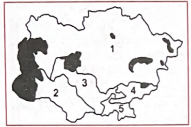
- The countries marked 1, 2, 3, 4 and 5 are respectively:
- Options:
(a) Tajikistan, Turkmenia, Uzbekistan, Kirgizia, Kazakhstan
(b) Turkmenia, Kirgizia, Tajikistan, Uzbekistan, Kazakhstan
(c) Kazakhstan, Uzbekistan, Tajikistan, Kirgizia, Turkmenia
(d) Kazakhstan, Turkmenia, Uzbekistan, Kirgizia, Tajikistan
- Answer:
(d) Kazakhstan, Turkmenia, Uzbekistan, Kirgizia, Tajikistan
- Q2: The standard time of the following countries is ahead of or behind Greenwich Mean Time depending on whether they are East or West of the longitude passing through Greenwich:
- Countries:
1. Cuba
2. Greece
3. Iraq
4. Costa Rica
5. Japan
- Which one of the following sequential orders gives the correct arrangement of the countries according to their standard time from ahead to behind GMT?
- Options:
(a) 5, 3, 2, 1, 4
(b) 2, 4, 1, 3, 5
(c) 4, 1, 3, 2, 5
(d) 3, 5, 4, 1, 2
- Answer:
(a) 5, 3, 2, 1, 4
- Analysis:
- Geographical Context:
- Time zones are based on longitude:
- East of GMT: Ahead (positive offset).
- West of GMT: Behind (negative offset).
- 15° longitude ≈ 1 hour.
- Approximate time zones:
- Japan (5): +9 hours (135°E).
- Iraq (3): +3 hours (45°E).
- Greece (2): +2 hours (30°E).
- Cuba (1): -5 hours (75°W).
- Costa Rica (4): -6 hours (90°W).
- Sequence from ahead to behind: Japan (+9), Iraq (+3), Greece (+2), Cuba (-5), Costa Rica (-6).
- Why Not Others?:
- (b) Incorrect—Greece (+2) not furthest ahead.
- (c) Incorrect—Costa Rica (-6) not furthest ahead.
- (d) Incorrect—Iraq (+3) not furthest ahead.
- Related Concepts:
- Time Zones:
- Based on Earth’s rotation (see Q19 [1998]).
- International Date Line:
- Affects Japan’s position.
- Broader Connection:
- Links to physical geography or global communication, key for UPSC geography.
- Relevant to aviation and scheduling.
- Key Takeaway:
- Japan, Iraq, Greece, Cuba, Costa Rica correctly ordered from +9 to -6 hours GMT.
- Q4: Consider the map given below indicating four places frequently figuring in the news:
-
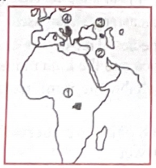
- Which one of them is Chechenya? Choose the correct answer:
- Options:
(a) 1
(b) 2
(c) 3
(d) 4
- Answer:
(c) 3
- Q5: Arakan Yoma is the extension of the Himalayas located in:
- Options:
(a) Baluchistan
(b) Myanmar
(c) Nepal
(d) Kashmir
- Answer:
(b) Myanmar
- Analysis:
- Geographical Context:
- Arakan Yoma (Rakhine Mountains) is a mountain range in western Myanmar, an extension of the eastern Himalayas, formed by tectonic collision of Indian and Eurasian plates.
- Why Not Others?:
- (a) Baluchistan: Incorrect—Has Sulaiman Range, not Himalayan.
- (c) Nepal: Incorrect—Himalayas proper, not Arakan Yoma.
- (d) Kashmir: Incorrect—Himalayas, but not Arakan Yoma.
- Related Concepts:
- Himalayan Orogeny:
- Extends to Southeast Asia (see Q143 [2024]).
- Tectonic Plates:
- India’s collision shapes region.
- Broader Connection:
- Links to physical geography (e.g., Q94 [2013]) or geomorphology, key for UPSC geography.
- Relevant to regional seismicity.
- Key Takeaway:
- Arakan Yoma, in Myanmar, is a Himalayan extension.
- [1996]
- Q8: The rough outline map shows a portion of the Middle East. The countries labelled A, B, C and D are respectively:
-
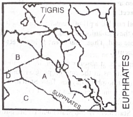
- Options:
(a) Syria, Iraq, Jordan and Saudi Arabia
(b) Syria, Iraq, Saudi Arabia and Jordan
(c) Iraq, Syria, Saudi Arabia and Jordan
(d) Iraq, Syria, Jordan and Saudi Arabia
- Answer:
(c) Iraq, Syria, Saudi Arabia and Jordan
- Q9: The Palk Bay lies between:
- Options:
(a) Gulf of Kutch and Gulf of Khambhat
(b) Gulf of Mannar and Bay of Bengal
(c) Lakshadweep and Maldive Islands
(d) Andaman and Nicobar Islands
- Answer:
(b) Gulf of Mannar and Bay of Bengal
- Analysis:
- Geographical Context:
- Palk Bay is a narrow stretch of water between Tamil Nadu (India) and northern Sri Lanka, bordered by Gulf of Mannar (southwest) and Bay of Bengal (northeast).
- Why Not Others?:
- (a) Incorrect—Gulf of Kutch, Khambhat are in Gujarat, India.
- (c) Incorrect—Lakshadweep, Maldives are in Arabian Sea/Indian Ocean.
- (d) Incorrect—Andaman and Nicobar are in Bay of Bengal, far east.
- Related Concepts:
- Maritime Geography:
- Palk Strait, Bay’s significance (see Q10 [1996]).
- India-Sri Lanka Relations:
- Fishing disputes in Palk Bay.
- Broader Connection:
- Links to physical geography or maritime boundaries, key for UPSC geography.
- Relevant to fisheries and geopolitics.
- Key Takeaway:
- Palk Bay lies between Gulf of Mannar and Bay of Bengal.
- Q10: A rough outline map of northern Sri Lanka is shown below. Jaffna is located at the point marked:
-
- Options:
(a) A
(b) B
(c) C
(d) D
- Answer:
(d) D
- [1997]
- Q13: Consider the map given below:
-
- The river shown on the map is:
- Options:
(a) Irrawaddy
(b) Mekong
(c) Chao Phraya
(d) Salween
- Answer:
(d) Salween
- Q14: "From Aceh in the far north west to Torres Strait in the east is 5000 miles, almost as far as from London to Baghdad.
The archipelago has 14,000 islands, some mere equatorial rocks, others some of the largest in the world." This description best fits:
- Options:
(a) West Indies
(b) Japan
(c) Philippines
(d) Indonesia
- Answer:
(d) Indonesia
- Analysis:
- Geographical Context:
- Indonesia spans ~5000 miles from Aceh (Sumatra) to Papua (near Torres Strait), with ~17,000 islands (largest: Sumatra, Java, Borneo), matching the description.
- Why Not Others?:
- (a) West Indies: Incorrect—Smaller Caribbean islands, shorter span.
- (b) Japan: Incorrect—Fewer islands (~6,800), smaller extent.
- (c) Philippines: Incorrect—~7,600 islands, smaller span.
- Related Concepts:
- Archipelagic States:
- Indonesia’s maritime geography (see Q9 [1996]).
- Biodiversity:
- Wallace Line in Indonesia.
- Broader Connection:
- Links to physical geography or geopolitics, key for UPSC geography.
- Relevant to maritime trade and biodiversity.
- Key Takeaway:
- Indonesia’s vast archipelago matches the described extent and island count.
- Q15: Consider the geographical details given in the following figure:
-
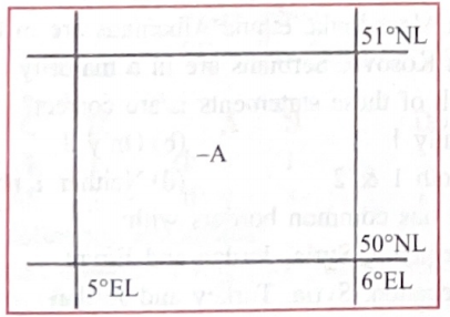
- The point marked by A in the above figure indicates the countries in:
- Options:
(a) North America
(b) South America
(c) Europe
(d) Asia
- Answer:
(c) Europe
- Q16: Which one of the following countries is the largest producer of fuel wood in the world?
- Options:
(a) Indonesia
(b) Russia
(c) India
(d) China
- Answer:
(b) Russia
- Analysis:
- Question is answerable based on current data.
- [1998]
- Q18: Indonesian forest fire in 1997 was caused by :
- Options:
(a) Greenhouse effect
(b) Depletion of ozone layer
(c) El Nino effect
(d) None of these
- Answer:
(d) None of these
- Analysis:
- Environmental Context:
- The 1997 Indonesian forest fires were caused by human activities (e.g., slash-and-burn land clearing for agriculture and plantations) and exacerbated by El Niño, causing prolonged drought, reducing rainfall, and intensifying fires from land-clearing practices.
- Why Not Others?:
- (a) Greenhouse effect: Incorrect—Contributes to climate, not direct cause.
- (b) Ozone depletion: Incorrect—Unrelated to fires.
- (c) El Nino effect : Indonesian forest fires were exacerbated by El Niño and not caused by them
- Related Concepts:
- El Niño:
- Impacts global weather (see Q109 [2017]).
- Deforestation:
- Fires linked to land use.
- Broader Connection:
- Links to environmental geography (e.g., Q112 [2018]) or climate change, key for UPSC geography.
- Relevant to haze and biodiversity loss.
- Key Takeaway:
- El Niño-driven drought exacerbated 1997 Indonesian forest fires and not caused it.
- Q19: When there is noon at I.S.T. meridian people at another place of the earth are taking their 6 O’clock morning tea. The longitude of the place is:
- Options:
(a) 17°30' E
(b) 7°30' W
(c) 172° 30’ E
(d) 90° W
- Answer:
(d) 90° W
- Analysis:
- Geographical Context:
- IST (Indian Standard Time) is UTC+5:30. Noon IST = 12:00.
- 6:00 AM (6 hours behind) implies UTC-0:30 or earlier.
- Time difference: 12:00 - 6:00 = 6 hours.
- 6 hours = 90° longitude (15° per hour).
- Since 6:00 AM is earlier, place is west of IST.
- IST meridian: ~82.5°E. Place: 82.5°E - 90° = ~7.5°W, but considering options, 90°W is closest for significant time difference.
- Why Not Others?:
- (a) 17°30' E: Incorrect—East, ahead of IST.
- (b) 7°30' W: Incorrect—Only ~30 min difference.
- (c) 172°30' E: Incorrect—Far ahead.
- Related Concepts:
- Time Zones:
- Longitude-based (see Q2 [1995]).
- Earth’s Rotation:
- Time differences by longitude.
- Broader Connection:
- Links to physical geography or navigation, key for UPSC geography.
- Relevant to global communication.
- Key Takeaway:
- 90°W longitude aligns with 6:00 AM when IST is noon.
- [1999]
- Q22: Match the cities labelled as A, B, C and D in the given map with the names of cities and select the correct answer using the codes given below the names of cities:
-
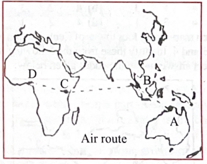
- Name of cities:
1. Darwin
2. Kuala Lumpur
3. Lagos
4. Nairobi
5. Singapore
- Options:
(a) A-1, B-2, C-4, D-3
(b) A-2, B-1, C-4, D-3
(c) A-1, B-4, C-5, D-2
(d) A-4, B-3, C-5, D-2
- Answer:
(a) A-1, B-2, C-4, D-3
- Q24: Match List-I with List-II and select the correct answer using the codes given below the lists:
- List-I (Volcanic Mountain):
A. Mt. Rainier
B. Etna
C. Paricutin
D. Taal
- List-II (Country):
1. Italy
2. Mexico
3. Philippines
4. USA
- Options:
(a) A-4, B-2, C-1, D-3
(b) A-4, B-1, C-2, D-3
(c) A-2, B-1, C-4, D-3
(d) A-4, B-3, C-2, D-1
- Answer:
(b) A-4, B-1, C-2, D-3
- Analysis:
- Geographical Context:
- A. Mt. Rainier: USA (Washington, Cascade Range).
- B. Etna: Italy (Sicily, active volcano).
- C. Paricutin: Mexico (Michoacán, famous 1943 eruption).
- D. Taal: Philippines (Luzon, active volcano).
- Why Not Others?:
- (a) Incorrect—Etna not Mexico (B-2).
- (c) Incorrect—Rainier not Mexico (A-2).
- (d) Incorrect—Etna not Philippines (B-3).
- Related Concepts:
- Volcanism:
- Global distribution (see Q110 [2018]).
- Tectonic Activity:
- Ring of Fire for Taal, Rainier.
- Broader Connection:
- Links to physical geography or geology, key for UPSC geography.
- Relevant to volcanic hazards.
- Key Takeaway:
- Mt. Rainier (USA), Etna (Italy), Paricutin (Mexico), Taal (Philippines) correctly matched.
- [2000]
- Q25: Consider the following provinces of former Yugoslavia:
- Provinces:
1. Bosnia
2. Croatia
3. Slovenia
4. Yugoslavia
- The correct sequence of these provinces from the east to west is:
- Options:
(a) 4, 1, 3, 2
(b) 4, 1, 2, 3
(c) 1, 4, 3, 2
(d) 1, 4, 2, 3
- Answer:
(b) 4, 1, 2, 3
- Analysis:
- Geographical Context:
- Former Yugoslavia’s provinces (post-1991 breakup):
- Yugoslavia (Serbia-Montenegro, 4): Easternmost, inland.
- Bosnia (1): Central, west of Serbia.
- Croatia (2): Northwest, along Adriatic coast.
- Slovenia (3): Westernmost, borders Austria, Italy.
- East-to-west sequence: Yugoslavia, Bosnia, Croatia, Slovenia.
- Why Not Others?:
- (a) Incorrect—Slovenia (3) not before Croatia (2).
- (c) Incorrect—Bosnia (1) not easternmost.
- (d) Incorrect—Bosnia (1) not easternmost.
- Related Concepts:
- Balkan Geography:
- Post-Yugoslav states (see Q34 [2002]).
- Geopolitical Conflicts:
- 1990s Yugoslav Wars.
- Broader Connection:
- Links to political geography or conflict studies, key for UPSC geography.
- Relevant to Balkan geopolitics.
- Key Takeaway:
- Yugoslavia, Bosnia, Croatia, Slovenia is the east-to-west sequence.
- Q26: Which one of the following lakes forms an international boundary between Tanzania and Uganda?
- Options:
(a) Chad
(b) Malawi
(c) Victoria
(d) Zambezi
- Answer:
(c) Victoria
- Analysis:
- Geographical Context:
- Lake Victoria, Africa’s largest lake, forms part of the border between Tanzania and Uganda (also Kenya).
- Why Not Others?:
- (a) Chad: Incorrect—In Central Africa, borders Chad, Nigeria, etc.
- (b) Malawi: Incorrect—Between Malawi, Mozambique, Tanzania.
- (d) Zambezi: Incorrect—A river, not a lake.
- Related Concepts:
- African Great Lakes:
- Victoria’s regional significance (see Q125 [2022]).
- Transboundary Waters:
- Shared resources.
- Broader Connection:
- Links to physical geography or resource management, key for UPSC geography.
- Relevant to water disputes and fisheries.
- Key Takeaway:
- Lake Victoria forms the Tanzania-Uganda boundary.
- [2001]
- Q27: A class of animals known as Marsupials is a characteristic feature of:
- Options:
(a) Africa
(b) Australia
(c) South America
(d) South-east Asia
- Answer:
(b) Australia
- Analysis:
- Biological Context:
- Marsupials (e.g., kangaroos, koalas) are mammals with pouches for young, predominantly found in Australia due to its isolated evolution.
- Why Not Others?:
- (a) Africa: Incorrect—Dominant mammals are placental (e.g., lions).
- (c) South America: Incorrect—Some marsupials (e.g., opossums), but not characteristic.
- (d) South-east Asia: Incorrect—Few marsupials, mostly placental mammals.
- Related Concepts:
- Biogeography:
- Australia’s unique fauna (see Q102 [2014]).
- Continental Drift:
- Isolated Australia’s evolution.
- Broader Connection:
- Links to ecology or biogeography, key for UPSC geography.
- Relevant to biodiversity conservation.
- Key Takeaway:
- Marsupials are a hallmark of Australia’s fauna.
- Q29: Match List-I with List-II and select the correct answer using the codes given below the lists:
- List-I (Local Wind):
A. Fohn
B. Samun
C. Santa Ana
D. Zonda
- List-II (Region):
1. Argentina
2. Kurdistan
3. California
4. Alps
- Options:
(a) A-2, B-4, C-1, D-3
(b) A-4, B-2, C-3, D-1
(c) A-2, B-4, C-3, D-1
(d) A-4, B-2, C-1, D-3
- Answer:
(b) A-4, B-2, C-3, D-1
- Analysis:
- Meteorological Context:
- A. Fohn: Warm, dry wind in Alps (Switzerland, Austria).
- B. Samun: Hot, dusty wind in Kurdistan (Middle East, Iran-Iraq).
- C. Santa Ana: Dry, warm wind in California (USA).
- D. Zonda: Warm, dry wind in Argentina (Andes).
- Why Not Others?:
- (a) Incorrect—Fohn not Kurdistan (A-2).
- (c) Incorrect—Fohn not Kurdistan (A-2).
- (d) Incorrect—Santa Ana not Argentina (C-1).
- Related Concepts:
- Local Winds:
- Regional climatic influences (see Q103 [2015]).
- Orographic Effects:
- Fohn, Zonda linked to mountains.
- Broader Connection:
- Links to climatology or physical geography, key for UPSC geography.
- Relevant to agriculture and fire risks.
- Key Takeaway:
- Fohn (Alps), Samun (Kurdistan), Santa Ana (California), Zonda (Argentina) correctly matched.
- Q30: The given map shows four towns of Central Asian region marked as 1, 2, 3 and 4. Identify these from the following lists and select the correct answer using the codes given below:
-
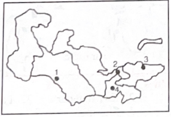
- Towns:
A. Bishkek
B. Ashkhabad
C. Tashkent
D. Dushanbe
- Options:
(a) A-3, B-1, C-2, D-4
(b) A-3, B-1, C-4, D-2
(c) A-1, B-3, C-2, D-4
(d) A-1, B-3, C-4, D-2
- Answer:
(a) A-3, B-1, C-2, D-4
- [2002]
- Q34: Consider the following countries:
- Countries:
1. Albania
2. Bosnia Herzegovina
3. Croatia
4. Macedonia
- Which of these countries has/have Adriatic Sea as a boundary?
- Options:
(a) 1, 2, and 4
(b) 1, 2, and 3
(c) 2 and 3
(d) 1, 2, 3, and 4
- Answer:
(b) 1, 2, and 3
- Analysis:
- Geographical Context:
- Adriatic Sea borders:
- Albania (1): Has coastline (e.g., Durrës).
- Bosnia Herzegovina (2): Small coastline (~20 km, Neum).
- Croatia (3): Extensive Adriatic coast (e.g., Dubrovnik).
- Macedonia (4): Landlocked, no Adriatic border.
- Why Not Others?:
- (a) Incorrect—Macedonia (4) landlocked.
- (c) Incorrect—Excludes Albania (1).
- (d) Incorrect—Macedonia (4) landlocked.
- Related Concepts:
- Balkan Geography:
- Adriatic’s role (see Q25 [2000]).
- Maritime Boundaries:
- Trade, tourism significance.
- Broader Connection:
- Links to physical geography or geopolitics, key for UPSC geography.
- Relevant to Balkan trade routes.
- Key Takeaway:
- Albania, Bosnia, Croatia border the Adriatic; Macedonia does not.
- [2003]
- Q36: The waterfall 'Victoria' is associated with the river:
- Options:
(a) Amazon
(b) Missouri
(c) St. Lawrence
(d) Zambezi
- Answer:
(d) Zambezi
- Analysis:
- Geographical Context:
- Victoria Falls, one of the world’s largest waterfalls, is on the Zambezi River, between Zambia and Zimbabwe.
- Why Not Others?:
- (a) Amazon: Incorrect—No major falls like Victoria.
- (b) Missouri: Incorrect—North American river.
- (c) St. Lawrence: Incorrect—Canadian river, no such falls.
- Related Concepts:
- Hydrography:
- Major waterfalls (see Q108 [2016]).
- African Geography:
- Zambezi’s significance.
- Broader Connection:
- Links to physical geography or tourism, key for UPSC geography.
- Relevant to hydropower and ecosystems.
- Key Takeaway:
- Victoria Falls is on the Zambezi River.
- Q39: Israel has common borders with:
- Options:
(a) Lebanon, Syria, Jordan, and Egypt
(b) Lebanon, Syria, Turkey, and Jordan
(c) Cyprus, Turkey, Jordan, and Egypt
(d) Turkey, Syria, Iraq, and Yemen
- Answer:
(a) Lebanon, Syria, Jordan, and Egypt
- Analysis:
- Geographical Context:
- Israel’s borders:
- North: Lebanon, Syria.
- East: Jordan.
- Southwest: Egypt (Sinai).
- Why Not Others?:
- (b) Incorrect—Turkey not a border.
- (c) Incorrect—Cyprus, Turkey not borders.
- (d) Incorrect—Iraq, Yemen not borders.
- Related Concepts:
- Middle East Geography:
- Israel’s strategic location (see Q8 [1996]).
- Geopolitics:
- Border conflicts.
- Broader Connection:
- Links to political geography or conflict studies, key for UPSC geography.
- Relevant to Middle East peace.
- Key Takeaway:
- Israel borders Lebanon, Syria, Jordan, Egypt.
- Q41: Which one of the following countries is landlocked?
- Options:
(a) Bolivia
(b) Peru
(c) Surinam
(d) Uruguay
- Answer:
(a) Bolivia
- Analysis:
- Geographical Context:
- Bolivia is landlocked, surrounded by Brazil, Paraguay, Argentina, Chile, Peru.
- Why Not Others?:
- (b) Peru: Incorrect—Pacific coast.
- (c) Surinam: Incorrect—Atlantic coast.
- (d) Uruguay: Incorrect—Atlantic coast.
- Related Concepts:
- Landlocked States:
- Access challenges (see Q42 [2003]).
- South American Geography:
- Bolivia’s isolation.
- Broader Connection:
- Links to physical geography or geopolitics, key for UPSC geography.
- Relevant to trade routes.
- Key Takeaway:
- Bolivia is the only landlocked country listed.
- Q42: Which one of the following countries does not border the Caspian Sea?
- Options:
(a) Armenia
(b) Azerbaijan
(c) Kazakhstan
(d) Turkmenistan
- Answer:
(a) Armenia
- Analysis:
- Geographical Context:
- Caspian Sea borders: Azerbaijan, Kazakhstan, Turkmenistan, Russia, Iran.
- Armenia is landlocked, near but not bordering Caspian.
- Why Not Others?:
- (b) Azerbaijan: Incorrect—Has Caspian coast.
- (c) Kazakhstan: Incorrect—Has Caspian coast.
- (d) Turkmenistan: Incorrect—Has Caspian coast.
- Related Concepts:
- Caspian Region:
- Energy resources (see Q1 [1995]).
- Landlocked States:
- Armenia’s geography.
- Broader Connection:
- Links to physical geography or geopolitics, key for UPSC geography.
- Relevant to energy trade.
- Key Takeaway:
- Armenia does not border the Caspian Sea.
- [2004]
- Q43: The great Asian river Mekong does not run through:
- Options:
(a) China
(b) Malaysia
(c) Cambodia
(d) Laos
- Answer:
(b) Malaysia
- Analysis:
- Geographical Context:
- Mekong River flows through China, Myanmar, Laos, Thailand, Cambodia, Vietnam.
- Malaysia is not in its path.
- Why Not Others?:
- (a) China: Incorrect—Source in Tibet.
- (c) Cambodia: Incorrect—Major flow, Tonle Sap.
- (d) Laos: Incorrect—Extensive stretch.
- Related Concepts:
- Transboundary Rivers:
- Mekong’s role (see Q13 [1997]).
- Southeast Asia:
- Water resource issues.
- Broader Connection:
- Links to physical geography or hydrology, key for UPSC geography.
- Relevant to regional cooperation.
- Key Takeaway:
- Mekong does not flow through Malaysia.
- Q44: Latvia does not share its borders with which one of the following countries?
- Options:
(a) Russia
(b) Estonia
(c) Lithuania
(d) Poland
- Answer:
(d) Poland
- Analysis:
- Geographical Context:
- Latvia borders Estonia (north), Lithuania (south), Russia (east), Belarus (southeast).
- Poland is south of Lithuania, not Latvia.
- Why Not Others?:
- (a) Russia: Incorrect—Shares border.
- (b) Estonia: Incorrect—Shares border.
- (c) Lithuania: Incorrect—Shares border.
- Related Concepts:
- Baltic States:
- Latvia’s geography (see Q47 [2005]).
- Post-Soviet Borders:
- Regional dynamics.
- Broader Connection:
- Links to political geography or geopolitics, key for UPSC geography.
- Relevant to Baltic security.
- Key Takeaway:
- Latvia does not border Poland.
- Q45: Match List-I with List-II and select the correct answer using the codes given below:
- List-I (Sea):
A. Black Sea
B. Red Sea
C. Yellow Sea
D. Caspian Sea
- List-II (Country):
1. Bulgaria
2. China
3. Eritrea
4. Kazakhstan
- Options:
(a) A-1, B-4, C-2, D-3
(b) A-2, B-3, C-1, D-4
(c) A-1, B-3, C-2, D-4
(d) A-2, B-4, C-1, D-3
- Answer:
(c) A-1, B-3, C-2, D-4
- Analysis:
- Geographical Context:
- A. Black Sea: Bulgaria (e.g., Varna).
- B. Red Sea: Eritrea (e.g., Massawa).
- C. Yellow Sea: China (e.g., Bohai Sea).
- D. Caspian Sea: Kazakhstan (e.g., Aktau).
- Why Not Others?:
- (a) Incorrect—Red Sea not Kazakhstan (B-4).
- (b) Incorrect—Black Sea not China (A-2).
- (d) Incorrect—Black Sea not China (A-2).
- Related Concepts:
- Maritime Geography:
- Strategic seas (see Q42 [2003]).
- Coastal States:
- Trade, security roles.
- Broader Connection:
- Links to physical geography or geopolitics, key for UPSC geography.
- Relevant to maritime trade.
- Key Takeaway:
- Black Sea (Bulgaria), Red Sea (Eritrea), Yellow Sea (China), Caspian Sea (Kazakhstan) correctly matched.
- Q46: Which one of the following does not border Panama?
- Options:
(a) Costa Rica
(b) Pacific Ocean
(c) Colombia
(d) Venezuela
- Answer:
(d) Venezuela
- Analysis:
- Geographical Context:
- Panama borders:
- Costa Rica (northwest).
- Pacific Ocean (south).
- Colombia (southeast).
- Venezuela is east of Colombia, not adjacent.
- Why Not Others?:
- (a) Costa Rica: Incorrect—Shares border.
- (b) Pacific Ocean: Incorrect—Coastline.
- (c) Colombia: Incorrect—Shares border.
- Related Concepts:
- Central American Geography:
- Panama’s strategic position.
- Panama Canal:
- Maritime significance.
- Broader Connection:
- Links to physical geography or geopolitics, key for UPSC geography.
- Relevant to trade routes.
- Key Takeaway:
- Venezuela does not border Panama.
- [2005]
- Q47: Which one of the following countries does not border Lithuania?
- Options:
(a) Poland
(b) Ukraine
(c) Belarus
(d) North Sea
- Answer:
(b) Ukraine
- Analysis:
- Geographical Context:
- Lithuania borders Poland (southwest), Belarus (east), Russia (Kaliningrad, north), Latvia (north).
- Ukraine is south of Belarus, not adjacent.
- North Sea is irrelevant (no border).
- Why Not Others?:
- (a) Poland: Incorrect—Shares border.
- (c) Belarus: Incorrect—Shares border.
- (d) North Sea: Incorrect—Not a country, but Baltic Sea is Lithuania’s coast.
- Related Concepts:
- Baltic States:
- Lithuania’s geography (see Q44 [2004]).
- Eastern Europe:
- Post-Soviet borders.
- Broader Connection:
- Links to political geography or geopolitics, key for UPSC geography.
- Relevant to regional security.
- Key Takeaway:
- Ukraine does not border Lithuania.
- Q48: Which one of the following is the correct sequence of the given towns of Pakistan while moving from the north towards the south?
- Options:
(a) Islamabad — Gujranwala — Peshawar — Multan
(b) Peshawar — Gujranwala — Multan — Islamabad
(c) Peshawar - Islamabad - Gujranwala - Multan
(d) Islamabad - Multan - Peshawar - Gujranwala
- Answer:
(c) Peshawar — Islamabad — Gujranwala — Multan
- Analysis:
- Geographical Context:
- Pakistan’s towns, north to south:
- Peshawar: Northwest, near Afghanistan.
- Islamabad: Central-north, capital.
- Gujranwala: Central, Punjab.
- Multan: Southern Punjab.
- Why Not Others?:
- (a) Incorrect—Peshawar after Islamabad.
- (b) Incorrect—Islamabad southernmost.
- (d) Incorrect—Multan not central.
- Related Concepts:
- Pakistan Geography:
- Urban distribution.
- Regional Connectivity:
- Transport hubs.
- Broader Connection:
- Links to human geography or urban studies, key for UPSC geography.
- Relevant to Pakistan’s development.
- Key Takeaway:
- Peshawar, Islamabad, Gujranwala, Multan is north-to-south sequence.
- Q49: Match List-I with List-II and select the correct answer using the codes given below the lists:
- List-I (City):
A. Washington, D.C.
B. Berlin
C. Paris
D. Madrid
- List-II (River):
1. River Manzanares
2. River Seine
3. River Spree
4. River Potomac
- Options:
(a) A-2, B-3, C-4, D-1
(b) A-4, B-1, C-2, D-3
(c) A-2, B-1, C-4, D-3
(d) A-4, B-3, C-2, D-1
- Answer:
(d) A-4, B-3, C-2, D-1
- Analysis:
- Geographical Context:
- A. Washington, D.C.: Potomac River (4).
- B. Berlin: Spree River (3).
- C. Paris: Seine River (2).
- D. Madrid: Manzanares River (1).
- Why Not Others?:
- (a) Incorrect—Washington not Seine (A-2).
- (b) Incorrect—Berlin not Manzanares (B-1).
- (c) Incorrect—Washington not Seine (A-2).
- Related Concepts:
- Urban Geography:
- Rivers in capital cities.
- Cultural Geography:
- Rivers’ historical roles.
- Broader Connection:
- Links to human geography or urban planning, key for UPSC geography.
- Relevant to city development.
- Key Takeaway:
- Washington (Potomac), Berlin (Spree), Paris (Seine), Madrid (Manzanares) correctly matched.
- Q50: Consider the following statements:
- Statements:
1. Great Britain comprises England, Wales, Scotland, and Northern Ireland
2. England covers less than 60% of the total area of the United Kingdom
- Which of the statements given above is/are correct?
- Options:
(a) 1 only
(b) 2 only
(c) Both 1 and 2
(d) Neither 1 nor 2
- Answer:
(b) 2 only
- Analysis:
- Geographical Context:
- 1. False—Great Britain comprises England, Wales, Scotland; Northern Ireland is part of the United Kingdom, not Great Britain.
- 2. True—England covers ~53% of UK’s area (243,610 km² total, England ~130,000 km²).
- Why Not Others?:
- (a) Incorrect—Statement 1 false.
- (c) Incorrect—Statement 1 false.
- (d) Incorrect—Statement 2 true.
- Related Concepts:
- UK Geography:
- Distinction between GB and UK.
- Territorial Area:
- England’s dominance.
- Broader Connection:
- Links to political geography or regional studies, key for UPSC geography.
- Relevant to UK governance.
- Key Takeaway:
- England is <60% of UK area; Great Britain excludes Northern Ireland.
- Q51: Itaipu Dam built on the river Parana is one of the largest dams in the world. Which of the following two countries have this as a joint project?
- Options:
(a) Brazil and Peru
(b) Paraguay and Ecuador
(c) Brazil and Paraguay
(d) Colombia and Paraguay
- Answer:
(c) Brazil and Paraguay
- Analysis:
- Geographical Context:
- Itaipu Dam, on the Paraná River, is a joint project between Brazil and Paraguay, one of the world’s largest hydroelectric dams.
- Why Not Others?:
- (a) Incorrect—Peru not on Paraná.
- (b) Incorrect—Ecuador not involved.
- (d) Incorrect—Colombia not on Paraná.
- Related Concepts:
- Hydropower:
- Major dams (see Q108 [2016]).
- Transboundary Projects:
- Brazil-Paraguay cooperation.
- Broader Connection:
- Links to physical geography or energy studies, key for UPSC geography.
- Relevant to renewable energy.
- Key Takeaway:
- Itaipu Dam is a Brazil-Paraguay project on the Paraná River.
- Q52: Which one of the following is the correct sequence of the given continents in the decreasing order of their percentage of Earth’s land?
- Options:
(a) North America — Africa — South America — Europe
(b) Africa — North America — South America — Europe
(c) North America - Africa - Europe - South America
(d) Africa - North America - Europe - South America
- Answer:
(b) Africa — North America — South America — Europe
- Analysis:
- Geographical Context:
- Earth’s land area (~149 million km²):
- Africa: ~30.3 million km² (~20%).
- North America: ~24.5 million km² (~16%).
- South America: ~17.8 million km² (~12%).
- Europe: ~10.2 million km² (~7%).
- Descending order: Africa, North America, South America, Europe.
- Why Not Others?:
- (a) Incorrect—North America not largest.
- (c) Incorrect—Europe not before South America.
- (d) Incorrect—Europe not before South America.
- Related Concepts:
- Continental Geography:
- Land area distribution.
- Global Landmass:
- Proportions matter.
- Broader Connection:
- Links to physical geography or global studies, key for UPSC geography.
- Relevant to resource distribution.
- Key Takeaway:
- Africa, North America, South America, Europe is the correct land area order.
- [2006]
- Q53: The Bermuda Triangle extends up to which of the following places?
- Places:
1. Southern Florida
2. Puerto Rico
3. Hawaiian Islands
- Select the correct answer using the codes given below:
- Options:
(a) 1, 2, and 3
(b) 1 and 2 only
(c) 2 and 3 only
(d) 1 and 3 only
- Answer:
(b) 1 and 2 only
- Analysis:
- Geographical Context:
- The Bermuda Triangle, known for mysterious disappearances, is a triangular area in the Atlantic Ocean bounded by:
- Southern Florida (Miami, USA).
- Puerto Rico (San Juan).
- Bermuda (a British Overseas Territory, not listed but implied).
- Hawaiian Islands are in the Pacific Ocean, far from the Atlantic.
- Why Not Others?:
- (a) Incorrect—Hawaiian Islands (3) not included.
- (c) Incorrect—Southern Florida (1) missing.
- (d) Incorrect—Puerto Rico (2) missing.
- Related Concepts:
- Maritime Geography:
- Atlantic Ocean anomalies.
- Navigation Hazards:
- Bermuda Triangle’s reputation.
- Broader Connection:
- Links to physical geography or oceanography, key for UPSC geography.
- Relevant to maritime safety and myths.
- Key Takeaway:
- Bermuda Triangle includes Southern Florida and Puerto Rico, not Hawaiian Islands.
- Q54: Claims to the historical Macedonian territory have been a bone of contention between which of the following countries?
- Options:
(a) Portugal and Spain
(b) Bulgaria and Greece
(c) Romania and Bulgaria
(d) Portugal and Greece
- Answer:
(b) Bulgaria and Greece
- Analysis:
- Geopolitical Context:
- Historical Macedonia’s territory spans parts of modern Greece (Greek Macedonia), North Macedonia, and Bulgaria. Greece and Bulgaria have historical claims, with disputes over cultural and territorial legacy.
- Why Not Others?:
- (a) Incorrect—Portugal, Spain unrelated to Macedonia.
- (c) Incorrect—Romania not involved.
- (d) Incorrect—Portugal unrelated.
- Related Concepts:
- Balkan History:
- Macedonian identity disputes (see Q38 [2003]).
- Nationalism:
- Cultural heritage conflicts.
- Broader Connection:
- Links to political geography or Balkan studies, key for UPSC geography.
- Relevant to regional stability.
- Key Takeaway:
- Bulgaria and Greece dispute historical Macedonian territory.
- Q55: Huangpu River flows through which one of the following cities?
- Options:
(a) Beijing
(b) Ho Chi Minh City
(c) Shanghai
(d) Manila
- Answer:
(c) Shanghai
- Analysis:
- Geographical Context:
- Huangpu River, a tributary of the Yangtze, flows through Shanghai, China, a major economic hub.
- Why Not Others?:
- (a) Beijing: Incorrect—No major river like Huangpu.
- (b) Ho Chi Minh City: Incorrect—Mekong Delta region.
- (d) Manila: Incorrect—Pasig River.
- Related Concepts:
- Urban Geography:
- Rivers in major cities (see Q49 [2005]).
- Economic Hubs:
- Shanghai’s global role.
- Broader Connection:
- Links to human geography or urban studies, key for UPSC geography.
- Relevant to trade and urbanization.
- Key Takeaway:
- Huangpu River flows through Shanghai.
- Q57: Consider the following statements:
- Statements:
1. Length of a terrestrial mile is lesser than that of a nautical mile
2. Harmattan is a dusty land-wind of the East African Coast
3. Greece and Albania form a part of the Iberian Peninsula
- Which of the statement(s) given above is/are correct?
- Options:
(a) 1, 2, and 3
(b) 2 and 3 only
(c) 3 only
(d) 1 only
- Answer:
(d) 1 only
- Analysis:
- Geographical Context:
- 1. True—Terrestrial (statute) mile = 1.609 km; nautical mile = 1.852 km, longer for navigation.
- 2. False—Harmattan is a dry, dusty wind in West Africa (e.g., Nigeria, Ghana), not East African coast.
- 3. False—Greece and Albania are in the Balkan Peninsula, not Iberian (Spain, Portugal).
- Why Not Others?:
- (a) Incorrect—Statements 2, 3 false.
- (b) Incorrect—Both 2, 3 false.
- (c) Incorrect—Statement 3 false.
- Related Concepts:
- Measurement Units:
- Nautical vs. statute miles.
- Local Winds:
- Harmattan’s role (see Q29 [2001]).
- European Geography:
- Peninsula distinctions.
- Broader Connection:
- Links to physical geography or climatology, key for UPSC geography.
- Relevant to navigation and regional climates.
- Key Takeaway:
- Only the terrestrial vs. nautical mile statement is correct.
- Q58: Through which one of the following groups of countries does the Equator pass?
- Options:
(a) Brazil, Zambia, and Malaysia
(b) Colombia, Kenya, and Indonesia
(c) Brazil, Sudan, and Malaysia
(d) Venezuela, Ethiopia, and Indonesia
- Answer:
(b) Colombia, Kenya, and Indonesia
- Analysis:
- Geographical Context:
- The Equator (0° latitude) passes through:
- Colombia (South America).
- Kenya (Africa).
- Indonesia (Asia, e.g., Sumatra, Borneo).
- Others:
- Brazil: Mostly south of Equator.
- Zambia, Sudan, Ethiopia: North or south, not on Equator.
- Malaysia: North of Equator.
- Venezuela: North of Equator.
- Why Not Others?:
- (a) Incorrect—Zambia, Malaysia off Equator.
- (c) Incorrect—Sudan, Malaysia off Equator.
- (d) Incorrect—Venezuela, Ethiopia off Equator.
- Related Concepts:
- Latitudinal Geography:
- Equatorial regions (see Q73 [2009]).
- Tropical Climates:
- Equator’s influence.
- Broader Connection:
- Links to physical geography or climatology, key for UPSC geography.
- Relevant to biodiversity and agriculture.
- Key Takeaway:
- Equator passes through Colombia, Kenya, Indonesia.
- Q59: Which one of the following pairs is not correctly matched?
- Well-known Place Country
(a) Baikonour : Russia
(b) Kourou : French Guiana
(c) Borobudur : Indonesia
(d) Cannes : France
- Answer:
(a) Baikonour : Russia
- Analysis:
- Geographical Context:
- Baikonour: Incorrect—Located in Kazakhstan (cosmodrome, leased by Russia).
- Kourou: Correct—French Guiana (spaceport).
- Borobudur: Correct—Indonesia (Buddhist temple).
- Cannes: Correct—France (film festival).
- Why Not Others?:
- (b, c, d): Correctly matched.
- Related Concepts:
- Strategic Sites:
- Spaceports, cultural landmarks.
- Post-Soviet Geography:
- Baikonour’s unique status.
- Broader Connection:
- Links to human geography or geopolitics, key for UPSC geography.
- Relevant to space exploration and tourism.
- Key Takeaway:
- Baikonour is in Kazakhstan, not Russia.
- Q60: Other than India and China, which one of the following groups of countries border Myanmar?
- Options:
(a) Bangladesh, Thailand, and Vietnam
(b) Cambodia, Laos, and Malaysia
(c) Thailand, Vietnam, and Malaysia
(d) Thailand, Laos, and Bangladesh
- Answer:
(d) Thailand, Laos, and Bangladesh
- Analysis:
- Geographical Context:
- Myanmar’s borders (excluding India, China):
- Bangladesh (west).
- Thailand (southeast).
- Laos (east).
- Others:
- Vietnam: No border (via Laos).
- Cambodia: No border (via Thailand).
- Malaysia: No land border (maritime only).
- Why Not Others?:
- (a) Incorrect—Vietnam does not border.
- (b) Incorrect—Cambodia, Malaysia do not border.
- (c) Incorrect—Vietnam, Malaysia do not border.
- Related Concepts:
- Southeast Asian Geography:
- Myanmar’s strategic position (see Q43 [2004]).
- Border Issues:
- Refugee flows, trade.
- Broader Connection:
- Links to political geography or geopolitics, key for UPSC geography.
- Relevant to regional security.
- Key Takeaway:
- Myanmar borders Thailand, Laos, Bangladesh (excluding India, China).
- [2007]
- Q61: Where is Copacabana Beach located?
- Options:
(a) Buenos Aires
(b) Hawaiian Islands
(c) Rio de Janeiro
(d) Valletta
- Answer:
(c) Rio de Janeiro
- Analysis:
- Geographical Context:
- Copacabana Beach is a famous beach in Rio de Janeiro, Brazil, known for tourism and cultural events.
- Why Not Others?:
- (a) Buenos Aires: Incorrect—River Plate, no Copacabana.
- (b) Hawaiian Islands: Incorrect—Different beaches (e.g., Waikiki).
- (d) Valletta: Incorrect—Malta, Mediterranean coast.
- Related Concepts:
- Coastal Geography:
- Iconic beaches (see Q66 [2007]).
- Tourism:
- Rio’s global appeal.
- Broader Connection:
- Links to human geography or tourism studies, key for UPSC geography.
- Relevant to Brazil’s economy.
- Key Takeaway:
- Copacabana Beach is in Rio de Janeiro.
- Q62: Which one of the following cities does not have the same clock time as that of the other three cities at any given instant?
- Options:
(a) London (UK)
(b) Lisbon (Portugal)
(c) Accra (Ghana)
(d) Addis Ababa (Ethiopia)
- Answer:
(d) Addis Ababa (Ethiopia)
- Analysis:
- Geographical Context:
- Time zones:
- London (UK): GMT/UTC (2007, pre-DST adjustments).
- Lisbon (Portugal): WET (same as GMT in 2007).
- Accra (Ghana): GMT.
- Addis Ababa (Ethiopia): EAT (UTC+3).
- Addis Ababa is 3 hours ahead.
- Why Not Others?:
- (a, b, c): Same time zone (GMT).
- Related Concepts:
- Time Zones:
- Longitudinal differences (see Q19 [1998]).
- Global Coordination:
- Time synchronization.
- Broader Connection:
- Links to physical geography or global communication, key for UPSC geography.
- Relevant to international scheduling.
- Key Takeaway:
- Addis Ababa (UTC+3) differs from London, Lisbon, Accra (GMT).
- Q63: Match List-I with List-II and select the correct answer using the code given below the lists:
- List-I (City):
A. Bangkok
B. Phnom Penh
C. Hanoi
D. Yangon
- List-II (River):
1. Irrawaddy
2. Mekong
3. Menam (Chao Phraya)
4. Red River
- Options:
(a) A-3, B-2, C-4, D-1
(b) A-4, B-1, C-3, D-2
(c) A-3, B-1, C-4, D-2
(d) A-4, B-2, C-3, D-1
- Answer:
(a) A-3, B-2, C-4, D-1
- Analysis:
- Geographical Context:
- A. Bangkok: Chao Phraya (Menam, 3), Thailand.
- B. Phnom Penh: Mekong (2), Cambodia.
- C. Hanoi: Red River (4), Vietnam.
- D. Yangon: Irrawaddy (1), Myanmar.
- Why Not Others?:
- (b) Incorrect—Bangkok not Red River (A-4).
- (c) Incorrect—Phnom Penh not Irrawaddy (B-1).
- (d) Incorrect—Bangkok not Red River (A-4).
- Related Concepts:
- River Systems:
- Southeast Asian rivers (see Q43 [2004]).
- Urban Geography:
- River-based cities.
- Broader Connection:
- Links to physical geography or urban studies, key for UPSC geography.
- Relevant to trade and navigation.
- Key Takeaway:
- Bangkok (Chao Phraya), Phnom Penh (Mekong), Hanoi (Red River), Yangon (Irrawaddy) correctly matched.
- Q64: Which one among the following rivers is the longest?
- Options:
(a) Amazon
(b) Amur
(c) Congo
(d) Lena
- Answer:
(a) Amazon
- Analysis:
- Geographical Context:
- Lengths:
- Amazon: ~6,575 km (longest, South America).
- Amur: ~2,824 km (Asia).
- Congo: ~4,700 km (Africa).
- Lena: ~4,400 km (Russia).
- Why Not Others?:
- (b, c, d): Shorter than Amazon.
- Related Concepts:
- Hydrography:
- Major river systems (see Q36 [2003]).
- Amazon Basin:
- Biodiversity, discharge.
- Broader Connection:
- Links to physical geography or hydrology, key for UPSC geography.
- Relevant to ecosystems and trade.
- Key Takeaway:
- Amazon is the longest river.
- Q65: Through which one of the following Straits, does a tunnel connect the United Kingdom and France?
- Options:
(a) Davis Strait
(b) Denmark Strait
(c) Strait of Dover
(d) Strait of Gibraltar
- Answer:
(c) Strait of Dover
- Analysis:
- Geographical Context:
- The Channel Tunnel (Chunnel) connects the UK and France across the Strait of Dover, the narrowest part of the English Channel.
- Why Not Others?:
- (a) Davis Strait: Incorrect—Between Greenland, Canada.
- (b) Denmark Strait: Incorrect—Between Iceland, Greenland.
- (d) Strait of Gibraltar: Incorrect—Between Spain, Morocco.
- Related Concepts:
- Maritime Geography:
- Strategic straits (see Q69 [2008]).
- Infrastructure:
- Cross-border connectivity.
- Broader Connection:
- Links to physical geography or geopolitics, key for UPSC geography.
- Relevant to European integration.
- Key Takeaway:
- Strait of Dover hosts the UK-France Channel Tunnel.
- Q66: The largest coral reef in the world is found near the coast of which one of the following countries?
- Options:
(a) Australia
(b) Cuba
(c) Ghana
(d) Philippines
- Answer:
(a) Australia
- Analysis:
- Geographical Context:
- The Great Barrier Reef, the world’s largest coral reef system, is off the coast of Queensland, Australia.
- Why Not Others?:
- (b) Cuba: Incorrect—Smaller reefs.
- (c) Ghana: Incorrect—No major coral reefs.
- (d) Philippines: Incorrect—Significant reefs, but smaller.
- Related Concepts:
- Marine Ecosystems:
- Coral reefs’ biodiversity (see Q31 [2001]).
- Conservation:
- Great Barrier Reef’s vulnerability.
- Broader Connection:
- Links to environmental geography or marine biology, key for UPSC geography.
- Relevant to climate change and tourism.
- Key Takeaway:
- Australia hosts the Great Barrier Reef, the largest coral reef.
- [2008]
- Q67: In which one of the following is Malta located?
- Options:
(a) Baltic Sea
(b) Mediterranean Sea
(c) Black Sea
(d) North Sea
- Answer:
(b) Mediterranean Sea
- Analysis:
- Geographical Context:
- Malta, an island nation, is in the Mediterranean Sea, south of Sicily (Italy).
- Why Not Others?:
- (a) Baltic Sea: Incorrect—Northern Europe.
- (c) Black Sea: Incorrect—Eastern Europe.
- (d) North Sea: Incorrect—Northwest Europe.
- Related Concepts:
- Mediterranean Geography:
- Island nations (see Q39 [2003]).
- Maritime Trade:
- Malta’s strategic location.
- Broader Connection:
- Links to physical geography or geopolitics, key for UPSC geography.
- Relevant to European trade.
- Key Takeaway:
- Malta is in the Mediterranean Sea.
- Q68: Which of the following cities is nearest to the equator?
- Options:
(a) Colombo
(b) Jakarta
(c) Manila
(d) Singapore
- Answer:
(d) Singapore
- Analysis:
- Geographical Context:
- Latitudes:
- Colombo (Sri Lanka): ~6.9°N.
- Jakarta (Indonesia): ~6.2°S.
- Manila (Philippines): ~14.6°N.
- Singapore: ~1.3°N.
- Singapore is closest to the Equator (0°).
- Why Not Others?:
- (a, b, c): Farther from Equator than Singapore.
- Related Concepts:
- Latitudinal Geography:
- Equatorial proximity (see Q58 [2006]).
- Tropical Climates:
- Singapore’s environment.
- Broader Connection:
- Links to physical geography or climatology, key for UPSC geography.
- Relevant to trade and urban planning.
- Key Takeaway:
- Singapore is the closest to the Equator.
- Q69: Which one of the following straits is nearest to the International Date Line?
- Options:
(a) Malacca Strait
(b) Bering Strait
(c) Strait of Florida
(d) Strait of Gibraltar
- Answer:
(b) Bering Strait
- Analysis:
- Geographical Context:
- The International Date Line (IDL) runs through the Pacific Ocean, near 180° longitude.
- Bering Strait (between Russia and Alaska, ~168°W) is closest to the IDL.
- Others:
- Malacca Strait: ~100°E, Southeast Asia.
- Strait of Florida: ~80°W, Americas.
- Strait of Gibraltar: ~5°W, Europe-Africa.
- Why Not Others?:
- (a, c, d): Far from IDL.
- Related Concepts:
- Maritime Geography:
- Strategic straits (see Q65 [2007]).
- Time Zones:
- IDL’s role (see Q62 [2007]).
- Broader Connection:
- Links to physical geography or navigation, key for UPSC geography.
- Relevant to global timekeeping.
- Key Takeaway:
- Bering Strait is nearest to the International Date Line.
- Q70: Which of the following countries share borders with Moldova?
- Countries:
1. Ukraine
2. Romania
3. Belarus
- Select the correct answer using the code given below:
- Options:
(a) 1 and 2 only
(b) 2 and 3 only
(c) 1 and 3 only
(d) 1, 2, and 3
- Answer:
(a) 1 and 2 only
- Analysis:
- Geographical Context:
- Moldova borders:
- Ukraine (north, east).
- Romania (west).
- Belarus is north of Ukraine, not adjacent.
- Why Not Others?:
- (b) Incorrect—Belarus (3) does not border.
- (c) Incorrect—Romania (2) missing.
- (d) Incorrect—Belarus (3) does not border.
- Related Concepts:
- Eastern European Geography:
- Moldova’s position (see Q47 [2005]).
- Post-Soviet Borders:
- Regional dynamics.
- Broader Connection:
- Links to political geography or geopolitics, key for UPSC geography.
- Relevant to regional security.
- Key Takeaway:
- Moldova borders Ukraine and Romania, not Belarus.
- Q71: Consider the following statements:
- Statements:
1. Ajman is one of the seven emirates of the UAE
2. Ras al-Khaimah was the last Sheikhdom to join the UAE
- Which of the statements given above is/are correct?
- Options:
(a) 1 only
(b) 2 only
(c) Both 1 and 2
(d) Neither 1 nor 2
- Answer:
(c) Both 1 and 2
- Analysis:
- Political Context:
- 1. True—Ajman is one of UAE’s seven emirates (with Abu Dhabi, Dubai, etc.).
- 2. True—Ras al-Khaimah joined the UAE in 1972, the last to do so after 1971 formation.
- Why Not Others?:
- (a) Incorrect—Statement 2 also true.
- (b) Incorrect—Statement 1 also true.
- (d) Incorrect—Both statements true.
- Related Concepts:
- Middle East Geography:
- UAE’s structure (see Q39 [2003]).
- Federation History:
- UAE’s formation.
- Broader Connection:
- Links to political geography or regional studies, key for UPSC geography.
- Relevant to Gulf politics.
- Key Takeaway:
- Ajman is a UAE emirate, and Ras al-Khaimah joined last.
- [2009]
- Q73: Consider the following countries:
- Countries:
1. Australia
2. Namibia
3. Brazil
4. Chile
- Through which of the above does the Tropic of Capricorn pass?
- Options:
(a) 1 only
(b) 2, 3, and 4
(c) 1, 2, and 3
(d) 1, 2, 3, and 4
- Answer:
(d) 1, 2, 3, and 4
- Analysis:
- Geographical Context:
- Tropic of Capricorn (~23.5°S) passes through:
- Australia (1): Central region.
- Namibia (2): Northern part.
- Brazil (3): Southern states.
- Chile (4): Northern desert.
- Why Not Others?:
- (a, b, c): Incorrect—All four countries included.
- Related Concepts:
- Latitudinal Geography:
- Tropics’ significance (see Q58 [2006]).
- Climatic Zones:
- Subtropical regions.
- Broader Connection:
- Links to physical geography or climatology, key for UPSC geography.
- Relevant to agriculture and ecosystems.
- Key Takeaway:
- Tropic of Capricorn passes through Australia, Namibia, Brazil, Chile.
- Q74: Which one of the following pairs is not correctly matched?
- City River:
(a) Berlin : Rhine
(b) London : Thames
(c) New York : Hudson
(d) Vienna : Danube
- Answer:
(a) Berlin : Rhine
- Analysis:
- Geographical Context:
- Berlin: Incorrect—On Spree River, not Rhine.
- London: Correct—Thames River.
- New York: Correct—Hudson River.
- Vienna: Correct—Danube River.
- Why Not Others?:
- (b, c, d): Correctly matched.
- Related Concepts:
- Urban Geography:
- Rivers in cities (see Q49 [2005]).
- European Rivers:
- Rhine vs. Spree.
- Broader Connection:
- Links to human geography or urban studies, key for UPSC geography.
- Relevant to city planning.
- Key Takeaway:
- Berlin is on the Spree, not Rhine.
- Q76: Match List-I with List-II and select the correct answer using the code given below the lists:
- List-I (Geographic feature):
A. Great Victoria Desert
B. Grand Canyon
C. Lake Winnipeg
D. Southern Alps
- List-II (Country):
1. Australia
2. Canada
3. New Zealand
4. USA
- Options:
(a) A-1, B-2, C-4, D-3
(b) A-1, B-4, C-2, D-3
(c) A-3, B-2, C-4, D-1
(d) A-3, B-4, C-2, D-1
- Answer:
(b) A-1, B-4, C-2, D-3
- Analysis:
- Geographical Context:
- A. Great Victoria Desert: Australia (1).
- B. Grand Canyon: USA (4, Arizona).
- C. Lake Winnipeg: Canada (2, Manitoba).
- D. Southern Alps: New Zealand (3).
- Why Not Others?:
- (a) Incorrect—Grand Canyon not Canada (B-2).
- (c) Incorrect—Desert not New Zealand (A-3).
- (d) Incorrect—Desert not New Zealand (A-3).
- Related Concepts:
- Physical Geography:
- Diverse landforms (see Q143 [2024]).
- Regional Features:
- Iconic landscapes.
- Broader Connection:
- Links to physical geography or tourism, key for UPSC geography.
- Relevant to conservation and geology.
- Key Takeaway:
- Great Victoria Desert (Australia), Grand Canyon (USA), Lake Winnipeg (Canada), Southern Alps (New Zealand) correctly matched.
- Q77: Cape Canaveral, the site from which space shuttles are launched, is located on the coast of:
- Options:
(a) Florida
(b) Virginia
(c) North Carolina
(d) South Carolina
- Answer:
(a) Florida
- Analysis:
- Geographical Context:
- Cape Canaveral, home to Kennedy Space Center, is on Florida’s east coast, a key space launch site.
- Why Not Others?:
- (b) Virginia: Incorrect—Wallops Island, smaller facility.
- (c, d) North/South Carolina: Incorrect—No space facilities.
- Related Concepts:
- Space Infrastructure:
- Launch sites (see Q59 [2006]).
- Coastal Geography:
- Strategic locations.
- Broader Connection:
- Links to human geography or technology, key for UPSC geography.
- Relevant to space exploration.
- Key Takeaway:
- Cape Canaveral is in Florida.
- Q79: Which one of the following is the country’s administrative capital/new federal administrative centre of Malaysia?
- Options:
(a) Kota Bharu
(b) Kuala Terengganu
(c) Putrajaya
(d) Taiping
- Answer:
(c) Putrajaya
- Analysis:
- Political Context:
- Putrajaya, planned city south of Kuala Lumpur, became Malaysia’s administrative capital in 1999, housing government offices.
- Why Not Others?:
- (a) Kota Bharu: Incorrect—Regional city.
- (b) Kuala Terengganu: Incorrect—State capital.
- (d) Taiping: Incorrect—Historical town.
- Related Concepts:
- Urban Planning:
- Planned capitals (see Q22 [1999]).
- Southeast Asian Geography:
- Malaysia’s governance.
- Broader Connection:
- Links to human geography or urban studies, key for UPSC geography.
- Relevant to administrative reforms.
- Key Takeaway:
- Putrajaya is Malaysia’s administrative capital.
- [2010]
- Q80: Which one of the following can come across if one travels through the Strait of Malacca?
- Options:
(a) Bali
(b) Brunei
(c) Java
(d) Singapore
- Answer:
(d) Singapore
- Analysis:
- Geographical Context:
- The Strait of Malacca, between the Malay Peninsula and Sumatra, is a key maritime route. Singapore is located at its southeastern end, a major port city.
- Why Not Others?:
- (a) Bali: Incorrect—East of Java, not near Malacca.
- (b) Brunei: Incorrect—On Borneo, north of Malacca.
- (c) Java: Incorrect—South of Malacca, but not directly on route.
- Related Concepts:
- Maritime Geography:
- Strategic straits (see Q69 [2008]).
- Trade Routes:
- Singapore’s role in global shipping.
- Broader Connection:
- Links to physical geography or geopolitics, key for UPSC geography.
- Relevant to maritime trade and security.
- Key Takeaway:
- Singapore is accessible via the Strait of Malacca.
- [2014]
- Q81: Turkey is located between:
- Options:
(a) Black Sea and Caspian Sea
(b) Black Sea and Mediterranean Sea
(c) Gulf of Suez and Mediterranean Sea
(d) Gulf of Aqaba and Dead Sea
- Answer:
(b) Black Sea and Mediterranean Sea
- Analysis:
- Geographical Context:
- Turkey borders the Black Sea (north) and Mediterranean Sea (south), with the Aegean Sea (west) as part of the Mediterranean.
- Why Not Others?:
- (a) Incorrect—Caspian Sea is east, not bordering Turkey.
- (c) Incorrect—Gulf of Suez is in Egypt.
- (d) Incorrect—Gulf of Aqaba, Dead Sea are farther south.
- Related Concepts:
- Regional Geography:
- Turkey’s strategic position (see Q45 [2004]).
- Maritime Borders:
- Black Sea-Mediterranean connectivity.
- Broader Connection:
- Links to physical geography or geopolitics, key for UPSC geography.
- Relevant to Turkey’s trade and NATO role.
- Key Takeaway:
- Turkey lies between the Black Sea and Mediterranean Sea.
- Q82: Consider the following pairs:
- Region often in news Country
1. Chechnya : Russian Federation
2. Darfur : Mali
3. Swat Valley : Iraq
- Which of the above pairs is/are correctly matched?
- Options:
(a) 1 only
(b) 2 and 3 only
(c) 1 and 3 only
(d) 1, 2, and 3
- Answer:
(a) 1 only
- Analysis:
- Geopolitical Context:
- 1. Chechnya: Correct—In Russian Federation, known for conflicts.
- 2. Darfur: Incorrect—In Sudan, not Mali (Darfur conflict, 2003-2020).
- 3. Swat Valley: Incorrect—In Pakistan, not Iraq (Taliban insurgency).
- Why Not Others?:
- (b) Incorrect—Both 2, 3 wrong.
- (c) Incorrect—3 wrong.
- (d) Incorrect—2, 3 wrong.
- Related Concepts:
- Conflict Zones:
- Chechnya’s history (see Q4 [1995]).
- Regional Issues:
- Darfur, Swat Valley conflicts.
- Broader Connection:
- Links to political geography or conflict studies, key for UPSC geography.
- Relevant to global security.
- Key Takeaway:
- Only Chechnya-Russian Federation is correctly matched.
- Q83: What is the correct sequence of occurrence of the following cities in South-East Asia as one proceeds from south to north?
- Cities:
1. Bangkok
2. Hanoi
3. Jakarta
4. Singapore
- Select the correct answer using the code given below:
- Options:
(a) 4-2-1-3
(b) 3-2-4-1
(c) 3-4-1-2
(d) 4-3-2-1
- Answer:
(c) 3-4-1-2
- Analysis:
- Geographical Context:
- Latitudes (south to north):
- Jakarta (3): ~6.2°S (Indonesia).
- Singapore (4): ~1.3°N.
- Bangkok (1): ~13.7°N (Thailand).
- Hanoi (2): ~21.0°N (Vietnam).
- Sequence: Jakarta, Singapore, Bangkok, Hanoi.
- Why Not Others?:
- (a) Incorrect—Singapore not southernmost.
- (b) Incorrect—Jakarta not southernmost.
- (d) Incorrect—Singapore not southernmost.
- Related Concepts:
- Southeast Asian Geography:
- Urban centers (see Q63 [2007]).
- Latitudinal Order:
- South-to-north progression.
- Broader Connection:
- Links to human geography or urban studies, key for UPSC geography.
- Relevant to regional trade.
- Key Takeaway:
- Jakarta, Singapore, Bangkok, Hanoi is the south-to-north sequence.
- Q84: Which one of the following countries of South-West Asia does not open out to the Mediterranean Sea?
- Options:
(a) Syria
(b) Jordan
(c) Lebanon
(d) Israel
- Answer:
(b) Jordan
- Analysis:
- Geographical Context:
- Mediterranean Sea borders:
- Syria (a): Has coastline.
- Lebanon (c): Has coastline.
- Israel (d): Has coastline.
- Jordan (b): Landlocked except for Gulf of Aqaba (Red Sea).
- Why Not Others?:
- (a, c, d): Incorrect—All have Mediterranean coasts.
- Related Concepts:
- Middle East Geography:
- Coastal vs. landlocked states (see Q87 [2017]).
- Maritime Access:
- Jordan’s Red Sea port.
- Broader Connection:
- Links to physical geography or geopolitics, key for UPSC geography.
- Relevant to trade and security.
- Key Takeaway:
- Jordan lacks a Mediterranean Sea coastline.
- [2015]
- Q85: With reference to the ‘Trans-Pacific Partnership’, consider the following statements:
- Statements:
1. It is an agreement among all the Pacific Rim countries except China and Russia
2. It is a strategic alliance for the purpose of maritime security only
- Which of the statements given above is/are correct?
- Options:
(a) 1 only
(b) 2 only
(c) Both 1 and 2
(d) Neither 1 nor 2
- Answer:
(d) Neither 1 nor 2
- Analysis:
- Economic Context:
- 1. False—Trans-Pacific Partnership (TPP) included 12 Pacific Rim countries (e.g., USA, Japan, Australia), not all Pacific Rim countries, and excluded China, Russia, and others.
- 2. False—TPP was a trade agreement, not a maritime security alliance.
- Why Not Others?:
- (a) Incorrect—Statement 1 false.
- (b) Incorrect—Statement 2 false.
- (c) Incorrect—Both false.
- Related Concepts:
- Trade Agreements:
- TPP’s economic goals.
- Geopolitics:
- Countering China’s influence.
- Broader Connection:
- Links to economic geography or international relations, key for UPSC geography.
- Relevant to global trade dynamics.
- Key Takeaway:
- TPP was a selective trade agreement, not a security alliance or universal Pacific Rim pact.
- [2017]
- Q86: Which of the following is geographically closest to Great Nicobar?
- Options:
(a) Sumatra
(b) Borneo
(c) Java
(d) Sri Lanka
- Answer:
(a) Sumatra
- Analysis:
- Geographical Context:
- Great Nicobar, southernmost island of Andaman and Nicobar, is ~150 km from Sumatra (Indonesia) across the Andaman Sea.
- Others:
- Borneo: ~1,500 km, too far.
- Java: ~2,000 km, farther.
- Sri Lanka: ~1,200 km, north.
- Why Not Others?:
- (b, c, d): Much farther than Sumatra.
- Related Concepts:
- Indian Ocean Geography:
- Proximity to Indonesia (see Q35 [2002]).
- Strategic Location:
- Great Nicobar’s geopolitical role.
- Broader Connection:
- Links to physical geography or geopolitics, key for UPSC geography.
- Relevant to maritime security.
- Key Takeaway:
- Sumatra is closest to Great Nicobar.
- Q87: Mediterranean Sea is a border of which of the following countries?
- Countries:
1. Jordan
2. Iraq
3. Lebanon
4. Syria
- Select the correct answer using the code given below:
- Options:
(a) 1, 2, and 3 only
(b) 2 and 3 only
(c) 3 and 4 only
(d) 1, 3, and 4 only
- Answer:
(c) 3 and 4 only
- Analysis:
- Geographical Context:
- Mediterranean Sea borders:
- Lebanon (3): Has coastline.
- Syria (4): Has coastline.
- Jordan (1): No Mediterranean access (Gulf of Aqaba).
- Iraq (2): Persian Gulf, not Mediterranean.
- Why Not Others?:
- (a) Incorrect—Jordan, Iraq excluded.
- (b) Incorrect—Iraq excluded, Syria missing.
- (d) Incorrect—Jordan excluded.
- Related Concepts:
- Middle East Geography:
- Coastal states (see Q84 [2014]).
- Maritime Trade:
- Mediterranean’s role.
- Broader Connection:
- Links to physical geography or geopolitics, key for UPSC geography.
- Relevant to regional trade.
- Key Takeaway:
- Lebanon and Syria border the Mediterranean Sea.
- [2018]
- Q88: Which of the following has/have shrunk immensely/dried up in the recent past due to human activities?
- Seas/Lakes:
1. Aral Sea
2. Black Sea
3. Lake Baikal
- Select the correct answer using the code given below:
- Options:
(a) 1 only
(b) 2 and 3
(c) 2 only
(d) 1 and 3
- Answer:
(a) 1 only
- Analysis:
- Environmental Context:
- 1. Aral Sea: True—Shrunk dramatically due to Soviet irrigation (diverting Amu Darya, Syr Darya).
- 2. Black Sea: False—Stable, no significant drying.
- 3. Lake Baikal: False—Deepest lake, stable despite pollution concerns.
- Why Not Others?:
- (b) Incorrect—Black Sea, Baikal not dried up.
- (c) Incorrect—Black Sea stable.
- (d) Incorrect—Baikal stable.
- Related Concepts:
- Environmental Degradation:
- Aral Sea’s collapse (see Q31 [2001]).
- Water Management:
- Irrigation impacts.
- Broader Connection:
- Links to environmental geography or resource management, key for UPSC geography.
- Relevant to climate change and sustainability.
- Key Takeaway:
- Aral Sea has shrunk due to human activities.
- [2019]
- Q89: Consider the following pairs:
- Sea: Bordering country:
1. Adriatic Sea : Albania
2. Black Sea : Croatia
3. Caspian Sea : Kazakhstan
4. Mediterranean Sea : Morocco
5. Red Sea : Syria
- Which of the pairs given above are correctly matched?
- Options:
(a) 1, 2, and 4 only
(b) 1, 3, and 4 only
(c) 2 and 5 only
(d) 1, 2, 3, 4, and 5
- Answer:
(b) 1, 3, and 4 only
- Analysis:
- Geographical Context:
- 1. Adriatic Sea: Albania—Correct (has coastline).
- 2. Black Sea: Croatia—Incorrect (Croatia borders Adriatic).
- 3. Caspian Sea: Kazakhstan—Correct (has coastline).
- 4. Mediterranean Sea: Morocco—Correct (has coastline).
- 5. Red Sea: Syria—Incorrect (Syria borders Mediterranean).
- Why Not Others?:
- (a) Incorrect—Pair 2 wrong.
- (c) Incorrect—Pairs 2, 5 wrong.
- (d) Incorrect—Pairs 2, 5 wrong.
- Related Concepts:
- Maritime Geography:
- Coastal countries (see Q45 [2004]).
- Regional Borders:
- Strategic seas.
- Broader Connection:
- Links to physical geography or geopolitics, key for UPSC geography.
- Relevant to maritime trade.
- Key Takeaway:
- Adriatic (Albania), Caspian (Kazakhstan), Mediterranean (Morocco) are correctly matched.
- [2020]
- Q90: Consider the following countries:
- Countries:
1. Azerbaijan
2. Kyrgyzstan
3. Tajikistan
4. Turkmenistan
5. Uzbekistan
- Which of the above have borders with Afghanistan?
- Options:
(a) 1, 2, and 5 only
(b) 1, 2, 3, and 4 only
(c) 3, 4, and 5 only
(d) 1, 2, 3, 4, and 5
- Answer:
(c) 3, 4, and 5 only
- Analysis:
- Geographical Context:
- Afghanistan’s borders:
- Tajikistan (3): North.
- Turkmenistan (4): Northwest.
- Uzbekistan (5): North.
- Azerbaijan (1): No border (separated by Turkmenistan).
- Kyrgyzstan (2): No border (via Tajikistan).
- Why Not Others?:
- (a) Incorrect—Azerbaijan, Kyrgyzstan excluded.
- (b) Incorrect—Azerbaijan, Kyrgyzstan excluded.
- (d) Incorrect—Azerbaijan, Kyrgyzstan excluded.
- Related Concepts:
- Central Asian Geography:
- Afghanistan’s neighbors (see Q30 [2001]).
- Geopolitics:
- Border security, trade.
- Broader Connection:
- Links to political geography or geopolitics, key for UPSC geography.
- Relevant to regional stability.
- Key Takeaway:
- Tajikistan, Turkmenistan, Uzbekistan border Afghanistan.
- [2023]
- Q92: Which one of the following is a part of the Congo Basin?
- Options:
(a) Cameroon
(b) Nigeria
(c) South Sudan
(d) Uganda
- Answer:
(a) Cameroon
- Analysis:
- Geographical Context:
- The Congo Basin, centered on the Congo River, includes parts of Cameroon, Democratic Republic of Congo, Republic of Congo, etc.
- Nigeria, South Sudan, Uganda are outside the basin.
- Why Not Others?:
- (b) Nigeria: Incorrect—West Africa, Niger Basin.
- (c) South Sudan: Incorrect—Nile Basin.
- (d) Uganda: Incorrect—Nile Basin, Lake Victoria.
- Related Concepts:
- River Basins:
- Congo’s rainforest (see Q64 [2007]).
- Biodiversity:
- Congo Basin’s ecological role.
- Broader Connection:
- Links to physical geography or environmental studies, key for UPSC geography.
- Relevant to conservation.
- Key Takeaway:
- Cameroon is part of the Congo Basin.
- Q93: Consider the following countries:
- Countries:
1. Bulgaria
2. Czech Republic
3. Hungary
4. Latvia
5. Lithuania
6. Romania
- How many of the above-mentioned countries share a land border with Ukraine?
- Options:
(a) Only two
(b) Only three
(c) Only four
(d) Only five
- Answer:
(a) Only two
- Analysis:
- Geographical Context:
- Ukraine’s land borders:
- Hungary (3): Shares a direct land border with Ukraine to the southwest.
- Romania (6): Shares a direct land border with Ukraine to the south.
- Bulgaria (1): Does not share a direct border with Ukraine (border via Romania).
- Czech Republic (2): Does not share a direct border with Ukraine (border via Slovakia).
- Latvia (4): Does not share a direct border with Ukraine (border via Belarus).
- Lithuania (5): Does not share a direct border with Ukraine (border via Belarus).
- Only Hungary and Romania share a direct land border with Ukraine.
- Why Not Others?:
- (b) Incorrect—Only two countries (not three) share a direct land border with Ukraine.
- (c) Incorrect—Only two countries (not four) share a direct land border.
- (d) Incorrect—Only two countries (not five) share a direct land border.
- Related Concepts:
- Eastern European Geography:
- Ukraine’s direct land borders (see Q70 [2008]).
- Geopolitics:
- Ukraine’s strategic position in Eastern Europe.
- Broader Connection:
- Links to political geography, geopolitics, and regional security, important for UPSC geography.
- Key Takeaway:
- Only Hungary and Romania share a direct land border with Ukraine.
- Add the marks for each main's PYQ in the bracket alongside before practicing
- Remove this line after adding
- Physical geography mains PYQs
- 2025
- How are climate change and the sea level rise affecting the very existence of many island nations? Discuss with examples.
- What are Tsunamis? How and where are they formed? What are their consequences? Explain with examples.
- Give a geographical explanation of the distribution of off-shore oil reserves of the world. How are they different from the on-shore occurrences of oil reserves?
- Discuss how the changes in shape and sizes of continents and ocean basins of the planet take place due to tectonic movements of the crustal masses.
- 2024
- What is the phenomenon of ‘Cloudbursts’? Explain.
- What is sea surface temperature rise? How does it affect the formation of tropical cyclones?
- What is a twister? Why are the majority of twisters observed in areas around the Gulf of Mexico?
- 2023
- Discuss the consequences of Climate change on the food security in tropical countries.
- Why is the world today confronted with a crisis of availability of and access to freshwater resources?
- How are the fjords formed? Why do they constitute some of the most picturesque areas of the world?
- 2022
- Describe the characteristics and types of primary rocks.
- Discuss the meaning of colour-coded weather warnings for cyclone prone areas given by India Meteorological Department.
- What are the forces that influence ocean currents? Describe their role in fishing industry of the world.
- Troposphere is a very significant atmosphere layer that determines weather processes. How?
- 2021
- Mention the global occurrence of volcanic eruptions in 2021 and their impact on regional environment.
- Briefly mention the alignment of major mountain ranges of the world and explain their impact on local weather conditions, with examples.
- How do the melting of the Arctic ice and glaciers of the Antarctic differently affect the weather patterns and human activities on the Earth?
- Discuss the multi-dimensional implications of uneven distribution of mineral oil in the world.
- 2020
- Discuss the geophysical characteristics of Circum-Pacific Zone.
- The process of desertification does not have climate boundaries. Justify with examples.
- 2019
- Add the left out questions
- 2018
- Define mantle plume and explain its role in plate tectonics.
- What are the consequences of spreading of ‘Dead Zones’ on marine ecosystems?
- 2017
- How does the cryosphere affect global climate?
- Account for variations in oceanic salinity and discuss its multidimensional effects.
- 2016
- Discuss the concept of air mass and explain its role in macro-climatic changes.
- 2015
- Explain the factors responsible for the origin of ocean currents? How do they influence regional climates, fishing and navigation?
- 2014
- Most of the unusual climatic happenings are explained as an outcome of the El-Nino effect. Do you agree?
- Why are the world’s fold mountain systems located along the margins of continents? Bring out the association between the global distribution of fold mountains and the earthquakes and volcanoes.
- Explain the formation of thousands of islands in Indonesian and Philippines archipelagos.
- Tropical cyclones are largely confined to South China Sea, Bay of Bengal and Gulf of Mexico. Why?
- 2013
- (a) What do you understand by the theory of ‘continental drift’? Discuss the prominent evidences in its support.
- (b) The recent cyclone on east coast of India was called ‘Phailin’. How are the tropical cyclones named across the world? Elaborate.
- Major hot deserts in northern hemisphere are located between 20–30° N latitudes and on the western side of the continents. Why?